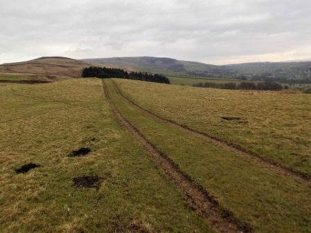
What could have been an uninspiring day in the hinterland of Bradford and Leeds turned out to be almost a green corridor of pleasant walking. It was not difficult to keep close to our lateral line with the proviso from Sir Hugh to incorporate a visit to his primary school in Thackley.
From the rail station in Saltaire we quickly reached the Leeds – Liverpool Canal to follow it off and on throughout the morning. At first all was industrial, historically relating to the canal with some fine mill buildings brought into the 21st century.
There were a few scattered sculptures including this one which was a pun on the Salt Mill connection…Hanging on the wall of my garage is an Ellis-Briggs cycle frame, probably 40years old, so I was delighted to pass their establishment which has been building steel frames since 1936. The cycling scene was booming in the 1930’s and the other notable established builder was W.R. Baines, whose factory was based at Thackley, see above and further into the walk. Coincidentally I rode a 1950’s Baines ‘Flying Gate’ cycle for many years.
Some nondescript scenery followed enlivened by some dubious and unsuccessful canal boat manoeuvering, it is difficult to do a three point turn.
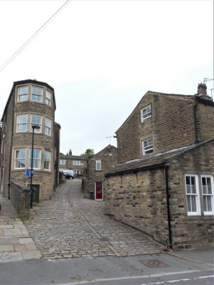
Climbing away from the canal on cobbled paths above railway tunnels we entered Thackley, a mixture of old stone houses and modern estates, and found Sir Hugh’s school still open and extended since his time. Up here was the local cricket club with a very challenging sloping pitch, Sir Hugh’s father had been a member.
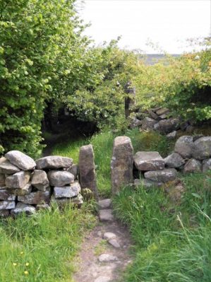
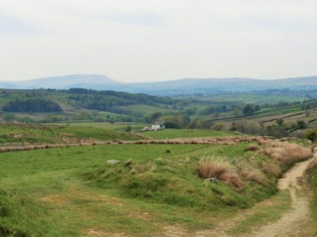
From the map we were not sure whether we could access the canal towpath from open country but thankfully there was a bridge. Soon we were sat on a bench looking down locks near Apperley Bridge, this was a busy stretch with pedestrians but no boat movements.Crossing busy orbital roads took time unless there were lights. We switched from the canal to follow the River Aire alongside the sports grounds of Woodhouse Grove School. The river continued through remarkably rural scenery despite being close to the railway and new housing developments.
Pleasant suburbs gave us twisting streets heading for Hawksworth Park which turned out to be a wooded valley. More parkland and upmarket housing and we arrived at our excellent budget hotel for the night.
There were several unexpected highlights on today’s walk and despite heading into the congested Aire Valley we enjoyed rural walking throughout on one of the warmest sunniest February days I remember.
Continuing our straight line walk meant once again logistics of two car parking. Sir Hugh suggested Saltaire as a finishing point so we arranged a rendezvous in the large free car park there, all went well with my journey until I became stuck in early rush hour traffic, not the best of starts for a day’s walking. With the late start and more traffic problems we drove back to our last point in the Ponden Valley. Sir Hugh seemed to know all these intricate Pennine roads and little villages or at least the lonely Public Houses where he spent his money when living in the area as a young man. We were stunned when the lane up to our isolated parking spot was closed necessitating back tracking and finding an alternative route on what was becoming a frustrating morning.
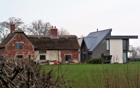
At last we set off down a bridleway high above Ponden Reservoir only for Sir Hugh to realise he’d left his phone on the car, fortunately we hadn’t gone far. This initiated a conversation on things left behind on walks and the cut off distance where one is prepared or able to return. Poles, passports, waterproofs, cameras and particularly hats were prominent on the list. We ran into problems with unmarked, difficult to follow and blocked paths in the Oldfield area and at West House farm admitted defeat and took to the road for a while. None the less there were many interesting houses passed.
High above Ponden Reservoir.
Before he’d realised his loss.
We were concerned with our poor progress after the delayed start on what would be a long day but as often happens things suddenly improved and remained so all day. We encountered a deep gorge not apparent on the map and decided to take the old flagged path alongside down to the River Worth which was then followed for a mile or so through green fields. We reached a road at an old mill that had been restored to provide modern living accommodation. There were several pack horse type bridges on this stretch reflecting the days when the valley was thriving with small riverside mills.
On the edge of Haworth I had noticed on the map a ‘Railway Children’s Walk’. The Railway Children by Edith Nesbit, published in 1906, was set in Yorkshire and a 1970 film used The Keighley and Worth Valley Railway as a backdrop. I remember watching a BBC TV series back in the 50s. Thus Haworth’s tourism benefits from both the Bronte connection and the preserved steam railway. We followed the lane across the Mytholmes railway tunnel made famous in the film …
… I regret now not going the extra few hundred yards to view the authentic Oakworth station featured prominently in the film. No trains today so we climbed up the steep hill to the busy Cross Roads and would you believe it – halfway up a steam train came into view way below us in the valley, bad timing. Up on the road the stone houses all bore that blackened look of the industrial past.
At Barcroft we reached high open countryside and enjoyed marching out with distant views to Bingley. In the fore ground was a prominent rocky tor, Catstones, and we speculated on the climbing possibilities and the height of the faces.
A bench below was perfect for lunch, I didn’t have the energy to ascend to the rocks. An inscription was dedicated to a Cllr. Ron Senior who pioneered a circular walk around Cullingworth, Senior Way. We felt well qualified to follow it.
We ended up just using the pavement through Harden but then entered St.Ives country park for a popular woodland walk to the edge of Bingley. The park is yet another old estate taken into council ownership providing a wide range of activities, we only skirted the edge.
A lane dropped down to bridges and fords at Beck Foot, a site of old mills, all very picturesque in the sun. An ecyclist proudly showed us his bike and extolled the virtues of battery powered leisure, not sure what it is doing for his fitness.
The River Aire, on its way into the industrial Leeds, was followed through fields to give another aspect to this day’s walk. Surprisingly rural although there was rubbish evident. A last stretch of woodland linked to the Leeds Liverpool Canal which took us into the heart of Salts Mill at Saltaire. Formerly a textile mill, now an arts centre, built by the philanthropic Sir Titus Salt in 1853, along with the adjoining Saltaire village in the hope of improving the conditions for working people. The whole complex is worthy of a day’s exploration. We found our car as the sun was setting and joined the heavy traffic home.
We are out walking our Northing 438 line again. A lane leads steeply out of Barrow through mainly new housing, ribbon development if ever I saw it. Crossing the busy A59 we continued climbing into Wiswell, an interesting little hamlet with a famous gastropub. A van was delivering organic vegetables to houses, one of these expensive subscription ideas where you probably finish each week with a box still full of potatoes and carrots. From here the route became moorland onto a ridge which was really an outlier of Pendle Fell, the mast marked on the map seems to have disappeared. We had climbed 500ft in a mile and were beginning to steam in the mild weather. Sabden could be seen in the distance. Below us was the large hidden valley of Sabden Brook and we slowly made our way down to pick up tracks into the village. I mentioned the famous Sabden Treacle Mines of which Sir Hugh had no knowledge, sadly they are no more and I will leave those with curiosity to investigate. We followed lanes to the 19th-century church and then out past a farm from where a pipe led into the fields. This pipe actually came out of the midden slurry tank and snaked into the fields, a tractor pump was starting up to inflate the pipe which we followed almost hypnotically for several fields. Eventually, the pipe seemed to connect up with another tractor with spreading machinery, but nothing happened. By now we realised we were off track so diverted back onto a rough farm road. This led to the 16th century Dean Farm with its wonderful mullioned windows and incongruous 19th-century extension. Muddy fields and rough reedy grass below the ridge of the so-called Forest Of Pendle led us to lunch on the wall of Tinedale House. A climb onto the grandly named Rigg of England which was mainly equestrian farms. Up here were good views back to the massive bulk of Pendle and across to Newchurch in Pendle which we had visited on The Lancashire Witches Walk. Below to the south was the industrial Burnley – Nelson – Colne corridor. It didn’t look too bad from up here. Ancient tracks down the hillside brought us into Fence alongside the White Swan pub where I recalled a seasonal wild garlic meal. Where do these memories unexpectedly come from?
We made a mistake in trying to follow footpaths parallel with the busy road, we were hemmed in by unnecessary plastic ‘hedging’ on the boundary of more equestrian enclosures. Escaping eventually into a large graveyard, where we were surprised by the number of Muslim graves. We started dropping down into the valley alongside a small beck. Surprisingly green paths led us into the heart of the Lomeshaye Industrial Estate. At the large Wellocks complex we enquired what ‘The perfect ingredient‘ was but unfortunately only Polish was spoken. Subsequently, we discovered that it was a high-end food distribution firm to the restaurant trade founded originally by a potato merchant whom Sir Hugh had known from his Yorkshire days. It was pleasant to enter Nelson through Victoria Park with its bandstand and paths alongside Pendle Water.
Under the motorway, over the canal and then a steep road heading up into Nelson town centre where we found the modern bus station which gave us a busy ride back to Barrow.
Normally I can see Beacon Fell from my house – but not this morning. A freezing mist hung over the landscape. Not to be deterred I wanted to walk up there and back, in deference to the weather and my late start I took the car some part way. I know these footpaths well as I often do this walk or a variation, it is in fact the first section of my Longridge Skyline Walk.
The snow was disappearing from the fields as I set off. Soon I was walking through the first of several developments where an original farmhouse with its surrounding barns has morphed into an expensive looking ‘hamlet’. This one is based around Higher Barker.
Familiar field paths [I didn’t need a map today] lead to the Cross Keys Inn where holiday type units have been built around the site, none ready for occupation in what is a speculative development. The Cross Keys was a farm-cum-basic pub run by brothers and known affectionately and ironically by locals as The Dorchester. What of its future?
The lane ahead is always soggy and today was no exception. I could hear a woodpecker in the trees of Whitechapel.
The sun was trying to break through the mist as I crossed fields to Crombleholme Fold another group of houses old and new. The sheep were surprised to see me emerging from the gloom.
Still no view of Beacon Fell which I knew was looming up above me. The trees were soon reached and as I entered them a small herd of Roe Deer passed in front of me seconds after taking this picture.
The car park at the visitor centre was virtually empty and I was the only one in the cafe where I enjoyed a good coffee. To reach the summit I followed the latest version of the walking snake, this one is expertly crafted from stone so should be more durable than the previous wooden sculpture.
I had the summit to myself with tantalising glimpses of Parlick and Fairsnape Fells through the mists.
A newish path, there are many since the storms of last year, and a concessionary bridleway through deciduos plantings took me out of the park.
A field footpath led me down to the fishing lake/holiday homes of Woodfold, another development which seems to be enlarging every time I pass this way. Do these places go under the planning radar?
My next aim was Barnsfold Farm environs where more sympathetic conversions were carried out decades ago.
Then it was muddy fields to Bullsnape Hall and back to my car just as the sun finally burst through. The final stile was a challenge.
The night before I arrange with Sir Hugh where to meet up for our next stretch along northing 438 . I’m sat waiting at New Hall whilst he is sat waiting at Cuddy Hill a mile and a half away, a misunderstanding compounded by the wrong mobile numbers. Red faces and ‘mea culpa’ all round. Once communications are re-established we drive to Singleton to start walking later than we had planned. By now there is a glimpse of sunshine.
Singleton is an interesting village with an old PO, several lodges and halls, picturesque cottages, a fire engine shed and a Parish Church. The estate was developed from 1853 onwards by the Miller family, wealthy cotton manufacturers working with the Horrocks family in Preston. The estate is now held in trust and appears well maintained. There are permissive paths through the estate but we lack the maps to use them.
At Singleton Hall’s South Lodge the original gates bear the initials of Thomas Horrocks Miller and on the gate posts ‘Demi Wolves’ taken from the Miller coat of arms.
The old PO.
Lodge gates.
A Demi Wolf.
The timber-framed fire engine house is nearby, it has decorated plastered walls and a louvred bell tower. The engine was horse-drawn and before a fire could be attended the horse had to be rounded up in the adjacent field.
Estate cottages lined the lane and worshippers were leaving the church as we passed.
Thistleton, Elswick and Inskip villages were visited in turn. Not far off is the site of Cuadrilla’s controversial fracking wells and the local feeling is demonstrated by all the anti posters.
Does fracking cause earthquakes?
Todays walking was easy through fields but we lost count of the high awkward styles and muddy farm tracks.
The farms we passed were a mixture of traditional working and modernised for rich commuters. The strangest was an old thatched cottage with a very modern residence built within yards of it. Strange, who would want to do that?
Everywhere were ponds, former marl pits, that look as though they are used for fishing and duck shooting.
Elswick is known for the Bond’s ice cream shop, now more of a restaurant.
Inskip is known for RNAS Inskip, a former forces base and airfield. It is now used as a military high-frequency radio transmitting station and the antennae can be seen for miles in this flat landscape.
The last farmyard was the worst for muck just before we reached the car. Jolly Japes.
I couldn’t think of a theme for this post until I was caught up in the transport chaos that is almost the norm down here. [almost as scary as the Hieronymus Bosch painting seen below] After a lovely weekend I was dropped off a few streets away from Woking station as the traffic came to a stand still. I was going to catch a train up to London Waterloo to begin my journey home but the station was closed as the lines were blocked due to ongoing weekend engineering works. I was pleased with my lateral thinking and quickly had an E-ticket on my phone for the coach to Heathrow to link in to the tube system. OK the bus was an hour late due to the traffic but once on board the driver skilfully navigated the traffic and dropped me off at Terminal 5. Should I go back to Preston or fly off to the Caribbean?
I was down here to see my old friend Mel [a regular walking companion on many of my posts here] who has had some recent heart surgery and is on kidney dialysis, some people get a bad deal. He was feeling great and looked really well.
I’d arrived at Euston Friday lunchtime, usually I have a break in the British Library but today headed across the road to The Wellcome Collection, ‘the free museum for the incurably curious’.
What a strange but fascinating collection – artificial limbs, paintings, sex aids, obesity, pharmaceutical jars, Charles Darwin’s walking sticks, Napoleon’s toothbrush, Everest medicine chest and much more all collected by Sir Henry Wellcome.
The Garden of Earthly Delights from Hieronymus Bosch.
On at the moment is an exhibition Living with Buildings looking at the relationship between our health and the spaces we live in. Included is a painting by Pissaro, Andreas Gursky’s iconic photo of apartments in Paris, the Paimio chair. There is a separate Global Clinic exhibition looking at a new design for simple and sympathetic installations in emergency situations and remote locations.
Oh and there is a nice cafe and an upside down Gormley statue. Quite a place and one I’ll put on my visit list for trips to Euston.
Whilst Mel was at hospital Saturday morning I visited the Woking Lightbox for an Impressionism Exhibition. This gallery is only small but seems to organise some outstanding displays and this was no exception…
There was a good selection of paintings but I was intrigued by the previously unknown bronze statues. A glorious infants head [Dalou], a simple peasant worker [Dalou] and a brutal figure [Rodin] drew my attention.
Next door was an exhibition of Elisabeth Frink’s works and when you step in the room you are confronted by …
… the gallery lady on duty felt uncomfortable when alone with this figure.
I joined up with Mel’s wife for a street Korean lunch at Shins, I was confused by the menu and smiling staff so I just opted for a tofu Bipimbap – tasty and filling. The Katsu curry looked good as did the glass noodle soup. Waiting at the bus stop was an experience as we were directly below the cranes working on some new sky scrapers almost as scary as Frinks works. These will completely transform the skyline not necessarily for the better according to local opinion, but they may save some fields being built on.
Sunday morning saw us at the RHS Wisley garden, it was clear and sunny but very cold so we headed to the cafe for hot drinks. A walk around the grounds is always selective but we managed to see the vegetable plot, rock gardens, Bowles corner, alpine houses and the Tropical Glasshouse. The autumn colours were still prominent and I found this a relaxing interlude in a busy schedule, I am envious of having this wonderful place on your doorstep and being able to visit regularly and leisurely to see the changing seasons.
I didn’t fly off to the Caribbean but caught the train to Paddington and a bus to Euston. With all the rearrangements and travel this morning I’d not eaten so I ventured into a Nepalese Restaurant in a nearby side street for a late lunch. https://www.great-nepalese.com/eat/ It was actually quite authentic and made me wish I was back in Kathmandu but I ended up in Preston.
It’s the end of August, and I’m back in the Lot Valley, France, for a couple of weeks as is usual.
The house of my friends is as welcoming as ever and the weather is perfect. The problem is I can’t get out of bed in the morning. My stiffness in shoulders and hips has intensified and nobody sees me until lunchtime when I’m the head chef. After that I’m semi OK and can walk up the easy Combe de Filhol behind the house. To my amazement on an oak tree I spot a luxuriant fungus. Orange and yellow bracts sprout from the tree, I’ve no idea what it is, but I suspect it is edible and return to cut off a few slices.
A quick search suggests, no proves, it is ‘chicken in the woods’ – a delicacy in some regions. Without further to do I fry a piece up and season up with salt and pepper. It tastes good but more like a lemon flavoured mushroom than chicken. I start with a small piece, some people are allergic to them, but the next day fry up more pieces for friends who realise I’m not dead.
Nothing to do with the fungus, but I slowly become worse with the stiffness and pain, almost certainly PMR [look it up], and have to resort to the steroids prescribed to me. I take two after breakfast and two the same evening and miraculously the next morning I’m virtually back to normal. Life has returned; I’m able to do some gardening, swim and go on my usual walks around the area. I enjoy a lovely walk along the ridge to the communication tower and back along the vineyards. Buzzards flying above and butterflies fluttering alongside, blues and clouded yellows. From the ridge I have great views of Puy L’Eveque above the River Lot and am impressed by the size of the church above the town, arrowed below. I don’t think I’ve ever visited it,
So a couple of days later we make a pilgrimage to investigate. What a find! The church of Saint Sauveur began in the 13th century and is in an elevated position with views over the valley. It is of course built from limestone giving it a clean bright appearance. There is an elegant arched entrance porch soaring up to the bell tower. Elaborate stone carvings are found above the door. The interior is generally plain with high vaulted Gothic arches, but there are fine stained-glass windows. Coming back outside we can see where the building was extended in the C19th. High on the North East wall is a strange observation tower. Surrounding the church are masses of burial vaults.
Apart from that it is mainly eating and drinking at the numerous local hostelries. In particular Le Pigeonnier alongside the River Lot gives a fine view of Puy L’Eveque’s medieval houses rising from the valley. In contrast, Le Cote Lot restaurant in the Bellevue Hotel has a fine terrace room looking down onto the Lot below. Le Caillau courtyard restaurant close to the house has a romantic atmosphere with fine food but due to its popularity we found the service has deteriorated. More fine evening dining was experienced at La Venus Restaurant in nearby Prayssac and of course we made our usual pilgrimage to the Brit Hotel in Fumel for their fabulous lunchtime buffet.
Looking up at Puy L’Eveque from Le Pigeonnier.
Looking down from Cote Lot to the river.
Le Caillau courtyard.
The Brit’s Buffet.
Back at the house mirabelles, quince, plums and figs all collected locally gave a healthier balance to our diet.
It will be a wrench returning to the UK as Autumn starts.
One of the tags for my blog is ‘Chipping Vale’ and its used quite frequently. I’m often looking down into this valley as it lies between Longridge Fell and the Bowland Fells. I’m not sure whether this is an official designation or a figment of my imagination. There is no mention on the OS maps, basically I’m referring to the Loud River catchment area which arises in the hills near Beacon Fell and meanders under Chipping into the Hodder at Doeford Bridge. Well today we’ll explore into this valley.
Chipping Vale from Longridge Fell.
There are several points of interest – historic houses, ancient bridleways and limestone quarries. I’ve a book about limestone kilns and quarries in the area which highlights Arbour Quarry at Thornley as a major commercial site, so I was keen to revisit it.
Since my trip up the NE coast of Scotland I’ve hit a problem – I suddenly overnight painfully stiffened up in my shoulders and thighs. After some prognostication I presented myself to my GP – Polymyalgia Rheumatica [PMR] was his initial diagnosis, but the blood tests were equivocal. Give it another week and nothing much has changed, painful stiffness and similar bloods. I’m limiting myself to gentle walks around the village later in the day when I’m less stiff.
To hell with it I’m going for a longer walk and phone JD for companion, he’s strong enough to carry me if things become difficult.
So our venture into Chipping Vale commences. Field tracks out of Longridge are taken past ponds, where my lads used to fish for tench, to Gill Bridge over the River Loud, more of a stream than a river, where they had tickled unsuccessfully for trout. Private roads through the Blackmoss Estate formerly Lord Derby’s domain took us past converted barns and gentrified houses as is the norm around here. Indistinct field paths which seemed little walked brought us into the farmyard of Hesketh End a grade one listed C17th house. The sandstone house has lovely mullioned windows and is noted for Latin inscriptions on the exterior telling of historic incidents.
Hesketh End.
Chipping Vale with Longridge Fell in the background.
A nearby property was ruinous 20 years ago and is now a substantial dwelling. We came out onto the road close to the recently closed Dog and Partridge, many pubs are capitulating in rural surroundings. From here we crossed the River Loud by a wooden footbridge. The banks of the river were heavily overgrown with Himalayan Balsam, its scent pervading the area. The low-lying meadows here are frequently flooded in the winter months when our track would be underwater. We were heading for the extensive Arbour quarry, a source of limestone into the early C 20th. Lime was important to the farmers for improving their land. All that remains now are grassed over ridges and ponds, the latter having a large duck population. Sitting on a limestone outcrop for lunch we were covered with little black flies which fortunately were of the non-biting variety. We couldn’t identify them but they were similar to ones I call Thunder Flies, it was certainly very humid today. There was wild mint growing everywhere giving a strong aroma and attracting Painted Lady butterflies. I had vague memories of a large limekiln somewhere here but we couldn’t find it today in all the summer growth. There is a photo in my book of it operational.
Crossing to the other side of the valley we climbed a lane to reach farms strung along the hillside of Longridge Fell on roughly the 150 m contour. I’ve often speculated this may be the spring line. Paths and lanes connect these properties and is known to some locals as ‘The Posties Track’. Some houses are still honest working farms but more and more are renovated as desirable properties, I must admit they all have superb views over Chipping Vale towards the Bowland Fells. We re-entered Longridge on the old railway line that ran along to stone quarries. The gentle walking was no problem but my stiffness made getting over the numerous stiles comical.
Breakfast was shared with a man from France who was taking a dog and a cat over to Orkney – that is a long story. The day was perfect – fresh and clear. The trail went out of town past the houses of the former Sutherland estate with their Duke’s statue looking down on them. In the close up photo below the quarry used for stone for the base can be made out.Onto the dunes and a path towards Dunrobin Castle the largest house in the Highlands and once owned by the notorious Duke Of Sutherland. I saw it from below and it did look impressive, I was too early for their falconry display. A bit further on and I diverted up to Dun Liath broch expecting I’d be the only one there but a mini bus pulled in and discharged a group of tourists who were mainly interested in taking selfies of themselves. After they departed I wandered round the 2000 year old ruins in peace. After regaining the shore I dropped onto the beach as the tide was out. There were some interesting rocks covered in seaweed, one reminding me of Dougal the dog from The Magic Roundabout. There were seals on the rocks and exposed sandbanks, their calls were hauntingly human. I arrived into Brora by the harbour area where a few fishing boats were preparing to go out to their lobster pots. Nearby was the old ice house used when the harbour was more prosperous. This coast was famous for its herrings which would have been smoked locally.Up the road was a clock war memorial of unusual design. I lunched in the delightful Linda’s Cafe and enquired about a taxi who could pick me up if I walked a few more miles up the coast, none was available but they suggested I would be able to catch a bus back. So off I went again over the golf course onto the perfect beach for two or three miles. A swim was needed halfway to cool me down. At the end of the golfcourse I clambered over the railway and landed on the A9 where I managed to flag down a bus back to Brora.
Notice Trail waymark.
Brora Golf Course.
Endless sands.
My airbnb was good with plenty of time for stimulating conversation with the hostesses and the Jack Russell. There was a private episode in my bedroom when becoming concerned I may have a tick attached to my derrière. I attempted to locate it without the benefit of mirrors with no success until I came up with idea of a selfie from my phone. Eventually I focused in to the right area, a false alarm as it happens, but I hate to think what Google may have done with my images. Now all I have to do is persuade someone to drive me back up the A9 in the morning which will make for an easier day’s walk to Helmsdale.
Two halves scenically and weather wise. It drizzled in the morning but was hot and sunny for the afternoon.
Dornoch Firth.
Breakfast in The Royal was excellent and made entertaining by a group of plonkers on a nearby table. On some sort of group activity holiday the 30somethings were engrossed in laptops and tablets and ignoring the staff. Their ‘leader’ announced that they had to leave at 9am and went off to rouse a couple of late risers. After 8.30 they eventually switched off, almost, their electronic devices and put in complex orders for the cooked breakfast. Not surprisingly they started getting frustrated with the slightest of delays and complaints were put to the waitress who dealt with the little darlings with restrained Scottish aplomb and a wry smile.
After passing the Glenmorangie Distillery little estate lanes were used before dropping down to another brush with the A9 to get across the Dornoch Firth – 30 minutes of fumes and speeding cars. I was glad to clamber down a steep bank onto the shore. The track eventually swung away from the coast onto a road past farms. Bulls guarded the fields and there was some equine presence at some stables. It was along here it started drizzling, so off with my shirt and on with the waterproof. A little further the JO’G Trail was signed into Camore Woods, pine woods standing on a gravel ridge from the ice age. Within this area were several obvious mounds which are the remains of hut circles and chambered cairns 3000 yrs old. A standing stone was seen in a field on the right seemingly reflecting the steeple of Dornoch Cathedral. As an aside I noticed for the first time the sound of rain falling on different trees – almost silent on the pines but waterfall like on the larger deciduous leaves.
Dornoch was busy with tourists, I visited the cathedral with its beautiful vaulted ceiling and then found a little cafe in the square behind for a light lunch. The rain had now stopped, the sun was out and fortified I walked down to Dornoch Royal golf course which has been used for the open in the past. The fairways were narrow between the sand dunes and the bunkers looked horrendous. The track on the edge of the course was directly above the sandy deserted beaches and I couldn’t resist a paddle which turned into a brief refreshing swim.
I was dry by the time I walked through a large camping/caravan park and into the little village of Embo. This was made up of streets of small houses presumably a fishing industry in the past. My B and B for the night was comfortable and peaceful.
It was only in the morning as I left that I noticed all the wall murals in town depicting the history and culture of the area. There is also a distillery on the edge of town, a part of Whyte & Mackay producing grain spirit for the blending industry.
The B817 road along Nigg Bay was almost absent of cars and for some of the way I could use the beach. Oil rigs were prominent in the bay.The villages passed had no facilities so I pushed on and found even quieter lanes inland. The odd cyclist passed me with a cheery greeting [not all cyclists are odd!] A petrol station appeared and an ice cream was purchased.
The A9 was perishingly close but I was able to continue on an old road which was slowly being reclaimed by nature. At its end it was a short hop across the main road to reach the rather isolated Shandwick Arms where I rested over a Belhaven ale and sandwich. Despite being refreshed I soon ran into blocked ways and escaped to fields and barbed wire crossings. Then all was all plain sailing on little used lanes passing small crofts. I didn’t try to join up with the JO’G Trail in the forests which I had heard was difficult. So I was soon dropping into Tain a prosperous looking town just above the Dornoch Firth. It was only in the last few hundred yards that I touched the JO’G Trail. An uneventful day’s walk through very pleasant scenery.
On the outskirts of town today a Highland gathering and games were taking place. My hotel was central and the games continued into the night by the sound of it.
After a breakfast of fresh farm eggs I took the lane dropping down to the Cromarty. The causeway bridge carrying the A9 was plainly visible, it looked a long way across. The traffic was heavy and fast, but there was an adequate footway on the verge for my 30-minute crossing. As well as the traffic hazards, Terns were dive bombing me at the far side. I couldn’t wait to leave the road, and I probably took the wrong path, which led me up to the railway but no further. I resorted to trespassing along the line, The Far North Line, for a distance until I reached the level crossing I should have been on. These private level crossings were a frequent feature across the single-line railway; there aren’t many trains per day. My track went up to a house and then onto a quiet country lane high above the water, so there were good views all morning. The only people using the lanes were cyclists, many of whom were on a LEJOG trip. Groups of them were using backup transport, allowing them to travel light. The busy A9 was somewhere out of sight and sound.
I arrived in sleepy Evanton at coffee time and the Novar Arms duly obliged. The B817 road was a bit busier but immediately out of the village was a signed cycle path in the trees alongside the road so the continuation was quite pleasant. Interestingly, most cyclists persisted on the fast road, leaving me to enjoy their cycle route. This gave me time to take in the views, and high above me on a hill was the Fyrish Monument. Built in 1782 for Sir Hector Munro, Lord of the area, who had served in India. It represents the Gate of Negapatam, a port in Madras, which General Munro took for the British in 1781. At the time, back home, the local population was being cleared from the lands they had worked for centuries to make way for profitable forestry and sheep farming. Survival was a problem, and it is said the folly was built to help keep the locals in labour. The view from up there must be good, but no time today. Along the road were signs of the Novar Estate, Sir Hector’s home. Now concentrating on tourism of the shooting and fishing variety, somewhere in there is the big house. Out of interest his two sons were both killed in India one by a tiger and the other by a shark! His daughter married, and the estate passed into new hands.
The cycle path ran out, leaving a stretch on a boring footpath adjacent to the busy but safe road into Alness. A thriving little high street, where I found the basic Cafe Picante for a cheese toastie. I got the impression that most of the staff were Central Europeans, as were many of the clients. Oh, and why do all these villages have so many, mainly Turkish, barbers?
Wanting to lengthen the day, I pushed on a further 3 miles or so to Invergordon. This meant leaving the JO’G Trail route, though there had been little signage throughout the day. Again, I was lucky as there was a cycleway out of town parallel to the road. I dropped down past the renowned Dalmore Distillery to the shores of the Cromarty, which I followed pleasantly into town. Along here, I passed a standing stone marked as a Symbol Stone on the map. This is the Bronze Age Thief’s Stone, which has three C6th or C7th Pictish symbols carved on it. I couldn’t make them out. Looking back across the Cromarty, I’m fairly sure that is Ben Wyvis in the background.
The views down the water were dominated by oil rigs in for repair. They looked strange with their legs up in the air.
Invergordon was an unpretentious town with a wide high street. It was at one time an important naval base and there are masses of old fuel tanks still on the edge of the houses. Aluminium smelting works closed and the oil rig business was a saviour. As I found later when wandering down to the harbour Cruise ships now call here because of its deep waters. One was being piped out this evening on its way further north.
The Marine Hotel where I stayed benefits from the cruises by the bus drivers and guides staying here, It was basic but friendly.
What had appeared to be a day on lanes turned very pleasant and interesting.
There’s a new trail being developed up the coast north of Inverness, partly to keep ‘end to enders’ off the maniacal A9. This venture also hopes to highlight the magnifcent scenery in NE Scotland.
In some ways the route consists of two halves. The southern week’s walking is mainly flattish along the shoreline whereas the second half north of Helmsdale is rugged walking over high cliffs.
The next few posts are of the first half from Inverness.
*****
The beginning of how to avoid the A9. Inverness to North Kessock.
As part of my ongoing Lands End to John O’Groats exploits another week was looming. We are having such hot weather down here i thought Scotland could give some relief. A few weeks ago JD and I filled the gap in the Scottish Lowlands leaving me only a section north from Inverness. I had heard horror stories of people walking on the A9 and was determined to avoid it if at all possible. A little eleventh hour research came up with the John O’Groats Trail, a coastal route from Inverness. Before I knew it, most of my trips are last-minute decisions, I was stepping off the train in Inverness. I was not impressed by the city – too many tourists, too many drunks and beggars, too many cheap high street shops. I was therefore glad I had booked a B and B across the river for the first night, this gave me an easy 4 miles evening walk to help me on the way and escape the city. I didn’t even stop for a coffee.
The official start of the trail is outside the castle where there is a fine statue of the Jacobite heroine Flora MacDonald, the one of Bonnie Prince Charlie fame. I did find a waymark for the JO’G Trail. Pleasant walking initially alongside the River Ness led into industrial estates where the only building of interest was Cromwell’s Tower – this is all that remains of a great fort here completed in 1682, It seemed incongruous in the industrial setting.
Once alongside the Beauly Firth the massive Kessock Bridge carrying the A9 made itself present. A scramble up the banking onto the pathway felt illegal. The way across was scary up close to thundering traffic which seemed to be ignoring the 50mph limit. It was a long way down to the water and my search for dolphins was futile.
Thankfully off onto quieter lanes at the far side life became tranquil once more. My B and B on this north side was a haven of peace overlooking the Beauly Firth. I slept well anticipating some interesting explorative walking.
The final day of our walk on the Bronte Way. By more good luck than management there was a bus stop outside the hotel to take us back to Bailiff Bridge. After some steep uphill road and lane walking we were once more in amazing rural areas. We had joined The Kirklees Way and a Brighouse Boundary Walk. There were some vicious dogs penned up in some of the properties we passed some on a running chain which is quite scary as they charge at you. We postulated what could happen if the chain snapped!
Some time was passed in a large pristine golf course, there’s always one on any long distance walk. Fortunately no fairways had to be crossed on this one. After crossing a motorway, M62, little lanes led into Liversedge where first we came across a quaker grave yard. Way back a man, who was a Quaker, had been refused a burial at Hartshead church, so he bought a piece of land for burials of his family. This is still being used today and there are four 17th century graves. It was on Hartshead Common that Luddites congregated in early 19th century to march on Arkwright’s Mill at Rawfolds with disastrous results. Could something similar happen in the future as robots take over workers jobs? We are also sharing The Luddite Trail now, oh and did I mention The Spen Valley Trail. there must be a lot of keen walkers hereabouts.
A little further was a plant hire depot with some interesting old tractors, two looked as though they had come straight off the American prairie. And another aggressive guard dog going nuts as we stopped to take pictures.
We were now in the Spen Valley area which was the backdrop to Charlotte’s novel Shirley enacted at the time of the Luddites. This novel sounds interesting and will get a copy for holiday reading. On our route was a farm cafe which turned out to be an excellent stop for coffee and toasted tea cakes. The waitress was interested in our route and was clearly enthusiastic about Oakwell Hall. On leaving the cafe we spotted the resident cat waiting patiently on the back step.
Up the road was an old house, Clough House, bearing a plaque to the Rev. Patrick Bronte who lived here before moving to Thornton.
Some rather messy navigating through lanes and parks, all very rural though, brought us into the honest looking Shirley Estate, Gomersal. We wandered into the local church bazar hoping to find an old copy of The Bronte Way guidebook. On mentioning we were on the Bronte Way we were escorted to the grave of Mary Taylor a lifelong friend of Charlotte. Mary apparently was a Women’s Rights advocate who incidentally led a women’s group to climb Mont Blanc in 1875.
Open fields should have led us down to an entrance to Orwell Hall but probably distracted by females we took the wrong field. All was not lost and I think we had a better way into the grounds of this beautiful and obviously popular property. Oakwell Hall may have been the inspiration for ‘Fieldhead’ in Charlotte’s novel Shirley. This is the last of our Bronte associations but I wonder how many we have missed. We came out on the way we should have gone in, a far inferior way. A bus stop was on the main road and eventually a bus full of friendly locals delivered us to the efficient Bradford Interchange.
The end to a really varied and interesting five days of walking. Sir Hugh’s new knee just about stood up to the whole trial. We’ve seen a lot and learnt a lot.
The train got us to Halifax almost on time despite having to make toilet stops at various stations en route, the train toilet being nonfunctional. The toilet stop at Hebden Bridge was cut short when it was realised that the station toilet was also nonfunctional, all very strange and can’t all be Northern Rail’s fault. Of course our bus waited for us and we were soon walking from the moorland Denholme Gate. Enclosed rough fields with ancient wall stiles took us eastwards into what looked like an urban setting but the route cleverly kept us mostly on green ways. Paths wandered past houses and barking dogs. We were heading to Thornton the birthplace of the Bronte sisters.Little streams added interest and then the largest cemetery I’ve been in for years. A moorland ridge above was home to Sir Hugh’s first house, as there was no plaque to commemorate this event we didn’t divert. Then we were in the main street of Thornton full off characterful houses off the beaten track and not a Japanese tourist in sight. No 74, was heralded as the Bronte sisters’ birthplace, their father Patrick being curate at the Chapel. A cafe-cum-museum here gave us a rest, coffee and entertainment listening in to the local ladies’ Yorkshire conversation.
A deep valley had now to be crossed but to be honest we seemed to be cruising along despite the long grass in parts. There were distant, if hazy, views down into Bradford city centre. My memory is of fields and lanes going nowhere, stone walls, buttercups and dog walkers eager to converse. The hidden world of West Yorkshire.
Somewhere we joined The Calderdale Way in a wild valley and eventually emerged into the affluent Norwood Green. More of the same took us down to the suburbs at Bailff Bridge and thankfully a bus into Brighouse for a night on the tiles – well not really – an early supper in our hotel by the canal followed by an early night.
Check out Sir Hugh for another version of today’s walk.
Once the car shuffles had been completed we set off to walk back up to the Pennine Way/Bronte Way. The PW continues up to the isolated Top Withins farmhouse, with its solitary tree visible from down here. There is no convincing evidence to support the claim that the farm was the ‘original’ Wuthering Heights, but if it is not, it is certainly the type of place that Emily Bronte had in mind when she wrote her famous novel. The picture below is from a previous visit. Our way today however branched off and headed into the valley of Staden Beck and down to Bronte Bridge, a stone clapper bridge across the beck. The water tumbles over a small series of rocks above and below the bridge. The area is somewhat optimistically known as Bronte Falls; it isn’t really a waterfall, but is a wonderfully picturesque spot and a popular area for picnics. The original stone bridge was swept away in a flash flood in 1989 and replaced the following year by the present bridge.
Signposts helped us onwards with addition of Japanese instructions reflecting their interest in the Bronte history. Signs kept coming thick and fast.The track took us out of the valley and over Penistone Hill heavily quarried in the past. Now a country park there are confusing paths everywhere, popular with dog walkers who all seemed to have Cocker Spaniels. We arrived into Haworth by the atmospheric graveyard, the Brontes are not buried here but have a crypt in the adjoining church. Above was the Parsonage where the sisters lived, now a museum. Bronte associations were everywhere. Below in the main street tourists flocked into the gift shops and cafes.
The Bronte Parsonage.
Bronte School.
We of course were above such things, avoided hoards of Japanese and headed out on ancient tracks to Oxenholme. Here we found a bench for lunch which happened to overlook the Worth Valley railway line and in came a steam special hauled by a Standard Four locomotive, withdrawn for scrap from the Southern Railway in 1965 but subsequently restored.
Things went a little astray as we took to small lanes, too much time chatting and admiring both the scenery and the local properties. We found ourselves on a narrow lane a few hundred feet above where we should have been. I’d already remarked that we seemed to have missed most of Oxenholme, dammed right it was there below us. Fortunately a lovely path was found to reunite us with the correct way but we had enjoyed our diversion and had chance to meet one of the locals.
Charlotte, Emily or Anne?
No sooner were we back on track when we seemed to go wrong again on small streets in the village and ended up on the wrong side of Leeming Reservoir. No problem, just walk across the damn access road. The hot afternoon drifted on and once more we found ourselves on old flagged paths going where? A hill was climbed past old enclosures and water catchment culverts to arrive at a fine belvedere. An opportunity for a breather, a snack and drink and time to admire the view over fine countryside. From here a good lane just under Thornton Reservoir made for easy walking. A cyclist stopped to show us his electric assisted bike with a multitude of gears, impressive until I realised I couldn’t lift the beast. We emerged from Black Edge Lane into Denholme Gate where a parked car was waiting for us.
Onwards looked more urban, a bus passed signed for Halifax so we’ve come a long way into Yorkshire. The last two days may be better reached by train and utilising overnight accomodation.
We were back in the beautiful Thursden valley after a bit of car manoeuvering. The day didn’t get off to a good start on an overgrown path, which had been superseded we realised later, involving some scrambling and barbed wire leading to torn shorts. Calm was restored on the open moor. A strange stone arch ‘The Doorway to Pendle’, the former New House farmhouse built in 1672 and occupied until the 1920s when the land was bought by Nelson Waterworks. It consists of a sandstone archway with a triangular head. An inscription relates to the Parker family in the 17th century. There must have been many similar isolated houses scattered on the moors.
A good track, popular with cyclists, was followed all along the northern flanks of Boulsworth Hill; an old way, flagged in parts, connecting scattered farmsteads. Lapwing, skylark and curlew country. At the far end the path is being ‘improved’ with alien chippings which at the present time are an eyesore. Escaping from this we found a delightful concessionary path sloping down the wooded hillside. Above were a series of boulders that looked climbable but I can find no reference to them, I’m kicking myself for not taking the short walk up to them.
Eventually we crossed the stream that flows into Wycoller where begin a series of interesting and often photographed bridges. In historical order a ford, a clapper bridge, a supported clapper and a two arched packhorse bridge.
We rested and ate lunch in the shade of the ruins of Wycoller Hall, probably Ferndean Manor in Jane Eyre, In a previous visit, whilst walking the Pendle Way, I bivied in the massive fireplace without realising it was haunted.
A gentle stroll back out of Wycoller was made for chatting. A farmer out checking his sheep and lambs on his quad bike bemoaned that he would probably be dragged out by his wife this afternoon to a local event when he would rather be putting his feet up. We saw him later driving to Haworth. We walked below another group of rocks where Foster had done some daredevil leaping. Open moorland was once more gained and appeared to go on forever, Pendle Hill disappeared for the last time in the west. We congratulated ourselves for being here on a perfect summer’s day – it can be grim up north. Somewhere we crossed over from Lancashire into Yorkshire, God’s own country if you are so inclined.
After Watersheddles Reservoir the valley of the infant River Worth was entered, almost a lost valley despite its close proximity to the road. A rough track alongside the lively stream, gritstone boulders, rhododendrons and bird song, my first Cuckoo of the year, a lovely spot for a refreshment break. It turned out we needed it as the way on became more laborious climbing in and out of valleys towards Ponden Reservoir. Passing Ponden Hall [Thrushcross Grange in Emily’s Wuthering Heights] I recollected coming this way in 1968 on an early Pennine Way journey and I’m sure they served teas then. Not today! Lets not forget that The Pennine Way was the brainchild of Tom Stephenson, Wainwright’s guide, which we didn’t have at the time was a later publication. A few more switchbacks shared with the PW brought us to the end of quite a tough day in the heat. The car was parked down the little lane leading to Stanbury.
Sir Hugh and I started at Gawthorpe Hall in Padiham. Many of the places we walk through have some connection to the Brontes or their novels. Gawthorpe Hall was the family home of the Shuttleworth family which Charlotte Bronte visited frequently as a friend of John Kay-Shuttleworth.
And a very stately hall it looked, but was closed today. We walk out of the grounds through a grove of chestnut trees. We were into farmland where we immediately got into the wrong field, no waymarks, and receive some advice from the farmer’s wife. Soon we drop down to a bridge over the River Calder where I’d been before on the Burnley Way. The river was a placid stream today but there was evidence of harsher days. Pleasant rural walking took us along and over a motorway and onto a canal. There was a large marina with people pottering about but little traffic on the water.
“That’s what a fish looks like”
We crept round Burnley and joined the River Brun into a park where we stopped for lunch. Despite us sitting on a park bench Sir Hugh felt obliged to demonstrate, not very convincingly, his new pocket folding chair. Lots of Asian families were walking past and in conversation we realised that Ramadan meant fasting from 4am till 9pm at this time of year, that can’t be good for children.
Further along the river the local fire brigade were enjoying the weather on a splashing about exercise. Into fields and along a stream our instincts to follow the trodden path were ignored and we ended up lost near the ruined and abandoned Tudor Extwistle Hall [no connection to the Brontes]. Some time later after difficult barbed wire negotiations we were back on route near a small reservoir. Crossing a road we picked up a good lane to Swinden Reservoir where two farmers were trying to burn accumulated years of rubbish.
We crossed a moor in lovely evening sunlight and dropped down through trees into the delightful Thursden Valley, the river was low due to lack of rain but still gave us a sparkling accompaniment to the road where a car was waiting.
A very pleasant introduction to The Bronte Way which probably doesn’t get a lot of traffic and has been poorly waymarked today.
First of all I have to admit getting my Bronte’s mixed up.
They were a nineteenth-century literary family, born in the village of Thornton and later associated with the village of Haworth. The sisters, Charlotte (1816–1855), Emily (1818–1848), and Anne (1820–1849), are well known as poets and novelists. Two other sisters died at a young age as did a brother Patric.
Like many contemporary female writers, they originally published their poems and novels under male pseudonyms: Currer, Ellis, and Acton Bell. Charlotte’s Jane Eyre was the first to know success, while Emily’s Wuthering Heights, Anne’s The Tenant of Wildfell Hall were later to be accepted as masterpieces of literature.
The three sisters and their brother, Branwell were very close and during childhood developed their imaginations first through oral storytelling and play set in an intricate imaginary world and then through the writing of increasingly complex stories.
The deaths of first their mother and then of their two older sisters marked them profoundly and influenced their writing, as did the relative isolation in which they were raised.
The ‘Bronte Way’ is a 44mile cross-Pennine route linking various places associated with the lives and works of the Bronte sisters. Starting at Gawthorpe Hall, visited by Charlotte, it goes by the Thursden Valley to Wycoller Hall (Ferndean Manor in the novel Jane Eyre), Ponden Hall [Thrushcross Grange in Emily’s Wuthering Heights] the moors to Top Withins (Earnshaw House in Wuthering Heights), Haworth Parsonage, where the Brontes lived and now a Bronte Museum, the Brontes’ birthplace at Thornton, along the hills west of Bradford to the Spen Valley (Shirley country) before finishing at Oakwell Hall (Fieldhead in the Charlotte’s novel Shirley).
You will be familiar with Sir Hugh from my previous posts, I should really have a tag to my walking companions. Well he has recently had his second knee replaced or whatever. He managed to walk thousands of miles on his first knee replacement much to the credit, amazement and interest of his orthopedic surgeon. He is keen to field test the latest operation so we have arranged a few short days walking on The Bronte Way. He has connections to the Yorkshire end of the walk so was keen to explore the route.
Sir Hugh’s new ‘new knee’
Guide books of the way are out of print but the route is marked on the OS maps so we should be OK.
Change of plan – Milngavie to Glasgow, the Kelvin Walkway.
I’m still not absolutely sure, and it was my idea I think, why we changed our direction for today. An early morning train was taken from the Exhibition Centre to Milngavie.It was years since I’d been here and I was surprised at the amount of signage for the obviously popular West Highland Way. Several groups of backpackers were setting off on that journey. There was no mention of The Kelvin Walkway and we realised the River Kelvin didn’t even come through here. We set off on paths marked on the map and our first sign after a while was for the Allander Way which we’d never heard of. Still it seemed to be going in the right direction so we moved on, we had a train to catch later in the day and didn’t want too many problems. The Allander was more of a drainage ditch than a river but gave easy walking through a dull landscape.
We began to notice on the river banks a large yellow flowered plant which turned out to be the American Yellow Skunk Plant. A garden escapee which apparently has an unpleasant odour as it matures.
The river was narrow and meandering, at one point a very substantial girder bridge had been installed by the Royal Engineers, it should last forever. That is more than can be said for ‘Stan’s seat’ We didn’t really notice where the Kelvin joined forces. Our next landmark was the Balmuildy Pipeline Bridge which deposited us on a rather busy road. The map showed nearby evidence of the Antonine Wall and Roman Forts but our brief diversion revealed nothing. The Antonine Wall was built in AD 142 between the Forth and Clyde. It didn’t last long and the Roman Legions retreated to Hadrian’s wall. As it was built mainly of wood and turf there is not much apart from its course to see on the ground.
Some pleasant riverside walking followed until we were suddenly diverted away onto roads near Maryhill. Left high and dry we followed our noses once more across Dawsholm Park and luckily [skillfully] rejoined the river. Now in a gorge and a more urban setting there seemed to be a plethora of abandoned railway bridges and at some stage we must have gone under the Forth-Clyde canal aqueduct of 1790. I wish we’d known as steps take you up to see Maryhill locks.
Signs for Glasgow appeared although I suppose we were already in it. The grounds of the Botanical Gardens were on the opposite bank and next an old flint mill site was passed. Kelvin Bridge was an impressive structure with some ‘homeless’ camping under its arches, not the best of campsites. Also beneath the bridge in the water a Heron was waiting patiently.
Kelvin park was next. The Highland Light Infantry memorial remembered those men who died in the Boer war. We looked into here yesterday evening when the place was packed with sunbathers – pale skin and ginger hair don’t make for tanning. All around are university buildings, churches and museums suggesting that Glasgow is definitely worth an extended cultural visit.
After all that the Kelvin runs into the Clyde almost unnoticed.
We had time for a celebration meal and drink in the Counting House, an interesting old bank-house a Wetherspoons acquisition, near Queen Street. The Modern Art Museum nearby was disappointing. Then on the train home to Preston.
So we had accomplished our venture, the Lanarkshire Link, to join up the Pennine Way with the West Highland Way. The journey was more interesting than I had envisaged, thankfully as JD had come along. It would be good to see in the future an official Tweed – Clyde linkup, it is 70% viable now.
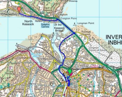
 What could have been an uninspiring day in the hinterland of Bradford and Leeds turned out to be almost a green corridor of pleasant walking. It was not difficult to keep close to our lateral line with the proviso from Sir Hugh to incorporate a visit to his primary school in Thackley.

 Hanging on the wall of my garage is an Ellis-Briggs cycle frame, probably 40years old, so I was delighted to pass their establishment which has been building steel frames since 1936. The cycling scene was booming in the 1930’s and the other notable established builder was W.R. Baines, whose factory was based at Thackley, see above and further into the walk. Coincidentally I rode a 1950’s Baines ‘Flying Gate’ cycle for many years.


 Crossing busy orbital roads took time unless there were lights. We switched from the canal to follow the River Aire alongside the sports grounds of Woodhouse Grove School. The river continued through remarkably rural scenery despite being close to the railway and new housing developments.