
JD and I had set off from the little village of Worston just off the A59. I’d just bought a new copy of the 1:25000 map of the Forest of Bowland, and it came with an upload version to my phone. Downloaded it to try today, I’m very sceptical of using electronic devices for navigation so brought along the paper map as a backup. We left the village down an alley to cross a bridge over Worston Brook. Following a path that seemed to be going in the wrong direction I whipped out my phone and located where we were, simple – turn left, and we were on our way across fields towards Little Mearley Hall with a little red dot taking us en route. Sheep were strolling in regimented lines across our path.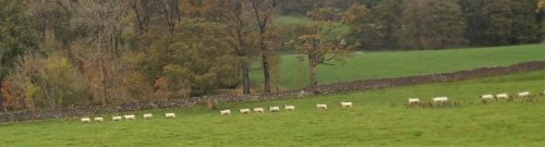 To get to our clough we weren’t sure about going direct through their farmyard so took a more circuitous route. Once in the autumn woods all was good, gentle walking above the beck.
  The little stream in the clough was our guide for the next hour. I’d been here before, once in a hard winter when we climbed with crampons and ice axes up the frozen cascades, how often would that occur nowadays? Today we made hard work of the steep ascent alongside of the beck.

 We [I] staggered to the plateau. Pause for views over Clitheroe. Little did we suspect what was to come as we reached the path. A gale force wind was sweeping across the moor. Fortunately it was behind us, from the west, but conversation became impossible. Or were we just becoming unsociable? Blown along the path past the Scouting Cairn we sought shelter in a sheep like enclosure for a hot drink and snack.


 Having gathered some rubbish left by others we continued along the plateau to the wall where you cut back to the true summit and trig point. Things have changed, there is a metal kissing gate in the wall at the Big End and the path up to the summit has been consolidated, now more of a yellow brick road. People were out in force, half-term, and some of them ill-equipped for the conditions. We didn’t spend much time at the trig point, you could hardly stand up and my hands were rapidly becoming frozen.
Back at the wall we found that elusive track that takes you off the Big End in lovely sweeping curves and down towards Downham.  We were glad to get out of the wind. Lanes link between farms below Pendle on this, its northern side. At one farm we were met by barking dogs, all very friendly, guess the name of the farm… Barkerfield.
And then we were back in Worston. We never met anybody on the north side of Pendle. I felt rather bruised and battered from the day, not as fit as I thought I was.
As an aside we came across some waymarks for a route we were unfamiliar with, their website gives all the information on an ambitious route through the best of Lancashire. http://www .lancashireway.com/ 
*****

I reckon wind can be the biggest problem arising from bad wether. One of the few times I have turned back from summiting was on Halls Fell Ridge on Blencathra with Tony. I was actually taken off my feet. And on a Munro (forgotten the name) with my friend Tom, on arriving at the summit the wind blew me over the shelter wall cutting my shin. We huddled in the shelter of those stones for quite a while before venturing out again for the descent.
Character building.
Pingback: A CIRCUIT OF PENDLE HILL VISITING A HIDDEN WELL. | bowlandclimber