 The Puddleducks cafe was just opening as we parked up in Dunsop Bridge so coffee was taken on their outside terrace. The plan today was to ascend Middle Knoll, a hill above Whitendale that neither JD or myself recollected visiting. On a recent walk here I was surprised to see how rocky the eastern slopes of Middle Knoll appeared and I was keen to investigate closer at hand a feature on the map marked Blue Scar.
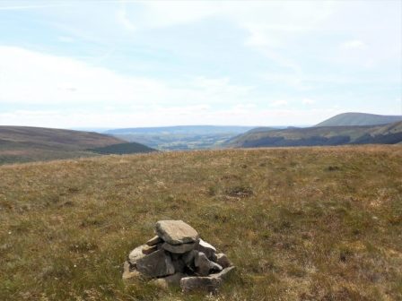
After a gentle stroll up the waterboard access road we took the left fork leading to Brennand Farm but immediately branched off on a path through the heather on the slopes of Middle Knoll. As we gained height we herded a few cattle in front of us. At some point we mutually agreed to start the steep climb up pathless ground to the summit, for about 500ft we staggered laboriously upwards trying to to keep to the easiest ground. This was one of those convex hills where you never see the top, you just have to keep going. The summit at 395m was marked with a few stones. The best views were southwards towards the Fylde Plain.


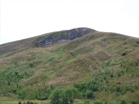
We crossed a nearby wall and ate our lunches in its shelter. Descending we were soon on the top of Blue Scar a steep shaley feature, a few little rock buttresses stood out but it all appeared loose and dangerous.
Curiosity satisfied we descended to the col but failed to find the path coming up from Brennand and stumbled about in high bracken and reeds for some time. Heath Bedstraw was in profusion. Eventually we came steeply down to Whitendale Farm. From down here Blue Scar was prominent. Those familiar Peak and Northern Footpath Society signs pointed in several directions, we chose the pleasant path leading down above Whitendale River to the luxuriant Costy Clough. 


After that we rejoined the outward route on the road alongside the River Dunsop. We thought that the beech trees down the valley had an unusually rich crop of nuts on display this year. 
Feeling weary from the heat and the steep trackless terrain on Middle Fell we were glad of a pot of tea at the cafe.
*****

Above and beyond – two days in a row on this tough Bowland terrain. What we need is a “Footpath Finder” app?
More of that later.
Pingback: BIRKETT FELL, A BOWLAND JEWEL. | bowlandclimber
Pingback: AROUND MIDDLE KNOLL. | bowlandclimber