Across the caldera.

Teide Volcano and the Cañadas caldera.
Image courtesy NASA
The above image gives a superb view of the Caldera, our walk was from middle left to lower central [where the trees start] and was an easy 17k with only 350m of ascent.
We took advantage of a good breakfast in the Parador and retraced our steps round to our path from Guaraja from the other day. There now stretched before us a flat track below cliffs to the SE with Mount Teide towering above us to the NW. If all had gone to plan we would have been descending from up there this morning. We walked through several flat Canadas, which apparently hold water after heavy rain or snow. There was evidence of old huts used by goat herders in the past. This area is also a good environment for Tajinastie, an Echium called Mt. Teide Bugloss, its red flowers were fading when we walked past. The other common plant in this barren landscape is White Broom. Onwards in the heat with no shade.


Tajinastie.

At the end on the road a visitor centre was busy and we had time to look around the ‘volcano exhibition’ including a video explaining how the Canary Island aboriginals (guanches) believed Guayota, the devil, lived inside Teide. Outside was a ‘botanical garden’ which I was looking forward to visiting to identify the volcanic plants we were seeing. What a disappointment, a scruffy lava hillside with few plants and even fewer labels, Our boots were completely covered in volcanic dust by the end of the day. Down the road was a welcome café where we passed the time waiting for the only bus of the day to take us down to Puerto de la Cruz, the nearest accommodation. 

 The bus station happened to be a few hundred metres from our good budget hotel, Puerto Azul. Due to a mix up with my booking we were upgraded to a balcony room with clear views up to Teide. I just had a feeling he was mocking us for our failed ascent. Throughout our stay the summit was clear, even at night with the full moon, we got to calling it Mount Tidy. Puerto de la Cruz turned out to be a pleasant place to stay, our humble hotel being right in the middle of the old town with lots of little alley ways and good restaurants. We had to try the local wine but were not impressed – tajinasty.
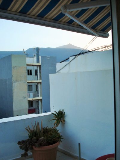


Just enlarged your photos. The one from the balcony makes Tiede look inviting, How far away is it and how high? The building opposite looks structurally dodgy – reminds me of my father, who was well known for apposite little phrases, taking us down to watch him fish, and crossing a little wooden bridge he turned to my brother – “Watch out Rod, it’s on the blink.”
Teide is 3,718m (12,198 ft), the highest Spanish mountain. Not to be sniffed at.
Unfortunately there is a restricted permit system limiting access. Our booking at the refuge would have circumvented that but didn’t work out and there was no alternative.
There is a cable car to within 200m of the summit.
Spanish construction is Spanish – on the blink.
What’s a canada? I’ve noticed this word on local maps here in Andalucia and assumed it was a ridge or something similar. But it obviously isn’t.
Alen
Yes I used to notice it on Spanish maps and place names. Only here on Tenerife have I discovered what the term meant. Low lying land between hills, often moisture laden and suitable for agriculture or grazing.