Tag Archives: Long Distance Walks

THIS MORNING.

SAM_3429

                                                                                               Al.

Today.  This morning the day begins well as I sit listening to a beautiful Blackbird serenading his belle. My spirit is uplifted. Then the phone rings – my climbing friend, Al, had passed away in the night. I’ve expressed my vulnerability here before, possibly cloaked in obscurity. Today I feel very vulnerable.

Yesterday.  We had been out on a gentle walk in the Bowland uplands, I was about to write a post about it. My ex-work partner and I meeting up with a close friend who had recently lost his wife to that cruel cancer of the pancreas. I had attended her funeral last week. We three walked through farms owned by The Duchy of Lancaster. now King Charles. A welcome sunny afternoon after all the rain. We talked of many things. Lambs frolicked in the fields just beginning to dry out. primroses covered the banks surrounded by reef knolls. This is Curlew country.

A chance conversation, or was it destined? at one of these remote properties with a retired teacher. Not sure how it started but at one stage –  “Do you remember Dave? I was his senior colleague for years in Blackburn”  “Bloody hell yes, a lovely bloke I climbed with him for years”  I replied. Naturally more reminiscing followed and I promised to phone Dave and tell him of the meeting and bring him up to date. 

I first met Dave in Preston Hospital when he was recovering from a serious climbing accident. An accident in which Al was influential in saving his life. Despite that accident Dave and I formed a comfy climbing partnership with his wife’s encouragement.

A few years later through Dave  I met Al (1982). I remember the day. It was at Attermire, a limestone crag north of Settle. Barrel Buttress to be precise. The start of a forty year friendship. He has made many appearances in my posts as ‘the plastic bag man’ – a reference to his trade rather than his street appearance. Regular meet ups in the Lancashire quarries every Wednesday night followed, along with the ‘rockman‘ and the ‘pieman‘. Holidays in the alps became an annual treat. Long days on the trails and long nights in the refuges. We lived life to the full is the euphemism.

We all got older and for some, physical activities were restricted. But that friendship continued with catchup meetings for a drink or a meal. Latterly all Al could manage was a phone call and then not even that. Bringing us to this morning. I ended up phoning Dave, not about my chance meeting with his headmaster but with news of Al’s death. Circles within circles. 

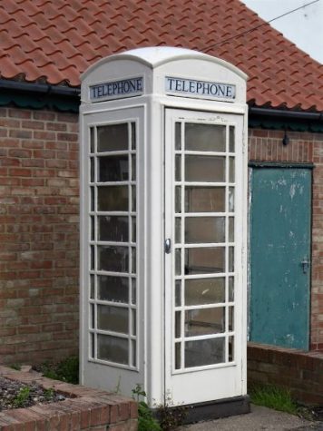
Thanks for bearing with my vulnerability, here are some photos of that walk yesterday with friends in Bowland including that iconic phone box, now put into another perspective.. My thoughts are with Al’s family.

P1050272

P1050275P1050276P1050278P1050283P1050285P1050271P1050287

***

In the words of Bob Dylan – It’s not dark yet.

SCULPTURES DOWN THE EDEN.

P10108732

 Eden Benchmarks are a series of ten contemporary stone sculptures located at intervals along the length of the river Eden between its source above the Mallerstang valley and Rockliffe, north of Carlisle, where it runs into the Solway Firth.
 “Each sculptor worked in residence for six weeks and this enabled them to formulate their ideas by familiarising themselves with the locations and talking with local people, including schools, who were encouraged to visit their workshops to see the sculptures taking shape. The artists’ brief allowed as much creative freedom as possible to produce site-specific sculpture, which harmonises with the landscape and captures the essence of each unique locality.
 Collectively the sculptures give visual expression to our awareness of the river’s ecology and the need to look after it; individually they foster a profound sense of place, their capacity as seats accommodating an interactive focus for quiet reflection.”

These sculptures were funded and commissioned by the East Cumbria Countryside Project group in 1996. It disbanded in 2008 when funding dried up, but the sculptures are still there even if not officially cared for.

I have already discovered the first two in the last couple of days, ‘WATER CUT’ in Mallerstang and ‘PASSAGE’ in Stenkrith Park, Kirkby Stephen. Today I intended to visit as many of the remaining eight before I ran out of daylight. It would mean more driving than walking, I had plotted a route down the Eden between all the village sites. The satnav on my new phone proved invaluable.

Capturebenchmarks

I’d enjoyed my two nights at the Black Bull in Nateby and they sent me off with a hearty breakfast, I didn’t eat again until I was back home in the evening. I stopped briefly in Kirby Stephen to take that photo of Lady Anne Clifford’s statue which I used yesterday. I noticed this seat with its friendly notice, I didn’t have time for chatting but what a good idea. As the benchmarks have all been sculptured to provide a seat to sit and contemplate this was a good start to the day.P1010658

A mad dash up the scary A66 and I was taking the road into Appleby. A little side lane, Bongate, lead down to an old ford over the Eden by a derelict mill and a small carpark. At the edge of the carpark was a rough looking boulder – could this be the benchmark? It was only when I walked around the other side of it that I could see fully the carved flower. I brushed the leaves aside and sat in it for awhile watching the river flow by. Stunning.

‘THE PRIMROSE STONE’ by Joss Smith at Bongate near Appleby.

Shaped from a nine ton block of St Bees Sandstone, the Primrose Stone magnifies the ‘inscape’ of the much loved first rose of spring. As you approach the sculpture from behind it looks like a rough erratic boulder and the carved petals of the flower at the front come as a surprise. It envelops the sitter in a bowl shape that is positively seductive and, like a primeval satellite dish, amplifies the sights, sounds and smells of the river”.

 Joss Smith lives in London. His work is mainly studio based and traditionally figurative but has recently been making accessible sculptures for public places.

P1010070P1010073P1010077P1010080P1010082P1010083P1010088

*

 I needed more time to explore Appleby but I was soon on the way farther north. I found a bit of roadside parking by the cricket pitch on the outskirts of Temple Sowerby and strode across muddy fields towards the river. You can see the state of the ground after all the heavy rain. The sculpture came as a surprise with the spheres scattered over the surface ripples. There was a distinct feeling of motion as the spheres ran into the river. I loved the ripple effects she had created around each grain.

‘Red River’ by Victoria Brailsford at Temple Sowerby.

“The stepped slabs of Lazonby Sandstone in this sculpture represent the contours of the landscape and its light, shade, pattern, shape and form. The spheres, reminiscent of gigantic pebbles in a fast moving stream, are a powerful evocation of the river and its energy but also, like hugely enlarged grains of sand, recall the origins of sandstone in the shifting sand dunes of Triassic Cumbria”

 Victoria Brailsford’s  work relates to ecological issues and ranges from charcoal drawings to wood carving and large stone sculptures. P1010107P1010110P1010117P1010116P1010140P1010120

*

 Back across the boggy fields and reset the satnav for Edenhall, a tiny red sandstone hamlet across the river from Langwathby. I park in a small pull off and ask the couple on the adjoining garden if I’m OK there. They don’t see many strangers in the village and I explain my mission. They are proud of their nearby Benchmark and regale me with their favourites, they haven’t made it to the Water Cut in Mallerstang as yet. I leave them to their pond maintenance and walk down the lane towards the squat red sandstone C12th church. I turn off at the wheel headed cross, the base looks ancient but the shaft as is often the case much more modern, There used to be a manor house down here which explains the churches isolated position surrounded by parkland. It also explains the name of the river bank walk I was about to set of along – The Ladies Walk. Built for the manor house occupants, a level path above the river with old iron railings and stone seats at intervals, fit for a lady. Not sure how far along I would have to go, met a bloke walking the other way but he knew nothing of Benchmarks. Up some steps and there is the sculpture. Two curved pieces of red sandstone in juxtaposition. They have graceful curving lines and wonderfully detailed surface rippling. The low lying one is being gradually covered by green moss and for a moment I think of cleaning it to reveal the detail, but I stop myself in time. These sculptures were specifically envisaged to reflect the landscape and now I feel they are slowly becoming part of it. That is probably hidden praise for the sculptor’s skill in the first place. I was warned that the ongoing path was flooded so I turned tail  and followed the  ladies alongside the ever enlarging river.

‘South Rising’ by Vivien Mousdell on Ladies Walk at Edenhall.

“Made from Lazonby Sandstone, ‘South Rising’ pays tribute to a vigorous ecosystem, representing the river’s perpetual journey and the annually recurring movements of migrating fish and birds. The horizontal stone alludes to the river itself, flowing north, and the tall vertical stone, with perhaps a passing resemblance to Long Meg, inclines south toward the rivers distant source. Chiselled with a surface texture reminiscent of water reflected sunlight, both stones have been carved in sweeping curves like the surrounding landscape, creating a rhythmic energy passing from one to the other”

 Vivien Mousdell trained in ceramics but switched to wood and stone carving and letter cutting. A skilled and versatile artist she has specialised in public commissions such as the stone boundary markers on the Cleveland Way and a variety of wood carvings on the Whitehaven to Ennerdale cycle path. She is also a puppet maker and performer and video artist. Some people are just so talented.

P1010717  P1010674

P1010677P1010713P1010679P1010682

P1010691P1010687P1010689P1010685

P1010711

 *

 Straight up little lanes in picturesque scenery, through Great Salkeld, I need to visit Long Meg and her Daughters on the other side of the river some day. Down there by the river are Lacy’s caves, chambers carved into the soft sandstone, which I distinctly remember from my Eden Way walk all those years ago. There was also an excellent climbing crag which is unfortunately now banned. Public footpaths and access are at a premium along this stretch which is a disgrace. The Settle-Carlisle line comes through the middle of Lazonby, I duck under it and head for the riverside picnic area. The Eden is in full flow. In rather drab surroundings the next benchmark lies low in the grass, can you spot it? P1010747P1010724

This one really is becoming organic. Moss is taking over and obscuring most of the stones’  cyphers. I see the sun or is it moon at one end and that’s about it. I do like the view up to the graceful bridge though.

‘Cypher Piece’ by Frances Pelly at Lazonby.

“The sculptor presents us with a series of puzzles to be decoded. The combined stones mimic the river landscape and contain various references to human history. A sun and moon have been carved at one end of the sculpture representing the winter solstice and a variety of images are portrayed elsewhere, including a fish, a Roman 1996, a Celtic horses head’ a rams horn and decorations taken from a Norse tomb”

 Frances Pelly lives in Orkney. As well as carving stone she also works in bronze.  P1010738P1010732P1010733P1010740

 *

 Where next? A short drive along the valley to another delightful village, Armathwaite. This a spot I know well having climbed on the riverside crags many happy times. I parked at the bridge and walked through the grounds of the Fox and Pheasant and up into Coombe Woods on a carpet of leaves until quite high above the river and the crags. The path leveled out and there was the carved block in a ring of smaller stones. I could easily pick out the intricate carvings of discarded clothing from the bloke who has gone for a swim. What an imagination, the sculptor’s not mine. I found a lower way back closer to the roaring river. A magic stretch of water.

‘Vista’ by Graeme Mitcheson in Coombs Wood near Armathwaite.

“A solitary walker reaches a plateau in Coombs Wood where beneath him, between the trees, he can see the winding river Eden. Nine stones form an ellipse in clearing. It is a hot day and he removes his clothes and goes for a swim. This sculpture is about walking in the countryside and being at one with nature. The largest of the stones is carved with representations of various items of clothing and a map, which also functions as a sundial. A tiny face depicted on the cap is reference to a series of faces carved on the cliffs below in 1885 by William Mounsey who famously walked the length of the Eden”

 Graeme Mitcheson  lives in Derbyshire. His work is based in traditional stone masonry and he turns his hand to everything from commissions for bird baths and garden ornaments to architectural restoration and memorials.

P1010757P1010762P1010766

P1010774P1010785

P1010788

P1010797P1010810

 An easy drive and I was parked on the village green at Wetheral near the church. It was just after one o’clock and for the first time I thought I might make the Solway today. A steep little lane took me down to the river and there was the next sculpture on a flat piece of land. This was a large affair, a bench with angels’ wings, cushions and arched panels reflecting the nearby bridge.

‘Flight of Fancy’ by Tim Shutter at Wetheral.

“The steep scale of the wooded bank across the river and the soaring viaduct combine to give the feeling of an outdoor cathedral. ‘Flight of Fancy’ plays with this ecclesiastical sense of lifting the spirit with angel’s wings, church style masonry and very convincingly carved prayer cushions”

 Tim Shutter is a master stone mason in the classical tradition. He is based in London.

P1010819P1010838P1010823

P1010825P1010826

P1010831

Back on the village green I became distracted by some tiny yellow fungi hidden in the grass -possibly Golden Waxcaps? There’s beauty in the minutiae too. P1010844

 *

 I was apprehensive of my detour into the centre of Carlisle for my penultimate benchmark. I new there was some parking near the castle so I asked my phone to take me there. It was clever enough to warn me that “the castle may be close today” Despite the heavy traffic delays I eventually arrived in the car park but couldn’t understand how to operate the pay machine. Two ladies took pity on me and as they had just finished their shopping spree gave me there still in time ticket. I felt the day was slipping away with these delays. P1010850

I walked towards the river only to find another car park without charges, the dog walkers used this one. Somehow rivers either bring a city to life or become subjugated into the background. The river Eden in Carlisle is of the latter character – lost between rail, roads and industrial sites or maybe it was the dullness of the afternoon that prejudiced me. The four stones were set in a line in the parkland alongside the river. Strange angular carvings which didn’t relate easily to me, erosion usually produces smoother features. OK they are smooth on one side but I find the other angles jarring.

‘Toward the Sea’ by Hideo Furuta in Bitts Park at Carlisle.

“The four components of this sculpture are manifestations of the sculptor’s intense and mathematical explorations of the stone itself and, almost incidentally, describe a sequence of water eroded stone running parallel with the flow of the river nearby”

 Hideo Furuta sadly died in 2007 aged 57. He was an artist of international standing and was based at a granite quarry  in Dumfries and Galloway. P1010853P1010861P1010862

 *

 Maybe I was a bit harsh about Carlisle as I know from my trip on the Hadrian Wall path that the Eden is in magnificent form either side of the city. Anyhow I was pleased to find an easy way out of the city to my last destination, the village of Rockcliffe on the Eden before it slips into the Solway.

The clock had turned three and the light was fading and I couldn’t find anywhere to park. I eventually used the carpark of a nearby pub and walked on down past the church to a little red cliffed bay area next to the river. Flood debris showed that it is often underwater. At the end I could see my final benchmark and thankfully it was a thing of beauty reminding me bizarrely of the amoebae I used to study under the microscope. How does the sculptor achieve such smoothness and shapes out of a block of sandstone? My only thought is that it could have been positioned closer to the Solway estuary itself but there may have been practical reasons against that. Here I saw the river slipping around the corner into that unseen estuary. I found a place to sit inside it and watched the sun fading in the greyness over the flat marshlands.

‘Global Warming’ by Anthony Turner at Rockcliffe.

“The title of this sculpture is indicative of its global perspective. Situated where the river Eden flows out to sea there is an expanding awareness of the wider world. It could simply be a huge sea creature washed onto the shore but it conveys the sense of an even bigger scale. There is a mysterious pregnant silence about it and it resembles a planet earth held carefully in a hand. The term global warming is now ominously synonymous with the world overheating yet we would like it to mean a nurturing, life enhancing glow”

 Anthony Turner was born in Kenya. A self taught painter and sculptor.  Recalling his childhood in Africa his sculptures are organic, exotic and sensual.

P1010878P1010879P1010883P1010881P1010886P1010892

*

 What a journey. I didn’t expect to reach all the Benchmarks today but time just seemed to flow for me. You must admit these sculptures are so impressive and yet so diverse. At each one I felt a strong connection with the artist, the stone and the setting. It is too late for me to rewalk the Eden Way but wouldn’t that be a finer way to appreciate the river and take in these works of art.

I’m back home after an easy motorway journey from Carlisle and preparing to visit my cousin and her husband down in Derbyshire. In the past I have shared walks with him but now he has advanced dementia and is bed bound.  Maybe I’ll show him some pictures of the River Eden.

ARTY THINGS IN THE EDEN VALLEY.

P1090554

It must be 40 years since I walked  ‘The Eden Way’, which as the name suggests follows the River Eden from its source in the fells above Mallerstang, through Kirkby Stephen and Appleby, past Carlisle to the Solway Firth. I remember I only took a bivy bag for lightness and ended up quite damp several mornings.

It’s an area a little out of comfortable reach from Lancashire and I have neglected it over the years. Some recent climbing nearby has brought it back to my attention and it so happens that one of the many books I have read in this month or so of poor weather was ‘The Stream Invites Us To Follow’ by Dick Capel. ( I seem to recollect John Bainbridge recommending it, that is one of the joys of Blogging, your readers, few though they may be, often come up with suggestions which you have overlooked. Thanks John )

Dick Capel came to Cumbria in 1982 working as a warden in the National Park as it was then. He changed areas in 1991 starting work for the East Cumbria Countryside Project, ECCP. This aimed to promote the conservation and enhancement of the natural environment of East Cumbria.  During this time he became heavily involved with the Eden Valley and particularly in developing a series of sculpture trails reflecting the area. He  writes evocatively of the area and his own trials and tribulations. In particular he highlights The Eden Benchmarks, The Poetry Path and a series of Goldsworthy Pinfolds that appeared under his watch.

*

The Eden Benchmarks.

The  Benchmarks are a series of ten contemporary stone sculptures located at intervals along the length of the river Eden between its source above the Mallerstang valley and to the Solway Firth.

“Ten sculptor’s were chosen as part of the East Cumbrian Countryside Project, ECCP. The artists’ brief allowed creative freedom to produce site-specific sculpture, which harmonises with the landscape and captures the essence of each unique locality. The sculptors worked in residence for six weeks and this enabled them to formulate their ideas by familiarising themselves with the locations and talking with local people, including schools, who were encouraged to visit their workshops to see the sculptures taking shape”

“Collectively the sculptures give visual expression to our awareness of the river’s ecology and the need to look after it; individually they foster a profound sense of place, their capacity as seats accommodating an interactive focus for quiet reflection”.

*

The Poetry Path.

Encouraged by the success of Eden Benchmarks Capel’s next arts project was the Poetry Path by the Eden on the edge of Kirkby Stephen interpreting the hill farmer’s life and love for the Eden Valley.

“Twelve short poems, written by Meg Peacocke, have been carved by lettering artist Pip Hall on blocks of stone installed at intervals along a circuital route either side of the river Eden. Decorative motifs with each poem depict some of the activities associated with every month of the hill farmer’s year”  

“The aim of the Poetry Path is to introduce a permanent and integrated interpretative experience into the landscape, which is assimilated as part of the heritage it promotes and conveys a powerful message about the farmer’s potential role in maintaining a sensitive but viable hill-farming regime in relation to the natural environment as a resource both for nature conservation as well as food production”.

  I could not have written that.

*

Andy Goldsworthy’s Pinfold Cairns.

In the area there are six of these stone cones built into village pinfolds, which used to hold stray animals,  Created by the sculptor Andy Goldsworthy (1996 – 2002) supposedly based on the prominent piles of stones called the Nine Standards above Kirkby Stephen. At one time Goldsworthy lived in the area.

*

The funding ran out in 2008 for the ECCP.  But the art remains. Sculptures and poems reflecting the area’s heritage and beauty, and hopefully enhancing peoples enjoyment and understanding of the countryside and environment.

Dick’s book has acted as a catalyst for some exploration on my part. I find myself visiting friends up here so I have decided to stay on, I’ve booked into the Black Bull in Nateby for a few days. P1010169

A related website  provides all the information you need on all the installations. I have quoted above from that site.

P1010171

*

“The stream invites us to follow…and certainly, there is no more fascinating pastime than to keep company with a river from its source to sea”  W H Hudson, Afoot in England.

“both the water of life and the river of death”

Amazon_logo.svg

The walking  and even the gardening has been put aside, and I’m spending a lot of time reading whilst it rains outside. My cousin has just published a comprehensive history of the parish of Bolton by Bowland. (Spot the B connection). He has lived there for many years and has spent much of his time researching the history, geology, genealogy, ecology and everything else interesting relating to the village and surrounding area. I’m already well through my complimentary copy and have learnt so much more of our nearby neighbourhood and English history in general.

(Our Craven Parish. Bolton by Bowland.  John Pallister.  ISBN 978-1-911138-39-6.  Amazon doesn’t stock it. When I see John next week I’ll find out where it is available.)

That brings me to that other subject – my aversion to Amazon. I don’t like to be controlled by some giant all invading corporation.  I have no wish to subscribe to Amazon Prime when I try to order a paperback. Can one control the internet?  I suspect not. Unfortunately all of us are hooked, even by innocently reading this post you are being tracked. I use the independent Blackwell’s or Abe books wherever possible. I now find out that Abe, even though they support smaller suppliers, is connected to Amazon!  What is the future for independent bookshops? They need the internet to sell their hidden volumes and yet Amazon must be contributing to the physical bookshops closing every week.  “both the water of life and the river of death”  is a quote from Simon Armitage, our current Poet Laureate

I’m presently into Simon Armitage, with an ongoing project to visit the Stanza Stones, his poems carved into Pennine rocks by Pip Hall.  http://www.stanzastones.co.uk/

Walking Home by Simon, his journey on the Pennine Way back to his home in Marsden. is a book I have just finished. A modern troubadour paying his way by poetry recitals in a variety of venues along the way. I found his writing engaging and romped through the volume. So it was back to Abe for the follow-up Walking Away. a similar trip bringing to life the SW Coastal Path. All Points North is a gritty and amusing  predecessor. He certainly does have a passion for observation and words.

It’s still raining, so I will start on something different, the next book.  A Celebration of Lakeland in Winter by a John Pepper. A recommendation from George at  Lakeland Walking Tales ‹ Reader — WordPress.com  That’s the value of blogging and linking into far more professional sites than mine.

My simple reading list is endless, and maybe I have added to yours.

CICERONE’S LANCASHIRE – ALMOST INTO YORKSHIRE.

P1000294 (2)I couldn’t resist a decent hill day as the weather remained fine. All change next week. ‘Head east old man’ was my mantra as I sped along the M65. Everyone else was going west to Blackpool or the Lakes. Boulsworth Hill my objective. So far so good, but the last chapter of Mark Sutcliffe’s Lancashire Cicerone guide would have had me parking above Wycoller. If there ever was a honeypot then Wycoller deserves that title. A secluded village of agricultural and hand loom workers in the C16th to C18th. Along came power looms in the C19th in nearby Lancashire towns and the population moved out. By 1896 the majority of people had moved away from the village, and it was virtually deserted. But a renaissance occurred in the mid C20th, the area was incorporated into a Country Park and people started moving back into the village renovating the properties. I well remember Longridge acquaintances of mine telling me of their plans for one of the houses in the 70s. I suspect you would have needed a bottomless purse to go ahead.  For more information look at Wycoller (abandonedcommunities.co.uk)

The village is a now a conservation area and is closed to outside traffic. The car park on Trawden Road is the one suggested for this walk. Today, Easter Sunday I suspect it would be probably full by the time I arrived and you have to pay. So I decided to park up in Trawden village on the line of the walk. This worked well, makes the walk more balanced and avoids backtracking at the end. I will give details at the end of the post.

Out of the car I was soon winding my way up a lane into the hills, slightly more directly than Mark’s route. Footpaths then led past isolated farms. I came across two unusual stone stiles with a circular centre and  exits into three separate fields, difficult to describe and difficult to photo, but I have never seen anything like them before. On down an ancient track into Wycoller.

P1000201

Early fields with the amorphous Boulsworth on the horizon. 

P1000202

Early crows’ nests in the bare trees. A walled enclosure like a pinfold. 

P1000211

P1000213

P1000214A good start to the day, although by now it was after noon. The expected crowds were milling around in the hamlet. Crossing and recrossing the series of bridges over the stream. For the record …P1000218P1000217P1000234

The information centre/café appeared closed, but some enterprising folk were running a mobile coffee shop, it was too early for me. This walk gives you the opportunity to explore Wycoller if you haven’t been before. I had a look around the remains of the hall and was reminded of the time when I slept in the fireplace Inglenook whilst on a two-day trip around the Pendle Way. At the time I was unaware of the phantom horse ghost story associated with the hall.  If I had known I may have slept elsewhere. P1000224P1000223

You have had enough historical homework on the area so far, and it is time to move on. There are ways either side of the stream, but the important junction is well signed leaving the Pendle Way and the Bronte Way to take a concessionary path alonside Turnhole Clough. (the Bronte connection being that Wycoller Hall may have been the inspiration for Ferndean Manor Jane Eyre’s residence with Rochester after the fire at Thornfield. The Bronte Way is a worthwhile short/long distance way)

Families were enjoying the country park with Easter picnics whilst high above the sci-fi Atom, one of Lancashire’s panopticons, looked down on us. P1000227P1000229

I don’t think I have been in Turnhole Clough before and I enjoy strolling through the trees above the lively beck. This sort of concessionary path should be more commonplace, I can think of several areas crying out for access. It just needs the local authority and landowners to come to some agreement, maybe pushed by interested rambling groups. P1000238

P1000239

P1000242

Anyhow, eventually the Clough brings me out onto open moorland. Above on the skyline is a row of rounded gritstone boulders which look interesting. I have a hill to climb today, so I’m not keen to add extra height wandering off route to them. There is a path up towards them but when I later search on the UK database there is no mention of them being climbed upon. I now regret coming so close without visiting, all I have are some telephoto pictures. What are they 10, 20 or even 30ft high, it is difficult to tell? Another day. P1000243P1000250P1000251

The book states you come out at the bailey bridge and cross it, but the concessionary path actually brings you back onto the Pennine Bridleway/Bronte Way above the bridge.  Now we head across open moorland on this ancient flagged mule track.

P1000252

Perfect wild camp site in the upper Turnhole Clough. 

P1000259

Which way? 

P1000264P1000269

Up and down until the barn where a signed path heads upwards to Boulsworth. This is a relatively new way so tends to just head upwards, none of the characteristics of worn winding historic routes. All is well until a fence is crossed and then the brutal 1000ft climb rears up steeply in front of you. I’m too old for this game but plod on at a slow pace being glad I stopped for an energising bite to eat back in the clough. Sometime later I breasted the ridge at some prominent gritstone boulders, Little Chair stones. Onwards past more boulders, The Weather Stones, I give them names in my imagination or am I hallucinating? Any suggestions?

P1000270 (2)

Start of the ascent. 

P1000275

The steepening. 

P1000282

Forever onwards to the Little Chairs. 

P1000288

P1000290

P1000291

P1000293

Up at last to the trig point at 518 m, Lad Law. There was nobody else here. Panoramic views over Lancashire and Yorkshire but now a little hazy. Am I actually in Yorkshire, well not quite but a stone’s throw away paths head deep into Bronte Country to the east. It all looks very bleak.

P1000298

Lad Law trig 518 m.

P1000302

A hazy distant Pendle over the Coldwell Reservoirs.

Turning back into Lancashire I head off downhill past the prominent Abbot Stone, too steep to contemplate bouldering.

P1000309

The Abbot.

P1000311P1000317

Boggy ground has me back on the Bridleway where after a few yards a stile takes me into fields and alongside Gilford Clough. Farther over to the right is Lumb Spout waterfall, a hidden gem. Maybe Mark missed a trick there, worth a diversion if you know where it is.

P1000320

Gilford Clough

I’m content to walk down the lane past an assortment of farmhouses, cottages, hen houses, barking dogs and allotments back into Trawden. A village where the residents run the library, pub, shop and community centre.

P1000323

Trawden FC?

P1000324

Free cooperative seeds. 

P1000327

Is they Islay? 

P1000325

Yes it is Spring but not summer.

***

My parking was on Lanehouse Lane just past the bowling green area alongside an old cotton mill where there is adequate room close to where the route enters and exits the lane. SD916380 

I was glad of this choice for it meant after a long tiring descent I was saved the climb back over to Wycoller completed  earlier. The map makes sense.

Captureoulsworth hill

CICERONE’S LANCASHIRE – THE UPPER WYRES.

DSC03324Down on the River Wyre in St. Michael’s a tragic drama is transpiring, a 45-year-old local lady, Nicola Bulley, has gone missing whilst walking her dog by the river. You will have seen it on the national news, the trauma her family are going through as the days pass, without resolution, doesn’t bear thinking about.

***

The River Wyre comes out of the Bowland Hills above Abbeystead, the Tarnbrook Wyre and the Marshaw Wyre join forces there and head off into the Fylde to reach the sea at Knott End/Fleetwood. A dramatic journey. I walked the whole of the Wyre Way in 2014, can’t believe it is so long ago. Today I’m parked up in a lay-by alongside the Marshaw Wyre at Tower Lodge as suggested by Walk 11 in Mark Sutcliffe’s Cicerone guide book, exploring these two upper Wyres.

I’ve just driven through the ‘Trough’ from Dunsop Bridge, a way through the hills beloved of NW Lancashire cyclists. There were plenty this morning, the forecast being good with sunshine and little wind. In fact the last time I came this way was on my cycle way back in 2014, I remember it being a tough ride in this direction. I would need an electric bike I think for such exploits now. I have previously walked a version of this route in reverse, again in 2014.

I thought the lay-by might have been full by the time I turned up at 11am, but there were only a couple of cars. Boots on and immediately a steady uphill begins. By chance, I’m heading into The Duke Of Westminster’s territory once more. I was disparaging about grouse moors in my recent post on Clougha Pike, so today I start optimistically with only healthy thoughts of the great outdoors. I can’t believe it the first WW stone marker, of which there were many better examples along the way, depicts a rifle and a grouse. Condescending bastards.

DSC03281

Putting that aside I march over the hill to views of the Clougha Pike/Ward’s Stone ridge above the Tarnbrook Wyre. I’m glad I’m not going up there today – it’s a tough long walk, although the Duke’s new motorway had made it easier in parts. We used to go up there to climb/boulder on Thorn Crag before it was open access, often resulting in being forcibly ejected. The CRoW act of 2000, despite its limitations, has been a gentle step forward. I cross the infant Tarnbrook Wyre without much thought to its journey from up on Ward’s Stone.DSC03285

DSC03312

DSC03310

The last time I came through Tarnbrook, an old farming settlement at the end of the road, I got talking to an elderly gent, born and bred there and the last remaining permanent resident. (his family checked up with him every day). I doubt be is still here as the properties all seem to be in the process of modernisation – for rich incomers or holiday lets? A lot of history possibly lost.

DSC03306DSC03304

Turning my back to the hills I make my way across multiple fields westwards. Yes the stiles are rickety and not easy to spot in the low light. A few adjustments are needed after my phone GPS mapping is consulted, in the past I would have been much more careful with map and compass.

DSC03314

DSC03319

A friendlier waymarker.

Abbeystead is reached without too much trouble and the Tarnbrook Wyre, (header photo) now more sizeable is crossed at Stoops Bridge, a popular parking area. The hamlet is the centre of the Duke’s Abbeystead estate with the mock Elizabethan estate offices, cottages and old stables.

DSC03323

Gated entrance to the Duke’s Abbeystead House.

DSC03325DSC03327

My path takes off from the road at the far end of the village, taking me high above the Reservoir and then down below the dam and a footbridge over the Wyre. The reservoir is silting up and there is a constant cascade of water over the beautifully curved dam. All very dramatic.

DSC03330DSC03333DSC03334DSC03335DSC03338DSC03346

The concessionary path alongside the water is in a dreadful state. Too many feet on the muddy terrain. There is an alternative higher path to the south via Marl House and Hawthornthwaite, longer but more sustainable.  It takes an age of slippery sliding to reach dry land again near the Stoops Bridge parking.DSC03347DSC03350DSC03356DSC03349

DSC03351

The Tarnbrook meets the Marshaw Wyre.

Then the parkland of Abbeystead House, the raison d’être of the area, is traversed with tantalising views of the enormous property. Lots of fields and stiles often high above the Marshaw Wyre. I must have fallen asleep and come out onto the road well off route. My map shows it all.

DSC03357

DSC03362DSC03363DSC03367

The Marshaw Wyre is then followed closely back up the Trough road to those well known pines alongside the river. Tower Lodge was a welcome sight. I was getting tired and have measured my route as 8.5 miles as opposed to Mark’s 7.25. Some of that was me getting lost.

DSC03376DSC03379DSC03381DSC03384

I have reservations about this walk, yes stunning scenery in parts but lots of field stiles to negotiate, needing careful navigation. The section to the south of Abbeystead Reservoir is horrendous, muddy and awkward. I think the route would be more balanced starting in Abbeystead, with an option to take the difficult reservoir 1.5 mile loop. The road up Marshaw was tedious at the end of the day, it would be so much more enjoyable early in a walk that gradually gained height and then brought you back anticlockwise down to Abbeystead.DSC03377

***

CaptureWyre Way

CICERONE’S LANCASHIRE – the darker side.

DSC02244

I’m being unkind there, the darker side of the Pennines is actually in the White Rose county. But it is often gloomy as you drive down through these eastern Lancashire valleys with the prominent Peel Tower watching over you.

Walk 28, Holcombe Moor from Ramsbottom promised “A non-too-demanding walk from the endearingly quirky of Ramsbottom up onto the moors and back in time for coffee and cake – or a pint – in one of many inviting bars and cafés” That turned out to be a little short on the detail, both good and bad, but we are out for adventure and discovery after all.

Ramsbottom, forget the corny jokes, is, or was a solid Lancashire Mill town. Wikipedia as usual has more than enough information. It is now an apparently thriving, on the evidence of all the people there today, shopping destination. Its strength is the number of independent businesses both basic and frivolous. Parking was not easy on a busy Saturday. The station, one of the main attractions, with sometimes steam hauled trains up the valley on the East Lancs Railway was just around the corner. Only diesels today but come later and there will be Santa Specials.DSC02246DSC02245DSC02251DSC02253

DSC02254

Relics of the past.

I’ll gloss over the first stretch through a modern industrial landscape. But all of a sudden one is out into open fields with the River Irwell alongside. I’d been here before on the  Irwell Sculpture Trail which at the time seemed very short of sculptures. Today I was noticing things new like the ‘stone hedge’ bordering a field, the nod to industrial heritage on the site of Cross End Mill, (a C19th dye, bleach and subsequent textile print works) the little allotments and a modern day communal food bank.

DSC02258DSC02269

Capture Cross End

DSC02270

The path deposited me in the isolated hamlet of Strongstry, a couple of back to back streets which must have provided housing for mill workers in the past. There seemed to be a sense of community with book banks and bird feeding stations. A nice place to live.

DSC02277DSC02271DSC02276DSC02275

Now for the interesting and unexpected bit, underplayed in the book. A scramble up alongside a lively stream in a hidden, rocky, tree lined gorge. Pure delight for 3/4 of a mile and 500 feet of climbing. Well done the National Trust who care for this land.

DSC02289DSC02283DSC02286DSC02285

Out the top and across the road the character of the walk changes as open moorland is reached with increasing views over all those industrial valleys. The arrival at the top was greeted with a plethora of signs warning of the dangers of the MOD firing range, with more regulations than you could throw a bomb at. There were no red flags or explosions today, so I could happily trip along the ridge of Holcombe Moor.

DSC02300

DSC02299

The main point of interest was a stone monument erected in 1902 on the substantial base of an ancient Pilgrim Cross. The inscriptions told of the way to Whalley Abbey in the C12th.

DSC02310DSC02311DSC02313DSC02312

From there I could have made a beeline to the distant Peel Tower over Harcles Hill, but the going looked boggy and besides I was following Mark’s footsteps. His way was no less boggy but had views down into the steep sided valley of Red Brook south of Bull Hill. I’m not certain I took the right track, there were so many, but eventually I homed in on Pell Tower after an arduous half hour or so, again underplayed in the guide. It was a lot taller than I had remembered, 128ft in fact, and today as always the destination of many family groups coming up the short way from Holcombe. Built in 1851 with public subscription to mark gratitude to locally born Sir Robert Peel for repealing the complicated Corn Laws which were causing starvation in the agricultural workers. Political intrigue was as complicated then as it is today. I think of him more for his reform of the criminal justice system and the establishment of Police Constables, ‘peelers’.

DSC02314

A murky tower in the distance.

DSC02317

Arduous conditions – welcome to winter walking.

DSC02322

Bull Hill – I’ve never knowingly visited.

DSC02329

Tried an arty shot with the ‘towers’ of Manchester in the background. It didn’t come off.

DSC02332

Look at the size of the figures.

I found a good stone to sit on overlooking the valley and opened my lunch box containing my lovingly handcrafted egg and tomato salad sandwich. Placing it on the stone behind me whilst I poured some hot tea. Reaching for the anticipated sandwich it had disappeared. I had to look twice, but it just wasn’t there. The culprit was a silent poodle who must have crept up behind me, there he was finishing off my lunch higher up the hill. I suspect his owner was hiding out of shame.

DSC02338

There’s a dog up there…     I’m on my way down.

Rested but not fed I started to make my way down steep tracks, past a Millennium Bench, and lanes through Holcombe. A mixture of old stone cottages and extravagant new properties, the former predominating the lower I went. My intention was to stop off for a pint in the Shoulder of Mutton pub and phone the plastic bag man, living nearby, for him to join me in what was once one of our haunts after climbing. But alas the place was boarded up , landlord needed. It is not a good time for pubs. So down steeply, and I mean steeply, into Ramsbottom.DSC02340DSC02341DSC02343

DSC02348

A Lowry’esque church – Holcombe.

DSC02351The streets were still busy. I was disappointed to see also that the Grant Arms in the centre had closed, I stayed there on the Irwell Sculpture Trail, it was pretty grotty at the time I must admit. It is now a financial investment office. You can see why traditional pubs suffer as quite a few small bars were scattered around, offering a good range of beers often home-brewed, cocktails and a bright environment. They were all full of happy people.DSC02357DSC02355

DSC02353

Maybe here lies the answer…

DSC02359

…more likely here in a modern bar.

I was pleased to see that the welcoming Chocolate Café across the way was still in business, it was always a haven on shopping trips. All things chocolate.DSC02358

Anyhow, a change of plan, and we were soon sat in The Garsdale on the edge of Bury enjoying a beer and chewing the fat as they say in these parts.

A superb varied walk full of interest but a little more demanding than Mark suggests, or am I getting old? Surely not. Thanks for sticking with me.

CaptureRamsbottom.

CICERONE’S LANCASHIRE – A regular Ribble ramble.

A walk I must have done dozens of times. I was looking for a short flattish walk to test out my knee. Walk 22 in the Cicerone guidebook fitted the bill, and I was anticipating the woods full of bluebells. It turned out to be a day of bright sunshine but with a violent wind out of the east.

The Shireburn Arms in Hurst Green was busy with the sunny weekend weather. I didn’t use their car park but found a spot in the village near the war memorial. Lambing Clough Lane took me down past the C17th Trough House (they have a fetish for weighing scales) to the new Dinckley bridge over the River Ribble. The river was running low with the exposed pebbly beaches accessible.

This stretch seemed to be popular with dog walkers today – but doesn’t everyone own a dog or two now. Entering Marles Wood the path threads between the trees often awkwardly over the exposed roots. The bluebells were only just starting, but there was a good display of  Wood Anemones and the Lesser Celandines were hanging on. The new beech leaves were the greenest of greens.

At Sales Wheel the river was completely placid, compare with conditions when running high – SALES WHEEL – THE RIBBLE POST-FLOOD.

One of the problems with this circuit is the kilometre of road walking from Salesbury Hall to Ribchester bridge. The road however was quiet and my attention was directed to the wayside plants. The blooms of the Blackthorn are fading to be replaced by the emerging Hawthorn. Yellow Dandelions and white Dead Nettles covered the verges. Soon I was crossing the elegant bridge which has seen some recent damage from vehicles.

Onwards past the farm and into the riverside woods where flood debris is always piled up, but thankfully someone has been collecting the plastics. Unfortunately the right of way leaves the river, what a shame – if only access could have been obtained all the way back to Dinckley Bridge. I have in the past persisted in trespassing alongside the river but remember it being difficult. On this day in 1932, hundreds of folk marched on the famous Kinder Scout protest, and we are approaching a time when we may need to resist the Tory’s crackdown on our access to land.

I’ve always found navigating the fields here a bit of a challenge and Mark’s  directions didn’t really help. The bluebells in the woods at Starling Brook compensated for my previous disappointment. Wild garlic was also showing well, I must pick some for a delicious meal with poached egg.

There are good views of Pendle and the Ribble Valley from these hills. With luck, I arrived at the bridge over Dean Brook, the stream I followed to find Raven Lumb Falls last April.

A steep climb led back to Lambing Clough Lane and into Hurst Green.

As an aside on the way home I spotted another of those evocative slate poems next to St. John’s Church.  Poignant thoughts.

Anyone wanting to follow this walk could shorten it by parking at Marles Wood and avoid the loop into Hurst Green.

*****

LAST DAY ON THE TWO SAINTS WAY.

Cannock to Lichfield.      7 miles.

  My B&B host gives me a lift back to the Ring Circle Fort, and I’m on my way, downhill to Lichfield.  One was supposed to be able to see the cathedral from up here, but low cloud prevented that. There was good walking up on Gentleshaw Common and then old tracks through woods to come out onto quiet lanes to sleepy Chorley.

Back into the fields I came to Farewell Hall and the Church of St. Bartholomew built on the site of a priory.

For the next two miles I walked along the ancient Cross In Hand Lane, so named from the wooden cross pilgrims would hold as they approached St Chad’s Well. This lane was a joy to walk, in places hewn out between sandstone banks and in others with mature hedges. A scattering of farms were passed along the way, and at the bottom of the last hill a cave reputedly used by Medieval candle sellers to pilgrims.

Medieval cave?

Lichfield was entered alongside the old Pinfold, which has been recently restored.

The house belonging to Erasmus Darwin, the Physician and naturalist and Charle’s grandfather, is now a museum in the shadow of the cathedral. The man himself was looking out of a window. There are many fine houses in Lichfield which is worth a longer visit.

At last the three unique towers of Lichfield Cathedral were seen as I approached the magnificent entrance. A Saxon church was built here to house the bones of St Chad, to be replaced by a Norman Cathedral, the present Gothic structure dates from the 13th and 14th centuries.  One walks down the beautifully vaulted nave, through the chancel and there in front of you is the shrine of St. Chad.

Behind in the Lady Chapel are the famous Herkenrode stained-glass windows rescued from Belgium. St. Chads Head Chapel was closed to the public.

Two relics related to St Chad were on display —  The Lichfield Angel,  a beautiful limestone carving from the chest that contained his bones. The 8th century St. Chad Gospels, from which St Chads cross emblem was derived.

Leaving the Cathedral I notice the statue of St Chad by local sculptor Peter Walker  recently installed in the grounds. He looks a kindly man. The south door is every bit as good as the main one,

I then wander alongside the lake, Stowe Pool originally a 12th century millpond and fishery, to reach St Chad’s Church and Well and my final interpretation board!  When St. Chad arrived in Lichfield, 669, he baptised converts at a local spring and founded a monastery. He was buried here in 672 but his bones moved the Cathedral when it was built in 700. The present day church is mainly from the 14th century with many more recent modifications. Nearby is the Well which has been popular as a pilgrimage place, at one time surrounded by arched walls but now by a simple wooden structure. I’m not sure that the water is very pure.

My journey had come to an end, I have learnt a lot and experienced a good mixture of rural and urban scenery. The route was well thought out in that respect. The churches have been inspiring and whatever your religious views they are beautiful buildings and how well we preserve the past in Britain. The problem of churches being closed occurs anywhere nowadays. The guide book is well written and informative, the instructions are clear. There was no shortage of accommodation (putting my Crewe faux pas aside) or dining possibilities, although Covid precautions are still affecting the latter. As usual, I met relatively few people walking any distance, and only four on The Two Saints Way. I covered 90 miles from Chester to Lichfield, but I have to say I was relieved to know I could now rest my heel for a few days. There has been constant background pain all week, which at times distracted me from my surroundings — I was beginning to feel like a real pilgrim towards the end and possibly should have dipped my foot in St. Chads Well.

*****

DAY SEVEN ON THE TWO SAINTS WAY.

  Milford (Stafford) to Cannock.        10 miles.

  You have done well to follow me this far. I have done well to get this far. There are no churches to bore you with today!

  I have a dilemma — an extra and not particularly inspiring 4 miles from Stafford to reach Cannock Chase which I’ve done before on other occasions. A bus goes to Milford every hour. Dilemma solved, I take the pilgrim’s bus.

  This section over Cannock Chase brings back memories of when I completed it in reverse with my mate Mel 20 years ago. I’ve just returned from his delayed wake, he died in the middle of lockdown, April 2020. We were finishing The Heart of England Way back then, having walked from Lichfield to Stafford. As was our custom before travelling to our respective homes, we would have a few beers and a meal. We were in some dingy curry house in Stafford, Mel ordered a Chicken Jalfrezi, a fairly hot dish. When it arrived there must have been 30 whole chillis in it, I don’t know if there was any chicken. Mel managed a good three quarters of his meal. He was sweating profusely when the waiter came for the dishes, seeing the remains of his meal the waiter turned to Mel and said “so you don’t like chillies?”  This was met by much guffawing from Mel, he was still laughing about it years later. Great times.

   There are tracks all over the common at Milford, it must have been a nightmare during busy times in lockdown. Today it was mainly dog walkers parking up. Once in the trees the tracks can become confusing, I took the first compass bearing of the trip to get me into the Sherbrook Valley. There are numerous named LDWs coming through here.  As the clouds were down on the tops  I thought the valley route would be more attractive and so it turned out. Hands in pockets type walking, whistling a tune.

Having dallied with The Staffordshire Way, I joined The Heart of England Way, which led me to a visitor centre where I enjoyed a coffee and cheese slice. This was timed well, as it had started to rain. The car parks were full to overflowing, and yet the area is so vast that people soon thin out.

  The area around the visitor centre was RAF Hednesford in WW2 and has an interesting history worth reading. There are remains of huts scattered around and a Burma Star Memorial.  

   This area is popular with mountain bikers and there are several demanding loops heading into the trees and hills. The railway is crossed by an elaborate footbridge, which I don’t think was here the last time. More mountain  bikers were parked up just off the main road.

The main track I was using undulates through the forest and gradually climbs up to pass by an Iron Age Castle Ring Fort. This is the highest point on Cannock Chase at 801ft. The bracken growth at this time of year tends to hide the features, and the views weren’t good today.

There is a pub just down the road, but as was the case of many, it was closed and looking unkempt. I set off to walk the lanes but came across a pub that was open, The Rag. A pint and crisps were welcome and there happened to be a bus stop almost outside which would get me to my B and B on the edge of Cannock.  The bus driver was surprised to get a passenger from this out of the way place.  It was soup and sandwiches in my room tonight.


*****

DAY SIX ON THE TWO SAINTS WAY.

Stone to Stafford.      11 miles.

*****

  I enjoy a leisurely breakfast, this should be a short day. Another gel pad is added to my right heel, I’m beginning to walk on high heels.

It didn’t take me long to get back onto the way at St. Saviour’s churchyard in Aston. In the porch of the church I noticed a cockerel mounted above the door. Its interesting history was noted..

Behind hedges and walls across the lane is Aston Hall, now a home for retired priests. It was here in 1839 that the bones of St. Chad were found, having been hidden at the time of  the Reformation. They are now strangely in Birmingham Cathedral rather than the more obvious Lichfield. A lady dog walking told me how she discovered many of the local paths around here during lockdown and had noticed the TSW markers. I enjoyed a long stretch through fields with open atmospheric skies, just what you need to put a spring in your step in the morning.

I  then entered a watery nature reserve. A man birdwatching was eager to tell me of a large bull blocking the path at the next stile. He had taken evasive action and clambered along the banks of the stream, he was in no hurry to return. Forewarned, I proceeded carefully and sure enough the bull was lying there with his herd of cows. I never know which breeds are allowed in fields with public footpaths, and I probably wouldst recognise them anyhow. A bull is a bull whichever breed and this was a large one. I couldn’t see any obvious escape route, so I stood and watched for a while before tiptoeing cautiously past against my better judgment. I’m alive to tell the tale.

Burston village was across the canal, a few cottages surrounding a millpond, delightful. Behind and strangely adjoined to the last cottage was a little chapel, St. Rufin’s. (he of the legend)  It is thought there has been a church in this vicinity visited by pilgrims since the Middle Ages.

A peaceful stretch of canal was now followed  with boat owners relaxing or busying themselves with jobs on board.  I watched as boats negotiated the locks, by now I think I would be able to navigate these canals.

The guide book said leave the canal at the ornate bridge…   This took me into the village of Salt, I had promised myself a pint and sandwich in The Hollybush Inn, one of the oldest pubs in the country. Alas, it was closed. An appointed caretaker has been here since last July 2020 keeping an eye on the place. He was sat outside and pleased to chat, but there was no offer of a brew, even when I expressed my disappointment.     There followed a bit of hilly walking and wandering through large fields to come out in a crop being harvested on the edge of an MOD property. The incongruous memorial behind bars told the story of the Battle of Hopton Heath, fought here in 1643 between Royalists and Parliamentarians.    The entry into Hopton  through sandstone cuttings was promising, but the village was mainly modern bungalows.

  My way onwards to Beacon Hill was obvious and the hill promised views to The Wrekin and Cannock Chase. All I got was the approaching dark rain clouds over Stafford..  I’d had no rain all week, but ended up donning waterproofs for the last mile or so through the streets of Stafford. By the time I reached the centre, it was dry. St. Mary’s church was much better cared for compared to Stoke Minster, but unfortunately was closed. The foundations of an earlier Pre-Norman church can be seen  in front of the church.

  The narrow lane leading to the high street passed the largest wooden framed town house in England. Shame they can’t spell ‘phone’    Next door was my comfortable hotel, The Swan an old coaching inn, and opposite was the oldest building in Stafford, St. Chad’s Church,1150. In its grounds was the base of a Medieval stone cross.

*****

DAY FIVE ON THE TWO SAINTS WAY.

Stoke-on-Trent to Stone.     13.5 miles.

  A long day.

Having slept in I crept out of my Airbnb at 9am, nobody else was up. My first priority was to find breakfast. By the station, all the cafés and bars were busy with football supporters topping up their alcohol levels before travelling to Birmingham for a derby match. I found a popular little café near the Cathedral where I had another oatcake, this time with an egg filling.

The Cathedral was large and imposing, but with rather run down grounds, it was not open. The present church is from the 19th century. In the graveyard is a Saxon cross from the earliest 8th century church. The cross has fine carvings, which may be the origin of  The Staffordshire Knot emblem. Another church was built in Norman times and its arches survive in the graveyard. Apparently inside the Cathedral is a memorial to Josiah Wedgwood and also to Stanley Matthews the footballer. I found the graves of Spode and Wedgwood. Time to move on.

The canal was regained for a few miles to get me out of Stoke. A typical stretch of urban towpath but well-used by joggers and cyclists. Somehow, I walked past the Britannia Football Stadium without noticing it, its new name is the awful Bet365 Stadium. I did however spot the sign on the marina — line dancing?

I cut through the backstreets of Trentham and arrived at the entrance to Trentham Gardens, a very popular family destination, I did not have time to visit the Gardens, but I called at their café for my mid-morning brew. Shopping seemed to be the main attraction.

After crossing the River Trent, I passed by an old courtyard, the original entrance to the estate. It seemed a shame it was going to ruin. Across the road was a modern courtyard development  modelled on it giving no doubt very expensive accommodation.

A little church, St Mary’s, was tucked away on the edge of the gardens. In the graveyard was a Saxon cross with  a well-worn Kneeling stone at its base. Pilgrims would have prayed here for centuries.

A steep track led up the hillside into King Woods on a ridge, all part of medieval hunting grounds. Down below, traffic crawled along the M6 on the stretch I broke down on last week, that’s another story. I couldn’t miss the football ground from up here. Despite all the cars and crowds below at Trentham, I was the only person walking along the airy ridge. I was surprised then when I came across a Colditz type wire fenced enclosure. Apparently this is The Monkey Forest, one of the Trentham attractions which must have cost millions to construct. There was no sign of the Barbary Apes that live in there, but I hadn’t paid my entrance fee.

Farther on, I could hear excited voices in the woods and again I was surprised to come across an aerial assault course, the Trentham people certainly know how to extract money from visitors.

I made my own assault of the hill in front of me to come out into the open at the 1st Duke of Sutherland’s statue. His statue was erected here in 1836 as an indication of his service to the local populace. This popularity didn’t extend to his time in the highlands, where he was responsible for much of the Highland Clearances and was hated by the Scots for evermore. His statue on Ben Bhraggie has been threatened with  demolition on many occasions. There were good views down over Trentham Gardens with its lake and the Stoke area in general, and quite a few people had come up here for that reason. (heading photo)

At the bottom of the hill was the little village of Tittensor with the church of St. Luke’s in the middle of a housing estate. It had an attractive timbered tower, a Duchess of Sutherland foundation stone, a bench for refreshments and the now familiar TSW interpretation board.

There was a very pleasant stretch over Tittensor Chase’s sandy heathland. Just visible in the high bracken were a Saxon burial mound and a much larger hill fort, Bury Bank,  which at one time was the capital of Mercia and probably the birthplace of St. Werburgh, a then princess, to  King Wulfhere. This family has gone into folklore from the ‘fact’ that Wulfhere killed two of his sons, Wulfad and Rufin. Read the full story involving St. Chad  here.

Tittensor Chase.

Saxon mound.

Bury Bank, ancient fort ahead.

Then I was back on the Trent and Mersey canal towpath for a mile into Stone. The town makes much of the legend mentioned above. The main street looks similar to many other pedestrianised town centres with its Costa Coffee, Wethespoons, Mountain Warehouse etc.

The St. Michael’s Church was built in 1758 in the grounds of a previous Augustinian Priory, where there was a shrine to St. Wulfad, who was supposed to be buried here under a pile of stones. Today the church was closed so I couldn’t view the stained-glass window dedicated to Wulfad and Rufin. In the grounds was a family Mausoleum of Earl Vincent,  an admiral in the time of Lord  Nelson and a Crompton grave.

Vincent Mausoleum.

Crompton family C17th tomb.

My hotel for the night was out of town. On the way I stopped at a garage to buy some milk and in conversation with the attendant found he had some involvement with the church back in Tittensor. He is doing the Two Saints Way in day sections, we compared experiences, a strange meeting. My hotel, Stone House, was the best of the trip yet.- a sumptuous bath and an excellent Indian restaurant.

*****

DAY FOUR ON THE TWO SAINTS WAY.

Barthomley to Stoke-on-Trent.     12 miles.

  I think I was still in shock this morning, I emptied the coffee sachet into the bin rather than my cup and then I used my asthma spray on my armpits. What more could go wrong?

The advantage of the taxi back to Barthomley was I didn’t have to face that busy road again. The driver was Turkish and on the way I got his life history. He lives in Alderley Edge because that has more say with the girls on dating sites than Crewe would have.      He made out he was also a football agent and told me to look out for an up and coming star at Liverpool – Harvey Elliott.

I’ve inserted an extra heel pad into my right boot.

Well signed and stiled field paths took me south from Barthomley, heading for a valley which the guide book author rated as one of the most scenic stretches on the way. Mill Dale. I wasn’t  that impressed. Once I had found the path down into the valley, I felt hemmed in by fencing. I would have liked to wander by the water. Yes, there were good stretches of water in the distance, but I seemed separated from the reality. This was reinforced at the end near houses where the way ahead was obscured, deliberately? I made my way up into fields above the valley.

I crossed what must have been the M6 and then started climbing a small hill with views back to the Cheshire Plain, Mow Cop to the northeast and then down to villages with a monument to Wedgwood prominent on Bignall Hill behind. I assumed it to be for Josiah Wedgwood of ceramics and pottery fame, but I find out later it is a John Wedgwood, 1760-1839, a local coal mine owner and employer. Within a few hundred yards, the scenery has changed – gentle Cheshire to grittier Staffordshire.

Audley is the first village I come to with a welcome little bakery where I can sit outside in the sun and enjoy a coffee and cheese slice. Naughty but nice.  The route winds its way between villages using green areas which in the past have been a hive of industrial activity. The area was rich in coal, ores and clay. First Leddy’s Field reserve and then the much larger Apedale Country Park. I meet three walkers who lived around here as children and can remember the pits and railways. They are having a nostalgic meet up.

Leaving Leddy’s field.

‘Last of the summer wine’

Apedale.

Walking along the old railway, I make good progress. A park warden tells me of the problems they have had during lockdown with bad parking and litter. They were reduced to a skeleton staff who spent most of the time dealing with the nuisances and now are way behind with their general work. He is a keen walker, having completed many long distance paths, and is proud that the Two Saints Way comes through his patch. In another part of the park there is a heritage centre, museum and narrow gauge railway. Tours of some old mines are possible.

The pit railway.

Nice job!

A steep road, there are a lot of hills today, brings me into Chesterton, an old colliery village, and the outskirts of Stoke. It is urban walking for the rest of the day. The pubs here have closed down, the church has an unkempt appearance and the streets untidy with litter  The café I find specialises in Staffordshire Oatcakes  These are a local delicacy like an oaty pancake, very popular in the Stoke area, I buy one filled with cheese and sit on the steps of the nearby Salvation Army hall to eat it with my coffee. I must look like a tramp.

  An unsavoury park takes me up a hill into the next area of housing where I rely on my phone satnav to navigate me down to the Trent and Mersey Canal.

  The walk along the canal was varied from industrial wastelands to upmarket waterside living. There were reminders of the pottery trade all along the way. I stuck to the canal towpath, whereas the Two Saints Way wandered into the old garden festival site and on to visit the Potteries Museum. I had hoped to see the Staffordshire Saxon Hoard there, but the museum is closed until later in the year, which is a shame.

Best floral display.

Wasteland.

The Round House. Formerly part of the Wedgwood Etruria Pottery works, and built 1769.

I dallied at the junction of the Trent and Mersey with the Caldon Canal. The Etruria Industrial Museum there was closed!

  My Airbnb room in Stoke was not far from the canal in the student area, my hostess is a holistic practitioner and a musician, the house was an oasis of calm. Down the road was an Afghanistan restaurant which served fabulous food, the staff were obviously concerned about their relatives and happenings out there at the moment now under the Taliban. Most won’t be eating as well as I am – Qabuli Pulau.

*****

DAY THREE ON THE TWO SAINTS WAY.

Nantwich to Barthomley.      12 miles.

  I reflect on the temporary healing powers of beer and Brufen as I hobble into Nantwich on a lovely sunny morning. The Church of St. Mary doesn’t open its doors until 10am, so I poke about in the narrow streets with some surprising finds.

Chimney from a wheelwright’s forge and smithy,

The Market Hall.

Good to see it thriving.

Parked up for the day’s shopping.

Immaculate Higgins classic.  I saw the proud owner cycling on quiet lanes later in the day.

  St Mary is an amazing church – cathedral like. You are enthralled as soon as you enter the Nave. Most of the church is C14th, and it is recognised as one of the finest Medieval churches in England.   The splendid, intricately carved Monks stalls with triple canopies and their Misericords grab your attention.     A fine tomb to a Thomas Smith and his wife from the C17th…     …and an effigy of C14th Sir David Cradoc, patron of the church, in alabaster.   A majestic modern stained window depicted life in rural Cheshire, linked into the creation story with Halley’s Comet in the right trefoil, dating it to 1985.    I forgot to look for the several ‘Green Men’ in the church. On the outside there were some fine gargoyles, in the red sandstone.
  At last, I was away and walking through pleasant parks alongside the River Weaver. Dog walkers were in ascendancy – I wonder how long this passion with dogs will last? Nantwich seemed to be a good place to live.

    And then I was in the countryside with well-marked paths leading me on.   I was on my way to Wybunbury, Winbury to you, and I was pleased to find the post office open with coffee and sandwiches available to enjoy on the seat outside. I take every chance I can for a sit down and some caffeine.

  At the end of the village was St. Chad’s tower once a C15th church but now truncated since the demolition of the main part of the church in 1972 due to subsidence. The tower was stabilised in 1832 using methods of under-excavation, later employed to stabilise that leaning tower in Pisa. Apparently it still leans to the north. It is thought that one of the figures at the entrance depicts  St. Chad. A modern St. Chad’s church was passed in the village earlier.

As it was early C20th.

  The path out of the churchyard took me through a wetland reserve and up into horse paddocks with a multitude of stiles, when a simple footpath diversion would have been more sensible.   On the outskirts of Hough I met up with a man and his Springer Spaniel, both as keen as each other on exploring the boggy land in the woods which we traversed. Then it was into fields of tall maize, where you just had to follow a narrow corridor. Somewhere along there I crossed the West Coast mainline, the real one this time. I was glad of a sit down and coffee at the White Lion in Weston. Across the road was the small brick built All Saints’ Church with its unusual semicircular chancel.

  Time was passing on as I walked the narrow lanes to Englesea Brook a small hamlet with a museum devoted to Primitive Methodism. Originated in America, the movement began in England around 1807. It was mainly a working class movement and had a part to play in the establishment of the trade unions.  A prominent tomb in the graveyard is that of Hugh Bourne, one of the pioneers of Primitive Methodism.   Onwards past some fine houses with a few hills to climb at the end of the day.   At last the steeple of St. Bertoline’s Church at Barthomley came into view, standing on Barrow Hill an ancient burial ground. This is where on a visit a few months ago I discovered the Two Saints Trail, it felt good to return here. Each section of the way has an interpretation board erected by http://www.twosaintsway.org.uk

St. Bertoline’s is a handsome church in red sandstone, most of it dating from the 15th century, though there is a Norman doorway built into the north wall. Inside are tombs of past notables in the Crewe Chapel. The chancel was rebuilt in 1925–26 by Austin and Paley, well known church architects from Lancaster. Above the west door are three carved heads, the left one was replaced in 2015 with the homely face of Bishop Peter Forster of Chester. I met the vicar as he came to lock up and of course discussed at length ‘my pilgrimage’.  He had recently come to this church from a Blackpool parish – what a contrast.

  Adjacent to the church is the friendly White Lion Inn where I enjoyed a pint of beer in memory of Dor whose relatives are buried here and who loved this pub.   This has been a long day, five churches, but it was not finished. I had struggled to find accommodation in Barthomley and all I could manage was the Travel Lodge a mile or so away just off the motorway on a busy dual carriage way. I risked life and limb getting there only to find I wasn’t booked in. Not knowing there were two, I had by mistake booked the Travel Lodge in Crewe, a few miles away. They could accommodate me here, but at the cost of £100, the ‘walk in rate’. I laughed at that, as they had never had anybody actually walk in before, cars and lorries only. Helpfully, the receptionist suggested getting me a taxi to the other place and before I knew it I was putting my feet up in my booked room. That was the least expensive way out of the dilemma, and I would book a taxi to take me back to Barthomley in the morning. But I did feel stupid.

*****

The arrow on the map shows my eventual destination.

DAY TWO ON THE TWO SAINTS WAY.

 Tarporley to Nantwich.   12 miles.

  As soon as I arrived in Nantwich I searched out a chemist before they closed. I was in need of more Brufen and some gel heel pads as I had been in increasing pain during the day. I was still considering catching the train home, the station was close by. But let’s see what difference a night’s rest makes. The Railway Inn where I was staying weren’t doing meals, shortage of chefs at the moment with Brexit and Covid. I was content with a pint and a sandwich and that early night.

  This morning I had rejoined the Two Saints Way on the Shropshire Union Canal at the Shady Oak pub for a short stretch to Wharton’s Lock. I’d been here before on the Sandstone Trail which was followed up to Beeston Tor, arriving before the castle opened – another time.

  Then I ended up walking along quiet Cheshire lanes, as apparently the right of way across fields has been disputed, time the Council sorted that problem, it sniffs of rich landowners to me. At least from up here there were good views back of Beeston Castle.

  Bunbury was a spread out village where I stopped off at The Nags Head for a coffee, surprising how many people were drinking in the bar at this early hour.

  St. Boniface church, C15th, was on the highest point and as I arrived a funeral service was just finishing with people milling around outside. Out of respect, I was going to move on, but a chance conversation with the funeral director assured me they would be gone shortly. In fact, this had been a memorial service for a local resident who’d died during last year’s lockdown. A Scottish piper headed the ash scattering procession into the churchyard. Then I eventually looked around the beautiful sandstone church, featuring some outstanding stained-glass and historic tombs. The friendly vicar, who was very proud of his church, was interested in my route and pointed out not to be missed churches further along the way. The day was getting on, so I didn’t visit the Dysart Arms opposite.


I walked on to rejoin the canal at Bunbury locks, where there was the old stabling for express horses of days gone by.  

  Continuing along the canal I passed the equivalent of a motorway service station busy with barges and boating people. It appeared as though some regulars along this stretch were vying for floral boat of the year. I came across an unexpected café at a cheese factory. I don’t often pass a coffee stop, so I was soon ensconced with a brew. Lots of friendly people to chat to and a chance to put my foot up.

  The canal continued alongside a busy road and industrial estates. I was distracted enough to photo all the different flowers on the towpath. Up to 30 different species in a short stretch, I won’t bore you with all the pictures.

  Slowly the walk became more rural as I passed the Middlewich branch of the canal. The waters became much busier with traffic, everybody seemed to be having fun. 

   I decided not to take the Llangollen canal as my heel was playing up, I just continued along the Shropshire Union into Nantwich, a busy section of the canal.

Soon I was in Nantwich, with its many attractive and historic buildings.

  The church could wait until tomorrow, I was in need of a rest.

*****

CaptureTSW 2

DAY ONE ON THE TWO SAINTS WAY.

Chester to Tarporley.  11 miles.

  I started my Two Saints Way  “pilgrimage” in Chester. An early morning train had me there by 9am and the Cathedral is not far from the station.  The Romans built a settlement here with straight intersecting roads in AD 79. It was later inhabited by a Romano/British population, and it remained an important location for the domination of Wales. At the site of the present Cathedral, Christian worship began in late Roman times. A church and abbey were dedicated to St. Werburgh when her remains were moved here, protected by the Roman walls.  At the dissolution,1538,  the abbey was destroyed but the Cathedral subsequently survived. As was normal, additions and alterations took place up to the Victorian era. It has to become one of the best representatives of the Gothic and Perpendicular styles. I went to see the shrine of St. Werburgh. I was greeted by a model railway exhibition!

  Pete Waterman OBE, the record producer and railway enthusiast, has designed a layout to commemorate the work of Chester’s Civil Engineer Thomas Brassey, 1805 – 1870,  who in his lifetime was responsible for many of the railways in Britain and the rest of the world. There is a commemoration bust to him in the cathedral. Lots of excited children and adults were gazing at the little trains whizzing around Pete’s West Coast mainline. Is that the man himself?

  To get back to my purpose down the far end of the magnificent nave of the Cathedral was the shrine to St. Werburgh who looked a little small in her niche.

Elsewhere, there were stained-glass images of both my saints.


  There was much more to explore in the Cathedral, but I haven’t space here for more pictures. My journey had begun.

  The streets of Chester were busy with tourists and shoppers but around the corner was an old cross unnoticed by many, it stands at the  central Roman crossroads.  Then it was shops galore down Bridge Street…

… leading to Newgate, the Roman amphitheatre and St. John’s Church with its attendant Medieval ruined chapel, the first Saxon Chester Cathedral.    I reached the canal and set off Eastwards at last. This area had been the industrial heartland of Chester in the C19th, when it was an important port. There has been a sympathetic preservation of the old alongside modern living. This was the Chester Canal, the first part of the Shropshire Union network. The towpath has been ‘improved’ with tarmac giving fast going, but I found hard going on my heel. More locks followed and at Tarvin Road lock there was a traditional lockkeepers cottage and an unusual round lengthman’s hut.

My first diversion was into the village of Christleton, a wealthy backwater, to visit St. James, a C15th church built on the site of a much older wooden church. Inside were several interesting relics, including a marble font, Millennium stained-glass windows and a wooden carving of a pelican tearing its breast to feed its young.

  Alongside the church on the green was the village well and Victorian pump house.

  I found my way back to the canal, now passing elegant houses and gardens. Fishermen were after perch and roach. One chap I chatted to said he had had 20 catches that day but whilst I was there not a single bite!

  There were no locks on this stretch through the flat Cheshire countryside. Passing a marina, I watched a couple trying to steer their newly hired boat out of the basin.

  Along here I saw my first Way of St. Chad’s roundel marker.

  Onwards the towpath was rather overgrown, not many people walking this stretch. Over to the right was Beeston Tor with its prominent castle, on tomorrow’s walk.

My destination today was Wharton’s Lock, where I intended to have a drink in the Shady Oak pub whilst waiting for a taxi to Tarporley. Alas, the pub was closed, the first of many. I was preparing to walk up the roads to Tarporley when another disappointed couple who had travelled here for a drink offered me a lift. Before I knew it, I was sat in the beer garden of the Forrester’s Arms. That was fortuitous because by then I was limping on my bad heel and ominous thoughts of having to catch the train home tomorrow were in my mind. A good evening meal and a night’s sleep hopefully would put me in a different frame of mind, if not body, tomorrow.


*****

TSW 1


THE TWO SAINTS WAY.

P1040017

   Whilst visiting Barthomley in Cheshire a few weeks ago I noticed a footpath marker for the Two Saints Way, a route I was unaware of. A bit of research on the LDWA site followed, and the guidebook was ordered.    (Incidentally I use Blackwell’s now for ordering online books. They are competitive with Amazon for price and delivery, are still independent and pay their taxes in the UK.)   The route has been devised as a 92mile (148K) Pilgrimage between the Cathedral cities of Chester and Lichfield. David Pott’s guide book is well produced and gives all the background information you need on the Saints and Churches. The directions seem precise and are separate from the descriptive information.

The Two Saints are St. Chad, whose shrine is in Lichfield, and St. Werburgh, enshrined in Chester. They were both alive in the kingdom of Mercia in the 7th century and were prominent in introducing Christianity to the region. In Medieval times, pilgrimages were made between the two cities and onwards. I have completed St. Cuthbert’s Way, The North Downs Way and St. Hilda’s way in the past, not to mention the Camino de Santiago de Compostaela, so this route sits alongside them nicely. I am not overtly religious, but the history and sense of purpose behind these ancient and  modern pilgrimages appeals to me and gives a theme and focal point to a long-distance walk. In any case, many ancient tracks now followed by our trails were originally used by monks linking their monasteries,  and these became trade routes. Wayside crosses are a common sight on our walking trails.

   St. Werburgh was the daughter of the Mercian King Wulphere, she learnt the Roman Christian faith from her mother and entered a convent at Ely. Over her life she came to oversee all the convents in Mercia and was respected as a model of Christian virtue. She was buried at Hanbury, Staffordshire, but during a Danish invasion in the C9th her bones were moved to the safety of St. Peter and St. Paul in the walled city of Chester. Her shrine there became a pilgrimage site, and the abbey church became Chester Cathedral. A story links St. Werburgh and a miracle with a flock of geese, and a goose became a symbol of her.

   St. Chad was born around 634 to a Northumbrian family and had his early religious training under St. Aidan at Lindisfarne and then in Ireland. In his life, known for humility and Godliness, he took on many monastic positions and came to Lichfield in Mercia where he would baptise the converted in a holy well. Nearby, he founded St. Mary’s church. He was buried there in 672 but when a new church was built nearby in 700 his remains were transferred there, this was superseded by the present day Cathedral started in 1085. At the Reformation some of his bones were removed and hidden by Catholic families in Staffs, they were found at Aston Hall, on the route, and moved to Birmingham RC Cathedral. St. Chads well became a site of pilgrimage. The Gospels of St. Chad, documents from his time, are preserved in the Cathedral and the symbol of St Chad’s Cross was taken from them.

Enough of the history, I am looking forward to walking through traditional English countryside and interesting towns and cities. Hopefully a varied walk. For no good reason I’m starting in Chester and heading to Lichfield.   Uniquely the Two Saints Way route is referred to as The Way of St Chad in the Chester to Lichfield direction and waymarked with the symbolic cross of St Chad. The route from Lichfield to Chester is referred to as The Way of St Werburgh and waymarked with a goose, her symbol.  So I’ll be following the Way of St. Chad, but paying homage to St. Werburgh whenever I look back.


Capture Two Saints Way. (2)_LI

*****

Since I wrote this I ‘bruised’ my heel bouldering and have delayed the start of my walk. Wish me luck.

NORTHING 438. OLD ELLERBY TO THE NORTH SEA.

P1030833

Saturday 10th July. 9 miles.

    The morning of our final day starts misty and damp. We struggle to find anywhere to park near the coast – it is all PRIVATE and NO PARKING signs and feels unfriendly. We ask at Low farm and they point us to a secure place in their yard. From Old Ellerby we are a happy to follow little lanes for most of the morning. We see nothing of the hall at Burton Constable. At last, a footpath alongside a drain gives some relief from the tarmac. We meet locals walking the lanes, one couple exercising their two energetic Spaniels. There is talk of drilling in nearby fields – fracking or natural gas? An industrial plant looms out of the mist on a path we do not follow. Our path into Aldbrough shows enough fractures to be worried about.

At Aldbrough, we head for the church and find a seat for some lunch. The Church, St. Bartholomew’s, is from the C12th and built predominantly with course cobbles.P1030818P1030825P1030821P1030822P1030816P1030824

The narrow lane takes us past our parked car and onto the top of the crumbling cliffs – the end of our walk  – or is it. We had seen fishermen on the cliff top and now they were down on the beach, so there must be a way down. All around are private and no entry signs, but I can rely on Sir Hugh to persevere, before we know it we are on the sands. A chat to the fishermen, whom are casting for Skate, and then using GPS we are exactly on the 438 latitude line which we draw in the sand. A satisfying end to our straight line coast to coast from Blackpool started in January 2019. It is unlikely that anyone else has done or will do this walk, making it quite unique.P1030828P1030832P1030854P1030846P1030843P1030841

We return to Low Farm along the crumbling cliff path and buy some fresh eggs from the 5year old who is in charge of the chickens. They are preparing for a family birthday party tonight, it should have been in Ibiza. Friendly people living in a distinctive landscape.P1030855P1030858


*****

CaptureSD38oe to sea._LI (2)

*****

A straight line, 121.78 miles.  We have taken 16 days and I estimate walked 157 miles.

Check out http://conradwalks.blogspot.com/ for an alternative story.

Capture 438line

NORTHING 438. BEVERLEY TO OLD ELLERBY.

P1030765Friday 9th July.      11.5 miles.

We are back at the golf course – dare we park in the President’s space – better not. The road into town leads through the common, the cows have moved to a cooler place. A dog walker tells us that sometimes the cows turn up in the town streets. P1030739

P1030742

P1030740

Our one point of reference is the Minster, and we are amazed at its size and presence. On a more mundane note, we spot the cream boxes of Hull Telephone Department, a separate entity to BT. We do not do Beverley justice as we slink along side-streets, aiming for the all important bridge across the River Hull. P1030747P1030748P1030750P1030751

Time seems to be dragging in the oppressive heat, so we are pleased to come across a café alongside the river. Two no-nonsense mugs of tea revive our flagging spirits.P1030755P1030754

This necessary crossing of the Hull and a major dyke took us just over one mile from our straight line, probably the most we have deviated on the whole walk. Once the bridge is crossed, a new land opens up – flat drained fields as far as the eye can see. Sir Hugh likened it to the ’empty quarter’. Fields of barley, wheat, rape and linseed. We are soon through Weel where complicated footpaths could have taken us south, but we had an eye to a black hashed line on the map following the Holderness drain. This proves to be an accessible and newly cut embankment, and we are soon at Meaux Bridge where a locked gate has to be negotiated. Something tells me that we weren’t supposed to be in there. It pains me to show the picture of Sir Hugh’s struggle.P1030759P1030760

P1030763

The empty quarter.

P1030770P1030777

P1030776

Cornflower and mustard.

P1030787

P1030786

Linseed.

P1030779

Little roads wander through the Benningholme Estate. The highlight along here was whilst we are sitting on a log, a man appears from the nearby house with offers of iced orange. These are very welcome and we spend time in conversation with him and his neighbour. Once the world has been put to rights we resume our journey to Skirlaugh, taking a field path for the last stretch.P1030783

The early C15th Church here takes us by surprise – according to Pevsner, a “gem of the early-perpendicular” style.

P1030791P1030792P1030793

A couple more miles on narrow lanes, crossing the Trans Pennine Trail/Cycleway which ends in Hornsea, and we are back at our car at The Blue Bell  pub in Old Ellerby.P1030794P1030795

It’s been a hot and sweaty day, relieved thankfully by our two unexpected drink stops.

*****

Capture SD38 b to oe_LI

NORTHING 438. NORTH CLIFFE TO BEVERLEY.

P1030735 (2)Thursday 8th July.    10.5 miles.

   You may wonder how we then found ourselves atop of a windmill.

   In hot sunshine we had been walking uphill on a minor road for about 5 miles when we decamped into a field for some lunch. I suggested to Sir Hugh that today’s post would be fairly short as little had happened, he wondered if anything exciting would occur towards the end.  We eventually left the road and found a footpath going in our direction, don’t forget we are following a straight line as close as possible to latitude Northing 438. This we gratefully followed onto the golf course and whilst getting our bearings got into conversation with a friendly chap walking across the course. We asked for the best way to cross towards a windmill we had seen marked on the map. Having explained what we were doing, he wanted to discuss the long distance paths he had walked and also suggested to us the best pub in Beverley – the gas lit Nellie’s.(the White Horse) His wife and friend had by now walked away,  we parted and approached the windmill which was surrounded by a large herd of cattle, so we didn’t get up close. Beverley Minster could be seen down below through the trees. We now made a b-line to the clubhouse, where our car was parked, and whilst photographing the windmill there our man approached again and asked if we would like to go up it. Turns out Brendon is President of the club! He tells us of the history of the course, founded in 1889 and the unusual nature of it being on common land with the cows wandering freely. There are local rules for if your ball lands in a hoof mark or even worse cow dung, apparently the greens are fenced around to keep them free of animals. Next thing we were all climbing the rickety stairs up the inside of the mill, We paused on the second floor to admire the clock mechanism gently ticking away. Once on the top parapet, we had views of the surrounding countryside in all directions. 

P1030719

On the golf course.                                                                                                                                                                                                                                                     

P1030723

P1030727

P1030731

El Presidente.                                                                                                                                                                                                                                                                                                                                                                                  

P1030732


P1030734

P1030736

P1030729

Zoom to Beverley Minster.

A strange but interesting meeting. 

***

   The day had started back at North Cliffe where we parked next to the church, we are using two cars to facilitate this linear walk. The church and hall caretaker appears, so we get some history of the estate and the church. He has been doing this work for 50 odd years and lives in an estate house opposite, we saw the Lodge yesterday – all of a similar architecture. Most interesting is that the founder of the estate was a Samuel Fox, who invented a steel ribbed umbrella superior to his competitors. He went on to establish a large steel producing complex. https://en.wikipedia.org/wiki/Samuel_Fox_(industrialist)  Mr Fox funded the building of this little church, dedicated to St John,  and was buried in its graveyard shortly after its completion in 1887.

The path out of North Cliffe doesn’t exactly go up a cliff, but does climb quite steeply up an escarpment which is the beginnings of the Yorkshire Wolds and into the pretty village of North Newbald. Old cottages surround a village green, complete with church and pub., quintessential English. We investigate a house on the green which had been the village school, the owners appear to give us some history and suggest cups of tea, we politely decline – if we had known what was coming on the road walk we would have accepted their offer.

Climbing the ‘cliffe’


Anybody with a dog or an MX5 gets a picture.

The old school.

It was then we began our hot  and sweaty ascent on minor roads farther into the Wolds. I walked the Wolds Way with Mel way back in 1999, no wonder I don’t recognise it. All up and down between extensive fields.


We eventually escape onto the golf course…

*****

CaptureSD38 nc to b_LI