Hoghton to Whittle-le-Woods.
I enjoyed the first part of this walk last week and was keen to return to complete the circuit. Today was strangely not so good, with overgrown paths, hidden stiles, and unhelpful landowners. Read on.
My bus into Preston arrives seconds after my connection to Hoghton leaves. I have time to visit the bus station cafe, not the best of coffees. The onward bus is modern with visual and audible announcements of the next stop, a great help in areas you don’t know well. I alight at the Royal Oak, as announced, where I finished last time. 
I stroll down the road to find the footpath leading down to the canal. It looks like a private drive, no signage, but I persist past the barking dogs onto a choked path, the first of and easier of many. 
 I’m not sure I have seen watercress flowering before.
I suddenly come onto the towpath of the Liverpool-Leeds Canal. Or is it the Leeds-Liverpool Canal? It depends on your perspective. Red rose, White rose. There is a small marina down here.


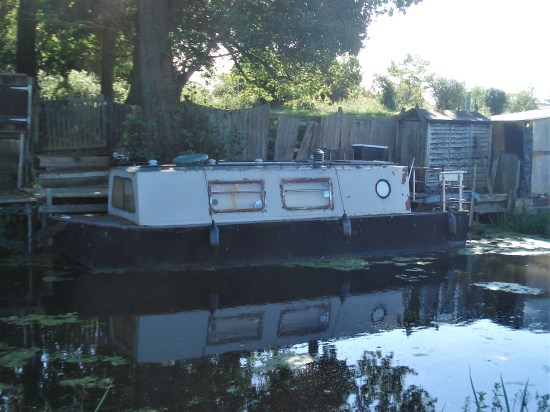
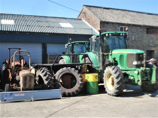
Life on the water.


I take some ancient steps away from the canal onto a busy road. 
 Thankfully, within a few yards I climb a stile into fields. But where does the path go – no sign of other feet.
  There is a stile somewhere, and then I’m confronted by this.
Out of the horsey property, there is more trouble; I climb a dodgy stile, only to be confronted by impassable undergrowth.

 Why don’t the property owners maintain the stiles and give adequate signage? A question I’m always asking. Would make life easier for all concerned.
Somehow I find my way to the bridge over the motorway, quite grand for a footpath. 
Why do I always take nondescript pictures of motorways?

Getting out the other side is not easy. Does nobody walk these paths?  I haven’t gone far, and soon I am lost with no sign of a path. Last week I relied completely on a paper map for navigation; today I am happy to switch on my phone OS app to locate my mistakes. I dodge through a field of cows and climb into a deserted, dilapidated farmstead.
 With more hope than faith, I stumble down into a deep ravine and thankfully find the footbridge and steep steps back out.

 I have a rest at the top and plan ahead. A field of maize will be impenetrable in a few weeks if nobody comes this way.
And it is a maze to find my way through the next ‘hamlet ‘, Ollerton Fold. All that is needed is a few discreet arrows to get the walker through, rather than blundering into gardens.  One resident helps me to escape but warns of worse to come. I do get a lovely view across the valley towards Brindle with the canal below.
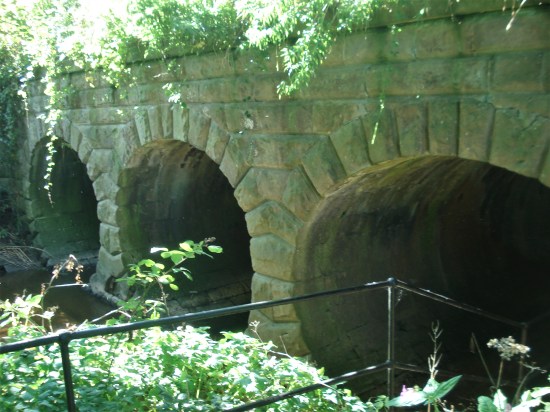
Then it is more of this…
…and this. I
I
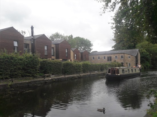
As I approach Withnell Fold, I am debating in my mind whether to drop down to the canal towpath for some easier going. The village is hidden from the world at the bottom of a cobbled cul-de-sac. Once a large paper mill operated here, and the terraced housing was built for the workers. Not a lot has changed, though there is some new housing in what used to be the mill complex. A good history of the village can be found here, and a local walker/historian, Boyd Harris, has even more fascinating history on his website.


Most of the remaining mill buildings are ruinous, but the engine house chimney has been restored and can be seen from miles around, as in my header photograph. 
 So after a mooch around the village, I end up on the canal towpath. The delights of the Witton Wander footpaths to Higher Wheelton and Heapey will have to wait for another time.

 A group of volunteers for the Canal Trust are busy Himalayan Balsam bashing; it is very profuse in one area which borders a nature reserve.


A group of cyclists are riding from Liverpool to Leeds in a day.You can do the maths. 


There are boats moored up further along, and I can indulge in my usual diversion in finding the corniest name.


There is more action when I reach the ‘Top Lock’, the highest of seven locks raising boats 65 feet. I ignore the inn on the other side.


Further down, two boats pass through a lock together, thereby saving water. Watching boats negotiating locks is a favourite spectator pastime.


I drop down to where a disused branch canal went off to Whittle-le-Woods and go in search of a footpath back on the real Whittle Wander. I paced up and down the towpath, using my GPS to find it, but there was no way through a thick hedge. Only now, looking more closely, do I see it was on a lane from the next bridge and not directly off the towpath (red arrow). An easy mistake to make but annoying nevertheless. I ended up backtracking and following the Whittle-le- Woods canal branch to the nearest road. 

The road, which fortunately has a pavement, takes me under the motorway past some neat cottages to the outskirts of the town. 

A friendly pub, The Roebuck, beckons from across the road from the small Jubilee garden with its clock.

I sit in their beer garden enjoying a pint and contemplating the day’s walk. The state of the footpaths in the early part was disappointing. They are not well used in what should be a popular area. On the day, I made the right choice to take to the towpath, which turned out to be an interesting stretch. It was my error near the end, not identifying the correct path. I intend to return and do a loop that includes the bits of the Witton Wander I have missed, as I do find the area historically and scenically interesting.


 St Bartholomew’s Church has a funeral in progress, so I don’t intrude. The tower of the present building probably dates from the 15th century. Most of the rest of the church is from the 16th century. In 1880, the Lancaster architects Paley and Austin renovated the church with more additions.


 When we came this way on the Canal Trod in January, the bridge cafe was closed – or was it? Today, I could see from the towpath that there was no sign of life in the cafe at street level above. I am not fussed about going up into Rishton to the friendly cafe we visited last time. I carry on, but once under the bridge, I think that the cafe may be open canalside.
  I push at an unmarked door and enter a den of iniquity. All heads are turned to the stranger. This is darkest Lancashire. Locals huddled over mugs of tea and scones in front of a roaring wood burner. I just about decipher the owner’s welcome and rather hurriedly order an instant coffee. During the time I spend in this hidden cavern, I glean a fair amount of local gossip from the ladies, possibly some of which would be helpful to the local police. The blokes are of the silent type. I take a furtive photo.
  Soon, after crossing the motorway on the Dunkenhalgh Aqueduct, I am approaching Church, a satellite of Accy. See how I have slipped into the local dialect there.

 I see my first lambs of the year, always a joyous occasion…
 … and then I am immersed in industrial squalor along the canal.


 Once we leave the lane into rough fields, the walking becomes taxing for a mile or so. Waterlogged ground with the odd icy patch, undulating in and out of small valleys, awkward stiles, low blinding sunlight, navigational errors, and some thick gorse bushes to negotiate. I’m not complaining; just look at that blue sky.


 When we reach the chain of reservoirs, things improve, and we meet other walkers. Some share our joy of the day, and others unhappy about the pending encroachment of urban areas into the scenery.


 Emerging onto the busy A678 Burnley Road, we have half a mile to walk before turning into the tree-lined avenue leading to the Mercure Dunkenhalgh Hotel. A C19th Tudor-style house built on the site of a C13th hall. Despite our appearance, we are upgraded to an executive double room unfortunately about half a mile away from reception and bar.


 All pure nostalgia and a pleasant way to spend a lazy summer afternoon – reassuringly not much has changed in this rural environment.