Category Archives: Pilgrimage to Lichfield.

PILGRIMS PROGRESS. FINISHING IN LICHFIELD.

Day 19.   Fradley to Lichfield.

I’ve been here before at the end of my Two Saints Way from Chester.

The bus stops right outside St Stephen’s Church in Fradley. I notice the writing on the porch above the door, a biblical quote. Presumably, that is where the phrase ‘watch your step’ originated, a fitting warning to us pilgrims.  It is open and the heritage group are setting up an exhibition. They are all very friendly and pleased to narrate the church’s history and show me around. We even find a chocolate egg hidden behind the piano, missing from the children’s Easter hunt. The interior is bright and airy.

One of the group was involved in the planning of the Pilgrim Way Church Trail, which I’m following. By the time I leave, the morning’s drizzle has abated, meaning I have walked the whole route without the need of waterproofs, if only I had known at the start.

They warn me of the HS2 workings closing several footpaths into Lichfield. I plot a way using minor roads further north. Even so much of the area seems to have been grabbed by the HS2 fiasco. I thought it was stopping at Birmingham.

I cross the Coventry Canal and, with hindsight, could possibly have used it for some distance up to Fradley Junction, then connecting to footpaths into Lichfield. I had to look up the Coventry Canal on the map, as I was previously unaware of it.

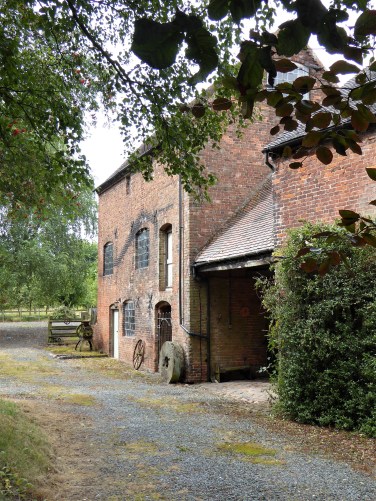
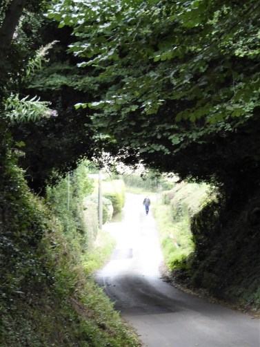
As it is, I’m committed to a narrow lane used as a cycleway. I think I’m walking through the site of the wartime RAF site, judging from the occasional hangars still visible.

My first view of the famous triple Lichfield steeples, Ladies of the Vale, is ironically through HS2 security fencing.

Little ginnels wind through housing estates and straight to St Chad’s church.

St Chad’s Well was looking attractive, with a covering of Russian Vine. That was until I was closer and could see a body slumped inside it, down and out. Inside the church, a wedding ceremony is being rehearsed, so I don’t linger.

 A word or two about St. Chad while we are here.
“St Chad was born to a noble family around 634. He was educated on Lindisfarne and spent time as Bishop of York and Abbot of Lastingham. In 669, he was appointed Bishop of Mercia, one of the most powerful Anglo-Saxon kingdoms. Chad chose to centre his administration in Lichfield, not Repton, where he founded a church near the holy well and a community which became the religious heart of the kingdom.
  On his death in 672, his remains quickly became venerated and a place of pilgrimage. Bishop Hedda, his successor, consecrated the first Cathedral in Lichfield. St Chad’s remains were transferred from his church to there, and the shrine grew quickly in importance and became one of the most important centres of medieval pilgrimage in the country. At the reformation, his remains were removed for safety into private hands, eventually resting in Birmingham Cathedral”
Since my last visit to Lichfield in 2021, a new shrine has been established in the Cathedral in 2023. Relics from Birmingham have been incorporated into its cross. See below.
The cathedral is across the park and Stowe Pool.

I pause on the way to admire the bronze statue of St. Chad by Peter Walker, 2021,  and some of the ornate stonework.

The usual crowds throng the magnificent western front with all 19th-century replacements of medieval figures, showing apostles, kings, and saints.

I’m greeted at the Cathedral door by one of their volunteers; they must have known I was coming. It turns out he is a historian of all things related to Chad. He tells me of many sites throughout the north; some close to home, which I will have to look into.

There is a service in progress in the chancel, so I sit and listen to it being broadcast throughout the Cathedral—a moving sermon reflecting sensibly on some of the world’s present problems, if only our politicians could listen.

Lichfield Cathedral is the only medieval three-spired Cathedral in the UK, and is a treasured landmark in the heart of England. (Lincoln only has towers) It is one of the oldest places of Christian worship, and the burial place of the  Anglo-Saxon missionary  St Chad. There is so much to see in its interior. George Gilbert Scott was heavily involved in its restorations. As noted above, a new shrine has been placed in the cathedral. It is a simple shrine with a cross incorporating a ‘relic’ of St. Chad from Birmingham, above a circular illuminated halo.

Among the cathedral’s many other treasures, in the Chapter House is the fine 8th-century sculpture of the ‘Lichfield Angel’, thought to be from St Chad’s tomb, as well as the 8th-century Lichfield Gospels.

Last time St. Chad’s Head Chapel was closed, so I am pleased today to be allowed up the steps to this peaceful space. This is where his skull was initially kept as a focus for pilgrims. After his remains were removed, people still came up here to pray. I suppose now his new shrine below will take preference. I’ve already been in the Cathedral for more than an hour and a half and have only cherry-picked my points of interest. One could easily spend half a day in here exploring. But before I leave, some mention should be made of the story behind the stained glass in the Lady Chapel. Originally commissioned for the nuns at Herkenrode Abbey (about 50 miles south-east of Antwerp) in 1532. Fortunately, the glass had been removed and taken to safekeeping before Napoleon’s troops arrived. It was bought by Brooke Boothby, who sold it to the Dean and Chapter for the price he had paid. It was installed here between 1803 and 1806. The abbey itself may be no more, but its images remain for us all to enjoy.

Lichfield’s streets are busy, it looks like an interesting city, but I have trains to catch.


*

*

Another walk completed, even if in stages from January, due to circumstances.  From an initial idea of connecting Whalley Abbey to Manchester Cathedral, it evolved into a more extended pilgrimage from my home to Lichfield. Maybe about 160 miles in all. Following ancient ways, passing Saxon crosses, absorbing Ecclesiastic history, meeting wonderful people, and experiencing our diverse environment in all its guises.

How you approach a route is in your own hands; it may be a spiritual journey, a chance to experience the rural beauty or simply hearty exercise. Let’s not forget that walking is fun.

PILGRIM’S PROGRESS. THE PILGRIM WAY CHURCH TRAIL.

Day 18. Branston Bridge to Fradley. 

Rather than just walking along the canal towpath towards Lichfield, I have found the Pilgrim Way Church Trail, A fourteen-mile route from St Michael’s Church in Tatenhill to Lichfield Cathedral. It follows an ancient path which may have been the route taken by Saint Chad on his journey to establish Lichfield Cathedral.

And how I’m enjoying it.

There are six churches on the trail, fine examples of churches from the Saxon to Victorian periods. The route takes you through some of Staffordshire’s finest countryside.

I’m back at Branston Bridge Inn, but I leave the canal to walk up lanes to Tatenhill. It’s already warming with the full sun.

Fortunately, there is a cycle path for most of the way.

Tatenhill.  St. Michael and all Saints.

  The squat sandstone Parish Church of St. Michael & All Saints Church is a 13th-century building which was substantially enlarged and altered in the 15th century. Around 1890, Bodley ‘restored’ the church.

The church is closed, so I walk on up the road. I stop to check where my footpath leads when a farmer appears. He has just been feeding his stock. He is happy to chat about all things rural. He runs a small farm with only 15 cows and 40 sheep, which he manages in an environmentally sound manner. He is a tenant on the current Lord Burton’s land. They tolerate each other despite being so different. Surprisingly, he knows Lancashire well from all his dealings, even visiting a blacksmith in Bolton-by-Bowland.

Whilst chatting, he points out a well across the road which I was unaware of. He calls it a ‘wishing well’, but it has possibly been a holy well in the past. Underneath its hood, there is clear water.

I take the path through the farmer’s fields, and thankfully, his cattle are out of sight. A wood alongside has won an award for forestry, but I can’t see why. Along the byway hedges berries are flourishing this year.

Over the valley is a large manor house, Rangemore Hall, previously owned by Lord Burton.

My way takes me through one of those places with accumulated junk, in this case, cars. There is a Morris Minor in there somewhere.

Escaping from the junk yard, I dive straight into a field of sweet corn where the path is not obvious, I just push my way through.

A lane takes me to my highest point and then straight down through varied countryside to the scattered houses and church of Dunstall.

Dunstall St Mary’s.

St Mary’s is a church built for the Dunstall Estate and stands alone. It has an imposing tower demonstrating the wealth of the benefactors, the Arkwright family, before they moved to Cromford. It was completed in 1853.

I enjoy the cool of the beautiful stone interior. The walls of the Chancel are particularly fine, lined with alabaster. The Church Warden is busy preparing for a wedding tomorrow.

The font is carved from Caen limestone with ornate panels, here Moses is striking the rock.

A fine alabaster Reredos at the altar was in memory of the Hardy family, who ensured the church was completed after Arkwright’s death.

Everywhere you look, there are delicate carvings.

The grandeur is completed with stained glass windows in memory of the Hardy family.

On a more mundane note. I eat my lunch sitting in the porch out of the hot sun.

The nearby listed church hall was once the estate’s school and has apparently a fine interior.

Onwards through the Dunstall Estate, past some delightful properties and across the land on a bridleway. The Dunstall Church stands out across the way. This is quintessential English countryside.

There are plenty of options through the fields.

Barton-under-Needwood has a busy main street, no more so than at the local Co-op, where I purchase a coffee and cake to be enjoyed on the seat outside. The church is only a stone’s throw away in a well-kept churchyard.

Barton-under-Needwood.  St. James’.

 Local boy John Taylor, the eldest of triplets, rose to prominence and riches under Henry  VIII. He decided to build a new church to replace the 12th-century chapelry, which existed in Barton. He was already a sick man and died in 1534, a year after the church was consecrated. 

Its exterior perpendicular style has changed little in seven centuries, but the interior has been altered many times. 

As I enter through the glass inner doors, I notice they are etched with what looks like a stylised conch shell, which is St. Peter’s emblem, found on many pilgrim routes.

I don’t find anything unique in the church, but there are some fine, mostly Victorian and modern, stained glass windows.

After a bit of newish estate wandering, I come across the Royal Oak. At last, a pub serving Marstons Pedigree on draught. I can’t leave the area without tasting one of Burton’s famous brews. And very cosy it is inside, top marks.. Out of town, I pick up a green lane leading straight to the church at Wychnor.

Wychnor St. Leonards.

The original church was a simple, small Norman nave, which was extended in the late 1200s. Over the next few hundred years, an aisle and a tower were added. Unfortunately, regular services are no longer held here, and it is not open today.

The adjacent fields show evidence of earthworks of a medieval village, which even I could make out.
.

Suddenly, I’m back alongside the Trent and Mersey Canal. I’m not sure where the original tow path ran, but along here, modern walkways have been installed over the marshy areas.

I manage to catch this Heron.

I’m on the edge of the village of Alrewas. 

A couple are enjoying a picnic by a branch of the River Trent, where a ford used to be on trade and pilgrim routes. Interested in my walk, she spends a lot of time helpfully suggesting cafes I could visit, despite the fact that most of them were miles from my route. Car drivers have little conception of what it is to walk a long-distance route.

Alrewas.  All Saints

A church, connected to Lichfield, has stood on this important site from at least 822AD (some suggest St Chad himself founded it in the 870s), the first building being of wood. This, in due course, was replaced by a simple structure in local stone and developed over the centuries since then.  It is closed today.

I don’t see much of Alrewas except the village sports fields before quiet lanes into Fradley.

 I walk along nondescript housing estates. People I meet, in their front gardens, have little knowledge of where or when buses leave to take me back to Burton. My reading of the timetable is mistaken; there is no 15.35. Despite the buses running supposedly  every hour, they seem to miss this slot.

So that gives me time to walk along to St. Stephen’s church

Fradley.   St. Stephens.

St. Stephen’s was built in 1861 as a Chapel of Ease for Alrewas. Its unusual design and its position on the corner of Old Hall Lane have made it a landmark feature for the village. A pleasing modern building, again closed, but that leaves me to look around the well-kept graveyard. There are 34 simple war graves, many Australian airmen alongside RAF pilots from the nearby wartime airport. In amongst them is a sole headstone to a German pilot, Joachim Schwarz.

My bus turns up at 16.35 and drives around in circles to get me back to Burton. It’s been a long, hot day, The Weighbridge Inn is the grounds of my hotel, so I enjoy a pint there on the way in.

***


PILGRIM’S PROGRESS. MAINLY REPTON.

Day 17. Repton to Branston Bridge. 

Everyone has been telling me of the wonders of Repton’s St. Wystan’s church.

My bus drops me off at the Cross, the original market cross..On the way in, I spotted a local butcher and grocery shop, so I head there first to buy a proper cheese and onion pie for lunch.  I’m disappointed with supermarket ones. Back at the cross, I am able to take better photos than I did during yesterday’s rush hour. I wander up the High Street to take a look at some of the buildings, many of which are owned by Repton School.

A sign advertises The Maple Leaf, a community cafe down a side street. I’m served a large cup of coffee for less than £3 by the lovely lady volunteers. A gentleman has the same idea, and we share a table outside. It is already uncomfortably hot and humid. In conversation, it turns out he is an amateur Local Historian. We enjoy chatting about Saxons, pilgrims, hidden wells, the Trent, and much more. You can find him at http://www.fourshireshistory.co.uk

Time to have a look around St Wystan’s Church. St. Wystan is depicted above the porch entrance, holding his sword.

“Repton is the cradle of Christianity in the Midlands”, says the sign in the church. Christians have worshipped since 653 AD, when an Abbey was established on this site, following the introduction of Christianity to Mercia by Elfleda. 

From the outside, St.Wystan’s is a handsome medieval church. Its tall and thin spire dates from the 15th century, as does the tower.  Other features date back to the 14th century. Much of the chancel is Saxon, extensively modified, and it becomes particularly interesting, for here, under the chancel, lies a Saxon crypt. 

The Chancel. Note the upper chamber, which would have been reached by steps from outside.

 Repton Crypt dates from the first half of the 8th century, during the reign of King Aethelbald of Mercia. Constructed perhaps as a baptistery, sunk 1.2 m into the ground,  with a spring below it. It was later converted into a mausoleum, perhaps to receive the body of King Aethelbald himself. King Wiglaf (827 – 840) built the church chancel above it. Wiglaf ‘s grandson, Wystan, was murdered in 849 and buried at Repton. Wystan became venerated as a saint probably after ‘miracles’ occurred, and the crypt then became a place of pilgrimage. When the Vikings invaded, the remains of St Wystan were taken away by escaping monks; they were returned to Repton after the Vikings had departed. (Later, King Cnut of England (1016-1035) had them removed to Evesham Abbey.) The church was restored after the Vikings left, but the importance of the crypt gradually declined. The adjoining priory didn’t survive the Dissolution, although the parish church was spared. Archaeologists discovered a mass Viking grave located above where the Trent used to run.

For a long time, the crypt was entirely forgotten, lost beneath later work. It was only when a workman fell into it during building work in 1779 that it was rediscovered. Near the crypt part of an Anglo-Saxon cross-shaft was found. On one side is a kilted warrior on a horse.   This is thought to be a representation of King Aethelbald of Mercia, who died in 757 and was entombed in the crypt. The ‘Repton Stone’ was seen in the Derby Museum on my previous visit.

Narrow, worn stairs lead down into it, and once your eyes have adjusted, you see beautifully carved stone piers supporting the arched roof enclosing four burial niches.  It is one of the oldest and most important examples of Anglo-Saxon architecture to survive intact.   Sir John Betjeman described it as “holy air encased in stone”. And when you stand down here in complete silence, you begin to feel what he meant. 

In comparison, the rest of the church has less interest. A tall bell tower, a C15th alabaster tomb, Victorian and later stained glass, and more fragments of crosses.

St Diuma, St Wystan, St Guthlac, St. Chad.

Adjacent to the church is the arched entrance into Repton School, from the C13th and the only surviving part of the Augustinian Priory on this site.

Enough history, let’s get on our way. 

Passing the School’s chapel, I find a path alongside the Leisure Centre, and I’m soon in undulating rough fields. There are occasional views across the way to the Willington Wetlands, where Beavers have been reintroduced. 

St Anne’s Well is marked on the map but is not obvious or signed from the PRoW. I have to backtrack and scramble down the bank to an overgrown hollow, and there it is, a stone-lined trough leading to a channel. I push through the brambles to get a closer look. There is no water at present, but the silted-up base is damp. What was its function? Given its name, did it have some religious connection?

It’s down there somewhere.

I move on through flower-rich meadows, now apparently on the Trent Valley Way.

Passing a pipeline bridge with dire warnings not to climb, so I just follow the footpath on this side of the Trent to Newton Solney.

A convenient bench serves for a snack. Newton Solney was a brick-making centre in the 17th and 18th centuries, and on a trade route with a nearby river crossing.

I have time to look around St Mary the Virgin’s church. 14th century, but restored and enlarged over the years. There are several tombs of the local de Solney family dating back to the C14th.

The kissing gate out of the churchyard is a precursor of those new galvanised ones – but much more elegant.

A busy main road bisects the village.

Once across, a walled track leaves the road, the bricks probably made in the village.

It leads to the large Newton Park farmhouse, but my footpath crosses fields with the spire of Winshill, the prominent church ahead.

Through Bladon Farm, and down their access road, do you remember these old farm diesel pumps?

The climb back up to Winshill was starting to look intimidating.

But then a  Trent Valley Way marker alerted me to the Dalebrook walk. So, back into the undergrowth to follow the little stream. The sandstone bed is clearly visible in places.

Local communities have facilitated some colourful wildflower areas.

I eventually come out onto the main road alongside the Trent, but at least there is a decent footway.

A lot of the properties along here have a riverside frontage, or rather backage. That must add a few grand to the value of your house.

I’m heading to the Trent Bridge, a famous Burton landmark. This 29-arch bridge was completed in 1864, replacing an earlier medieval 36-arch one downstream. The river has changed course over the years. The New Bridge was widened in 1926 and had a tramway running across it until 1929. There is a photo of both bridges coexisting for a short period.

It’s a different picture today with queues of cars trying to cross in the rush hour.

I was hoping to walk into Burton through the riverside Washlands, a flood plain on the edge of Burton. The way seems to be blocked off with those builder’s wire fences, so I don’t risk it.

Instead, I just walk along the High Street. Burton-on-Trent was the brewery centre of the country at one time, and there are some fine civic buildings from that prosperous time.  

Several old brewery sites are passed as I walk up Station Road. 

Coors Brewery is the new face of brewing in Burton. I’m feeling fit, so walk on past my hotel to do a few more miles and shorten tomorrow. Past the station, I come across the prominent Town Hall and then the Gothic style St. Paul’s Church.

An ally gains the Trent-Mersey Canal, whose towpath I follow for a couple of miles.

The Bridge Inn, where I waited for my taxi, didn’t even have a draft Burton beer. 


PILGRIM’S PROGRESS. ESCAPING DERBY.

Day 16. Derby to Repton.

 My mobile rings at 10 am “Do you fancy a coffee?”  I do, as I’ve just arrived back in Derby after a very early start from home. Over the sound of the busy traffic, I explain my whereabouts; no need to explain why I am here. Hopefully, completing my ‘pilgrimage’ to Lichfield. That coffee will have to wait. 

On this trip, I managed to walk across Manchester almost entirely on cycle paths or parklands. I was pleased with my choice of routes, but the leisure infrastructure was a great help. So far, I managed to walk into Derby in rural surroundings, but getting out of the southern side could prove challenging. Looking at the map, there are no obvious green spaces and no cycle ways or redundant railways. I need to get to Repton somehow.  Half the fun of choosing your own route is the time spent linking up likely footpaths on the OS map.

However, first, I want to visit a couple of sites in Derby that I missed last time. 

St. Alkmund’s Well.    Derby’s last remaining Holy Well. The earliest mention of the well dates back to 1190, but it may have been in use much earlier, possibly as early as 800. I find it hidden away in a residential area of the city.

https://www.bbc.co.uk/news/articles/c8reyld535jo

I retrace my steps to the bridge over the bypass leading to the stately St Mary’s Roman Catholic Church. It is closed, but I find a bench in its peaceful garden for a breakfast snack.

Nearby, a plaque commemorates the site of the original St. Alkmund’s church, which was demolished to make way for the bypass road. During this demolition, the sarcophagus of St. Alkmund was discovered, which I viewed in the Derby Museum on my last visit.  Here are some historic pictures of the church and its demise.

I can’t find the plaque, so I move on.

A 5-minute walk away is The Chapel of St. Mary on the Bridge, one of six medieval bridge chapels left in the UK. It stands just above the Derwent next to the 18th-century St Mary’s Bridge, which replaced a medieval bridge to which the chapel was originally attached. I don’t know how I missed it before.

The first chapel was probably built late in the 13th century on the original stone bridge. Later in the 14th century, it was replaced by the present building. The chapel would have been a place of prayer for travellers leaving the city and a collection point for bridge tolls.   The hagioscope, or squint, was used by the hermit to monitor traffic, as well as by passers-by to see the altar. One of the arches of the old bridge can be made out under the chapel.

Unfortunately, it is closed, so I miss out on its peaceful interior. It’s open on some Saturdays and continues to have services.

I don’t dally at the Museum of Making, the Cathedral, or the Art Gallery/Museum, all of which I visited last time.

Instead, I head across the city to visit St. Peter’s church, which apparently has much of interest from Medieval times. The streets around here are edgy with lowlife, a heavy police presence reinforcing the feeling. ( I learn later that there have been recent armed robberies here, a bank and the Pawnbrokers, hence all the police) Anyhow, the church was closed, so I don’t see the Florence Nightingale window.

I’ve had my fill of Derby’s beggars, drunks and addicts. Sorry to be judgmental, but it is a fact of many city centres these days. My resolve is weakened, and I jump on the first bus heading out of town. This saves a couple of miles of suburban walking. A Pilgrim’s dilemma, forgive me.

Using my bus app, I know where to alight in Littleover to get back on track. The road looks busy with little verge, but fortunately, there is a traffic-free way alongside a new housing estate. I get my first glimpse of the countryside along with the loud mooing of a herd of cows. Let’s hope I don’t encounter too many of them.

A footpath continues past a fishing lake to the edge of the farmland. The bedraggled Heron is the only one fishing.

The farm is bypassed, and I’m on my way. The fields are not well walked, but those new-fangled metal kissing gates lead the way. Strangely, they are all missing their yellow catches. Did they run out of funds during the installation, or are scrap metal dealers profiting? 

Kestrels quarter the newly cut fields;  no doubt, the rodents have less cover.

Over to my left are five cooling towers, all that remain of Willington Power Station, a familiar sight for travellers on the A50.

I pass through one of those farms that collect junk, but don’t worry, they are commited to the environment. 


The steeple of Findern church is a good landmark to head for. On a map somewhere, I saw this route marked as The Priory Way, and as I enter Findern, there is a board explaining where and why the Priory existed; it has since disappeared completely.

I find the Find Cafe in the village’s old meeting rooms.  A pleasant surprise: good coffee and cake. 

Findern was mentioned in the Domesday Book when it was held by Burton Abbey.  All Saints’ Church was rebuilt in 1863, on the site of a Saxon place of worship. Its fine sandstone a pale colour.  Again, it is closed. There are some interesting properties around the village green. The village pump is preserved along the High Street; it was used until 1931, when a water main arrived.  

A short stretch of pavement walking alongside a busy road over the A50, and I’m soon back in fields leading to the Trent and Mersey Canal. First, I can’t resist diving into the Willow Spiral, funded by the nearby Mercia Marina. It could do with a trim, but I do reach the centre. 

A metal footbridge has me on the canal towpath for a stretch into Willington. The canal barge owners are a friendly lot with some fine narrowboats.

There is little to detain me in Willington. Despite the sign, the church is closed. I’ve not had much luck so far today. The bridge leaving Willington over the River Trent was built in 1836, replacing a ferry, and was one of the last main road toll bridges in England. It was not made free until 1898. It has five elegant arches, which I can view from the site of the demolished toll house. The toll fees per animal, for assorted carriages and wagons, were based on the thickness of their wheel. 

The stretch of road leading to Repton is very busy, and the pavement is narrow.  The spire of St Wystan’s prominently ahead. I’m relieved to arrive in one piece.

Immediately, the influence of the Repton School premises takes prominence with their chapel and modern buildings. The Chapel was opened in 1859; prior to that, pupils attended St. Wystan’s.

It’s rush hour, and the village roads are a nightmare; I risk taking a photo of the Village Cross and St Wystan’s Church before catching the bus to Burton-on-Trent. Exploration of Repton can wait till tomorrow.  

***

I’m booked into the basic GO2 Hotel for three nights. A converted grain store by the railway.

***

PILGRIM’S PROGRESS. WIRKSWORTH CHURCH.

Day 13 postscript.      St. Mary’s Church.

Arriving in Wirksworth, I discovered another church, St Mary’s, where I spent some time absorbing its history. I have lost the information booklets I purchased, so once again I’m relying on my photographs and Simon Jenkins.

The church is very welcoming and provides a wealth of information for visitors interested in the site’s history. I met the friendly team vicar, there are 10 churches grouped together, who was busy with a treasure hunt for a local school in the grounds. She explained the local custom of ‘clipping the church’ in September when the congregation, probably augmented, holds hands encircling the outside of the building. She wished me good fortune on my journey and emphasised I must visit Repton.

The earliest parts of St. Mary’s date back to the 13th century, including the lower part of the tower. Much was added in subsequent centuries. Sir George Gilbert Scott was responsible for major restoration in the 19th century. This is probably when  all fragments of carving were incorporated into the walls, a gallery of early sculpture. These carvings suggest a church would have been established on this site as early as the 8th or 9th century.

Going around the church clockwise.

Starting in the north transept is a large collection of early carvings set randomly  into the wall.

In the north aisle, there are two 16th-century chest tombs, exquisitely carved in alabaster, of the Gell family. Sir Anthony Gell (d. 1583) has his statue on his tomb. He established a Free Grammar School in the town in 1576. Alongside is the simpler tomb of his father, Sir Ralph Gell.

The chancel contains the tomb of Sir Anthony Lowe, a Gentleman of the Bedchamber, who served Henry VII, Henry VIII, Edward VI and Mary I and died in 1555.

The church is noted for containing an Anglo-Saxon carving of a lead miner, “T’owd Man”, the oldest representation of a miner anywhere in the world. It was moved here in 1863 from Bonsall Church for safekeeping and has never been returned. The church makes a good deal of this relic and has installed a video featuring him in a ghostly form, in which he recounts his perilous life as a miner. History brought to life.

There are more random, rather strange fragments of carved stones on the walls. 

However, the most significant piece is a large coffin lid dating back to approximately AD 700. It is believed that this artefact belonged to one of the early mission priests who established the church here during the conversion of the ancient kingdom of Mercia to Christianity. The lid depicts scenes from the life of Jesus and other biblical stories in a complex composition. It was discovered under the chancel during those 19th-century restorations.

There are two fonts in the church. One is a Norman cauldron-type stone font, and the other dated 1662.

There were many Victorian stained glass windows. Perhaps the most notable is that in the north transept, which was designed by Edward Burne-Jones, a noted Pre-Raphaelite artist, and created by the William Morris workshop in 1907. It depicts Christ and various saints.   (You may remember his window in Youlgreave Church).

The biblical significance of some of the other windows is lost on me. 

I probably missed as much as I have highlighted here; the church was full of historical curiosities. The sad fact, the vicar told me, is that they only have a congregation of about fifty these days. It was built for five hundred. 

PILGRIMS PROGRESS. YOULGREAVE CHURCH.


Day 13 postscipt.   A brief look around All Saints Parish Church in Youlgreave, with its Saxon connections.

Usually, when visiting churches, I pick up or purchase an information leaflet, and most churches have an electronic payment machine.  I have mislaid my excellent guide to here, as well as Wirksworth Church, so I’m relying mainly on memory and Simon Jenkins’ comprehensive book – England’s Thousand Best Churches.

arrived here from Bakewell, with the church tower dominating the village.

There was probably a wooden Saxon church on this site, but the present building dates back to the 1150 period and has been much modified since.

The oldest surviving parts are in the nave, featuring typical thick Norman pillars and arches. Since then, many different styles have been incorporated – a large Gothic chancel, Tudor windows, and a 15th-century perpendicular-style bell tower.

Blocked Norman door.

Perpendicular style tower door.

The Norman font originally belonged  to the church at nearby Elton and is a simple sandstone affair, but with an added stoup with a salamander (a symbol of baptism) carved into its support. 

Above the altar is the great east window, featuring stained glass by the William Morris Company, designed by the Pre-Raphaelite master Edward Burne-Jones.

I’m not sure about these windows. A Victorian and a C20 memorial to incumbent vicars.

Another stained window in the north aisle is a poignant memorial window to Rennie Crompton Waterhouse of Lomberdale Hall, Middleton-by-Youlgreave, killed at Gallipoli in 1915.The window glass was gathered from the ruined cathedral at Ypres and other destroyed churches in Flanders, and brought back to Youlgreave by his brother.

I have two photos of tombs within the chancel.

The first one I’ve identified as a fine marble tomb to a Thomas Cockayne, who died in a fight in 1488. The effigy is smaller than life size, indicating that he died before his father.

The other chancel tomb is a worn effigy of a knight with his feet on a lion, dated to the 13th century and thought to represent Sir John Rossington. Notice the tiled floor.   

In the north aisle, there is a wall memorial dedicated to Roger Rooe of Alport, who died in 1613, and his wife, depicted wearing a top hat, and their eight children.  The memorial is an ornate Jacobean-style piece, featuring the couple facing each other with their children standing below.

Another memorial is an alabaster plaque from 1492 commemorating Robert and Julia Gilbert, featuring a central figure of the Virgin, and kneeling figures of Julia and numerous daughters on one side, and Robert with numerous sons on the other. The inscription says that Gilbert “caused this chapel to be made”. They certainly had large families back then.

The choir stalls, likely Victorian, feature some interestingly carved heads.

If I had looked up I would have seen wooden carved roof bosses.
I was most interested in the small figure in a semicircular niche, probably a C12th carving of a pilgrim, with his bag and staff. I felt a close infinity. Another probably AngloSaxon stone carving depicts a man, could he be peeing in the bushes?
Elsewhere a piscina is held up by a ?Norman head.

That was an hour well spent. My present mileage of 8 to 10 miles per day gives me ample time to explore and interact with people along the way.

PILGRIM’S PROGRESS. A TASTE OF DERBY.

Day 15 addendum.

I’ve never visited Derby before, and I’m pleasantly surprised by the mix of old and new. I want to visit the Cathedral and the Museum before catching my train home. I stop at a seat in an open square to rehydrate and pack my sticks away. This just so happens to be alongside The Museum of Making, which I had not intended to visit. Chatting to a couple on the n̈ext seat who happen to work there, I’m encouraged to have a look inside.  I’m glad I did. 

The Museum of Making. 

The Derby Silk Mill here is widely regarded as the site of the world’s first modern factory, built in the valley that helped to change the world. It has recently had a major facelift. Here is its raison d’être.

“Celebrating the area’s rich history of innovation, the Museum of Making in the Derwent Valley Mills UNESCO World Heritage Site is a contemporary space telling Derby’s 300-year history of making to inspire new creativity. Designed and made by the people and industries of Derby, with exhibits, workshops, activities and events, there’s something here for everyone” 

I am immediately enthralled as I walk in and am greeted by one of their volunteers. I explain that I’m just having a quick look around, as I’m really in Derby for its Anglo-Saxon associations. I come out two hours later and thank her. 

The Rolls-Royce engine dominates the entrance hall, a thing of beauty as well as engineering magic.

The subsequent floors feature the most amazing collections of memorabilia, all on display, more like a junk shop to browse through than a traditional museum of glass cases.  But it is not all random; the exhibits are organised by technology and materials. ‘Things’ made in or associated with Derby from the start of the Industrial Revolution. Far too many objects and information to share with you in this post.  Visit Derby, bring the children, and immerse yourself in the experience.

As a bonus, there is an art exhibition on the top floor, EarthBound.  Exploring the hidden layers of the  Earth, examining how we are connected to this surface through the eyes of a diverse group of artists.

“EarthBound aims to make us pause for breath and think that our future survival may well depend on our having a deeper understanding and respect for the incredible micro-organisms and fungal networks that hold our planet in balance. The smallest things can have the biggest impact on our survival as a species”.

I stop by the ‘making and repair’ room, where the couple who recommended I visit are busy working. I’ve been invited back for an extended visit. 

*

Churches dedicated to Saint Alkmund, the Saxon patron saint of Derby, who died in 800AD, have been constructed on a site in Derby since the 9th century. The most recent Saint Alkmund’s Church was a Victorian church, which stood in a Georgian square between Bridgegate and Queen Street. The church and its yard were demolished in 1968 to make way for the construction of a road to improve traffic flow.  A stone coffin and the remains of a 4-metre (13 ft) tall stone cross were recovered from the site and transferred to Derby Museum and Art Gallery. (I have also read about St. Alkmund’s Well, which is nearby)

*

So I’m off to the Museum and Art Gallery to see the Saxon stones, except most people I ask for directions don’t know of it. Typical of many of us, neglecting what’s on our doorstep for treasures further afield. I grab a ground plan and head to the Archaeology room.  The central space is occupied by a Bronze Age wooden boat, crafted from a single 10-meter-long oak log. 

St. Alkmund’s Sarcophagus, c. AD 800  is the stone coffin removed from St. Alkmund’s Church during its demolition. Initially placed in the 9th century church on the same site, it is remarkably well-preserved and features the intricate interlacing carvings with which I’m becoming increasingly familiar on this trip. It is carved from a single block of sandstone and weighs nearly a ton. Its lid has gone missing.

Alongside is St. Alkmund’s Cross, c.AD 850, an Anglo-Saxon stone cross found in the churchyard when it was being rebuilt in 1840. It is only part of the upper shaft and has intricate carvings on each face, mainly of animals.  These don’t show up well in my photographs, but I have one for completeness. 

Also found at St. Alkmund’s Church in 1840 is a fragment of a 10th-century Viking Hogback tombstone..

The Repton Stone was found in 1979 outside of  Repton Church. It is thought to be an upper section of a standing cross, c 700 – 873. One face shows a mounted figure, wearing mail armour and brandishing a sword and shield. This has been identified as King Æthelbald of Mercia. In 757, Æthelbald was killed and buried at Repton. If this is Æthelbald, it would make it the earliest large-scale pictorial representation of an English monarch.

I only glance at some of the other rooms, nature and history, etc, but I spend some time in the Joseph Wright gallery.

Joseph Wright, 1734-1797, was born in Derby and became a renowned portrait and landscape painter at the beginning of the Industrial Revolution and the Age of Enlightenment. He was particularly noted for his use of light on his subject matter. I have previously seen one or two of his paintings in other galleries; they are very distinctive, but to view so many in one room was a treat. Here are four well-known ones to sample.

In complete contrast, in another room, was some work by Marion Adams,1898 – 1995, a Derby-born teacher who found some fame as a surrealist.

*

I make my way back to the cathedral. The Cathedral Church of All Saints was founded in 943 by King Edmund of Wessex and is at the heart of the city. That church disappeared, and there were rebuilds in the intervening centuries. The present church is a Georgian rebuilding by James Gibbs, completed in 1725. The tower, however, dates from the 16th century.  To offset the rather austere interior, Gibbs introduced a wrought-iron chancel screen, extending across the entire width of the church, manufactured by the local iron-smith and gate-maker Robert Bakewell.

The first impression upon entering is one of space and light. There is no heavily stained glass.

An organist is playing, or rather practising, which adds to the atmosphere.

The two modern stained glass windows, by at the east end of both aisles represent the light and dark forces.

I come across the artist Joseph Wright’s gravestone, saved from the ill-fated St. Alkmunds Church. The tomb of Bess of Hardwick is a prominent feature,  “one of the richest and most powerful women in the kingdom”  This Elizabethan lady was responsible for Hardwick Hall and Chatsworth House.

I missed the memorial to Florence Nightingale and probably much more. 

*

In the distance, I can see a beautiful church. I walk towards it, and there is a connecting bridge across the freeway, St. Alkmunds Way. This is St. Mary’s RC church. Designed by Augustus Welby Northmore Pugin (1812-1852), an inspirational figure whose dedication and spiritual attachment to the Gothic medium was to transform English church architecture. 

*

I will be returning to Derby to start the last few days of my pilgrimage to Lichfield, and I have a few other sights to see in the city. 

PILGRIM’S PROGRESS. THE DERWENT VALLEY.

Day 15. Duffield to Derby.

The last day of my present intermittent progress.

I start the morning in Duffield with a coffee and a delicious custard. The cafe fills up quickly after ten, their coffee is very good and hence popular with the locals. I’m not in a great rush as I only have about five miles to walk to Derby.

The main street features some large Georgian properties, alongside little independent shops. All very pleasant.

I find the footpath leading to the church, which is a quarter of a mile south. Its position, so far from the village, is thought to have served travellers crossing the river on their way from Ashbourne to Nottingham in Anglo-Saxon times.

St. Alkmund’s Church is on the same site as an Anglo-Saxon timber church. The original part of the present building, however, is Norman, although it has undergone many modifications over the years.

 I reach the River Derwent from the rear of the churchyard and walk upstream a short distance to the fine stone bridge, where it is thought that pilgrims crossed to reach the church.  Duffield Bridge was built across the river, next to the Inn, in the thirteenth century. We sometimes take for granted these structures, but that’s 700 years ago!

A pleasant footpath, the Derwent Valley Heritage Walk, runs through woods and then open fields. 

Past old mills.

Soon, I leave the road up a cobbled track taking me to Little Eaton.

C18th St. Paul’s.

Turning a corner into the village, I am surprised by the variety of shops on offer. I try the butcher’s to purchase a proper pie for lunch later. Along the road is a reminder of the canal that once brought goods from Derby to be offloaded at a wharf, and connected by a tramway to bring coal from Denby. Peering through the trees, one can make out a short stretch of water, all that remains.

A cycle route follows the line of the infilled canal, but I choose a path nearer the river. It appears that there was industry on site at one time. Now, a maze of paths traverses the area. The vegetation is high in its summer growth;  poppies, foxglove, teasel, cow parsley and lots of nettles and brambles.

 Halfway along, I am diverted around an active demolition site; the dust and noise are unpleasant. It will be interesting to examine the old maps later to discover what was going on here.

The only way out is onto a busy main road, but fortunately, there is an underpass. I’m not enjoying this.

Things don’t improve as I lose the path in fields used for growing turf. Several fenced-off air vents border the track. What was their purpose?

I only have an occasional glimpse of the River Derwent.

Needless to say, I haven’t found anywhere suitable to eat that pie.

When at last I emerge from the fields, I’m on the edge of Darley Abbey village and mills.  I find a way through the mill complex, now offices, cafes, and an extensive wedding venue. The oldest parts date from 1789-92, built by the Evans family, some of the earliest cotton mills. The buildings have been carefully restored. There is a Toll house, no longer charging for crossing the Derwent above the mill’s slipway.

On the far side, I find a seat overlooking the waters and the mill buildings. After my brush with industrial wasteland, this is a perfect spot to eat that pie.

Abbey village is a haven of peace and tranquillity. It is a village of delightfully restored cottages, built in rows or around squares for the workers in Evans mills. It was originally an Augustinian priory, founded by Robert Ferrers, second Earl of Derby, around 1146. The Abbey was almost totally destroyed during the Dissolution. The Abbey Pub is the only remaining building, thought to have been used as the Abbey’s guest house for travellers and pilgrims during the 13th century. The pub has been tastefully and carefully restored. I have to stop for a small beer just to see the timbered interior.

There is a wealth of background history available about Darley Abbey

By staying close to the river, I miss the church and most of the village. But it is delightful to stroll through the park, which was given to the people of Derby by the Evans family.

Coming into the city alongside a fine bridge over the Derwent, C18th St.Mary’s Bridge. I must be tiring because I don’t notice the adjacent Bridge Chapel. Built in the early 14th century over the first arch of the then-existing bridge, it offered spiritual reassurance to travellers in dangerous times as they left the city. I may have to return.

The Cathedral towers above the rooftops.  I flop down on a riverside seat to get my bearings before exploring the city. I happen to be next to a very modern-looking gallery, whose purpose I have no idea – I’m about to find out.

***

PILGRIM’S PROGRESS. MORE HEIGHTS.

Day 14. Wirksworth to Duffield. 

It’s Market Day in Wirksworth and very busy, so I just set off without my usual morning coffee. I have to climb up to Alport Height somehow. There are numerous small lanes and field paths to choose from. The scattered houses of Gorsey Bank are my first objective.

I pass a small Catholic church on the way, and then Providence Mill. Wirksworth mills were renowned in the 19th and early 20th century for specialised tape manufacture. John Bowmer began tape making in 1883 at Providence Mill, later known as Gorsey Bank Mill. They produced narrow red tape to bind legal documents. (That’s where the term ‘red tape’ comes from.) The firm was later to take pride in the fact that it had manufactured the fuse-binding tape for every Mills Bomb used in the First World War. The mill is now an exclusive-looking private residence.

At the end of the metalled road, a wide byway, Prathall Lane, continues to climb. There is a wayside water trough, so this must have been a route regularly used by horses.

There are views back to the limestone quarry overshadowing Wirksworth and more rural scenes to the west. The summit of Alport Height with its antennae appears, so I just follow the little lanes in the right direction.

A path leads to the parking area next to the antennae. There is a toposcope, but to be honest, although the views are far-reaching, they lack interest, and the masts obscure half of it. The trig point is at 314 m (1,030 ft).

If this ‘port’ was on a long-lost trackway, could this be a marker stone? How do you date stones anyhow?

I don’t hang around on what is a bleak spot in the wind. My attempt at a shortcut back to the road is thwarted by a motocross track with noisy bikes churning up the sand. But what is this? Not noticed on the way up, but a rocky pinnacle in a small abandoned quarry. The Alport Stone. Chipped holds on one side tempt you onwards, but how do you get back down?

I have found some old photos of early ascents.

I make good progress by sticking to the quiet lanes, the type with grass down the middle.

The Midshires Way is encountered again, where it climbs onto a small ridge. Longwalls Lane must be an ancient track with signs of cobbles and worn down to the bedrock in places.

At its end, as I drop down to Blackbrook  (who, according to all the signs, doesn’t want any more houses, like similar villages being swamped with developments), there ahead of me is The Chevin, a gritstone ridge above Belper leading me straight to Duffield. How much more appealing than Alport Height? In Blackbrook, I cross a ford and climb through trees to a cluster of houses at Farnah Green, where by the roadside is a 19th-century milestone. Derby 7  Wirksworth 6. And then I’m onto the ancient track across the Chevin, possibly the Portway, and maybe used by the Romans to reach their Lutadarum, a grand way to finish my walk today. Cobbled most of the way with views down into the Derwent Valley and Belper. I walk along with a local couple, and he explains the history of the area to me. I would have been puzzled by this isolated wall structure, seen by the wayside without his knowledge.

From the listed buildings site – Former firing range. Circa 1800. The range is comprised of a tall, tapering target wall, aligned north-east to south-west, approximately 25 metres long and 5 metres high. The wall is built of coursed squared gritstone, with a heavy flat gritstone coping. To the southeast of the wall are a group of five regularly- spaced rectangular coursed stone firing butts or platforms, the first being approx 150 metres from the wall, and spaced every 25 metres thereafter.

The firing range was built for the local militia, the Belper Volunteer Battalion, raised by the Strutt family who established the textile factory communities at Belper and Milford. Lt. Cl. Joseph Strutt was the battalion commander. The range was used during the Napoleonic Wars, and again in 1860, during the Boer War and the First World War. The firing range is important evidence of the part played by local militias in the national defence strategy of the early C19, and is a rare survival of the period. 

Quite unique.

I left the couple and made my way down through the extensive and hilly golf course past the clubhouse onto the main road in Duffield.

I had not gone far when I noticed this sign by some steps.

Duffield Castle is a remnant of the estate of the de Ferrers family, who originally owned the village; however, they lost their local possessions to the king in 1266, and their castle, if it ever was finished, was demolished. All that is visible is the mound with traces of foundations and a well. As the sign says, use your imagination.

The train takes me back to Matlock.


***

PILGRIM’S PROGRESS. LEAD AND LIME.

Day 13.  Winster to Wirksworth.

Winster and Wirksworth were both known for lead mining, a very valuable commodity in the medieval period, and both are mentioned in the Domesday Book. They prospered in the 18th and 19th centuries. On the map the deep Griffe Grange Valley,  with its busy Via Gellia road, forms a barrier between the two villages. I need to find a way around this without incurring much height loss. The Limestone Way takes a far too circuitous route. 

Winster is bedecked for the culmination of its festive Wakes week. I get a coffee from the village shop and sit outside watching the locals come and go to what is now the centre of village life.

Across the way is the Market House, dating back to the 17th century, when it would have been the centre for village life. At one time, the ground floor was an open, arched space for the market while the first floor was for village assemblies. The National Trust now owns it, and some limited local information is available upstairs.

Time to make a start up that steep lane going south, the residents must be a fit lot. Pretty cottages and gardens are a pride to their owners. Although holiday lets are becoming more prominent. A lady is out checking on the hundred or so ducks hidden for the festive ‘duck hunt’.

At the top lane, the pinfold has become an attractive wild garden. I am impressed with Winster. 

Soon, I’m above the houses, a footpath heads across meadows, forever upwards. There is surface evidence of lead mining everywhere you look.

A stiff wind gives the weather a fresher feel as I climb higher. I could continue through a network of fields for another mile or so, but there are an awful lot of cattle about. Why have the hassle when there is a gated road with no traffic running parallel? As I’ve written, I’ve no definite route, just places to visit along the way. I’m my own master.

I get to see the views just the same, and I have time for some wayside flower spotting. 

In the distance is a working quarry, not realising I will end up beside it.

Down to Grangemill, a cluster of houses and a pub, the Hollybush Inn, at a busy crossroads. Here I found a bench for some lunch, watching the lorries come out of the working quarry opposite every minute or so onto the busy road down to Cromford, Via Gellia. There is a lot of lime dust in the air. 

The Via Gellia is named after the Gell family who lived at Hopton Hall for generations, having profitable quarries and lead mines. The building of the Via Gellia is dated to 1791 and was designed to allow carts of lead ore or stone to travel down from the Hopton area to the canal and lead smelters at Cromford. One of the Gell family may have named it in the Roman style. Todays traffic disappears down the road into the deep wooded Griffe Grange Valley.

Back into the fields bordering the old quarry, I pick up The Limestone Way again. It’s not entirely clear on the ground. A runner coming towards me is lost, trying to navigate using his watch. I point out the way, and off he rushes to complete about twenty miles, in this heat!


Now, on higher ground away from the quarry nose and dust, I can see the hilltop of Harborough Rocks, which I wanted to include in today’s route.

 A lady runner is also confused by the field systems, but she is only doing six miles and is much more relaxed, enjoying the scenery.

On to the High Peak Trail, the former line for the Cromford and High Peak railway, which I last met back in Whaley Bridge. It was built in the early 19th century to transport minerals and goods across the high ground between the two canal towns. I’m also back on the Midshires Way.

Up ahead are Harborough rocks—a popular low-grade climbing area of Dolomitic Limestone, full of pockets and jugs. Once again, I start reminiscing on sunny days spent here, but I don’t recall the noisy factory adjacent. A couple are climbing above the path; it turns out they are from Burnley, not far from me, and visit Craig Y Longridge from time to time—a small world.

Apart from the climbing, the other reason I wanted to visit here is to seek out the ‘Hermit’s Cave’. The cave has been excavated several times. Finds included human burials, dated to the Neolithic. Iron Age pottery and arrowheads, Daniel Defoe visited the rocks in the 18th Century and found the cave was inhabited by a lead miner and his family. If the Portway had come this way, could it have been used as an overnight shelter?

The High Peak Trail goes on and on. 

One forgets that these railways were originally horse-drawn and used Fishbelly rail laid on stone blocks, a common form of early track construction. This had the advantage of providing a continuous soft path between the rails that was suitable for horses.

Eventually, field paths drop away from the line, no sign of Wirksworth yet, but the hill in the distance must be Alport Height, tomorrow’s objective.

I find myself walking through the remains of a massive quarry.

At last an ally takes me to the high street of Wirksworth.

A busy market town with an impressive High Street of independent shops.

In Roman Britain, this limestone area yielded lead, and they named a place Lutudarum, which is likely the present-day Wirksworth. Roman roads from Wirksworth lead to Buxton (The Street) and to Castleton (The Portway). It was in the 17th century that Wirksworth further developed from its lead mines and limestone quarries. Richard Arkwright owned a cotton spinning mill here, marking the beginning of the industrial age. When the lead ran out in the 19th century, large-scale limestone quarrying took its place.  

I head to the parish church, St Mary the Virgin. The existing building dates mostly from the 13th century, but a church has stood on this site since at least the 8th century AD. One of its restorations was by Sir Gilbert Scott in 1870. 

The church is notable for its Anglo-Saxon carvings, a large Anglo-Saxon coffin lid, and beautiful stained glass. Again, like Youlgreave’s church, I may do a separate post on St. Mary’s. However, in the meantime, here is the carving of the medieval or possibly even Saxon lead miner.

After a bit of shopping, it is time to catch the bus back to Matlock. You may recall a car fire halting my bus in Buxton; well, this time, a fire broke out in an abandoned building on the outskirts of Matlock. When we arrived, the police were in attendance and let us through. Five minutes later, as the black smoke enveloped the valley and fire engines were rushing to the scene, the roads were closed. By then, I was safely in my B&B.

***


PILGRIM’S PROGRESS. PART OF THE PORTWAY?

Day 12. Bakewell to Winster.

For the next stretch of my ‘pilgrimage’, I’m booked into a B&B in Matlock. I won’t bore you with my travel logistics. These days, it is becoming more difficult to find accommodation in the smaller towns and villages. 

Where did merchants, drovers, and pilgrims, making lengthy journeys, stay overnight before the arrival of inns?  Before starting this walk, I had never heard of The Portway.

“There are several ‘portways’ in England, such as the route over the Long Mynd in Shropshire, but the Derbyshire Portway seems to be the longest and the best-researched. The route in Derbyshire was first suggested by Cockerton, a historian from Bakewell, in the 1930s, who based his idea of a long-distance route on a string of ‘port’ place names such as Alport and Alport Height, which can be linked together by existing tracks and paths. These place names are reinforced by references to a ‘Portwaye’ in some medieval documents and two Portway lead mines.  It seems clear that the word is Anglo-Saxon, and was applied by them to pre-existing, non-Roman routes.. A ‘port’ suggests a place of safety and shelter, so I think a portway was a long-distance route which had ‘ports’ for travellers at intervals of roughly ten miles. Sites where wayfarers could sleep, cook and graze their animals overnight. In Derbyshire, these are likely to have been on high ground for defence”

Stephen Bailey.  Old Roads of Derbyshire. 2019. 

An introduction from the book I’ve just been reading. Well, that adds another dimension to my walk. Again, like pilgrim routes, the portway is not defined precisely on any map, so my wanderings between significant Saxon religious sites can be combined with linking possible ‘ports’ together. They are likely to have had very similar routes.

I’m back in Bakewell for another four days ‘pilgrimaging’. As usual, I start the day with a coffee,  this time in the Graze café.

The church clock is striking 10 as I leave the hustle and bustle and start to climb steeply up Butts Road. They provide a handrail for the elderly,  and I make good use of it. At the top, there is a fresh breeze, so I’m hoping for cooler temperatures than of late. Alongside the cemetery, a gent is walking his dog. We stop to discuss the weather, and the conversation drifts to long-distance walking and eventually to climbing. He, in fact, moved here originally to be near the rocks. A pleasant interlude after the steep climb.

Suddenly, I’m out into rolling limestone country on a walled lane, and I feel I’m on an ancient route. A portway? Losing and gaining height as I go.

A short stretch on a road, and I spot the stile I’m looking out for. Pleased to be off the road, I enter a swaying sea of oats and, hopefully, by my passing, help to define the right of way. Skylarks are everywhere; it’s a glorious morning.

I reach the lane at Conksbury Bridge in Lathkill Dale. Across the way is the site of an abandoned Medieval village, but from here I can’t make out any features.

 Going down Lathkill Dale for a distance, I’m unable to access the stream. A man is picking raspberries from a particularly fertile patch, and I join him for a while. Last year, there was hardly any, but this summer is giving a bumper crop. Ice cream and fruit for him this evening.

Continuing downstream to Alport is an option, but I want to visit Youlgreave, it must be nearly 40 years since my two sons and I did a Limestone Loop around the Peak District, staying in YHAs. I remember the one in Youlgreave being at the top of a steep hill away from a river. My sons were convinced every youth hostel was at the top of a hill at the end of each day.

Youlgreave was mentioned in the Domesday Book. It increased in size in the late 18th century when lead mining prospered. It is now a magnet for visitors, thanks to narrow streets, interesting limestone properties, and charming cottages. The village street is hectic, far too narrow for the number of cars using it. 

All Saints Church dates back to the late 12th century, and I feel it would be best to dedicate a separate entry to my in-depth look around; otherwise, this post would become overly long. All I’ll mention here is a carving of a Norman traveller carrying his bag and shaft. Just like me.

The YHA is still here, looking as I remember it, but I don’t recall the cafe on the ground floor. Anyhow, I go in hoping for a pot of tea, but nobody is in a rush to serve me.

Wandering on, I reach the village fountain, which has an interesting history. A farmer’s daughter, a local spinster in her 70s. Hannah Bowman formed the Women’s Friendly Society of Youlgrave and had plans to bring water to the village. Previously, the villagers had to walk down to the valley for water. A 1,500-gallon capacity conduit was built in Youlgrave’s marketplace on the site of its ancient Saxon cross. At its opening in July 1829, the Derbyshire Courier voiced its approval: ‘The inhabitants of Youlgrave are rejoicing from at last having their anxious wishes realised by a salubrious spring of soft water being conducted to the village cross, where it now forms a beautiful radiated fountain discharging upwards of 10,000 gallons in 24 hours. The spring is as pellucid as crystal, almost equal in purity to distilled water. The cistern fills up overnight, and residents pay an annual charge of sixpence to use the splendid new facility”

It is still functional, owned and run by the villagers.

From the fountain, I take the lane down to the valley, where a clapper bridge spans the River Bradford. Lower down the river is proving popular with locals who, in this heatwave,  are enjoying paddling and swimming in the deeper pools created by the weirs.

By the lower clapper bridge I sit on a bench for a spot of early lunch before the climb out of the dale.

I’m not sure which way to navigate around Castle Ring at Harthill, marked by a red arrow above. The Bronze Age hill fort is on private land. This entire area, including nearby Stanton Moor, is characterised by numerous prehistoric circles and standing stones.

My choice is influenced by the fact that I’m now on the waymarked Limestone Way, last crossed in Miller’s Dale. So to the left we go, proving very pleasant in the shade provided by the stately beech trees.

I recognise the parking place on the road, which I’ve used many times for climbing at Cratcliffe. Despite being on the ‘Limestone Way’, this is gritstone country. Britain’s geology frequently baffles me. One of those stone circles can be seen by a tree in the fields below. Ahead are the twin rock pinnacles of Robin Hood’s Stride; the trees have grown since I was last here.

Let the Limestone Way wander on; I’m off to take a look at those climbs of old, and there is a Hermit’s cave to be found somewhere. There are voices in the trees. I’m hoping for some climbing action.  I get to enjoy some high-standard bouldering with friendly youngsters.

Everywhere seems overgrown as I try to find my way to the Hermit’s cave, but eventually, there it is. You can just make out the figure of Christ on the cross. 

https://derbyshireheritage.co.uk/curiosities/cratcliffe-hermitage/ gives a link to the Portway.

I peek around the corner at the imposing main crag. Did we really climb up there?

Below the rocks – everybody had a Hilary in their lives.

I find my way back to the Limestone Trail and begin the slow, now weary climb up Dudwood Lane, which is initially metalled, but soon becomes rough. 

Portaway Mine, presumably a lead mine, is marked on the map. 

One of those lovely stone squeeze stiles lead me into Winster through parkland..

There is a meeting of villagers in the church, St John the Baptist’s, so I won’t disturb them. The tower dates from 1721, and restorations to the body of the church were completed in 1885.

Today, the village is bedecked with bunting for its Wakes Week celebrations. I only have five minutes to spare before my bus.

Lead mining, for which Winster was renowned, may have originated here in Roman times. The boom in mining from the late 17th century turned the village into a prosperous town, one of the largest in Derbyshire.

Historically, Winster was also a main crossing point for many roads and trackways, one of the most important being The Portway, an ancient trading route that passes close to the village. Salt routes from Cheshire came through the village, as did the main turnpike from Nottingham to Newhaven in later years.

With more than 70 listed buildings, Winster has one of the most impressive street scenes in Derbyshire, and the main street is an array of impressive buildings which merge with a jumble of cottages up the bank on the southern side. The Old Market Hall, which dates from the 17th century and is now owned by the National Trust, together with The Old Hall and Dower House, are particular highlights”

 I’m lucky to catch that bus as the roads have been closed for resurfacing until today.

PILGRIM’S PROGRESS. THE SHORT, HOT DAY.

Day 11.   Monsal Head to Bakewell.

The day is forecast to be the hottest of the year, and I’m trying to avoid any references to baking hot in Bakewell. I skip breakfast at the hotel to get an early start and make the most of the cooler part of the day. As it is, I only have a short walk ahead of me.

That view accompanies my wake-up coffee in the room—a good start.

I walk along to Little Longstone, at one stage, a pavement cleaner prepares the way. There is a pub, a Congregational Church, a pinfold and a pump. 

Field paths head off down the hill.

I arrive in Ashford-in-the-Water. The information board tells me ‘Ford by the ash tree’. It was known in the Doomsday Book for lead mining.  This was where the ancient route of the Derbyshire Portway (from Nottingham to Castleton) crossed the River Wye,  a route that had existed since the Bronze Age before falling out of regular use in the Middle Ages. That reference directs me to the LDWA website, and I end up ordering a book on Abe titled The Old Roads of Derbyshire: Walking into History: The Portway and Beyond.  I wonder where that will take me. 

Ashford is a touristy village, but at this time of day, it is pleasantly quiet and quaint—lots of little limestone cottages.

I search for the church, dating back to the 12th-century, but with extensive modifications. It is currently hosting a flower festival, but I arrive too early for it to open. I content myself with the 15th-century cross base in the grounds.

Well dressing is a significant and unique historical tradition in the Peak District, possibly a Pagan ritual giving thanks for water, important in limestone areas. I come across several collages created on clay-covered boards at the village wells.

I leave the village by the timeless bridge next to the mill. The busy A6 bypasses the village.

The path follows the river, then passes by weirs and lakes, all of which were constructed for the watermills.

I try to follow paths closer to the river at Lumford Mill, but have to retreat. I then avoid the main road and climb through the woods next to an exclusive-looking private school. 

I head straight to the parish church, All Saints, in the higher part of town. The church was founded in 920, during the Anglo-Saxon period, and the churchyard features two 9th-century crosses that I would like to see. First, I come across the medieval stone coffins of various sizes leaning against one of the walls.

The two Anglo-Saxon crosses are in the churchyard. The one surrounded by railings was found at Hassop, about a mile away, where it may have been a marker or prayer cross on an ancient pathway.. My phone camera is refusing to take pictures due to overheating, so I only have a front view. Before it lost its head, it was thought to be 10ft tall. The other cross, dug up in nearby Beeley, has also lost its head, but the carvings are better preserved. Apparently, both crosses are covered in the winter months to lessen erosion.

I mostly put my phone away to cool down whilst looking around the church, but this site has a detailed history and lots of photos. 

There is a large collection of carved Saxon and Norman stones in the church’s porch. These have intricate patterns and detailed insignia. It is thought that Bakewell was a centre for stone carving, supplying the northern Mercian area.

Inside the church, the choir stalls feature some fine misericords, and a side chapel is designated as the mortuary chapel for the Vernon and Manners families. There are yet more carved stones in an alcove.   

It’s a short walk down the hill to the centre of town. Bakewell is another busy touristy market town full of nooks and crooks, mellow stone buildings, quaint courtyards, and enough shops and pubs to satisfy the crowds. Next time, I will have more time to look around, and hopefully it will be cooler. 

***

***

I catch my bus with seconds to spare, but not all goes to plan. As we are passing through Buxton on the way to the railway station, a car at the lights suddenly bursts into flames and explodes shortly after the driver escapes. All very dramatic. The fire brigade arrive quickly to quench the flames.

The road is closed, and by the time I walk to the station, I’ve missed the Manchester train. There is one every hour, but unfortunately Northern Rail decide to cancel the next one. So, a two-hour wait, and by the time I’m in Manchester, the rush hour is in full swing. Everyone is hot and bothered. 

The only good outcome is that as I’m walking home through Longridge, a long time later, two friends spot me from the wine bar and I’m dragged in for a welcome pint.

.

PILGRIM’S PROGRESS. MAINLY MONSAL.

Day 10.  Buxton to Monsal Head.

I say ‘mainly Monsal’,  as it takes me, with all my exploring, almost half a day to reach the Monsal Trail.. Slow progress, and be warned, a long post, but hopefully an interesting one.

In Buxton, I had spotted this café the night before and earmarked it for breakfast—a great choice, with perfect scrambled eggs on sourdough.

The walk out of Buxton along the main road is not good, I’m more than pleased to see a footpath into the fields. The viaduct is on the defunct Cromford to Whaley Bridge railway line, mentioned yesterday. On past Staden Farm to the rim of the massive Staden Quarry, where I was hoping to see some climbing action. We used to come here when the sun was hot, as the main wall faces north. Yes, there was a rope at the top, but no sign of the climbers. Barbed wire prevented me from looking down the face. I chat to the farmer and his wife, mainly about cows and calves in the fields. The threat of prosecution from the public weighs heavily on them.

Onwards through Cowdale and across newly mown fields, a walker is ahead of me, but he goes off in a different direction.

There is a small church, Christ Church, King Sterndale, by the road. There is a medieval cross in the nearby village, which I regret not visiting.

Back into the fields, the Midshires Way starts to drop steeply into Deep Dale. It arrives at the base right below  Thirst House Cave, and I scramble up to have a look.

I don’t venture too far into its depths. Roman artefacts have been found here, but it dates far further back, with a bear’s skull.

Deep Dale is a delight, a sunken gorge full of bird song, mainly Jackdaws from the higher crags, and carpeted with flowers. Nobody else about.

The limestone path is uneven in parts, and the summer foliage is encroaching, so slow progress is required.

The end of the valley has been despoiled by an overflow of waste material from the adjacent Topley Pike Quarry. How do they get away with it in a national park?


Escaping the modern industrial devastation, across the A6 at Wyedale, I am on the road leading to the former Midland Railway Line, Manchester to London—the Buxton to Bakewell section, which closed in 1968.  As well as passenger transport, this line served the limestone quarries hereabouts. Thirty to forty years ago, we would use stretches of it to reach crags in the valleys. The tunnels were closed at that time; since then, they have been opened and illuminated, and the route has been surfaced, making it suitable for cyclists and mobility vehicles – The Monsal Trail. So I expect it to be busy.

All routes lead to the Blackwell Mill cycle hire depot at the beginning of Cheedale. One is not actually on the railway until then, the bridges you pass under carry the Great Rocks Dale branch of the railway, which still operates to several quarries. This is as far as many people reach, all very pretty, but on a dusty road. This map may clarify the complexities of the initial trail, but there again…

I meet a man checking, just visually, the bridges. Every few years, they have to do a more detailed rope assessment. A pleasant job on a sunny day like today, we stroll along together.

Anyhow, I’m now on the trail for the next 5 miles, cyclists come whizzing past in both directions. The rest of us just saunter along.

To start with, the railway cuts through the limestone.

And then along the gorge of Cheedale.

The river is down below the towering crags. Plum Butress is one of the first climbing areas I recognise through the trees. A route called Sirplum goes through the overhangs and ascends the nose.  Happy memories of climbing in the sun with my mates, I’ve become distracted in no time. The first bridge I cross gives views down to Chee Tor. The bridge man is down there somewhere.

The first tunnel, Rusher Cutting, is only a short one, 111m.

The next one, Chee Tor No.2, is also short, 83m and unlit, but the next Chee Tor is much longer, 367m, and has roof lighting.

Back in the open, there is some excitement at the next bridge. A group of children are being introduced to the delights of abseiling. 40ft to the floor.

A more serene pastime is old-fashioned photography, which involves using a coated glass plate and developing the image on-site with all the necessary chemicals. A lot of equipment to carry about. I wish I had taken note of his details to view his work.The object he is going to focus on is this limekiln, a 20th-Century concrete structure hiding Victorian kilns. During the C19th the demand for quicklime, used in steelmaking, chemical industries and agriculture, increased. Quarries and lime kilns were developed alongside the railway, coal for burning was transported in and quicklime out.

It’s time for lunch. The cafe at Millers Dale is on the line. I sit inside, out of the sun, surrounded by railway memorabilia and enjoy a quiche and a Bakewell slice.

The additional viaduct, they built two, is being renovated.  The river is a long way down here.

More tall lime kilns appear close by the right-hand side of the trail.

The crowds have thinned out after the cafe at Millers Dale. Cyclists keep appearing on their return trip.

Down there is Raven Tor,  the jewel in the crown of Peak District sport climbing, ie using bolts for protection.  In 1982, Ron Fawcett initiated the action with Indecent Exposure, 7c,  a multi-pitch route that reached the top of the crag. 1984 Moffatt’s Revelations 8b became the hardest route in the country. 1988 was Martin Atkinson’s Mecca, which at 8b+ was one of the hardest routes in the world. Ben Moon beat Moffatt to Hubble  8c+,  the hardest route in the world at the time.  In 1998, Steve McClure climbed Mecca Extension, 9a, and quickly followed it with Mutation 9a+,  putting the Tor on the world map again. Fancy your chances, it’s even steeper than it looks?

I have time to dally and look at some of the flora lining the trail.

The chimney of Litton Mill can be seen down in the trees. Built in 1787 as a cotton spinning mill, it gained notoriety for exploiting its pauper apprentices. Later, it produced yarn for hosiery and was eventually converted into apartments.

Litton Tunnel, 471m goes through a spur in the hills and emerges overlooking Cressbrook Hall before diving into my last tunnel, Cressbrook 431m. (I will not reach the longest Headstone at 487m).

On emerging from Cressbrook Tunnel I can see up on the hill my hotel for the night, but first I have to leave the trail and drop into the Wye valley for the footbridge at Upperdale.  An angler is fly fishing for brown trout in this idyllic spot.

A bit of a slog up paths brings me to the popular tourist viewpoint at Monsal Head. It is some viewpoint. The Wye Valley is laid out below with the Headstone viaduct prominent in the foreground.

Monsal Head Hotel lords over the scene. Faded glory on the outside, but luxury in my room, where I was keen to have a shower and freshen up before a meal and a few drinks in the stable bar.

I can watch the sun go down from my boudoir.

It’s been a long ten miles, but every mile was full of interest. A classic walk.

This is what Ruskin had to say about the valley in 1871.

There was a rocky valley between Buxton and Bakewell, once upon a time, divine as the Vale of Tempe. You enterprised a Railroad through the valley – you blasted its rocks away, heaped thousands of tons of shale into its lovely stream. The valley is gone, and the Gods with it; and now, every fool in Buxton can be in Bakewell in half an hour, and every fool in Bakewell at Buxton; which you think a lucrative process of exchange – you Fools everywhere.

I think we have mellowed since then and have learnt to live with and interpret our industrial heritage.

***

PILGRIM’S PROGRESS. THE HIGH PEAK.

Day 9.    Whaley Bridge to Buxton.

I have my pilgrim shoes on once again, actually, they are my new boots. I bought a pair of HH lightweight boots about three years ago, and they have served me well. Last time out, I noticed a slit in the uppers, and the soles are wearing out. No problem, because I was so pleased with the original pair that last year, I purchased the same to be kept ‘under the bed’ until needed. They should fit straight from the box, I hope.

I’m continuing my ‘pilgrimage’ from home, Longridge, to Lichfield, following in the footsteps of Saxon monks through Mercia.  I’ve crossed Greater Manchester and I’m heading into the Peak District proper. 

My train from Manchester covers ground I recognise from my last trip. New Mills., Peak Forest Canal, arriving back in bustling Whaley Bridge. There is not a lot of ancient history in Whaley, although the name is of Anglo-Saxon origin. The Romans chose here for the crossing of the river Goyt on their road from Buxton to Manchester. Coal mines and mills were the biggest employers until the early 20th Century, and the canal and railway improved prosperity. 

The only cafe open is the Bridge Bakery, which proves very popular.

I sit outside with my drink, indulging myself with a Pain au Chocolat for my second breakfast.

Getting into conversation with a charming lady with a tale to tell. Both her husband and son-in-law suffered a stroke within 24 hours of each other. I end up staying much longer than planned. The morning is disappearing by the time I leave. 

It starts off well alongside the Goyt.

It was back in 2019 when the Todbrook Dam, directly above the town, leaked, causing a hurried evacuation. I had not expected the repairs to be continuing, so my planned paths were initially closed and diverted away from the dam. (The repair is running over budget and behind schedule).  A bit of improvising was needed. In hindsight, it would have been easier just to follow the road, which I end up on in any case.

The ongoing path, when I find it, skirts that all-too-familiar developer’s metal fencing before flower-filled meadows. 

I reach the few houses and the church at Taxal. Last night, I drew a red line on the map with my possible route, mainly based on the Midshires Way in the forest on the west side of the Goyt Valley. I meet a gentleman preparing to go metal detecting somewhere hereabouts. He suggests a better way on the east side, closer to the River Goyt.

I have time to explore the small 12th-century church. It is dedicated to St. James, associated with the Pilgrimage to Santiago de Compostela. It is only later that I read there are examples of his symbol, the scallop shell, around the church. The bell tower is the oldest structure within the church. I admire the stained glass of the East window.

While sitting outside, another man appears through the graveyard, walking his dog.  He also recommends the lower route, especially if you have a dog, which I obviously don’t. 

So the decision is made, dog or no dog, let’s go with their recommendations. I drop down to a ford over the shallow Goyt but resist the temptation to get my new boots wet.

I’m soon on lovely paths, often in trees and then in open meadows, with the River never far away. I think I have made the right choice as the Midshires Way seems to involve a lot more steep climbing. My path just gradually ascends over the next couple of miles.

At one point, men from the Environmental Agency are ‘electric fishing’, monitoring the fish population.

A road comes in from somewhere, and the car park is busy with people walking babies and dogs.

I don’t need to cross the dam; an unexpected lane goes alongside the east side of Fernilee Reservoir, following the line of the old Crompton to Whaley Bridge railway. Completed in 1831 to carry minerals, coal and goods through the hilly rural terrain, the highest and steepest in the country at the time. It closed in 1967. I enjoy my easy stroll along here. 

The interpretation boards recount the valley’s history before the construction of the two reservoirs. Stockport Corporation built Fernilee Reservoir in 1933 for drinking water, covering the old gunpowder mill, paint mill and several farms. 

When the last member of the Grimshaw family of Errwood Hall died in 1930, Stockport Corporation acquired their estate as well. In 1968, it completed the Goyt Reservoir, now known as the Errwood Reservoir. The  dam of Errwood Reservoir requires a bit more effort to reach, and once there, I see that the water is very low, the ugly side of reservoirs.  

Lunch is taken sitting on some rocks. It would be interesting to follow the course of the old railway over to Buxton or the Goyt to its source. But having rejoined the Midshires Way, I’ll be content with that. I almost miss the path, leaving the road and dropping down to a stream.

It is now continuous climbing for 600ft or more, I wonder if this has been a packhorse route.

Good to be up on the open moor on a day like this.

There are improving views northwards over Chapel-le-Frith to distant Kinder, and is that Castle Naze above Combs? 

I know I must be getting near White Hall outdoor centre when I spot apparatus in the woods and hear screaming children enjoying themselves. A boy comes hurtling past on a zip wire.

This P&NF sign dates back to 1938, number 95. I wonder where number one is?

The skylarks are in full force, but I fail to get a decent audio of them. 

The straight road was Roman, up from Buxton heading to Whaley Bridge. It has been resurfaced lately, allowing for carefree walking to my highest point of the day, which is about 1,500 ft. My attention is drawn to a line of gritstone crags to the left. I start imagining climbing routes up them. I expect they have already been documented. (Later at home, I track them down – https://www.ukclimbing.com/logbook/crags/buxton_boss-17725/#overview) I’m starting to tire, so stop for frequent drinks of water. I’m glad I brought plenty, as the temperatures are in the mid-twenties. The traffic-free lane meets up with the main road, which I am worried about walking down. But after a short stretch, a footway appears all the way into Buxton.

The houses are on the grand scale, most now split into appartments.

In the centre are the Dome, the Opera House, the Baths and the Crescent, to name a few.  Regency architecture is everywhere.

As I sit in the shade by the church, its bells ring out, 4pm.  St. John’s, the parish church from 1811, doesn’t look particularly inviting.

Time to fill my water bottles up at the well. St. Anne’s Well is built on the site of former wells, and pilgrims of old would have stopped here for the pure warm water. They also visited the mineral spars.   Buxton Mineral Water is bottled from pipes at this site. A couple have travelled from Leicester to fill up many gallon containers.

After the disappointment of St. John’s church, I seek out the oldest building in Buxton, St. Anne’s Church. Unsigned, it is tucked away down an alley. A single-storey building from the C17th.  It was the parish church until St. John’s was built. Unfortunately it is locked at this time of day.

There are some interesting old pubs in this part of town.

My room for the night is in the market square, located above The Vault, a former bank that has been converted into a pub.

I received emails from them. “Rooms@theVault is a Self-Service concept that requires very little interaction between yourself and the staff” – scary.

On the day I received instructions on gaining entry to the property. 

  “ACCESS –Your accommodation is located above The Vault pub, which is situated on the corner of Buxton’s Marketplace, opposite the Town Hall. Facing the pub, turn right for 20 yards down Chapel Street. Turn left along Torr Street (by the balloon shop) and you will see a wooden gate clearly marked. Walk down the passage to another clearly marked wooden gate. Take the wrought iron staircase to the black door and entry keypad.
REAR DOOR ACCESS CODE – 1303

ROOM ACCESS – Once in the building, you have been allocated Room 3, and your key safe code is 0033.

KEYS – On your keyring is a metal door key, a key card for the electric slot in your room and a plastic fob (when held to the entry keypad, this automatically opens the rear door).

EXIT – When leaving the building, you need to press the door release switch, which is located to the right of the exit door. The staff in the pub have no responsibility for the guests staying in the accommodation and will not be able to assist with check-in“.

What could go wrong? Well, I can’t find the first wooden door to start with, as I walk up and down Torr Street, nobody can help. I realise the wooden door is open, so I can go straight down the passageway. The outer door opens with the magic code, but I don’t initially see an obvious way to get the room keys out of the coded box. I eventually sit on the bed in my room. I need a coffee, it’s been a long day.  Modern technology sometimes confuses me; dare I go out again? 

The room was perfect, clean, spacious and well-appointed.

View of the marketplace.

The TV is in another world to me. I am unable to get a news channel to appear among all the other suggestions on Netflix and Disney. And no, I don’t want to watch a five-year-old episode of Love Island.

I venture out with care, clutching my key and remembering the codes. Fish and chips £12. Just to retain my sanity, here is a blast from the past, some of you may recognise. Established in 1972, I would often call in to buy equipment if climbing in the area. Nothing to do with Joe Royal, the footballer.***

PILGRIM’S PROGRESS. THE GOYT WAY.

Day 8.   Marple to Whaley Bridge.

An excellent breakfast, and I am away early (for me). I pick up the locks again and walk to the top. I love all the paraphernalia and ingenuity associated with these canal locks.

Near the top is a basin and a short side branch, along with a sign which explains some of the cargo when the canal was thriving. (Samuel Oldknow had a significant influence on the development of industry in the area, as you will find out later.)   Notice we are still on the Greater Manchester Ringway, which Martin is doing in stages, using transport in and out of town. I will follow this splendid project with interest.


I have been as far as this point before on the Peak Forest Canal, until branching off onto the Macclesfield Canal to follow the Cheshire Ring.  

Today, I follow the Peak Forest for a short distance past the marina. A boat owner enthuses about this stretch of canal to Whaley Bridge. I could follow it all the way for a quick six miles, but I’m keen to see more of the Goyt, so next to a crossover bridge, I take an alley down over the railway to a bridge over the Goyt 200 ft below.

 Another of those Peak and Northern signs down here. No mention of the Goyt Way, which I thought I was on. Over the bridge, I notice unexpected excavated remains in a field.

All is revealed once I start reading the interpretation boards.  This was the site of Samuel Oldknow’s Mellor Lodge, which he built near his Mellor Mill, the largest cotton mill in the world at the time, in 1790. 

I meet some of the volunteers who are excavating and preserving the vast industrial area by the Goyt. The mill burnt down in 1892. All is accessible with excellent information. Have a read here and here.

I did not expect to find all this industrial archaeology down here and spend a lot of time wandering through the remains and chatting to the volunteers. A hidden gem. I walk on past the lakes built by Samuel Oldknow to supply his mill. These are private but open occasionally. They are signposted Roman Lakes, but this is a Victorian affectation derived from a nearby ‘Roman Bridge’.It was good to see some Early Purple Orchids.

And I’m not sure what this shrub is; it looks tropical.I wander along the valley where the Goyt is livelier, passing under the towering railway viaduct. All very pleasant.

At a junction, there is one of those signs. I should have gone to Mellor, perhaps, as there is a Saxon cross in the graveyard there. However, the morning is dwindling, and it is a couple of miles off route.

I do have a look at the ‘Roman’ bridge over the Goyt. Obviously not Roman, more likely a rebuilt C18th packhorse bridge with added railings – but quite picturesque in its setting.

I see my first Goyt Way sign just as I’m leaving the river,it coincides with the Midshires Way.

Some lane walking through horsey country, and I’m puffing up the hill past the isolated Strine station.  A lady is leading a pony with her daughters up the hill; I catch up with them at the top, where an inn suddenly appears, The Fox. We exchange pleasantries; they are on a fairly long hack, mother leading one daughter on the Welsh Pony, while the other daughter walks – it was her turn to ride yesterday. They are a friendly family and are waiting for the inn to open in ten minutes. I’ve been out for three hours and barely covered four miles this morning, so I have no intention of stopping. But it is sunny and warm, I’m enjoying the conversation, and the mother does offer to buy me a drink, so here I am, almost an hour later. I’ve learnt a lot about ponies and the area; it’s a pleasure to meet children who don’t have their faces in their phones all the time. They seem inspired by my simple adventure and wish me well. 

From this height, I have an easy walk down a lane back to the Goyt.

Construction works almost block the way, but I like their signage. 

I am looking forward to following the Goyt through the gorge at New Mills, which is signed as the Torrs Trail. It doesn’t go to plan. Pleasant walking alongside the Goyt brings one into the gorge opposite Torr Vale Mill, where my map suggests you have to cross the bridge to escape.

But what is that metal structure across the wall below the railway? I kick myself for not investigating. It turns out to be the Millennium Walkway.    *I’ve linked to a YouTube video at the end to show what I missed*

But now I’m over the little bridge and climbing out the other side through the mill to a pub, the Rock Tavern.

I make another mistake and follow the signs to the Torr along a terrace of houses. That only brings me to the top of the road bridge in town with no obvious way down. I retrace my steps and take a slanting track down. The signs aren’t aligned correctly, I tell myself. Anyway, I’m now down at the river next to the ruins of Torr Mill.

I can remember climbing on the quarried walls down here in the past, long before they built the Millennium Walkway. I stroll down the gorge to take a look, and there are two climbers just starting up one of the steep routes. I hang around and get a series of photos of the leader progressing steadily on the wall, Electric Circus E2 5C. Thanks Simon.

I move on upstream under more arches until I’m in open countryside.  

A couple of fields and across the Goyt on a small bridge…

 …and I find myself on the Peak Forest Canal once again for the last few miles. The River Goyt is not far away in the valley, and I will pick it up again after Whaley Bridge. Easy strolling through Furness Vale, and I’m at the terminus basin of the canal. A busy little spot in the middle of Whaley Bridge. The goods shed, which provided direct access from the canal, has been converted into a café and a miscellania store. I resist the temptation to visit their book section.

There are cafes and pubs on the main street, but I have a long journey home, so I head to the station in time to operate the ticket machine for a train to Manchester and onwards.  

Another long, short day with plenty of unexpected interest and a free pint as a bonus. I’m looking forward to continuing on to the next stages once I’ve plotted a route. At least I have made it out of Greater Manchester.

Don’t forget to watch the start of the video for that section I missed. Grrr.

***

PILGRIM’S PROGRESS. OUT OF MANCHESTER.

Day 8.   Levenshulme to Marple.

I awake at 5.30 am to the sound of heavy rain.

*

Last night, I made the decision to continue my ‘pilgrimage’ out of Manchester towards Lichfield, which will take a couple of weeks or more in stages. Feeling stronger, I don’t want to let the grass grow under my feet. That idiom likely originated from our agricultural ancestors. In reality, it means no more procrastinating.

On the strength of a reasonable forecast, a room was booked in Marple for the night. The dice was cast.

*

The more I listened to the rain, the more anxious I became. I would get drenched just walking to the bus; I would stay cold and wet throughout the day. Had I been too ambitious with a reasonably long day, having only been taking strolls recently. Is this the man of Himalayan glory?

There was no chance of getting back to sleep; the forecast now indicated that rain would last through the morning. The first thing was to fish out and pack a heavier waterproof jacket. Rather than all the usual faff getting to Preston station, especially in the rain with a long day ahead of me, why not book a taxi? So whilst having a coffee, I phone the local firm, not knowing what time they start. But they answer, and yes, they will have someone round just after seven.

It turns out to be the best decision, but in the rush, I forget one or two things, which will impact me later in the day.

I’m at the station in no time, compared to the bus and walking. A train to Manchester leaves in five minutes, and all of a sudden, I’m joining the early morning commuters, except I probably stand out like the proverbial sore thumb with my boots and ski poles.

It’s a strange world, everyone in their own space, tapping away at their phones.

I try to save the battery on mine as I realise that in the rush, I’ve forgotten my charger. I alight at Picadilly and find the stop for the 192 Stockport bus, which will take me back to Levenshulme to rejoin the Fallowfield Loop.

I’m hoping to grab a coffee at the bike hub, but I’m too early. However, this road is full of Asian cafes and ethnic grocers, and barely 20 metres from where I leave the bus is the quirky Bia cafe/bar. I take coffee with two young mothers, meeting up with their babies.

Now I’m on that green corridor, leaving behind all the urban buzz. It is surprising how quickly the scene changes. Only a few early morning joggers and cyclists are out and about. I now realise I have also forgotten my camera, putting more pressure on the phone’s battery.

Within a short while, I turn onto a public footpath that goes through the heart of Houldsworth Golf Course. Usually, I feel uneasy crossing golf courses, even on a public right-of-way, but today I hug the banks of Fallowfield Brook on a strip of land left wild, in my own little tree-lined world.

All good things come to an end, and soon I’m navigating my way through the streets of Reddish. The clouds darken, and I think I’m in for a soaking. Looking skywards, I see several swifts swooping around the rooftops. Nature comes to town, but too fast to photograph.

With a bit of luck, I emerge from the streets straight onto the Trans Pennine Trail as it enters Reddish Vale Country Park.

My ‘pilgrim’ route to Lichfield is only loosely based on what may have been a medieval way trodden by monks between Christian sites. The little booklet I have only provides a brief outline; the section from Levenshulme to Marple takes three lines. So I am free to wander at will, choosing the most attractive route linking those venerated historic locations. I do, however, make use of the marked long-distance routes and cycleways found on the map. I’m hoping today to join up with The Midshires Way, which links the Trans Pennine Trail up here with the Ridgeway across the Shires of Middle England. 

The River Tame flows down Reddish Vale.  I have been here before, without realising it, on the Tame Valley Way. That was in January 2017 when the ducks were walking on ice, not today as the sun comes out.

I cross the Tame on a metal bridge, which celebrates in verse the ancient boundary between the Palatine Counties of Cheshire and Lancashire before Greater Manchester came into existence.

A cast-iron cycle path marker sits alongside the TPT with this poem inscribed at its base. I rather liked it. 

“Tracks”

Down a wandering path
I have travelled,
Where the setting sun
Lies upon the ground.
The tracks are hard and dry
Smothered with
The weather’s wear,
My mind did move
With those who had
Before me seen,
Trodding down the ground
A track for me to follow,
Leaving marks for others
A sign for them to follow.

David Dudgeon (Belfast artist and poet), 1999.

Artworks such as the Millennium Mileposts are important to encourage people to enjoy the journey and not just aim for the destination. The ultimate aim of the National Cycle Network is to help more people to get active by making everyday journeys on foot and by bike“.  Sustrans. 

I have seen these Sustrans posts before, but never realised that four have been designed by separate artists and scattered throughout the lands. I will take more notice in future. There are four distinctive designs. Tracks, The Cockerel, The Fossil Tree, and the Rowe design

For the most part, the river is deep in the valley, and my way is along the abandoned railway on the east side. The composite surface is a delight to walk on.

I leave the TPT and, after passing through a tunnel, I delve into a post-industrial landscape, becoming lost while trying to find a way under the motorway.

I emerge into Bredury to a familiar sight – Pear Mill—the clues on the roof. I have spent many hours at the climbing wall inside part of the mill, Awesome Walls. The attraction was the 30-metre-high walls for free climbing in the winter months. I thought I might take a coffee here for old times’ sake, but the path I took circumvented their site behind a metal fence.

A bridge appears spanning the River Goyt into Woodbank Park. Here I would link up with the Goyt Way to Marple. But first, I have a wander up the hill to a bench where I eat my lunch, as planes fly directly overhead into Manchester Airport.

Refreshed, I drop down to the Goyt at a weir, the river is full from this morning’s rain.

The path, such as it is, climbs high above the river and is steep and awkward in places. After my recent fall, I am a little wary of the scrambly bits. But it is glorious green woodland full of bird song. Blackbirds, Thrushes, Chaffinches, Chiffchaffs and Robins are competing with each other.

I drop down to the river where a gent was tackling the Japanese Knotweed, not a good idea to let it drop in the river though.

There is no way along there, so I climb back up. There are no waymarks, and I almost walk past the bridge I need to cross the Goyt. Another scramble down. I’m always pleased to come across one of these signs, especially when it shows me the route, good to know I’m on the Midshires Way.

There is the Pear in the distance and bits of Manchester.

At least I get a stretch along the river for a while.

I’m flagging, so I’m pleased to see a garden centre across the road – that means a cafe, tea and cake.

Onwards, I come to today’s historical site: Chadkirk, the church of Chad. The rebuilt chapel dates back to the 14th century, but the site is much older, possibly to the 7th century, when it is thought that St Chad visited to bless the nearby well. St. Chad is buried in Lichfield Cathedral, where he served as bishop, and I have visited his shrine on a previous walk, but I’m getting ahead of myself. The chapel is down a little lane and surrounded by beautiful gardens. Unfortunately, it only opens on select Sundays. All those flattened gravestones are from the 18th century.Up the hill past the farm is St. Chad’s Well, set in a wall, where a trickle of water flows.

This little chap was happy to be photographed. By now, my phone’s battery is running low.

I reach the Peak Forest Canal for some level walking. I recognise parts from my canal walk with Sir Hugh on the Cheshire Ring. I can’t believe that was ten years ago. 

The Hyde Bank Tunnel is bypassed overhead; this is the way the horses would be brought, and there is a wayside stone trough.


One of the highlights of this section is the aqueduct high above the Goyt Valley. They have erected a safety rail on the far side since I was last here. The railway viaduct towers above.

And if that is not enough, here comes the Marple Locks – all 16 of them.

Two lads are canoeing the canals from Tewitfields to Oxford, and they have just carried the canoes up the flight of locks!

I pop out into town and go looking for a phone charger before going in search of my B&B for the night. 

An old-fashioned guest house. Perfectly adequate, but I didn’t dare use the tardis-like ensuite shower after my recent episodes.  

All in a day’s walk. A long one full of interest and in perfect weather. That taxi ride was the catalyst.  

***

PILGRIM’S PROGRESS.  URBAN FOR A DAY.

Day 7.   Across Manchester.

Perhaps it is time for a recap. I started this ‘Pilgrimage’ from home at the end of January; my plan was to follow a possible medieval route from Whalley Abbey to Manchester Cathedral. By then, I had discovered a publication which extended the way to Lichfield.

And so it was that I reached Manchester Cathedral at the end of March. Circumstances prevented me from making further progress. At that time, the Cathedral was closed for an event and I didn’t have a chance to look around.

*

Today I’m back.  Bus and train from home, find me outside the Cathedral as it opens. I especially want to see the Saxon ‘Angel Stone’ inside. I’ve been linking Saxon finds along the way, which may have been on a Medieval route. Whalley and Manchester came under the realm of the Lichfield diocese way back then.

There is a long history, from 700 AD, of a church on this site, and https://manchestercathedral.org/timeline gives an ample summary.

One enters the long aisle of the nave with the new Stoller Organ pipes taking prominence above the Medieval carved wooden screen.

The choir stalls are fine examples of intricate wooden carving, along with the C16th ‘misericords’.

I go in search of the Saxon Angel Stone. It is attached to a column at the front of the nave and protected by reflective glass, which makes viewing it difficult. Found in the south porch during restoration work in 1871, it is thought to date from the 11th century or before, perhaps from an early wooden church. An angel is depicted holding a scroll with some lettering, but I find it hard to interpret. The Old English inscription reads “into thy hands, O Lord, I commend my spirit”

This is a better image from the British Pilgrimage Trust.

There is so much to see within the Cathedral that I am not even going to attempt to depict it all; a separate post would be needed.  But I do want to highlight the stained glass West Windows.  These are modern replacements for those damaged in the Second World War.

The cathedral was affected by the 1996 IRA bombing and the more recent Arena shootings of 2017. Visit yourself to find all the fascinating history.

I always admire the statue of Gandhi standing outside the cathedral, his ‘preachings’ a contrast to the high church.  

What I don’t know is that nearby is a section of ‘The Hanging Bridge’, a medieval arched bridge spanning Hanging Ditch, a watercourse which connected the rivers Irk and Irwell. The ditch formed part of the city’s defences in medieval times. (See below in Platt Fields later in the day). The only clue to this was a sign I spotted on leaving the precinct. Apparently, parts may be seen in the Cathedral Visitor Centre. (next time)

The next point of interest is the Nico ditch in Platt Fields, Fallowfield, three miles away, and the guide suggests catching a bus. Heresy. I will walk.

I stride out onto Exchange Street, avoiding the Arndale Centre, giving the appearance that I know my way. It has been years since I’ve been in this shopping area of Manchester, and I’m confused. People are setting up displays for the Flower Festival over the Bank Holiday weekend.

I recognise St. Anne’s Square and the busy King Street. Albert Square is under wraps and home to a tent city. Across the way is the upmarket Rajdoot restaurant, let’s hope they dish out some food for the homeless.

Trams and cycle tracks are everywhere, and a country boy like me must be careful at the crossings.

At last, I’m on Oxford Road and heading south through the university areas. A visit to Manchester wouldn’t be complete without a street mural.

I resist visiting the Manchester Museum, that’s a day in itself, but instead head to The Whitworth Art Gallery just down the road.    If you’re only interested in the walk, skip this section, another potential day in itself.

Their website states – “The Whitworth is proudly part of The University of Manchester, operating as a convening space between the University and the people of the city. It was founded in 1889 as The Whitworth Institute and Park in memory of the industrialist Sir Joseph Whitworth for ‘the perpetual gratification of the people of Manchester’ and continues this mission today in new contexts” 

There are several exhibitions I am keen to view. But first, I head to their airy restaurant for morning coffee.

There are four major exhibitions spread through the gallery; every space is light and airy, with the works displayed and interpreted to their best advantage.  I spend over two hours in here, leisurely looking around – it could easily have been more. I have no intention of trying to give a comprehensive view, only an outline of what’s on offer, but I do highly recommend a visit at the moment.    I should come to Manchester more often.

First on my list is ‘Turner in Light and Shade’. This marks the 250th anniversary of his birth and pairs all seventy-one of his Liber prints, 1807 to 1819, with a series of his watercolours. “These demonstrate how his use of light and shade atmospheric effects in his paintings were laboriously transferred to prints using lines, dots and spaces”. 

Storm in the Pass of St. Gothard. Switzerland. 1845. Watercolour.


Peat Bog, Scotland. 1812.          J M W Turner. Artist and etcher.        G Clint. Engraver.

One needs to be there to see the subtleties of Turner’s works. They even provide magnifying glasses to examine the engravings in detail.

In bold lettering, more rooms host WOMEN IN REVOLT!  Organised by Tate Britain, 90 women artists whose ideas have highlighted the women’s liberation movement.  “Exploring six key themes, spanning two decades of art and activism. Maternal and domestic experiences, anti-racist and LGBTQ activism, Greenham Common and the peace movement, and independent punk music”. That’s a lot to take in. Perhaps spend an afternoon in this space alone.

Mirror wall, Greenham Common.

Małgorzata Mirga-Tas is an acclaimed Roma-Polish artist. There are 20 textile-based works by her, alongside pieces from the Whitworth’s textile collection.  “The exhibition challenges stereotypical representations of Roma people throughout history. Elaborate, colourful, textile-based compositions featuring striking portraits of Roma people”. Enjoy the colourful portraits and learn something about the Roma history.

Exchanges. Whitworth holds an outstanding collection dating back to the 15th century. Paintings, prints, drawings, photographs, stitched, printed and woven textiles. The items on view reflect that diversity. 

All this gallery tramping is more tiring than walking through Manchester, and I still have far to go.

Wilmslow Road runs through Rusholme and is known as The Curry Mile, due to the concentration of Asian cafes. I used to visit here from the 70s to the 90s for basic Chappati and Dhal. One of my sons was attending university here, which meant frequent visits. On occasions, after climbing in the Peak District, we would often end up here for a cheap meal on the way home. That was until the time our car was broken into and all our gear was stolen. Looking around today, there are far fewer restaurants and more vape sellers, cheap jewellers and hairdressers, the way of many urban streets. 

An Asian supermarket’s fruit and vegetable display attracts me. Four delicious large satsumas are a refreshing treat as I walk down the road on a hot afternoon. It’s not far to Platt Fields, a large open space with a large pleasure lake and numerous recreational features. Tenting is going up on one of the fields for a national BMX meet at the weekend.

 My reason for visiting Platt Fields is the ‘Nico Ditch’ hidden away in one corner of the park. This was a ditch 5 miles long and up to 5ft deep across the previously boggy southern side of Manchester. Dating from the sixth or seventh centuries. Built by Anglo-Saxons as a defensive barrier. In most places, it has been filled in and built upon as part of the city’s urban sprawl. A stretch remains here. There isn’t much to see. South of the Girls’ school and behind iron railings is the sunken track of the ditch. The least vegetated section is on the edge of the park in the grounds of the chapel.

I have an option of catching a bus from here, which seem to run every minute or even borrow a bike.

But I decide to continue another mile or so towards the countryside. I do this on a pleasant old rail track which brings me out to the main A6 road in Levenshulme.

A bus soon has me in Piccadilly Gardens, from where I struggle to orient myself to find the station from which I can make my way back to Longridge.

*

*

I am satisfied with the day – I manage to almost cross out of Manchester into more rural landscapes, and on the way, take in some historic and cultural sites. I’ve started looking at the ongoing route to Lichfield, which I am now encouraged to follow. The guidebook is vague, giving only a brief outline and suggested paths. All the better, as I can now pore over maps, creating my own route and searching for accommodation in the towns and villages I pass through.

PILGRIM’S PROGRESS.  INTO MANCHESTER.

Day 7.   Radcliffe to Manchester Cathedral.

An easy 10-mile walk along cycle paths.

The good weather is lasting, so it’s time for another section of my ‘pilgrimage’ from home to Manchester. A  walk, a bus, another walk, a train and a final bus deliver me to Radcliffe bus station by 10 am. Strangely, there was an Emu puppet on that crowded bus from Bolton.

I’m surrounded by busy roads and feel a little disorientated. Across the way is Asda, which I recall being mentioned in my guide: “go down alongside their petrol station to pick up the Cycle Route 6.”

It is signed up a ramp onto the bed of the old Manchester to Bury and East Lancs line. I used it before coming out of Accrington.

Like magic, within seconds of stepping onto it, all is peace and quiet. Only bird song is audible – and quite a collection of species, all no doubt mating and preparing nests. I cross the Irwell Viaduct  (Built in 1846 from timber, but replaced with cast iron in 1881 and reopened as a cycle way in 1999) and plunge into the woods. This is Outwood Country Park, where coal mines once existed.  Little, inviting paths go off in all directions.

The cycle route joins the Irwell Sculpture Trail from time to time; signposting is excellent. I was along here before    https://bowlandclimber.com/2014/08/06/irwell-valley-trail-2-into-manchester/

The remains of an old platform for Ringley Road station are passed.

A667 brick bridge.

The rail line traverses beautiful, remarkedly undulating, wooded land.

I can hear the motorway long before I reach it.

I catch a glimpse of part of the Clifton Viaducet carrying the old railway across the Irwell once again; It has thirteen arches, a remarkable construction from 1846.

The day warms, and I end up stripping off layers for a change. I’m glad I brought plenty of water as I sit for an early sandwich. Dog walkers appear from everywhere. Notice boards tell me I am in Phillip’s Park, land previously an estate for a wealthy Manchester industrialist, but before that a medieval deer park. 

More parkland, Drinkwater, nothing spectacular, but with all the greens of Spring coming to the fore. Primroses, Blackthorn, Cherries and Willow catkins adding colour.

 In a clearing, there is a totem ploe.

I just keep following the cycle path 6.

My route keeps me away from the River Irwell until I arrive at the first road, Agecroft, of the day and a car park.

I cross the bridge over the river adjacent to the Thirlmere pipeline. ‘Manchester Corporation Water Works – 1892’. 

Continuing between the river and a massive cemetery. I’m impressed by the many graves that are brightly bedecked with flowers  – of course, it is Mothering Sunday this weekend.

The Irwell creeps into town. The Manchester skyline is ahead. The inevitable urban litter starts to appear where I reach housing; we are a messy and wasteful society..

When I last visited the Kersal wetlands, it was all wild; now there are houses. And this was/is a flood plain.

Murals on a pumping building reflect local history.

I cut across the fields to Cromwell’s Bridge, an impressive Victorian structure. In fact, as I wander by the Irwell, I cross several bridges with their foundation plaques.

I had noticed several large black canisters strewn by the path earlier, but now I come across a nest of them. On closer inspection, they are industrial-grade laughing gas, an illegal Class C drug. These are full and no doubt hidden for use at a later time. Welcome to the city.

I’m now surrounded by skyscrapers. 

The River Irwell creeps off through them to join the Ship Canal in Salford.  Would it be worth using a scooter or bike for the last section?

I find my way through the maze of streets to the Cathedral forecourt. I’m unlucky; the Cathedral, dating from Saxon times, is closed for a charity dinner this evening.

I will have to make time to explore when I return for onward travel to Lichfield. Yes, what started as a ‘pilgrimage’ from my house to Manchester Cathedral is leading to bigger things. I need to get the maps out and start planning.

*

With time to spare, I spot a statue of Mahatma Gandhi.

“Be the change that you wish to see in the world”

Our present world leaders are intent on war, land-grabbing and financial deals. A far cry from Gandhi’s vision.  Let’s have a look at some of his other famous quotes.

“Live as if you were to die tomorrow. Learn as if you were to live forever.”

“The greatness of humanity is not in being human, but in being humane.”

“In a gentle way, you can shake the world.”

“Change yourself – you are in control.”

“I will not let anyone walk through my mind with their dirty feet.”

“The weak can never forgive. Forgiveness is the attribute of the strong.”

“Freedom is not worth having if it does not include the freedom to make mistakes.”

“We need not wait to see what others do.”

“A ‘No’ uttered from the deepest conviction is better than a ‘Yes’ merely uttered to please, or worse, to avoid trouble.”

“The best way to find yourself is to lose yourself in the service of others.”

“To call woman the weaker sex is a libel; it is man’s injustice to woman.”

“Earth provides enough to satisfy every man’s needs, but not every man’s greed.”

Love is the strongest force the world possesses.”

“Nonviolence is a weapon of the strong.”

“A man is but the product of his thoughts. What he thinks, he becomes.”

*

On a lighter note, the Manchester bee is all over the place.

The facade of Victoria station advertises the places it serves.  Inside, everything is new and confusing. Northern trains have a bad reputation, but I am soon back at Preston.

And on a hoarding, there is this line from Erin Hanson.
.

There is freedom waiting for you,
On the breezes of the sky,
And you ask, “What if I fall?”
Oh, but my darling,
What if you fly?

A good enough take on life as I enter another decade, I have flown most of the time.

***

LAST DAY ON THE TWO SAINTS WAY.

Cannock to Lichfield.      7 miles.

  My B&B host gives me a lift back to the Ring Circle Fort, and I’m on my way, downhill to Lichfield.  One was supposed to be able to see the cathedral from up here, but low cloud prevented that. There was good walking up on Gentleshaw Common and then old tracks through woods to come out onto quiet lanes to sleepy Chorley.

Back into the fields I came to Farewell Hall and the Church of St. Bartholomew built on the site of a priory.

For the next two miles I walked along the ancient Cross In Hand Lane, so named from the wooden cross pilgrims would hold as they approached St Chad’s Well. This lane was a joy to walk, in places hewn out between sandstone banks and in others with mature hedges. A scattering of farms were passed along the way, and at the bottom of the last hill a cave reputedly used by Medieval candle sellers to pilgrims.

Medieval cave?

Lichfield was entered alongside the old Pinfold, which has been recently restored.

The house belonging to Erasmus Darwin, the Physician and naturalist and Charle’s grandfather, is now a museum in the shadow of the cathedral. The man himself was looking out of a window. There are many fine houses in Lichfield which is worth a longer visit.

At last the three unique towers of Lichfield Cathedral were seen as I approached the magnificent entrance. A Saxon church was built here to house the bones of St Chad, to be replaced by a Norman Cathedral, the present Gothic structure dates from the 13th and 14th centuries.  One walks down the beautifully vaulted nave, through the chancel and there in front of you is the shrine of St. Chad.

Behind in the Lady Chapel are the famous Herkenrode stained-glass windows rescued from Belgium. St. Chads Head Chapel was closed to the public.

Two relics related to St Chad were on display —  The Lichfield Angel,  a beautiful limestone carving from the chest that contained his bones. The 8th century St. Chad Gospels, from which St Chads cross emblem was derived.

Leaving the Cathedral I notice the statue of St Chad by local sculptor Peter Walker  recently installed in the grounds. He looks a kindly man. The south door is every bit as good as the main one,

I then wander alongside the lake, Stowe Pool originally a 12th century millpond and fishery, to reach St Chad’s Church and Well and my final interpretation board!  When St. Chad arrived in Lichfield, 669, he baptised converts at a local spring and founded a monastery. He was buried here in 672 but his bones moved the Cathedral when it was built in 700. The present day church is mainly from the 14th century with many more recent modifications. Nearby is the Well which has been popular as a pilgrimage place, at one time surrounded by arched walls but now by a simple wooden structure. I’m not sure that the water is very pure.

My journey had come to an end, I have learnt a lot and experienced a good mixture of rural and urban scenery. The route was well thought out in that respect. The churches have been inspiring and whatever your religious views they are beautiful buildings and how well we preserve the past in Britain. The problem of churches being closed occurs anywhere nowadays. The guide book is well written and informative, the instructions are clear. There was no shortage of accommodation (putting my Crewe faux pas aside) or dining possibilities, although Covid precautions are still affecting the latter. As usual, I met relatively few people walking any distance, and only four on The Two Saints Way. I covered 90 miles from Chester to Lichfield, but I have to say I was relieved to know I could now rest my heel for a few days. There has been constant background pain all week, which at times distracted me from my surroundings — I was beginning to feel like a real pilgrim towards the end and possibly should have dipped my foot in St. Chads Well.

*****

DAY SEVEN ON THE TWO SAINTS WAY.

  Milford (Stafford) to Cannock.        10 miles.

  You have done well to follow me this far. I have done well to get this far. There are no churches to bore you with today!

  I have a dilemma — an extra and not particularly inspiring 4 miles from Stafford to reach Cannock Chase which I’ve done before on other occasions. A bus goes to Milford every hour. Dilemma solved, I take the pilgrim’s bus.

  This section over Cannock Chase brings back memories of when I completed it in reverse with my mate Mel 20 years ago. I’ve just returned from his delayed wake, he died in the middle of lockdown, April 2020. We were finishing The Heart of England Way back then, having walked from Lichfield to Stafford. As was our custom before travelling to our respective homes, we would have a few beers and a meal. We were in some dingy curry house in Stafford, Mel ordered a Chicken Jalfrezi, a fairly hot dish. When it arrived there must have been 30 whole chillis in it, I don’t know if there was any chicken. Mel managed a good three quarters of his meal. He was sweating profusely when the waiter came for the dishes, seeing the remains of his meal the waiter turned to Mel and said “so you don’t like chillies?”  This was met by much guffawing from Mel, he was still laughing about it years later. Great times.

   There are tracks all over the common at Milford, it must have been a nightmare during busy times in lockdown. Today it was mainly dog walkers parking up. Once in the trees the tracks can become confusing, I took the first compass bearing of the trip to get me into the Sherbrook Valley. There are numerous named LDWs coming through here.  As the clouds were down on the tops  I thought the valley route would be more attractive and so it turned out. Hands in pockets type walking, whistling a tune.

Having dallied with The Staffordshire Way, I joined The Heart of England Way, which led me to a visitor centre where I enjoyed a coffee and cheese slice. This was timed well, as it had started to rain. The car parks were full to overflowing, and yet the area is so vast that people soon thin out.

  The area around the visitor centre was RAF Hednesford in WW2 and has an interesting history worth reading. There are remains of huts scattered around and a Burma Star Memorial.  

   This area is popular with mountain bikers and there are several demanding loops heading into the trees and hills. The railway is crossed by an elaborate footbridge, which I don’t think was here the last time. More mountain  bikers were parked up just off the main road.

The main track I was using undulates through the forest and gradually climbs up to pass by an Iron Age Castle Ring Fort. This is the highest point on Cannock Chase at 801ft. The bracken growth at this time of year tends to hide the features, and the views weren’t good today.

There is a pub just down the road, but as was the case of many, it was closed and looking unkempt. I set off to walk the lanes but came across a pub that was open, The Rag. A pint and crisps were welcome and there happened to be a bus stop almost outside which would get me to my B and B on the edge of Cannock.  The bus driver was surprised to get a passenger from this out of the way place.  It was soup and sandwiches in my room tonight.


*****