My ageing house is like a Beaufort Scale for the wind. Gentle flutters at the windows, 2. Windows start to rattle, 4. Whistling down the stove flue, 6. Cold draughts through any gap, 7. Constant rattling windows, 8. Slates are falling from the roof, 9. I dread to think what a 12, hurricane, would feel like.
Today, a strong breeze is forecast, building this morning with sharp rain showers. There is a yellow wind warning with gusts up to 40mph in exposed places I stay in watching my holly and yew bending outside the window 
By afternoon, the wind is stronger, but the rain has passed. Time to wrap up and get out for one of my 52 Walks. I try the back garden first. Tree branches are waving violently at times, with a ‘whooshing’ rather than ‘rustling’ sound, as there are no leaves on the trees. Quite hypnotic.
On the street, the wind is strong enough to buffet me, and with one arm in a sling, I feel somewhat vulnerable. But striding out confidently with the wind at my back Imake good time to the supermarket. Being Britain, all the talk in the shop is of the wind.
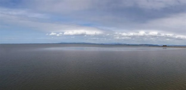
Returning by a longer route, I feel the full force of the wind through my body as well as on my face. Any hat would be in danger of taking flight. Indeed, paper litter is being blown in eddies around the streets. I look up at the fells and imagine how exhilarating it would be up there.
***
Today is just one of my local walks, but I do feel very refreshed even from this short exposure to the wind. In the past, I have had my fair share of gale-force walks and camps.
As a greenhorn backpacker on the early Pennine Way in the sixties, pre-Wainwright’s Guide of 1968, I had reached the Northern Pennines and was camped high on Knock Fell. The inevitable happened in the night as the notorious Helm Wind did its best to blow me and my tent into oblivion. I remember I was scared, and at first light packed up and braved the roaring gale back down to Dufton. I reached the pub to phone home and arrange a rescue. The locals in the bar were impressed that my tent, a cotton Black’s Tinker, had stood up to the force; it can blow at 100mph.
Still young and foolish, we set off to walk the Kentmere horseshoe one winter when gale-force winds were forecast. I’m sure there was probably a warning to stay off the hills; there certainly would be these days. The fells were covered in ice and snow, but we were equipped with crampons and ice axes. At the top of Garburn Pass, we started on the ridge to Yoke. The wind became fiercer as we gained height. The ridge is very exposed, and we had difficulty keeping on our feet. Any fall onto the icy surface had us being blown along horizontally towards the steep drop into Kentmere. Ice axes were needed to prevent us from disappearing. I have no idea why we didn’t turn back, but I vaguely remember enjoying the challenge. We reached the imposing Thornthwaite Beacon, where there was some shelter from the westerly. At least we could almost hear ourselves discuss our escape plan. There was no possibility of continuing the horseshoe over Kentmere Pike. There are not many easy ways off the ridge at the head of Kentmere in winter, and reading the map was impossible. To add to our problems, we were now in a whiteout. We needed to get down to Nan Beild pass, where there is a stone shelter and an easy way off the fells. On a compass bearing, we were literally blown down towards it, but a few degrees out, and we found ourselves descending on very steep ground. Fortunately, a break in the clouds revealed Blea Tarn directly below, and we realised our mistake before committing to dangerous territory. With relief, we changed course and reached the shelter at the pass, from which we could slowly descend out of the worst of the wind, battered physically and mentally by the experience. There was no other person to be seen out that day.
My latest memorable experience of gales was on our high-level traverse of the Pyrenees. Having crossed over from an icy France to sunny Spain, we were enjoying a high camp just off the ridge at about 2,500m, sitting around watching the sunset and distant peaks. We were unaware that a deep low-pressure system was approaching from the west. The lightning strike on the ridge above woke us in the early hours. Deafening thunder, a gale-force wind, and torrential rain followed. We battened down, dressed and packed rucksacks for an emergency exit. We must have been in the eye of the storm, as there was no respite for about two hours. We didn’t expect the tent to survive; it is still torn where we were hanging onto its flaps. Our plan was to escape down the valley to Torla in the morning and lick our wounds. But dawn broke without any further damage, and we headed to the Goriz refuge for sustenance. All in a day’s mountain travel.
So much for taking a windy walk.


 Even more options – Dalemain (5 miles) and Lowther (7miles) loops from Pooley Bridge. And there is a new link from Penrith to Pooley Bridge, the grandly named Eamont Way, all 5.5 miles of it. A separate Heritage trail of sculptures is to be explored along the way. There are also some important archeological sites close to Penrith. A plan is taking shape. This is becoming a week’s holiday.


 I now realise there was another Mary ‘panel’ at the start of the wall farther back – it gives me an excuse to have another leisurely exploration.


 As I approached the west end of Morecambe I was intrigued by a large building set back from the front. The building now known as The Battery once marked the boundary between Morecambe and Heysham. (in 1928 the two districts merged). In the nineteenth century the site was occupied by an old mill and the area was later used as a firing range, with an artillery battery stationed there because of fear of an invasion by the French. The mill, then known as The Roundhouse, was used for storing ammunition. The Battery Inn was built in 1863 and in 1900 it expanded to become The Battery Hotel, later acquired by Thwaites Brewery and functioned into the 1980s. It has recently been bought by a property developer for conversion into luxury flats. I’m not sure whether much progress has been made.

 And what’s more on the other side of the road a series of artistic panels brightening up an otherwise drab development hoarding at the former Frontier Land. I now remember Eunice from the Mouse House mentioning them


 I can’t believe it but on a cold winter’s morning I get mixed up again with a half-marathon run along the cycleway from Halton into Lancaster. Back in the summer I was in the mixt of a larger run, and it proved frustrating on the narrow paths.
 So today I took an early opportunity to seek escape up the ramp onto the Lancaster Canal Aqueduct, over the Lune and into quiet countryside. Only the odd dog walkers were met before I disembarked onto the promenade leading around the Bay to Morecambe.


 I was now wheeling by cycle along the pavements. The old station with its impressive frontage was next. Peeping inside there was a rather lacklustre Xmas fayre in progress. The room was presumably the old spacious waiting hall, in its heyday this station would have been extremely busy bringing tourists to the heart of Morecambe. ‘Bradford-by-the-Sea’. The new station is a bleak platform in an industrial waste – so much for thoughtful planning.