This may take some time to write up and to read. I completed the short cycle ride on a frosty January 18th. 2024.
How many times have I cycled down the seafront from Fleetwood to Blackpool? How many times have I later flown past, with the wind behind me, the several pieces of artwork without realising their significance? The answer, my friend, is blowin’ in the wind. A song still appropriate to the present troubles of our world and my wanderings.
Grab a coffee, relax, listen and read on.
I aim to put that right today. I have done a little research on the Cleveleys website. Over recent years the sea defence improvements at Rossall and Cleveleys have provided a wonderful promenade, a leisure amenity alongside the coast popular with walkers and cyclists. At the same time funding was secured by Wyre Council through Sea Change, a national fund designed to regenerate the coast through the Arts.
This gave rise to Cleveleys Mythic Coastline art work following the story of The Sea Swallow A children’s fairytale, written by Gareth Thompson and illustrated by Hannah McGee, it blends legends with local features. Each primary school child in Wyre was given a copy of the book in 2011. (I need to find out if any copies are still available – just this minute ordered ordered one from ABE Books.) The book tells of the epic story of land versus sea and uses old fables from this stretch of the Fylde coast with the sea swallows protecting it. A tale of an Ogre stirring up the sea with his giant paddle, threatening the waterfront community, only to be thwarted by the story’s heroine, Mary and her golden shell. Mary is granted the ability to journey to the seabed for an encounter with the sea-ogre, who covets the shell and threatens her village with inundation. I need to read the book to find out the hopefully favourable outcome. The story and pictures from the book have been the basis for the public artwork subsequently installed along the seafront.
***
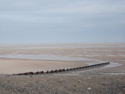
To set the scene: I unload my bike as usual near the delightful ‘Welcome Home’ statue on the front at Fleetwood and pedal off in the freezing temperatures, my hands rapidly becoming numb. There are patches of ice along the promenade and the beach is frozen solid. The tide is farther out than I’ve seen it before and one can imagine the difficulties of navigating into the mouth of the Wyre and Fleetwood’s docks. Out to sea the Isle of Man ferry is heading to Heysham whilst a couple of freighters are leaving, with the back drop of Barrow, Black Coombe and the snowy Lakeland hills.


Once past the toppling coast watchers and round Rossall Point I’m onto the new tiered promenades of Rossall’s sea defences with concrete walls showing wavy themes in relief. 


Along here are three art installations I’ve not bothered to examine before. Each one consists of three slender arching columns, grass-like, decorated with a floral theme. Ragwort, Sea Holly and Sea Spurrey and their animal dependents, Cinnabar Moth, Red Tailed Buff Bee and Common Toad respectively. I can find little information on them, but obviously, they reflect coastal species. They are sited at access points to the beach for maximum impact; perhaps they are marker posts between here and Cleveleys. 


It was along here that Sea Swallows started appearing in the back wall and, at the end an impressive larger relief featuring Mary. 

 I now realise there was another Mary ‘panel’ at the start of the wall farther back – it gives me an excuse to have another leisurely exploration.
The main installations of the Mythic Coast are from the storybook – The Shell, The Ogre, The Ogre’s Paddle and The Sea Swallow, and the nearby Shipwreck Memorial. They have all been put together by artists and designers from Broadbent Studio.
First up was Mary’s Shell, a large piece of spiralling metal in a shell shape on the Cleveley beach below the café. Looking through it at low tide is the sea; at high tide, it becomes completely submerged. The complex Conch shell was made from stainless steel in Ulverston, with a blast finish and weighs in at 17 tons. Today, the tide was out, and I could have, should have, gone down the steps to come up close, but with the bike in tow, I was content to view from the promenade.


The Ogre is easily missed alongside the boulder groyne just south of the Shell. It is in fact a boulder carved to represent the crouching giant. He was hand carved from a single fifteen ton block of limestone by the stonemason Adrian Wright and fittingly submerged for a lot of the time. Today, I was lucky, and he was plain for all to see. Again, I should have gone down onto the beach for a closer look, but as I said a good excuse to return.

Can you spot him?


The Ogre’s Paddle is on the higher promenade, unceremoniously in front of the cinemas and gym. The paddle was constructed in purple heart wood from South America, carved with decorations and text from the story by the woodcarver John Merrill.
“the Sea Ogre’s paddle drifted up to lie on the muddy sand like some strange offering”


The Sea Swallow monument is right in the middle of the promenade. A 10m tall sculpture, its shape inspired by the feel of a book coming to life and the swallows flying out of it.. The swallows are the town’s protectors, and I now realise are representative of Sea Terns. Just look at that blue sky.
“This feature acts as a visual beacon to draw people from the town centre to the seafront” . The granite was supplied by Hardscape, and the aluminium structure fabricated and installed by Chris Brammall Ltd. of Cumbria.


‘For at night they stand together on the sea wall, as if protecting the town with their great white wings.’
Illustrations from the book have been carved and blasted into the granite base of the sculpture. “maybe somewhere along the coast, the shell waits for someone to find it again”

You may have noticed everything is curvy (wavy) on Cleveleys promenade, often practically to soften the force of the waves but more of an ongoing architectural statement. I think it works quite well.


The last piece, the Shipwreck Memorial, stands proudly on the Cleveleys Promenade. A huge piece of iron, 15mm thick, laser cut with the names of lost vessels. It stands 4.5m tall against the sky, supported by two huge solid pieces of timber. The metalwork is slowly rusting, as would have the sunken ships.
It acts as a memorial to all known ships lost along the Fylde since 1643. It is positioned on the promenade at Cleveleys, adjacent to the site of the most recently lost ship – The Riverdance, which ran aground in 2008 and became a tourist attraction as it slowly lost its cargo and was subsequently dismantled. In the same area the wooden ribs of The Abana, sunk in 1894, still show up at low tide. Apparently, they can be seen through the disc in the memorial, I should have looked more carefully.
On the wooden supports are a couple of panels listing all the ships with more information about their wrecking. A sobering list, a huge graveyard of over 200, The first listed as Unidentified, wrecked near Fleetwood in 1643 having run aground after being set on fire by Loyalists in the Civil War. In more modern times, the Trawler industry suffered disproportionately. A full list of wrecks has been transcribed onto a page on the Cleveleys website.


A final installation – Coloured Sea Swallows, cast in resin, was planned to sit along the seawall on the Cleveleys promenade. They have been temporarily removed following the unfortunate theft of several of them, and are awaiting re-siting.

Historical picture.
The Shipwreck Memorial stands on the border between Wyre (Cleveleys) and Blackpool. I’ve gone as far as I want today; it’s time to head back.
But first I stop to watch some activity on the beach. They are building more stone groynes to prevent potentially dangerous deep-side channels from developing across the beach. Blocks of stone, Granite from Shap and Limestone from Carnforth, have been ‘dumped’ on the beach. Concrete ramps to allow access along the beach have been built, and they are now starting to carefully place the boulders at right angles to the prom, forming the groynes. Each block weighs between 3 and 8 tons; anything lighter would get washed away in storms.


Needless to say, I haven’t seen any Sea Swallows but a cheeky Starling joined me for some lunch. 
Thanks for sticking with me. Maybe listen to Bob again.
***


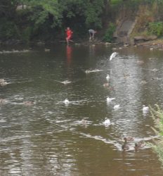
 Down on the River Wyre in St. Michael’s a tragic drama is transpiring, a 45-year-old local lady, Nicola Bulley, has gone missing whilst walking her dog by the river. You will have seen it on the national news, the trauma her family are going through as the days pass, without resolution, doesn’t bear thinking about.