Tag Archives: The way of the crow

NICKY NOOK ANOTHER WAY.

Wednesday Oct 28th.  6.75 miles.  Scorton.

When I phoned Sir Hugh and suggested Nicky Nook there was some hesitation in the air. Maybe he was tired from his daily walk, maybe he was tuned to Autumn Watch, maybe the forecast was dubious but most probably he had ‘done’ Nicky Nook too many times in the past. Of course, being the gentleman that he undoubtedly is, he agreed tomorrow  – Scorton. 9.30am SD 503 485.

I had visited the summit back in February just before lockdown proper and again recently with the Cheshire set.

*****

9.30 AM. I was stood taking pictures of my new boots when he arrived. It was several hours later that we met many other walkers at the trig point on Nicky Nook. Sir Hugh kept reminding me that we had been walking uphill all day, a slight exaggeration.

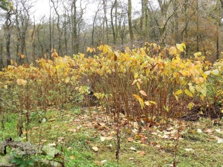
Lanes had taken us out of Scorton with a delightful stretch of old pathway into lower Grizedale. There is a footbridge which I’ve passed many times with an inviting path up into the woods on the other side. Today that’s the way we went.  Delightful. The boggy field at the top was not so good,  I was glad of my new boots with high ankles. We passed quickly through the grounds of Burns farm. Suddenly we were high above the coastal plain and could pick out various landmarks, notably Blackpool Tower although you can’t see it or much more in the picture below. Good waterboard tracks led us around the two Barnacre Reservoirs up to the three wireless stations. This was moorland walking on the edge of the Bowland Hills and I think we reached a point higher than our intended summit. We were still climbing.

We came out onto the fell road at a point where in the past we had followed the River Calder up to Arbour, of rhinoceros fame, as part of the straight line route linking our houses. Walking down the road we could see Nicky Nook from its far side. The car park at Grizedale Bridge was full and lots of walkers started appearing. More squelchy fields took us past the large and untidy Fell End Farm. Some drainage pipes served as seats for lunch when we had the only drops of rain all day. Rams were sparring and butting each other to try and win the affections of a passing ewe.  At last, we set foot on Nicky Nook and slowly made our way to the top. What you think, hope, is the top turns out to be a surveying column from the reservoirs’ construction. There are always people on top and today was no exception. We studied the motorway trail up through Lancashire, picking out the Forton Service station tower and further on Lancaster University. The lakes were in cloud and I forgot to look for the Isle of Man. Whoever Nicky was he had superb views.

The track down has been resurfaced and stepped awkwardly. The lane at the bottom was busy but not as chaotic as earlier in lockdown, where does everybody come from? Some day I will have to walk alongside Wyresdale lake, the hall there was apparently designed by the renowned Lancaster architect Paley. The Priory, where I always stopped for a coffee when cycling the ‘Trough’, looked closed and the Barn busy, so we were soon back at the car close to the church with the spire that you see from the motorway.

My new boots performed admirably and I’m looking for a long association.

*****

AMBLING AROUND ABBEYSTEAD.

*****

https://i0.wp.com/www.map-of-uk.co.uk/maps/map-of-lancashire.gif?resize=501%2C334

The green area on the above map is the County of Lancashire which as you may well know has, as of this last weekend, gone into the highest Covid-19 restrictions – Tier 3.  So my wanderings in the foreseeable future will be solely in the Red Rose County. There are far worse places to be. As it happens I was already planning to visit Abbeystead today for a walk plucked out of Jack Keighley’s  Cicerone ‘Walks in the Forest of Bowland’  guide which seemed to have several points of interest. I’ve been following quite a few from this guide in the last weeks and have been impressed by their quality. The forecast is for cloud so a low level walk suits.

*****

I arrived at the carpark at 12noon to find it full, I’d half expected that. Fortunately a couple of early birds were just finishing their walk so I grabbed their spot. The River Wyre has two initial tributaries, The Marshaw and The Tarnbrook. I started my walk alongside the latter and soon came to the former. My curiosity had me bashing through the undergrowth to find the confluence of the two – a Dr. Livingstone experience. The two small streams meet and soon the River Wyre takes on a more majestic flow. Satisfied I go back to where I had started, it’s going to one of those days.

Marshaw Wyre bridge.

Meeting of the Waters

The Wyre flows on.

I took some photos of these large plants growing profusely along the banks – I don’t know their name? I thought the leaves were too large for Japanese Knot weed but I’m not so sure now.

My path left the Wyre Way and shot up some steep stone steps which kept on going. Eventually fields followed to come out onto the road at Hawthornthwaite with the fell road heading across to the Trough of Bowland just above me. All around were the Bowland Fells looking a bit dismal today.

The mole catcher has been working overtime.

A farm track took me past Marl House and then into open fields with no obvious track. For this walk the guide states “A somewhat complex route requiring careful reference to map and directions”  Well I was soon searching for the next stile and essential footbridge across a formidable little gorge, Cam Brook. Walking up and down my GPS didn’t seem to be helping. I persisted with my search and finally found a new looking bridge across but not where shown on my map. Anyhow, I was across and climbing fairly new steps but at the top where I should have gone right to an old mill a new pheasant fencing blocked my way and shepherding me upwards. I tried an open space in a hollow but at its end a high gate. I could see no path continuing, so I decided to head for a barn shown on the map and follow the track from there.   As I walked on I spotted three walkers coming the other way towards where I should have been. After pleasantries with them, I set forth or was that back, determined to find the mill ruins. After a couple of stiles I came across them in the woods, sad reminders of a bygone time. It had been a water driven cotton spinning mill until destroyed by fire in 1848. Associated workers’ cottages were disappearing nearby. That hollow I had been walking in half an hour ago was in fact the old empty mill pond.

Satisfied I returned to pass again the cheerful three sat on a log having lunch.

Last of the summer wine.

Now I knew where I was going – Little Catshaw 1763 and Catshaw Hall 1678. I passed through here before with Sir Hugh on our straight line walk from Longridge to Arnside in November 2018.

Little Catshaw.

Catshaw Hall.

The steep track led down over a sparkling side stream and to the Wyre in its heavily wooded valley. A sturdy bridge was crossed before stone steps went straight up the opposite hill to Lentworth Hall. These tracks must be centuries old linking farms and maybe going to the church where I was heading.

More stone steps.

A gate at the top of a field, suitably full of sheep, admitted me into the churchyard of Christ Church, The Shepherds’ Church.  [The gate has its own story which I thought was a joke at first] The church dates back to the C14th but was rebuilt in 1733 and a spire added to its tower later.  Its stained-glass windows depict Biblical shepherd scenes, these would have been better appreciated from the interior but it was locked. In the porch are rows of hooks supposedly for visiting shepherds to hang their crooks. Above the door is an old inscription –  ‘O ye shepherds hear the word of the Lord

I found a bench to sit on for lunch, it was 2.30 after all.  Next to me was a war memorial with a thought-provoking inscription perhaps aimed at the agricultural soldier.

My next objective was a Friends Meeting House and Quaker burial ground up the hill at Brook House. As well as the meeting house there had been a school and schoolmasters house in this little complex of buildings, now residential conversions. The graveyard with its simple uniform headstones was accessible and was a very calming place. Apparently the Friends Meeting House In Lancaster has use of it but there didn’t appear to be many recent burials.

I was now quite high on the northern flanks of the Wyre Valley but views were limited by the weather. More fields took me past Chapel House Farm with its barking dogs and over a rickety stile to the road at Summers House.

Then a walk across rough country in worsening light to Grizedale Bridge over the Tarnbrook Wyre. A cart track was followed back to Stoops Bridge.

Grizedale Bridge.

Stoops Bridge.

Before I got my car I had a wander into Abbeystead  itself. All the C19th buildings are now part of the Duke of Westminster’s vast estate and built in an Elizabethan style. The big house is hidden from view. The hamlet is named after an Abbey founded here in the C12th by Cistercian monks from Furness. It didn’t last long and was soon abandoned.

All I needed was a bit of sunshine to bring out the Autumn colours.


*****

THE WAY OF THE CROW. Seventh day. Carnforth to Arnside.

Was today going to be anticlimax of lane walking  into Arnside?  No, with Sir Hugh’s local knowledge we weaved our way through unknown woods, nooks and crannies. Our plan a few week’s ago was to walk between our residences, they sound grand, as close as possible to a straight-line drawn on the map. We have actually kept it to within a kilometre of said line.

The road from the Carnforth/Warton marshes was busier than we had hoped so at the earliest opportunity we took a hidden path up onto the higher lane. We knew this area well from climbing on the  numerous limestone crags. Warton Main Quarry was a place to fill you with fear but the higher outcrops were far more attractive. We had met up at Warton Pinnacle Crag before.

Warton Main Quarry.

Passing on we dropped down to Crag Foot where there is a distinctive chimney, the remains of a pumping station for the low-lying fields that now are abandoned for the reed beds of Leighton Moss Reserve made famous for its Bitterns. The other chimney seen across the marshes at Jenny Brown’s Point is related to copper smelting works dating from the end of the 18th century.

Crag Foot Chimney.

Jenny Brown’s Point

Saltmarshes.

Soon we were crossing those saltmarshes towards an RSPB hide named in honour of Sir Eric Morecambe. We had no binoculars so we bypassed towards the wooded Heald Brow where a limestone track wandered through the woods towards Silverdale. This was all new to me and I was enjoying the atmosphere. Devious lanes and paths were taken around the edge of Silverdale through various National Trust Properties and despite a basic navigational error, not knowing which road we were on, we arrived at Waterslack Farm where I remembered a garden centre and cafe in days gone by. On the way we passed several wells, Lambert’s Meadow, Ancient woodlands, lots of limestone outcrops and The Row of houses. This whole area is worthy of detailed exploration.

Limestone pavement.

Burton Well Scar.

Lamberts Meadow.

Burton Well.

Dog Slack Well.

The Row.


The Black Dyke runs parallel with the railway into Arnside but we first had to have a look into Middlebarrow Quarry, a large abandoned limestone site where there would be climbing possibilities if it wasn’t on the dreaded private Dallam Estate land where any public access is unwelcome.

We heard shots in the distance and were wary of this guy with a high-powered rifle.

Black Dyke.

A final sting in the tail was when Sir Hugh launched up a steep slippery track to arrive into the village next to his house.

Mission accomplished before the end of 2018.  Happy New Year for 2019. What next.


*****


THE WAY OF THE CROW. Sixth day, The Lune to Carnforth.

                                                       We’ve had a lot of rain.

It was going to be difficult today to stay within the kilometre of our self-imposed straight line from my house in Longridge to Sir Hugh’s in Arnside. To get this far, as the crow flies, we had employed dubious means and been lucky with the positioning of important bridges. Another footpathless zone faced us this morning. Simple, said Sir Hugh just ask the farmer if we can tramp across his fields and walls, I wasn’t convinced.  In the mist we ghosted through the farmyard, not a dog barked or a cow stirred but there ahead was our adversary.  A burly farmer, I pushed Sir High forward with his simple proposition. Please sir… ” Yes just go down that field , through a gate and onwards.  But why didn’t you just follow the road?”  Our explanation seem to baffle him, as I thought it would. Rejoicing we ploughed on, the magic straight line was becoming our mantra.

Onwards.

The day had started back at Halton station, a few dog walkers were gathering. The bridge across the Lune was strange, it looked like a railway bridge but carried a single lane highway. The history here explains all…


Safely across we wandered through Halton, a mixture of old and new housing. As soon as we could field paths were followed on surprisingly undulating terrain, Both of us, recovering from chesty coughs, wheezed up hill. The forecast was wrong and we found ourselves in that miserable and annoyingly wetting mizzle. Before long the track to Stub Hall Farm was reached and our fate for the day in the farmer’s hands. A big thank you.

Once on the public footpath we relaxed into Nether Kellet and were soon going out on the wrong lane, a short cut was spotted across the recreational ground. Here was a war memorial to the Second World War from some distant benefactor.

Our next barrier, the M6, was easily crossed and some interesting paths taken through fields, woods and quarries.

Sacrilege to affix onto ancient stones.

We were intrigued by this standing water pipe curiosity.

The Lancaster Canal was reached and the adjacent A6 highway, a convenient seat for lunch next to a bus stop had locals peering at us through the condensed bus windows. I felt quite tramp like under their gaze. Although this was officially Carnforth we walked out through Crag Bank which seemed to have lots of old stone cottages, origins unknown. We were now in the drained marshlands of Morecambe Bay, today a little eerie with the mist.  Getting off the road proved difficult, a gate fell apart in my hands and we encountered impenetrable stiles in the march. Nobody uses the paths past Galley Hall. Another fortuitous bridge took us across the muddy River Keer and we were in the outskirts of Warton, the gloom preventing any views of the limestone crags above us. Hopefully the weather will be better for our last stretch into Arnside.


*****

THE WAY OF THE CROW. Fifth day, Postern Gate to The Lune.

                    The classic English countryside of Qurnmore Hall Park.

Quernmore Park estate forms the most formidable obstacle to our straight line route and over the last week in anticipation Sir Hugh and I have been plotting a military style assault. Using aerial photos and maps we have tried to find a way through, unobserved, without too many unclimbable fences, we have more plan A, B, C and D’s than the present Brexit debacle. There’s not a public footpath in sight. However our chief negotiator is highly skilled and has behind the scenes obtained permission from the owners to walk through on the forbidden lane. Here we are at the Postern Gate on a bright afternoon ready to stride past all the private signs to join the privileged classes.

The hall itself was well hidden behind walls and security gates.

To be honest we enjoyed our passage through the grounds even being greeted by the owner half way through.

At the end we emerged at the North Lodge onto a busy road, which would not have been pleasant or safe to walk along, a quick climb over a gate had us into a steep field leading down towards the River Lune. Fortunately another fence assault brought us onto the Lune Valley Ramble route and a clear walk along the old Lancaster to Wennington railway, closed under the Beeching axe in the 1960s and now a landscaped cycle path as far as Bull Beck, Caton. A complete contrast to the previous parkland.

On the opposite bank were new houses built since my last visit. They looked like affordable housing and were impressively roofed in solar panels.

The old station at Halton was busy, not with passengers but with students gathering for an afternoon’s rowing on the river. They have use of the listed building as a boat house which according to their coach costs a fortune.

A satisfying short walk through forbidden ground, all should be easy from now on.

*****

THE WAY OF THE CROW. Fourth day, Lentworth to Postern Gate, Quernmore.

                                                               Clougha Pike.

Serendipity – whilst we were looking for ways into the extensive private Quernmore Hall estate blocking our ongoing straight line a car drew up and out stepped the daughter of the owners! A pleasant chat ensured and we had their contact phone number for possible further progress on another day. But I’m getting ahead of myself.

Today should be easy walking , paths and lanes keep close to our ‘line’. Last night I’d been kept awake by heavy rainfall, frequent showers and gales were forecast but we set off and enjoyed sunshine and a bracing breeze. A quiet lane climbed away from the Wyre valley giving us a gentle warmup. Opposite the Quaker Friends Meeting House a carved stone was placed close to the stile we needed, we conjectured as to its antiquity. Once across a couple of swampy agricultural fields,  we approached a ramshackle farmyard, Low Moorhead, with trepidation, dogs and obstructions looked imminent. Another carved stone took our attention. As it happened the friendly farmer was busy nearby and we ascertained that he and his wife had created the stones rather than some medieval mason, we congratulated him on their artistry.

Most of the day we traversed Daleslike farmland below Grit Fell and Clougha Pike, gritstone moors above with Morecombe Bay spread out below. Our incursion onto the rough fell, boggy reeds, was not succesful and we were glad to hit the road and subsequently return into pheasant woods. The ‘beast from the east’ had been active here and we picked our way through the fallen trees.

Our incursion onto the rough fell, boggy reeds, was not succesful and we were glad to hit the road and subsequently return into pheasant woods. The ‘beast from the east’ had been active here and we picked our way through the fallen trees.

The last mile or so was along a supposedly quiet lane leading to those private woods above Postern Gate, the only highlight apart from a rainbow above the green valley was Quernmore Church.

*****


THE WAY OF THE CROW. Third day, Arbour to Lentworth Hall.

Distant Ward’s Stone Fell.

First a moan…                                                                                                                                             The Countryside and Rights of Way Act of 2000 ( the CROW Act, not the crow we are following )  gives a public right of access to land mapped as ‘open country’  known as open access land. A large area of the Bowland Fells are so designated which should give some degree of freedom to roam on the moorlands. However not all is as it seems. The 1:25,000 OS maps highlight open access land with  orange shading but the areas do not always link up with the public rights of way, creating a problem of reaching the access area in the first place. There are actually some ‘islands’ of access land with no access! This morning we are faced with one of these dilemmas, the lane back to Arbour is private for the first kilometre [red dots] so the logical way into the access area is denied legally. Who came up with these walker unfriendly ideas? I’m afraid those powerful landowners had too much influence when the plans were being drawn .Anyhow here we are back at the Arbour shooting lodge in its remote setting, ready for another ‘up and over’. Today we have to climb over Stake House and Grizedale Fells. There is still no sign of the rhino. We take the opportunity of some shelter by the lodge to divest of some clothing before the sweaty climb. A vague track is lost and then found as we puff up the steep slope alongside a series of very posh shooting butts. This track in fact takes us to the unmarked summit of Stake House, 402m, where we can admire views of Morecambe Bay, the Clougha Pike, Grit Fell, Ward’s Stone and Wolfhole Fell group with  the Trough Of Bowland spread out below. We take a compass bearing to a pond which should be near the start of the track at Grizesdale Head. We are in the middle of a wilderness here though the going is better than we’d anticipated, short heather and not too much bog. The weather is changeable!

A hazy Morecambe Bay with another storm coming in.


Wilderness – on a compass bearing.


Out of nowhere a gate in the boundary fence appears and this gives us easy access to the landrover track we are relying on to take us off the moors. We do so in swoops down the hillside as the weather takes a turn for the worse, wind and hail. At the road we are glad to hide behind a wall for lunch and watch the lazy antics of some contractors trying to offload fence posts. I do not envy their work outside in these conditions.

Opposite is a private lane to Catshaw Farms which is right on our route line, we wave enthusiastically at farm workers who pass us but nobody seems bothered by our presence. Once at the large farm complex we are back on public rights of way. Catshaw Hall Farm dates from the 17C, grade II listed with mullioned windows. There was work going on today.Muddy fields drop down towards the River Wyre where many trees are down from recent storms.   At a side stream the path has been washed away leading to some undignified bum sliding to reach the newly reconstructed footbridge. The bridge over The Wyre is made of sturdier timbers.  I realise have been here before.

Steep slippy steps bring us into fields belonging to Lentwoth Hall, now divided into apartments.

The final lane with ‘walking’ trees.

This whole area of Abbeystead is part of the Grosvenor estate owned by the Dukes Of Westminster. It holds the record for the biggest grouse bag in a day. On 12 August 1915, 2,929 birds were shot by eight shooters. We have survived the day through their estate and will carry on no doubt to trespass further estates on our straight line. I’m glad we finished when we did as the weather became atrocious, it’s the first day of winter tomorrow.

*****


THE WAY OF THE CROW. Second day, Bleasdale to Arbour, Calder Valley.

JD seemed worried when I described the next leg of our straight line way – “it is extremely rough going, the game keepers are unfriendly and there are rumours of a wild rhinoceros”. Despite all that he agreed to join us on his recommended shortened version. The picture above was taken from his house when I picked him up in the morning, The Bleasdale Fells which we had to cross are to the left of the higher Fairsnape group. Beacon Fell is far left.

The car park at Bleasdale Church was busy with Sunday worshippers.

It was a glorious sunny morning as we used field paths into the heart of Bleasdale discussing our individual Saturday night’s exploits, I probably had the largest hangover, Sir Hugh had been consructing a cat flap and JD entertaing his family.

Donning extra layers when we realised how cold it was.

No that’s not the rhino but pretty scary anyhow.

After the isolated Hazelhurst Farm we found the beginnings of a land rover track that would, via a series of zigzags, take us steeply into the open access area and onto the fell top. We puffed our way up with frequent stops to admire the views over the nearby Fairsnape/Parlick fells with Bleasdale and  the Fylde below. Surprisingly and fortunately another quad track led to the remote trig point, 429m, of Hazelhutst Fell. We are on grouse shooting moors up here and much has been written about the persecution of other wildlife in this vicinity to try to promote the shooting fraternity. Whatever one’s opinions about grouse shooting I am strongly against the wilful and unlawful killing of our protected species. On this stretch of the walk we came across several loaded Fenn Traps which are legally only allowed for stoat trapping [killing] but are known to trap other species. These are lethal looking spring-loaded traps which could almost take the tip off your walking pole.

From the trig point there were hazy views across Morecambe Bay to Black Combe and Barrow. Taking a compass bearing we set off across the heather in a NNW direction and fortunately found another quad bike track taking us down past shooting butts so avoiding all the heavy going. After what I’ve said about the grouse shooting land owners we were thankful for their tracks. The final descent was vertiginous. The surroundings were reminiscent of a Scottish Glen and we found the bridge over the Calder to the Victorian shooting cabin of Arbour. This must be one of the best kept secrets of Lancashire.

We found a sheltered spot out of the cold east wind for lunch. There were no windows into the shooting lodge to see the rhinoceros head. The story goes that a rhino escaped from a train near Garstang and had to be shot, it’s trophy head being mounted in the lodge.

By now all the excitement was over and we had an easy walk out on the track alongside the River Calder.  We were back at Sir Hugh’s car much sooner than we’d planned because of those good moorland tracks. We will have to walk back in next time to rejoin our line.

*****


THE WAY OF THE CROW. First day, Longridge to Bleasdale.

I was apprehensive, walking in a straight line as possible would take us on unfrequented paths, would the way be feasible. We left the village down overgrown Gypsy Lane and shortly after found a gate secured by a cord, a veritable Gordian Knot. Out came Sir Hugh’s, I’ll blame him, Swiss Army Knife and we were through.

‘Gypsy Lane’

We passed the ponds, ‘figure of eight’ where my children used to go fishing without much success but I’m sure they had an adventure away from parental supervision – they never drowned so I must have been doing something right.

The next farm-yard, where I’d previously climbed walls to escape, was now well signed and we even had a resident directing us to the hidden stile ahead though the accompanying foot plank, couldn’t call it a bridge, didn’t inspire confidence.

The slippery plank.

We reached a farm gate on a public footpath which was securely padlocked, no Swiss Army knife could cope, but as if on cue a lady drove up in her battered pick-up and opened up for us. Remonstrating about obstructed footpaths didn’t seem to be appropriate. All was pleasant rural scenery with scattered farms, some in better condition than others.

The next problem was of our creation, contentedly walking along the tiny River Loud we were almost in someone’s back garden when we realised we’d missed our path but fortunately a gate allowed our escape onto the road.

The infant Loud.

Things improved as we headed closer towards the Bowland Hills and Bleasdale. We passed the small rural Bleasdale School and headed for the church where our car was parked. We were last here in gale force Ali. A group of fell runners were just setting off for a quick few miles and we exchanged pleasantries. Walkers, climbers , cyclists, runners tend to have a common background.

Is that an Ofsted verdict?

We had completed the first leg of our project with very little deviation from the straight and narrow and to be honest no serious obstacles except a lot of slippery stiles. Our way ahead over Hazelhurst Fell could be seen, the fell runner is pointing the way, but will there be any paths?

Yet another slippery stile.

***** 

THE WAY OF THE CROW. LONGRIDGE TO ARNSIDE.

My good friend Sir Hugh  [http://conradwalks.blogspot.com/ ] inhabits that lovely village Arnside whereas I have to put up with the gross overdevelopment of Longridge. For the last few winters we have had projects to keep us active in the shorter days. He has emailed once or twice with suggestions for this year but nothing has struck me as original, boringly I seem to have walked most of the Long Distance Paths in the NW. I came up with a counter suggestion – why don’t we draw a straight line between our houses and follow it as closely as possible. I know this idea has been used before, particularly successfully  by Nic Crane on his straight line Two Degrees West journey from Berwick-on-Tweed to The Isle of Purbeck. I seem to remember he gave himself  a kilometre leeway either side but had a lot of media support, I wonder if we could be even stricter. True to form Sir High has taken the bait and the line has been drawn.

It is the wrong time of year for backpacking so we will split the route into day walks. The distance as the crow flies is 26.5 miles but we will be lucky to keep it under 35 miles. No rules except keeping as close to the line as possible preferably on footpaths or quiet lanes, legal ground or not. There are some obvious obstacles in the way – the fells of Bleasdale, the Rivers Wyre and Lune, Quernmore Hall Estate and the M6. It will be a challenge overcoming them, lets get started.