Category Archives: Lancashire Witches Walk.

TWO FELLS. EASY EASINGTON AND WINDY WADDINGTON.

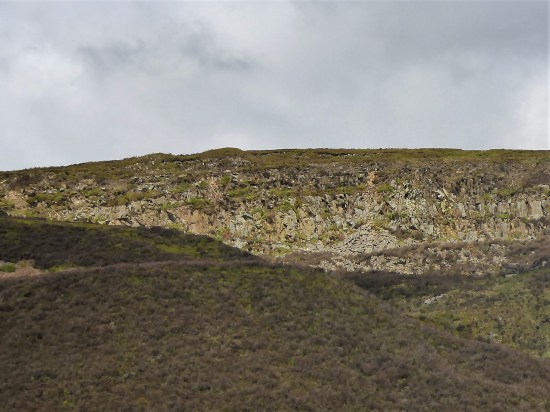
 The above shows Waddinton Fell on the left and Easington Fell on the right.

 The last thing I need when I’m trying to squeeze in an afternoon fell walk is a road closed sign.

 There is no quick way around Waddington, so it is even later, 1 pm, when I park up at the summit of the B6478 road over to Newton. This road doesn’t seem to have its own name, unlike nearby ‘The Trough’ or ‘Birdy Brow’. Long ago, we called it The Moorcock Road. But the Moorcock Inn has been gone for decades, replaced with private houses.

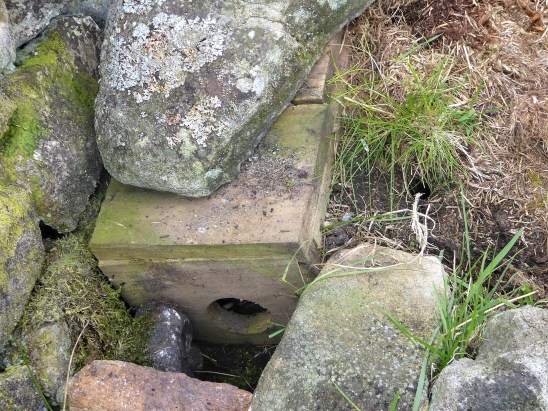
 Anyhow, I am here, the sun is shining, and the air is clear. I’m looking forward to a short fell excursion. Walking down the road from the parking, I pass Walloper Well. The fresh water flows continuously most of the year, passing cyclists often top up if they know about it. In the past, this would have been essential for horse-drawn carriages.

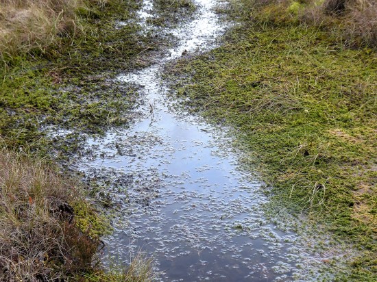
 My footpath leaves the road here, across boggy ground, and I wonder if it is the correct one as I flounder in the mire. Eventually, it becomes clearer and drier. I’ve been here many times, but not often in such brilliant conditions.

 Striding onwards, I don’t go to investigate Old Ned or The Wife, piles of stones on the moor. I’ve checked them out before, and they are just what the map says—piles of stones. I have never found an explanation for their origins.

The Wife?

  Leaving the Right of Way, I follow a quad bike track towards the summit of Easington Fell.  It’s all open access anyhow. The views open up in all directions, but most obviously towards the Yorkshire Three Peaks across the Craven Gap. A few stones mark the summit, a modest 396m.

 Turning around, I head back to the road. Initially, I had planned to extend the walk into Grindleton Forest, but looking at the time, I think better of it. The wind is increasing, and it is feeling quite cold. 

 Over to my left, across the Ribble Valley, Pendle looks as proud as ever.

 There is a clear track back after I get through the fell gate, which seems easier than usual.  A cross stile reminds me that the Lancashire Witches Way comes across here before heading into Bowland.

 All I have to do is follow the obvious track back to the road seen across the way. It is boggy but not too bad. Just wait until we have had some more rain. I’m aiming straight to the quarry at the summit of the road with Waddington Fell and its prominent mast behind. I can see my car clearly —the only one.

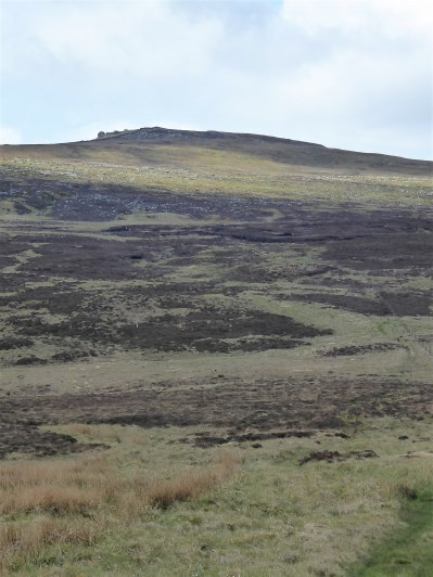
 On a whim, I decide to climb up onto Waddington Fell. But I first have to circumnavigate the extensive quarry, which is not in operation on weekends. Dropping down the road for some distance to a gate I know, which gives access onto the fell. It’s all supposed to be Open Access, but gates and walls get in my way. Nonetheless, I arrive at the trig point. Is it 395m or 396m, equalling Easington Fell, which I stood on less than an hour ago? I don’t care, as it is one of the best viewpoints in the area.

 360 degrees. Down Chipping Vale, The Bowland Fells and beyond, Yorkshire’s Three Peaks, Ribblesdale, and Pendle, obviously. My attempt at a whole-panorama shoot on my phone didn’t work out, so here are a few shots from my camera that don’t do it justice.

 The walk back is along the rim of the massive quarry.

Easington Fell in the background.

 A bonus as I make my way around are views down to the Hodder Valley with the village of Newton nestled in below Beatrix Fell.

 I’m still the only car parked up.

 A short but very satisfying afternoon. I’m relieved to be back in the car. On Waddinton Fell, I was exposed to a vicious wind, and the temperature dropped significantly—time to get the woolly hat and gloves out of the cupboard. And it is the end of British Summer Time for this year.

*

BACK TO BOWLAND.

Croasdale nostalgia.

A chance conversation with a stranger in the woods the other day reminded me that I have been neglecting my home ground, Bowland, in my posts of late—too much Southern stuff. We had a mini walk from Dunsop Bridge in the summer, but it is high time to get back up there. This morning at 7 am, my new watch tells me I have only had three hours of sleep despite being in bed for eight hours. So I turn over for a lie-in, only for the watch to suddenly tell me it’s “time to get moving”.  I had been mulling over in my mind last night on where to walk today, maybe that’s why I didn’t sleep.  

The weather plays a part in where I decide to go, and this morning, late, it has to be said, the mist has lifted with the promise of sunshine. I’ve not been up the Salter Fell track in Croasdale for a while, so why not have a leisurely afternoon exploring The Bull Stones up there? This was a regular haunt of mine when AB and I were developing the bouldering potential on these remote rocks. What a great time we had back at the start of the century. 

The journey there is almost as good as the walking. A lot of the time, following the Roman Road from Ribchester.  Coming down Marl Hill, Ingleboough is in the haze if you know where to look. Bowland is laid out to the north west. The famous Trough can be made out, but I’m heading for that other pass through to Lancaster, Salter Fell, on through Newton and Slaidburn, classic Bowland villages. Sadly, it appears that The Hark to Bounty pub has closed. There’s a lot of history attached to that inn.

I drive up the little lane leading out of Slaidburn, past many barn and farm conversions.  As you turn into Wood House Lane, the surface begins to deteriorate. Past the agricultural machinery graveyard, it becomes worse. The road to nowhere. 

I press on, knowing I can park up in a space at the top of the lane. But when I get there, the space has gone, a new gate has been installed, and any verge parking has been obliterated. Turning around is not easy, but I come back down the lane a little to where there is some hard standing. One wouldn’t want to get a wheel stuck in this remote spot.

It is 12 noon when I set off walking back up the lane.  Through the fell gate is a memorial to the aircrashes and loss of life in this area of Bowland.

At last, I am on the Salter Fell Road, which goes over to Hornby. The Romans came this way from Ribchester to Carlisle, suggesting there would have been an even older way through the hills. The Medieval Monks came this way with pack ponies, wool from their estates in Yorkshire and returned with salt from the coast, hence the name. The Lancashire Witches were brought over here to Lancaster to be tried and hanged. Alfred Wainwright thought it “the finest moorland walk in Britain”,  and I won’t disagree. And I must have walked or cycled it many dozens of times. 

I always get a thrill when you come around the corner and see the full length of Croasdale ahead, with the track winding its way to the watershed. A herd of tough  Belted Galloway cattle roam the hillside. Belties. They have a double coat that allows them to thrive in harsh climates. They are raised primarily for their high-quality, lean beef. Today, they mill around the track but are very docile, the type of cows I like.

There is an old quarry up there, and when it was in operation, attempts were made to upgrade the road. You can still see traces of tarmac here and there. But the way is rough now, which I can attest to from my past cycle rides along it. Only United Utilities and the shooting fraternity have the right to use motor vehicles on it. A few years ago, a section of the track just past the bridge was eroding, threatening to close the route. Drastic action was taken, no doubt costing tens of thousands, to stabilise the hillside. It seems to be working so far. Whilst they were at it, they improved the road surface going up the hill. There is a shooting hut up there after all.

A  Witches Way tercet is reached on the shoulder of the hill. Sir Hugh and I followed that route from Barrowford to Lancaster Castle back in 2016. It commemorates the 400th Anniversary of the 1612 trial and hanging of the Lancashire Witches. Ten, white, cast-iron installations on or near the path were embossed with tercets of the walk’s poem, written by Carol Ann Duffy. Appointed Poet Laureate in 2009, she was the first female and the first Scottish Poet Laureate in the role’s 400-year history.

Standing alone up here, a harsh reminder of brutal times, but giving Elizabeth Device a fine view back down Croasdale.

There is still some way to go; this is a wide, expansive Bowland. But where’s the sun?

I reach the gate across the track at the watershed and gaze at the horizon on the other side. Can you see the sea? I certainly can see Wolfhole Crag,  one of the more remote Bowland hills. I had an epic walk there in May 2023.

But today I am going no further on the Salter Fell Road.  I know a little track going at right angles up towards the Bullstones Circuit. It’s always boggy up this stretch until the first easy boulder is reached, where you can traverse across the fell on firmer ground until beneath the Taurus Boulders.

From up here, one looks at the ‘back’ of the Chipping Fells across acres of peat and heather.

I am always ready for a rest and a bite to eat on reaching here. Today was no different.

This is where AB and I first started our exploration. He couldn’t wait for the gamekeepers to pass by before he launched up the tower of Bully Off.  I did warn you there is some serious nostalgia ahead. 

Just forget my hankering for the rock and immerse yourself in the wild moorland scenery, even if the light is rather flat. One can always see further than the camera can reach on days like this.

I stroll along below the boulders, taking in the scent of decaying bracken as I look down the valley. I am the only person for miles.

As I come around the corner, the sun finally appears, lighting up the higher boulders.

I don’t bother climbing up there; I’m happy enough to scan the horizon with my binoculars. And I want to see if I can find that massive ancient stone trough. Can you imagine sitting up here, in all weathers, with your hammer and chisel, crafting this out of a gritstone boulder?

I take a sheep trod I know under Reeves Edge. Thankfully, the bracken has died back, so as long as I concentrate, I can’t go wrong, especially with sheep leading the way.

It’s a long way back across the hillside, but eventually a stalking track is reached, which takes me down to the little reservoir and the ford through Croasdale Brook.

I have struggled to cross this water in winter in the past, but today I just walk through rather than risk slippery stones. Yes, my feet are wet, but I’ll soon be back at the start.

Pendle is coming out of the mist as I follow the track back to the car.  But this post is not about Pendle. It is about the wild and beautiful Bowland. I haven’t seen a soul all day. Oh, and did I mention I watched a Hen Harrier gliding low over the fells?  Magic.

Thanks to that random conversation in the woods, I have again tagged Bowland to a post. At least I should have one reader.  Maybe they will comment. 

For any climbers interested in a detailed bouldering guide, feel free to download it  here.

A RAMBLE AROUND CLITHEROE.

P1060609
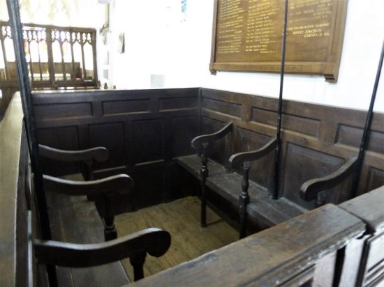
Another from a leaflet in the series of Walks with Taste in Ribble Valley, this time setting off from the centre of Clitheroe. I’m becoming lazy with route planning and relying on someone else’s choice, Ribble Valley BC this time. It promised “starting from Holmes Mill, wandering through the grounds of Clitheroe’s Norman Castle to the River Ribble for an easy riverside ramble” P1060718

I park in a side street in Clitheroe near Holmes Mill which has its own small pay and display carpark. The place is just opening up and I will sample its delights later in the morning.

My first objective is Clitheroe Castle and I navigate a series of steep and sinuous paths to reach its ramparts. Arriving at a terrace  there is an ornate stone turret, strangely from the Houses of Parliament, presented to the borough by its MP (Sir William Brass) in 1937, in commemoration of the coronation of King George VI. Also known as the Pinnacle, it dates back to the mid-1800s when there was rebuilding work at the Palace of Westminster after a fire. P1060604P1060594P1060600

On the next tier is the oft photographed  war memorial, a sculpture of a soldier standing in a mourning pose with head bowed.  The main inscription reads “Erected by the inhabitants of Clitheroe in grateful remembrance of their fellow townsmen who gave their lives in defence of their king and country in the Great War 1914 – 1918”. The sculptor was Louis Frederick Roslyn,  (incidentally you will see the same figure at a memorial in Slaidburn) P1060608

On its rocky limestone outcrop the remains of the castle keep rise above me , up yet more steps. Built in 1186 by Robert de Lacy, the Norman keep, reputed to be the second smallest in England, was in an important strategic location. After the death of Henry de Lacy in 1311, the castle passed to the Earldom of Lancaster, and then became the property of the Duchy of Lancaster. The castle was used during the Wars of the Roses, but was soon in a state of disrepair and it  was damaged further by Parliamentary forces during the English Civil War. The castle was privately owned until 1920 when it was sold to the local council to establish a memorial to the First World War.

The medieval buildings associated with the castle have all disappeared. In the eighteenth-century Castle House in the castle grounds is a museum which of course is not open a this time of day. P1060605

I climb to the top for views over the Ribble Valley, into Yorkshire, the cement works and the nearby Pendle Hill. All a little hazy. I do spot the  white Waddow Hall, at the base of the Grindleton hills, I’ll soon be walking close by it. But first I have to find my way down. 

P1060612P1060613

Leaving the grounds I notice one of the Tercets installed at intervals on The Lancashire Witches Walk enjoyed with Sir Hugh back in 2016. P1060626

I made a special effort to come and see Dandy, the Black Dog last week and here I am again walking past him near Booths Supermarket.  The Platform Gallery at the railway station is open so I have a look around at the art and crafts on display resisting any attempt to purchase. P1060631P1060634P1060635P1060636

Time for some proper rambling. I make my way through familiar streets down to Brungerley Bridge and my reunion with the River Ribble for the third time in thee outings. A gentle stroll downstream and I see the imposing C17th Waddow Hall on the opposite bank. It has been used by girl  guides for decades but now the Association in their wisdom has decided to sell it. P1060644P1060650P1060655

The river has been placid until now where it flows over a weir and cataracts down the valley. This is where water would have been taken off into a leat for the mill downstream. Out of the woods and past all the horsey fields and tidy allotments. Down here was once a mill village, Lowmoor. In 1928 when the mill closed, there were 200 houses (many back to back), nine shops, a National school, church and two Methodist chapels. The mill was demolished but many of the houses remained now being swallowed up by a modern estate on the site of the mill. P1060657

P1060662P1060663

I pop out onto the road between the Swimming Pool and gym and head back to the river at Edisford Bridge. I walked this section less than a week ago. The riverbank being popular with young families. Still no Kingfisher.P1060667P1060668

 Across the road, the one leading to the tip, and at last onto new ground –  a field path alongside Pendleton Brook.  A hazy Pendle Hill in the background. New housing is spreading out here and soon after the railway bridge I’m hemmed in.P1060671P1060675

P1060678

P1060687

Did an architect actually design this.

I recognise the buildings of Primrose Mill, an early cotton mill, which have been tastefully converted into office spaces. At Scott Bridge the culverted Mearley Brook heads through the complex before joining the for aforementioned Pendleton Brook. A fish ladder has been built along this stretch to give fish access to higher water beyond the dam of Primrose Lodge, Having spent thousands I wonder has anybody told the fish. P1060681P1060682

P1060684

Looking down onto the fish ladder.


Screenshot 2024-05-31 225043

Fish ladder in construction.     ribbletrust.org.uk

Rather than walk along the road I take to the Primrose Nature Reserve which follows the valley of Mearley Brook beyond the lodge. At the end I escape up a cobbled street towards the church.P1060683P1060692P1060696

It’s noon when I find my way into the Holmes Mill complex. A former C19th Textile Mill, it was the last working cotton mill in Clitheroe, steam-driven until 1973.  Historic England  tells you all about it.  In the last ten years redevelopment has resulted in a cornucopia of beer, food, ice cream, cinema, bowling alley and hotel. I head for the Beer Hall, said to have the longest bar in England, and home to Bowland Brewery. I choose their new season pale ale – Happy Hedgehog and find a quiet corner to enjoy. There are more waiters than customers. As well as the Bowland Beers the bar holds at least 40 other drafts. Next door is the engine room with a steam engine in situ. The bistro and foodhall  are packed with customers. P1060698P1060712

P1060700

Four and a half miles and I was home for lunch. More of a verbal ramble than actual walking.

*** 

Screenshot 2024-05-31 232919

ALL HALLOWS CHURCH, MITTON, AND A BLACK DOG.

P1060470

Following my morning’s walk to Clitheroe and back by the River Ribble I had time to look around the church in Mitton, which was fortunately open. It features in Simon Jenkins England’s Thousand Best Churches.

The church dates from the late C13th.

Inside, the chancel screen includes some medieval woodwork, which possibly came from Sawley Abbey,  after the dissolution of the monasteries.. There are ornate carvings on it.

P1060406P1060452

In the C16th a chapel was built on the north side of the church to house memorials of the staunchly Catholic Shireburn family from Stonyhurst. The alabaster tombs, dating from the 16th to the18th centuries. are said to be some of the finest in England. This is where it gets complicated, all of the men commemorated by the effigies in the chapel were named Richard Shireburn.

P1060413

Screenshot 2024-05-28 223318

The first Sir Richard died in 1594 shortly after the chapel was built. and is buried with his wife Maud, with voluminous petticoats. The detail on the carving is exquisite. It was created in the Royley family workshop in Burton-upon-Trent.P1060432P1060434

P1060427

Sir Richard’s son died in 1629 and he is remembered by a large plaque on the north wall, depicting Sir Richard junior and his wife Catherine, kneeling in prayer, plus smaller images of their children.  Two of the children are pictured in a bed, suggesting that they died in infancy.  P1060425P1060423

Three more altar tombs along the north wall are to the next succeeding generations: Richard (d.1668), Richard (d.1689) with his wife Isabel ( d.1693) and their son Richard (d. 1690). it was Isabel who commissioned the four marble effigies in the chapel before her own death in 1693.  These were I think sculptured by William Stanton of Holborn, London.

P1060421

Richard Shireburn, d.1668.

P1060418

Sir Richard d.1689 and wife Isabel.

P1060419

P1060416

Richard Shireburn d. 1690.

A monument on the west wall, is to Richard Francis Shireburn, (grandson of Richard and Isabel), who died in 1707, aged nine. The centre piece is thought to be his mourning mother. Screenshot 2024-05-28 222428P1060415

On the floor is a badly eroded figure of a knight in armour, the notice tells the story. P1060435P1060436.

What a unique chapel telling the story of the Shireburn family whose legacy lives on in Stonyhurst School. Here it is seen from outside with the date stone and Shireburn family coat of arms above the door.P1060481P1060476P1060478

Whilst I’m outside in the graveyard I search for two Grade II listed historical relics – a sundial and an ancient cross.

The sundial is a tall inscripted, sandstone shaft dated from 1683. P1060460

The medieval cross has a C14th round head on a more modern shaft. The head depicts scenes from the crucifixion. It possibly came from one of the monasteries after dissolution. P1060462

Not far away up the lane is the base of another medieval cross. Whalley is close by and there would have been trade with Sawley Abbey.

P1060483

*

And now for something completely different.  I drive a few miles into Clitheroe to seek out a new statue that Sharon of Sunshine and Celandines pointed out. A black dog prowling the streets, it’s just outside Booths supermarket.

We are at the heart of Pendle Witch country and several of my posts have reflected on their troubled history. Only recently I was exploring the The Pendle Sculpture Trail  and in the past followed the Lancashire Witches Walk.  A black dog was often associated with so called witches, and this one relates to James Device. He was one of the ten accused back in 1612 and was found guilty of witchcraft and hung at Lancaster. He had named his spiritual black dog Dandy.

An evocative statue made from stainless steel by Darwen based Marjan Wouda. It was certainly getting plenty of attention from the Saturday shoppers. A Devilish looking black dog.

P1060492

P1060489

P1060485

PENDLE SCULPTURES.

Screenshot 2024-04-19 095258

If you go down to the woods today, you’re sure of a big surprise.

I had heard of the Pendle Sculpture Trail for years but never searched it out. Launched in 2012 to commemorate the 400th anniversary of the trial of the Pendle witches. The Pendle area is steeped in witchcraft heritage and legends.  I have previously walked the 50 mile Lancashire Witches Walk from Barrowford to Lancaster Castle, where the witches had been tried, again commemorating the 400 years. Along that walk are a series of cast iron Tercets (like a Haiku) embossed with stanzas from the walk’s poem, written by the then Poet Laureate Carol Ann Duffy, each one relating to one of the ten witches hung.

The Pendle Sculpture Trail has a similar theme and starts in Barley taking you around nearby Aitken Wood. We come armed with a leaflet downloaded from the Visit Pendle website. It shows 26 installations, I think we find a dozen at most. sculpture_trail_print_friendly_2019_v2.pdf (letswalkinpendle.co.uk)

P1050413

An easy stroll out of Barley on a private United Utilities lane is pleasant in the morning sunshine but there is a cold wind blowing from somewhere. Is there a storm witch behind us?  Entering the woods is an outsized rubric cube type wooden puzzle. We marvel at its intricate construction but have no idea why it is here. P1050414

Be prepared for a steep start to the forest trail, perhaps we are out of puff and so don’t spot the first few sculptures. A roe deer disappears in the trees. P1050415

We can’t miss the Magic Chair (Ben Gates) right by the path. Intricate wood carvings connected by metal fastenings. distorted and moulded. Spooky limbs and eyes but lovely boots. It was a little cold on the bum to sit in for long. P1050419P1050418

I am disappointed we missed, or had it disappeared, the Quaker Tree in view of my recent postings on George Fox and the beginnings of Quakerism.

The Witchfinder (Martyn Bednarczuk) was obvious through the trees. Based on Roger Nowell the local magistrate who investigated and prosecuted the witches. Very stern. Why do people feel the need to insert coins into wooden statues, apart from being unsightly it hastens the demise of the wood.P1050420

Neither of us can work out the significance of the Ceramic Column, (Sarah McDade) and it isn’t particularly attractive despite the exquisite smoothness of the ceramics which is appreciated by Clare who dabbles in pottery. The good thing about outdoor sculptures is there are no signs saying ‘don’t touch’.P1050422

Are we getting our eyes in, for we soon spot the next two. Reconnected 1 and 2. (Phillipe Handford) are trees that have been felled and cleverly sprung back to their stumps. I like these, very organic. Unfortunately, as it is with wood, rot is setting in.  P1050424P1050423P1050425P1050426

Nearby and rather scary is the resin Wishing Widow,  (Joe Hesketh). The artist herself, a local lass, apparently was a loner in her childhood and felt herself a witch, casting spells on her classmates. This may explain her strange sculpture.

P1050429

We miss a few more until we come across the Rings of Time, (Phillipe Hartford) strung from the trees. Maybe a nod to Star Trek  or the rings aging a tree. We don’t see the significance of the dates on the discs, but here is a full explanation. All a bit too obtuse as we are stood below them.

1324 – Barley ‘Barlegh’ appears

1507 – Pendle Forest deforested by Henry V11

1612 – Local ‘witches’ taken to Lancaster Castle

1652 – George Fox

1661 – Richard Towneley’s barometric readings on Pendle Hill

1750 – First Inghamite church in Fence

1894 – Black Moss reservoir built

1912 – Clarion House built

1918 – War memorial in Barley

1935 – Aitken Wood planted

1938 – Whitehough established

1945 – end of WW2 and losses from Barley

1987 – The Pendleway created

2012 – Sculpture trail started

2018 – second phase of the trail

One of the blank discs is for when time began and an empty ring for infinity.

P1050430

The Black Dog, (Incredible Creations) can’t be missed. More like a fierce demonic wolf than a dog. Black dogs were associated with witchcraft back in those days. We give him a replacement horn for the one that had gone missing. P1050431P1050432

Look up and you will see Three Bats In Flight, (Steve Blaycock) another animal associated with witches, is this all getting too scary for children? I hope I don’t have nightmares.  P1050435P1050434

Somehow we miss other bats allegedly hanging in the trees. The Living Wall, (Phillipe Harford) is unanimously dismissed as rubbish. P1050441

I am looking at the all encompassing greenery on the trees in the shady forest and there all of a sudden is a Dryad, (Incredible Creations) emerging from her tree. She is covered with Ivy, has acorn earrings and a butterfly in her hair. Closer examination shows it isn’t a living tree at all but part of the sculpture, the bracket fungi have me fooled. There is even a ladybird lurking around the back. Dryads or Tree Nymphs only live as long as the tree they inhabit, which could be a long time.

  . P1050436

P1050438P1050440P1050440P1050437

Spiders, owls and a fairy are not found; we aren’t doing very well really. But there is a Unicorn, (Incredible Creations again) another mythical beast. Only the deep surrounding mud prevented Clare taking a ride of fancy.P1050444P1050445 As we leave the forest a stark metal silhouette of Chained Witches, (Peter Naylor) being marched from Pendle to Lancaster. I am impressed with the detail imparted by a few strips of metal, a reflection of the artist’s skill. P1050446P1050449P1050450P1050451

As the artist says and implies in his sculpture “These women were not actual witches but rather misunderstood individuals. Some of them were elderly, and some with various mental issues. Society and the authorities unjustly persecuted and executed them. The sculpture serves as a reminder of their plight and the importance of empathy and justice in our own time” The latter I fear sadly missing.

All along up here in these delightful woods Pendle Hill has been looking doen on us, as it seems to do in most of this part of Lancashire. P1050452

We walk back down to the Black Moss reservoirs and take a different path home through fields full of primroses and trees festooned with healthy lichen. P1050453P1050454P1050457P1050458

Across the way the rather stark Aitken Wood hides her secrets.P1050456

That witchy wind has become even colder so we are glad of a coffee in the friendly little café back at the carpark in Barley. Next up for more Pendle sculptures is Letcliffe Park in Barnoldswick.

If you do this walk, about three miles, be sure to highlight the sculptures we have missed.

***

Screenshot 2024-04-19 195723

CICERONE’S LANCASHIRE – REMOTE BOWLAND.

P1010516 (2)

I’m running out of titles for my series of walks in Bowland as set out by Mark Sutcliffe in his Walking In Lancashire book. He has certainly covered the area well. Highest, Best of, Heart of,  and today Remote or even the Remotest…  How many of you have been to Wolfhole Crag  or Whitendale Hanging Crags? This is a long post I’m afraid – it was a long day.

I enjoy the familiar drive into the hills with the roof down. Along the Hodder Valley; farmers busy silage cutting in the fields; over the Roman road with views to Ingleborough; down to picturesque Newton; along to stately Slaidburn and up Woodhouse Lane to my parking place just before the fell gate. I say my parking place as it was a regular spot when we were developing the bouldering potential of Croasdale’s Bullstones all those years ago. Not many drive up this far, but Mark mentions the single space, there is a little more back down the lane.

P1010468

Newton on the Hodder.

The hike up the rough Hornby Road, a Roman Road again, (aka Salter Fell Track) has been done dozens of times and I pass familiar landmarks. The war memorial to airmen lost on these fells; the ancient sheep folds and bothy down in Croasdale where I have stayed with my grandson; the culvert where one can still see the Roman workmanship; the large quarry where the peregrines nest; the bridge where the road has been saved from sliding into the valley; the Tercet stone demarking the Lancashire Witches fateful route to the assizes in Lancaster;  over to the right the bouldering playground of Bullstones and later the vague track dropping into upper wild Whitendale. P1010473

P1010484

P1010485

P1010492

P1010489

P1010494

P1010507

P1010527

Along here somewhere I meet two RSPB workers checking on nesting Hen Harriers. It is good the birds have returned and let’s hope more survive the persecution by the shooting fraternity this year. No photos and as they say on the news “their anonymity and location have been protected”  The road goes on over the watershed.P1010503

After four miles I leave the road for another four miles of mostly trackless and waterlogged ground. Mark says “the next stretch is very boggy and needs careful negotiation” Go no farther if you are unsure or if the weather is bad. This is remote country with no easy escape routes. My walking poles disappear into the mire quickly followed by my boots. Jack be nimble. It is not so bad – I survived. There is beauty there if you look closely.P1010534P1010536P1010541P1010540

P1010539P1010535
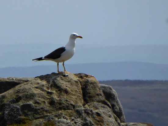
If I close my eyes I could be at the seaside, the sound of gulls is everywhere. I think they are Black Backed, Great or Lesser?, a large colony exists up here. I try for a video, more for the sounds than the fleeting fly overs. They are becoming more aggressive, dive-bombing me. I look down and there below my feet is a scrape of a nest with three eggs. Better move on taking extra care where I place my feet. 

P1010599

P1010555P1010590

It doesn’t take much to persuade me to take the ‘optional’ diversion to Wolfhole Crag half a mile away. One wouldn’t come this far in good weather and not go to the highest point. There is a trig point, 527 m, and also an interesting collection of gritstone boulders. I can’t resist a few simple boulder problems, keep them simple as you don’t want to break an ankle up here. The longer routes look fearsome. Somewhere there is a shallow cave in the rocks – the original wolf hole. P1010552P1010559

P1010567P1010569P1010577

A good place to eat my sandwich, wish that had been two as the day panned out. All around – The Lakes, Yorkshire Three Peaks and most of East Lancashire. Pendle is always visible. All a little hazy in today’s heat. P1010578

Walking back down the fence line, no navigation needed, is not easy because of more bogs. Maybe it is better on the other side, No it isn’t I tried. White Crag is nothing but a few boulders. Whitendale Hanging Stones are not much bigger. But according to the gravitational method to establish Britain’s centre of gravity  OS calculated that the geographical centre of the British Isles, including Islands, lies at SD 6419 5654 virtually where I’m stood. I’m too weary to take it in. In fact as I drop down very steeply I’m just too pleased to see the small tarn on the col between Brennand and Whitendale. The walls and fences aren’t too easy to negotiate. I lose even more height as I descend to the Duchy farm at Whitendale where my route ahead climbs back up zigzags for 800ft onto Dunsop Fell. P1010614P1010609

P1010611

White Stones.


P1010619

Whitendale Hanging Stones, centre of Britain.


P1010632 (2)

My way down.

P1010643P1010646

Small mammal traps remind me I’m on shooting lands, the hunting class have some barbaric practices. P1010637P1010636

I collapse onto a wall at the farm, nobody is about, I’m even wondering if I should phone my son for a cop-out evacuation, but a drink and a banana fortify me for the final stage. Thankfully once back on a stony trail my steps become stronger, and I push on up.  The trail disappears into peat, but there are some posts and cairns to guide me to Dunsop Head, a vague col with a wall, gate and another of those crafted signs. Looking at the map and the terrain I realise I’ve never been on Baston Fell to the north, today is not the time to visit. Let’s just get down.  

P1010642 (2)

My way back up.

P1010648

P1010649

Looking back down to Whitendale with Hanging Stones above somewhere.

P1010654P1010655

P1010659

Go east across more bog. By the time Stocks Reservoir comes into view you are almost home and dry, although your feet are probably wet by now. Eventually the bridleway becomes more visible as a sunken way and the airmen’s memorial appears. There is my car down the lane with Pendle still watching over us. Seven hours of remote walking, one to talk about in the pub later.  

P1010664

P1010667

P1010668

***

CaptureWolfhole. (2)

CICERONE’S LANCASHIRE – Gentle Pendleside.

DSC02123I

It’s been a while since I walked alongside Mark Sutcliffe, he of Cicerone’s Walking in Lancashire guide. Apart from a short road walk around Longridge Fell with JD the other day I’ve languished in the house. Time to get going again and test my knee out. I scan the chapters looking for something undemanding. I toss up between Blacko hills, (Chapter 27) and the Clarion House walk on Pendle. The former looks the easiest, even if the latter looks the more interesting. The fact that it was Halloween Eve never crossed my mind as I delved into Pendleside. On reflection the immediate Pendle area would have been chock-a-block. (I like that word)  Lucky choice.

My mood in the morning was as gloomy as the weather, but I had enjoyed that extra hour in bed. The weather improved alongside my mood, I was just glad I was in the car post walk when the afternoon deluge hit the area. The M65 virtually came to a halt as the skies blackened and gallons of water came down from somewhere. I’m now safely home.

Let’s park up at Higherford, there is a bridge here now over Pendle Water. I struggle with the car park machine, ‘it’ knows I’m here and will charge me later on my return – that preys on my mind for much of the walk.

Across the way is Pendle Heritage Centre. I think I was too early for its attractions – tearoom. gardens and museum. Maybe later but then it is too late. Park Hill House below has associations with the Bannister family later to run the sub 4 minute mile. I do spot the first Tercet on The Lancashire Witches Walk .DSC02105DSC02104

Alongside the water I get into my stride. Autumn is everywhere. There are reminders of previous mill operations, but I am soon out into the countryside.DSC02114DSC02119DSC02120

DSC02118

DSC02122

I’m heading towards Blacko Tower.

 A plaque reads Built by J Stansfield1890 Restored 1950. Approximately 30ft high. Built as a folly. Circular. Coursed rubble. Widely spaced battlements. Two steps up to a plain doorway. Spiral stone staircase inside leading to observation platform. Prominent hilltop landmark. 

Such a shame there is no public access, it must be a fine viewpoint. Time for the citizens of Blacko to stage a protest march. I make a mental note to return mid-week and make a clandestine ascent.DSC02127

Today I’m content to follow vague contouring paths on the rough hillside past farms to Malkin Tower Farm. Maybe the site of a ‘witches coven’ in 1612 from where the women were marched off to Lancaster to be tried and executed. There is lots of speculation as to the true version of events. All is quiet today with the farmer’s wife subtly showing me the diverted way. A few arrows would have helped, but all is mysterious around here. DSC02129 At the next farm I weave through a complicated series of gates in their garden. Enquiring of a lady, to confirm my way, that few people walk through here – she says “most get lost”. I doubt the irony strikes her. Again a few yellow arrows wouldn’t go amiss. At last, I’m free and walk down a lane to another farm, Whitemoor Bottom. The guide says take the footpath on the right, but there is no obvious way –  I strike boldly through the farmyard and onwards down the fields. This is horsey country and barriers keep appearing, is it this side of the wires or the other? Determination sees me through, and I drop into a wooded gully with little sign of others coming this way. But I’m on course and eventually come out onto a lane at Holly Bush Farm. Sand Hall, which looks as though it should be listed, is passed, and the lane takes me to Foulridge Reservoir.DSC02132DSC02135

DSC02136

Time for lunch, so I climb up to the dam for a bird’s eye view of the reservoir. It’s depleted of water and the only action from the sailing club is a model yacht race.DSC02137DSC02144

A bridle way takes me to join the canal as it emerges from the mile long Foulridge Tunnel, completed in 1796! A way mark confirms it is the Leeds – Liverpool Canal. Maybe I should walk its historic length one day.DSC02146DSC02149DSC02150

DSC02154

Halfway down the locks a path takes me through a pasture and into an upmarket estate. As I progress down the main road the older stone houses typical of these mill villages appear, Weavers cottages now desirable properties. On the corner by the packhorse bridge is the old toll-house (early C19th) with a board listing prices – almost as complicated as the pay machine in the car park.DSC02115DSC02106 (2)DSC02107

A good start to my winter walking, shorter than the guide book suggests, and not a ghost or witch in sight.

DSC02121

*****

Foulridge

A WHALLEY WALKABOUT.

Saturday, 26th June.    6 miles.     Whalley.

We hadn’t intended to explore Whalley, as the walk that Mike had found written up in a booklet only skirted the village, but on a whim, we parked near the Abbey. I have visited Whalley many times, most recently on my Lancashire Monastic Walk  The C13th Parish Church has always been closed when I’ve passed by but this morning we were in luck, and I was able to view the elaborately carved stalls in the chancel. They date from about 1430, and came out of Whalley Abbey after the dissolution. The misericord carvings under the seats represented all manner of everyday subjects. There were several cage pews usually belonging to one family for prayer but also near the door a churchwarden’s pew seating eight. The stained-glass windows were resplendent in the bright sunshine.

   Back outside we couldn’t resist the jam and chutney sale for church funds, I came away with some lovely marmalade which we took back to the car. An hour had passed and we hadn’t even reached the start of the walk. We decided against visiting the Abbey.

   Cutting down the side of the abbey brought us into a mews development based on an old corn mill, we were to pass the weir and mill race on the River Calder shortly. This whole area was inundated in the Boxing Day floods of 2015…

Down a pleasant street of cottages, all with immaculate gardens, and we were en route. There was very little water in the river today, it’s hard to believe its destructive power. Crossing a road, we entered a field which has been taken over by mountain bike tracks and jumps, they look great fun for the youngsters.

  It took patience to cross the busy A671 road to reach a path up the golf course. Above the course, steep fields continued with good views back to Whalley Nab and Kemple End. No sooner were we up than the guide had us perversely coming back down again. We were not very impressed with the guide’s vague instructions. Young bullocks blocked our way, hens free ranged and horses followed us. More fields (“aim for a bush”) and then we were in the manicured grounds of Read Hall. Mike recollected a bumpy landing in a hot air balloon here, but he obviously survived.

Puzzled by the guide.


Whalley and its Nab.


Kemple End and distant Bowland.

Still puzzled.


Read Hall Gatehouse.

   An old lane took us down to pass a busy little garden centre, we smelt coffee and were drawn in but queues and Covid regulations suggested a long wait, so we escaped without spending any money.

   The path onwards followed the banks of the Calder until we climbed out of the valley to pick up an ancient packhorse track heading towards the Abbey.


This went around rather than over Whalley Nab and to be honest we didn’t get the best of views down to Whalley. A lovely day for a walk through beautiful English countryside, but as I said the guide was poor, we could have and should have devised a far better round ourselves.

*****

COVID FREE CROASDALE – PURE NOSTALGIA.

“I may not have gone where I intended to go, but I think I’ve ended up where I needed to be”  Douglas Adams.

After a late breakfast Sunday, I set off to Slaidburn for a gentle walk around Stocks Reservoir. I was enjoying the drive over with the roof down listening to the West Indians scoring too freely in the Test match. As I came over the rise on the road up from Cow Ark there in front of me were the Three Peaks of Yorkshire, a view I always thrill to. Out of the corner of my eye were the Bowland Fells, vying for attention. I was aware of the half-hidden valley of Croasdale and realised I hadn’t visited it for a year or so. A quick change of objective and I found myself parked up in that little pull off at the very top of Woodhouse Lane. I pondered on how many times I’ve parked there over the years especially in the early years of this century when we were developing the bouldering potential of the Bull Stones higher up the valley. We would race up the track to climb all-day and then most nights come down in the dark, we knew every twist of the route.

Of course, we were not the first to come this way. The Romans forged a road over the fells, probably adopting ancient ways, linking Ribchester with Carlisle. Some of the culverts on this The Hornby Road date back to the Romans. Later there was trade between the Monasteries of Yorkshire and the coast, wool one way and salt the other, hence the other name for this route, Salter Fell Track. A metal marker on the track commemorates the 400th year anniversary of the Lancashire Witches being dragged this way to their trial and execution in Lancaster.

It was a Lancashire Witches Walk waymark on the fell gate that reminded me of probably my last visit here whilst undertaking that excellent way. At the time a group of workmen were repairing a section of road just past the bridge. A gully was undermining the road and an expensive shoring up exercise was underway. That has been completed and the repairs extended up what was a very rough section of road by resurfacing with limestone chippings which look out of place in this gritstone environment. No doubt this has all been done using taxpayers funds and yet the only people to benefit from it are the shooting fraternity who have a lodge further up the track.

Few people walk up this valley and today the only people I see are motorcyclists who are able to travel right through from Slaidburn to Hornby a classic moorland journey. The man himself, A Wainwright described it as the best moorland walk in England although I’m not sure what he would have had to say regarding the motorcycles.

My more modest aim today is just to reach the gate near the summit and then traverse back along the hillside visiting the Bull Stones. I’ve brought my binoculars along as this area used to be a good place to see Hen Harriers, but alas no more due to persecution from ‘hands unknown’.  Many of you will know the story of Bowland Beth. So I don’t see harriers but I do spot a pair of kestrels, some stonechats and more excitedly two ring ouzels.

I sit under a favourite boulder and eat some lunch whilst gazing down the valley with Pendle in the far distance, there is not a soul in sight. The only sounds are the occasional bleating of sheep and the cries of seagulls which come inland here.

I continue along the edge of the rocks, past the spring of sparkling water where I know I can refresh myself even in the middle of summer. Around the corner, the continuation of the rocks is at a higher level and I make my way slowly up to them. I’m aiming for one particular group where there is a 50-degree slabby rock which we called ‘super slab’ on our first visit, I’m inclined to overdramatize but it is super. Perfect clean steep rock, rippled slightly with the odd pebble for a finger hold. 

Somebody produced a video featuring this slab so you can see what I’m going on about –

After lovingly fingering the start of the climb, I don’t have my rock shoes with me, I make my way to the end of the rocks, the Calf Stones.

Down below is that massive stone trough carved from an in-situ boulder. Time for another sit and contemplative look down the valley towards Pendle. I have time to examine the minutiae of the lichen growing into the gritstone.   I then head down to pick up a hidden sheep trod in the bracken that I know will take me across the rough hillside to join an estate track down to the ford. It had been at the back of my mind all afternoon as to whether I would be able to safely cross the stream here. One winter it was impossible and we had to make quite a detour to find a way across. Today, despite the recent rainfall and the stream flowing quickly, I seemed to just hop across.

Just follow the path.

Back on the main track, I had time to reminisce on times staying in the barn visible down below. It has been overhauled by United Utilities partly to preserve the unique sheepfolds that surround it.  Once with my eldest grandson, we had two nights there and were treated to hen harrier flypasts both evenings as we sat by a campfire eating baked beans and sausages, magic.

From up here, I could see in the distance a small section of Stocks reservoir where I could well have been. Another time.

*****

WAINWRIGHT’S WAY. 4. DUNSOP BRIDGE TO HORNBY.

The heart of Bowland.

I knew this would be a long arduous day so I did it out of sequence in the good weather mid-September. I used devious tactics to complete the walk but I’m happy to write it up as it should be.

Head of Whitendale. A Wainwright. 1981.

Following a coffee at Puddleducks Cafe,  I set off along the lane out of Dunsop Bridge heading into the fells. A gentle stroll, alongside the Dunsop River, leads to the prominent Middle Knoll where the water board roads divide, one going left into the Brennand Valley the other going right into Whitendale. Wainwright’s Way follows the latter but I know a better way.  Cross the river and follow a path up the right bank before climbing into Costy Cough and picking up a level path all the way to Whitendale Farm.

Middle Knoll.

Costy Clough.

Whitendale Farm.

There is lots of interest along this path but today the highlight was seeing a Hen Harrier rising from the valley and fluttering up the fell. This is a rare sight these days as their population over grouse moors has been drastically reduced by foul means. Bowland should have a decent population of Hen Harriers, a book well worth seeking out is Bowland Beth by David Cobham which highlights major issues in UK conservation.

At Whitendale Farm, part of the Duchy of Lancaster, paths go in several directions. WW goes up the valley following the Whitendale River. The dogs in the kennels give you a good send-off. This is shooting country and bred pheasants are everywhere. The grouse shooting this year has been restricted due to the Heather Beetle devastating large areas. It is usually a squelchy route up the valley and today is no different. A few random boardwalks don’t really help but the waymark posts keep one in the right direction. I plod upwards in the heat with the occasional submerged leg.

Side valleys often have Ring Ousels and Dippers but none today.  A post on the Hornby Road beckons and I’m soon sat on a convenient rock for a snack, I could probably sit here for hours before another person appeared.  This old road over Salter Fell has been described as one of the best moorland walks in England. The Romans came this way en route from Manchester to Carlisle and then the packhorses, bringing salt to Lancashire and wool to the coast. The Lancashire Witches were dragged across to Lancaster Court for sentencing and hanging. I’m surprised that WW comes up Whitendale, a difficult route rather than the easier way from Slaidburn, AW was familiar with both. His Bowland Sketchbook from 1981 illustrates the area well and he had a certain respect for relatively unknown Bowland, not much has changed from his time.

I set off along the good track, below on the left is the head of Whitendale and way above the rocks of Wolfhole Crag. All is wild and remote. the track follows the slopes of Salter Fell for a good way before views open up to the west. The infant Roeburn River gradually gains volume running west, To the north Ingleborough and its neighbours stand out, a little hazily in the afternoon sun. The silence is only disturbed by a couple of motorcyclists making the through trip.

Upper Roeburndale.

A lone cyclist comes the other way. The track goes on and on and slowly loses height towards Higher Salter Farm. There are hazy views of the Lakes, Howgills and the Barbon Fells. The last time I was up here was on The Lancashire Witches Walk which at Higher Salter veers off to Littledale and Caton Moor.


Higher Salter Farm.

Higher Salter Farm.  A Wainwright. 1981.

Today I carry on past Middle Salter to Lower Salter where there is a small Methodist chapel. Built in 1901 it will have been a meeting place for the far-flung farms in Roeburndale. It was open so I rested a while in its plain interior.                                                                                                                                                                               Looking back up the Salter Fell Road Mallowdale Pike is prominent, described by AW as “one of the few fells in Bowland with a graceful outline”  It is an outlier of the Clougha Pike/ Ward’s  Stone range. The road drops further to cross the Roeburn, a river of hidden delights. WW follows the road for almost a mile with the bonus of good views to the Northeast but I notice concessionary paths possibly by the river, I haven’t time to explore today but make a mental note to return.

Reaching Back Farm the way goes steeply down into the heavily wooded valley on a path that gets little use. There are signs of occupation: yurts, sheds, coppicing, vegetable plots, orchards between the trees. Looks like an organic environmental settlement but there is nobody about. http://www.middlewoodtrust.co.uk/

A narrow wooden bridge crosses the river into more orchards. There is still no sign of anybody about. I suspect that one of those concessionary paths would bring you here without the road walking. Anyhow, I gain a cart track leading up through the woods and fields to arrive at a small road heading back down to a converted mill. Wray Mill started as a woolen mill but adapted to produce silk, cotton a nd bobbins, it closed in the 1930’s.  Kitten Bridge, nice name, crosses the Roeburn and a little track leads straight into Wray.

This bridge was washed away in the August 1967 floods along with cottages at the lower part of Wray. I’m not sure that I’ve ever been in Wray before, it’s off the beaten track. Anyway, the Main Street off the main road is a pleasant collection of cottages with a homely feel to it. There aren’t many buses so I have to continue a further mile through fields to Hornby. Ingleborough is over my right shoulder all the way and ahead is Hornby Castle, its C13 base obliterated by a C19 Gothic building. I join the River Wenning for the last stretch into the village.

A Wainwright 1980.


Shares
26

CROASDALE/BULLSTONES WALK.

                                               Looking down a murky Croasdale.

One seldom meets another person in upper Croasdale, but today the Salter Fell track was busy with contractors making repairs to a steep section of the road above New Bridge. The road, also known as Hornby Road, dates from Roman times as Watling Street, which ran from Manchester to Carlisle.  It was along this road that the Lancashire Witches were taken from Clitheroe to Lancaster, and in fact, the last time I walked it was following a long distance walk called the Lancashire Witches Walk from Barrowford to Lancaster. Back to today, I was with JD, both of us needing some exercise. A lorry was taking stone up to the repairs, and the driver told us of the cost to Lancs. County Council, who apparently are obliged to maintain the highway, for whose benefit I’m not sure. An awful lot of potholes around Longridge could have been repaired for less. The repairs were extensive and thorough but not lot of work seemed to getting done today. More stone was being extracted from the higher quarry which in the past had been used for the construction of Stocks Reservoir dam in the thirties.

Track repairs with one of the Lancashire Witches Walk tercet waymarkers.

It took longer than usual to reach the top gate where we left the track and headed uphill through the heather. Looking westwards are views of upper Whitendale and remote Wolfhole Crag, this is wild Bowland country. I found the tiny sheep trod that traversed to the first group of Bull Stone boulders where we had our refreshments. The day was rather dull but there was no wind and silence prevails up here. Looking down the wide valley of Croasdale a misty Pendle rose in the distance. I had resisted bringing up my rock shoes but now regretted it as the conditions were perfect. Big boots would not have stuck to the friction slabs.

Sketch of the same scene from the Bowland Beth book mentioned below.

For a taste of the bouldering up here, have a look at  https://vimeo.com/183222521

We wandered on below more rocks, all bringing back memories to me, though JD had never been here. So it was a great pleasure to show him the massive stone trough carved on the hillside.

We found the little trod heading down valley, and at the ford we decided to continue down rough marshland to look at the bothy and surrounding sheep-pens. About ten years ago, I spent a couple of nights here with my teenage grandson whilst we explored the surrounding fells. In those days, Hen Harriers were a common sight on these Bowland fells, which were an important breeding ground for these beautiful birds. Things have gone downhill since then, with more and more persecution of raptors on grouse moors where the shooting lobbies run roughshod. I have just been reading a little book about the short life of Bowland Beth, born near this spot. A thoughtful analysis of the plight of wildlife on shooting estates.

Bowland Beth. The life of an English Hen Harrier.   David Cobham.     William Collins.

The bothy was unlocked, but animals had soiled the flagged floor. It did not look an attractive proposition for an overnight stay now, but would soon clean up.

Onwards down the valley with a few stream crossings and then we climbed back up the road passing on the way the remains of the House of Croasdale, a 17th century farmhouse built on the site of an ancient hunting lodge. It would have witnessed the witches being taken across the fells.

Remains of House of Croasdale.

An interesting circuit as usual, although a little sunshine would have helped with the photos.

*****

THE WAY OF THE CROW. Fifth day, Postern Gate to The Lune.

                    The classic English countryside of Qurnmore Hall Park.

Quernmore Park estate forms the most formidable obstacle to our straight line route and over the last week in anticipation Sir Hugh and I have been plotting a military style assault. Using aerial photos and maps we have tried to find a way through, unobserved, without too many unclimbable fences, we have more plan A, B, C and D’s than the present Brexit debacle. There’s not a public footpath in sight. However our chief negotiator is highly skilled and has behind the scenes obtained permission from the owners to walk through on the forbidden lane. Here we are at the Postern Gate on a bright afternoon ready to stride past all the private signs to join the privileged classes.

The hall itself was well hidden behind walls and security gates.

To be honest we enjoyed our passage through the grounds even being greeted by the owner half way through.

At the end we emerged at the North Lodge onto a busy road, which would not have been pleasant or safe to walk along, a quick climb over a gate had us into a steep field leading down towards the River Lune. Fortunately another fence assault brought us onto the Lune Valley Ramble route and a clear walk along the old Lancaster to Wennington railway, closed under the Beeching axe in the 1960s and now a landscaped cycle path as far as Bull Beck, Caton. A complete contrast to the previous parkland.

On the opposite bank were new houses built since my last visit. They looked like affordable housing and were impressively roofed in solar panels.

The old station at Halton was busy, not with passengers but with students gathering for an afternoon’s rowing on the river. They have use of the listed building as a boat house which according to their coach costs a fortune.

A satisfying short walk through forbidden ground, all should be easy from now on.

*****

THE LANCASHIRE WITCHES WALK – Caton Moor to Lancaster Castle.

Our final stage of this fascinating walk began high on the Caton Moors. The well known, when  viewed from the motorway, wind turbines were rotating rapidly in the strong wind as we passed. Up here today we had extensive views of the Bowland Fells, Ingleborough and Pennine fells north, the Lune Valley and Morecambe Bay, an exhilarating start to the day. In a picnic area we found our first tercet of the day, No 6. A lane coming from nowhere brought us down into Brookhouse and we explored the back lanes and pretty houses of the village, roses seem to be a specialty of the gardens here.

Across the main road we joined the Lune Valley Ramble into Lancaster along an old railway. All of a sudden humanity appeared – dog walkers, joggers and cyclists supporting the idea of good exercise and being able to participate in a safe and beautiful environment. Well done Lancaster with the help of European money!  Two men were setting off  cycling coast to coast  to Bridlington, a route my son speaks highly of. They were an odd couple one young and fit on a classy bike, the other hoping to rely on his electric motor to get across the Pennines. I hope their enthusiasm saw them through although I suspect they will have been very wet at the weekend. We crossed the famous Crook Of Lune [painted by Turner] on an impressive bridge. More cyclists were passing the next tercet. For a break we sat on the banks of the river below a weir near Halton old station. A fisherman engaged us in conversation about all things Lancashire, No fish were caught. it was about at this time that the zip on Sir Hugh’s shorts malfunctioned causing great hilarity to the fisherman and great embarrassment to the wearer. Apologies to anyone in Lancaster whom we shocked or offended.

A pleasant stretch on a lane parallel to the motorway followed, large puddles where evidence of recent rainfall. We were heading for the castle but first we visited the prominent hill forming part of Williamson Park thought to be the site of the witches’ gallows, and now the site of the 9th tercet.  We wandered through attractive parkland and climbed up the baroque Ashton Memorial for views over Lancaster and the surrounding areas. Then it was down busy streets across town passing the Golden Lion pub where the witches were supposed to have been offered a final drink on the way to be hung – an unlikely tale. Incongruously two walkers in shorts, with walking poles, marched through the shopping area and eventually climbed up to the impressive castle gates and the last tercet. A lot of restoration work is going on so we didn’t linger.

Thus we had completed a trail full of interest which deserves to be better known.

The complete poem

‘The Lancashire Witches’ by Carol Ann Duffy

One voice for ten dragged this way once
by superstition, ignorance.
Thou shalt not suffer a witch to live.

Witch: female, cunning, manless, old,
daughter of such, of evil faith;
in the murk of Pendle Hill, a crone.

Here, heavy storm-clouds, ill-will brewed,
over fields, fells, farms, blighted woods.
On the wind’s breath, curse of crow and rook.

From poverty, no poetry
but weird spells, half-prayer, half-threat;
sharp pins in the little dolls of death.

At daylight’s gate, the things we fear                                                                                               darken and form. That tree, that rock,
a slattern’s shape with the devil’s dog.

Something upholds us in its palm-
landscape, history, place and time-
and, above, the same old witness moon

below which Demdike, Chattox, shrieked,
like hags, unloved, an underclass,
badly fed, unwell. Their eyes were red.

But that was then- when difference
made ghouls of neighbours; child beggars                                                                                              feral, filthy, threatened in their cowls.

Grim skies, the grey remorse of rain;
sunset’s crimson shame; four seasons,
centuries, turning, in Lancashire,

away from Castle, Jury, Judge,
huge crowd, rough rope, short drop, no grave
only future tourists who might grieve.

Sir Hugh’s own blog tells a similar tale of our progress –  http://conradwalks.blogspot.co.uk/

THE LANCASHIRE WITCHES WALK – Clitheroe to Slaidburn.

The scenery changes today as we leave the Ribble Valley and climb into the Bowland Hills. Rain is forecast and its rather dull in Clitheroe. Canoeists float downstream as we cross the river at Brungerley Bridge  and a group of youngsters are on the field path learning navigation.  We soon leave them behind and cross fields around Waddington, most of the farms/barns look hundreds of years old but many have had expensive makeovers.  Looking back Pendle Hill is in cloud. The hay meadows we pass through are full of flowers and brighten up a dull day. I have a painting at home representing the same scene. As we climb onto the moor on a drove road we realise we have been here together before whilst exploring Easington Fell last winter.There are no views today in the low cloud which is a shame as this is a wild and desolate moor. On the map are marked The Wife and Old Ned but they turn out to be disappointing piles of stones. A good track, presumably shooting, takes us down the fell to a shooting lodge marked as Fell Side. Dogs are caged up and greet us excitedly. At the moment we arrive the rain starts so we are lucky to find shelter and tables outside the lodge, lunch is taken. On the approach I had stuck my walking pole under a stone and a metal trap snapped shut almost breaking it, I couldn’t imagine what it could do to fingers. What are they trying to catch? Our lunchtime was enlivened by a ‘turkey’ parading about in front of the windows. The rain stopped and we continued on our way over a hill and down into Slaidburn, usually seen with a backdrop of Bowland Fells, but not today. Our tercet was in the carpark. The village was busy hosting a small steam fair which kept us entertained for awhile though the crowds and vehicles detractied from the normal tranquility of this lovely village. Familiar paths through woods and then open fields gained height, Curlews and Lapwings became a constant sight and sound. On past a graveyard for farming implements which looked like a ‘herd’ of dinosaurs across the land. We finished the day under the Bowland Fells just before the start of Roman Road over Salter Fell. We will want better visibility for that next section.


.


THE LANCASHIRE WITCHES WALK – Higham to Clitheroe.

An interesting day’s walk.

Delightful walking through farmland started the day from Higham. We passed several old farmhouses with mullioned windows and in the distance saw an unusual Gothic feeding shed [on the Huntroyde estate]

DSC01983

The next estate we entered was Read Hall, the walk goes through converted stables and into the parkland next to the rebuilt hall. Its owner in 1612 was Roger Nowell the magistrate who sent the witches to trial at Lancaster. Under Pendle Hill we followed bridleways which may well have been the actual route taken by the carts used to transport the captured witches. We diverted to Spring Wood to view our third tercet.

 Read Hall parkland.

Read Hall parkland.


On arriving at Wiswell we found a hidden pub, Freemasons Arms, and enjoyed a relaxing drink in its cosy bar. The village was a delight to explore with its alleys, stone cottages and neat gardens.

As we wandered through fields towards Clitheroe the sky was blackening over Pendle Hill and before long we were in a brief thunder storm.

Darkening skies.

Darkening skies.


Clitheroe is dominated by its castle and we spent time exploring. In the castle grounds was an ornamental turret, 1850, removed from the parapet of The Houses of Parliament and presented to the Borough of Clitheroe in 1937. Strange. We collected our 4th tercet and finished the day in sunshine at the parish church.


THE LANCASHIRE WITCHES WALK – Barrowford to Higham.

It was a hot morning when Sir Hugh and I parked up next to the Heritage Centre in Barrowford, the start of The Lancashire Witches Walk. Having  found the first tercet installment with its verse and witches’ name we set off through the alleys and cobbled back streets and were pleasantly surprised by the hidden beauty of the town. There were many reminders of its industrial past and we contemplated the human movement to and from the mills on the footpaths we were following today. Soon we were out into rural Lancashire at its best, undulating tracks between small stone built hamlets, over fields and alongside sparkling streams. On arriving in Barley we suddenly collided with mass tourism alongside Pendle Water – more Blackpool than countryside. Somehow we missed the cafe.  Then we were climbing away and passing the presumed site of  Malkin Tower, home of the Demdike family, a ruined hillside farm. .The next hour passed pleasantly but aimlessly circling round Lower Ogden Reservoir passing another tercet.  We ate lunch in the shade high above Newchurch in Pendle. Once in the village the Witches Galore gift shop had to be visited stocking everything from tacky witches to learned books, The lady owner had been there for 30 years and was a wealth of knowledge.  Sir Hugh emerged with a witch to scare his granddaughter and I another black cat, Impulsive shoppers. On a more cultural note we visited the church with its ‘eye of God’ to ward off evil spirits.  I was keen to visit the nearby Faughs Quarry where I’d climbed in the past and where there is a carved face in the rock, ?created by one of the quarry-men. Up to the ridge, Rigg of England, with good views, and then down to the village of Fence where the pub is closed and new housing is taking over.

Old house in Fence.

Old house in Fence.

Along the main road Ashlar House was passed, here some of the witches were questioned by local magistrates in 1612. The route onwards through  Lower White Lee farm was not helpfully waymarked and we had the impression they didn’t want walkers on their land. We finished in Higham with its prominent pub, Four Alls Inn, where one of the  witches, “Chattox” was accused of turning the beer sour  and bewitching the landlord’s son!

A good start to our walk with varied scenery and interesting history.


THE LANCASHIRE WITCHES WALK – pre ramble.

The Pendle district of Lancashire is infamous for its history of witches. Back in the 15-16th centuries witches made a living from herbal remedies, bone-setting and midwifery [humans and animals] and dabbled in curses and spells.  Usually single women they lived on the edges of society. Things came to a head in April 1612 when Alizon Device, a Demdike,  had an argument with a pedlar and he suffered what was probably a stoke. The landed gentry, who were also the magistrates, were keen to support the monarchy, James 1st who was opposed to ‘witchcraft’ and hoping to put themselves in a good light saw an opportunity to prosecute Alizon. Things then became complicated as other families, such as Chattox, were embroiled in the plots. Eventually twenty local ‘witches’  were arrested and brought before the magistrates and taken to Lancaster Castle for trial. Ten were hung in August of that year. Over the years a great deal of folklore has developed from this story. The walk, to coincide with the 400th anniversary of the events, was designed to follow roughly the route from Pendle to Lancaster and include some notable locations. Alongside this again to celebrate the 400 years  the poet laureate, Carol Ann Duffy, has written a poem in ten tercets to comment on the proceedings. To reflect the poem 10 cast iron installations  have been placed along the route each with a tercet from the poem and the name of a witch.


‘The Lancashire Witches’ by Carol Ann Duffy

One voice for ten dragged this way once
by superstition, ignorance.
Thou shalt not suffer a witch to live.

Witch: female, cunning, manless, old,
daughter of such, of evil faith;
in the murk of Pendle Hill, a crone.

Here, heavy storm-clouds, ill-will brewed,
over fields, fells, farms, blighted woods.
On the wind’s breath, curse of crow and rook.

From poverty, no poetry
but weird spells, half-prayer, half-threat;
sharp pins in the little dolls of death.

At daylight’s gate, the things we fear                                                                                               darken and form. That tree, that rock,
a slattern’s shape with the devil’s dog.

Something upholds us in its palm-
landscape, history, place and time-
and, above, the same old witness moon

below which Demdike, Chattox, shrieked,
like hags, unloved, an underclass,
badly fed, unwell. Their eyes were red.

But that was then- when difference
made ghouls of neighbours; child beggars                                                                                              feral, filthy, threatened in their cowls.

Grim skies, the grey remorse of rain;
sunset’s crimson shame; four seasons,
centuries, turning, in Lancashire,

away from Castle, Jury, Judge,
huge crowd, rough rope, short drop, no grave
only future tourists who might grieve.

The walk is 51miles long and divides neatly into 5 sections, which being relatively short would give us time to explore. Following on from our successful Wainwright’s Outliers venture Sir Hugh and I have joined forces to complete the walk which is fairly local to both of us. This also will facilitate car sharing logistics for daily ventures. The path has been well waymarked and much of the scenery will have changed little in the 400 years.

There are a couple of guide books available as well as a wealth of information on the web.

The Lancashire Witches Walk Guide.   Ian Thornton-Bryar  and  John Sparshatt, who developed the route.

The Lancashire Witches Walk.   Sue and Peter Flowers, Artistic Directors of Green Close who developed the Lancashire Witches 400 program and involved the various artists and Carol Duffy.

THE LANCASHIRE WITCHES WALK – Slaidburn to Caton Moor.

As we wandered up the Roman Road to Salter Fell I was expounding to Sir Hugh about the remoteness of this track and how one hardly meets another person when we glanced behind to see about 20 walkers bearing down on us. A charity walk was in progress, from Slaidburn to Lancaster on our route, they all seemed cheerful enough and we managed to keep our own solitude for most of the day. In truth they were going far quicker than us.

Charity walkers.

Charity walkers.

DSC02171

This is a familiar way for me, I must have walked it dozens of times whilst approaching The Bullstones a favourite remote moorland bouldering area of mine. The extensive rocks were clearly seen across the valley and I scanned some of my favourites with binoculars. Below in Croasdale is a barn with unusual stone sheep pens, I have bivied there with my grandson and watched Hen Harriers before their demise. We soon passed today’s tercet no 6.   A good pace had us over the watershed and looking down into Whitendale, another remote valley with Wolfstones high above and the Chipping fells in the background. To add to the splendour the Yorkshire Three Peaks became hazily visible as our track stretched across the moors. This is the place to be on a summer’s day and we stopped for lunch.  Black clouds appeared and it was raining over The Lune Valley, but we stayed dry for now. Leaving the main track at Higher Salter we plunged into an unknown world of deep hidden cloughs at the head of Mallowdale. A roller-coaster mile or so past remote farms, wooded valleys and uncut meadows,. A haphazard route where we had to keep checking our navigation, the preceding charity group had left a trail that helped. Waterproofs were donned but by the final rise onto Caton Moor we were drying out and reflecting on a great days walking full of contrasts.