Three Brothers, but no Caves.
I am first showing the map of our wanderings, which will make little sense to you. It makes even less sense to Sir Hugh and me, and we were there, possibly.

My plan was straightforward, or so I put it across to Sir Hugh the night before. One feels nervous about suggesting an expedition into his home territory. And an expedition it was meant to be. Pouring over maps, there appeared to be three caves noted on the eastern side of Warton Crag. Harry Hest Hole, Fairy Cave and Potts Hole. All very good, but the internet search revealed little except “they are not easy to find”. But Sir Hugh was up for the challenge, not having visited any of them. As an added incentive, I threw in the Three Brothers, erratic boulders on land north of the Occupation Road, the old drovers’ route, now a prominent bridleway. He has previously visited them after several navigational attempts in years gone by. So they should be easy to find.
Why not make use of this wandering for this week’s 52 Ways to Walk – Walk to get lost. I have a feeling we will. Getting lost stimulates your brain’s spatial awareness.
The day dawns, and I arrive to collect Sir Hugh. He had had a rather disturbed previous evening tending to his elderly neighbour, who had had a fall in her garden and ended up in hospital with a suspected broken wrist. Not a good omen for our off-piste explorations. I forgot to mention that I am now driving again and keen to broaden my horizons.
A short drive and we are parking up in Warton Main Quarry – the big one. In the sunshine, it looks spectacular, but I know from experience that climbing in here is not for the faint-hearted. There is a large amount of loose rock on many of the climbs. 
After a bit of faffing (which will be relevant later), we set off along a narrow path toward the village. Just before the small quarry, we take a well-signed path up the hillside; the area is a nature reserve. 
I had tried to obtain grid references for the three caves we hoped to visit beforehand. I was not sure of their accuracy. Heading off the main track on a small trod towards the first, Harry Hest, we penetrated into the thickly wooded hillside. The path, such as it was, led us to a band of rock below, where my grid reference hinted at its location. I think we spent possibly an hour scrambling about on that rocky escarpment to no avail. Pushing through the vegetation only to hit a dead end, and then trying to find a way out again. We admitted defeat and were glad to get back onto our original track to escape. But what is that on the skyline? A black hole resembling the only picture I had found on the Geograph site. We had difficulty photographing it, just for the record, from this distance. Curiosity got the better of me, and despite all our failed attempts, I struck back up the precarious hillside only to be sorely disappointed when I reached the outcrop to find the black hole we had been trying to photograph was only a deep black slit in the rock, certainly not Harry.


A glimmer of hope.

But only a wide crack.
Tails between our legs, we managed to reconnect with a more prominent path, taking us all the way back down to the main path we had left all that time ago. A good 90% of the paths we have used so far do not appear on the map. 
All thoughts of Potts and Fairy Caves evaporated. It seemed like a long slog along the undulating, slippery limestone path to reach Occupation Road. My original plan was to follow the nearby tarmacked lane north and approach the Three Brothers from a rather roundabout direction on a track marked on the map. In view of the day passing quickly and our slow progress, plans were changed to attempt to find the Brothers directly off the drovers’ route. The map above may help, though I doubt it. The drovers’ route was a well-surfaced track between walls, but involved more ascent and descent than we were prepared for.


We were looking for a marked path that went off to the right and, thankfully, found a gate and a stile leading into the area of the Brothers. 
Both Sir Hugh and I had a grid reference for the rocks; unfortunately, both differed, but not that far out. Luckily, we hit upon an area of open ground which gave the first easy walking of the day. I found a large rock near our grid references, but no sign of any others in the increasingly overgrown surrounding woodland. 

In the meantime, Sir Hugh’s sharp eye spotted three dots on the OS map, some distance from our original coordinates. 
That was so obvious. Why hadn’t we spotted them before? Fortunately, open ground took us towards them, and a bit of bramble bashing had us alongside them.

Three eroded erratic rocks about 5m apart on the escarpment. Each one is resting on the top of the limestone pavement and not easy to photograph. But are they erratics? They are limestone, which is the local bedrock around here. Had a glacier brought them from the north? Another theory is that they were Megaliths erected for some cultural or religious purpose. For a more scientific explanation.

One.

Two.

Three.
Whatever we had found them! Not many people come this way. Was that other boulder I found earlier another brother or a distant cousin?
Somehow, we managed to find a different way out of the plantation. But we arrived back at the gate on the Occupational Road. Only then did we spot the private sign, honest m’lud. 
All we had to do now was follow the bridleway until a path headed up toward the Warton Crag summit itself. We thought we had found it, but after a fairly long stretch, we started heading downhill away from the hill. Not for the first time today, we retaced our steps. I began to doubt my ability to read the map, but, again, most of the paths trodden on the ground are not shown on it. We stuck to the sensible option and followed only uphill paths, eventually coming out at the beacon on top of Warton Crag.

 It was nearly three o’clock – time for a rest, perched on the summit rocks, and a bite to eat. The view over Morecambe Bay was hazy as the afternoon heated up – we are expecting a heatwave this Spring Bank Holiday weekend. But Jenny Brown’s Point stood out, as did the railways at Carnforth. Name me a better lunch stop than this.

Dropping down, we followed our noses. Still confused by the terrain, we came unexpectedly upon Pinnacle Crag, a friendly little climbing venue of old. 
We seemed to be following cattle tracks and came across the herd of Red Polls, who roam freely grazing invasive shrub and bracken, helping to preserve the limestone grassland. They were wearing electric tags around their necks, which I later read emit audible sounds if the cow reaches a boundary – virtual fences. 

The cattle must be doing their job, as there was an ever-changing flora throughout the day, but somehow that took second place to our objectives. Get up there to see the variety of limestone-loving plants.
We somehow ended up back at the road and followed trails and a newly laid track into the main quarry.
A group of bird enthusiasts had their scopes trained on Peregrines nesting on the crag. We were given a view and even offered a cup of tea, which, looking back on, we should have accepted.
It had been a strange day. We had walked less than four miles in six hours. Our explorations have only achieved the Three Brothers. We certainly trampled new paths, getting lost for the better part of the day. My brain just wasn’t in focus, which may explain why, on return to the car, I find I had left my door open all day.

Help yourselves.
Sir Hugh has written his version of the day, which may be truer than mine.
A reminder to anyone exploring this area – Warton Crag is renowned for its ticks. I found a couple today.


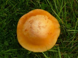
 More fungi.

 … a couple walking a dog, the first of several encounters along the way. When they overtake us, the dog is nowhere to be seen; it is, in fact, taking a lift. I often come across people carrying little dogs or pushing them in a pram. In the high Pyrenees, we were overtaken by a couple of female fellrunners, each with a pooch in a pouch.