Tag Archives: North Yorkshire

THE CRAVEN LIME WORKS.

P1020519

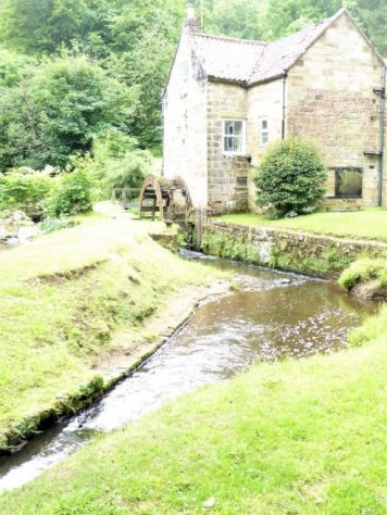
I’m enjoying a lunchtime pint of Tetley Bitter in the Craven Heifer in Stainforth. The last time I was here was at the end of February 2020 when I stayed a night mid-walk.  “It was Chinese New Year, and they were fully booked in the restaurant for a Chinese Banquet, but the chef was able to cook a fish and chip supper for me before festivities commenced.” There was talk in the bar of a new virulent virus spreading in China. We all know what happened next. P1020561

Hopefully the virus is now behind us, and it is good to be walking in Limestone Country. The barman says the pub closed during lockdown and only reopened under new managers last year. It is still owned by Thwaites, the present landlord has a five-year lease but grumbles that trade hasn’t really picked up. One problem is that the village is becoming dominated by holiday cottages, not many locals left, and the cottages are only occupied less than half the time. Who would want to run a pub in these cash strapped days?    I finish my pint and bid them good day.

I’m halfway on a short walk mainly devised to explore the Craven Lime Works. It was only recently that I was made aware of this Industrial Heritage site on the delightful Walking Away  site. I must have walked and driven past dozens of times without realising its existence.

There is further information from these two sites.

 Visit Settle – Craven Lime Works & Hoffman Kiln “Without doubt the centrepiece is the huge Hoffmann Kiln. Built in 1873 it is a huge industrial scale lime kiln” 

and more thoroughly  Craven and Murgatroyd lime works 400m north east of Langcliffe Mill, Langcliffe – 1020888 | Historic England

Good, that’s saved me trying to interpret and explain everything.

There is no signage off the road north of Langcliffe, but Hoffman Kiln Road  sounds promising, it leads to a large new purpose built office and light industrial complex in the grounds of the former lime works. A lot of money has been spent by Craven District Council with help from European cash – we are going to miss that. I only hope this is a successful enterprise as at the moment the majority of the units are standing empty.P1020623

The almost hidden car park for the Industrial Heritage site is impressively large even with electric charging points. It is situated directly below the massive old quarry on the hillside that supplied all the limestone for the kilns. We used to climb up there in the distant past, I think that is discouraged now. Today I am the only car parked on the site. P1020635

P1020619

I wander into the ‘preserved’ site, the interpretation boards are very good. This has been a vast industrial complex  – limestone from the quarries, converted in coal-fired kilns to lime which was transported off site by the integrated railway. As well as the kilns there are so many other associated ruins to see – inclines, winding houses. weigh bridges, water courses, tunnels, old rails, tram ways, spoil heaps.  The operation lasted from the mid C19th to the 1940s.

Capturelome works1909

1907 OS map.

First I look at the remains of the buttressed bases of a pair of massive vertical Spencer steel kilns. Difficult to visualise the scale of this operation that provided purer lime from the beginning of the C20th. P1020508P1020507

Back round onto the quarry floor and a dilapidated weigh house. P1020514

And then along to the Hoffman Kiln – wow it’s massive, think football pitch. In I go, you don’t need a torch as the frequent limestone inlet arches give enough light, in fact a magic image. I’m enthralled. There are the vent  holes for the smoke up to the now demolished central chimney; there are the holes in the roof for the coal inlets; there are the ageing firebricks; there are the miniature stalactites from the slow seepage over the years. Are there bats or giant spiders in here? I walk around the massive kiln twice, and even think about a third, this is so atmospheric. P1020629

P1020521

P1020624

P1020528

P1020529P1020527

P1020525

P1020543

P1020627

At the far end is a tunnel which accommodated a line bringing stone from the quarry above. A waterway used for counterbalancing a crane lower down delivering fuel into the kiln from the roof. Ingenuity far beyond our present engineers involved in the HS2 going above budget from week to week. They can’t even sort out the Euston terminus after 10 years, money down the drain, revised plans costing another £5bn!  How many cycle lanes could you build for that amount of money.

P1020534P1020535

The only part of the complex that wasn’t viable was the separate Murgatroyd quarry and overhead triple kiln next to the railway at the northern end of the site. A smaller scale operation which collapsed in 1887. Today I couldn’t make out the tops of the three kilns for the abundant vegetation, I realise now I should have dropped down to see the lower outlet of the kilns. P1020548

P1020549

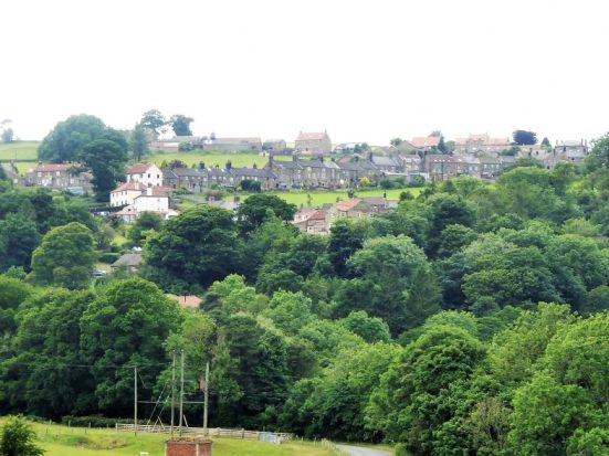
Industrial history satisfied I walk through the fields up to Stainforth and my pint. I come back, not on the familiar riverside path but on a higher way through Stainforth Scar. Gently climbing out of the meadows into the trees on the scar and emerging on the limestone plateau. The way ahead is etched into the fields, signs of an ancient passage way to Winskill Farm. 1675 says the date stone with the initials NBCB. What history could these walls tell. It is surrounded by what look like traditional meadows with a variety of flowers and butterflies.P1020569

P1020590

P1020587

P1020573P1020558

From up here looking back over my right shoulder is the prominent Smearsett Scar and distant Ingleborough. Over my left shoulder Pen-y-ghent has suddenly appeared quite close by.P1020579P1020581

There are some tempting ways leading to Attermire Scar from here, but I’m only looking for a short day. My path is clear through stiles in the extensive network of fields and old lanes. The view is down the shallow valley with its patchwork of fields to Langcliffe. That’s where I was planning to head, part of Wainwright’s Pennine Journey, until I spot a vague path/sheep trod going between a wall and the Langcliffe Quarry, now alongside. Will it take me on a shortcut?  I said I was looking for a short day especially after that pint. Worth a try and yes it brings me out into the Lime Works without any serious obstruction, but don’t necessarily follow me on any of these walks. Mine was still the only car in the car park.P1020596

P1020592

P1020601

P1020608

P1020603

P1020617

I would highly recommend a visit to the Craven Lime Works with or without a walk.

***

CaptureHoffman Kiln. (3)

ST. HILDA’S WAY. DAY 4.

Friday, 2nd July. 8 miles. Sleights to Whitby.

I catch the bus back to Sleights and head down to the station to rejoin my route. As well as being on the Esk Valley line, the Whitby – Pickering Heritage uses this section. I had seen steam from trains yesterday and when I heard a hoot this morning I grabbed my camera for a shot of the steam train powering through…

…it turned out to be a diesel hauling the carriages today!

   I soon left the Esk Valley Way and used footpaths gradually gaining height through pleasant farmland. A bit of a hiccough had me vaulting barbed wire to get back on course to Sneaton, a small village in the hills, you have no inkling that the coast is just a couple of miles away. St. Hilda’s Church, Sneaton is set back from the road and yet again it was locked. I’ve chosen a bad time to visit these churches. The graveyard looks like a haven for wildlife. This church is renowned for its stained-glass window depicting Caedmon. Caedmon was a lay brother and herdsman at St. Hilda’s monastery. He had a dream that he could sing and, relating this to Hilda, she encouraged him to compose and sing religious verses, the original hymns? From up here I had my first view of Whitby Abbey, and my continuation was named the Monk’s Walk heading that way. Excellently preserved flagstones for almost a mile, well-worn from the passage of time, and a stone clapper bridge for good measure..

On the outskirts of town, I decided to try and stay high and approach the Abbey from the SE. This worked well, and I was soon on the headland with the Abbey ruins in front of me. That’s when I joined the crowds swarming out of the car park. I hadn’t quite expected the place to be so busy when for the last three days I was mostly alone. I suppose the Abbey is a major attraction and when you throw in Dracula, Scampi and Captain Cook, Whitby is a magnet for tourists.

St. Hilda’s Abbey  was destroyed by Danish invaders in 867. A new Abbey was started in 1078 as a Benedictine monastery. Gradually this became one of Yorkshire’s great houses with 40 monks and a large estate.  It was rebuilt several times in the C14th and C15th, and these are the ruins we see today. Henry V111 put paid to the monastery. Shelling by German warships in 1914 ensured the building deteriorated further.                                                                                                                                                                    (Don’t know what happened to my camera settings there.)

On the headland close to the Abbey is  St. Mary’s Anglican Church, of Norman foundation but much changed over the years, it probably is on the site of St. Hilda’s original monastery.

This was the first church that I had found open, and it had an interesting  interior, most of the floor space being occupied by box pews – some labelled for their occupants .               

Nearby is the Caedmon Cross, erected in 1898, which celebrates the spread of Christianity from St. Hilda’s Whitby and Caedmon and his Hymns  in particular. Hilda is depicted standing on the headless snakes – ammonites, and surrounded by five bishops she taught. In the background can be seen the square tower of St. Hilda’s Anglican Church, my next objective.

   The graveyard is extensive, but apparently starting to fall down the cliffs into the sea. There have been reports of bones on the beach!

I go down those famous 199 steps, join the crowds jostling in the narrow streets and find a café with a free table, I enjoy the traditional Whitby ‘fish and chips’ – not really different to fish and chips elsewhere.

I thread my way through the narrow alleys and steps past the famous Whalebones and Captain Cook.   …to arrive in front of St. Hilda’s Anglican Church. This impressive structure was built in 1888 when it was thought it may become a cathedral, hence its size and apparent rich contents again denied me by Covid restrictions.

   Across town was the more pleasing to my eye St. Hilda’s RC Church. Again apparently it is richly embellished with many references to Hilda.  It is a shame that I have not been able to view the interiors of all these St. Hilda’s churches, particularly for the stained-glass windows depicted her life. 

All I had to do now was walk up to St. Hilda’s Priory at Sneaton Castle. (a different Sneaton to this morning). I was a little dismayed to find it is now a wedding venue.

The Sisters of the Holy Paraclete owned Sneaton Castle, a Georgian property originally built by a Caribbean sugar plantation owner, James Wilson, when he retired to Whitby. The nuns moved into adjacent St Hilda’s Priory in 1915, and the castle was run as a girls’ boarding school and then a retreat, but the increasingly elderly community of nuns, whose numbers have dwindled to around 25, decided to sell up in 2018, realising the castle was making a loss. They have moved to a new priory on another part of the estate. I found it all a little confusing and didn’t take the opportunity to ask if I could view the Norman priory or even the new one.

Castle and Priory.

P1030610

St. Hilda.

*****

*****

That was my 40-mile circuit of this wonderful corner of the North Yorkshire Moors and the Esk Valley completed. Eight St. Hilda’s Churches were passed, as well as other important places of worship. My regret is not being able to view the interior of those churches, however they gave a focus to the walk. The stone trods were a delight, as were the villages, making this a worthwhile and interesting tramp which for the most part you have to yourself.

I think that is enough of going round in circles looking for churches for a while, Sir Hugh is trying to get me back on the straight and narrow.

ST. HILDA’S WAY. DAY 3.

Thursday 1st July. 10 miles. Glaisdale to Sleights.

Today I followed the Esk Valley Way except for my extra loop to visit St. Hedda’s RC Church, Egton Bridge; the Mortuary Chapel, Egton and St. Hilda’s Church, Egton.

   I walk down the road from my hotel past the rail station to arrive at the much photographed Beggar’s Bridge. There are several stories behind its construction.

It was built by a Thomas Ferris in 1619. Ferris was a poor man who hoped to wed the daughter of a wealthy local squire. In order to win her hand, he planned to set sail from Whitby to make his fortune. On the night that he left, the Esk was swollen with rainfall, and he was unable to make a last visit to his intended. He eventually returned from his travels a rich man and, after marrying the squire’s daughter, built Beggar’s Bridge so that no other lovers would be separated as they were. Wikipedia.  

   Whatever the story, it is an elegant bridge in good repair.  

The Esk Valley Way goes across a ford and into the woods, the Coast-to-Coast comes this way too, but I have no recollection of it. The woods are a peaceful haven as one climbs above the river, Stone trods appear and are a feature for the rest of the day.

   These stone paved ways are difficult to date but were thought to have originally connected the large monasteries, they being the only resources to fund such a scheme. Later in the 17th and 18th centuries, they would have extended as more commercial trade routes. I try to imagine this route being busy with packhorses travelling the county. The paving stones are worn from all that trade. Here in the woods is a particularly long section of preserved paving stones, how many more elsewhere have disappeared under tarmac or been destroyed by the plough? There are rocks in the woods which I wonder had been quarried for the paving I’m walking on.

One emerges onto a steep road, one in three, dropping to Egton Bridge. Here, hidden behind the Horseshoe Inn, are two series of stepping stones going across the Esk. A weir and mill race are obvious reminders of the industry on the river.

   Going up the road is St. Hedda’s RC Church. Hedda was a contemporary of Hilda at Whitby. Egton was a hotbed of dissention during the reformation. Its most famous RC priest, Nicholas Postgate, became a martyr, executed at York in 1679. The Roman Catholic congregation however continued to worship in secrecy, and this new church was built in 1866. Today the church is Covid closed, inside apparently is a shrine to Postgate. On the school next door is a statue of St. Hedda.

   Leaving the Esk Valley Way I take to the fields and woods past Lelum Hall Farm and climb steeply out of the valley, again with traces of the trod no doubt heading towards the old chapel.

Off the road at the top is Egton Memorial Chapel and Graveyard. The original C13th chapel of St. Hilda survived the dissolution period and continued as the Anglican Parish church, but it deteriorated and was demolished in 1876. A new St. Hilda’s was built in Egton, see below, but the graveyard has continued in use. The present mortuary chapel was built on the foundations of the old in 1897.  A rather sombre place but with good views across the dales.

   Egton village is spaced out around the wide street with lots of old attractive houses. I ask a man with his dogs the history of some buildings, but it turns out he has just moved here and is slowly finding out himself. He tells me of his restoration plans for his new property, not the retirement he had planned. He did however know about the  surviving ‘hearse house’ down the hill, as well as the house where secret Catholic masses were held.

The village continues down a steep hill, which must be a nightmare in hard winters. The new St. Hilda’s Church was built,1879,  using some stones from the original church. I wander around the outside to spot some old date stones, the church of course being locked.

                                                                                                                                                                                                                                                                                                                                               Back at the bottom of the hill I call in at The Postgate Inn (remember him  – the martyr) for a pint and surreptitiously my vegetable slice from yesterday – delicious.

    Now back on the EVW there is a rather dull track for a mile or so, my attention shifts to the plethora of common hedgerow flowers.

  This must have been a toll road through the estate at one time. The river is never far away, with the old stone paving alongside it. An old priory is mentioned, but now looks like a country residence. I meet up with the Egton newcomer again, he is out walking with his wife and one of the dogs, he knows nothing of the priory.

Further on, stone trods reappear as I walk through Spring Woods and on to elegant Newbiggin Hall with its nearby rusting tractors and paraphernalia collection.

More surviving stone trods cross fields and woods, with Sleights in view on the hillside ahead. I enter the lane close to St. Oswald’s Retreat, where some sisters from St. Hilda’s Priory, Whitby, live.

The lane leads to Sleights Station and a bus stop back to Glaisdale. I’m the only one on the bus, but at the next stop a lady boards and sits right adjacent to me. She obviously doesn’t understand social distancing. I was expecting three days sweat would keep most people away from me. It’s been a long day, and I’m rather weary when I arrive back at the Arncliffe Arms for my second night.

*****


ST. HILDA’S WAY. DAY 2.

Wednesday, 30th June. 11 miles. Danby to Glaisdale.

  People appeared from the woodwork this morning for breakfast, all the tables were occupied. Strange, I saw no one last night. Around the corner was a great little bakery where I queued outside in the rain, socially distanced, face mask on, to purchase my lunch. A lattice vegetable slice and a cheese scone, I was tempted by much more from their excellent selection. Danby sits around the village green with characteristic warm sandstone walls and those red clay pantile roofs, though the damp weather meant I didn’t linger.   

The bakery the previous evening.

The old water mill.

I had to walk a bit of a loop to visit St. Hilda’s Church outside Danby. As I walked up in the mist I had a vision of St. Hilda in the fields by her church. 

   If you are going to build a church two miles out of town and put it at the top of a steep hill, you are not guaranteed full congregations. But things would have been different 900 years ago when the first church appeared on this site. Parts of the present building go back some 500 years. Even the vicarage which I passed is a good walk to the church.  Again the church is locked, Covid precautions, so I missed the opportunity to view the stained-glass window depicting St. Hilda at the 664 Whitby Synod when she oversaw the debate on settling the date of Easter between the Roman and Celtic factions of the Church. Stained-glass doesn’t look as good from the outside.

The Whitby Synod window.

Some vicarage…

*****

…with guard dogs.

   I was wondering about the decision to follow the route up onto the moor in poor visibility and rain, but then I came across these ancient paving stones alongside the farm track and leading onto the moor. A path stretched out before me, and I marched along, oblivious to the weather. This is what walking is all about, a clear trod through the bracken traversing the valley side and eventually dropping to pick up the signed Esk Valley Walk with its logo of a leaping salmon. There were no leaping salmon at this time of year, but alongside the river with its sandbanks were lots of chattering sand martins.      I spent a little time chatting to the water bailiff who gave me lots of information about his work along the river.    A pleasant surprise was the Park Visitor Centre where despite coachloads of children I was able to have a good coffee.    Refreshed, I set off, knowing I had to climb back onto the moors once more. Coming down were a jovial trio of a certain age out on their weekly tramp, they had already done over ten miles. I slowly gained height in fields and then a steep rough track took me up onto a minor road which I would follow for two or three miles. It was up here that I met Graham, who was cycling from Luxembourg to Scotland with all his worldly possessions. A like-minded soul, we chatted for half an hour about all the things that are good and bad in the world. Whilst we were stood by the side of the road, a couple of road cyclists pulled up to say hello. They had come from Clitheroe (close to where I live) that morning and were heading for Whitby. A hundred miles of hilly country. Asked where they were staying for the night, I could hardly believe that they were turning round and heading home! We wished them good speed. My new mate trundled off at a more leisurely pace.

   It was good walking up on high, I hadn’t realised I was just under Danby Beacon which I passed yesterday – I am taking a circuitous route! As you can see from the pictures, the views across to the extensive valleys and moors were limited, but probably more atmospheric for that. A stone by the road took my attention and I could just make out lettering on one side. Later research showed it to be a listed boundary stone from 1736. The noisy lapwings seemed to enjoy having their photographs taken

Suddenly I was dropping down a 1in4 hill into the village of Lealholm. I now wish I had spent more time exploring this attractive place, as there is much more to see than is obvious from the road I came in on. I did however find a café open, The Shepherd’s Hall. Under strict COVID-19 rules, I was able to enjoy a pot of tea and a toasted teacake. When I was climbing with Tony it was almost a ritual to start the day with tea and toasted teacakes, I sat with pleasant memories.

An old well…

…with its chained cup.

   All I had to do now was to follow the well trodden Esk Valley Walk into Glaisdale, not always by the river as you would think. A watermill had been converted into a highly desirable residence. As my inn was in the lower half of the village, I didn’t have to climb  to the centre. I will never know what I missed, but I could sit outside with a pint looking up to it.    An excellent varied day despite the mixed weather. Because of the café stops, I hadn’t got round to eating my purchases from the bakery, they should still be fresh tomorrow.

*****

ST.HILDA’S WAY. Day 1.

Tuesday 29th June. 10.5 miles. Hinderwell to Danby.

   Not surprisingly the walk starts at my first St. Hilda’s Church. I’m in Hinderwell after a long drive to Whitby and a delayed bus journey, so I’m  more interested in the café set up in the old school. Fortified, I go in search of the church. An interpretation board gives me a potted history of St. Hilda, which is similar to my preamble.

  There has been a church on this site since the C12th, but the present church was started in 1773, it is dedicated to St. Hilda. The well said to have been discovered by her probably predates her, but gave its name to the village. (Old English Hildewella meaning Hild’s well.) The church is squat and plain and unfortunately locked under Covid conditions. I am able though to find the well in the grounds and yes, there is water in it. One down, seven to go.   The first half of the afternoon is spent wandering through farmland rising from the coast. Hay is being cut or rather silage is being baled. The paths are high in vegetation, not good for my hay fever or bare legs. St. Hilda’s Way is not signed, but follows rights of way. It’s all up and down, I suspect that’s going to be a feature of this walk, I’d forgotten how hilly this region is. As a teenager, living in Darlington, we cycled and youth hostelled extensively in the North Yorkshire Moors. Of course in due time we completed the Lyke Wake Walk, Cleveland Way, Wolds Way and the Coast to Coast through the area, but it is years since I’ve been back.

   I’ve a good feeling about the authors of the guidebook already. The instructions are clear and precise to navigate the way, which as I said is not waymarked. The logo for the way is an ammonite, which would have been an excellent choice for signing.

The afternoon heat became oppressive, the fields more and more equestrian orientated, so I escaped to the minor road running in the right direction. Here I could make better progress and there were views back to Hinderwell and the coast.   Eventually I reached Scaling Dam Reservoir, an artificial lake on the edge of the moors. Once this was skirted, I don’t know why paths on the north side weren’t  chosen away from the traffic noise of the busy A171, the walk took on a different character. Open moorland beckoned.   The bracken had not yet reached its full smothering growth so the footpath onto the moor was clear. It was good to hear the familiar call of the Lapwings and Curlews yet again this year. Height was gradually gained, and Bell Heather bordered the narrow path. Ling comes later in the year to give the ‘purple moors’ in August. Higher still a broader track was followed, all around on the map were marked tumuli and antiquities, but little was obvious to my untrained eye. I did however make a short detour to the remains of a medieval cross. The base was clear to see, with perhaps a bit of the shaft inside. These must be ancient tracks. Crosses were placed on regularly used routes linking settlements or on routes having a religious or funereal function.  A broader track took me up to Danby Beacon Hill which was rather disappointing as a motor road comes up here with all its litter problems. Apart from the car park there was a trig point, a topograph and a modern beacon to visit. Late afternoon was not the best time for distant visibility.

   Danby, down below somewhere, was hidden in the trees. Waymarkers reminded me I was in the North York Moors National Park. Rough fields dropped to Clither Beck and a lane took me to the door of The Duke of Wellington, my bed for the night.


   I’ve noticed before that bar staff often have poor local knowledge. I was the only one sat in the bar and asked the barman where the pleasant Daleside Beer I was drinking came from – he didn’t know, though he had been pulling pints of it for some time. (turns out it’s brewed in Harrogate)  He proceeded to ask where I was walking and then bring up on his phone an indecipherable satellite map of a completely different area where there was a recommended walk. Of course, he hadn’t heard of St. Hilda’s Way, but I wouldn’t have expected him to have. The conversation dried up, so I had an early night.


*****

ST. HILDA’S WAY.

I think I spotted this walk in the LDWA magazine a few years ago, and the guide book, by Nancy and John Eckersley, has been on my bookshelf since then. (along with several others!)

The original idea for the walk came at the time of the 1400th anniversary of the birth of Hilda (or Hild as she would have been known) in 614. The area around Whitby has many associations with St. Hilda, so through local churches a 40mile route was devised. It was designed as a pilgrimage visiting the churches named after St. Hilda.

So who was St. Hilda?  She was born into royalty in the turbulent C7th. Her father was assassinated before she was born, and the family lived in exile in the Kingdom of Elmet, now part of Yorkshire. At the time the large region of Northumbria was ruled by Hilda’s uncle King Edwin.  After his death, Oswald became king and re-introduced Christianity to the region, founding Lindisfarne monastery and Aidan preached the gospel.

When Hilda was 13 she heard Paulinus, a missionary from Rome, preach and she was subsequently baptised in York, 627. The family later fled to Kent when Northumbria was overrun again. At the age of 33 she became a nun and was called by Aidan to found a monastery north of the Wear and a year later she became an Abbess at Hartlepool. In 657, she founded the monastery at Whitby. To cut a long story short, she became a woman noted for her wisdom and kindness, she trained bishops, advised Kings and laid the beginnings of a literary house at Whitby. She remained at Whitby for the rest of her life, dying in 680. She was buried there, but later her remains were moved to Glastonbury. Sainthood after her death was probably bestowed upon her by the local Christians.

A legend has it that St. Hilda turned snakes into stone, which were then recognised as ammonites found in the Whitby area. The ammonite has been used as a logo for the walk. 

I’m not intending my walk to be a pilgrimage in the religious sense, but a way of exploring the moors and valleys of this part of North Yorkshire with the added interest of the St. Hilda connections. In order to have time to visit and appreciate the churches, I am planning on about 10 miles per day, which fits in with accommodation possibilities.

Now how do I get  to Whitby?

From Walking St. Hilda’s Way.