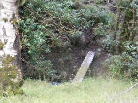
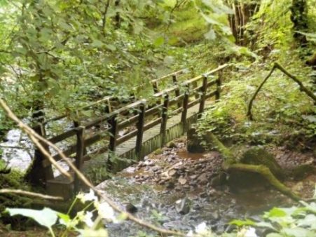
 28 years ago I remember a footpath above the River Hodder coming to an abrupt stop where a bridge was falling down. My son Chris and I were on a backpacking trip around the old Lancashire boundary. We had left Mossley, East of Manchester, and worked our way through high Pennine country, Pendle, Ribble Valley, and now we were heading north through Bowland towards Arnside. After getting through the no access, closed and danger barriers we balanced precariously across crumbling masonry high above a stream and carried on our way. Do I have a photo somewhere of that day? I often wondered what happened to that bridge above Mill Brook. Today I set off to find out.
I parked next to the village hall in Bashall Eaves and set off along a farm track to Mason Green Farm. This turned out to be one of those almost industrial sized complexes. By chance I found a way around it and across fields, full of cows, in the right direction towards Agden Farm which seemed to be a Land Rover hospital. Numerous varieties of the marque were lined up in various states of repair, from a barn there were sounds of restoration.

The overgrown path dropped into a gully, the first of many today, and climbed out steeply on recently installed steps. Somebody must come here.
 I was now in pastures surrounded by all the familiar fells, Pendle, Longridge Fell and the Fairsnape group. I disturbed a few deer as I dropped into the next gully in Paper Mill Woods. This steep and rather slippery descent took me onto the banks of the River Hodder, full from the last few days’ rain. This is about the only access to the Hodder between Doeford Bridge upstream to Higher Hodder Bridge below. It makes me think that I must be on The Hodder Way a route devised by Clitheroe Ramblers and one I walked in recent times – I have no recollection of this demanding stage. There was no bridge across the stream but it was no problem to hop across.

Climbing away from the river I pass three magnificent oaks. In the next field of long grass, my only objective is an ash tree on the horizon. 
 Then it is down once more into woods and a difficult descent of a bluff to reach that bridge from years ago, now converted to a wooden structure spanning the stone abutments. There are references to Roman times but I think that is unlikely even though they passed by quite closely. This is a deep ravine, Mill Brook, and the new wooden bridge, rebuilt in 1997, is more impressive than in the photo.
A vague path climbed up through the woods to emerge into fields with open views of the fells. These were crossed and a final dip overcome to reach a track which follows a Roman road, Ribchester to Kirkby Lonsdale. It had taken me two hours to cover three miles and I was ready for a break and a snack.


Onwards I followed the lane to Lees House Farm, now supporting several developments. It’s called diversification.
 Steep paths lead down to a stream, Mill Brook once again. Coming up the other side into an overgrown field was not easy if there was a path I didn’t find it.

From here to Micklehurst Farm was straightforward though I managed to herd a lot of sheep in front of me. This morning it had been all cows and now sheep everywhere. Barking dogs, thankfully chained, followed my progress through the farmyard. I’ve passed the road end to Micklehurst Farm many times, I think they are distant relations, I never realised how far off the road they are.
On the corner is one of the entrances to Browsholme Hall, South Lodge, I sneaked a photo of the gatehouse and cottage.
Now I was onto little-used roads through woodlands some of which are described as nature reserves. I met a couple leisurely ambling down the lane, they had been out birdwatching.
Further on an old Alvis Speed was parked up. It was in fantastic condition. The owner working in a field nearby was obviously proud of the vehicle,1932, – “all original bodywork”. He admitted that the engine wasn’t firing correctly, hence the bonnet was up for tinkering.

I continued down the lane to reach Saddle Bridge which I mentioned in a recent post. It is always good to look at things from a different angle and I can’t resist a photo of a packhorse bridge.
Returning up the path, Rugglesmire is passed, I trespassed a little to try and see the grade II farmhouse.
Into the hamlet of Bashall Eaves, a few cottages with evocative names – The Old School House, The Vicarage, The Old Forge, The Post Office etc.
There is also an old Lancashire Cheese press.
Just down the lane is The Red Pump, now a thriving inn/restaurant, but it has a dark history. In 1934 a farmer, Jim Dawson, was shot whilst walking home from the Edisford Bridge Inn at Clitheroe and died later of his wounds. Investigations were hampered by a “wall of silence” from the villagers and the mystery has never been solved. There is talk of ghosts…..
I usually show a map of my wanderings below and I would suggest that any local readers of my posts try this unknown area. The first half of the walk is particularly scenic and interesting – the best of rural Lancashire, and the paths could with a bit more footfall.
*****


Jungle springs to mind from some of the photos but an interesting walk.
As I said they need more people walking them.
It’s a lost world by the Hodder in that area.
Jim Dawson, not Douglas .
Sean, thanks for spotting my mistake – have rectified it.
As far as I know Jim Dawson had been drinking in the Edisford bridge Inn the night he was murdered, not the Red Pump.
Thanks for your comment. I’m sure you are correct. It is difficult to piece together the story, different versions abound. Somebody has written a book about it – Wall of Silence, J L Cobban. Have you read it?
Jennie Cobban is Jim’s great neice I have seen an excerpt from her book that mentions the Edisford Bridge Inn, the book actually calls it the Edisford Arms and it might well have been called that backind in 1934 . My parents often pointed out the spot where local gossip say the fatal shot was fired from. But of course nobody is saying for sure.😊
Pingback: BASHALL EAVES CIRCULAR. | bowlandclimber
Pingback: Bashall Eaves – Northwest Nature and History
A lovely little area. Thanks for the link – though it wasn’t the easiest of walks.