Monthly Archives: May 2022

CICERONE’S LANCASHIRE – Lunesdale and Kirkby Lonsdale.

***

This is my latest route from Mark Sutcliffe’s guide to walks in the Red Rose county, although this one starts in Cumbria. Kirkby Lonsdale is a bustling market town in south Cumbria, My journey here had been slowed by several convoys of horse-drawn travellers probably heading to Appleby Horse Fair to be held next month. I park near the Devil’s Bridge where I know the parking is free, his suggestion of central parking is probably unwise.

The medieval Devil’s Bridge has three graceful, ribbed arches and is closed to traffic. I was in no hurry and in fact on arrival cross the bridge on foot to buy a coffee from the mobile stall, a favourite with motor cyclists, when at weekends up to a hundred may congregate here. It has also been the scene of youngsters ‘tombstoning’ into the river below, not to be advised. Chatting to a cyclist, of the bicycle genre, it transpires he has ridden from Preston in a time not that much more than double my car journey. The bridge has a legend relating to the devil, I liked this version…(ignore the plugs towards the end)

So it’s getting late when I start my walk downstream alongside the Lune. For two miles along this stretch all is peace and quiet, only a few dog walkers. The air is however full of rapidly flying Sand Martins, I’m almost mesmerised by their acrobatics. I suspect that this year’s juveniles are boosting the numbers. On the opposite side is a long low sandbank with obvious nesting holes visible. Ahead in the distance are the Bowland Hills, just visible in the rather cloudy sky. Behind are the Barbondale group of lower fells and there across to the east is the distinctive Ingleborough. Once he has attracted your attention you are hooked and spend the rest of the day taking more and more duplicate photographs. I make an effort today to avoid that trap, unsuccessful as you will see later.

Before long I’m heading away from the river on a flooded track up into the village of Whittington. Mark’s route takes a path parallel to the village road, but I am curious to see the old houses so take a slight diversion up the main street. I’m glad I did as there are some interesting properties many from the C17th, most of them listed.

Barn at Low Hall, late C18th…

…with pigeonholes and an owl opening.

Malt Kiln House.

The pub is closed.

The Old School. 1875.

Manor House.

The grand Whittingham Hall from 1831 is hidden down a private drive.

Eventually up the hill I reach the parish church of St. Michael with its early C16th tower. The rest having been largely rebuilt in 1875 by Paley and Austin, well known for their church architecture in Lancashire. Internally there is an elaborately carved chancel screen. The church is built on the motte of an earlier castle, where I sat in the sunshine enjoying a sandwich, The path I should have approached the church by was clear to see ahead of me. Whilst admiring the view I witnessed something I’d never seen before – an angry blackbird was chasing at low level a squirrel across the field. Presumably the squirrel had been attacking the bird’s nest.

Rest over I tackled the very steep lane heading north, it appeared to be a ‘green’ lane but was in fact a highway though I doubt few motorists would tackle it from the bottom. All was in fact very green and shady.

Once at the top I took diverted paths around Sellet Hall with views across to Barbondale and of course Ingleborough.

Sellet Hall. C17th much modified.

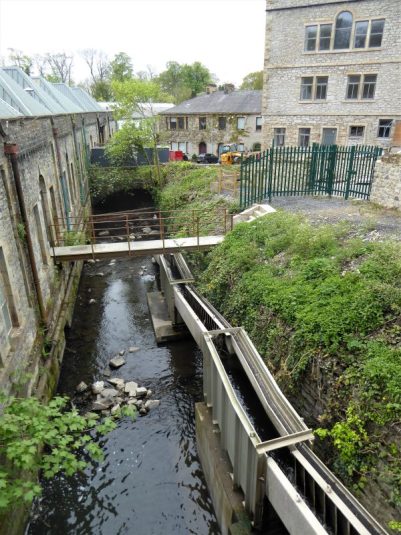
Down a meadow full of contented cows to Sellet Mill, a former water powered corn mill where the iron mill wheel has been preserved.

Sellet Mill. C19th much modified.

The continuing bridleway back up the hill was rather strange, behind the mill was the original millpond (now a leisure pond) and coming down into it a rocky stream. The bridle way took me straight up this stream, in parts the old cobbles were visible, but most will have been washed away. After heavy rain this way would be impossible.

At the top I came out into meadows above Kirkby Lonsdale with excellent views over the valleys and to, yes you’ve guessed it, Ingleborough. Again strangely the RofW went straight across the middle of a rugby pitch, what are your rights when there is game on?

Then it was through the middle of the Queen Elizabeth high school, I felt I was trespassing.

I found Kirkby over touristy. There are lots of interesting buildings and alleyways, but the town suffers from a traffic problem with cars everywhere, even though my photos seem to show an absence of them!. I was glad I’d parked out of town – be warned. The flags are out for the Queen’s Platinum Jubilee later this week, in case you are from another planet.

I made my way towards St. Mary’s Church. The oldest parts of the church are Norman, doors and pillars, but the structure has had numerous alterations over the centuries. Inside there are three Isles and the nave, so the church appears grand. Some of the Norman pillars have incised decoration similar to Durham Cathedral. I missed a ‘green man’ carved on one of the C12th columns. There is a C13th piscina in another.

The graveyard is extensive with some impressive memorials and at one corner is an unusual octagonal stone gazebo from the late 18th century which was formerly in the vicarage garden.

I’d come over here to visit Ruskin’s View, a celebrated view of the Lune as it curves gracefully in the wide valley with the hills beyond. Turner had painted this scene in 1822 and Ruskin, art critic, painter and poet had this to say about it – “I do not know in all my country, still less in France or Italy, a place more naturally divine.” Kirkby Lonsdale’s tourist jewel was set forever. Unfortunately there has been a land slip below the path which has therefore been closed for safety reasons. There was no way round it, so I give you this picture from the tourist board.

Disappointed I descended the steep Radical Steps to the river. The steps were built in 1820 for Dr Francis Pearson, a political radical, to divert the existing public footpath from his garden – a radical step. A level walk along the riverside, popular with locals and tourists, lead back to the Devil’s Bridge.

In its six miles an excellent walk, one of the best I have done from the book so far

*****

NATURE NOTES.

*****

Every day I see a pair of Mallards sitting on my lawn. They were attracted no doubt by my small pond and the bird food I spread on the ground every morning. The fact that they are together suggests that the duck hasn’t laid any eggs yet, I cannot see any sign of a nest.

I made a rough home for a hedgehog out of reeds, twigs and leaves earlier in the year hoping to attract them into my garden. Yesterday at dusk a hedgehog wandered across the lawn. It is probably around when I’m in bed. Let’s hope for a family.  My photograph is not that good,I missed its snout.

The male pheasant who used to come for food has gone elsewhere. There is an abundance of blackbirds, robins, sparrows, starlings, great and blue tits all busy feeding their young scattered in hidden nests around the garden. A pair of magpies are no doubt doing damage to the smaller birds eggs.

These three were less welcome visitors.

Meanwhile, up on the Upper Dilworth Reservoir where I park to go bouldering in Craig Y Longridge there is quite a lot of activity. The Mallards had chicks a while back, not sure how many will survive.

The Canada Geese are showing off their youngsters.

The Tufted Ducks are just swimming around though they have nested on the island in previous years.

But the highlight of this week was watching the pair of Great Crested Grebes on the water. I have been keeping an eye on them for several weeks, I missed their mating dance. I saw them building a nest in the reeds, but the foliage growth had camouflaged it, so I didn’t know if she had laid any eggs.  I can see now that she has two chicks and is carrying them on her back whilst the male goes off diving for fish. They are quite a way out on the water, so my camera struggled to cope. The  two young are virtually invisible on her back from this distance, just a flash of white feathers, but when the male returns their heads pop up, and sometimes they take to the water. He feeds her small fish, and I’m sure he was also giving titbits to the young. What a privilege to be able to watch their family life.

While I’m bouldering in Craig Y I often hear a Wren’s alarm call, and today I saw her fly out from low down in the rock face. On investigating there was the domed mossy nest in a crack. I kept well away for the rest of my session.

Oh! And I thought my garden was looking very green. You can’t see the weeds.

PS. I called in to see some friends today after a walk, they have a rough patch of grass in front of their house, and it was full of orchids –  I’m not sure which variety, but I liked them.

NEW PATHS AT HURST GREEN.

I’ve probably walked out of Hurst Green dozens of times. The Tolkien Trail takes you along the River Ribble and going the other direction towards Longridge Fell you have the delightful Dean Brook and Stonyhurst College. Today I was walking with a group whom I first met at Haigh Hall a month ago – they always walk the last Wednesday in the month.

It was still raining when we met up at The Shireburn Arms at 10am. The forecast said it would stop at 12. I didn’t bring my camera partly because of the weather but also because in a group there are limited chances for photography. Of course, we all have our phones these days with functional built-in cameras. Anyhow, I didn’t expect to tread new territory.

As we walked up through the village and down into Dean Clough I contented myself with idle chatter. The interesting mill weirs and races in Dean Brook went unnoticed to most. The quarry, Sand Rock, where the building materials for many houses in Hurst Green originated passed us by. Greengore, a medieval hunting lodge of the Shireburns was duly admired. It is currently up for sale £1,250,000.

Onwards up the bridleway and I realise it has stopped raining which is a bonus for the assembled crowd, although it is very muddy underfoot. We are on the edge of woodland belonging to Stonyhurst College where they have their own private lake as a water supply and fishery. I have trespassed many times into those secret  lands where there is a hidden cross, Park Cross, with a history going back possibly to a Maria Shireburn, whose body may have been carried past here on the way to her burial at Mitton in 1754. It is one of nine  Stonyhurst crosses I incorporated into a walk from Hurst Green. I digress.

To my delight our leader takes us off on a bridleway through Hudd Lee Woods an area I had never knowingly trodden. The bluebells were over but the greens of the beeches and ferns were splendid, as a little sunlight filtered through. My spirits were lifted.

On down to the main road where we saw the remains of the C18th grade II listed Punch Bowl Inn. It is said to have been visited by the highwaymen Dick Turpin and Ned King in 1738. They stayed for three days after which Turpin travelled to York while King attacked travellers on the local roads. King was executed in 1741 and his ghost was reputed to haunt the pub. The pub had been closed for many years and the new owners tried to get planning permission for several schemes which were turned down so last year they demolished it without permission. An investigation followed, leading Ribble Valley Council to instruct the owners to rebuild it! I can see them appealing the decision and getting away with a slap on the wrist. We seem to have lost any sense of duty and honesty in this country as exemplified by the findings of the Sue Gray report published today on the goings-on of our ‘honourable’ Prime Minister.

Back onto the quieter Shire Lane with views over the Ribble Valley. Just when I thought we were cruising into Hurst Green we were taken through a farmyard and into fields trampled by a herd of frisky bullocks. While most of us tried to avoid the worst of their  excrement a brave member of the group held the beasts at bay with his walking poles.  “They weren’t here yesterday – honest” was the plea of our leader.

A bonus was one of those Peak & Northern Footpaths Society green signs erected in 2016.

A couple of awkward high stiles slowed the less agile of the party, but they were the only ones uncounted all day. Then we were heading downhill quickly and slipperily back to Dean Brook. At the bottom we found ourselves in the garden of a couple of stone built properties, one had been originally a bobbin mill supplying bobbins and shuttles to the Lancashire cotton mills  using power from a mill race taking water from Dean Brook. Again this is something I had missed in the past.

We had come full circle and retired to the excellent Shireburn Arms for lunch.

Greengore.

The Punch Bowl 2019

Now.

Heading down to the old bobbin mill.

That had been an excellent circuit and I regretted not bringing my camera.

.

CICERONE’S LANCASHIRE – Cockerham Coast and Canal.

The day was gloomy and so was I – perhaps I overdid the whisky last night. I was still mooching around the house late morning. But I keep trying to push my walking that bit farther. As you know I’m slowly working my way through Mark Sutcliffe’s Cicerone guide to Walking in Lancashire. In this I’m mirrored by Phreerunning Martin who always gets an interestingly different take from me, the pleasures of blogging. I needed something not too long and preferably as flat as possible. Walk 15 seemed perfect. I know the Glasson Dock area well and have done several variations of this walk before, probably most recently on my Lancashire Monastic Way. But looking at Mark’s  route I spotted some paths I had never walked. I might struggle to say something original about this walk.

I was a little embarrassed to leave my car in The Stork’s private car park, but the other space was taken by Travellers and their caravans. The channels of the Condor don’t look at their best during low tide. Following the old railway I came into Glasson, busy with people visiting an outdoor market. I couldn’t go past the little shop without buying a coffee, this time to drink as I climbed the minor hill to the viewpoint. The views were disappointing but the coffee good, sorry about the environment polluting cup.

I worked my way around the coast. The tide was out, so Plover lighthouse was accessible, it was previously maintained from the shore before becoming automatic. The incumbent keeper was based at Lighthouse Cottage where there was another light atop a wooden scaffold to line up ships coming into the tricky Lune channel. Across the channel I could see Sunderland Point at one time the major port on the Lune.

A sign talks of plovers nesting on the shoreline, but I wonder about this as the tide comes in fully most days.

Lots of walkers were converging on Cockersand Abbey, of which the only remaining building is the octagonal Chapter House. This has survived because it was used as a mausoleum by the Daltons of Thurnham Hall (see later) during the 18th and 19th centuries. The red sandstone rocks on the shore  line  show where the building blocks of the Abbey originated.

Continuing around the coast on the sea embankment passing several caravan parks which looked very vulnerable to high tides. It will be interesting to view this area in the coming decades as sea levels rise.  Those are the Bowland Hills behind.

Tree of the day.

Small planes kept taking off from somewhere on Cockerham sands, disappearing into the dark clouds only for tiny parachutes to fall from the skies. They were from the Black Knights centre. Was the sign for parachutists that had gone astray on their descent?

I left the coast and followed bridleways through drained lands up to Thursland Hall where one is corralled into narrow ways to bypass their fishery. Change of scenery.

A kilometre of tedious walking brought me to Thurnham Hall, a C17th country house converted into a spa hotel. It looked very smart and there were plenty of people staying in the attached residential block. Walking through I reflected that my life seems very simple compared to others. Escaping by a gate into a field I was wary of proceeding through the large herd of frisky bullocks, so I resorted to an outflanking manoeuvre bringing me back to an ancient green lane. A bridge gave access to the Glasson branch canal.

Herons are a common sight on waterways, staring motionless into the water. I have never seen one catch a fish, but today I was lucky this heron had just caught an eel and was having difficulty trying to swallow it whole. The highlight of the day.

*****

CADSHAW – FAIRY BATTERY.

By the time I arrived they were setting up the ropes – yes we have succumbed to top roping with the excuse of our too many birthdays. I was roped in, literally, when Dave phoned at 9am to say he and Rod were heading for a short day’s climbing at Cadshaw in the hills south of Darwen. I always enjoyed climbing there. By the time I had breakfasted, boiled an egg for a sandwich, cut my toenails, found my rock boots, filled my flask and put petrol in the car I was behind schedule, but no matter I was not expecting to climb for very long.

Motorways are becoming busier and busier and Darwen town centre was a nightmare. I eventually parked up alongside their cars. The OS map shows the ?natural crag as the Fairy Battery. Fairy Buttery or Fairy Buttress the origin is unknown. I decided to walk in a slightly longer way than usual to cross the sometimes tricky Cadshaw Brook by a footbridge downstream. This was a mistake as the path on the north side of Yarnsdale was overgrown and little used. Colourful bluebells diverted my attention. A cuckoo was calling in the woods above. I eventually made it through to below the rocks, there wasn’t a fairy in sight.

Not to be repeated.

I tied on and made my way up the first easy route – West Buttress, this was first climbed back in the 1930s certainly in big boots. The rock has become much more polished over the years. The route further to the right was a classic hand jamming crack – I noticed a few scars on the back of my hands as I relaxed in the post climb bath. I had to be lowered off the next climb, unable to hold on long enough to get my legs up without straining my left knee ligaments. I’m climbing basically with one leg!

West buttress.


Hand jamming.

Time for lunch.

The next two climbs on the higher east face were enjoyable on more positive rock where one could move around finding the best hand and footholds.

I used to solo all these routes before turning to harder things – how times change. Looking at an old guide book I see that I have led all the climbs here but one – Druids Direct E3 6a. How times change indeed.

Those harder routes, Druids Face.

I didn’t retrace my difficult inward route but joined Dave and Rod crossing the stream dry footed, walking out well satisfied with the day.

*****

CICERONE’S LANCASHIRE – Blackburn’s countryside.

                                                                            Glorious May.

Walk no 36 from Mark Sutcliffe’s guide combines the hills of Billinge with the River Darwen.

The River Darwen winds its way through the urban environments of Darwen and Blackburn and then has a glorious run in the countryside to eventually empty into the Ribble. I first met it today as I followed Mark’s route from Pleasington Station into Witton Country Park. Here it flows quietly through the meadows and playing fields. Walking upstream I met lots of families, dog walkers and picnickers in the afternoon sunshine. The park s very popular and well-used by the multinational people of Blackburn.

Billinge Hill above Witton Park.

Butler’s Bridge on the River Darwen.

Soon after leaving the river I was climbing steadily for what seemed ages but was only a mile or so. There are paths everywhere in Billinge Woods, there is even a tunnel, and I do find them confusing, so it was with some surprise that I found myself at the summit without any problem. The instructions in the guide were spot on. The OS map shows this as a viewpoint, but that was long ago before the trees took over. Maybe a bit of forest management by the council is needed. The plaque commemorating a court up here in 1429 is looking worse for wear also.

I headed west to find my way out of the woods and onto the ridge of the Yellow Hills (named after the Gorse that flowers here most of the year) pausing at the toposcope dedicated to Alfred Wainwright who needs no introduction. There were views over the nearby towns, but it was too hazy to see his beloved Lakeland. There are several links to walks to the memorial  For more details.

Paths, now following The Witton Weavers Way, led down through bluebell woods, lush meadows,  inquisitive cattle, newly cut fields, into the wooded gorge to meet the River Darwen once again. This I followed on familiar ways through the old mills at Hoghton Bottoms, under the railway arch and past the weir into meadows alongside the river. The last time I was along here the paths were almost impassable with mud and water, today the ground was bone dry.

Ford through the Darwen, oh there is a footbridge.

I didn’t enjoy the stretch alongside the busy A road and was glad when I turned off on the lane back to Pleasington. A seat in the garden of the parish churcof Feniscowles, Immanuel, was ideal for a break and snack. The River Darwen was crossed for the last time at Walk Mill, and I was back at the station where the local bowls club was in full swing as was the pub opposite.

Remains of Old Feniscowles Hall down by the Darwen.

Immanuel Church Feniscowles.

One for the archives.

I had seen a sign for Pleasington Priory and realising it was just a little farther up the lane went to investigate this Grade I listed Catholic Church. Trees in the grounds prevented a good view of the exterior with its tall front elevation. Above the arched entrance doorway was a prominent rose window. Gargoyles and statues seemed to be everywhere.

A well thought out and varied walk, apart from the short unavoidable A6061 stretch. The day was perfect with the countryside at its late spring best, making me feel truly alive. The modest 7 miles took me nearly four hours against the three suggested in the guide, I wasn’t rushing as I tried to protect my knee ligament and there was a profusion of colourful flowers to photograph.

*****

A RIGHT GOOD TRUNDLE.

When I started writing this blog nearly 10 years ago I called myself ‘bowlandclimber’. My first post incidentally was information on the climbing at Kemple End Quarry on Longridge Fell. I was out climbing most days, either in the mountains of Wales or the Lake District, the edges of the Peak District or Yorkshire, the Lancashire quarries or the bouldering in Bowland. What great friendships shared. As somebody said – “we had it all”

Time moves on, life evolves I’ve lost a great many friends in those years, that is the worst thing. My climbing unfortunately has taken a back seat for all sorts of reasons – OK I’m getting old and the joints aren’t what they used to be. But I’m not giving up that easily.

Today I find myself hanging from an abseil rope doing a spot of ‘cleaning’ in Kemple End. I love it up here. Those views over the Ribble Valley, the deer hiding in the quarry floor, the fresh green growth of bracken, the barn owl roosting across the other side, the thrill if anybody else is climbing here, the first chalked up handhold and the familiar movement across the rough rock, brushing off any loose dust.

Someone has reported, on a climbing forum, concerns about a hanging flake on one of the climbs – Birdy Brow for those familiar. I’ve soloed up and down this route, perhaps recklessly, for many years enjoying the positive layback moves on the flake’s edge. It has never moved.

I went back up there a few days ago and all seemed well but when you examined the flake carefully it was only balanced there by a bit of soil. There was no direct attachment to the quarry face. I felt a pang of conscience – what if someone was injured or worse, killed on this route. I was responsible for finding the route and publishing it to the climbing network. There it was in print in the Lancashire guide book, it even has a star.

Here’s a great photo of Phil Gillespie soloing it – (?copyright UK Climbing)

I’m back today intending to remove the flake which must weigh a ton. Hence, the abseil rope. I’ve brought a crow bar, but it only moves the flake a little, Maybe it is more secure than I thought, but once started I may have made the situation worse. Huffing and puffing I realise I don’t have the strength to prise it from its resting place. My car is only 50 m away and in the boot is the jack – never used in earnest before. Is this a job for the AA? 

I return and carefully place the carjack between rock and flake, a few turns of the screw and I can see results. Slowly the gap is widening, and I have time to ensure my safety and recover the jack intact as all that rock crashes to the ground. With a touch of sadness I realise the flake is no more. But there is one hell of a mess of broken rock on the quarry floor and some revision due to the climbs here.

All looks well on Birdy Brow.


Well maybe not.


That’s a lot of rock to fall down on you.


Jack in place. Does this photo make you feel dizzy?


Going.

Gone.

Down below.

A new scar to climb.

As I said my first post ever was about climbing at Kemple End, so it was fitting that this, my 1000th post, was on the same locality. Unfortunately I managed to delete a past post into the ether yesterday, so technically this post no 999, but I’m not having that. 

This is my 1000th post – maybe it is time to stop?

CLITHEROE – CROSSHILL QUARRY AND THE SCULPTURE TRAIL.

After my pleasant interlude in the Primrose Nature Reserve I drove across town to visit the Cross Hill Nature Reserve, managed by the Lancashire Wildlife Trust.

“Colonised by orchids and teaming with butterflies, Cross Hill Quarry is a shining example of how nature reclaims the relics of our industrial past.”

I found parking difficult on the road used by all the lorries visiting the cement works but eventually found a quiet spot on the Pimlico Road.  The area is dominated by the works, limestone Cross Hill Quarry was apparently abandoned in the early 1900s. I entered by the path next to the railway to walk round in a clockwise direction.  What struck me most was the notice board for the Ribble Valley Sculpture Trail. in  This was established in 1993 to make art accessible to all whilst enjoying the walks in the park. Artists liaised with the local community to produce works relating to the specific environment. I had previously passed a few of them on the riverside walk, part of The Ribble Way through Brungerley Park. There have been many newer installations, so why not follow the whole trail today?   Download your own leaflet here.

The first sculpture is one of several by Halima Cassell,  a flower head of  Great Burnet, 2009. Made up of many ceramic bricks it displays strong  patterns reflecting her Islamic heritage which you will recognise in her other works.

To start with the path was very close to the industry on the left, but one soon lost oneself in the greenery. I diverted to see the Tawny Owl Seat, 2018, created out of sandstone by the prosaic Ribble Valley Stonemasonry. I wasn’t impressed, but it did have a good view of the Ribble and distant misty Bowland.

There was a good showing of Cowslips in the meadowland here, but I realised I was probably a month too soon for the orchids and butterflies, although I did spot a solitary male Orange Tip.

Back on the peripheral path were a stunning pair of Sika Deer, 2007, by Clare Bigger. These life-sized minimalistic animals sprang out of the woodland in a flury of movement.

A little farther and there was another of Halima Cassell‘s geometric ceramics – Fir Cone.  Very grand and distinctive.

In contrast, was the diminutive stainless steel Butterflies, 2007, the first of three waymarks by David Appleyard. He developed these in collaboration with local schools.  The symbolic nature of the cutouts demand a much closer attention.

A little farther is another of his installations – Ivy, 2007.

The higher path led into the more formalised Brungerley Park. A workman was busy blowing the leaves off the paths, work I always think of as lazy and ultimately unproductive when the next winds blow. Here was the strangest of sculptures in the park. The Cook House, 2000, Helen Calaghan.  Apparently depicting a pan of boiling  tripe, is there a history of this in the quarry?  She has incorporated fossils, as found locally, into the goo.  Very strange.

Back to the more familiar at the gate – Common Comfrey, Halima Cassell, 2009.

I left the park through the ornate gates with a Latin inscription beyond me…

…only to re-enter the park lower down near Brungerley Bridge.

Again a comforting installation from Halima Cassell welcomed me back – Alder Cone, 2009.

This path now was closer to the river. The garden blower was still at work but had time to explain to me how at one time there was a landing stage for pleasure boats here and long before the bridge was built hipping stones across the shallows, with links to Henry VI’s capture in the C15th.

Disappointedly I couldn’t make much of Tom Dagnall‘s  Two Heads in an elm tree from 1993. I know the artist but couldn’t see one head never mind two. I think they must be on the other side or have rotted away.

Down some steps to the riverside I found Fish Mobile, 2007, by Julie Ann Seaman. Depending on where you stand the fish either swim in the Ribble or leap above the water. Mine did neither.

Onwards I retraced my steps on the outbound route and then dropped to the river again where I found another of David Appleyard‘s steel waymarks, Brook, 2007. Symbolic of flowing water.

Down here was also As the Crow Flies a compass feature in wood by David Halford from 1994.  Wooden sculptures don’t seem to last long in the damp NW. The next ceramic mosaic was inspired by Victorian shop doorways in Clitheroe,  Wildlife,  from Louise Worrell,  2000. It looked more  Roman than Lancastrian.

Another Halima Cassell brick creation Lords and Ladies, 2009. Nearby were the real flowers.

Alongside the riverside track were three Mosaic Waymarkers created by Paul Smith in collaboration with Clitheroe primary schools in 2005. They depicted wildlife found in the area with glass and ceramic mosaics.


My side trip into the quarry was not a great success, I forgot to look for Thomas Dagnall’s Footprints as I examined the slanting strata of the limestone. I was too soon for most flowers, though the delph was alive with birdsong.

Where the Ribble Way leaves the park to follow the river there was a striking sculpture of an Otter in white limestone, Fiona Bowley, 2007. I don’t know why, but it reminded me of the Little Mermaid on the waterfront in wonderful Copenhagen. I have yet to see an otter on the Ribble.

Down by the river was the jolly The Ribble King an imaginative piece created by Matthew Roby, 2007, from recycled materials. At least I often see Kingfishers on the Ribble.

Fittingly, as her geometric representative floral statues composed of multiple ceramic bricks have been a highlight of the trail, my last as I left the reserve was Halima Cassell’s Thistle. Again this had been installed in  the relative recent 2009 which explains why I had not seen them on my infrequent visits.

An eclectic collection of statues all having some relevance to the Ribble Valley environment. I like the way schools have been involved in some installations but from a purely visual impact the more professional statues had the most impact on my limited appreciative sensibilities. My favourite has to be the Sika Deer.

I appreciated the bench in the park and the sentiment.

Back at the car and looking at the map there was another disused quarry on the other side of the road with a green public right of way around it. I couldn’t resist it, but unfortunately the quarry has been in filled and the path is fenced in most of the way, so there was little to see. At least I tried.

Salthill Geological trail will have to wait for another day, perhaps in early June when those rare orchids may appear.

*****

CLITHEROE – A SURPRISE IN PRIMROSE NATURE RESERVE.

Clitheroe is just down the road from my home and at the back of my mind was an excellent  post from Shazza regarding a nature reserve in town. Three in particular I wanted to visit; Primrose, Crosshill Quarry and Salthill. 

I got away at lunchtime and eventually found somewhere to park adjacent to the newish Primrose Nature Reserve. I remember the excellent Primrose Nursery which used to trade across the road – now an Aldi. There is a bridge above the lodge dam and below is the new fish ladder allowing fish and eel access to Mearley Brook. The mill buildings are being converted to apartment living spaces. Work has been carried out to improve the water environment and access to it. Community And Wildlife | Primrose Nature Reserve | Clitheroe (primrosecommunitynaturetrust.org)

The lodge was created to supply Primrose Mill, opened for cotton spinning in 1787, the  arrival of the Industrial Revolution in Clitheroe Subsequently the mill was used for calico printing and later became a paper mill. The paper mill at Primrose had a relatively short life until1890, but the lodge continued to feed a Lower Mill which ultimately became a bleaching and dying works and continued to operate until 1963. The lodge became silted up. 

I stood at the bridge for some time intrigued whether the heron was real or not, it didn’t move an inch.  

I found a way into the reserve and down to a viewing platform – a few ducks only. The path through the reserve strip was followed with Blackbirds and Chiffchaff noisy in the canopy somewhere. I stopped at the ‘Manet’ bridge to view some water sluices when along came along a black Labrador which I thought I recognised from Shazza’s posts – Hugo. Of course, he was with Shazza herself, so I bravely introduced myself. What an amazing meeting of bloggers. She was as charming as her posts, and it was a joy to meet her.

I let her carry on with Hugo’s exercise as I left the reserve on to the main Whalley Road. The trustees and volunteers have created a vital green space in the centre of Clitheroe which will only improve as it matures.

Ahead of me was St. James Church looking almost as an L S Lowry painting in its starkness.

I walked back along the road and on crossing the lodge bridge once more I saw that the heron had changed its stance proving its existence.


  I next went to explore Crosshill Quarry Reserve but became distracted by the Ribble Valley Sculpture Trail, so I think I will leave that to another post.