Category Archives: Geopark Way

THE GEOPARK WAY. Newent to Minsterworth.

Tues. 16th July.

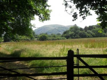
Not so distant May Hill.

My last day.  By now, looking at the map and guide book, I realised that the hill on the horizon for days is May Hill. Felt that I should get an early start to get up there before the heat notched up. Didn’t have a good night’s sleep because of street noise outside my room – the PO sorting office was next door!!! You can imagine what time they started work, so I was up early anyhow.

Lanes lead out of Newent into Acorn Woods. The undergrowth was fairly thick here particularly with nettles. As I was in shorts I developed a swashbuckling style, with my poles, to plough through these stinging plants. Very effective.

Nettle highway.

Out of the woods I came into the scattered community of Clifford’s Mesne. The most notable feature of the hamlet was the bus stop which had been decorated, presumably by the local children. Not up to Banksy’s style, but very diverting nonetheless whilst waiting for the infrequent bus.

There was a phone box nearby, how often do you use one in this mobile phone era?

Up out of the houses past the ‘gastro-pub’ the Yew Tree, of course it wouldn’t be open for anything simple like a drink. A steady rise on good paths lead up to the tree clad summit of May Hill, managed by the NT.

I was greeted on arrival by the sound of chain saws cutting down some of those distinctive trees. Red Band Needle Blight has reached the famous clump of trees, which can be seen from all over Gloucestershire. It particularly affects Corsican Pines, most of which were planted to mark Queen Victoria’s Golden Jubilee and also latterly Queen Elizabeth’s Silver Jubilee in 1977.

There are views into Wales and the Black Mountains, north to the Malverns, south down the Severn to Gloucester and round to the Cotswolds. All a bit hazy today. Came down off the hill and into the, again, scattered houses of May Hill Village and Ganders Green where there was a prominent old brick factory chimney.

I then entered the Huntley Quarry Reserve and spent some time looking at sandstone beds. These were deposited when we were in the Sahara 400 million years ago and the climate was hot and arid – a bit like today.

Ancient Sandstone.

Carried on through the trees to Huntley Church and School – both outstanding examples of Victorian Architecture. The church displays a combination of dominant sandstone and limestone on the exterior, this is reversed in the interior. There are some magnificent old Yew and Cedar trees in the churchyard.

Next door is a garden centre which importantly has a café!

After a rest and brew I was off into the fields again. Navigating was not easy with few waymarks and large fields. Didn’t look as though these paths were walked much even though I was now sharing with The Gloucester Way.

The stiles in the hedges were difficult and frustrating to find.

The railway had to be crossed and that was scary – no sooner had you stopped, looked and listened – than the train was hurtling past you.

Careful!

Now through orchards and onto the banks of the Severn. This is the longest river in Great Britain and has the highest water flow. It is along this stretch one can witness the Severn Bore, but not today.

The Severn with Gloucester in the distance.

I was content to walk a couple of miles down the river to Calcott Green and the strange Apple Tree pub, the bus stop was just across the road and I was soon in Gloucester and catching a train home.

I’ve had a great week’s walking, didn’t expect the exceptional heat, which has worn me down a bit. The Geopark Way is full of interest and covers some beautiful areas. More character than many Long-Distance walks I’ve done. Waymarking on the whole is good but sparse in some areas so that you need a good OS map. There are good overnight stops no matter what distance you are planning. The selection of beers and ciders is mind-boggling.

I would recommend this walk – give it a try.

THE GEOPARK WAY. Hollybush to Newent.

Mon 15th July.

Again was able to get an early start today, almost hijacked by my lovely Irish friend but I managed to wriggle free. Today turned into a rather frustrating walk with poor navigation on my part, blocked paths and not the best of scenery. On a long distance walk there are always one or more days not as good as the rest, they shouldn’t be taken in isolation but rather a part of the whole experience.

Paths through the woods brought me to the hamlet of Whiteleaved Oak and some pleasant properties including Cider Mill Cottage. A reminder of all the apple orchards in the area.

Cider Mill Cottage.

From here a steep!! path led up to Chase End Hill. This was a wonderful vantage point. The Cotswolds were prominent to the east and looking south was a hill even more prominent that I’d seen in the distance for a few days, recognisable from its jockey cap of trees. I could not identify it but had that sneaky feeling that I would end up climbing it, felt drawn towards it.

Wasted time on the way down the hill looking for a quarry with Pegmatite intrusions. Walked around in circles and never did find the place. Then into the Bromsberrow estate and on to the Church and Court. Both equally impressive.

The church porch proved a good shady place for a rest and drink before moving on to rather busy lanes crossing the M50. A boring and hot open section followed through crops of asparagus in acres of poly tunnels.

The workers inside did not seem to respond to my cheery hello.

Maybe a clue here –

Sign of the times

Walking on in the heat of the day I missed the odd turn or two in the fields of asparagus. But having put myself right at an identifiable house I immediately had difficulty escaping a motor bike scramble course where all waymarks and paths were obliterated. Eventually cresting a ridge in the right direction I found myself in more dense asparagus, had to almost plough through on a compass bearing! Getting hot and bothered by now and cursing landowners. There was some respite on small farm lanes until I followed a valley up to an impenetrable fence protecting vineyards.

I escaped elsewhere onto a lane which brought me to a batch of small holdings and stables back on route. In the middle of all this rural desert there was obviously more going on than I had imagined. What was I saying about small holdings?

Took to the fields again and had a leisurely few minutes watching a family of Buzzards overhead. There was a lot of loud crying going on – I think they objected to my presence. This was the best I could do against the sun.

Climbing out of the valley I was confronted by a large herd of cattle with an enormous bull in their midst. No matter what they say about bulls with other cattle I always err on the side of caution and did a small detour through someone’s garden to avoid the danger. I’ve had relatives killed by ‘friendly’ bulls, I wonder about the wisdom of any bull in a field with a public footpath in this day and age.

I’d had enough of the field paths around here so followed quiet country lanes for some distance before meeting up with an old disused canal. This was once part of the Hereford to Gloucester system. The canal towpath is still walkable and a lock and aqueduct are having some restoration work done – will need an awful lot!

Glad to arrive in Newent. First stop the convenience store for cartons of fruit juice. My hotel for the night is very central, the room is OK and the food good. But had an awful night’s sleep because of the early morning noise from the road – the PO sorting office was next door!

Next to the PO is a gold painted postbox celebrating a gold medal won in the 2012 London Olympics by local Charlotte Dujardin in the individual Equestrian Dressage. I’ve not come across one of these gold boxes before.

THE GEOPARK WAY. Colwall to Hollybush.

Sun. 14th July.

Go west young man.

Because I was in a private house B&B I managed to arrange an early breakfast at last, and a good one it turned out to be with lots of fresh fruits. Who needs a hotel? Striding down the main street I was surprised to see lots of ‘scarecrow’ figures in the front gardens. Apparently it was the annual Scarecrow Day and there was a good turn out, it’s good to see local community events happening.

Duly scared I was soon running out of the village through fields towards Colwall Church. This is a considerate farmer, well done —

Thank you!

The church is another 13th century construction of sandstone and in the grounds is 16th century half timbered hall. This was used as an ale house after the service raising money for the parish. Now there’s a good idea.

Colwall Church

and Ale House

Met a man out with his dog and no map, hoping to walk to Wellington Heath. I suggested he follow The Geopark Way waymarks. The route was more complicated than that as I found out – I never saw him again – sorry.

This one missed modernisation.

Wandered through fields of barley and then orchards as I climbed over limestone ridges. Always good views back to the Malverns.

Views back to the Malverns.

Climbed steeply up onto Oyster Hill with views to the Black mountains. Interesting summit with the trig point well below the highest point. [checked with my altimeter – 3m lower]

Oyster Hill

Not much was happening in Wellington Heath when I arrived, the pub [The Farmer’s Arms] had closed so I hurried on through the woods to Ledbury. The place was packed with day trippers to the market and those attending the Poetry Week. Dived into the first pub I came to in a narrow cobbled lane. Cool inside and a welcome ploughman’s lunch and beer.

After the worst of the heat I ventured out again, looked around the interesting but busy town.

Unusual street name.

I then climbed over two wooded ridges to reach the estate of Eastnor and what I thought was an easy walk to Hollybush. The 19th century mock sandstone castle was passed and I entered the deer park.

I had to climb another limestone ridge before dropping down to fishing lakes in the camping park area. As I approached, a fisherman was just reeling in a catch. After quite a struggle he landed a massive carp [about 15lb] – his first catch of the day – he seemed fairly pleased. I was just amazed.

Catch of the Day.

I could plainly see my next climb up to an obelisk and it still was oppressively hot.

The obelisk was erected in 1812 in memory of an Edward Somers, it stands 90 ft high. Continuing on I rejoined the southern end of The Malvern ridge and walked down to the road at Hollybush. Tonight I was booked into a bunk house, Berrow House,  and I arrived to find the place deserted but a note and key for me. I was allocated  ‘The Fold’  fortunately being a Sunday the usual youth groups were absent. Made myself comfortable with some brews and sat and watched Peregrine Falcons coming and going in the quarry across the road.

Stalag 9

The owners returned later, the southern Irish lady engaged me in conversation forever, she had mastered the art of the ‘Non sequitur’. Staggered to bed weary and slept like a log. The facilities were basic but comfortable.

Yet another day full of interest.

THE GEOPARK WAY. Alfrick to Colwall.

Sat. 13th July.

The Leigh Brook.

Up early for the best breakfast of the trip so far. Lots of fresh fruit and a perfectly cooked ‘English’. Once again the inn came up trumps and I obtained a lift back to Alfrick. Walking through fields brought me to The Knapp & Papermill gorge on the Leigh Brook [ a nature reserve.] Somebody had been before me and amazingly left all the gates open!!!  Met them on their way back, three youngsters, and they seemed unconcerned about their slovenly habits.  No wonder land owners get ruffled.

More complicated fields and diversions past posh houses brought me out near a pub on the roadside. Fairly average place, but a pint of lemonade never did anybody any harm in this heat. Leaving, after a brief stop, the Malvern Hills became more prominent and needed to be climbed.

Ever since I viewed Ken Russell’s Monitor documentary on Elgar in 1962 depicting a young Elgar riding a white pony over the Malvern Hills accompanied by his music I’ve wanted to walk these hills. Certainly picked a very hot day to do so!          Several springs lie below the hills and these gave rise to  Malvern Bottled Water. Famous for having nothing in it!!    I passed the Beauchamp Fountain whose daily out put was 10,000 gallons.

I was surprised how steep the ascent onto the Malverns was from the north end. Toiled up alongside various groups of young people, the girls naturally in high heels. These hills are Pre-Cambrian resistant volcanic rock,  granite, with dolerite intrusions visible as crags on the hillsides. There has been extensive quarrying on the lower flanks. Eventually I reached Worcester Beacon the highest point at 425m. There is a toposcope [erected 1897] highlighting the visible points from the summit. Apparently this was ‘stolen’ in 2002 but has since been replaced.

Sat looking at the rather hazy views with the temperature in the 30s. Swifts were flying low. Sounds drifted up from Malvern town below, the colleges and churches clearly visible.

The ridge southwards was a lovely stroll…

Looking south.

…and I was soon down at The Wyche cutting, the original low route through the hills before the railway tunneled below. The tunnel opened up the Colwall area for many businesses, including brick works and a bottling plant. The latter now handles 12million litres of Malvern Spring water annually. One of the ventilation towers for the railway tunnel stands by the path and apparently is home to a large colony of Horseshoe Bats. Loss of concentration at the end of a very hot and tiring day meant I added to my distance by wandering on the wrong paths in parkland.

Looking back to Worcester Beacon.

Eventually found my cosy little B&B in the village, cold shower and lots of fluids.    Went out for supper to the pub later, few people in – just too hot to bother.

THE GEOPARK WAY. Great Witley to Alfrick.

View back to Abberley church.

Frid. 12th July.

The limestone ridge was soon gained before the sun really got going. There were views back to Abberley with the church tower prominent. The ridge was mainly tree covered and I was glad of the shade. Buzzards seem very common in this part of the country and I spent some time trying to get a photo of their beautiful soaring flight. However the calm and stillness experienced on the ridge that morning watching them wheel around is difficult to describe. Nobody else about as usual.

I’ve had the same frustration with my photographic attempts of the numerous butterflies in the fields, and I must brush up my identification skills. Flowers were easier prey for me as shown by this magnificent wild rose…

‘Bull in field’ became a reality further on requiring a detour on the other side of the hedge.

I skirted Woodbury Limestone Quarry and could hear Peregrines. The vertical strata of the rock showed well and there was a large deep pool in the quarry floor. There have been several drownings this week in the area with youths cooling off in these dangerous waters.

Another shady ridge brought me down to the River Teme which was sluggish this morning at the site of an old mill. Pleasant change to be near water again although the Horse Flies were a pest.

Arrived in the village of Martley to find the Crown Inn closed but luckily the little Mace convenience store sold all I needed for dehydration and a picnic lunch in the shade. The local church of St. Paul dates from the12th century and was built from the local sandstones. Apparently the tower has a set of 6 bells from 1673 – the oldest complete peal in the country. Inside has lovely timber work and some faded medieval plaster wall paintings, some depicting animals familiar to the country folk. All this was explained by an electronic ‘listening post’ – excellent.

A rather pointless climb back up onto the ridge brought me to Ankerdine Hill, from here there were no views because of tree growth despite being shown on the OS as an all round viewpoint. Felt a bit frustrated with all the climbing to no avail in this heat. Soon down to Knightwick where my B&B was situated, The Talbot Inn. Arrived early and as tomorrow would be a long day decided to do a few more miles today. The kindly bar lady at the inn gave me a lift to the next village of Alfrick and I walked back through orchards and hop fields by the river Teme, to arrive in time to buy her a drink before she went off duty. Cheers Sue.

Hop plants.

There are some expensive looking houses in the area, some even being converted hop kilns. Quintessentially old English.

 A lovely evening was passed outside over a light supper and the beers [THIS, THAT and T’OTHER] produced at the Talbot Inn from the local hops.

The Talbot Inn.

THE GEOPARK WAY. Bewdley to Great Witley.

The River Severn.

Thur. 11th July.

Looking to make life easier in this heat I decided to use The Severn Way from Bewdley to Stourport instead of the more tortuous Geopark. At least it being a named trail along the river there should be no problem with overgrown paths.

The waymarking on the Geopark Way  has been good to sporadic and a careful reading of the guide along with the OS maps is needed to follow it easily. The logo on the waymarks is a stylised image of a trilobite fossil from the Silurian Period, I never found one [a fossil that is] on the way.

A quiet stroll along the river, with few people about but lots of semi residential caravan parks in close proximity. This area is the escape route from the midlands. Green woodpeckers were flying from tree to tree. Soon I was walking into Stourport where The Staffordshire and Worcester Canal  [1771 – James Brindle] appears joining the Mersey and the Trent to the Severn. This canal and its extensive basins established Stourport as a major port, making Bewdley redundant. Sarsons Vinegar was one of the industries benefiting from it. It was fascinating to wander around the old basins with their present day boats and the associated warehouses all connected by a complicated series of locks. Genuine industrial heritage.

But why, oh, why Stourport have you allowed one of the basins in the middle of all this heritage to be used as Treasure Island Pleasure Park? I’m not snobbish about these places but surely there was somewhere else to locate it!!!

Made a hurried retreat across the river to escape [what must it be like in the school holidays] Along the river bank you come across Redstone Rock, a soft sandstone cliff that has been excavated in the past, 16th century, to create an hermitage. Unfortunately you can’t gain access to the interior now.

Redstone hermitage.

Moving away from the river I seemed to go astray but found myself on a minor road that led to Larford Lake, a popular commercial fishery which looked very attractive with its water lily beds. Not bad for 10 quid a day.

I was getting hot and tired by now and glad to reach and follow the river bank to arrive at The Hampstall Inn at The Burt. A pleasant place on the riverside. Further on the route followed a side stream, Dick’s Brook, hard to believe this had once been navigable, as a canal with locks, to an iron furnace and forge.

Dick’s Brook.

Continuing in the same line I arrived at the retreat of Glasshampton Monastery which was originally the stables of the manor which was burnt down twice. Careless!

Glasshampton monastery.

Across the hillside could be seen the church of St. Peter’s at Astley. This proved to be of great interest with a lovely sandstone exterior and an interior with many religious relics.

Tombs of the Blounts.

Interesting barrier at the church gate – didn’t have time to wait till evening.

From Astley steady climbing in the heat of the afternoon gained the ridge of Abberley Hill at the limestone quarry of Shavers End. It was not possible to see directly into this quarry and as there seemed to be some police activity in the area I continued on along the way below the ridge. I was climbing up and down in trees most of the way so views were limited and orientation difficult. I knew I had to leave the ridge before the end to reach my, off route, evening destination. With a maize of paths to choose from I was lucky to choose one that descended out of the woods into open fields. From on high I got my first glimpse of the Malvern Hills and also the continuation of today’s ridge for the morning.

Distant Malverns.

The fields luckily led directly down to the road at my hotel – The Hundred House. This place was rather behind the times but my room was comfy, the food good and the staff friendly. The hotel needs some care and attention -but that costs money. The hotel name dates from centuries ago when  the building was used as the collecting house for the tithes gathered from 100 districts in the county.

In the bar at night got chatting to a visiting worker who turned out to have a house in the Lot Valley in France from which I’d just returned. [see post]
Remarkably we knew a lot of mutual friends from the area and share a love of our favourite café in Duravel.  Small world!

The Hundred House.

A long but interesting day.

THE GEOPARK WAY. Highley to Bewdley.

Wed. 10th July.

Shared a breakfast table with overnighting fishermen who were not catching anything because of the heat. They were taking the day off and having a trip on The Severn Valley steam train, for a while I even contemplated the day’s journey using the same means. Made of stronger [read stupider] character I set off with large reserves of water, steeply, up past the authentic looking Highley station, that takes those of a certain age back in time! Note the platform ticket machine.

Highley station Severn Valley Railway.

On through the site of the old Highley coal mines. This area has been expertly transformed into a local country park with several reminders of its heritage.

The morning was getting hotter by the minute, so I was glad of a shady walk following an old colliery railway along a valley. The whole area is scattered with industrial relics. Stopped to talk to a gentleman walking in the opposite direction, it turned out he had been a coal miner in the Highley pits. Fascinating encounter, he had left the mines in 1962 as the coal dust was getting on his lungs. He remembered following seams of coal only for them to disappear in a fault. He described going down the mines on the Alveley site [east] and coming under the Severn into the Highley [west] system. He also remembered several deaths due to tunnel collapses. He was 74 and most interested in the detailed mining information in my guide book.      The mines closed in 1969.

Came out onto the road near Ray’s Farm attraction, which offered refreshments. Enjoyed a coffee whilst watching the local school kids coming close to nature – a few goats and chickens.

Today’s walk was quite long and tortuous, so I decided to save a couple of miles on a shortcut down a lane and then through fields. Things didn’t work out too well as the footpaths were overgrown and almost impassable, also I got lost and ended up bushwhacking and cursing across fields and fences to escape. Shortcuts don’t work! Not many people come this way. Not a good plan on these hot and sweaty days…

…lost…

… no wonder my hayfever was playing up!

Eventually sorted myself out and came onto the road right next to the Eagle and Serpent pub. Not a name I’d come across before.

Not a very inspiring pub but a half of beer and a pint of lemonade were to become the norm on this overheated trip. There does seem to be an awful lot of local breweries producing decent beers in this area – see later re. hop fields.

More wading through crops [actually quiet a lot] but through beautiful countryside…

… brought me into The Wyre Forest.

This turned out to be one of the most memorable sections of the walk. This is  a great recreational area. It served as a royal hunting ground in medieval times, then its timbers were valued by the ship builders. In the 17 -18th centuries the wood provided fuel for the local iron forges as well as besom and basket making. It is one of the most important ancient woodlands in the country. I loved the variety of trees.

A highlight was walking along the Dowles Brook – I spotted kingfishers, dippers, herons, wagtails and woodpeckers along with buzzards and red kites above. Managed a picture of the Dipper but what  chance the Kingfisher?

Dipper mid-stream.

Further along was an old semi-preserved flour mill, apparently there were previously several along this stretch.

The afternoon wore on in oppressive heat, I joined the River Seven again for the last mile into Bewdley. This stretch of path coincided with The Worcester Way and I could hear the whistles from the steam trains on the other bank. This attractive town on the banks of the river was once an important port and there are many fine Georgian buildings. Today it was overrun with tourists enjoying the fine weather.

I enjoyed a pleasant old fashioned friendly B&B up in the old town. [Bank House]

An interesting way to advertise the ales of the local brewery

THE GEOPARK WAY. Bridgnorth to Highley.

The Geopark Way is a semi-waymarked 109 mile walk through the heart of the Abberley and Malvern hills, from Bridgnorth in the north to Gloucester in the south. The guide book has been written not only to allow you to follow the way but also to explain in detail the geology of 700 million years that you pass over. So there are Sandstone, Limestone , Volcanic and the Metamorphic rocks.  Geology lesson over.

Tues 9th July.

The bus from Wolverhampton to Bridgnorth was packed with concessionary travel carded trippers. Local knowledge gained from my fellow passenger allowed me to alight from the bus at the top of the Medieval town. First stop, the castle remains …

The keep leans at an unlikely 15 degrees. behind is a church designed by Thomas Telford in 1792. There is a confusion of steps leading down to the lower town on the Severn or you could take the only inland funicular railway.

Found a great little cafe for a brew and a light lunch,  Olive’s Cafe by the the bridge over the Severn. A pleasant alternative to the organic cafes and wine bars  prevalent all around. Olive was quiet chatty and informative. Every one around here seems to have a friendly Brummy accent – lovely.

The walking started seriously as the heat of the afternoon built up, this was to be the pattern for the next week’s heat wave.  Mainly dog walkers and the occasional fisherman encounted on this stretch of the River Severn.

  Coming away from the river and into the woodland of Dudmaston Estate was a delight. Here  because of enlightened planting a hundred years ago there is a wonderful mix of trees now manged by the NT.

 Particularly impressive are the ancient chestnuts.

 Whatever the tree I was glad of the shade.   Arriving at Dudmaston Hall I realized I’d forgotten my NT card so couldn’t gain entry to the gardens and more importantly the cafe. Had to make do with a bottle of ‘Dandelion and Burdock’ purchased from the kiosk. Very refreshing – as many of my drink stops prove in this hottest week of the year.

A  walk along The Long Covert brings one to Hampton Loade  [ferry] where the foot ferry doesn’t seem to be in operation.

From here I climbed up the sandstone ridge to the village of Alveley and the friendly  Three Horse Shoe pub for further refreshment. This area is the site of extensive coal mining in the 20th century. The path I followed down to the river was the line of the coal tramway to link up with the railway on the north side of the Severn. All day I could hear the whistling steam trains on the preserved Severn Valley Railway but I never coincided for a picture. Likewise I could hear deer in the forests but never saw any. A delightful path led along the river to emerge at the Ship Inn, my accommodation for the night.

The Ship Inn.

In the past this Inn was always popular with coalminers and day trippers from Birmingham. Now it is a destination for the well healed and the local fishermen. It proved to be an excellent overnight stop.