I was just recovering from a delayed late flight back from Gran Canaria when Sir Hugh suggested that tomorrow, Wednesday, is the only good day in all this awful weather. [I’m a few days behind] So on a bright and cool morning we are parked above Windermere and setting off on a simple circuit of School Knott hills and Brant Fell. Knott is a Cumbrian word simply meaning hill. This morning this area seemed very popular mainly, or rather exclusively, with dog walkers. On the first summit overlooking Windermere, School Knott 232m, we met a local dog walker very proud of his area and yet he had never been to our second summit 1/2 a mile away. We did however and Grandsire, 251m, was a splendid rocky perch with views up into snowy Coniston, Langdale, the Helvellyn and the High Street ranges. We cut back to Cleabarrow Hill 247m and climbed a wall to the highest rocky point. Retracing our steps we picked up the Dales Way, which I walked in Nov. 1981. This took us via several small tarns, not marked on my ancient map, through the well-kept estate of Matson Ground. All the properties being painted blue. We gained the open hillside and climbed to Brant Fell, 192m. On top of this prominence are the remnants of a summer house! Some iron railings and stone gate posts are all that survive. What a great lunch spot in the sun overlooking Windermere. Then we dropped down to the inferior Post Knott viewpoint, the bench was occupied! Paths on the edge of Bowness soon brought us back to the car. Sir Hugh was right this was the best day of the week if not the year.

Windermere and Langdale Pikes from School Knott.

Grandfather striding out to Grandsire.

Onwards to Cleabarrow.

Manicured Matson.

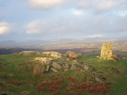
Lower reaches of Windermere from Brant Fell.

Post Knott.