
Worsthorne to Portsmouth.
Rain all morning, once again the summer weather had conspired against me but rather than be inactive I opted for another short stage. My lunchtime arrival in Worsthorne coincided with a brightening but showers were still in the air, however I didn’t need waterproofs for the rest of the day. A flagged path across a field took me into Hurstwood described as a delightful Elizabethan village with attractive buildings – most seemed to be under renovation at present so I didn’t dally. 

 A lane crossed the infant River Brun which I had come across a couple of days ago in Burnley centre. The now cobbled lane passed isolated farmhouses onto the moor, I pondered on the man-hours needed to construct these old highways. Dropping down into Shebden Valley the reason for the lane became apparent – an extensive area of quarrying. Apparently this was for limestone extraction using hushes and what remained was piles of unwanted stone, the sheddings. I joined The Pennine Bridleway at the bridge but for some reason I was directed to a smaller path into the workings, this soon became indistinct and my wanderings were more and more erratic until I hit the Long Causeway road. [Stay on the bridleway!]
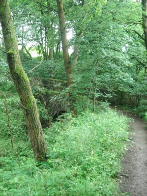

 This straight road possibly dates back to the Romans and was used as a packhorse trail in the 18th century. It is characterised now by the Coal Clough Windfarm which it runs alongside, I remember this as one of the first in this area. From up here Pendle dominated the skyline to the north. At a corner a farm track continues on the original line and I just followed this although the footpath supposedly takes to the field. Another isolated farm is passed and a lovely little building which would make a good bothy but more likely an expensive holiday cottage.


The path traverses above a wild clough and passes through plantations which are part of The Forest of Burnley a lottery funded scheme to create new forest around the area, I had noticed secveral others on these walks. Pathfinding through the new plantations is not always easy and waymarking could have better. I found myself on the top of a gritstone cliff, Pudsey Crag according to the map, a diversion was taken to view it from the valley. It looked worthy of climbing but is apparently out of bounds on private land. 


 Deep wooded cloughs are entered as one progresses towards the Cliviger Gorge, occasional cottages appear out of nowhere – this is a secret place. Coming out of one of the cloughs towards Brown Birks farm I was confronted by a large brown bull right on the track, I was so overawed I didn’t even get a picture. Backtracking I picked up another footpath circumnavigating the field and with a bit of ingenuity safely avoided the bovine obstacle. I was now dropping into Cliviger Gorge and looking at the climb out on the otherside which will start my next stage. Looking down were the back to back terraces of mill villages Cornholme and Portsmouth.


 I jumped on the bus to take my me back to Burnley but found it pulled off the main road to visit some smaller villages and I surprisingly saw I was only a mile from my start so I was dropped off and walked into Worsthorne. Another day of discovery.

Not sure about your logistics. Are you going home after each section?
There’s a clue in the next post, coming soon.