Category Archives: St. Cuthbert’s Way.

A WEE DONDER* a walk from the Southern Upland to the West Highland Way.

Innerleithen to Milngavie.

I finished the Pennine Way at Kirk Yetholm 50 years ago and started the West Highland Way in Milngavie 15years later. So as part of my humble protracted Lands End – John o’Groats I could fill that gap.  I’ve done K.Yetholm to Melrose on St. Cuthbert’s Way, and Melrose to Innerleithen on Southern Upland Way so I’m left with Innerleithen to Milngavie. Out with the maps and I realise by a combination of old railways and riverside paths I could have an easy week’s  walking. I’ve called it the Lanarkshire Link.

That highlighted a problem as rights of way are not shown on the OS maps of Scotland. There is no definitive map of rights of way as there is in England and Wales and no single place on the web where you can find out about them. Paths are marked with black dotted lines but that is no indication of whether they are passable. Finding out about footpaths through Scotways [Scottish Rights Of Way & Access Society] is cumbersome for a non local so we will just have to see how things work out on the ground. Interestingly ‘rights of way’ in Scotland can be lost if there is no evidence of their use over 20 years which seems heavily biased towards the landlords.

I happened to mention my plans to JD, of Canary Island GR131 fame, who jumped at the chance of a bit of exercise and within hours he’d booked a train heading north. Cost less than £15 for Preston to Galashiels via Edinburgh.  Finding accommodation in the various villages en-route wasn’t too big a problem although that will be more expensive.

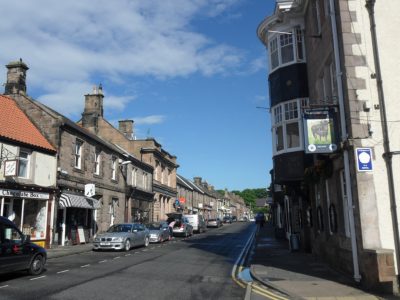
So we found ourselves on an afternoon bus from Galashiels asking for a ticket to  Innerleithen, which we couldn’t pronounce. Even in the Borders the Scottish accent is going to be a problem.


*
DonderTo walk in a slow and carefree manner, not really concerned with how long it takes to arrive at one’s destination. Scottish slang.

That is a good maxim to follow.


ST. CUTHBERT’S WAY – THE END ALMOST.

                                                          Detchant – The Causeway.

                                                     View of Lindisfarne.

Yet another lift this morning – back to Detchant to rejoin the way. Sunny again. With views over the coast we walked along the ridge and then into the woods, lovely mixed woodland. This area seems to be popular as the tracks were very muddy, the worst on the trip. The pleasant rural scenery however made up for it . The village of Fenwick was passed without much fuss and then the busy A1 crossed back to quiet lanes. We started to meet several SCW walkers going E to W, they had crossed the causeway before the tide encroached. Crossing the main East Coast Railway line involved phoning the signalman to check no trains were coming – they approach at great speed.

just a blur!

Our next hazard was a great big bull in a field, quickly passed!  Safely at the coast there were reminders of our WW2 defences, concrete blocks to make landing difficult, fortunately never needed. The low lying seaward land was a sea of thrift.  We knew the tides were against us today so a walk onto Lindisfarne awaits another time. [like the look of The Northumberland Coastal Path] All we had to do was dip our toes in the sea and phone a taxi to whisk us to Berwick, a quick lunchtime Chinese and the train home.                                                           Croft Cabs to the rescue.

So another LDW completed. I would certainly recommend St. Cuthbert’s Way, easily accomplished with good paths through beautiful scenery.

ST. CUTHBERT’S WAY – CAUGHT IN THE RAIN.

                                                             Wooler – Detchant.

                        Approaching storm over the Cheviots.

An early breakfast meant we got away in good time with a mixed forecast for the day. A long rising road took us out of Wooler and on to Weetwood Moor, a large open space above the town. Luckily the council team were out ahead of us strimming the weeds and bracken. Dropping down at the far end we had a good view of the 16th century elaborate Weetwood Bridge over the River Till which we crossed to follow lanes to the Horton Farms. Seen in the photo winding up the hill. This is a thriving agricultural area and the farmers were out cutting the grass, thus aggravating my hayfever. According to local legend, the young St. Cuthbert tended sheep hereabouts. A fallow deer was spotted jumping through the grass. A drink/snack stop was taken on an old sandstone wall by old agricultural workers cottages. As soon as we left the heavy rain started with thunder in the air. Waterproofs on, we trudged along quiet lanes for about 3miles, there was very little shelter. Fortunately, as we took to the fields again the rain stopped and as we approached the rocky escarpment ahead the sun reappeared. I’ve visited this area in the past climbing at Bowden and Kyloe, well-known sandstone crags. Today we were looking for St. Cuthbert’s cave hidden in the woods. This is an overhanging sandstone cave where the monks fleeing from Lindisfarne perhaps rested with St. Cuthbert’s remains, AD875. It made a good rest stop for us looking out over the Cheviots. Climbing above it to a rocky tor gave even better views, now including the coast with Lindisfarne, The Farne Isles and Bamburgh Castle. And ‘they’ want to build a wind-farm here!  I’m totally p….. o.. with our so-called planning departments at the moment, it seems to be a free for all for the developers.

Distant Lindisfarne.

We left the way at Detchant to spend the night in Belford a pleasant market town on the old A1 road.


ST. CUTHBERT’S WAY – THE CHEVIOTS Part 2.

                                                             Kirknewton – Wooler.

The return up the lane to rejoin our route seemed easy this morning – in our hostess’s car!  She told us to look out for feral goats on the slopes of Yeavering Bell as we passed by, we saw none but there was a buzzard above and a kestrel hovering. The hilltop of Yeavering Bell, 361m, is encircled by a pre-historic stone wall clearly visible from a distance. The remains of many stone huts are to be found inside the hillfort. Shame we didn’t have the time or energy to visit. We reached the col between Yeavering Bell and Hare Law relatively easily and the visibility was good. At some point we must have entered The Northumberland National Park as new signs appeared depicting the elegant, and in these parts boisterous, Curlew.Open moorland walking was a delight today though at times boggy. We made the small diversion up to the trig point of Gains Law 319m for a snack stop and a chance to survey the Cheviots. The Cheviot summit at 815m seemed to overshadow everything else. Nearly every hill in the vicinity seemed to have a hill fort. Also In this area of moorland are some impressive examples of glacial meltwater channels. Soon the town of Wooler was spread out below us, but it took some time to reach. We dropped into woodland and a country park on the edge of the town, but then the way took us up in an arc into more forest before eventually following lanes to the main street of Wooler, a traditional market town. A welcome café on the corner of the High Street was our first point of call, The Terrace Café. Our B&B in the High Street was previously a bank with the manager’s living quarters above – lovely large rooms. A curry and some local beer were consumed.

ST. CUTHBERT’S WAY – THE CHEVIOTS Part 1.

                                                       Town Yetholm – KIrknewton.

This morning’s walk through Kirk Yetholm onto the Pennine Way was nostalgic as we had walked the PW together in 1965 but didn’t quite finish it, we cut off to Wooler to catch a bus. So today we were completing. The PW finishing in Kirk Yetholm must have helped this tiny hamlet’s economy, there are several B&Bs and The Border Hotel. We were too early to meet any Pennine Wayfarers on their last leg [or legs]. There was a collection of worn boots outside one house. You can just imagine their owners saying never again.

St. Cuthbert’s Way leaves the PW after a mile or so and winds its way to cross the border into England high on the moors. The trail is well used but not badly eroded. Before long we were coming down into another valley. A dark pine plantation we walked through had a very spooky feeling to it – other walkers we met later had experienced the same.

A remote farm was passed followed by a long walk down the Elsdon lane to Hethpool. This hamlet consists of a house, a farm and a row of associated cottages. These are executed in the Arts and Craft style and considered to be amongst the finest examples of such dwellings to be seen anywhere in Northumberland. A good spot for a lunch break in the sun.

There were good views up the College Valley into the heart of the Cheviots.

After crossing The College Burn we turned East on the slopes of Hare Law and gradually ascended to a remote shepherds cottage, Torleehouse.  Ahead we could see a monument on Lanton Hill for Alexander Davison who was Chandler to Horatio Nelson at the Battle of Trafalgar, an unsung hero. Here we left the way for a stroll down the lane to our superb B&B at Old Yeavering cottage.

ST. CUTHBERT’S WAY – THE HIGHEST POINT.

                                                    Morebattle – Town Yetholm.

We were heading into the Cheviots today. Chatting to a farmer, on the lane into the hills, he said he had over 1000 cattle in the fields, I cannot imagine how many sheep and lambs are at loose. Lapwings and cuckoos gave call and a buzzard quartered overhead. The way up was steep and direct  but soon we were  enjoying a snack, sheltered behind a wall from the wind, on the aptly named Wideopen Hill 368m. As well as being the highest point on St. Cuthberts Way it is also half way from Melrose to Lindisfarne. We were surrounded by hills, Horse riders made a dramatic appearance on the skyline. Morebattle was far below and the Yetholms visible ahead in the next valley.The forecast was for thunder storms in the afternoon so we didn’t hang around long. a good ridge walk eventually brought us down onto lanes leading into Town Yetholm. A few thatched cottages still exist here and the shop was luckily open when we arrived. Our pub for the night, The Plough, was on the village green. We were safely into our first pint when the storm started outside.

ST. CUTHBERT’S WAY – THE SUN’S OUT.

Mounthooly – Morebattle.

A very peaceful night in the cottage and breakfast without the dogs. We never seem to get away much before 9.30am but the day is not arduous and we have time to explore. The waymarking has been so good we have hardly had to consult map or guide.

The amazing change in the weather after the rain of the last couple of days. Bright sunshine and warm from the start. Dispensed with the major uphill in the first mile or so climbing on Dere Street, Undulating sandstone ridges and valleys were then the nature of the day. This gave delightful countryside walking on a summer’s day.

We met few people out and about, today a couple from the states walking StCW as part of their Scotland tour.

We had our first clear views of The Cheviot Hills as we progressed towards the farming community of Cessford. In the past these farms must have employed a small army as each one has numerous workers’ cottages on site. Now vast fields of wheat and barley are harvested by monster machines.

The next attraction was the ruin of the 15th century, Cessford Castle, on its fortified hill. The borders were a battlefield for many years. The castle emitted solidarity and the beautiful red stone shone in the sunshine. Very impressive.

Lane walking took us into Morebattle and our convivial pub for the night.

ST. CUTHBERT’S WAY – DAY TWO.

St. Boswells – Mounthooly.     


Our lovely hosts gave us a lift to the bridge on the Tweed where we left off yesterday.

Forgot to mention in the last post that I’m with my mate Mel from school days, we meet up for a long-distance walk every year — though these are getting shorter.

With all the rain in the night the river was running a good foot higher and the paths muddy but the morning was dry and the day remained so, only just!

Good progress was made along the river bank. We met a version of Two Blondes Walking   [if you know the reference!]  with a group of primary school kids. There was lots of interest along the way — particularly the pumping station up to an old house. To save the maids carrying the water up they had installed a pumping station using mule power in the upper room. The water from the spring looked crystal clear. Climbing slightly away from the river we came to the hamlet of  Maxton, a cluster of typical Scottish workers’ cottages. We reached the start of a few miles along the line of the Roman Dere Street. At its highest point, there is a stone commemorating The Battle Of Ancrum fought here in 1544 and the mythical Lilliard –                                                                                                                                                           Fair maiden Lilliard
lies under this stane
little was her stature
but muckle was her fame
upon the English loons
she laid monie thumps
and when her legs were cuttit off
she fought upon her stumps.
We had good views back to yesterday’s Eildon Hills, in fact, they remained in the background for several more days. Relief came at the end of this as we dropped into the forest and the lovely Birdhouse Café in the atmospheric Woodside walled garden, This is how cafés should be — walker-friendly, warm and comfy, relaxed atmosphere and excellent fare. Would be perfect on a sunny day with its outside seating. A stretch of walking by the River Teviot provided a pleasant end to the day. Our B&B spot was something from the past with an enthusiastic hostess, countless dogs and no hope for any hotel inspector. Suited us fine.

ST.CUTHBERT’S WAY – A WET START.

                                                            Misty Eildon Hills.

 Melrose – St. Boswells.

The walk is named after Cuthbert a 7th-century saint, a native of the Borders who spent his life in the service of the church. He began his work at Melrose Abbey. He achieved the status of Bishop and when he died he was buried on Holy Island.

We enjoyed a beautiful sunny evening in Melrose, a great little town with it’s Abbey and the main street full of interesting shops and pubs. There was an interesting clock in the main street with an inscription to a past worthy GP,  why have I not achieved this status?

                                                                                                                                                                                  The next morning we woke to the sound of rain and it was to stay with us all day. Full of a full Scottish breakfast, having picked up The St. Cuthbert waymarks, we tackled the steep climb up into The Eildon Hills on a muddy path through the gorse.

They like to keep Melrose clean and tidy – a sign on leaving the village…..

At the col in the hills we spared ourselves the climb up to the higher top and its view-marker – there were no views.

Down the other side damp woodlands and lanes took us to the Dryburgh Arms in Newton St. Boswells for refreshment and respite from the rain. A decision was made to use the afternoon and walk the next three miles along the bank of the River Tweed and shorten tomorrow’s section. This proved to be a delight. Sand Martins were prolific catching insects above the water. The fly fishermen were having less success with the Salmon.

The River Tweed.

Using the excellent local bus service we were soon back in St. Boswells and our B&B. We made the mistake of ordering a Chinese takeaway, delivered, it was dire but we escaped any subsequent ‘problems’.