Tag Archives: The Clyde Walkway

A WEE DONDER. 7 Uddingston to Glasgow.

The Clyde enters the big city.

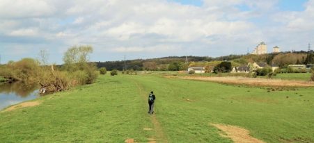
The trains were back to normal this morning and we had a quick journey back to Uddingston. We dropped down to the Clyde and crossed a pedestrian bridge but immediately we were taken away from the river on undulating paths and roads through what looked like old mining or industrial areas which are slowly being developed with housing estates. Not particularly attractive. We eventually rejoined the Clyde near an abandoned railway bridge just upstream from an attractive weir, I think we were in Carmyle.  Somewhere along here was the stork’s nest on a lamppost. One benefit of the urbanity was a nearby supermarket whose well known value cafe we visited for morning tea and snacks. 

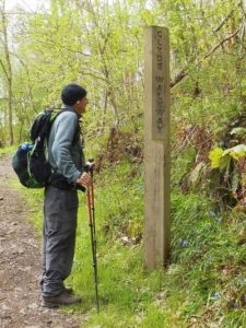
We crossed another old railway bridge onto the north bank of the river where we remained all day. On this side we came across new signs which detailed the route in minutes. The M74 was ducked under and then there were surprising stretches of pleasant countryside as well as modern housing. Somewhere we passed near by Parkhead and Celtic Park the home of Celtic FC.

Along here we were brought into conversation with [accosted by]  a well known Glaswegian on a bike with his dog. Tales of the slums of Glasgow,  a Barras stallholder, working with the London privileged in the 60’s [he showed us the scar on his hand from a bite from Christine Keeler’s dog!!] some sort of ongoing protest about a drugs/jewellery raid on his house many years ago and his subsequent life as an artist. James Donnelly, all is documented on the internet. For a flavour watch …

Anyhow onwards around a towering wall hiding old water treatment works. The cycle way we were sharing became busier with families out cycling and we spent a lot of time dodging bikes. Now into the parkland of Glasgow Green which houses the Peoples Palace Winter Garden glasshouse and Templeton’ s Carpet Factory brick facade. Through the park, today busy with families, is an obelisk built to honour Horatio Nelson.

Bridges come thick and fast now as we approach the centre. across the way was once the infamous Gorbals tenements. The route stays alongside the Clyde all the way but mostly with a busy road adjacent so there are no riverside developments or cafes to enjoy. Having just returned from the Thames Path through London I feel Glasgow has missed a trick. We could have easily diverted into the busy centre of Glasgow and all its historic buildings. The river also seems to lack any boat traffic.

The most interesting section on the river is the Exhibition Area in the west. Lots of modern designs are highlighted in this area as well as restored dock side relics. There is the Finnieston Crane and on either side of the river Rotunda which once housed lifting equipment for the passenger tunnel, closed in 1980.  The old tower and pump-house has been converted into a distillery. On the far bank is the BBC Studios, a science museum and an old paddle steamer.

This all culminates at the Riverside Museum with its Tall Ship alongside.

It is here where the Clyde Walkway finishes and the River Kelvin enters the Clyde. Tomorrow we will follow that river to Milngavie to complete our week.

*****

We could have been singing this as we walked the last few days. All together now –

*****

A WEE DONDER. 6 Dalserf to Uddingston.

On and off the Clyde.

There were two obstacles today: the large towns of Motherwell and Hamilton straddling the Clyde and a complicated motorway system where I had read that it may be necessary to catch a bus around major roadworks. We found more problems in the streets of Blantyre.

From our morning bus we recrossed Garrion Bridge and sped up the hectic road to seek The Clyde Walkway going off down a lane. it wasn’t signed, waymarks and posts have a mysterious habit of disappearing from roads. The traffic noise faded and soon we were in beautiful woodland and showing our, or at least my, lack of knowledge at tree identification.

We continued to see a garlic-like plant we had noticed for the last few days growing prolifically in the shade alongside the river, it looked introduced and invasive. Research showed it to be the Few-flowered Garlic, Allium paradoxum, which we had never seen before and is obviously a nuisance. I have in my garden the bluebell like Three-cornered Garlic Allium triquetrum a similarly invasive species which although attractive I am constantly battling with.

Most of our walk along the Clyde here was on a flood plain with lots of evidence of previous high waters, there were in fact signed alternatives for when the river was high. On the hill above us were high rise flats in the vicinity of Motherwell, are these the ones you see driving north on the motorway? But generally the towns had little impact on the walk. All seemed rural and peaceful especially looking back to our old friend Tinto Hill.

Around us was the old Hamilton Estate but to be honest we didn’t see any of the remaining ruins. If we had had more time it would have been interesting to explore some of the obviously popular paths around Dalzell House in the estate. There was a nature reserve, Barons Haugh, with observation hides over the marshes but without binoculars all we could see were the flats.

The  railway Ross Viaduct was a landmark high above us.

Heading for Strathclyde Loch and Country Park. we could hear it before we saw it. One minute this…

…the next this.

The boom boom of loudspeakers was an intrusive element of the day and totally unnecessary in a ‘country park’ but it was good to see people out enjoying themselves. We followed the masses alongside the artificial loch which was centrepiece for the 2014 Commonwealth Games water sports venue.

At the North end of the loch the River Clyde had disappeared somewhere and we ended up on roads to a restaurant at the Innkeepers Lodge where we enjoyed a coffee in the sun and discussed our options for onward travel. The bus transfer was still advertised but the new pedestrian bridges and walkways through the motorway complexes had literally just been opened days before so we followed our noses on a carousel of paths. I’m not sure what we crossed over or where we ended up but the Bothwell Bridge over the Clyde appeared  and at its far side a way-post down to the river path. Unfortunately this didn’t last long and soon we were back up on the roadside following our instincts. This we did through a good part of Blantyre urban area. A cyclist approached us looking for a cycle shop to buy inner tubes, he’d had a lot of punctures. We couldn’t help which was a shame as he also was on a LEJG journey. We eventually realised we must have missed something so before entering a huge shopping complex decided to strike off down a side street and under the railway to luckily join up with Clyde Walkway on a newly surfaced path which had come from we know not where.

Soon we were at The David Livingstone Centre. This includes the listed building of his birth, surrounding parkland, and a 3,000 piece David Livingstone collection. We managed unintentionally to miss it all, I presume it may have been closed.

An elegant iron cantilevered suspension bridge, built in 1952 but rebuilt more recently in 2000,  took us onto the north bank of the Clyde for our final stretch. And what a delightful stretch. woodland, bluebells, sparkling river, dippers and a kingfisher. Suddenly ahead up in the tree covered banks was a red sandstone castle looking impregnable. Boswell castle was started in the 13th century and played a major roll in the Scottish Wars of Independence.

We diverted off the route into a place named Uddingston to find the station only to find no trains running but there was a replacement bus which eventually arrived and took us into Glasgow for our two nights of accommodation.

*****

A WEE DONDER* a walk from the Southern Upland to the West Highland Way.

Innerleithen to Milngavie.

I finished the Pennine Way at Kirk Yetholm 50 years ago and started the West Highland Way in Milngavie 15years later. So as part of my humble protracted Lands End – John o’Groats I could fill that gap.  I’ve done K.Yetholm to Melrose on St. Cuthbert’s Way, and Melrose to Innerleithen on Southern Upland Way so I’m left with Innerleithen to Milngavie. Out with the maps and I realise by a combination of old railways and riverside paths I could have an easy week’s  walking. I’ve called it the Lanarkshire Link.

That highlighted a problem as rights of way are not shown on the OS maps of Scotland. There is no definitive map of rights of way as there is in England and Wales and no single place on the web where you can find out about them. Paths are marked with black dotted lines but that is no indication of whether they are passable. Finding out about footpaths through Scotways [Scottish Rights Of Way & Access Society] is cumbersome for a non local so we will just have to see how things work out on the ground. Interestingly ‘rights of way’ in Scotland can be lost if there is no evidence of their use over 20 years which seems heavily biased towards the landlords.

I happened to mention my plans to JD, of Canary Island GR131 fame, who jumped at the chance of a bit of exercise and within hours he’d booked a train heading north. Cost less than £15 for Preston to Galashiels via Edinburgh.  Finding accommodation in the various villages en-route wasn’t too big a problem although that will be more expensive.

So we found ourselves on an afternoon bus from Galashiels asking for a ticket to  Innerleithen, which we couldn’t pronounce. Even in the Borders the Scottish accent is going to be a problem.


*
DonderTo walk in a slow and carefree manner, not really concerned with how long it takes to arrive at one’s destination. Scottish slang.

That is a good maxim to follow.


A WEE DONDER. 5 Lanark to Dalserf.

The Clyde Walkway through the ‘orchards of Scotland’

We were on a roll now as there was a waymarked trail, The Clyde Walkway, it was signed from Lanark’s centre. We even had a useful app for the phone giving directions and points of interest. For a change it was warm and sunny. After a brief section by the river out of Lanark we had to cross over and follow the road through Kirkfieldbank before a lane led to a barrage at Stonebyres power station and a decent riverside path. The fourth of the Clyde Falls was downstream but we didn’t have a good view because of the tree foliage which is in its full flush of green.

Gentle strolling through open countryside along the banks of the river felt right for the warmer weather we were enjoying.

Are we in the wrong field?

Approaching Crossford there was extensive housing development near old properties of the Carfin Estate, looked like it would be a gated estate. This estate in the 19th century was extensive with orchards and gardens. Their old Iron Bridge across the Clyde was closed for repairs. We came out at the elegant stone road bridge just as an MG sports car rally drove across. The pub was closed and asking a local about a cafe suggested there was one close-by but after walking half a mile back towards Lanark we gave up and sat on a park bench with a banana and water – far healthier.

Where’s the cafe?
Oh and have you seen any MG’s?

The fields onwards were famous at one time for orchards and on the opposite bank were several garden centres doing a roaring trade. If we had been more observant we might have spotted an occasional apple tree. To give variety we had some ups and downs through woods on the Milton Lockhart estate.

More people were met as we neared the road, families out enjoying the sunshine. Two backpackers stopped to chat, they were from Manchester and doing a Dover to Cape Wrath journey! They quickly disappeared into the distance.

Off to Cape Wrath.

I meant to say that the Clyde Walkway markers had taken on Brobdingnagian proportions [word of the day]

Ahead was Mauldslie Bridge which with it’s elaborate gatehouse used to form the entrance to one of Lanarkshire’s oldest hunting estates.

Again across the river was sighted Dalserf church with its unusual clock tower. A ferry once operated across the Clyde at Dalserf, although this has long since been superseded by the nearby Garrion bridge.

We meandered with the Clyde and suddenly popped out onto a very busy road. This is where we diverted for our bus stop, walking thankfully down a pavement as the traffic hurtled by. The complicated two bridge roundabout at Garrion was traffic hell.

Stood in no-mans land at a solitary bus stop is a sobering experience: is the bus running today? did I read the time table correctly? how do I get a taxi?

Anyhow we made it back to Lanark and a good Italian meal.

*****


A WEE DONDER. 4 Carmichael to Lanark.

The Carmichael Estate, The Falls of Clyde and New Lanark – interest throughout the day.

The number 91 bus dropped us back at the entrance to the Carmichael Estate, the ancestral home of Clan Carmichael for 800 years. Luckily there is a series of marked trails through the extensive grounds which are farmed for beef and venison.  Carmichael House was built in 1754 on the site of an earlier castle. In 1952 the roof was removed to avoid property taxes and death duties, a short sighted action, and it is now a substantial ruin surrounded by woodland. We found our way up to it – what a place it must have been in its heyday. We were surprised the public are allowed to wander in and out of the decaying buildings in these days of health and safety. Our path leading west traversed the once substantial gardens and even went through a pets’ graveyard.

Once out of the estate we made our own way on quiet country lanes passing yet another abandoned railway and over The River Douglas. The small town of Douglas was only 5 miles away, Clan Douglas has associations there and JD’s ancestors were hereabouts. Tinto that pointed hill still loomed over us to the south.

Bridge over the River Douglas.

We were making good progress towards the Clyde and only had to worry about a lane leading to a possible river crossing. Gates across the lane looked ominous but we squeezed by onto the banks of the Clyde and yes there was a way across the bridge at a water extraction barrage. Thankfully we didn’t have to risk the older crossing.

We were now on a waymarked trail visiting the Falls of Clyde. The Falls of Clyde is the collective name of four linn (waterfalls) on the River Clyde. This afternoon we would pass Bonnington Linn, Corra Linn and Dundaff Linn, Corra Linn is the highest, with a fall of 84 feet.  [The lower falls of Stonebyres Linn would be seen tomorrow] I had previously never heard of this area so was delighted when we entered a wild sandstone gorge with waterfalls round every corner. Despite the river level being low, blame that water extraction plant, this was spectacular. We passed a peregrine lookout but apparently they haven’t nested here for a few years which is a bit strange, is there persecution occurring in the area?

At a viewing point overlooking the falls there was a series of interpretation boards – the most interesting related to William Wallace. Thats what happens if you lead a rebellion against England, take note Nicola Sturgeon.

To complete a great day we entered New Lanark, founded in 1786 by David Dale who built the mills with Richard Arkwright to take advantage of the water power of the waterfalls on the River Clyde.  Dale built the cotton mills and housing for the mill workers. With his son-in-law, Robert Owen, a social reformer, New Lanark became a successful business and an early example of a planned village environment. The New Lanark mills operated until 1968. Thankfully most of the buildings have been restored and the village has become a major tourist attraction and a UNESCO World Heritage Site. You come round a corner and there in front of you is the mill complex which was far bigger [not another Biggar joke]  than I had imagined. Large water power powered mills with workers cottages perched above. I was impressed. We wandered around but didn’t pay to go into the various sites but we did visit the cafe in one of the old mills. As well as reaching the Clyde we were now on the Clyde Walkway which should take us into Glasgow.

Resisting the road up into Lanark we followed the river for another half mile through delightful woods before a steep ascent up into Castlebank Park and to our wee b and b.

Lanark was an odd place with an even odder road system which seemed designed to kill pedestrians. We were here for two nights and would be using buses to help with logistics – surely not another number 91.

St. Nicholas Parish Church Lanark.

*****