Monthly Archives: December 2015

Pottering on the fells.

In his chapter on Potter Fell, in the Outlying Fells guide, Wainwright states – “it behoves a walker subject to sudden maladies to endure a companion on this expedition” As I seem to be now inflicted with ‘sudden maladies’ I called upon Sir Hugh to accompany me, besides he has a more suitable car for navigating the presently troubled lanes in The Lake District. So we parked on a lane north of the River Kent near Staveley. A flooded beck [a lovely north country term] had devastated a bridge on its way to join the Kent; we have just experienced storms Desmond and Eva. Today is clear, but tomorrow, along comes Frank!

A man and his dog were walking by. I broached the subject of the local flooding; shaking his head, he told me of the farmer from the fellside above who, whilst tending his sheep, had slipped into the said beck and was washed away into the Kent. His body was found near Kendal – a sobering thought to start the day. Our walk started up the lane to his remote farm, and as we passed, I would have doffed my cap if I had been wearing one. It’s a hard life farming these fells.

Its a hard life.

It’s a hard life.

The first top was surprisingly craggy [a taste of things to come], and we gazed south to Sir Hugh’s house at Arnside.
Onwards to Brunt Knott, we met a local  Christmas family outing, stopped for pleasantries and were soon quite rightly involved in discussing the problems of overgrazing and lack of trees contributing to the serious flooding. Everyone up here is becoming concerned and is conscious of a lack of guidance or even sensible practical will from our southern politicians.

There was a stone trig point on Brunt Knott [427m] from where we tried to identify the surrounding hills of Kentmere and Longsleddale. One has a different perception of the supposedly familiar landscape from these lesser fells. Looking north, we couldn’t figure out why he hadn’t included a higher top of 429m in Sleddale Forest in this round; miles later, we were glad we hadn’t.

Approaching Brunt Knott.

Approaching Brunt Knott.

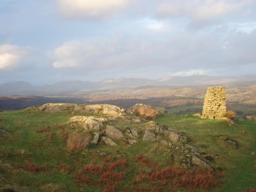
The whole area is rough, with craggy fellsides, which we found challenging to navigate, even with Sir Hugh’s electronics. Intervening walls, unfortunately, had to be climbed, our increasing inelegance becoming a source of mirth. Photos deleted.  Passing over an unnamed summit on the list, we focused on the prominent cairn on Ulgraves and eventually reached it. What a surprise. It is perched on the edge of these Potter Fells and looks straight down and up into an unfortunately mirky Longsleddale.  To the south, the Howgills were prominent once we had orientated ourselves in this complex terrain.

Longsleddale.

Longsleddale.

Distant Howgills.

Distant Howgills.

Things became easier as we picked up tracks to picturesque Gurnal Dubs, with its boathouse and then onto Potters Tarn. These waters are both dammed and originally supplied the paper mills at Burnside.

In the maze towards Gurnal Dubs.

In the maze towards Gurnal Dubs.

We found a way down alongside a rampant beck to the road and a rendezvous with our transport as the daylight disappeared. So much for an easy half-day; this was a proper Lakeland Fell walk. I had forgotten my altimeter but reckoned on climbing 1500ft.  Tomorrow, I could be clinging to Preston climbing wall or shopping in the sales as Frank passes by; guess which wins.

As usual, check out  https://conradwalks.blogspot.com/search?q=potter+fell  for the true story.

Don’t let the sun go down on me – Knipescar.

Knipescar.

                                                                            Knipescar.

Having descended to Askham from a good half day’s walk on Heughscar Hill I was not keen to risk again the flooded lanes around Penrith and chose to drive south to Shap. The distinctive Knipescar appeared up to my left, I pulled into a layby  to consult Wainwright and the map – an ideal quickie. Parked at the bottom of the lane to Scarside Farm I was in too much of a rush in the late afternoon and had gone well up before realising I’d forgotten my camera. Running back down I greeted four others going up for a late visit. Once camera reunited and relaxed on the lovely limestone promenade along the scar I could take in views of Haweswater, Cross Fell and now distant Blencathra. To my right was a substantial wall, the boundary of Lowther Castle estate. I soon reached  the summit in a maze of limestone pavement with several contrasting erratic boulders dumped by retreating glaciers. Those other four seem to have disappeared – where could they have gone at this time of night?

Erratic boulder, Knipescar and distant Blencathra.

                                          Erratic boulder, Knipescar and distant Blencathra.

My search in the limestone pavements for the stone circle/enclosure marked on the map was fruitless, I couldn’t even locate the Ministry of Works sign mentioned by Wainwright and as the light faded I didn’t fancy braking an ankle up here. So I headed back as the shadows lengthened and the temperature dropped. The sun went down as I reached the farm lane.

Where is the 'stone circle'?

                                                          Where is the ‘stone circle’?


Evening Shadow.

Evening Shadow.

The sun goes down.

                                                The sun goes down.

The end of a beautiful day.


HEUGHSCAR ANTIQUITIES.

The Summit Of Heughscar looking to Ullswater.

                                                     The Summit Of Heughscar looking to Ullswater.

Escaping from local flooding on the Calder and Ribble I headed up the M6.  It wasn’t as easy to get to the little village of Askham as I thought, every lane after the motorway seemed to be closed due to floods or damaged bridges. I was doubting my wisdom of driving into the Lakes, such was the devastation from the recent heavy rain. But the day was sunny and dry and an ideal time for more limestone walking amongst Wainwright’s Outlying Fells, my project for this winter. I avoided the quick dash to the summit and back and enjoyed his suggested walk around Heughscar Hill. The area had abundant Bronze Age cairns,  stone circles, a Roman Way and medieval quarries to explore. Paths went everywhere which helped the wandering. From the summit and a limestone escarpment were views into Ullswater and surrounding mist topped hills. Blencathra’s ridges could just be discerned.   As it was the Sunday after Xmas the area was popular with crowds of friendly walkers, going in all directions, and despite Wainwright promoting this Fell for old gits like me families and young children were in the majority.

A wet Roman Road, Heughscar and distant Pennines.

                                              A wet Roman Road, Heughscar and the distant Pennines.

Moor Divock with a couple of Bronze Age picnickers.

                                                   Moor Divock with a couple of Bronze Age picnickers.

Blencathra.

                                                                          Distinctive  Blencathra.

I ended up at The Cop Stone, a standing stone, with views down to Shap with the Howgills behind. As I returned to Askham the ornate Lowther Castle acted as a foreground to Cross Fell throwing off its mantle of cloud, the Radar station on adjacent Great Dun Fell shining in the sunshine. As an aside I remember well as a teenager camping up there on The Pennine Way and experiencing the full force of the local Helm Wind. I survived the night, or rather did my Black’s Tinker cotton tent, but I retreated the next morning with my tail between my legs. This area also brings to mind an expedition I did along that Roman Way, High Street, between the forts of Brougham and Ambleside, a 25mile stroll worth doing if you can sort out the transport logistics.

The Cop Stone with distant Shap and the Howgills.

                                                    The Cop Stone with distant Shap and the Howgills.

'Burial site' with Heughscar Hill above.

                                                               ‘Burial site’ with Heughscar Hill above.

Askham, Lowther Castle and the Cross Fell group.

                                        Descending to Askham, Lowther Castle and the Cross Fell group behind.

So for pleasant walking, all-round views and interesting antiquities Heughscar takes some beating, a real Lakeland gem. Let’s just hope the worst of the rain is over and this part of Cumbria can start to return to normal.


A quickie -CARTMELL FELL.

Having dropped out of the gale from Hampsfell

‘Calm’ before the storm – HAMPSFELL.

I was rattled and in no mood to go high again. Scanning my map I thought the lowly outlier Humphrey Head would be ideal for a quick ascent. Having driven towards it I realised the flooded access road was no place to be in my low clearance car.  A quick turnaround and I was navigating the complicated narrow lanes up to Cartmell Fell Church. This is an isolated church built in about 1504 as a chapel of ease to Carmel Priory. It has a squat functional construction, at one with the surrounding fells. The interior is welcoming with notable ornate wooden pews.    On the walls of the chancel are boards painted with the Lords prayer, the Creed and the Ten Commandments.

From here it was an easy dash up the rough fellside to the prominent stone cairn [The Old Man] on Raven’s Barrow. The highest point of the fell was a few metres SW. There were views to the Coniston Fells and over the still waterlogged Winster valley. The sun was beginning to set and the wind becoming colder so I didn’t linger. Better get home for Christmas and before little Eva arrives.


‘Calm’ before the storm – HAMPSFELL.

Desmond has passed but left its toll of flooding in Cumbria, and now little Eva is approaching. After a night of more rain, the day improved so I had a late drive up to the Lakes. Consulting my Wainwright Outlying Fells I chose Hampsfell as today’s destination. I now realise there is a ring of limestone to the south of the Lakes and in this rain-soaked month they hold the promise of better walking underfoot, several of Wainwright’s Outlying Fells occupy this region. Having said that there were some muddy paths out of Lindale but once on the fell things improved. This was a land of limestone pavements and miniature edges with paths going everywhere. I chose one that led me to the summit and walked up into a gale, with constant battering I wondered whether any of my photos would be in focus. There were birds’ eye views down to the Kent estuary with Arnside and Ingleborough in the distance. The highest point has an unusual ‘Hospice’, built-in 1846 under the instruction of a vicar of Cartmel as a shelter for travellers. The substantial structure has a flight of steps leading to the roof and an unusual viewfinder, an alidade, which act as a pointer to the surrounding fells. Today it was virtually impossible to stand on the roof let alone line up the views. Back in the calm interior of the shelter I was able to read the cryptic poems displayed on the walls. Above the entrance is a Greek inscription which translates as ‘rosy-fingered dawn’, a phrase apparently used by Homer referring to Eos, goddess of dawn.  According to Greek mythology, Eos’s task was to open the gates of Heaven each morning to allow the sun to rise, a romantic idea which could be put to the test by spending a night in here and witnessing the phenomenon. Today I could only view Morecambe Bay to the south and the misty Lakeland Hills in the rest of the compass.  I forced my way along the ridge in the gale-force wind in a northerly direction, the Cumbrian Fells in front of me. Dropping off the ridge field paths took me back to Lindale. My only problem was a large bull in one field, I trespassed in the adjoining field to avoid it, I would rather face an angry farmer than an angry bull.

Catch it while you can … a Ribble Round.

Perception of our weather can sometimes belie reality. It seems as though it has rained for a month, in fact it largely has but there have been a few windows of brightness. The forecast, why are we so dependent, hinted at a dry Sunday morning but with worse to come. Catch it while you can.  So a quick dash for a couple of hours walking by the River Ribble from the graceful bridge at Ribchester. This was once a favourite walk with my young family and later with my ageing father.

Perversely within a few minutes of starting it was raining  but within a few more minutes there was blue sky and rainbows were appearing.. This is part of The Ribble Way. The banks of the river show the aftermath of recent flooding, debris washed up 2 or 3 meters above the normal level. Unfortunately plastic seems prominent along the ‘high’ water mark.

The path is forced away from the river edge after a mile or so. There is an anglers’  track continuing but we are denied it, although I have on previous occasions followed it. Having spent some time this year in Bavaria and Austria, where recreational paths seem to have higher prominence, I ponder what damage we could inflict on the angling community. How have the privileged classes hung on to this injustice, higher up the river things get worse where ‘public’ paths have been closed. This is supposed to be The Ribble Way. The only benefit was that as you climbed away from the river views opened up to Pendle and the distant Dinkley footbridge.

Soon I was crossing that bouncy Dinkley suspension bridge back over the turbulent Ribble, the floods last week must have been a few inches below the bridge. Previously there was a ferry at this spot until the bridge was opened in 1951.  I walked back along the river bank with a chatty lady and four dogs. Before the road is Sail Wheel where the river does a dog leg and interesting currents and eddies develop below the rocks.


The road back passes  grandiose gates giving access  to  extensive meadows which  occasionally host the Royal Lancashire Show. The success annually depends upon the amount of summer rain and mud, not possibly the best site. White Elephant springs to mind……

Rain settled in again as I reached my car and probably will continue to the end of the year. At least I caught a little sunshine.

SCOUT SCAR – limestone highway.

Wainwright’s  Outlying Fells  –  Cunswick Scar and Scout Scar.

Scout Scar.

Scout Scar.

I mused about starting to complete Wainwright’s Outlying Fells a couple of weeks ago and it hasn’t stopped raining since. The Lake District has had some dreadful flooding and it’s been best to avoid travelling there. This weekend there was heavy rain again on Saturday but the forecast for Sunday was for frost and clear morning. Hence we found ourselves parked up in Kendal adjacent to Serpentine Woods, the higher western side of town which has some pleasant housing. We simply followed the master’s guide from then on [Chapter 1]. An old tramway took us past its limestone quarry into the fells, or more correctly into a golf course. Tracks led everywhere but we just followed the crowds. A large proportion of Kendal’s population seemed to be heading for the heights,  is that normal for a Sunday or are they all going up to survey the surrounding floods?  They were the usual dog walkers and casual walkers but also a fair proportion of runners enjoying the firm dry tracks, the whole area is Limestone. Everyone gave a friendly greeting. Before we knew it we were atop Cunswick Scar on the edge of the escarpment with views all round of snowy Lakeland peaks.

Kendal below.

Kendal below.

Approaching Cunswick Scar.

Approaching Cunswick Scar.

A path followed the edge southwards towards a communication tower and crossing a road we were on the continuation ridge to Scout Scar. The prominent summit structure is called ‘the mushroom’ or ‘the umbrella’, it is, in fact, a shelter with a built-in viewfinder. It was built in 1912 commemorating the coronation of George V and has had several refurbishments. A perfect spot for refreshments and viewing, the Howgills looked close and splendid in their winter coat, as did the Langdale Pikes. The continuation along the edge gave us views over the Lyth Valley sadly still underwater. In the past I have climbed on the cliffs below, memories of loose trad climbs and some poor sport climbs [bolted] but from up here you had no impression of the crag face. I did spot one lower off and a couple of bolts. The day had been freezing with watery sunshine but clouds were building from the south as we descended through junipers to the outskirts of town. It started raining as we reached the car.

'The mushroom'

‘The mushroom’

Distant Langdale Pikes.

Distant Langdale Pikes.


Distant Morecambe Bat and the flooded Lyth Valley.

Distant Morecambe Bat and the flooded Lyth Valley.

A perfect little walk in these conditions, good underfoot with wide-ranging views.


WIRRAL WALKABOUT – it’s a dogs life.


Hoylake – Hooton.

What is it about dog walkers?  This stretch seemed to be inundated with them in all shapes and sizes, usually the dogs get more exercise than their owners.

The first person I asked for directions strangely didn’t have a dog, but nonetheless he gave me  advice about getting round the beach to Red Rocks. It had rained all night and it was difficult to tell if the tide was in or out so I quickly walked round Hoylake beach to reach these rocks. Expecting a cliff they turned out to be no more than a platform of reddish sandstone. Inland was now The Royal Liverpool Golf Course more commonly called Hoylake when I have watched the Open on TV. Not much could be seen over the dunes and I didn’t spot anybody famous.

The second man had one dog and gave me good advise about traversing the dunes and information on walking out [at low tide] to the three islands Little Eye, Little Hilbre and Hilbre less than a mile off the coast at West Kirby. I think summer would be the time to return, they looked totally inaccessible today with wind blowing up the waves.The weather took a turn for the worse and I was fairly miserable as I walked the promenade on the landside of the Marine Lake, people using the path on the seaward side looked in danger of being swamped and there was not a boat in sight. My saviour came in the shape of Tanskey’s Bar which was open at 9.30 [despite the staff having a hangover from last night’s Christmas Party] and served me a wonderful coffee, with classy background music, whilst I dried out. These little cafes are a treasure, I notice they even have a classic cinema evening with food once a month.

Refreshed I navigated round some expensive real estate and sailing clubs to the start of The Wirral Way which follows the abandoned railway line calling at all stations to Hooton through the Wirral Country Park along the Dee Estuary. It was now full steam ahead on the flat straight trail. Passing through the exclusive looking Caldy Golf Course, bridges passed regularly and an old station platform appeared at Thurstaston.  Getting bored with the railway I wandered through fields onto a cliff top path which gave me views across the Dee to Wales. Committed to this path I followed it to steps leading down through the loose red sandstone cliffs and on to the sandy beach. Turn left and walk along the shore was my only option, ahead I could see a boat on a ‘side stream’ of the Dee. From the map there was no obvious way off the beach.

But I met a man with two dogs, we chatted about Liverpool, Thurstaston and Thor’s Rock which I had wanted to visit. Its some distance inland and hence an excuse to return to this delightful area.  More importantly he showed me the way, by a little path, off the beach to regain the Wirral Way. After more marching along the railway and then nondescript streets saw me hemmed in at Neston Golf Course, I felt the need to rejoin the river. The couple with three dogs showed me a lane towards the estuary which when I reached it had become an extensive salt march. There was evidence of stonework of ancient quays from before the silting up of this area. A birdwatcher reported peregrines but none of the harriers he had come to see. Lanes then took me to the ‘sea front’ promenade at Parkgate, Neston. There was previously a port with links to Ireland but gradually this silted up in the 19th century, this also put paid to the local bathing. All that remains is the stone sea wall and some elegant houses on the ‘promenade’ – rather surreal. However today it is still popular for its pubs and eateries and for the birdwatchers who come at high tide which sometimes floods the salt marches. Here the Wirral Way turns inland, still faithfully following the old railway which closed in 1962.

The silted up River Dee.

The silted up River Dee.

After a few more streets built on the line I found myself in a kilometre long, stone cutting completed in 1866. This was an amazing place. Quarried sandstone cliffs enclose the track and you can see the marks of the picks used to carve it out. Also featured are areas of ripple sediments known as ‘current bedding’. Ferns bedeck the walls and tree roots seek weaknesses in the sandstone. Met a man with three greyhounds who was equally enthusiastic about the place, he was interested in my walk and I was beginning to unravel the ‘scouse’ accent.


Once out of the cutting I was surrounded by green fields and horses of the Cheshire countryside. A lady jogging towards me had four dogs – the record – and as she bent down to ‘poo scoop’ explained it kept her hands warm, rather her than me. I was transported back to my youth at Willaston where Hadlow Road station has been ‘preserved’ giving a real sense of past travel on the railways. A last rural stretch through trees saw me chugging in to the platform at Hooton station for my modern train journey back to Preston.I found the Wirral a fascinating area with lots of hidden gems. A good way to spend a couple of days and avoid the Xmas shopping .

WIRRAL WALKABOUT – a breath of sea air.

Seacombe  Ferry  –  Hoylake.

Despite its proximity I’ve not visited the Wirral Peninsular very often, I remember once  going to Ness Botanic Gardens to buy some rhododendrons and magnolia. They are still thriving in my garden. But there are two walks which combined seem to highlight the best of this peninsular – the North Wirral Coastal Path and the Wirral Way. Due to the weather and Lake District flooding I thought now was a good time to explore.

Could have subtitled this as ‘Ferry across the Mersey’ but opted for a more practical train journey under the river.  I wish I had taken the ferry as it would have made a superb start to the day. Too late now as I watch from this side the ‘Dazzle’ ferry heading across with the famous Liverpool sky line behind. The Three Graces are being overshadowed by elegant modern buildings. The day is overcast.The Wallasey promenade stretches before me and opposite are the remnants of the once mighty  Liverpool and Bootle dockyards. Few cranes remain now but on this side of the river are poignant reminders of their wartime duties. Plaques have been put on the sea wall to honour the many boats lost in both wars, each plaque placed opposite the dock where the sinking took place.


The whole waterfront along here is full of history – Guinea Gap, the ‘back to front’ Wallasey Town Hall, the Egremont Ferry, Magazines Drive, Vale Park and The Tower Grounds. Look them up at – http://www.visitwirral.com/dbimgs/3WCT%20-%20North%20Wirral%20Coast%281%29.pdf

Wallasey Town Hall.

Wallasey Town Hall.

Egremont Ferry - pub sign.

Egremont Ferry – pub sign.

As New Brighton approached there were avenues of houses from more opulent times. New Brighton had its hay days either side of WW2. Ferries from Liverpool stopped sailing in 1971 and the famous Open Air Bathing Pool closed in 1990. There has been an attempt to regenerate the area but mainly by building new retail outlets, Brand New Brighton. The past is remembered at Fort Perch Rock and Rock Lighthouse.

Lighthouse and Fort with shipyards across the river.

Lighthouse and Fort with shipyards across the river.

Leaving the mouth of the river and turning along the north coast brought a change of character. Inland suburbia was replaced by sand dunes and a bracing sea breeze. Sand had been blown and deposited everywhere. The tide was retreating and flocks of birds were feeding at its edge – oyster catchers, redshanks, knots, turnstones and others – I had forgotten my binoculars.  I was able to walk along the beach on firm sand, a change of surface. Crunchy empty Razor Clams were everywhere. Out to sea were lines of wind turbines.Clambering back up to the sea wall there is a golf links course in the dunes, a ruined ‘Mockbeggar Wharf’ and another redundant  lighthouse passed, the Welsh Hills were glanced in the late afternoon sunshine. Small fishing boats waited on the beach.Housing reappeared and Hoylake was reached. Next to the modern lifeboat house a couple of intrepid sailors were fighting the wind across the pond. An information plaque relates some of the tragedies at sea. Nearby an ornate cast iron drinking fountain erected in 1901 to commemorate Queen Victoria’s Jubilee. Xmas parties were in full swing at my hotel for the night, but needless to say I experienced friendly Merseyside hospitality. Thank you Green Lodge Hotel.

Wainwright Outlying Fells postscript – Desmond.

Storm Desmond has been causing  lots of trouble in the NW this weekend and Cumbria has been hit hard. There were reports of flooding and roads closed throughout the area. I’d planned a start on some of those Wainwright Outliers but thought I’d better wait and see what this morning brought. The A590 into the southern Lakes was closed, Kendal was in trouble, so I wisely cancelled.

My heart goes out to all those people with flooded houses.

WAINWRIGHT’S OUTLYING FELLS.

My copy of Wainwright’s The Outlying Fells of Lakeland is dated 1974 [£1.50] and I’ve hardly used it in those 40 years.  ‘a pictorial guide to the lesser fells around the perimeter of Lakeland written primarily for old age pensioners and others  who can no longer climb high fells but can still, within reason, potter about on the short and easy slopes of the foothills

I’ve covered a lot of ground in the Lakes over the years, walking and climbing, and I now avoid the overcrowded central areas. I also, unfortunately, come into the old age pensioner category. So when I fished this volume off my bookshelves and dusted it down this week a plan materialised. I daren’t venture abroad at present because of some unresolved medical issues so why not attempt to complete the outlying fells this winter?

The book is not as well laid out as his Lakeland Fell Guides and I found it a bit difficult to actually find the locality of some of the walks and their relationship to others. The internet helped out on that account with some lists and decent outline maps of the selected fell areas. Plans rapidly develop.

I have noted in my copy a few walks I have completed, namely 10, but suspect I traversed many more. so that leaves me with 46 chapters to go.  Each chapter is actually a walk.  As he often groups several fell tops into the same chapter/walk there is a larger number of Fell tops. Another list is produced on pages 270 – 271 of the 110 individual tops but this incorporates some inaccuracies, duplications and omitted nameless ones. I’ve marked down 24 of these I’ve visited, can’t believe I’ve not done more.

A more realistic list of 116 tops appears here https://en.wikipedia.org/wiki/The_Outlying_Fells_of_Lakeland   Better just start again, I told you it was complicated.

Chris Jesty has published an updated edition which might help but that would be straying from Wainwright’s original. As I want to read and follow his accounts –  I’ve bitten the bullet.

CHESHIRE RING WALK. Southern section – Day 4.

Middlewich – Acton Bridge.

Surprisingly another clear sunny morning, with an horrendous afternoon forecast, but couldn’t get away early because breakfast is 8am at weekends! Quick marching soon led me out of Middlewich and into rural Cheshire. The first few miles had the added attraction of the River Dane on the left, meandering at times up against the canal and then across the fields.Mock Tudor mansions with large well kept grounds were securely on the other canal bank. These expensive looking estates certainly were in prime settings – it is Cheshire – think footballers. A black mink slipped into the water next to this house. A kingfisher flashed by. As you can see from the picture starlings were doing what starlings do best, congregating in mass flight from the trees.This whole area was previously a vast salt mining site and subsidence has been a problem for the canal, in parts there are large flashes alongside creating a lake-like atmosphere. In some places the canal has had to be rebuilt altogether and the concrete sides stand out. You can see from the clouds the gathering storm.New marinas were being constructed further along and I wondered whether they were making use of these flashes.The established marinas were full of boats at this time of year.

The names on the boats are a fascinating study, ranging from the whimsical….


to the corny….

to the functional….


Back to industry as I passed right through these chemical works and on past the old Lion Salt works which is now a museum. More of the canal’s industrial past came round the next corner in the shape of the famous Anderton Boat Lift. The River Weaver 50ft below navigates into the Mersey at Frodsham and originally salt and coal were sent down on chutes and inclines from the canal. As traffic increased the lift was designed and opened in 1875, working on a double hydraulic system until updated to electric at the beginning of the 20th century. It was declared  structurally unsafe in 1983 but eventually has been restored, this time using a hydraulic oil system, and was reopened in 2002. An amazing feat of engineering.By now the threatened rain and wind had arrived but my saviour for the day was a great little cafe hidden away in their visitor centre which deserves a mention. What’s more is that they had a sale on in their bookshop. Looks a good trip here with the grand-kids when the lift is operating.

Two canal tunnels followed, the Barnton, 572yds and the Saltersford, 424yds, apparently some of the first attempts at canal tunnelling. They are both narrow and there is a rota system for boats to pass through, I of course went over as there is no towpath.Between the two is an idyllic basin where I came across this chap fishing in the pouring rain. I don’t usually find fishermen particularly chatty as they are concentrating on the line. My response from him when I tried to start a conversation was a terse  “better than sitting at home”.

In a couple of miles I had completed the Ring at Acton Bridge, if I’d carried on a little further I might have come across the section of trekking pole I lost in January. Drying out over a drink in the nearby Leigh Arms i had time to contemplate  this enjoyable four day canal walk. Full of interest both places and people, an insight into our industrial past, a good surface for walking at this time of year whatever the weather – all in all better than staying at home.                                                                      On guard!

CHESHIRE RING WALK. Southern section – Day 3.

Kidsgrove to Middlewich.

Clear blue skies welcomed the day but heavy rain was forecast for the afternoon, so I won’t be hanging around. The canal basins in Kidsgrove were navigated and the correct towpath chosen, it’s not that difficult to set off on the wrong canal. The Trent and Mersey is a much larger canal and for the most part has double locks. I was rather dismayed at its ‘mustard’ colour this morning, suspecting pollution, but I was told later that it was rust from the Kidsgrove Tunnel. As countryside was reached, now back in Cheshire, there was a view of Mow Cop Castle a folly built in 1754, again a reminder of my previous Gritstone Trail walk. The mile posts on this canal are metal in contrast to the stone on the Macclesfield, giving a different feel to the banks. Still they prove so useful in determining your whereabouts and progress.Locks were being repaired and stretches of the canal closed so there was not much boat life today and I made quicker progress. Double locks dropped the canal down further and the countryside improved. In parts there were badger sets in the earth on the far bank, I wonder whether Badgers can swim. Pretty canal side cottages were passed.The busy M6 crossed overhead, a complete contrast to down here. At Wheelock I was ready for a sit down and a brew, the pub didn’t open till 4pm but today’s saviour came in the shape of Liz’s Plaice down the road where a mug of tea was 60p. Deserves a mention. Skirting Sandbach the signs of old abandoned chemical works and salt mining became more evident and the landscape took on a flat desolate appearance. Some areas were being redeveloped for masses of Belway housing [other builders are available] but they were hemmed in by industry and train lines – not ideal. But I did think this more upmarket housing by the canal was attractive.The walk deteriorated with a busy main road running alongside and more dereliction on the way into Middlewich. A fairly miserable few miles which I passed through quickly with one eye on the weather. At least I had a ‘welcoming committee’ on the outskirts of town.The canal in Middlewich was busy with locks, boat yards, wharves and holiday cruisers moored up, must be hectic in the summer. Within 15mins of arriving at my lodgings the heavens opened and did so most of the night.

Centre of Middlewich.

Centre of Middlewich.


CHESHIRE RING WALK. Southern section – Day 2.

Macclesfield – Kidsgrove.

Yesterday I had walked past Macclesfield for 2 or 3 miles to make today shorter., My taxi back to that point was waiting for me at 7.30am, a nice bloke – Polish of course. He had started work at 6am having driven from his home town of Bury. His main complaint with working in this country [he’d been here for 6 years] was our regional accents, he has difficulty with Scousers and thinks Glaswegians sound Chinese. I can sympathise.

The Macclesfield Canal has some lovely features. The original milestones were hidden in the war to confuse any invaders. The Canal Trust has restored as many as possible as well as some 1/2 mile stones. 

The canal is known for its several ‘roving bridges’ with spiral ramps for the horses to avoid unhitching when changing tow-path sides. Also known as ‘snake bridges’ they are of beautiful construction. Just think about the logic behind their beautiful design.Rural Cheshire countryside passed by but the surrounding hills of Macclesfield Forest were invisible. Several properties had their own moorings. I got to thinking whether when they wanted a shopping trip do they take the boat or a canoe down to Tescos?

Soon I was at the top of the12 Bosley Locks taking the canal down 118ft. Bosley Cloud from where the stone was quarried was in the cloud somewhere. The locks had an ingenious function of half emptying into side tanks which saved water when refilling for the next boat. The urban side of Congleton appeared out of the mist. My hope for a hot drink was dinted when I realised the town centre was a good distance, however when I emerged onto the road there was a sandwich shop and they kindly found me a seat whilst I enjoyed tea and a freshly baked pastry. They were very friendly and were baking some wonderful food for the steady stream of customers coming to take away. Deserves a mention.

There was a fine aqueduct and restored wharf as I left Congleton.The countryside round here is undulating and one has to marvel at the canal engineers skill of keeping dead level for miles. Quite a few aqueducts are crossed looking down onto roads or streams far below. One cannot really appreciate their architecture from up here but to drop down at every one for a better view – well I haven’t got all day.

A row of drilled  stone stanchions  borders the canal, presumably connected by wire hawsers at one time. Further on are the more elegant railings at Ramsdell Hall where the canal cut across their front lawn, a kind of Ha-Ha. They have recently been restored to their former glory.The Macclesfield Canal continued for another 5miles, I was offered free coffee and biscuits at a canal side cottage, I must have been looking bedraggled. On through one small last lock to eventually cross the Trent and Mersey Canal  [which I’ll follow for the next couple of days]  and did a dog leg into complicated basins in Kidsgrove. Think I have walked into Staffordshire – the accents are different.

The larger Trent and Mersey Canal.

The larger Trent and Mersey Canal.