Category Archives: Somerset.

SOMERSET INTO DEVON ON THE COAST PATH.

Porlock Weir – Lynmouth.

The sun is shining and by the time I leave after a hearty breakfast the temperature is more pleasant than the last few days. People are wandering round the quayside in holiday mood. The coastal path soon rose into the woods and contoured along nicely. There was only the sound of birds as the sea seemed so far below and was only occasionally visible. A group of three women appeared, they meet up at weekends for walking and are just starting on the coastal path – it will take them years. They skipped along happily chatting and laughing and I was somehow reminded of ‘Three little maids from school’, the tune from The Mikado. Guess what I was whistling all morning.

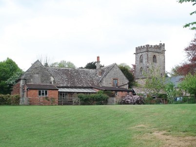
Not far along I spotted a church tower below in the woods and took the short detour to explore. It turned out that a service was just about to start – chaplain, organist and churchwarden were preparing and two parishioners appeared. The churchwarden, a local farmer, chatted to me in the sun about the church and several other topics until he was needed. The church is in the parish of Culbone although it is in the middle of nowhere. I was told it was the smallest complete parish church in England, for more information – https://en.wikipedia.org/wiki/Culbone_Church


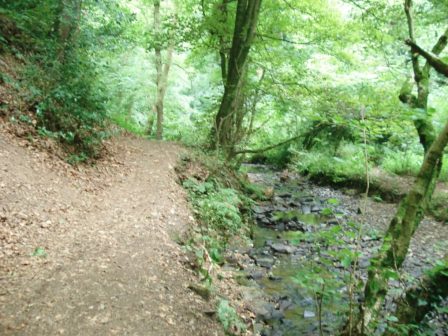
I think I crossed into Devon at Coscombe Stream… Close by was Sister’s Fountain fed from a spring and topped with a cross. I’m not sure of the history of this place but the cool water was delicious. The track continued winding its way with occasional views of the inaccessible beaches below. More people were out strolling as well as the coastal path regulars, one lady carrying her little terrier who didn’t like walking. I decided to take the longer way round Foreland point, the most northerly part of Devon. A small locked bothy was passed on the path. There were extensive views back up the coast to Hurlstone Point. At the end there was a lighthouse and then a narrow exposed path, perched just above the cliffs, continued round the headland. The Coastal Path was rejoined at Countisbury where there was a small church and a busy looking pub. The path ran parallel to the road down into Lynmouth. A local taxi man was advertising by the road for anyone too weary for the last mile or so. Eventually I reached sea level at a lovely little sheltered beach.  Lynmouth is infamous for the serious flooding of 1952 killing 32 people and devastating properties. My hotel for the night was close to the meeting of the two streams which being in steep sided valleys couldn’t cope with the 9inches of rain coming off Exmoor. A later stroll round the harbour area gave perfect views in the evening light.

I had planned another three days or so but my wretched cold and sinusitis showed no signs of abating so next morning it was a bus out to Barnstaple and a long train journey home. Can’t wait however to return and continue in this beautiful area.

START OF THE SW COAST PATH.

Minehead – Porlock Weir.

Today I would follow the SW Coastal Path, a National Trail which covers over 600 miles from Minehead to Poole Harbour  –  wow. But first I couldn’t resist  a look around the station of the West Somerset Railway. The platform is in period style, stalls are selling railway memorabilia and coaches are waiting for an engine for the first trip of the day. Along comes 6960 Raveningham Hall to be hitched up and passengers start arriving for their 40 mile round trip. I tear myself away, railway nostalgia is deep in my soul having been brought up in Darlington and hearing the distinctive whistle of the Gresley A4 Pacific’s as they hurtled north every day,

On the promenade there are signs for the start of the coastal path. A couple with heavily laden sacks are just departing, they turn out to be New Zealanders just recovering from their first ‘full English breakfast’ They are here for a couple or so months to complete the trail.

Before long the path starts climbing on well graded loops up through the trees and ferns to reach the open moorland high above the sea, old tracks take me to the highest point, Selsworthy Beacon 308m with blurry views into Exmoor. Onwards easy leads towards Hurlstone Point where I meet a young scouser setting off on an adventure round the coastal path, I suspect to discover herself. On her arm she has a tattoo of an acorn [the National Trail Waymark] which she says is for motivation.  I leave her as I drop off the trail and traverse round the point on an exposed path with good coastal views. Round the other side past an old lookout I meet up again with the main route and head into a pleasant garden cafe in Bossington, the NZ pair had already found it. Tea and toasted teacake seemed perfect. Old narrow paths deposit me into Porlock village for a bit of shopping, I’m growing tired of pub meals so buy some salad and fruit to eat in my room tonight. There is a sign pointing to Porlock Weir through the woods, still on the Coleridge Way. This turns out to be a pleasant way walking alongside some beautiful rhododendron gardens in full bloom. Greencombe Gardens I find out. Later I pass one of those ‘Tin Tabernacles’ from the late 19th C, still having services.

The lane eventually drops into Porlock Weir and to my most expensive B&B, The Cafe. I enjoy a pint of Exmoor Ale in the quayside bottom Ship Inn although it upsets me when in a pub every bar table is reserved for diners. I know this is how they earn their money but what about us drinkers?


SOMERSET – meandering to the coast.

Williton – Minehead.

It was bright but there was still a cold easterly wind blowing as I left Williton. The sandstone church on the edge of town seems much younger than most of the Norman churches passed so far. A little lane was signed to a Bakelite Museum, outside the building were random exhibits – miniature egg shaped caravans, bikes,etc. Unfortunately it didn’t open till 10.30 so after a quick external peep I was on my way. The paths hereabouts seem to be part of an estate with walled sections and bridges over driveways. The lanes in the area have a reddish tinge to them caused by the farm vehicles from the red clay fields. The way was undulating to say the least with constantly changing scenes, tiny hamlets dotted the landscape, compass work was needed to navigate the network of unsigned narrow lanes. On paths, often the Macmillan Way, the vegetation was already high with nettles, the shorts I’d been tempted into today didn’t seem such a good idea now.

I arrived in Withycombe ready for a rest but was attracted to the squat towered church. To my surprise inside there was coffee and tea making facilities available to visitors so I enjoyed a sit down and refreshments. Thank you. The interior itself was interesting with some fine woodcarving. Two stone carved effigies, one of a lady with a dog at her feet and one of a man wearing a hat. There were also 15C stone carvings depicting ‘green man’ – these figures are apparently common in SW churches  All in all a worthwhile stop.

Effigy with dog.

Effigy with hat.

One of the Green Men.

I found a sign pointing up a lane, Dunster 2½ miles via Withycombe Hill. Soon I was up on top with views to Minehead, the Bristol Channel and into Exmoor, and behind back to the Quantocks. Further along the ridge was Bats Castle an Iron Age fort whose ramparts and ditches were clearly visible.

The Quantocks of yesterday.

Bats Castle and distant Exmoor.

I was glad to loose height out of the cold wind into forestry on the edge of Dunster. Until now I had seen nobody all day but suddenly there were car parks, signed ways and hordes of people. Dunster is a picturesque village with the added attraction of its castle. First though a visit to the Chapel House Tea Rooms for cheese scone and tasty tomato chutney, cream teas seemed popular with other tables. I wandered through the crowded streets and into the castle grounds but felt I didn’t have enough time for the castle itself so don’t know what I’ve missed.

I was keen to find lanes taking me to the coast for the last few miles. The tide was going out so I enjoyed an exhilarating walk along the sands rather than on the golf course above. All to soon I was passing a busy Butlins complex and checking into my cosy B and B in Minehead.


ALONG THE QUANTOCKS.

West Bagborough – Williton.

Thank you Charlie, from Bashfords Farmhouse B and B, who gave me a lift back up that steep lane to Birches Corner to continue my progress along the Quantocks. I find I’m following a waymarked Macmillan Way West from the car park. A couple are just emerging from their van having slept up here, they are on their way back to Cornwall after a trip to Glastonbury to buy a brimmed hat for him. Three ladies set off with their dogs on a school reunion weekend, I follow discretely behind their nonstop chat. This is proper open heathland, yellow gorse and skylark country. Additionally beech trees border what must have been an old drove road. There are tracks everywhere but it is simple to follow one along the crest to the highest point, a trig point at 386m, curiously named Wills Neck. The visibility is poor unfortunately. Onwards easily along the undulating crest for another three miles or so with that freezing wind behind me. Lovely wooded slopes and valleys drop off both sides.

My way down Bicknoller Coombe could easily have been missed, there are no signs. Once out of the wind I stop for a snack, a cuckoo is heard [first of the year] and then seen in a nearby tree, buzzards fly overhead and sounds of a whistle from the steam railway below drift up. A small stream is followed all the way into Bicknoller village, some lovely little thatched cottages with tidy gardens, wisteria and roses complete the ‘English’ scene. A particular climbing rose with tight small yellow flowers is popular, I was not aware of seeing it before – probably Lady Banks.

I walk straight into the community store and order a coffee which is enjoyed in the sunshine. Just about everything can be bought in this little shop run by volunteers, hope it survives. As I walk small lanes through agricultural land I hear an approaching steam train and arrive just in time to see it pass. This is the restored West Somerset Line running over 20miles from Minehead to Bishops Lydeard run again by volunteers. I notice signs for The Coleridge Way, a feather quill pen, he wrote some of his major works whilst living in this area of Somerset.

The next village Sampford Brett has more picture postcard cottages and an unusual orientated

Church. A few fields later and I am entering the busy little town of Williton and booking into my comfortable accommodation for the night, the Mason’s Arms.

Macmillan Way West.

Coleridge Way.

FASCINATING RURAL SOMERSET.

Bridgwater – West Bagborough.

I used quiet country lanes for a couple of miles, my attention was drawn to the roadside flora which was a few weeks ahead of our northern lanes.


Ragged Robin.

Horse Chestnut.

Hawthorn.

Comfrey and Cow Parsley.

I entered North Petherton via a series of alleyways and was unexpectedly confronted by a magnificent church. A 15th century minster with a highly decorated tower, Inside are some fine wooden furnishings and a replica of a gold Alfred Jewel said to have been found after the dissolution, the original is in the Oxford Ashmolean Museum. Opposite the church was a perfect little coffee shop – Truly Scrumptious – it was.

I now started climbing towards the Quantock range of hills, an area I had never explored. Kings Cliff woods were popular with dog walkers, the cliffs of sandstone looked very precarious. Oak and beech woodlands followed the steep valley running west to east, the bluebells were spectacular. Slowly I gained height in the valley and it opened up into farmland with some exclusive properties scattered on the hillsides.The stream coming down the valley had been dammed in many places to produce ponds and mill races. I spotted a fox walking towards me but despite my stillness he ran off before I could get a decent view or photo. At the top of the valley was the village of Broomfield and the NT Fyne Court. There is much to interest you here – an old church, schoolrooms, estate houses and the remnants of the estate. The estate was owned by the Crosse family whose most famous son was Andrew, the mystical ‘thunder and lightning’ man,who in the 19th century carried out complex electrical experiments using wires strung out through the trees in the estate.Little is left of the property which burnt down in 1894 but the NT have a wonderful little cafe in one of the surviving buildings. If you like home made cakes and scones this is the place! Whilst chatting to the staff I was given helpful instructions on how to proceed for the afternoon without having to loose much height. I took these with a pinch of salt as they only recognised  walking on roads and I didn’t want to miss Cothelstone Hill.  I was given a lovely hand penned map to help me on my way. But first I would explore some of the well marked trails through the estate – embarrassingly, I managed to get seriously lost! So I thought after all that their helpful advice could be useful and followed their more than adequate map along quiet, twisting  and undulating lanes. I found the path going off to Cothelstone Hill,332m, and was soon walking up open heathland. Exmoor ponies graze this area and they were posing for photographs at the Seven Sisters beech plantation  towards the top. There were good views down to the Bristol Channel, Wales and the Minehead headland. I passed an obvious burial chamber and then headed down through bluebell woods back to a road, Following my paper map I was soon heading steeply down into West Bagborough on the edge of the Quantocks. I’ve thoroughly enjoyed today’s variety.

I enjoyed an excellent B and B at Bashfords Farmhouse, they took pity on me as I was now in the middle of a nasty head cold – a long luxurious soak in their large bath.

The local pub was overrated and expensive, this is very much a riding and hunting area.

BACK IN SOMERSET.

Last year  http://bowlandclimber.com/2016/08/16/somerset-ways/  I started to fill in missing sections of ‘my’ LEJG trail, then I was heading N to Bath this time I’m heading SW. I find myself back in Bridgwater a rather seedy town I do not take to – everyone to their own. I march past my previous unsavoury lodgings and connect up to a canal, Bridgwater to Taunton,  heading wisely out of town. It is a couple of miles walk to my B and B for the night, it is a pleasant evening and soon Industrial sites are left behind and rural scenery takes preference. There are more cyclists than walkers as the towpath is part of the national cycle network. An old bridge takes me across to the canalside Boat and Anchor.

The forecast is dry for the week but a cold easterly wind is blowing – I had thrown in an extra fleece.

My map shows several paths going in the appropriate direction for the next few days, I can mix and match  Macmillan Way, Somerset Way, Coleridge Way and eventually the SW Coastal Path.

View from Boat and Anchor bedroom.

Well wet before Bath.

Tunley – Bath.

I knew it was going to rain but all I expected was a bit of southern drizzle but no it rained and I was well soaked when I jumped on the train to head home. I had started early because of the forecast and the need to catch a reasonable train. Back down to pick up the Limestone Link and then mainly followed the River Cam which is really a stream.

 Cam valley gloomy in the rain.

Cam valley gloomy in the rain.

I was walking on the edge of fields and soon was soaked from the knees down. Halfway across one of the fields I was confronted by two snarling dogs with their owner way ahead. Bared teeth or wagging tails – which do you trust?  I walked on with sticks at the ready. The owner gave the usual response and I marched past without a comment, what self control. I think that distracted me and I went off the wrong way on the next road and had to retrace after half a mile. I’ve not been doing too well with navigation on this trip partly because I didn’t have the relevant maps. Another lesson learnt. From then on I followed the waymarks more carefully through rolling wooded hills and even spotted the point where I left the Link to head towards South Stoke.  It was here I met a backpacker who had walked from John o Groats and was on his last section. The church in the village was dedicated to St. James and there was a stone carving featuring his emblemm a scallop shell. Most of the buildings of South Stoke used that cream coloured Cotswold limestone. Before I knew it I was in the streets of Bath [or Baaaath as they pronounce it down here] I was expecting Georgian terraces but mostly modern housing accompanied me into the centre and railway station. I caught the 12 o’clock to Bristol and was back in Preston by 5pm. It was still raining.


A long day of Somerset wandering.

Compton Martin – Tunley.

My b and b continued to surprise, a man in his pyjamas and stocking feet gave me one cup of tea, previously ordered scrambled egg and promptly disappeared [presumably back to bed] never to be seen again. I let myself out. It had rained all night and back on the wooded slopes of the Mendips the luxuriant undergrowth was damp a pleasant feeling after the last three days heat. Monarch’s Way was encountered for a few fields. Buzzards were a constant sight and sound. Little villages were encountered, West Harptree having a rare shop where I was able to buy a fresh sandwich. Even at this stage of the day I was making silly navigation mistakes through not concentrating, maybe I was tiring. A steep hill brought me up to  Prospect Viewpoint and seat with the Chew Valley lake below, I was joined by a couple of dog walkers and a cyclist. A short distance further and I couldn’t resist a morning coffee in the Ring o Bells pub, Hinton Blewett. I looked behind me and there were 20 -30 cyclists arriving, desperate for beer and food, the place was heaving. A large sociable group had come from Bristol.

Prospect viewpoint.

Prospect viewpoint.


I then had difficulty finding my way out of the village, coffee only I assure you, and I had now walked off my OS Explorer map and onto my photocopied bits of paper. At one point the path through a couple of fields had been freshly mown – thank you. In the next barley field there was a constant popping sound which I couldn’t trace  – must have been seed pods of some plant in the field.    

Walking up a lane a couple climbed a stile to my right which I would have missed, this led to a high traverse above a valley with hundreds of anthills. Then I became lost walking out past a farm onto a road, the paths just didn’t fit but I pressed on into more fields with no stiles, out came the compass, I don’t have GPS, and I realised I wasn’t at all sure of my whereabouts, I’d walked off my map. It wasn’t helped by my the fact that my photocopied map was disintegrating from sweat in my pocket. I had only one choice, knock on the door of the only cottage in sight and ask “can you tell me where I am?” The young lady was so helpful and pointed me in the right direction and after some creative walking within 30mins I was back on route.A surprise section in a deep wooded gorge brought me onto a disused railway and then a disused canal at Timsbury Basin. This was the terminus of the Somerset Coal Canal running to Bath, parts of the basin are still evident and I walked a stretch of the canal towpath. Elsewhere I used the disused railway which replaced the canal. There had been many collieries in this area, all now assimilated into the landscape. I remember reading an account of William Smith’s contribution to  geology and this was highlighted by his observations whilst surveying in this area for the canal. He recognised  from fossils that the earth was laid down in strata and this was replicated throughout the country. He published the first Geological map which went against the current religious thinking that the earth was only a few thousand years old. He suffered for his forward thinking, became bankrupt and discredited and only later recognised as the ‘father of geology’.

If a public footpath comes through your garden what do you do?  In the next mile I came across two frustrating solutions and their occupants.                                                                                           1. Ignore it.  The first delightful garden was entered on a signed way but then I was left to wander about looking for an exit. The pleasant man pointed out a gate exit. We had a long chat about the canal, dieting, immigration, bees etc but it had never occurred to him to put an arrow on the gate to get people off his property.                                                                                                2. Divert it.  A little further at a gate guarded by three friendly dogs the sign said go straight through but there was an obvious way round. The owner appeared and agreed that hundreds of people used this route, he had provided a simple ‘unofficial’ diversion but not signed it. He did not want to pay for an official diversion and I did  not want to walk through his garden.

Someone's garden.

Someone’s garden.

Both these examples show the owners’ resistance to public rights of way across their properties and their ineffectual ways of dealing with the problem. They knew about the footpath when they purchased but have buried their heads in the sand.  Come on be reasonable. Both gentlemen were pleasant enough and it was good to meet them but how simple is to resolve the problem and make life easier for all. I shall be writing to the relevant highways authorities.

Moving on I followed the Cam valley further and then climbed the steep hill to my wonderful Airbnb near Tunley with views south across the valley.  Another day without rain.


Somerset Levels and Polden Hills.

Uploading…

Bridgwater – Street.

The sign above my Bridgwater b and b stated “simple home comforts for hard working folk”. Most of the hard working folk here are Eastern European and they are up and about all night. Makes me realise what a sheltered life I lead in my Lancashire village. Bridgwater is an old port and the constant screaming of seagulls give it a nautical air. 

It took a while to walk out of and I was glad to be in the rural Levels, a flood plain that has been drained to provide agricultural land, both arable and pastoral. A lot of the fields are divided by ditches rather than hedges. The paths were poorly marked and overgrown, a large scale OS map was essential to find the little plank bridges spanning the dykes. 

 The walking was of course level as I made my way between small hamlets – Chedzoy, Parchy, Sutton Mallet and Moorlinch. Interesting  squat Somerset churches were visited. The one in Sutton being particularly fine with its wooden box pews. In the church yard I sat on a seat donated by the BBC after shooting an episode of The Monocled Mutineer, a historical drama I had missed.

Behind were the Quantocks and ahead I slowly climbed into The Poldens. There was a messy section through farmland where you were made to feel unwelcome. Any  Samaritans Way signs had been a rarity.

Public Footpath.

Public Footpath.

At last I was on open ground past the conspicuous Windmill Farm and onto the highest point Walton Hill 82m!  A nearby viewfinder from 1940 has been made redundant by tree growth. In other areas there were good vistas across the Levels and to the north up popped the strange Glastonbury Tor. 

All downhill now to Street which came as quite a shock – a shopping extravaganza and a busy outdoor pool resembling the seaside, the temperature was in the high 20s. Cider and fish and chips seemed appropriate.

Glastonbury, more Levels and The Mendips.


Street – Cheddar.

Breakfast was chaotic, I was down at 7.30 wanting an early start before the heat, but was beaten to it by a coachload of Isreali tourists. They were giving the waiter a hard time with all their demands. As well as breakfast they were preparing lunch at the tables and asking for ingredients stored in the kitchens fridge. I settled down to copious fruit juices and observed the farce, my cooked meal not appearing for an hour when they had gone their way to no doubt create mayhem elsewhere. I congratulated the Spanish waiter and his backup on their cool manner.

I was almost at the top of Wearyall Hill when a man hailed me asking the whereabouts of the thorn tree. I had heard the legends of holy thorn trees being planted here, going back to Joseph of Arimathea from Christ’s time sticking his staff in the land. The man, not Joseph, had come from Poland on a pilgrimage to search out holy sites. So we joined forces to find it  and in fact stumbled on it within yards. It looked dead following recent vandalism but was hung with ribbons from the faithful who feel the forces. A local lady joined in with more information and we had a pleasant interlude up here all the time overlooked by Glastonbury Tor.

My Polish friend and the tree.

My Polish friend and the tree.

On my way down I came across a group led by a girl scattering rose petals as they  climbed up – but this Avalon, land of long skirts, beads and crystals all very evident in the town.

I listened to music on the long flat miles through the next levels, I find The Traveling Wilburys a good walking beat.

Ahead was a small ridge to cross and the paths again seemed unused, several were blocked and there were lots of annoying electric fences with those awkward hook ups. I was hot and bothered by the time I reached the pub in Westbury sub Mendip, an ice cold drink did the trick. Sub Mendip meant there was climbing to be faced but the views back to Glastonbury Tor were outstanding. Along the ridge there was a succession of stone stiles  featuring a large stone to be mounted.

Looking down on Cheddar I fell into conversation with a local man reminiscing on his childhood in the 50s with this as his playground, we had lots in common.


Cheddar below.

Cheddar below.

Ice cream was my next priority, the delights of the gorge can wait till tomorrow.

SOMERSET WAYS.

When I sit and reflect on UK long distance walks that I’ve completed over the years I realise I’ve walked most of the land. I wont bore you with lists. I was out the other day with Sir Hugh, a prolific long distance walker, who in the past has gone end to end in one continuous push. This set me thinking, I’m never going to emulate that but what about filling in any gaps. There’s a large chunk from Inverness to John O’Groats,  a link from the Pennine Way to the West Highland Way and the SW below Bath.

I found an interesting website covering the whole of the route in stages – http://www.jbutler.org.uk/e2e/index.shtml   Sadly I read that the author passed away in 2011 but his site is maintained and provides a wealth of information and inspiration. Hamish Brown’s 1981 book should also prove helpful.

I’ve a spare week coming up so have planned a short section linking Bridgwater with Bath. The LDWA website showed a plethora of paths winding through Somerset and I have hopefully plotted an interesting outline route based on them. Mainly the Samaritans Way SW, A Somerset Way and The Limestone Link. This enables me to visit some new hill areas – Polden Hills, The Mendips and the Camerton Hills just south of Bath. – and in contrast The Somerset Levels.

Enough waffle, the train is booked and the weather down there should be better, time to pack the sack.

Cheddar Gorge and Beacon Batch.

Cheddar – Compton Martin.

My accommodation for tonight doesn’t open until 6, see later, so I organise the day to fit. Lie in, leisurely breakfast and a stroll up the Gorge. The open top buses are already packed and every commercial outlet is touting for business. I’ve come to look at the famous Coronation Street, a climb I did with Rod about 15 yrs ago.Today from directly below it looks frightening, I remember it was when we climbed it just finishing before sunset and the onset of rain.  Curiosity satisfied I came back down to find everywhere even busier but stumbled upon a semi-decent place for a coffee and snack – the rear garden of Lion Rock Cafe.

Coronation Street. E1 5b. 350ft.

Coronation Street. E1 5b. 350ft.

DSC03299

From the cafe it is a stiff climb straight up onto the northern rim, I am disappointed with the views into the gorge as the rocks are in shadow – I should have known. It is good to see families up here walking the circuit although I was dismayed at the woman with lots of little ones picnicking on the very edge.

Spot the picnickers.

Spot the picnickers.

A ‘roller-coaster’ led me into the wooded limestone valleys at the heart of The Mendips where I found The West Mendip Way going in my direction. It took me up onto the tops once more and then across to a different landscape. The acidic ground of Black Down was a complete contrast. Rough walking through heather and gorse to the trig. of Beacon Batch [strange name] at 325m the highest point of the Mendips.  I was not expecting to see anybody up on this remote spot let alone on a cycle. But there was this pleasant chap, not at all surly,  on an interesting Surly bike pedaling his way across country to a festival near Cheddar.

Classic Mendips valley

Classic Mendips valley

Beacon Batch.

Beacon Batch.


Not at all 'surly' cyclist.

Not at all ‘surly’ cyclist.


To the north I could see a change back to limestone on a wooded range of hills on the edge of the Mendips and this is where I picked up the Limestone Link waymarks which I followed, or tried to, for the rest of the trip in this area mainly on long straight paths and old lanes. There was almost a geometrical theme to the walking hereabouts through estates previously owned by the Sainsbury family, I patiently watched a fox ahead of me but never managed a photo.

Eventually I came down a lane into a combe in which nestled Compton Martin with its millpond, Ring o Bells pub and fine Norman church [the latter unusually has a dovecote built into it for the priest’s use]. By now the pub was open, my room was OK but there was a strange atmosphere to the place. Owned by some music entrepreneur there were signed pictures of rock stars on the walls and million selling disc tributes, all a bit egocentric but I guess that’s the nature of pop music. Apparently Kylie Minogue sang here last year, tonight it was only screaming kids – probably very similar.

Compton Martin.

Compton Martin.