Tag Archives: Long Distance Walks

THE SEFTON COASTAL PATH. Formby to Crossens.

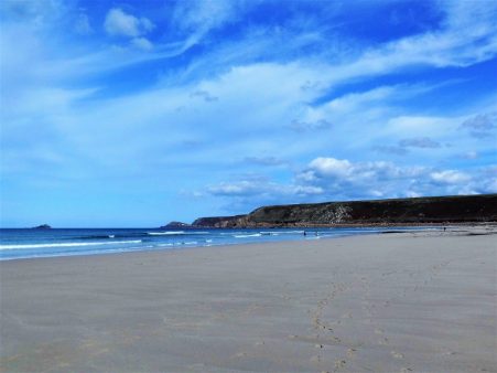
I’m the only person on the beach and I can hear music across the dunes,     yes that is the ‘Last Post’ being played and I realise it is the eleventh hour of the eleventh day of the eleventh month. What a place I’d found to quietly contemplate. Of course 2018 is 100 years since the end of WW1 and special events are being held, on the train this morning were army cadets off to one. I didn’t know at this time that back on Formby beach the face of one of the fallen soldiers was being temporally created in the sands. I’d arrived onto the southern end of Southport beach to escape the busy road I’d found myself walking on, another example of the present deficits of the Sefton Coastal Path.

An early start from my airbnb and I was back at Freshfield station and walking through the golf course which was already busy. In Ainsdale Dunes I followed the SCP as marked on my leaflet. This started really well through the woodland, no Red squirrels, and the undulating track was popular with dog walkers, runners and cyclists. The rain started heavily just as I emerged from the tree cover onto a less pleasant track so finding a marked trail leading back into the dunes and trees I blindly followed thinking it would take me back to the coast so I could avoid the busy coast road.

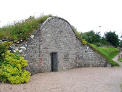
There were enticing tracks everywhere in this attractive wilderness and I somehow arrived at the depot of Natural England who care for the area. Sheltering under a store for a snack gave me time to speak to one of the wardens who admitted that it is a well kept secret. He pointed me on a way to the coast and I was back in the expansive dunes. Walking was not easy once the path was lost. As I headed for the coast I could see Pontins Holiday Camp looming in front of me and made the mistake of avoiding it on the right which had me alongside that busy road.

Simple but very effective stile on NE Reserve.

I don’t want to be here…

… or here.

After the dismal looking Pontins I continued for 2 miles up the lonely beach towards the pier and then began to worry about getting back to solid land before the tide turned, there seemed to be a lot of marshy grassland to cross. What followed was not pleasant, 300m of bog hopping with some sizeable channels  amongst the reeds, more serious than I thought. Time for a sit down and a sandwich – phew. Across the bay was Blackpool and Lytham, I’m just glad I won’t be attempting any more of the coast  – too many inlets to negotiate. By now the tide had come right in to the sea wall and the sun had come out.

What’s the history of this case?

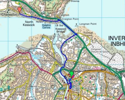
Here is the start of the Trans Pennine Cycling Trail and there were sculptures to mark it. Seaside resorts look empty in the winter but the boating lake was busy. An easy stretch along the promenade was marred by the constant traffic.

Start of the Trans Pennine Trail.

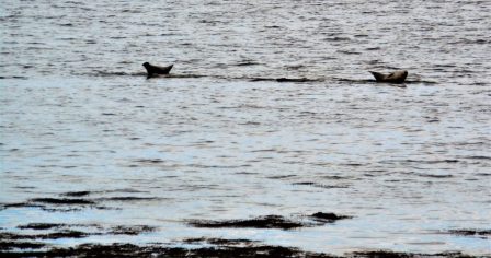
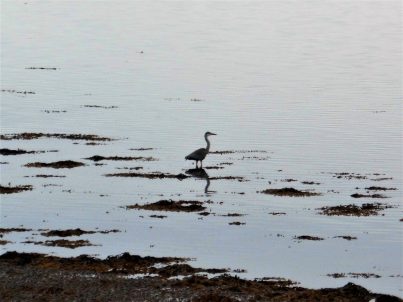
At the first opportunity I took a side road which gave access to a lovely footpath across a golf course and then into the RSPB’s Marshside Reserves. The afternoon was sunny by now and the paths were popular with locals and their dogs. On my right was a housing estate and on the left the marshy reserves with lots of distant bird life but without binoculars identification becomes guesswork. Ahead I could see the distant Bowland Fells which appeared giants in the clear sky. At the end a walk alongside a Ribble Estuary drainage channel brought me conveniently to my bus stop home.

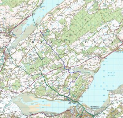
Sefton Coastal Walk has been mixed with plenty of highlights and quite a few lows. Some of the latter were unavoidable and some were my mistake, a decent map would help as would waymarking through the forests and dunes, and local knowledge of the beaches and tides.  I suspect it was designed by committee rather than enthusiastic walkers. Nonetheless a decent 23 mile walk fortunately blessed with decent weather.

*****

THE SEFTON COASTAL PATH. Waterloo to Formby.

At only 21 miles long The Sefton Coastal Path hardly qualifies for a long distance walk category. In the past I would have happily seen this as a one day challenge, but in my maturity I’m happy to take a couple of leisurely days over it – one of my two-day classics. [must link in the numerous others]

I’m setting off again without a map but I’ve a decent leaflet from Sefton Council which should see me through. I met my Waterloo at the bus stop and walked down to the beach to be alarmed by the sight of men standing up to their necks in the water. And there more some on the beach and others with their heads disappearing under the waves. In fact there were a hundred [I didn’t count them] all part of Anthony Gormley’s installation of ‘Another Place’. A brave man to depict all those identical nude images of himself. Not being one who is comfortable in water I found the statues disturbing, I am not in the best of places.

In the background were the industrial cranes of Liverpool, or more precisely Bootle, Docks and a constant stream of boats being escorted up the Mersey. A cold wind from the south was behind me as I marched along the beach and then the prom with all the dogs and their ‘masters’.

Once out of Crosby the path headed off across dunes but all was not as it should be – the edge of the coast was eroding away and exposing building rubble not sand. The local coast guard out on patrol explained that postwar the debris of the heavy bombing of the city was dumped here to help shore up the sea defences and now those weathered bricks were resurfacing. What a history they must have.

I blindly followed the surfaced track which took me inland to Hightown, there had been no waymarking as such and I realised I was following a cycle route. I could have continued along the coast for more pleasant walking and this slowly dawned on me as I progressed over the two days. I might as well say it now The Sefton Coastal Path as promoted is a rather boring cycle route and a far better walking route could be devised, I made it up as I went along with varying degrees of success. So that is why I was walking through a housing estate trying to see the coast. At the first opportunity I turned west and for a while walked alongside the Alt River but red flags were flying with a lot of gunfire. It didn’t need much persuading to walk around the perimeter of Altcar Training Camp. The next fenced in stretch by the railway was uninspiring with explosions to my left and emptiness to my right, I felt isolated and vulnerable.

As soon as I could I escaped out onto the Formby dunes, there were paths everywhere and I ended up on one going to the Devil’s Hole, an extensive crater in the dunes thought to have been started by a wayward German bomb and carved out over the years by the wind, the largest ‘blow out’ in Britain. Coming through the dunes I was onto the beach with views back to Liverpool Docks, across to Wales and Anglesey, and out to wind turbines in the open sea, the whole creating a sense of immense space.

The sense of space was enhanced as the tide was way out with an extensive stretch of sand in front of me and I was able to walk three miles up the beach. At the high tide mark were thousand of empty Razor Clams apparently washed ashore in recent high winds, crunchy walking.

Most of the time I had the beach to myself but there was always a gaggle of people and dogs where a path through the dunes led to a car park. Yes that is Blackpool Tower in the distance. The low light was constantly changing as clouds drifted across the sun.It was time for a spot of dune walking on the edge of the pine forests famous for their Red Squirrel population. I found a maze of paths, didn’t see a squirrel and eventually followed a route inland through the mixed woods and across a golf course to Freshfield station as darkness was approaching.

A train whisked me one stop down the line to Formby where I enjoyed an excellent Airbnb.  https://www.airbnb.co.uk/rooms/18223313

*****

SW COASTAL PATH. Porthcothan to Padstow.

Leaving Porthcothan.

The last stretch.

An interesting breakfast conversation with two Finnish ladies, mother and daughter, walking part of the SWCP, their English was of course perfect. There had been rain in the night but by the time I left there was no need for waterproofs, that’s 8 dry days in a row, and very soon the sky brightened. The headlands seemed busy this morning with people walking short stretches and using the connecting bus services. Between Porthcothan and Treyarnon the coast is deeply indented which meant lots of ups and downs but ever-changing scenery. The tide was high and in the wind there was quite a swell so all the little sea stacks were taking a bashing. In one narrow inlet the sea was being whipped up into a foam that was blowing up onto the tops just like snow.

Up here there were some good examples of ‘Cornish hedges’ which are really stone walls with plants growing in them. An ancient and lasting field boundary.

I was able to walk the long stretch of Constantine Beach on the sands. At the strangely named Booby Bay groups of bird watchers were focusing their attention on the rocks – all I could see were oyster catchers and gulls, not a Booby in sight.

I made the full traverse of Trevose Head passing a very large blow hole where you could just make out the sea below without risking your life. Dinas Head seemed to stick right out into the Atlantic with some impressive sea stacks The Quies a mile out and another The Bull closer at hand.

The way continued past the automatic lighthouse and in the next bay Padstow lifeboat station relocated here as the Camel Estuary silted up. You can see from the photos how rugged and dangerous this coast is and the need for the light and lifeboat. In the past many vessels came to grief on this stretch.

I passed some drab looking holiday chalet sites which are probably deserted now, most people I met had rented cottages. After another headland Harlyn Bay was approached, rather than walk on the beach I headed inland to visit the pub for a coffee. Not the friendliest of hostelries I moved on quickly rather depressed by the area and the mist that had descended. I think I’d had enough so consulting my ‘map’ I could see lanes cutting across to Padstow and made the decision to head direct and celebrate with fish and chips in Rick Stein’s cafe on the harbour.  I arrived there only to find they had just closed at 3pm.  A bus trip to Bodmin for the night and I was able to sample the same fare in Bell Lane probably at half the price.

Padstow harbour.

I was last in Padstow in October 2017  so I have now completed most of my LEJOG walk [over the period of 50 years] I have only a few more days walking up to John O’Groats itself, watch this space.

*** *

SW COASTAL PATH. Newquay to Porthcothan.

Plenty of steps.

Today’s walk had the most ascent of any of the days so far and there were a lot of those steps to negotiate, I think they are worse descending than ascending.  After last year when I developed a hip bursa whilst doing long days on the coast I was more circumspect this time particularly downhill when I took things slowly. Of course the highlight of today was Bedruthan Steps themselves,  pictured above. On the beach here are several sea stacks which may have been stepping stones for the giant Bedruthan or more likely the name is more recent from the staircase of steps accessing the beach.  All that had me thinking of John Coltrane’s classic recording of Giant Steps which became my earworm for the day although a little too fast for my pace.   Go on listen and brighten up your day…

I had found a way down through the streets to a little beach near the harbour in the centre of  Newquay and then I had to find my way back up again, the start of todays steps. Trying to avoid the shopping centres I came across an old tram line taking me in the right direction. So I never saw the famed Fistral Beach. It didn’t take long to clear the suburbs of town, the intriguingly named Lusty Glaze cove was just a mass of commercial development but as I dropped into Porth the coast was again wild. There were a few early morning surfers out in the bay. Before a traverse of Trevelgue Head I sat chatting to a gentleman who backpacked with camping all the way from Minehead. He was beginning to think the b and b option might be more sensible.

The low clifftop fields I followed were the habitat of corncrakes apparently, no sound of them today as I presume they’ve flown. There were good views back to Trevelgue Head and Newquay and the beach below was interesting. I was walking parallel to the busy coastal road and I joined it when I dropped into Watergate Bay which seemed to be one large holiday complex, architecturally bleak. I stopped for an expensive coffee in a fairly nondescript cafe, another of those surfer establishments I’ve been critical of. I didn’t find escape out of the complex easy and ended up trespassing through a chalet park, it felt invigorating to be free again on the cliffs with a bracing easy stretch high above the beach. At one point dropping down steps to a cove I found a rocky platform just above the waves which gave an exciting snack stop. Waves crashing below and a distant horizon to contemplate the unknown.

Up more steps and before long and I was down again into Mawgan Porth another bay spoilt by modern apartment development. At least here was a quirky cafe, The Beach Box, with friendly staff where I grabbed a light lunch sat on their balcony watching the world go by. Why do surfers when donned in tight wet suits have to walk around like Tarzan? Time to get going.

Once across the beach I climbed back up to Trenance Point and enjoyed superb cliff walking in the best October weather you could hope for. The views along the coast were outstanding. Gradually I realised I was sharing the path with more and more people, I had reached the carpark area for the famed Bedruthan Steps.  There is a steep staircase going down onto the beach and today at low tide little figures were strolling on the sand between the rocks. It looks a classic situation to be cut off by the incoming tide and my landlady this evening confirmed that the rescue services were called out frequently, in her opinion the unprepared should be left to sit it out on a safe ledge for a few hours. Whatever, the scene is breathtaking.

Moving on the crowds disappeared as I walked over the grassy Park Head. A chough, red legged and red billed, seemed completely unconcerned by my presence as it picked around for insects in the grass. Apparently they were becoming rarer in Cornwall due to loss of grazed habitat but are now making a comeback, the NT use ponies and cattle on their land for this purpose.

One more valley to drop into and steps to climb out of and I was walking alongside Porthcothan Bay. The little shop where I expected to buy food was already closed so I walked up to my B and B in the handful of houses that comprised the village. What a friendly place to stay, the lady was a professional photographer amongst other things and a wealth of Cornish knowledge. She and her husband were retiring and this was probably the last night  for accommodation here which will leave a big gap for coastal walkers. She came to my rescue with a delicious Cornish pasty, thanks. I wandered out to try to get some ‘sunset over the sea’ pictures but was largely denied by a low bank of cloud. A lone surfer was returning from an evening session.

That seemed a longer day than the ‘Long Day’

*****

SW COASTAL PATH. St. Agnes to Newquay.

The Long Day.

Because I sold myself short yesterday I left myself with a long day today if I wanted to reach Newquay. Being a Sunday I would struggle with buses if I fell short. I used some little lanes out of St. Agnes to pick up the path up through the dunes as it swung onto the first headland where it ran alongside an old RAF airfield. In the war Spitfires operated from here but now only a few private planes, there were none today. The cliffs below were very crumbly and paths have disappeared into the sea. Again there was much evidence of previous mining.

The going was actually fairly level and I made good progress to Perranporth. There was a lot of new building work as I dropped down and some very expensive looking properties. In the car park a tea van promptly served me a decent coffee with no fuss for £1.50 – take note those other cafes where a simple coffee order becomes a major catering event trying to justify the exorbitant cost. Of course I had to sit on a park bench.

Again I was lucky with the tide and able to walk along the Perran Beach rather than in the tiring dunes. I have never seen so many dogs being walked, apparently from September onwards they are allowed the freedom of the sands. The 2 mile walk was bracing in the wind, there were some interesting cliffs and the crowds thinned out the further one went. Climbing a steep path up the dunes and I was onto Ligger Point with great views back along the beach. From this lofty perch I was able to watch a kestrel hovering just below me. Kestrels have been a common sight every day on the cliffs along with ravens, choughs, buzzards, the occasional peregrine and of course the gulls.

Inland now was a military base with its surrounding security fence though it is no longer used.. Penhale Camp itself looked like a small village but again access was denied and one had to follow the perimeter fencing right round Penhale Point. There was agood view of some original Nissen Huts on the site. Despite the dreary nature of the camp the cliff scenery down to my left was dramatic.

I arrived in Holywell, with its beautiful looking beach, in good time and popped into the St. Pirans pub for a coffee taken outside so I could surreptitiously eat my own banana and biscuits. St. Pirans turns out to be the Patron Saint of Tinners. Cast out of Ireland he was washed ashore on Perran beach where he built a chapel.The legend goes that he discovered tin by accident – a stone on his fire leaking a white liquid.

St Piran's Flag

The Cornish Flag, the Flag Of St Piran (white cross on a black background) represents white tin flowing from the black rock, or good overcoming evil.

A text message arrived from tonight’s accommodation  asking my time of arrival as they were out from 5pm onwards, the instructions for picking up the key if I was late were so complicated that I decided to speed up and get there in time. That’s how I found myself lost in the middle of a deserted holiday park. Looking at my pathetic photocopy of a map I had reckoned I could miss out a couple of headlands and a mile or so by using a path straight across to Crantock. Public footpaths don’t do well in commercial properties or maybe I shouldn’t have been here in the first place and there was nobody to ask. For the first time this week the mist had come down perhaps shielding my indiscretions. Eventually I resorted to a compass bearing which saw me out of the camp but onto a golf course but again there was nobody arround. With some relief and a few fences climbed I came out onto the NT’s Cubert Common, lanes and paths had me back on route at Crantock Beach. The town of Newquay could be seen on the opposite side rising up from the estuary, a town of two halves with the other facing the Atlantic.The tide was still out which was important as I needed to cross the River Gannel at one of the low lying bridges to avoid a lengthy detour on roads. The first bridge I came to had been closed and apparently dismantled but fortunately the next one was intact and I crossed straight into the suburbs of Newquay. Some street walking with incongruous SWCP signs on lampposts took me up into town.

The missing bridge.

My way further upstream.


The owners of the B and B were surprised at my early arrival.

http://www.trelinda.co.uk/

*****

SW COASTAL PATH. Portreath to St. Agnes.

 A short day.

I enjoyed a leisurely breakfast chatting to a couple walking the whole coastal path to celebrate their retirement. They had every day planned out, accommodation booked and were walking like clockwork when they passed me yesterday. I’m not sure how much they were enjoying it as they didn’t have much to say about the scenery, wildlife or exceptional weather. I reflected on my attitude to long distance walking and when I was younger it was probably exactly the same, partly personality trait and partly the necessity of time restraints. Indeed we would choose a route no matter what length, within reason, divide the mileage into a week and do it, often entailing 25 miles a day: a race against the clock. My regular walking partner back then came to retirement and we set off on a journey across the Pyrenees with no time limit and no pre-booking, it was a revelation to him how it changed your outlook. We were able to do short days to start to avoid burn out, we had time to explore off route, time to sit out the worst of the weather, could change our plans when needed [in fact ended up walking in the opposite direction for the majority of the route] and best of all time to sit and enjoy the scenery and realise how lucky we were. Choose your own style. I won’t see that couple again as they race ahead but I hope they enjoy their last two weeks.

Today I opted for a short walk to St. Agnes, the mileage will remain short but it is surprising how the day itself lengthens.

I walked steeply up the road out of the village, the cliff path has been eroded so its best to keep with the road for longer until a signed path across a car park. Two blokes were enjoying the view before driving back to the midlands after a family reunion, they really seemed to appreciate the wild coast. A lady who had moved here from Sheffield 30 years ago was walking her dogs, she had an airbnb in Portreath. The dogs needed a wash after rolling in Badger excrement. The next encounter within a few minutes was a man who was down on holiday with his daughter when she had gone into labour ending up in Truro Hospital giving birth to a Cornishman, his first grandchild – I think he needed a brisk walk.

The path along the headland was separated from some military land by never ending fencing. A spooky dome appeared. Below were deserted beaches. Ahead were deserted tin mines, Wheal Tye, where some attempt had been made to preserve and protect with unsympathetic concrete. There were interpretation boards everywhere including a bold statement  –  On 13 July 2006 select mining landscapes across Cornwall and West Devon were inscribed as UNESCO World Heritage Sites, placing Cornish mining heritage on a par with international treasures like Machu Picchu, the Taj Mahal and the Great Wall of China. 

A steep decent into Porthtowan brought me abruptly onto a busy road and I was glad of a break at the cafe. There’s something about these surfers’ cafes that I’m missing, inexperienced part time staff,  basic  beefburgers and coffees at exorbitant prices accompanied by some indecipherable electro music. As long as they are near the action and there is outside seating then its OK.  At this one I ordered a coffee and croissant and after an inordinate time two croissants and the coffee arrived, I said nothing and whilst enjoying the fare a new waitress turned up with another croissant!

The penalty to pay was a steep uphill where I chatted to a lass originally from Sheffield out on a run along the coast in training for a mountain marathon. Apart from running she was keen on surfing and climbing. She sped off into the distance. Soon I was dropping down again into Chapel Port which was just a car park at the end of a lane. The car park was full yet more cars, mainly expensive 4x4s, kept coming down only to be turned around and sent away.  A steep pull and I was back on the bleak tops where there was more evidence of previous mining activity with a couple of atmospheric pump houses. Notice the mine shafts, topped with conical grids (known apparently as Clwyd caps).

I was crossing St. Agnes Head standing out into the Atlantic waves. There seemed to be an abundance of sea stacks on the coast here, one group curiously named ‘Man and his man’.  As I started the descent guess who should come past but the fell runner, she had done well over ten miles since I last saw her.

I didn’t have any reliable maps so out came my phone to navigate me into St. Agnes. without dropping me down to Trevaunance Cove which can wait till tomorrow. The village was delightful, winding streets, old pubs, interesting church, brilliant B and B [with a mining engine house in the back garden] and not least a good fish and chip shop.

http://www.enysvilla.co.uk/

Quite an interesting short day.

*****


SW COASTAL PATH. Hayle to Portreath.


Have you seen Poldark?

My most interesting encounter today was in the Godrevy Cafe above Hayle Sands. Two ladies, turned out to be sisters,  were looking for an outside table in the sun; I was just finishing my coffee so invited them to share the table. Conversation ranged far and wide and I outstayed my welcome. A chance remark opened up the subject of Poldark and the lady to my left explained she was the daughter-in-law of Winston Graham the author of the original series of historical novels. Her husband, the son, is involved in the TV productions and that very morning they had all been filming in a hidden cove on the south coast. No, she would not divulge any secrets but did say filming would be continuing on the northern coast this week. She was impressed that I had purchased a cheap plastic Poldark key ring for a fan back home.


The day had started by saying farewell to my lovely host in Penzance as I prepared to backpack up the coast. In 10 minutes the train had me in Hayle across the estuary and those busy roads where I’d finished yesterday. Hayle was worth an exploration for its maritime heritage and gave me the opportunity for some picnic shopping. Amongst the shops was a more chic ladies’ clothes outlet with a sign that amused me…Once across the harbour bridge I picked up the way through holiday chalets in the dunes and down to the beach as the tide was out. This then gave me 3 miles of flat walking with no navigating except to pick out the firmest sand, ahead was the lighthouse on Godrevy Island and across the bay St. Ives. There was a stiff Northerly wind blowing which made for brisk walking to keep warm. In the waves were lots of amateur surfers and bodyboarders who were mainly congregating at points where the lifeguards were on duty. Black cliffs loomed above the beach for most of its length but I found a way up, The Goat Track, at the far end which landed me in the said cafe.

The area was popular with dogwalkers and these three were ready in the carpark…Sand dunes, which can be heavy going [remember Herb Elliot’s training which led me to this very British video  clicking here.]  took me onto Godrevy Point with views down to the island lighthouse. In my experience where there’s a crowd there is something happening and so it turned out on the cliff top above Fishing Cove, the group of Exeter zoology students had spotted the seals in the bay.

The way onwards on paths through heathland was not difficult and most of the time paralled close to the road. The cliffs along here looked very crumbly and it was wise to stay clear of the edge particularly in the strong winds, strong enough for me to don a fleece for the first time this week. I felt I was making good progress until in the last mile I encountered two steep valleys with all the usual steps and zigzags. The descent into Portreath was punctuated by lots of expensive looking modern properties which I doubt if any of the local population could afford. The village itself looked a little drab in what is now classified as out of season. The pub next door to my B and B had a karaoke night so it was preferable to eat in my room.


Home

*****

SW COASTAL PATH. Zennor to Hayle.

The ‘busy’ stretch.

I was sat on a headland trying to observe seals on The Carracks, in earshot but out of eyesight, whilst a combination of sweat and suncream irritated my eyes and dripped down my face. I can hardly believe my luck, well there was a little planning, to be experiencing these perfect conditions at this time of year. Little boats out of St. Ives were ferrying tourists to view the seals at close quarters, certainly closer than I could get. I had encountered lots of people using the path today most were intending to get the bus back to St. Ives. Everyone was in a good mood enjoying the hot sunshine and the spectacular scenery. The stretch out from Zennor Head was however particularly gruelling with lots of scrambling on awkward granite rocks as well as the usual ups and downs. Over the years I’ve become more aware of the need for caution in these situations, thoughts of a broken leg ensure I’m no longer the mountain goat I once was. At least I’m better shod than many of the holidaymakers I pass although there are quite a few hardy backpacking types, mainly women for some reason; I think this type of walking on well-marked tracks in a fairly civilised part of the land enjoying good weather attracts them but why oh why do they have to burden themselves with those enormous rucksacs?

I had started the day in Zennor village where I had time to look around the little Norman church of St. Senara which was full of interest. It is most famous for the unique medieval Mermaid Bench with the mermaid carving on one end. There are many reminders of the sea in the church, indeed its roof is shaped like an upturned boat keel. Hanging from the roof is a model of a West Country schooner, created as a memorial to WA Proctor, who died on a solitary round-the-world voyage, and also to all unnamed sailors who were shipwrecked along this stretch of the Cornish coast. There is a colourful collection of hassocks made by the congregation many depicting coastal themes. The Burma Star window dedicated to WWII forces. A Norman font, a C18 sundial showing symbols of death [cross-bones] and immortality [an angel], celtic crosses and plaque to a John Davey [1812 – 1891], one of the last locals with knowledge of the Cornish language.


A friendly gent in a mobility scooter was manoeuvering himself down the track towards the sea, as I walked alongside I warned him that the path became much rougher but he seemed pretty determined, hope he made it back up. As you can see my departure from Zennor was delayed, by the way there is a cafe in the village as well as the pub. Once on the coast the going was fairly easy undulations and despite the roughness mentioned above I strode along enjoying every moment of the dramatic scenery. Up here in patches the heather and gorse are still giving a good show plus I’ve just learnt from mine host Rachel one can eat Gorse flowers which have a faint coconut taste. A good few of the serious backpackers were Germanic and I’m not sure what they made of my friendly how do and now then.  These two had the dog in tow for the whole trip.Passing a trig point where a lady from near my home town was in deep thought. A few more headlands and bays with Caribbean blue seas and St. Ives, from where most of the people had come, was in sight.The section I’ve been walking was relatively busy today, deservedly so, but from here on the crowds mass, ice creams are everywhere. people stagger out of the sea in wet suits and the pubs are packed. The Tate is passed, closing in 10 minutes, and little narrow lanes of former fishing cottages are navigated from one of St. Ives’ beaches to the other. I don’t have time for any of the art studios on every corner but was tempted by fish and chips. But I’ve still some way to go, surprisingly sylvan tracks by the railway take me first to Carbis Bay and on past the quieter Porth Kidney sands. I’ve had enough by the time Lelant railway station appears, there are some busy roads and industrial areas to negotiate around the Hayle estuary so I jump on a train back to Penzance.

Porthmeor Beach.

Porthminster Beach.

Carbis Bay.

*****

SW COASTAL PATH. Pendeen to Zennor.

The Granite Coast.

There are several magnificent granite climbing cliffs along this coast but none finer than Bosigran. I first visited here 30 odd years ago and tentatively climbed some easy routes. I returned a few years later on an extended climbing trip with my lovely friend Pete when we climbed every day for a fortnight. In those days I was ticking off routes in the Classic and Hard Rock volumes. There was plenty to go at down here, we were camped near the Logan Rock Inn at Treen on the southern coast but all areas were easily accessible and we roamed far and wide,  we visited Bosi a few times. One day choosing a time of lowish tide we were able to climb the full height [200m] of Commando Ridge. On other days we concentrated on the non-tidal main face, Doorpost Little Brown Jug,, Anvil Chorus all immaculate exciting climbs. Probably most memorable and subsequently tragically ironic was Suicide Wall with a scary traverse across the Coal Face and some very overhanging climbing to reach the top. I remember we rescued a young couple stranded on a ledge by giving them a top rope to safety. We had a wonderful time and today as I pass I reflect that I can no longer reminisce with Pete, God bless him. Surprisingly today depite the perfect weather there was no one climbing on the main face but a climber can just be seen high up on Commando Ridge.

This morning I had taken a late bus back to Pendeen for what should be a short day, first things first – a breakfast bap at Lillies next to the bus stop. I then started by cutting down some ancient lanes between lichen encrusted granite walls and coming across those characteristic stiles of cross pieces of granite, more like a hurdle.I was soon back on the coast and facing steeper gradients and the dreaded steps. High above me on the bracken covered slopes I thought I saw a working party clearing the path, but as I climbed higher realised it had been fell ponies doing the same job efficiently.

From up here there were views onwards to endless bays and headlands, but I keep remembering to look back – Pendeen lighthouse was a prominent landmark but yesterdays coast is a thing of the past. Inland on the rough hills the patchwork of cleared fields is also photogenic. It’s just great to be up here.

The coast was becoming more dramatic and the sea noisier and all of a sudden I was above Bosigran Cliff itself. The ghostly mines above were silhouetted against the sky and people were strolling down from the carpark enjoying the warm sunny weather. I sat for a while taking in the scene and rocky architecture.  I was then soon over the slope and on the switchback path high above the sea. The path was rather awkward through boulders and vegetation and was busy with coastal strollers. At on point I stepped aside into the rough to let a lady through. I muttered something about taking the rough to which she thanked me and as an afterthought remarked “I hope you are not referring to me” which brought a smile to my face.

Other rocky headlands were passed, a large group of children on some sort of adventure course on one of them, I hoped they were all roped on as it all looked rather chaotic. Gurnards Head and finally Zennor Head were places I’d climbed on.

Gurnard’s Head.

There were numerous descents into side valleys at sea level where a stream was often crossed using old granite slabs. This one has had the health and safety people interfering.Many of the sandy bays on this section of coast appear to be very difficult to access and I don’t think I saw anybody down there.

Time was passing quickly, I had a bus to catch and the ups and downs wouldn’t stop. I was glad when at the top of a steep flight of steps a little lane ran up into the popular little village of Zennor, I had no time for explore or visit The Tinners Inn and made for the main road with minutes to spare before my bus appeared. In my short day I had climbed over 2000ft in 7 miles.

Almost there…

*****

SW COASTAL PATH. Land’s End to Pendeen.

When tin was king.

This section of rugged coastline over the centuries has been the scene of intensive mining mainly for tin with some copper, silver and arsenic. The extrusion of granite into the area’s sedimentary rock produced extensive mineralisation. Surface mining is thought to have commenced about 2000BC when it was found that adding tin to copper produced the much harder Bronze. Tin was subsequently used in pewter and coins. The industrial heritage now on view dates back to the 16th century when underground mining as well as opencast developed on a large scale and reached its peak in the 19th century until a collapse in the price of tin and copper made it unprofitable.

The remains of pumping houses, crushing plants, winding wheels, open shafts, associated works and spoil heaps are found scattered all the way up the coast but are particularly frequent in the Pendeen area. Some of the workings went deep under the sea. The tin ore was crushed before smelting. What a sight it must have been when the industry was booming.The early bus from Penzance to Land’s End was full, my companions on the front seats upstairs were a couple from Canada on a grand tour. We marvelled at the bus driver’s skill negotiating the narrow Cornish lanes. As expected Land’s End has become a theme park and lots of tourists were arriving by coach for a morning’s visit and opportunity for some shopping etc.

I quickly bypassed the ‘attractions’ and headed for the most westerly point, Dr. Syntax’s Head, past several first and lasts. It was a beautiful clear morning but I couldn’t make out the Scilly Isles. The Longships lighthouse was however very prominent out to sea.

There were seals in the bay as I walked round to Sennen. A couple of rock climbers were just setting off for would be a perfect day on the cliffs, I was envious. Sennen Cove was busy as usual and a coffee in the cafe was hurried but the situation is magnificent.

The tide was low so I was able to walk across the sands, a feature that should last all week.

I climbed out onto Aire Point and followed the path easily to Cribba Point with a few of those dreaded steps. There was a zigzagging drop into Cot Valley and then a stiff pull up the other side.

An English girl was walking with a Spanish speaking lad, turned out he was from Nicaragua, and giving him lessons in English although he spoke well with an accent. I greeted him in Spanish and conversed for a short time. As they proceeded ahead of me I heard him say that I spoke Spanish like he spoke English, thought that was more of a criticism than praise.

Ahead was the hump of Cape Cornwall with its landmark chimney and lots of visitors. I didn’t go onto the point but chatted to the volunteer at the NT car park, a very friendly Annie, is it any wonder that I take so much time to walk short distances. 

Shortly after climbing up I was descending through gorse and bracken into the Kenidjack valley with its atmospheric ivy covered mining buildings.Climbing out the other side I tried to find the descent route into Carn Kenidjack where I did a classic climb, Saxon HVS 5a, over 20 years go with my friend Pete whilst on  a Cornwall trip. Today everything looked steep and dangerous, I didn’t have my climbing head on. More of that trip later.  Somewhere down there …

The next few hours were spent wandering through the old tin mines. In the distance was the prominent Pendeen Watch Lighthouse but by now I’d had enough and escaped up a lane to Boscaswell to catch the bus back to Penzance. On the way up there was a more modern mine, Geevor, which operated into the 90’s but now is a tourist destination only. Sat at the bus stop was an old bearded guy who remembered those times and was all to happy to chat about them.Not a bad start to my walk up the coast.

*****

BACK ON THE SOUTH WEST COASTAL PATH.

I arrive at Penzance station after a 9 hour journey, a journey that had only been decided on a couple of days ago. The weather forecast for the SW was excellent for the next week or so. I’ve unfinished business linking Land’s End and Padstow as part of my ongoing LEJOG completion. The South West Coastal Path is already in my thinking and I’ve even a map of some of the route.

An Airbnb is booked in town for four nights to get me started. It turns out to be 5 minutes from the rail and bus stations. Perfect. As I walked into the courtyard I was impressed by the artwork. It turned out my room was rented from an artist, photographer, author and forager extraordinaire. www.wildwalks-southwest.co.uk  It was fascinating talking to her about her exploits

A few weeks ago I was barely able to move never mind think of setting off on a rough backpacking trail. The tablets have worked and I’m here. So that I can monitor my progress without being overstretched I will do short stages to start and link them using buses from Penzance. If you look at the map it is all logical as Penzance occupies a central position transport wise in this part of Cornwall.

Setting off tomorrow…


JOHN O’GROATS TRAIL. 7 Brora to Helmsdale.

On the beach.

The route description “Sections on railway embankment are stony and narrow, overgrown vegetation and long grass make the going difficult in places, Loth Burn requires wading (could be impassable in spate conditions) ”  was not encouraging and I thought I was in for a long day.

I enjoyed a sociable breakfast with my hosts and managed that lift up the road to where I’d left off yesterday which gave me a good start. The tide was out so I was able to walk on the beach which in most places was easier than the poor track. The first stretch of sand was a joy seemingly going on for ever. Fresh boot imprints in the sand suggested I was not alone today and sure enough I caught up with a couple walking to Helmsdale. They are on their last stretch of a LEJOG pilgrimage over several years using a campervan backup. This time they have walked from the Southern Uplands and actually married in Peebles en-route. We exchanged the usual pleasantries and kept overlapping all day. These were the only ‘serious walkers’ I’d met all week and yet within an hour a couple appeared coming the other way with heavy rucksacs. They had only just started on their end to end and were not complimentary about the JO’G Trail further north which they’d found virtually impassable.

Happy honeymooners.

A long way to go for some.

The beach varied from sandy to rocky and from time to time I had to scramble up into the dunes adjacent to the railway, on one of these occasions I disturbed a sizeable adder which slithered off into the grass.

Adder territory.

Intermittently along the coast were groups of common seals both in the water and out on rocks. They were ‘talking’ amongst themselves or was it to me? a haunting sound. There was also an abundance of bird life but without binoculars only the commoner species were recognised.

Halfway along there was a better track in the dunes which took me past some caravans on an informal site. Outside one of these was Julie who invited me for a morning coffee. We sat in her ‘garden’ as she told me about her life there overlooking the sea. Very self-sufficient she’d slowly added to her encampment with storage vans, sheds, chairs and tables, barbeques etc. As I left she was about to start cutting up her winter wood supply, I imagine winters here can be pretty bleak.

The crossing of the burns was no problem today with all the dry weather and being on the beach. One had to take the rough with smooth as some of the beaches became extremely rocky. This added interest in itself with the variety of rocks. Many were of a conglomerate granite, probably technically breccia, almost artificial in appearance.  There were also black rocks that looked suspiciously like coal – I found out later that there was a coal mine in the past at Brora.Many bays later the route used a level crossing to climb into the hamlet of Portgower. Some nice wee cottages ideal for a quiet life. This village was just off the A9 which was crossed and then little lanes climbed into the countryside to find a quiet way into Helmsdale which was seen below with its prominent harbour. On the way in was another of those clock tower war memorials. Theres not a lot to Helmsdale once you’ve walked round the harbour and up the main street.

Portgower.

My hotel was central and characterful. The dining room something from the 60’s but with some good food and the bar had a good selection of whiskeys!  Veteran motorcyclists [their bikes – not necessarily them]  were staying here on their North Coast 500 trip, a  scenic route around the north coast of Scotland, which seems to be achieving widespread popularity if not notoriety.

I have to return home for the weekend, so I will be at the station early for a long train journey. The station apparently was an important staging post for troops on the journey up to Thurso and naval bases in both world wars. There were no facilities on the crowded trains so the WVS had a tea stall at the station. Hopefully today’s journey will be more comfortable.

I’ll return to complete the sections up to John O’Groats in the autumn when the vegetation has died back.

*****

JOHN O’GROATS TRAIL. 6 Golspie to Brora.

A perfect walk.

Breakfast was shared with a man from France who was taking a dog and a cat over to Orkney – that is a long story. The day was perfect – fresh and clear. The trail went out of town past the houses of the former Sutherland estate with their Duke’s statue looking down on them. In the close up photo below the quarry used for stone for the base can be made out. Onto the dunes  and a path towards Dunrobin Castle the largest house in the Highlands and once owned by the notorious Duke Of Sutherland. I saw it from below and it did look impressive, I was too early for their falconry display. A bit further on and I diverted up to Dun Liath broch expecting I’d be the only one there but a mini bus pulled in and discharged a group of tourists who were mainly interested in taking selfies of themselves. After they departed I wandered round the 2000 year old ruins in peace. After regaining the shore I dropped onto the beach as the tide was out. There were some interesting rocks covered in seaweed, one reminding me of Dougal the dog from The Magic Roundabout. There were seals on the rocks and exposed sandbanks, their calls were hauntingly human. I arrived into Brora by the harbour area where a few fishing boats were preparing to go out to their lobster pots. Nearby was the old ice house used when the harbour was more prosperous. This coast was famous for its herrings which would have been smoked locally. Up the road was a clock war memorial of unusual design. I lunched in the delightful Linda’s Cafe and enquired about a taxi who could pick me up if I walked a few more miles up the coast, none was available but they suggested I would be able to catch a bus back. So off I went again over the golf course onto the perfect beach for two or three miles. A swim was needed halfway to cool me down. At the end of the golfcourse I clambered over the railway and landed on the A9 where I managed to flag down a bus back to Brora.

Notice Trail waymark.

Brora Golf Course.

Endless sands.

My airbnb was good with plenty of time for stimulating conversation with the hostesses and the Jack Russell. There was a private episode in my bedroom when becoming concerned I may have a tick attached to my derrière.  I attempted to locate it without the benefit of mirrors with no success until I came up with idea of a selfie from my phone. Eventually I focused in to the right area, a false alarm as it happens, but I hate to think what Google may have done with my images.  Now all I have to do is persuade someone to drive me back up the A9 in the morning which will make for an easier day’s walk to Helmsdale.

*****

JOHN O’GROATS TRAIL. 5 Embo to Golspie.

Around the Fleet.

Ex-Little Ferry on the Fleet.

Crossing the Fleet today on the bridge far left.

At one time there was presumably a ferry service at the Little Ferry marked on the map but now a detour is needed to get round the estuary using the A9’s bridge.   It was refreshingly cool when I left Embo across the dunes which are apparently threatened by another golf course development. People were out dog walking and it is interesting to see how many are English who have moved up to this part of our land for peace and quiet. Everyone I met had warnings about the local tick population. Before long I’d joined the track of an abandoned railway which gave easy walking. This became tarmacked with the ruined C14 Skelbo Castle visible ahead on an outcrop above the Fleet. It was along this stretch that I also became aware of the prominent monument on Ben Bhraggie which overlooks Golspie. This is the statue to The Duke Of Sutherland who became notorious for the clearances forcing the population to resettle in favour of sheep. Apparently it is 100ft high and was erected in 1837 after the Duke’s death. The monument was a constant landmark for the next couple of days.

Railway hut and distant monument.

Typical makeshift JO’G Trail stile.

Typical cattle.

Ben Bhraggie and Sutherland Monument.

The road now followed the coast and there were ample opportunities for seal spotting as they lay up on the exposed sanbanks. These are Common Seals and have a head and tail up posture on land. They have probably just finished rearing their pups. After that pleasant interlude the trail came up against the A9 and entered woodland above the rocky shore. As it is in the making the route was very overgrown and vegetated, I stopped briefly and realised the place was teeming with ticks. I moved on quickly but became paranoid about any slight itch on my exposed skin.

Typical tick terrain.

The busy A9 had to be joined to cross a bridge over the River Fleet and was rather dangerous with a narrow verge. Looking down I was thrilled to see salmon leaping from the water. Once over I was glad to escape into a lovely wooded area on a well-marked path which if I had followed all the way would have brought me to the foot of a rock climbing venue, bolted routes on conglomerate rock. Looking back whilst I ate lunch I could see climbers in action and I regretted not having visited. I was back beside the railway line which was followed through fields to a level crossing.

Crossing The Fleet.

Missed crag.

A long narrow road headed back to the coast and into a forest park where I followed a nature trail. Another golf links was crossed on the outskirts of Golspie and then a gentle stroll along the dunes into town.

Deep in trouble.

Golspie.

My homely b and b was on a quiet backstreet and on their recommendation I walked into town to the Fish and Chip restaurant. There were queues in the street for takeaways and the restaurant was full, apparently people come from miles around and I suppose there are a lot of holidaymakers about. Not wanting to wait for ages I visited the reliable Co-op shop for some sandwiches to be eaten on a bench overlooking the harbour.   Back at my room a couple of ticks were removed from my legs.

*****

JOHN O’GROATS TRAIL. 4 Tain to Embo.

A day of two halves.

Two halves scenically and weather wise. It drizzled in the morning but was hot and sunny for the afternoon.

Dornoch Firth.

Breakfast in The Royal was excellent and made entertaining by a group of plonkers on a nearby table. On some sort of group activity holiday the 30somethings were engrossed in laptops and tablets and ignoring the staff. Their ‘leader’ announced that they had to leave at 9am and went off to rouse a couple of late risers. After 8.30 they eventually switched off, almost, their electronic devices and put in complex orders for the cooked breakfast. Not surprisingly they started getting frustrated with the slightest of delays and complaints were put to the waitress who dealt with the little darlings with restrained Scottish aplomb and a wry smile.

After passing the Glenmorangie Distillery little estate lanes were used before dropping down to another brush with the A9 to get across the Dornoch Firth – 30 minutes of fumes and speeding cars. I was glad to clamber down a steep bank onto the shore. The track eventually swung away from the coast onto a road past farms. Bulls guarded the fields and there was some equine presence at some stables. It was along here it started drizzling, so off with my shirt and on with the waterproof. A little further the JO’G Trail was signed into Camore Woods, pine woods standing on a gravel ridge from the ice age. Within this area were several obvious mounds which are the remains of hut circles and chambered cairns 3000 yrs old. A standing stone was seen in a field on the right seemingly reflecting the steeple of Dornoch Cathedral. As an aside I noticed for the first time the sound of rain falling on different trees – almost silent on the pines but waterfall like on the larger deciduous  leaves.

Dornoch was busy with tourists, I visited the cathedral with its beautiful vaulted ceiling and then found a little cafe in the square behind for a light lunch. The rain had now stopped, the sun was out and fortified I walked down to Dornoch Royal golf course which has been used for the open in the past. The fairways were narrow between the sand dunes and the bunkers looked horrendous. The track on the edge of the course was directly above the sandy deserted beaches and I couldn’t resist a paddle which turned into a brief refreshing swim.

I was dry by the time I walked through a large camping/caravan park and into the little village of Embo. This was made up of streets of small houses presumably a fishing industry in the past. My B and B for the night was comfortable and peaceful.


*****

JOHN O’GROATS TRAIL. 3 Invergordon to Tain.

Quiet roads.

It was only in the morning as I left that I noticed all the wall murals in town depicting the history and culture of the area. There is also a distillery on the edge of town, a part of Whyte & Mackay producing grain spirit for the blending industry.

The B817 road along Nigg Bay was almost absent of cars and for some of the way I could use the beach. Oil rigs were prominent in the bay.The villages passed had no facilities so I pushed on and found even quieter lanes inland. The odd cyclist passed me with a cheery greeting [not all cyclists are odd!] A petrol station appeared and an ice cream was purchased.

The A9 was perishingly close but I was able to continue on an old road which was slowly being reclaimed by nature. At its end it was a short hop across the main road to reach the rather isolated Shandwick Arms where I rested over a Belhaven ale and sandwich. Despite being refreshed I soon ran into blocked ways and escaped to fields and barbed wire crossings. Then all was all plain sailing on little used lanes passing small crofts. I didn’t try to join up with the JO’G Trail in the forests which I had heard was difficult. So I was soon dropping into Tain a prosperous looking town just above the Dornoch Firth. It was only in the last few hundred yards that I touched the JO’G Trail. An uneventful day’s walk through very pleasant scenery.

On the outskirts of town today a Highland gathering and games were taking place. My hotel was central and the games continued into the night by the sound of it.


*****

JOHN O’GROATS TRAIL. 2 Culbokie to Invergordon.

Over and along the Cromarty Firth.

After a breakfast of fresh farm eggs I took the lane dropping down to the Cromarty. The causeway bridge carrying the A9 was plainly visible, it looked a long way across. The traffic was heavy and fast but there was an adequate footway on the verge for my 30 minute crossing. As well as the traffic hazards terns were dive bombing me at the far side. I couldn’t wait to leave the road on the other side and I probably took the wrong path which led me up to the railway but no further. I resorted to trespassing along the line, The Far North Line, for a distance until I reached the level crossing I should have been on.  These private level crossings were a frequent feature across the single line railway, there aren’t many trains per day.  My track went up to a house and then onto a quiet country lane high above the water so there were good views all morning. The only people using the lanes were cyclists, many on a LEJOG trip. Groups of them were using backup transport which meant they could travel light. The busy A9 was somewhere out of sight and sound.

I arrived in sleepy Evanton at coffee time and the Novar Arms duly obliged. The B817 road was a bit busier but immediately out of the village was a signed cycle path in the trees alongside the road so the continuation was quite pleasant. Interestingly most cyclists persisted on the fast road leaving me to enjoy their cycle route. This gave me time to take in the views and high above me on a hill was the Fyrish Monument. Built in 1782 for Sir Hector Munro lord of the area who had served in India. It represents the Gate of Negapatam, a port in Madras, which General Munro took for the British in 1781. At the time the local population was being cleared off the lands they had worked for centuries to make way for profitable forestry and sheep. Survival was a problem and it is said the folly was built to help keep the locals in labour. The view from up there must be good but no time today. Along the road were signs of the Novar Estate, Sir Hector’s home. now concentrating on tourism of the shooting and fishing variety, somewhere in there is the big house. Out of interest his two sons were both killed in India one by a tiger and the other by a shark!  His daughter married and the estate passed into new hands.

The cycle path ran out leaving a stretch on a boring footpath adjacent the busy but safe road into Alness. A thriving little high street on which I found the basic Cafe Picante for a cheese toastie. I got the impression that most of the staff were central European as well as many of the clients. Oh and why do all these villages have so many, mainly Turkish, barbers?

Wanting to lengthen the day I pushed on a further 3 miles or so to Invergordon. This meant leaving the route of JO’G Trail, not that there had been much evidence of signage throughout the day. Again I was lucky as there was a cycleway out of town parallel to the road. I dropped down past the renowned Dalmore Distillerry to the shores of the Cromarty which I followed pleasantly into town. Along here I passed a standing stone marked as a Symbol Stone on the map. This is the Bronze Age Thief’s Stone which has three C6th or C7th  Pictish symbols carved on it, I couldn’t make them out. Looking back up the Cromarty I’m fairly sure that is Ben Wyvis in the back ground.

The views down the water were dominated by oil rigs in for repair. They looked strange with their legs up in the air.

Invergordon was an unpretentious town with a wide high street. It was at one time an important naval base and there are masses of old fuel tanks still on the edge of the houses. Aluminium smelting works closed and the oil rig business was a saviour. As I found later when wandering down to the harbour Cruise ships now call here because of its deep waters. One was being piped out this evening on its way further north.

The Marine Hotel where I stayed benefits from the cruises by the bus drivers and guides staying here, It was basic but friendly.

What had appeared to be a day on lanes turned very pleasant and interesting.

*****

JOHN O’GROATS TRAIL. 1 North Kessock to Culbokie.

The Black Isle lanes.

A delightful day’s rural walking.

Munlochy Bay.

The day started dull and moist but before long brightened up with ever increasing temperatures. From the tranquility of the waterside I ducked under the A9 and followed lanes up onto the Black Isle. It’s not an isle at all, just a peninsula and there doesn’t seem to be an adequate explanation of the ‘black’ bit either. Walking along I had time to award a top 5 of discarded cans in the ditches – Iron Brew, Dr. Pepper, Lucozade,  Red Bull and Tenants in that order. Wild flowers also drew my attention in a more positive way. There were wooden signposts which I wasn’t sure related to footpaths or roads. The road I was on soon became a dirt track anyway to isolated farms. At the first the farmer explained to me that the dominant crop on the Isle was potatoes, which weren’t doing well in the draught conditions, there was ample evidence where they went to.

Further on was a croft where the man expressed surprise at my presence, he proceeded to tell me how he existed in this remote place as buzzards wheeled overhead. His 4 wheel drive vehicle was backed up by several identical scrapped versions lying around – “for spares”. He proudly showed me the onward path down to the bay which he personally mows for his own route to the pub. It was therefore a pleasant stroll down to the water’s edge where I met up with the real JO’G Trail which had come through the forests. My hostess had warned me about ticks and in the high vegetation I was becoming paranoid about their presence.

Oyster catchers and Shelducks congregated on the bay. By the time I reached Munlochy village I was hot and sweaty and ready for a drink so the Allangrange Arms was irresistible. The locally brewed [Cromarty Brewery] Happy Chappy pale ale was perfect with a salmon bagel. In the village was an impressive church, unfortunately locked, with its presbytery alongside.

I followed a sign for forest footpaths, birch and pine, to the Clootie Well, a place of pilgrimage where a cloot or rag belonging to a sick person is hung in the hope of a cure. I wasn’t prepared for the vast amounts of rags deposited within a 50 yard radius of the well itself, every tree was festooned.

I used small lanes passing crofts and cattle but no traffic to take me over the hill to Culbokie, a small hamlet with a shop and a part time pub. I stocked up with salad items before going down to my evening’s B and B. This proved to be a characterful lodging with sociable hosts and dogs, lovely rooms and a view over the Cromarty Firth and distant Ben Wyvis. Whilst watching the sunset I got to sample Steve’s home brewed beers which were every bit as good as many a micro brewery.

*****


JOHN O’GROATS TRAIL. [Episode1] Inverness to Helmsdale a start.

There’s a new trail being developed up the coast north of Inverness, partly to keep ‘end to enders’ off the maniacal A9. This venture also hopes to highlight the magnifcent scenery in NE Scotland.

In some ways the route consists of two halves. The southern week’s walking is mainly flattish along the shoreline whereas the second  half north of Helmsdale is rugged walking over high cliffs.

The next few posts are of the first half from Inverness.

*****

The beginning of how to avoid the A9.  Inverness to North Kessock.

As part of my ongoing Lands End to John O’Groats exploits another week was looming. We are having such hot weather down here i thought Scotland could give some relief. A few weeks ago JD and I filled the gap in the Scottish Lowlands leaving me only a section north from Inverness. I had heard horror stories of people walking on the A9 and was determined to avoid it if at all possible. A little eleventh hour research came up with the John O’Groats Trail, a coastal route from Inverness.  Before I knew it, most of my trips are last-minute decisions, I was stepping off the train in Inverness. I was not impressed by the city – too many tourists, too many drunks and beggars, too many cheap high street shops. I was therefore glad I had booked a B and B across the river for the first night, this gave me an easy 4 miles evening walk to help me on the way and escape the city. I didn’t even stop for a coffee.

The official start of the trail is outside the castle where there is a fine statue of the Jacobite heroine Flora MacDonald, the one of Bonnie Prince Charlie fame. I did find a waymark for the JO’G Trail. Pleasant walking initially alongside the River Ness led into industrial estates where the only building of interest was Cromwell’s Tower – this is all that remains of a great fort here completed in 1682, It seemed incongruous in the industrial setting.

Once alongside the Beauly Firth the massive Kessock Bridge carrying the A9 made itself present. A scramble up the banking onto the pathway felt illegal. The way across was scary up close to thundering traffic which seemed to be ignoring the 50mph limit. It was a long way down to the water and my search for dolphins was futile.

Thankfully off onto quieter lanes at the far side life became tranquil once more. My B and B on this north side was a haven of peace overlooking the Beauly Firth. I slept well anticipating some interesting explorative walking.

*****

THE BRONTE WAY five.

Bailiff Bridge to Oakwell Hall.

The final day of our walk on the Bronte Way. By more good luck than management there was a bus stop outside the hotel to take us back to Bailiff Bridge. After some steep uphill road and lane walking we were once more in amazing rural areas. We had joined The Kirklees Way and a Brighouse Boundary Walk. There were some vicious dogs penned up in some of the properties we passed some on a running chain which is quite scary as they charge at you. We postulated what could happen if the chain snapped!

Some time was passed in a large pristine golf course, there’s always one on any long distance walk. Fortunately no fairways had to be crossed on this one. After crossing a motorway, M62, little lanes led into Liversedge where first we came across a quaker grave yard. Way back a man, who was a Quaker, had been refused a burial at Hartshead church, so he bought a piece of land for burials of his family. This is still being used today and there are four 17th century graves. It was on Hartshead Common that Luddites congregated in early 19th century to march on Arkwright’s Mill at Rawfolds with disastrous results. Could something similar happen in the future as robots take over workers jobs?   We are also sharing The Luddite Trail now, oh and did I mention The Spen Valley Trail. there must be a lot of keen walkers hereabouts.

A little further was a plant hire depot with some interesting old tractors, two looked as though they had come straight off the American prairie. And another aggressive guard dog going nuts as we stopped to take pictures.

We were now in the Spen Valley area which was the backdrop to Charlotte’s novel Shirley enacted at the time of the Luddites. This novel sounds interesting and will get a copy for holiday reading. On our route was a farm cafe which turned out to be an excellent stop for coffee and toasted tea cakes. The waitress was interested in our route and was clearly enthusiastic about Oakwell Hall. On leaving the cafe we spotted the resident cat waiting patiently on the back step.

Up the road was an old house, Clough House, bearing a plaque to the Rev. Patrick Bronte who lived here before moving to Thornton.

Some rather messy navigating through lanes and parks, all very rural though, brought us into the honest looking Shirley Estate, Gomersal. We wandered into the local church bazar hoping to find an old copy of The Bronte Way guidebook. On mentioning we were on the Bronte Way we were escorted to the grave of Mary Taylor a lifelong friend of Charlotte. Mary apparently was a Women’s Rights advocate who incidentally led a women’s group to climb Mont Blanc in 1875.

Open fields should have led us down to an entrance to Orwell Hall but probably distracted by females we took the wrong field. All was not lost and I think we had a better way into the grounds of this beautiful and obviously popular property. Oakwell Hall may have been the inspiration for ‘Fieldhead’  in Charlotte’s novel Shirley. This is the last of our Bronte associations but I wonder how many we have missed. We came out on the way we should have gone in, a far inferior way. A bus stop was on the main road and eventually a bus full of friendly locals delivered us to the efficient Bradford Interchange.

The end to a really varied and interesting five days of walking.  Sir Hugh’s new knee just about stood up to the whole trial.  We’ve seen a lot and learnt a lot.

Sign in the cafe.

*****