The clock on the tower of Mitton Church says 4.30. I’m glad I’ve delayed my departure until the sun has come out leaving a beautiful evening for my walk.
I’ve walked the East bank of the Ribble up to Clitheroe several times, it is on the Ribble Way. I’ve often contemplated walking back down the other side. The problem was there didn’t appear to be a public footpath going south from Edisford Bridge which would mean walking some distance on a busy road. A closer look at the 1:25,000, however, showed a black dotted field path on that section so maybe there was a way. Time to find out.
Mitton is a rather amorphous district of scattered farms and houses, Great and Little Mitton are separated by the Ribble just north of where the Hodder joins. Mythe in Old English means the joining of two rivers. The Shireburn family of Stonyhurst were the principal lords.
All Hallows Church where I parked is in Great Mitton and has C13th origins with a C15th tower. Today it was closed [Covid precautions] so I was unable to visit the interior famous for its Shireburn tombs and wooden artefacts from nearby monasteries. So instead I wandered around the graveyard coming across the sundial dated 1683 and an unusual cross with an ancient C14th rounded head featuring crucifixion carvings. From the graveyard is a lovely view down to the Ribble with proud Pendle Hill in the background.


Neighbouring the church is C16th Great Mitton Hall now smartly renovated with classy gardens visible over the wall. This is not to be confused with Mitton Hall, now a wedding venue, down the road in Little Mitton. The Three Fishes pub opposite the church has been closed for some time now.
I crossed over the Ribble on Mitton Bridge, another classic view of river and hill in heading photo, to reach the temporarily closed Aspinall Arms. This was once a coaching inn known as the Mitton Boat. A ferry boat operated across the River Ribble before the present road bridge was built in the C19th. This was the border between Lancashire and Yorkshire before the reorganisation.
A signed path goes down the side of the inn into fields alongside the River Ribble. There is quite a high banking along here and sand martins were in evidence swooping low over the water ‘chattering’ as they fly past. After a short way, a rather elegant aqueduct crosses the river, the pipes carrying water from Haweswater in the Lakes to Manchester.
A farm road is reached and followed almost to Clitheroe. Taking this photo I managed to get an electric shock from the unseen live wire I was bending over!  A calf was brand new in a field and there were new countryside signs on display.


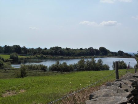
A riverside path continues to Edisford Bridge. It was along here the last time I passed that I had a wonderful view of a Kingfisher. No such luck today as the river is running very fast from all the rain we have endured. The campsite hidden in the trees was packed with people taking advantage of the easing of coronavirus lockdown.
I sat by Edisford Bridge for a drink taking in the scenery. This is a place where there was a ford before the present bridge was constructed, although it goes back to Medieval times. I crossed the bridge and found there was the start of a path going downstream although it wasn’t signed. A muddy section led to a gate into woods, this was now designated a concessionary path so I was confident of a way back.

A long bend of the river was closely followed at the edge of a large meadow. This side of the river was much quieter. A couple of girls were frying some sausages up for a picnic supper in the warm evening sunshine. I met another couple walk in the other way and they assured me of a route back to Mitton. The sand martins were again plentiful. At one point I disturbed a family of mallards which took to the fast-flowing water, I was concerned for the ducklings that seemed to be swept away but they ended up in a calm stretch by the other bank.

Steps led away from the river and a field was crossed signed by large yellow dots. A strange seat carved from a trunk with a couple of Bears was not that comfortable. This brought me onto the Public Footpath having avoided any road walking. Now that was what I would call a sensible concessionary path serving a good purpose and well used.

Stiles led through the lush fields.
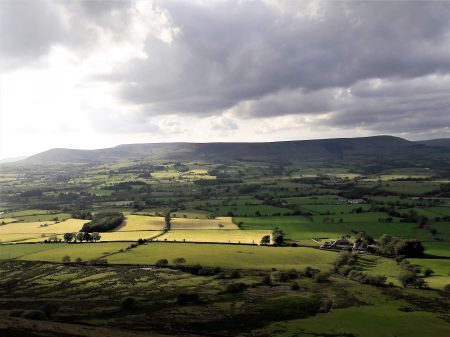
 Looking back there were fine views of Waddington and Newton Fells, all familiar ground.
  Eventually, a narrow enclosed path brought me out onto the road less than 100 yards from the church.
A very satisfying walk of about 4.5 miles, one I will repeat. Beautiful English countryside and curiosity satisfied.
The clock now read 6.30.
*****