Tag Archives: Long Distance Walks

ST. HILDA’S WAY. DAY 3.

Thursday 1st July. 10 miles. Glaisdale to Sleights.

Today I followed the Esk Valley Way except for my extra loop to visit St. Hedda’s RC Church, Egton Bridge; the Mortuary Chapel, Egton and St. Hilda’s Church, Egton.

   I walk down the road from my hotel past the rail station to arrive at the much photographed Beggar’s Bridge. There are several stories behind its construction.

It was built by a Thomas Ferris in 1619. Ferris was a poor man who hoped to wed the daughter of a wealthy local squire. In order to win her hand, he planned to set sail from Whitby to make his fortune. On the night that he left, the Esk was swollen with rainfall, and he was unable to make a last visit to his intended. He eventually returned from his travels a rich man and, after marrying the squire’s daughter, built Beggar’s Bridge so that no other lovers would be separated as they were. Wikipedia.  

   Whatever the story, it is an elegant bridge in good repair.  

The Esk Valley Way goes across a ford and into the woods, the Coast-to-Coast comes this way too, but I have no recollection of it. The woods are a peaceful haven as one climbs above the river, Stone trods appear and are a feature for the rest of the day.

   These stone paved ways are difficult to date but were thought to have originally connected the large monasteries, they being the only resources to fund such a scheme. Later in the 17th and 18th centuries, they would have extended as more commercial trade routes. I try to imagine this route being busy with packhorses travelling the county. The paving stones are worn from all that trade. Here in the woods is a particularly long section of preserved paving stones, how many more elsewhere have disappeared under tarmac or been destroyed by the plough? There are rocks in the woods which I wonder had been quarried for the paving I’m walking on.

One emerges onto a steep road, one in three, dropping to Egton Bridge. Here, hidden behind the Horseshoe Inn, are two series of stepping stones going across the Esk. A weir and mill race are obvious reminders of the industry on the river.

   Going up the road is St. Hedda’s RC Church. Hedda was a contemporary of Hilda at Whitby. Egton was a hotbed of dissention during the reformation. Its most famous RC priest, Nicholas Postgate, became a martyr, executed at York in 1679. The Roman Catholic congregation however continued to worship in secrecy, and this new church was built in 1866. Today the church is Covid closed, inside apparently is a shrine to Postgate. On the school next door is a statue of St. Hedda.

   Leaving the Esk Valley Way I take to the fields and woods past Lelum Hall Farm and climb steeply out of the valley, again with traces of the trod no doubt heading towards the old chapel.

Off the road at the top is Egton Memorial Chapel and Graveyard. The original C13th chapel of St. Hilda survived the dissolution period and continued as the Anglican Parish church, but it deteriorated and was demolished in 1876. A new St. Hilda’s was built in Egton, see below, but the graveyard has continued in use. The present mortuary chapel was built on the foundations of the old in 1897.  A rather sombre place but with good views across the dales.

   Egton village is spaced out around the wide street with lots of old attractive houses. I ask a man with his dogs the history of some buildings, but it turns out he has just moved here and is slowly finding out himself. He tells me of his restoration plans for his new property, not the retirement he had planned. He did however know about the  surviving ‘hearse house’ down the hill, as well as the house where secret Catholic masses were held.

The village continues down a steep hill, which must be a nightmare in hard winters. The new St. Hilda’s Church was built,1879,  using some stones from the original church. I wander around the outside to spot some old date stones, the church of course being locked.

                                                                                                                                                                                                                                                                                                                                               Back at the bottom of the hill I call in at The Postgate Inn (remember him  – the martyr) for a pint and surreptitiously my vegetable slice from yesterday – delicious.

    Now back on the EVW there is a rather dull track for a mile or so, my attention shifts to the plethora of common hedgerow flowers.

  This must have been a toll road through the estate at one time. The river is never far away, with the old stone paving alongside it. An old priory is mentioned, but now looks like a country residence. I meet up with the Egton newcomer again, he is out walking with his wife and one of the dogs, he knows nothing of the priory.

Further on, stone trods reappear as I walk through Spring Woods and on to elegant Newbiggin Hall with its nearby rusting tractors and paraphernalia collection.

More surviving stone trods cross fields and woods, with Sleights in view on the hillside ahead. I enter the lane close to St. Oswald’s Retreat, where some sisters from St. Hilda’s Priory, Whitby, live.

The lane leads to Sleights Station and a bus stop back to Glaisdale. I’m the only one on the bus, but at the next stop a lady boards and sits right adjacent to me. She obviously doesn’t understand social distancing. I was expecting three days sweat would keep most people away from me. It’s been a long day, and I’m rather weary when I arrive back at the Arncliffe Arms for my second night.

*****


ST. HILDA’S WAY. DAY 2.

Wednesday, 30th June. 11 miles. Danby to Glaisdale.

  People appeared from the woodwork this morning for breakfast, all the tables were occupied. Strange, I saw no one last night. Around the corner was a great little bakery where I queued outside in the rain, socially distanced, face mask on, to purchase my lunch. A lattice vegetable slice and a cheese scone, I was tempted by much more from their excellent selection. Danby sits around the village green with characteristic warm sandstone walls and those red clay pantile roofs, though the damp weather meant I didn’t linger.   

The bakery the previous evening.

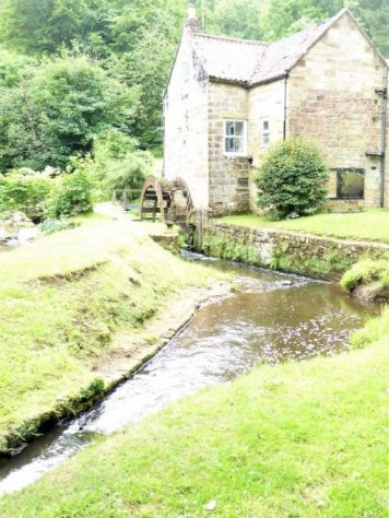
The old water mill.

I had to walk a bit of a loop to visit St. Hilda’s Church outside Danby. As I walked up in the mist I had a vision of St. Hilda in the fields by her church. 

   If you are going to build a church two miles out of town and put it at the top of a steep hill, you are not guaranteed full congregations. But things would have been different 900 years ago when the first church appeared on this site. Parts of the present building go back some 500 years. Even the vicarage which I passed is a good walk to the church.  Again the church is locked, Covid precautions, so I missed the opportunity to view the stained-glass window depicting St. Hilda at the 664 Whitby Synod when she oversaw the debate on settling the date of Easter between the Roman and Celtic factions of the Church. Stained-glass doesn’t look as good from the outside.

The Whitby Synod window.

Some vicarage…

*****

…with guard dogs.

   I was wondering about the decision to follow the route up onto the moor in poor visibility and rain, but then I came across these ancient paving stones alongside the farm track and leading onto the moor. A path stretched out before me, and I marched along, oblivious to the weather. This is what walking is all about, a clear trod through the bracken traversing the valley side and eventually dropping to pick up the signed Esk Valley Walk with its logo of a leaping salmon. There were no leaping salmon at this time of year, but alongside the river with its sandbanks were lots of chattering sand martins.      I spent a little time chatting to the water bailiff who gave me lots of information about his work along the river.    A pleasant surprise was the Park Visitor Centre where despite coachloads of children I was able to have a good coffee.    Refreshed, I set off, knowing I had to climb back onto the moors once more. Coming down were a jovial trio of a certain age out on their weekly tramp, they had already done over ten miles. I slowly gained height in fields and then a steep rough track took me up onto a minor road which I would follow for two or three miles. It was up here that I met Graham, who was cycling from Luxembourg to Scotland with all his worldly possessions. A like-minded soul, we chatted for half an hour about all the things that are good and bad in the world. Whilst we were stood by the side of the road, a couple of road cyclists pulled up to say hello. They had come from Clitheroe (close to where I live) that morning and were heading for Whitby. A hundred miles of hilly country. Asked where they were staying for the night, I could hardly believe that they were turning round and heading home! We wished them good speed. My new mate trundled off at a more leisurely pace.

   It was good walking up on high, I hadn’t realised I was just under Danby Beacon which I passed yesterday – I am taking a circuitous route! As you can see from the pictures, the views across to the extensive valleys and moors were limited, but probably more atmospheric for that. A stone by the road took my attention and I could just make out lettering on one side. Later research showed it to be a listed boundary stone from 1736. The noisy lapwings seemed to enjoy having their photographs taken

Suddenly I was dropping down a 1in4 hill into the village of Lealholm. I now wish I had spent more time exploring this attractive place, as there is much more to see than is obvious from the road I came in on. I did however find a café open, The Shepherd’s Hall. Under strict COVID-19 rules, I was able to enjoy a pot of tea and a toasted teacake. When I was climbing with Tony it was almost a ritual to start the day with tea and toasted teacakes, I sat with pleasant memories.

An old well…

…with its chained cup.

   All I had to do now was to follow the well trodden Esk Valley Walk into Glaisdale, not always by the river as you would think. A watermill had been converted into a highly desirable residence. As my inn was in the lower half of the village, I didn’t have to climb  to the centre. I will never know what I missed, but I could sit outside with a pint looking up to it.    An excellent varied day despite the mixed weather. Because of the café stops, I hadn’t got round to eating my purchases from the bakery, they should still be fresh tomorrow.

*****

ST.HILDA’S WAY. Day 1.

Tuesday 29th June. 10.5 miles. Hinderwell to Danby.

   Not surprisingly the walk starts at my first St. Hilda’s Church. I’m in Hinderwell after a long drive to Whitby and a delayed bus journey, so I’m  more interested in the café set up in the old school. Fortified, I go in search of the church. An interpretation board gives me a potted history of St. Hilda, which is similar to my preamble.

  There has been a church on this site since the C12th, but the present church was started in 1773, it is dedicated to St. Hilda. The well said to have been discovered by her probably predates her, but gave its name to the village. (Old English Hildewella meaning Hild’s well.) The church is squat and plain and unfortunately locked under Covid conditions. I am able though to find the well in the grounds and yes, there is water in it. One down, seven to go.   The first half of the afternoon is spent wandering through farmland rising from the coast. Hay is being cut or rather silage is being baled. The paths are high in vegetation, not good for my hay fever or bare legs. St. Hilda’s Way is not signed, but follows rights of way. It’s all up and down, I suspect that’s going to be a feature of this walk, I’d forgotten how hilly this region is. As a teenager, living in Darlington, we cycled and youth hostelled extensively in the North Yorkshire Moors. Of course in due time we completed the Lyke Wake Walk, Cleveland Way, Wolds Way and the Coast to Coast through the area, but it is years since I’ve been back.

   I’ve a good feeling about the authors of the guidebook already. The instructions are clear and precise to navigate the way, which as I said is not waymarked. The logo for the way is an ammonite, which would have been an excellent choice for signing.

The afternoon heat became oppressive, the fields more and more equestrian orientated, so I escaped to the minor road running in the right direction. Here I could make better progress and there were views back to Hinderwell and the coast.   Eventually I reached Scaling Dam Reservoir, an artificial lake on the edge of the moors. Once this was skirted, I don’t know why paths on the north side weren’t  chosen away from the traffic noise of the busy A171, the walk took on a different character. Open moorland beckoned.   The bracken had not yet reached its full smothering growth so the footpath onto the moor was clear. It was good to hear the familiar call of the Lapwings and Curlews yet again this year. Height was gradually gained, and Bell Heather bordered the narrow path. Ling comes later in the year to give the ‘purple moors’ in August. Higher still a broader track was followed, all around on the map were marked tumuli and antiquities, but little was obvious to my untrained eye. I did however make a short detour to the remains of a medieval cross. The base was clear to see, with perhaps a bit of the shaft inside. These must be ancient tracks. Crosses were placed on regularly used routes linking settlements or on routes having a religious or funereal function.  A broader track took me up to Danby Beacon Hill which was rather disappointing as a motor road comes up here with all its litter problems. Apart from the car park there was a trig point, a topograph and a modern beacon to visit. Late afternoon was not the best time for distant visibility.

   Danby, down below somewhere, was hidden in the trees. Waymarkers reminded me I was in the North York Moors National Park. Rough fields dropped to Clither Beck and a lane took me to the door of The Duke of Wellington, my bed for the night.


   I’ve noticed before that bar staff often have poor local knowledge. I was the only one sat in the bar and asked the barman where the pleasant Daleside Beer I was drinking came from – he didn’t know, though he had been pulling pints of it for some time. (turns out it’s brewed in Harrogate)  He proceeded to ask where I was walking and then bring up on his phone an indecipherable satellite map of a completely different area where there was a recommended walk. Of course, he hadn’t heard of St. Hilda’s Way, but I wouldn’t have expected him to have. The conversation dried up, so I had an early night.


*****

ST. HILDA’S WAY.

I think I spotted this walk in the LDWA magazine a few years ago, and the guide book, by Nancy and John Eckersley, has been on my bookshelf since then. (along with several others!)

The original idea for the walk came at the time of the 1400th anniversary of the birth of Hilda (or Hild as she would have been known) in 614. The area around Whitby has many associations with St. Hilda, so through local churches a 40mile route was devised. It was designed as a pilgrimage visiting the churches named after St. Hilda.

So who was St. Hilda?  She was born into royalty in the turbulent C7th. Her father was assassinated before she was born, and the family lived in exile in the Kingdom of Elmet, now part of Yorkshire. At the time the large region of Northumbria was ruled by Hilda’s uncle King Edwin.  After his death, Oswald became king and re-introduced Christianity to the region, founding Lindisfarne monastery and Aidan preached the gospel.

When Hilda was 13 she heard Paulinus, a missionary from Rome, preach and she was subsequently baptised in York, 627. The family later fled to Kent when Northumbria was overrun again. At the age of 33 she became a nun and was called by Aidan to found a monastery north of the Wear and a year later she became an Abbess at Hartlepool. In 657, she founded the monastery at Whitby. To cut a long story short, she became a woman noted for her wisdom and kindness, she trained bishops, advised Kings and laid the beginnings of a literary house at Whitby. She remained at Whitby for the rest of her life, dying in 680. She was buried there, but later her remains were moved to Glastonbury. Sainthood after her death was probably bestowed upon her by the local Christians.

A legend has it that St. Hilda turned snakes into stone, which were then recognised as ammonites found in the Whitby area. The ammonite has been used as a logo for the walk. 

I’m not intending my walk to be a pilgrimage in the religious sense, but a way of exploring the moors and valleys of this part of North Yorkshire with the added interest of the St. Hilda connections. In order to have time to visit and appreciate the churches, I am planning on about 10 miles per day, which fits in with accommodation possibilities.

Now how do I get  to Whitby?

From Walking St. Hilda’s Way.

ISAAC’S TEA TRAIL. 4. ALLENDALE TO NENTHEAD.


Thursday,    10th June.      11.5 miles.

As usual, I don’t get away as early as I had planned, there is rain forecast for after lunch. Allendale is quiet, the school bus has taken the local children off somewhere else.

At the bottom of the hill I rejoin the East Allen River next to an old corn mill, but soon I’m on paths through the meadows. Remote farm houses appear out of nowhere. One little cottage has no road to it, they have to walk down to the footbridge over the East Allen and up to the main road, the lady said she had just done her school ‘run’, what a place to find for a Bohemian lifestyle. They keep horses too. Eventually I reach that footbridge over the river at Peckriding Crags, a popular Victorian picnic spot.

The house with no road.

The morning drifts by as I follow carefully the waymarks through complicated fields, sometimes close to the river and others diverted away from it. There are rabbits and sheep everywhere.

I drop down to the river at Studdon Bridge where there is a shaft going down to the Blackett Level 25 m below. More isolated farms are passed. A farmer from one tells me of a successful scheme to introduce children to agricultural and environmental projects. At Rowantree Stob a bastle has been conserved and one is able to wander around it.


Rowantree Stob Bastle.

Spot the Curlew.

Slowly I start climbing out of the valley and meet The Black Way, at first a rough estate road but becoming a vague path through the heather. This route would have been busy in the mining days with ponies taking their loads of ore to the smelt mills. The weather is changing with a cold wind bringing in light showers and obscuring the views. I shelter in the lee of a peat hag for a bite to eat before carrying on over higher ground. It would be easy to go astray up here. Over to the southeast is Killhope Law in County Durham, I’m hovering between Northumberland and Cumbria. As I lose height, the enclosures and ruins of Coalcleugh come into sight – once a thriving village with chapel, library and pub. Not much remains, and today it feels a rather bleak place to be.

That provocative estate sign again.

KIllhope Law, been there …  done that.

Coalcleugh.

The last climb over the moors takes me to the highest point of the Tea Trail, 585m, on the county boundary. I don’t linger but press on down towards Nenthead where the moors are full of the evidence of the past – spoil heaps, hushes and ruined buildings.


The border.

‘Old Peter’ clock face from the tower on Nenthead market house until the early 1900s.


Bainbridge Memorial Water Pump. 1841.

The bike repair man is still busy but The Miners Arms  no longer serves refreshments and the museum is closed, so there is nothing to keep me in Nenthead. My car is the only one in the carpark, thankfully it still has four wheels.

*****

*****

Isaac’s Tea trail has proved to be a classic little long distance way, all 38 miles of it. This is beautiful English countryside with a wonderful heritage. The villages are largely unspoilt and seem to retain a good sense of community often lost in today’s society. Accommodation and shops are plentiful. I’ve enjoyed the wildlife, even though I didn’t encounter any red squirrels, and learnt something of the lead mining industry which shaped the area. The ancient paths are clear but not heavily used, so are a joy to explore. I would highly recommend this as a short backpacking trip for the casual walker looking for exercise and interest.   Where to next in this ‘staycation’ year?


ISAAC’S TEA TRAIL. 3. NINEBANKS TO ALLENDALE.

   Wednesday, 9th June.    11 miles.

  From the terrace of the YHA the hills I would be traversing were all too obvious, it would be a day of ups and downs. The weather just got better and better as the day wore on.

  A gentle walk up the lane brought me to Redheugh, a cluster of houses, Isaac Holden was born here in 1804 and baptised at Ninebanks church in 1806. The way followed a ridge across fields and through the remains of Keirsleywell lead mine, where he worked with his father and brother in the 1820s. At the road  I walked alongside the low Mohope Beck watching Sand Martins coming and going.

Redheugh.

Keirsleywell Spoil.


Malakoff Bridge.

Mohope Beck.

The bridge in Ninebanks crossed the larger West Allen River. Some steep steps came out on the higher road, where I diverted to visit some buildings of interest. First was the old Hearse House, built in 1856 after fundraising by Isaac. It wasn’t long after that Isaac died and was carried on the hearse to be buried in Allendale. The little museum was filled with an eclectic collection of objects relating to mining, funerals and tea. A great deal of information was displayed about the Holden family. Not to be missed if you are walking the trail.

  Along the lane is a terrace which was once Ninebanks school and Ninebanks church, St Marks, dating from 1764. A peaceful place for a short break.

  From then on I used ancient tracks through rough farmland, there were lambs everywhere. I crossed two old bridges below Dryburn which would have been used by lead carriers with their string of ponies going to the smelt mill in Allendale. Most of these old bridges have been washed away in floods.

  A road was crossed alongside High House Wesleyan chapel, now a private residence but the graveyard is still there. I had difficulty finding the path in the next group of fields, but received a friendly reception from a farmer’s wife and dogs when I wandered into their yard. She showed me a way and complained that the RofW hasn’t been maintained.

  After a few more difficult fields I was ready for a sit down and some lunch overlooking the valley.  There was a long stretch in Monk Woods high above Whitfield Hall and Church. The Whitfield  Estate belongs to the Blackett-Ord family, it was their moorland I tramped across yesterday and it is their woods I’m walking through today. Every hundred yards are pheasant feeders and the estate is very proud of its ‘sporting’ pheasant shooting, which I find abhorrent.

Baby pheasants, what a life.

I was glad to be away from the woods and on the final climb to take me to The East Allen valley. I passed limestone quarries and was in the heart of Curlew and Lapwing territory. Lovely open upland walking territory.

Heading down towards the river I passed Keenly Wesleyan Methodist Chapel established in 1750 after John Wesley had preached nearby.  It is said to be the oldest chapel in the world in continuous use.

  Without checking, I followed a very steep path down to a footbridge and steeply up the other side to find myself lost in field. I could see my mistake on the map and decided to follow the edge of fields until I could join up again without backtracking. This involved some risky crossing of barbed wire and then some very steep descending to reach the RofW by the river. The path alongside the  East Allen wasn’t straight forward with irritating diversions.

Going off track.

Definitely lost.

East Allen River.

A large Weir appeared by a road bridge and alongside was the site of Allendale Smelting Mill. There are some ruined buildings, but a lot is now a small business park. From the C17th, the Blackett family owned the mineral rights to the Allen Dales. Ore was extracted by levels driven into the mineral veins with horses pulling carts along the tunnels.  In addition to lead, the smelting mill produced silver, it closed in 1896.  The trail  crossed the bridge for the final mile. Of note was the opening to the Blackett Level which in 1855 was to run for miles in search of new veins of lead ore. It never fulfilled its promise.

Recommended.


The Blackett Level.

Leaving the East Allen River a steep hill brought me into Allendale, a small market town. The central square was busy with many taking advantage of the sunny weather to enjoy a drink outside one of several inns. I was staying at the King’s Head and my room had a bath which I much appreciated after a longish day.

After a rest and a brew, I wandered around the village, which had several Isaac Holden connections. First and foremost was St. Cuthbert’s Church where Isaac is buried with a fitting memorial.

On the edge of the marketplace is Isaac’s Well, 1849. He raised funds for its construction  to bring clean water to the town.

Across the road is the old savings bank, of which Isaac was a founder member. He also raised funds for two of the Methodist chapels in the town. On the edge of town is a row of cottages, Wentworth Place, where the Holden’s grocery store was. A busy man.

Old Savings Bank.

Primitive Methodist Chapel.

Trinity Methodist Chapel.


The PO. in Isaac’s time.

Wentworth Place.

*****


ISAAC’S TEA TRAIL. 2. ALSTON TO NINEBANKS.

  Tuesday, 8th June.     9 miles.

I wandered around the quaint cobbled streets and alleyways of Alston in the morning sunshine. There are a variety of small shops, some are aimed at the arts and crafts end of the market, but thankfully there are grocery and bakery outlets so I was able to buy a picnic lunch.

Town Hall.

St. Augustine’s Church where Isaac’s parents married in 1796.

  The Tea Trail follows the Pennine Way out of town but I decided on a different route, The South Tyne Trail which runs alongside the South Tynedale Railway. This narrow gauge track once linked Alston to Haltwhistle and the rest of the network. It has been partially restored for tourist trips. I therefore headed to the Station just out of town. The café was just opening and volunteers were busy with odd jobs, but alas no trains were running today. I had to be my own pretend train as I followed alongside the single track a couple of miles to Kirkhaugh Halt, where I picked up the official Tea Trail once again. It had been a pleasant diversion alongside the South Tyne.

  The path dropped to the South Tyne and a new footbridge replacing one washed away in 2018 floods. This one looks built to last, confirmed later by a local resident living next to Kirkhaugh Church who had watched the whole progress. The church was where I was heading next.

Note the church steeple.

  To give its full title – The Church of the Holy Paraclete. (Holy Spirit- I had to look it up.) The church has symbols of the dove inside, there are nine to seek out, I managed a measly three. Isaac married Ann Telfer here in 1834. The church was subsequently rebuilt in 1869 by the Rector Octavius James, inspired by Bavarian churches – hence the needle steeple. A bench outside was ideal for an early lunch.

  The stretch of minor road running back along the S Tyne was tree lined and the habitat of red squirrels but I didn’t see any. I left the road near Randalholme,  and climbed steeply through fields to reach the few houses named Ayle, a remote spot. Some flower filled meadows followed before a steep drop through hawthorns came to a footbridge over the gentle Ayle Burn, another bridge replacing one washed away in 2002.

Ayle.

A new waymark appears.

  It was a steep pull up to Clarghyll Hall, a good example of a bastle, a fortified farm. Rector Octavius James had a hand in its restoration.

  Various lanes and tracks took me through remains of mines and a colliery all reverting to nature. Bits of old machinery are evidence of recent attempts at mineral extraction. Curlews and Lapwings provided entertainment, but with little success with the camera. Then it was out onto the open heather moor.

Plantings on old colliery.

   A large notice proclaimed the virtues of the management of this moor which is of course for grouse rearing and shooting. I can’t agree with the propaganda and patronising information put out by the shooting fraternity. Anyhow, it was a good upland walk with skylarks singing above, no doubt any resident birds of prey have been done away with. Northumberland does not have a good history on raptor persecution.

As it descended to West Allendale the track became very rutted and stony, I spotted a field on the edge of the open access land which avoided all this and took me straight to the door of Ninebanks YHA. What a splendid hostel this turned out to be. Dating from the C18th during the lead mining bonanza, all around are visible reminders of that era, open shafts, spoil heaps and hushes down the hillsides. Sitting outside on the terrace, looking out over the Moors with the only sound that of birds – what a place to forget the Covid problems.

A good long varied day.

*****

ISAAC’S TEA TRAIL. 1. NENTHEAD TO ALSTON.

Monday, 7th June.           7 miles.

  I pull off the motorway at Tebay services, it’s chaotic. There is virtually no parking space, the whole area is like Blackpool front on a Bank Holiday. So they were correct when it was hinted that all the Benidorm crowds would be let loose in the British countryside.  Not that I have anything against Benidorm. I wasn’t going to queue to spend a penny, so I drove out and headed  for what I thought would be a quieter area of the country – the Northern Pennines as they are signed off the motorway at Penrith. Nenthead was my starting point for a few days walking Isaac’s Tea Trail

  Nenthead was a major centre for lead mining from 1750 to the end of the C19th. The London Lead Company was founded by Quakers, and they built decent houses  (considering the period) for the workers, complete with a free lending library and schooling for the children. There was a brief spell of reworking the mines for zinc, but that ceased in 1940. The village clings on as a quiet backwater with little to attract the tourist.

  It is however on one of the c2c cycle routes and there in the centre of the village is the bicycle repair man. He is tinkering with the gears on a lady’s bike. I stop to ask him where it might be safe to leave my car for three nights. He points across the way to the  mining museum, which looks closed, but there is a large car park with no overnight  restrictions, so that is where my car is I hope. I leave Nenthead as quickly as I arrived, I’ll look around when I return.

  From the village centre an Isaac’s Tea Trail finger post points along an ordinary looking street but at its end I’m surprised to see a model village of Nenthead with added features from around the world, obviously the lifetime’s work of a local. Along the riverside path, presumably the Nent, I meet a man walking his dogs, I notice one is attached to a harness and wheels. Apparently he has a form of a neurological disorder where they lose the use of their back legs before even worse symptoms develop. The owner is giving his dog some sort of life for now.

  The whole area has signs of past mining with the spoil heaps now reclaimed by nature. There are lime kilns and mine entrances scattered across the hillsides. The soft sand from reworked spoil heaps is riddled with rabbit holes. Apart from the grazing sheep, I come across a group of alpacas.

  The path is well signed as it crosses from field to field along the valley side on stone stiles. There are a few farms still working, but many have fallen into ruins. At one time up here was a thriving village, Nentsberry, with pub, chapel and school. An old man out walking looks as though he comes from that period, they are probably bred tough up here.

  Down some steps the road is reached at a bridge. The Hare and Hounds is ruined, but a once blacksmith’s shop is still standing. Across the bridge is Nent Hall built from the proceeds of the rich Hudgill mine and now a country house hotel.

  I meet a woman coming along the riverside path and she warns me of a closure farther along due to flood erosion repairs. So my brief spell by the water comes to an end at the Path Closed sign. I suspect that people are still using it, but I decide to be sensible and follow an alternative FP up past the neglected Lovelady Shield Hotel. I  climb steeply up the hillside to meet a quiet road and then a rough mining track contouring the valley. There are a few farms up here, but most of the surviving properties are holiday lets. All around are signs of past mining, I’m getting good views of the valley and stride out purposefully.

The track drops me into Blagill, another old settlement clinging on.

The last stretch into Alston is a delightful path alongside the River Nent as it slides over limestone slabs and tumbles down small waterfalls. Along here there has been flood damage from Storm Desmond and repair work has been carried out using European money. What’s the future for funding these projects now?

  Curlew are making a commotion as I pass through their fields. I forgot to mention that I spotted a red kite early on.

Alston is reputed to be the highest market town in England and I enter it on twisted cobbled alleys, arriving at the Market Cross. I’ll explore farther tomorrow as I’m ready for a brew and a rest. My Inn for the night is run rather incongruously by a Chinese lady who is most welcoming and full of laughs. I think I’m going to enjoy this walk.

*****
ISAAC’S TEA TRAIL.

The memorial stone to Isaac Holden in the churchyard at Allendale states –

IN MEMORY OF ISAAC HOLDEN

A NATIVE OF THIS PARISH

WHO DIED NOVEMBER 12TH 1857

AGED 51YERS

HE GAINED THE ESTEEM

BY HIS UNTIRING DILIGENCE

IN ORIGINATING WORKS OF CHARITY

AND PUBLIC USEFULNESS

UPWARDS OF 600 PERSONS

SUBSCRIBED TO ERECT

THIS MONUMENT

  Isaac was born to a poor family in the West Allen valley NE of Alston. He naturally started work in the lead mining industry from a young age  but at some stage in the 1830s  when work was hard to come by he and his wife opened a grocery shop in Allendale and he began selling tea in this local area of the Northern Pennines. Tea was becoming popular, its price had dropped meaning the less prosperous could afford it. Methodist Chapel tea bazaars were a means of raising money. Around the same time he became devoutly religious and started fundraising for local projects. It is for his charitable deeds that he is mainly remembered.

  This 37 mile long distance walk has been established to explore the scenic area of these Northern Pennines and introduce one to the rich mining and religious history still to be found in the villages. Isaac would walk these very paths, selling his tea to the local lead miners and farmers.

  The Wesleyan Chapel, Allendale, 1839,  Savings Bank, Allendale, 1840s,  Isaac’s Well, Allendale, 1849,  Hearse House, Ninebanks,1856 are some of his legacies visited en route.

It is a circular walk and thus can be started anywhere, there are sufficient accommodation opportunities in the villages to support the walker on what is described as a strenuous route. There is a website with all the information you need and downloadable directions and maps. https://isaacs-tea-trail.co.uk/  The route is marked on the OS maps. A guide book has been written by Roger Morris and is available from the Allenheads Trust Ltd.

The forecast remains fair for another week, so time to put on my boots again; follow in Isaac’s footsteps; explore this quiet region; soak up some history and maybe drink some tea.

*****

Day 1. Nenthead to Alston.

Day 2. Alston to Ninebanks.

Day 3. Ninebanks to Allendale.

Day 4. Allendale to Nenthead.

THE CUCKOO WAY. FIVE.

Tuesday, May 25th,       10 miles.     Killamarsh to Chesterfield.

Rain was forecast for the afternoon, so I boarded the first bus to Killamarsh, it took well over an hour to reach the destination having travelled around most of the Chesterfield district. I’ve become used to sitting for all this time with my face mask on. Calling at the hospital we picked up a drunk who had probably been released from casualty, as could be expected he caused some chaos on board before staggering off in the middle of nowhere.

I alighted at the Canal Bridge stop where I finished yesterday, but it was difficult to make out the bridge as the canal was filled in, encouragingly though was a sign for The Cuckoo Way to Chesterfield. The Greenway runs all the way to Renishaw and is a facility I hope the locals make use of, there were very few on it today.  So I disappeared into the undergrowth on the edge of a housing estate. The line of the canal was just a ditch to my left, at least it doesn’t seem to have been built over. The Cuckoo Way roundels, which I explained yesterday, were a help in navigating where the canal has all but disappeared.

Turning a corner the Trans Pennine Trail cycling route appears to the right following an old railway line. One could walk on the cycleway but I preferred to stay on the “towpath”. All of a sudden there was water in the canal, this section has been a fishery part of the Sitwell Estate. Coming towards me was a gentleman and his hound, he turned out to be the water bailiff for the estate. During the periods when we’ve not been allowed to travel far local fishing became a boom pastime and he was kept busy supervising the waters. He told me of the plans to restore more stretches of the canal, how to save and transfer the fish and how the line of the HS2 was coming through the region adding complications to the scheme. In this age of zoom conferences and working more from home will another railway be needed? The canal reverts to a ditch farther on.

The water bailiff goes on his way.

The line of the canal, the towpath and the Trans-Pennine Trail alongside.

The Greenway continued at times narrow and muddy, at others alongside the redundant canal. The cycle way has gone elsewhere. It passed the outskirts of Renishaw and then as a footpath following the filled in canal across open fields. Good progress was made as the way was clear ahead, although I had no idea of where I really was.

Approaching Staveley the canal originally was carried on a high embankment to cross the River Doe Lea, this is apparent on the ground except at the river itself, Staveley Puddlebank.

Staveley Puddlebank.

A lot of work is being undertaken at Staveley with a new lock and a basin constructed. This is some achievement as much of the labour is voluntary, Chesterfield Canal Trust. It was easy to get lost here with the new works and the many cycle routes.

Lunch was eaten on a bench next to the old Mill Green bridge. Men were fishing in the basin using very lifelike lures. As I sat two vessels came up the canal. The first powering a reed cutter and his mate using a rake to clear the water. In front of my eyes, the raker pulled a bath out of the canal – catch of the day. A little farther along he’d netted a bike and a supermarket trolley or were they art installations?.

Much friendlier than they look.

Catch of the day.

Entertainment over, I set off on the last few miles into Chesterfield. The towpath remained good and  a café was open at Hollingwood Lock.  On this section to Tapton new locks and bridges have already been built, and the canal is viable, although the only two boats I saw were from the Canal Trust used for pleasure trips raising money for the restoration cause. If you had a boat why would you put it on a section of canal only navigable for six miles.

And then there was a mile to go…

The end of the 6mile navigable section is short of the city and the rather dreary water comes to an end by building development sites which were basins in the years of the working canal. There are plans for a new showcase canal basin close to the city centre.

This lady’s not for turning.


First and last lock.

Even if the canal peters out before you get into Chesterfield, the sight of that twisted landmark is inspiring.

On reflection, I think it would be better to walk the way in the opposite direction with a far better finish at the Trent in West Stockwith.

46 miles of varied walking and I only became lost once in the housing estates of Killamarsh. I never heard a cuckoo, but I found a plausible reason for the Cuckoo tag, 

*****
 

THE CUCKOO WAY. FOUR.

Wednesday, 26th May.      10 miles.     Worksop to Killamarsh.

I found myself changing trains in Sheffield, but all went well and I was in Worksop by 9.30. Getting out of Worksop was more pleasant than getting in on the Eastern side had been – that old adage “West End Girls” comes to mind as I hum the almost Miles Davis like composition, hear that trumpet interlude!. The west ends of many towns and cities in England were usually cleaner and healthier to live in with the prevailing wind blowing the smog to the east ends.

Excuse my indulgence.

Back to the inauspicious start at an enclosed lock under the main street, but then all was lovely and green as this canal walk has been so far. I thought the sign was probably unnecessary.

I’m sure these were Tufted Ducks.

Today was going to be a day of locks, 30 were needed to raise the canal up to the Norwood Tunnel which went through the limestone ridge in the path of the canal between the Trent and Chesterfield, “The Giants Staircase”. Several of them were double or treble locks where there is no basin between the locks, these are quite rare in England. An amazing feat at the beginning of the Industrial Revolution. This stretch has been restored between 1995 and 2003, but the work is ongoing.

Eight locks up and I arrived at Shireoaks Marina, originally a C19th basin for a local colliery -the last coal left here in 1949. I had read about a recent building in the traditional way of a Cuckoo Boat, Dawn Rose, and that she was moored in the marina. I could find no way into the marina so if she was there I was denied a sight which is a shame.

Entrance to Shireoaks Marina.


The marina through the railings.

About this point I started to notice Cuckoo Way roundels. The birds didn’t look like cuckoos to me and I later read that they are choughs borrowed from Retford’s coat of arms and incorporated into the original Chesterfield Canal seal and now used in the Trusts emblem. The diamonds were from Chesterfield’s seal.

It was good to find some of those lovely Peak and Northern signs along the way. Above Shireoaks was the start of more climbing, the seven Turnerwood Locks and some old cottages picturesquely situated on the towpath. It was here I met a man cycling the towpath on a 1970s Claud Butler bike, one of the elite British bikes at the time. We chatted all things cycling and it was obvious he was very proud of his steed. Notice the Shimano gears with down tube shifters.

Around the corner a swan was sitting on her nest, it was only a few years ago that someone shot a pen in the same spot leaving the cob distraught. Why? Let’s hope this bird brings up a successful brood.

I was now at the bottom of the Thorpe series of locks with two triple locks and two double locks, 15 locks in half a mile all in sylvan scenery. I was suitably awestruck.

At the top the canal levels out. On the right is one of those old farms with accumulated junk from 50 years ago. I would have loved to explore deeper into the undergrowth but the whole place had a forbidding atmosphere.

Farther on was a DL – CC boundary stone which I’m still trying to decipher. The canal has the rail line running close by it and just before Kiveton Park station is the wharf where stone quarried nearby was loaded and taken off to London to rebuild the Houses of Parliament after they burnt down in 1834. At Dog Kennet Bridge the towpath changes sides for the short stretch to the blocked Norwood Tunnel. The last turnabout point is rather ornate. The tunnel ran for 2,880 yards before it was blocked by mining subsidence in 1907. I have to walk over the top.

The walk over was quite pleasant first past Kiveton Waters fishery, their café was closed, then through the old reclaimed colliery land where care was needed with the many paths going in all directions. Dropping downhill through fields there was an underpass for the M1 and then slowly water appeared on the left where the Norwood Locks had been. These were a series of 13 in a third of a mile, three treble and one quadruple. They are all filled in now. The way passes extravagant houses with traces of canal stonework in the water channel running alongside. It was whilst looking into the garden of one house that a kingfisher flew straight towards me, landed on a reed and then flew back again showing me all its colours.

Kiveton Fisheries.

Bits of the canal reappeared and then vanished under houses in Killamarsh where land was sold off. I became disorientated in the estates and reappeared at the bus stop 3minutes before the bus came down the hill. I have to get back here tomorrow morning hoping the line of the canal will be more obvious. It has been very short-sighted to build a housing estate here and it will be a major engineering undertaking to connect the two halves of the navigable canal.


Rather than end today on a sour note, here are a few photos of the detail that goes into lock construction.


*****

THE CUCKOO WAY. FIVE.

THE CUCKOO WAY. THREE.

Sunday,  May 23rd.        10.5 miles,     Retford to Worksop.

Today I’m left with vivid memories of abundant greenery along the canal for most of the way. I started off from the Town Lock in the middle of Retford but within minutes I seemed to be surrounded by trees. The canal crossed aqueducts, including one over the River Idle, and then with the King’s Park on the right and a massive manicured cemetery on the left I was in the countryside. A few old wharves were evident and then the West Retford Lock. Close to town was popular with dog walkers, one lady pushing a baby buggy had a little terrier close behind, as she passed me I realised another terrier was having a ride in the babyless buggy – arthritis was her excuse.

Doggy buggy.

I hadn’t gone far when I came across boats moored up and their owners engaged in canal side chat. Most times you pass moored vessels all you are aware of is some smoke from the chimney with the occupants tinkering deep inside out of view. Anyhow, these three were very sociable as we discussed the difficulties of restoring canals. I was able to chip in with the Lancaster – Kendal problem which they seemed to know all about. As with yesterday’s couple drinking wine I’ve  never been offered even a cup of tea  from a canal boat. I’m sure Sir Hugh will have partaken.

Lady Bridge, number 54, had good examples of the grooves cut into the stone by the horses tow-ropes. Nearly all the bridges and locks on the Chesterfield Canal have been given names with past associations, I suspect it was a very sociable trade being a boatman along here.

The next sequence of narrow locks were named after the Forest of Sherwood which extended this far in the C18th. The third one was named Charlie’s after the lockkeeper who live in the adjoining house. More open countryside bordered the canal with rich looking sandy soil. However, there were still a lot of trees bordering the canal, particularly some fine specimens of weeping willow.

Charlie’s Lock.

Today’s corny name.

A stretch of the canal ran alongside the A1 and the noise was only just tolerable, pity the people living  there. The inviting looking pub, The Chequers at Randby, was on the wrong side of the water which was probably a blessing as I had a way to go. The canal twists and turns through the Randby Bends seemingly getting nowhere, but it is only cleverly following the contours.

By the time I reached Osberton Lock I was ready for lunch and luckily found a bench which happened to be a memorial to a gentleman who had lived in the attached lockkeeper’s cottage for many years.

I was now entering the estate of Osberton Hall and I found the towpath changing over to the left-hand bank – the owner of the Hall in the late C18th  had an Act of Parliament keeping the towpath on the opposite side from his house. The landowning toffs have always been up to it, nothing changes. I managed a sneaky shot of the stately pile.

Now it was all semi urban scenery into Worksop. Interest was maintained by the defunct steam driven Bracebridge Pumping Station, for Worksop’s C19th sewerage. The canal then comes alongside a massive factory, apparently a flour mill. There were some pleasant canal side cottages still standing.

Then over the canal in front of me was a warehouse with direct access to canal boats moored below – the trap door is still there. The warehouse was at one time owned by Pickfords of removal fame but now functions as a coffee shop and gym, I had visions of a weight lifter coming crashing through.  It was time to finish for the day.

*****

THE CUCKOO WAY. FOUR.

THE CUCKOO WAY. TWO.

Saturday May 22nd.     6.5 miles.     Clayworth to Retford.

The bus drops me off opposite St. Peter’s Church, this originates from the C13th but was much altered in the C19th. Murals by the arts and crafts artist Phoebe Traquair cover all four walls of the chancel, but there was no entry today. Outside though the churchyard wall contains a large boulder, perhaps unearthed by navvies digging the canal or was it a meteorite landing in the village? The village cottages were bedecked in clematis and all was quiet on the little lane leading to the canal at Otters Bridge, now down to number 68..

This was the start of a delightful walking through open countryside, views across the flat drained fields, lively birdsong and the all-pervading Mayflower scent. A roe deer was seen scampering across an open field, mother mallards shepherding their broods and swans protecting their cygnets. There were long stretches of reed beds and I heard several warblers but only caught sight of the one Reed Warbler.

‘There are boats moored up alongside the headquarters of the Retford and Worksop Boat Club. Much tinkering is going on, but nobody is sailing. Today’s prize for the corniest boat name goes to Goldilocks.

Several canal side pubs were passed, but none looked inviting, plastic children’s play areas and hastily concocted Covid dining areas. One, The Hop Pole, reflected on the acres of hops grown locally in the C18th until the canal ruined their trade by bringing hops from Kent, which had a better taste. Another of interest on the outskirts of Retford, the Packet Inn, was once the terminus for the weekly packet boat from Clayworth bringing people and produce to market. This was a two-hour journey and the return was an alcohol fuelled party. 

Bridge 61 is named Bonemill bridge alongside the building where bones were crushed for use as fertiliser. All these bridges and the older warehouses are constructed with attractive local bricks which have aged well.

Alongside the canal a garden has been furnished with signs and the occupant was all to pleased to chat about them.

After miles without, the first lock of the day was named Whitsunday Pie Lock, this strange title having many dubious origins. It is the last wide lock on the canal.  People were fishing unsuccessfully for perch and a couple had pulled up in their boat having cruised out of Retford for the weekend. They had just opened a bottle of wine and were in no hurry to proceed. This resulted in a lengthy conversation about boating, Covid and the best pubs in Retford. They had named their newish boat Our Lass – they were well and truly Yorkshire born and bred. For some reason I omitted to take a photo.   The next couple walking their greyhound were just as chatty and seemed to have all the time in the day, maybe life is more relaxed around here. Eventually I came into Retford with more old warehouses making an appearance. As is often the case these have been either converted into attractive living accommodation or become cafés or restaurants. so it was pleasant enough as the rural scene turned to urban hustle and bustle. The Town Lock is much narrower than those before, a good place to finish for the day.


*****

THE CUCKOO WAY. THREE.

THE CUCKOO WAY. ONE.

Monday,  May 24th.      10 miles.     West Stockwith to Clayworth.

The bus to W Stockwith went around the houses more than once, at one time reversing the way through Misterton. I have a tight logistical transport plan to enable me to walk linearly and I was beginning to see it go wrong on the first day,  or is it the third? – it is too complicated to explain.

Suffice to say I started the walk at the canal basin next to the River Trent.  Is this the start or the end of the canal, well it depends, but in my case it is the start. 46 miles to go.

The River Trent is wide here and tidal, boats used to access it from or to the basin by the first lock. The canal as far as Retford had locks wide enough to accommodate  the larger River Barges. People are busy tinkering with their boats in the basin and the sign says the lockkeeper is on duty from his converted warehouse.

The River Trent with the old winch which pulled engine-less vessels into the basin.


The river lock and keepers cottage.


1798 warehouse, now the lock-keeper’s office.


A busy basin.

 A few boats were moored up on the first stretch of the canal. The towpath surface to Misterton has recently been improved and there are benches at regular intervals, that’s a good start.  The May Blossom was a delight, often lining both sides of the water, the theme of the day really. The sun was shining and the wayside flowers vying for attention. Life outside Lancashire was good.

The start of the canal.

Alongside Misterton, swans had made their nest on the towpath side, apparently if the male is on the path you had better turn around. Today he was too busy chasing ducks that came near the female on the nest.

The brick bridges are all numbered, counting down from 85, and modern mileposts are in place counting down from 45. I don’t know if any of the original mile markers have survived.

Bridge 82 0f 85.


One mile gone, 45 to go.

The rest of the morning is spent out in open countryside with hardly a habitation to be seen. I chat with a couple of lady dog walkers who tell me about the wild life I may or may not see. Kingfishers and otters are at the top of the ranks. One stretch of reeds is full of the song of Reed Warblers, but I only catch a glance of them. https://www.youtube.com/watch?v=jgFDzVeyg94

The surrounding countryside is flat agricultural land as far as the eye can see, there is nothing here for the fellsman. Having said that I do pass at a distance Gringley-on-the-hill, an ancient village with far-reaching views. I can just spot its church tower on zoom.

Lunch is taken sat on the steps of Shaw Lock. On the adjacent bridge are the initials of the builder and date.  In a field nearby is an old brick works, boats brought coal in to a wharf and took the bricks out.

More wild woods and lush verges followed until I came to the mouth of Drakeholes Tunnel. Here the path goes over the top as did the horses whilst the boatmen pushed the barges through.


At the other end of the tunnel was a small wharf and across the road an Inn due to reopen soon, but will they still serve beer?

The next bridge along is named Face Bridge but the face on the keystone is very weathered. The bridge is ornate as it was the on the driveway to Wiseton Hall. The canal bends around the estate because the owner stated that it should not be built within 200 yds of the hall. The power of the upper classes.

 There had not been much traffic on the canal but in the last mile along comes a boat and two men paddleboarding.

I need to pay attention to the bridge numbers as I leave the canal at no. 68, Otters Bridge, to climb up to Clayworth and the end of my first day. I arrive just as the rain does.

*****

THE CHESTERFIELD CANAL – WALKING THE CUCKOO WAY.

The Cuckoo Way follows the towpath of the Chesterfield Canal for 46 miles, arguably one of the most beautiful and varied waterways in England.

The canal was designed by James Brindley but much of the work was by his assistant John Varley. The line, known locally as ‘Cuckoo Dyke’, opened in 1777, five years after Brindley’s death. It was at the forefront of canal design in its day with a multiple staircase lock flight and the longest tunnel in the country at Norwood. Originally extending 46 miles from the River Trent through Worksop and Retford to Chesterfield. Along the way it negotiated two tunnels and a combination of narrow gauge and broad gauge locks. A decision was made for the canal to be narrow from Chesterfield to Retford, but on a larger scale between Retford and the River Trent to accommodate wider-beam river traffic along that section.

Throughout the 19th Century the canal was very successful, carrying coal, agricultural goods, bricks, iron, timber, pottery and ale. Its most famous cargo was 250,000 tons of stone from local quarries which were used in the construction of the Houses of Parliament. The original cuckoo boats, all horse-drawn, were unique to the canal. Most boat trips were short, this meant that there was no requirement for overnight accommodation and hence no, or only a small, cabin or shelter. The “traditional” canal art was also missing.

The advent of the railways brought a gradual decline that was compounded in 1907 by a collapse in Norwood Tunnel. Although some trade did continue on the canal, the last recorded commercial cargo was in the 1960s. A sizeable section between Stockwith and Worksop remained navigable. In 1976 the Chesterfield Canal Society, now known as the Chesterfield Canal Trust, was formed and restoration completed of the Worksop to Norwood and Staveley to Chesterfield sections. The path apparently follows close to the original line of the canal on the remaining unrestored section.

The Cuckoo Way has the making of an interesting and varied walk in a part of the country I hardly know. Maps and a guide are available from the Canal Trust. After all our problems with the Covid pandemic and the resultant restrictions it is perhaps time I ventured farther afield – so here I go on an easy ‘expedition’ to get me started.

*****

.

THE CUCKOO WAY. ONE.

A SETTLE CIRCULAR. Second day.

“I may not have gone where I intended to go – but I think I’ve ended up where I needed to be”  Douglas Adams.

As I slogged up the steep lane out of Stainforth I was regretting the good and filling breakfast I’d just eaten in The Craven Heifer. I’d had a quick look around the churchyard, crossed the stepping stones over the beck and then followed the Pennine Bridleway signs. At the top of the lane was a gate giving access to some more spectacular waterfalls – Catrigg Foss. A placid beck wanders through upper pastures before disappearing into woods. Looking down from the top only revealed a very steep ravine with the water rushing way down below, it was time to explore the lower reaches by a steep path. The falls tumble down in two stages through vertical strata. A magic place to while away time.

Back on the Pennine Bridleway, I cross fields to reach a footpath going towards Attermire, passing a prominent erratic on the way. The day was not looking good with low cloud covering all the tops, down to about 400m. The bridleway I was intending to follow would be in the mist all the way to Ryeloaf Hill which couldn’t be seen – my resolve faltered. I was close to Jubilee Cave so I thought I would climb up to have a look not having been here for years. The two entrances were obvious and I went into the main one but didn’t explore further. This cave and several others in the area have been excavated finding animal bones from before the last ice age and evidence of early human since. There is a large platform area outside the cave, more evidence of human activity, where I sat and had a coffee and debated the day. Why not explore a few more caves at Attermire and then take a shortcut to Rye loaf if the cloud lifts.

So I took the footpath leading around the corner passing Wet Cave … … just spotted on the photo that good looking layback crack to the right of the cave.

Higher still was the larger Victoria Cave, discovered in 1837 and excavated extensively. Plenty of animal bones were found. The earliest, at 130,000 years old, [Upper Pleistocene interglacial]  when the climate was much warmer than today, included hippos, rhino, elephants and spotted hyenas. The glaciers returned and the cave filled with clay.  After the last Ice Age brown bear and reindeer bones were found as well as an 11,000-year-old antler harpoon, the first evidence for people in the Yorkshire Dales.  More recent Roman layers yielded bronze and bone artefacts including brooches and coins. The inner depths of the cave are now barred to preserve any further archaeological finds but I remember years ago exploring deeper connecting passages.

Returning down to the main path which goes south through the gap between Warrendale Knotts and Attermire Scars.

The back of Warrendale Knotts.

This area was one of my favourite climbing venues with a whole range of buttresses and tiers of limestone, all facing south and giving a huge variety of routes.  The scene as you approach the rocky crest from the south reminds me of those old cowboy films when hundreds of Indians suddenly appear along the horizon. Today one could hardly make out the features shrouded in mist. Anyhow, I walked on to find the trod leading up through the screes to the long escarpment where I remembered Attermire Cave should be.

It seemed much steeper and exposed than I recall but I think the mist added to the atmosphere. I reached an area of solid rock which I recognised from past climbs, Hares Wall etc, some of the best VS to E1 routes hereabouts. The vertical rock is immaculate limestone with cracks and pockets leading to overhangs higher up. I was pleased to identify so many climbs but I couldn’t find Attermire Cave itself. Exploring around the corner I came across the vertical cleft of Horse Shoe Cave, more of a landslip than a cave. Now pacing back and forth along the base of the cliffs I remembered that the cave I was looking for was on a higher shelf. [It’s there on one of the photos above!]  So  I scrambled up at a likely spot and traversed airily along a ledge to an exposed step into the mouth of Attermire Cave. The cave entrance is smoothed off from the previous flow of water, phreatic, and one can walk in, under an ominous wedged boulder, for several metres before a crawl takes you through to another chamber. I was not equipped for crawling today but the light on my mobile illuminated the outer large chamber well enough. Again this cave has yielded animal remains but also more recent human artefacts including of all things part of a chariot suggesting the cave had some spiritual significance.

Views were restricted so I retraced my steps carefully and descended the screes below. In the valley floor, previously a lake at one time, are metal targets apparently commissioned in the C19  when it was thought France may invade. They were used again before WW1.

There was no point going up the valley to climb Ryeloaf Hill as it was completely obscured by the low cloud. Another time. To save the day and incorporate a ‘loaf’ I climbed the easy low Sugar Loaf Hill on the way back to the car.

On reflection, my amended walk would be better called ‘Caves and Fosses,  AKA Loaves and Fishes’. I had made the best of today’s weather by keeping low and searching out those caves. I ended up climbing 20000ft in the space of 5miles.

*****


My Settle Circle below…

Caves and Fosses Walk.

A SETTLE CIRCULAR. First day.

You often hear the sound of crashing waterfalls before you reach them. A sign off the road directed me to Scaleber Foss in a wooded valley. Scrambling down to the base gave the best views as the water cuts through the horizontal strata. There are some lively smaller falls before  the beck disappears down a valley at a more sedate pace to be met later.

I had just started another walk plucked from the LDWA database. A circular 23-mile walk in Limestone country from Settle in North Yorkshire named  ‘Loaves and Fishes’. I enjoy a two day walk away from home, I’m not sure this brings it into the long-distance category but it is a good excuse to have a night in a pub halfway. Considering the winter days and my level of unfitness this walk would seem to fit the bill perfectly. At the last minute, whilst parked up at the start I changed the direction of my walk to fit in with the weather forecast, rain today and maybe drier tomorrow when I would be higher in the fells.

Back up onto the road, I was soon on an old lane following Brookil Gill, this is Langber Lane an ancient drove route linking Settle with Otterburn and on through to Skipton. Easy walking left me thinking on important topics: the state of the world politics, our future after so-called Brexit this Friday, Coronavirus, our own mortality and is that water getting into my right boot?

After a hop across the beck, a path continued into pasture land where the stream from Scaleber Foss joined at a wooden footbridge. An ideal wild camping spot.

A steep climb out of the valley and I joined a lane overlooking Long Preston, one minute I could see it and next clouds and hail showers obscured the view. As I came out onto a road there was a bench perfect for an early lunch. I’m not sure why this road heading onto the moors is surfaced, there are no properties up there. On old maps it is Queen’s Road [? Elizabeth I ] and was the direct route from Long Preston to Settle over Hunter Bank before the turnpike road was built in the valley in the 18C. An old milestone was thus inscribed.

Dog walkers told me of the fine views up and down Ribblesdale, not today. Once over the top, I took to a direct footpath and a blurry Settle appeared below me. Little lanes, some still cobbled, thread their way into town. I took a coffee and dried out in The Folly, a late C17th manor house built by a wealthy lawyer Richard Preston.

I didn’t have time for more coffee and cake in the Ye Olde Naked Man, formerly an undertakers with a ‘naked man’ on the outside wall, 1663 covering his privates. There were more delights to discover off the beaten track in Settle. Narrow streets, quaint cottages, a Quaker burial ground and an old Victorian Music Hall.

I was aiming for a footbridge over the Ribble and then I would follow the river upstream past Stackhouse and Langcliffe Weir to Stainforth. The imposing large quarries at Langcliffe were in the gloom. I must be on a Long Distance Walk according to the signage. The going was muddy and by the time I arrived at Stainforth Falls, the light was fading. Sat-Nav is responsible for wide vehicles becoming stranded and damaging the old packhorse bridge.

I stayed the night in The Craven Heifer,  a friendly and comfortable inn. There are a number of pubs named after the Craven Heifer, a massive cow bred on the Duke of Devonshire’s Bolton Abbey estate at the beginning of the C19th.

The restaurant was fully booked for a Chinese New Year banquet but the chef was able to cook a fish and chip supper for me in the bar before festivities commenced. There was talk in the bar of a new virulent virus spreading in China.

The fish was significant as it was the only one I saw all day – remember the title of the walk. The loaves come tomorrow but the fish are the salmon seen in October/November leaping the falls at Langcliffe and Stainforth, not my battered variety.

Gung hay fat choy!

*****


VIRTUAL WALKING.

Since the successful weekend away with Sir Hugh walking our straight line, coast to coast, on Northing 438  there have been some sunny days and the forecast is for several more soon. I would expect to be posting some interesting walks. But no I have developed one of those annoying twinges in my right knee. I’ve strapped it up and I’m hobbling about trying to keep off my legs as much as possible. There goes the phone again and by the time I’ve reached it, the line is dead, probably a nuisance call anyway.

This gives me time to think about future trips but first I have to sort out some National Grid conundrums. Sir Hugh and I set off from Blackpool last year on the Northing 438  line, I called it the SD 38 but hadn’t realised that it would take us into the SE and then the TA squares, There were more 38 crossings in Britain so I had to be more exact. A little revision on the National Grid site was used to resolve the nomenclature.  I needed to re-evaluate my title. SD38 to SE38 to TA 38 was too cumbersome and inaccurate so I dropped the letters and used numbers only arriving at the more precise 438 Northing.  Interestingly I have an app on my phone that gives me my precise grid reference at any one point with the touch of a button, but that uses the lettered 100K squares, ie SD. Using ordnance survey maps if I click on a point I’m given both the latter and additionally the all number reference. I’ve also the app ‘whatthreewords’ which pinpoints my position in a more literary way. I didn’t realise I had so much technology at my fingertips. I should never get lost, if only life was so simple.

Anyhow now I know where I am – where am I going? Well, nowhere at the moment but I’m always dreaming.

I don’t want to be away for long as I have certain commitments at home. The LDWA has a very good, nigh on encyclopedic, index to any walks you may aspire to. The search system allows you to choose any length of walk in any area of the country. My two latest searches for three or four days came up with St. Hilda’s Way in North Yorkshire [40miles and designed as a pilgrimage visiting sites associated with St. Hilda] and The Cuckoo Way along the Chesterfield Canal from Derbyshire to Nottinghamshire [46miles along the 240-year-old canal.] A quick click on Amazon and the guide books are coming to my postbox. I think the latter may be most suitable for walking at this time of year. If my knee settles I should find a window of opportunity for the canal walk whilst Sir Hugh is occupied and then we will be able to complete our coast to coast.

Time for another Brufen and then I can continue following the routes on my maps.

NORTHING 438. SKIPWITH COMMON TO FOGGATHORPE.

The correct carpark was found this morning, 50metres down the road. We were the first arrivals and waited for a torrential downpour to pass. The start couldn’t be delayed any longer and waterproofs were needed for the light rain. We headed due east on a good track into the woods, mainly birch at this end with Scots pines further on. All around was heathland, waterlogged at this time of year, giving a pleasant start to the day despite the dampness. The information board states that this is one of the last remaining lowland heaths in the north. Longhorn cattle, Hebridean sheep and Dartmoor ponies graze it to help maintain the habitat. It must be a joy in the summer when the heather is in bloom.

Good progress was made on the easy tracks and soon we were in North Duffield, a rather undistinguished village though it did have a village green and pond. Down a side street was a hut adverting woodcrafts, Stan was busy inside and offered to make us anything from a pillbox to a Welsh Dresser. It would have been good to purchase something from this craftsman who had previously worked in church restorations.

We had been dreading the 2K walk on the busy A163 road, there was no pavement but most drivers gave us a wide birth and by now the sun had come out. In the distance to the south was the massive Drax power station one of several in this area of Yorkshire presumably established when the coal industry was at its peak, what future now?

Over to our left was another nature reserve, the Lower Derwent Valley, and we wondered whether we could have found a way by the river. People were walking their dogs along the embankment and bird watchers scanning the flooded fields [header picture]. Our stint on the road came to an end at the elegant bridge over the Derwent.

Bubwith had some period brick houses and an old church started in Norman times.

Whilst looking around the churchyard we found a seat overlooking the River Derwent for lunch. Looking at the map I notice that this river comes all the way from the North York Moors near Scarborough on its way to join the Ouse. There was a good view back to the bridge with its flood arches.

Originally when plotting a route I thought we would be stuck on the A163 a lot further but Sir Hugh had spotted an old railway line now converted into a trail. We gladly went slightly beyond our ‘mile either side’ limit to access it.

This was the route of the Selby – Driffield railway which closed in 1965. Work has been done recently to unearth Bubwith station platforms. On the way, we met a chatty man walking his dog who worked part-time counselling rugby league players at Castleford Tigers, sounds an interesting job. We steamed into Foggathorpe station ahead of the time table.

That was the end of our three-day jaunt on the 438 line, good walking each day and not a hill climbed or a Harry and Meghan mentioned.

*****

NORTHING 438. CHURCH FENTON to SKIPWITH COMMON (ALMOST)

In this area are scattered some delightful small villages of which we knew very little, a combination of limestone and red bricks giving each one a friendly feel. We are getting to know them and today visit several.

Church Fenton is a long village street with a community shop and a couple of pubs, one doing better than the other. My thoughts today were to photo all the pubs we passed but I kept forgetting. More importantly, there is a railway station. East Coast mainline trains rush through but there is a stopping service to Leeds and York adding to our thoughts that these villages are commuter dormitories.

We opt for a quiet lane rather than muddy fields around an old RAF aerodrome, there is no sign of life this morning.

Rather out of the blue in this flat landscape, we climb stairs to cross that main rail line, a couple of trains thunder through shaking the bridge alarmingly.

A quieter stretch through ploughed fields but fortunately on good tracks and we enter Cawood on the Wolsey Way, more of him later. The village is built around an old medieval manor site, the Garth, which the village own as an open space. We wander into it over a ditch which despite its modest size was used to transport limestone out of the area for buildings in Southern cities. The outline of a moat is clearly seen on the ground. Hidden behind trees is the original gatehouse to the castle and adjacent banqueting hall, the only traces remaining.  An information board tells the history; how the Archbishops of York owned it, how Cardinal Wolsey was arrested here for high treason and the link to Humpty Dumpty, and how the Garth was saved from development by the crested newt. https://en.wikipedia.org/wiki/Cawood_Castle

Through the town with its brick houses and narrow streets, two pubs with different fates.

We cross the River Ouse on a fine metal swing bridge which won’t be used for shipping very often.

Once across we use a path on the raised flood embankment into Kelfield with its closed pub and seemingly inadequate flood defences. Lunch is taken in a very comfortable bus stop. Several of the older buildings in this locality have moats and there is one to see just along the lane.

We progress on continued good paths alongside the prosaically named Main Drain, the water flow is considerable given the lack of a discernable incline. One has to be on the alert to mischievous gates. The Watermill Bridge is a bit of an anticlimax. Riccall is another interesting village with a large church.

Once on King Rudding Lane all we have to do is walk back to the car but there is more about this place than is obvious. An information board tells us of its ecology, coal mines, and a wartime aerodrome. The country park car park where everyone is heading is not where we parked this morning so we have more to find tomorrow.

Our walk is finished just after 3pm, ideal to drive back to our comfortable hotel in Hambleton, The Owl.

*****