Tag Archives: Northing 438

NORTHING 438. FOGGATHORPE TO NORTH CLIFFE.

Wednesday 7th July. 9.5 miles.

   It was January 2020 when Sir Hugh and I were last over in East Yorkshire, walking our straight line coast to coast. (My comment on that post may explain the naming of our line) No progress has been made since then, for obvious reasons. But today we are back, with four days walking to reach the sea.

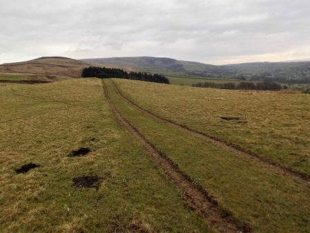
   Foggathorpe feels familiar as we pick up the old Market Weighton to Bubwith rail line which is now a pedestrian and cycle route conveniently coinciding with our 438 latitude line. As a railway line goes, this is quite pleasant, with verdant vegetation and a succession of locals with a variety of dogs. We even meet a horse rider trotting along.

 Back on the Bubwith – Market Weighton Line.


Australian Shepherd Dog and Patterdale Terrier.


Cocker Spaniel.


Patterdale x Jack Russell.

   We leave the line at the Old Holme station, where the last lady we met lives on the old station house.

Holme Upon Spalding Moor Station.


Station House.

A minor road is used to bypass the main road through the village, this brings us out  exactly opposite the lane we need to take to reach All Saints Church. It is set on the top of the only hill, 45 m, in the area. We approach through a wonderful flower meadow. It is an ideal spot to find a bench, enjoy the view and have some lunch. The church is Medieval, with some parts dating from the C13th. The limestone stonework is elaborate on the C15th tower, and in parts the softer sandstones show a lot of wear. It is closed, so we wander around the very extensive graveyard. There are several war graves of English and Australian airmen, nearby there used to be an RAF airbase used in the second world war.

War Graves.

  Close by the church on the hill in a field of wheat is the remains of a Royal Observer Corps post from the second world war, this is of interest to Sir Hugh as his father was a member of the Corps. There is not much left to see. There is also evidence of a locked underground bunker which was used during the Cold War years as a nuclear monitoring post.

   A good public footpath ran straight through the crops and linked up at the bottom of the hill with a farm track, which we planned to use to avoid busy road walking. We were aware of possible trespass, and when the first farm vehicle approached we were asked if we had “lost the footpath”. Explaining our route, we were given the go ahead but “to keep our heads down when passing the big house”, this we did. We were walking through an enormous pig farm with muddy pigs everywhere and little tin huts for them to sleep in.

   Our plan works, and soon we are on a quiet road heading east to North Cliff where our car was parked. I suspect we will have to follow many of these lanes to stay close to our line. It looks like we are walking through an estate whose properties have similar architectural features. Our car is parked by the North Cliffe Village Hall next to an old church. 
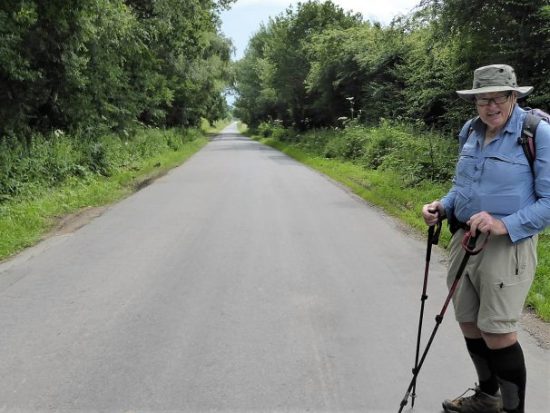
 

North Cliff Lodge.


North Cliff Church and Village Hall.

Black clouds appear and thunder reverberates all around us, but we survive without a soaking, although the muggy conditions are unpleasant.

Time to go and find our hotel north of Hull, we may struggle to find much of interest to write about on this walk.

*****


VIRTUAL WALKING.

Since the successful weekend away with Sir Hugh walking our straight line, coast to coast, on Northing 438  there have been some sunny days and the forecast is for several more soon. I would expect to be posting some interesting walks. But no I have developed one of those annoying twinges in my right knee. I’ve strapped it up and I’m hobbling about trying to keep off my legs as much as possible. There goes the phone again and by the time I’ve reached it, the line is dead, probably a nuisance call anyway.

This gives me time to think about future trips but first I have to sort out some National Grid conundrums. Sir Hugh and I set off from Blackpool last year on the Northing 438  line, I called it the SD 38 but hadn’t realised that it would take us into the SE and then the TA squares, There were more 38 crossings in Britain so I had to be more exact. A little revision on the National Grid site was used to resolve the nomenclature.  I needed to re-evaluate my title. SD38 to SE38 to TA 38 was too cumbersome and inaccurate so I dropped the letters and used numbers only arriving at the more precise 438 Northing.  Interestingly I have an app on my phone that gives me my precise grid reference at any one point with the touch of a button, but that uses the lettered 100K squares, ie SD. Using ordnance survey maps if I click on a point I’m given both the latter and additionally the all number reference. I’ve also the app ‘whatthreewords’ which pinpoints my position in a more literary way. I didn’t realise I had so much technology at my fingertips. I should never get lost, if only life was so simple.

Anyhow now I know where I am – where am I going? Well, nowhere at the moment but I’m always dreaming.

I don’t want to be away for long as I have certain commitments at home. The LDWA has a very good, nigh on encyclopedic, index to any walks you may aspire to. The search system allows you to choose any length of walk in any area of the country. My two latest searches for three or four days came up with St. Hilda’s Way in North Yorkshire [40miles and designed as a pilgrimage visiting sites associated with St. Hilda] and The Cuckoo Way along the Chesterfield Canal from Derbyshire to Nottinghamshire [46miles along the 240-year-old canal.] A quick click on Amazon and the guide books are coming to my postbox. I think the latter may be most suitable for walking at this time of year. If my knee settles I should find a window of opportunity for the canal walk whilst Sir Hugh is occupied and then we will be able to complete our coast to coast.

Time for another Brufen and then I can continue following the routes on my maps.

NORTHING 438. SKIPWITH COMMON TO FOGGATHORPE.

The correct carpark was found this morning, 50metres down the road. We were the first arrivals and waited for a torrential downpour to pass. The start couldn’t be delayed any longer and waterproofs were needed for the light rain. We headed due east on a good track into the woods, mainly birch at this end with Scots pines further on. All around was heathland, waterlogged at this time of year, giving a pleasant start to the day despite the dampness. The information board states that this is one of the last remaining lowland heaths in the north. Longhorn cattle, Hebridean sheep and Dartmoor ponies graze it to help maintain the habitat. It must be a joy in the summer when the heather is in bloom.

Good progress was made on the easy tracks and soon we were in North Duffield, a rather undistinguished village though it did have a village green and pond. Down a side street was a hut adverting woodcrafts, Stan was busy inside and offered to make us anything from a pillbox to a Welsh Dresser. It would have been good to purchase something from this craftsman who had previously worked in church restorations.

We had been dreading the 2K walk on the busy A163 road, there was no pavement but most drivers gave us a wide birth and by now the sun had come out. In the distance to the south was the massive Drax power station one of several in this area of Yorkshire presumably established when the coal industry was at its peak, what future now?

Over to our left was another nature reserve, the Lower Derwent Valley, and we wondered whether we could have found a way by the river. People were walking their dogs along the embankment and bird watchers scanning the flooded fields [header picture]. Our stint on the road came to an end at the elegant bridge over the Derwent.

Bubwith had some period brick houses and an old church started in Norman times.

Whilst looking around the churchyard we found a seat overlooking the River Derwent for lunch. Looking at the map I notice that this river comes all the way from the North York Moors near Scarborough on its way to join the Ouse. There was a good view back to the bridge with its flood arches.

Originally when plotting a route I thought we would be stuck on the A163 a lot further but Sir Hugh had spotted an old railway line now converted into a trail. We gladly went slightly beyond our ‘mile either side’ limit to access it.

This was the route of the Selby – Driffield railway which closed in 1965. Work has been done recently to unearth Bubwith station platforms. On the way, we met a chatty man walking his dog who worked part-time counselling rugby league players at Castleford Tigers, sounds an interesting job. We steamed into Foggathorpe station ahead of the time table.

That was the end of our three-day jaunt on the 438 line, good walking each day and not a hill climbed or a Harry and Meghan mentioned.

*****

NORTHING 438. CHURCH FENTON to SKIPWITH COMMON (ALMOST)

In this area are scattered some delightful small villages of which we knew very little, a combination of limestone and red bricks giving each one a friendly feel. We are getting to know them and today visit several.

Church Fenton is a long village street with a community shop and a couple of pubs, one doing better than the other. My thoughts today were to photo all the pubs we passed but I kept forgetting. More importantly, there is a railway station. East Coast mainline trains rush through but there is a stopping service to Leeds and York adding to our thoughts that these villages are commuter dormitories.

We opt for a quiet lane rather than muddy fields around an old RAF aerodrome, there is no sign of life this morning.

Rather out of the blue in this flat landscape, we climb stairs to cross that main rail line, a couple of trains thunder through shaking the bridge alarmingly.

A quieter stretch through ploughed fields but fortunately on good tracks and we enter Cawood on the Wolsey Way, more of him later. The village is built around an old medieval manor site, the Garth, which the village own as an open space. We wander into it over a ditch which despite its modest size was used to transport limestone out of the area for buildings in Southern cities. The outline of a moat is clearly seen on the ground. Hidden behind trees is the original gatehouse to the castle and adjacent banqueting hall, the only traces remaining.  An information board tells the history; how the Archbishops of York owned it, how Cardinal Wolsey was arrested here for high treason and the link to Humpty Dumpty, and how the Garth was saved from development by the crested newt. https://en.wikipedia.org/wiki/Cawood_Castle

Through the town with its brick houses and narrow streets, two pubs with different fates.

We cross the River Ouse on a fine metal swing bridge which won’t be used for shipping very often.

Once across we use a path on the raised flood embankment into Kelfield with its closed pub and seemingly inadequate flood defences. Lunch is taken in a very comfortable bus stop. Several of the older buildings in this locality have moats and there is one to see just along the lane.

We progress on continued good paths alongside the prosaically named Main Drain, the water flow is considerable given the lack of a discernable incline. One has to be on the alert to mischievous gates. The Watermill Bridge is a bit of an anticlimax. Riccall is another interesting village with a large church.

Once on King Rudding Lane all we have to do is walk back to the car but there is more about this place than is obvious. An information board tells us of its ecology, coal mines, and a wartime aerodrome. The country park car park where everyone is heading is not where we parked this morning so we have more to find tomorrow.

Our walk is finished just after 3pm, ideal to drive back to our comfortable hotel in Hambleton, The Owl.

*****

NORTHING 438. BARWICK IN ELMET TO CHURCH FENTON.

It has taken us nine days to walk on our straight line, 38, Blackpool to Barwick last year. We are back in the maypole village this morning hoping to progress further along the grid line. It turns out to be worthwhile, unfrequented walking country, virtually all new to us, ideal for a short trip.

A quiet lane leads to Potterton where we pick up a bridleway heading across fields. On the map, there are numerous ridges marked as antiquities. People were building defences or just marking their boundaries from the iron age.  Our path goes along one of these ridges which are obvious on the ground, a ridge and maybe a ditch. The ridges have been taken over by trees and would probably be better seen from the air as is the case with most earthworks. Rather than keeping to the public footpath, we keep to the ridge as close as possible. Walking harmlessly along the edge of a field of cropped maize we are accosted by an angry gamekeeper. We plead innocence but he suggests that we have ruined the shoot for tomorrow. We actually only saw one pheasant fly out of the cover but we were not prepared to argue, we just accepted – mea culpa. Fortunately, we were by now almost back on the right of way. Close by guns could be heard loudly blasting away, enough to disturb any birds in the vicinity. Putting aside the question of shooting beaten birds we had already enjoyed the glorious sight of buzzards and red kites, hopefully flying without danger of being shot.

We emerged on an access road to Becca Hall, probably the owners of the fields we had been trespassing in. Another ridge, Becca Banks was followed into Aberford; this ridge probably protected the important ford during Roman times. The village once lay astride the Great North Road equidistant between London and Edinburgh.

A curiosity was the uniquely named Arabian Horse Inn.

The C19th  bridge, replacing the ford, over the River Cock is far larger than the present water flow warrants.

Further through the village, we should have visited the Gothic-styled Almshouses built by the Gascoigne family who had made their money from coalpits in the area.

Wikimedia

We couldn’t find a way under or over the motorway and ended up on a lengthy diversion to rejoin our route.

The fields are large here and planted with cereal crops. The soil had a tendency to stick to one’s boots. We found a rickety bridge crossing the fast-flowing River Cock which we then followed seemingly flowing uphill.

I wanted to visit the little church of St. Mary abandoned in a field where previously there had been a community. The chapel was open and exhibited some old wooden pews, a triple pulpit, an ancient font and old gravestones. It was a peaceful place and we took the advantage of a bench for some lunch in the sun, I’d forgotten to mention what a beautiful day it was.

The nearby Crooked Billet pub set us off on a debate as to the derivation – I suggested army beds, Sir Hugh pieces of wood. We were both correct, but why crooked?

Open fields headed towards Saxton and past a quintessential English pub next to the church.

This area is steeped in history but no more so than the Battle of Towton, in March 1461, a War of the Roses struggle that is said to be the bloodiest battle in English history.

Once we crossed a busy road a quiet lane through a golf course continued on a wide, open grassy trail.   We had to contend with the wettest field yet to enter Church Fenton where we failed in a roadside boot cleaning operation.

*****


NORTHING 438. HORSFORTH TO BARWICK IN ELMET.

It would be a challenge to find green footpaths across the north of Leeds so we ate a hearty breakfast. If we weren’t doggedly following SD38 we could have used the waymarked Leeds Country Way which skirts northern Leeds. Away at 9am the morning was cool but promised a clear day. Within a street or two of our hotel we entered Meanwood Park for an interesting mile of varied park and woodland – what a good start to the day. Even the incursion into strange David Lloyd territory gave us open access across a park into Moortown where we watched but failed to photo a low flying Red Kite, what a magnificent bird – how can people shoot them out of the skies?

Meanwood Park.

Anyone for the gym?

Blackthorn in profusion.

Our next aim was Roundhay Park and we had no option but to take to the pavements weaving through quiet streets.

Classic walking territory.

The park was busy with families enjoying the warm sunshine and open spaces. Our first priority was a coffee at the Mansion House overlooking the park. A stroll through the grass down to the lower lake, here we left the crowds and climbed up through the woods to cross Leeds Golf Course out onto a lane by Cobble Hall.

Grand entry to Roundhay Park.

Expensive coffee break.

Looking back at the Mansion.


Across another busy road was an industrial area where we thought we may be able to creep through to Red Hall, but no such luck new building is in progress and the whole area fenced and gated. We stood around wondering about some form of trespass when only 10yds away was a signed permissive path going in our direction. We skipped along pleased with our SD38 fortune and came out the other side en route.

No way …

… but how lucky are we?

A mile and a half straight rural road looked promising on the map but turned out to be the highway from hell, our worst section of the whole trip, I suspect it was a short cut out to the A1[M].

With relief we found a footpath, time for lunch and some peace and quiet. The scenery changed becoming rolling open fields, the start of the Wolds. Our destination was Barwick in Elmet a busy little village with a cross, the largest maypole I’ve ever seen [26m], a few good-looking pubs and more importantly a bus stop to Leeds.

Barwick in Elmet.

Leeds centre on a Saturday was all a buzz and we were glad to catch the crowded train back to Skipton. Two excellent days walking across the Bradford – Leeds corridor on surprisingly green paths.  We are now over halfway across our 438 line and looking forward to rural walking to the coast.

*****

NORTHING 438. SALTAIRE TO HORSFORTH [LEEDS]

What could have been an uninspiring day in the hinterland of Bradford and Leeds turned out to be almost a green corridor of pleasant walking. It was not difficult to keep close to our lateral line with the proviso from Sir Hugh to incorporate a visit to his primary school in Thackley.

From the rail station in Saltaire we quickly reached the Leeds – Liverpool Canal to follow it off and on throughout the morning. At first all was industrial, historically relating to the canal with some fine mill buildings brought into the 21st century.

There were a few scattered sculptures including this one which was a pun on the Salt Mill connection…Hanging on the wall of my garage is an Ellis-Briggs cycle frame, probably 40years old, so I was delighted to pass their establishment which has been building steel frames since 1936. The cycling scene was booming in the 1930’s and the other notable established builder was W.R. Baines, whose factory was based at Thackley, see above and further into the walk. Coincidentally I rode a 1950’s Baines ‘Flying Gate’ cycle for many years.


Some nondescript scenery followed enlivened by some dubious and unsuccessful canal boat manoeuvering, it is difficult to do a three point turn.

Climbing away from the canal on cobbled paths above railway tunnels we entered Thackley, a mixture of old stone houses and modern estates, and found Sir Hugh’s school still open and extended since his time. Up here was the local cricket club with a very challenging sloping pitch, Sir Hugh’s father had been a member.

From the map we were not sure whether we could access the canal towpath from open country but thankfully there was a bridge. Soon we were sat on a bench looking down locks near Apperley Bridge, this was a busy stretch with pedestrians but no boat movements.Crossing busy orbital roads took time unless there were lights. We switched from the canal to follow the River Aire alongside the sports grounds of Woodhouse Grove School. The river continued through remarkably rural scenery despite being close to the railway and new housing developments.

Pleasant suburbs gave us twisting streets heading for Hawksworth Park which turned out to be a wooded valley. More parkland and upmarket housing and we arrived at our excellent budget hotel for the night.

*****

NORTHING 438. OLDFIELD TO SALTAIRE.

There were several unexpected highlights on today’s walk and despite heading into the congested Aire Valley we enjoyed rural walking throughout on one of the warmest sunniest February days I remember.

Continuing our straight line walk meant once again logistics of two car parking. Sir Hugh suggested Saltaire as a finishing point so we arranged a rendezvous in the large free car park there, all went well with my journey until I became stuck in early rush hour traffic, not the best of starts for a day’s walking. With the late start and more traffic problems we drove back to our last point in the Ponden Valley.  Sir Hugh seemed to know all these intricate Pennine roads and little villages or at least the lonely Public Houses where he spent his money when living in the area as a young man. We were stunned when the lane up to our isolated parking spot was closed necessitating back tracking and finding an alternative route on what was becoming a frustrating morning.

At last we set off down a bridleway high above Ponden Reservoir only for Sir Hugh to realise he’d left his phone on the car, fortunately we hadn’t gone far. This initiated a conversation on things left behind on walks and the cut off distance where one is prepared or able to return. Poles, passports, waterproofs, cameras and particularly hats were prominent on the list. We ran into problems with unmarked, difficult to follow and blocked paths in the Oldfield area and at West House farm admitted defeat and took to the road for a while. None the less there were many interesting houses passed.

High above Ponden Reservoir.

Before he’d realised his loss.

We were concerned with our poor progress after the delayed start on what would be a long day but as often happens things suddenly improved and remained so all day. We encountered a deep gorge not apparent on the map and decided to take the old flagged path alongside down to the River Worth which was then followed for a mile or so through green fields. We reached a road at an old mill that had been restored to provide modern living accommodation. There were several pack horse type bridges on this stretch reflecting the days when the valley was thriving with small riverside mills.

On the edge of Haworth I had noticed on the map a ‘Railway Children’s Walk’. The Railway Children by Edith Nesbit, published in 1906, was set in Yorkshire and a 1970 film used The Keighley and Worth Valley Railway as a backdrop. I remember watching a BBC TV series back in the 50s. Thus Haworth’s tourism benefits from both the Bronte connection and the preserved steam railway.  We followed the lane across the Mytholmes railway tunnel made famous in the film …

… I regret now not going the extra few hundred yards to view the authentic Oakworth station featured prominently in the film. No trains today so we climbed up the steep hill to the busy Cross Roads and would you believe it – halfway up a steam train came into view way below us in the valley, bad timing. Up on the road the stone houses all bore that blackened look of the industrial past.

At Barcroft we reached high open countryside and enjoyed marching out with distant views to Bingley. In the fore ground was a prominent rocky tor, Catstones, and we speculated on the climbing possibilities and the height of the faces.

A bench below was perfect for lunch, I didn’t have the energy to ascend to the rocks. An inscription was dedicated to a Cllr. Ron Senior who pioneered a circular walk around Cullingworth, Senior Way. We felt well qualified to follow it.

We ended up just using the pavement through Harden but then entered St.Ives country park for a popular woodland walk to the edge of Bingley. The park is yet another old estate taken into council ownership providing a wide range of activities, we only skirted the edge.

A lane dropped down to bridges and fords at Beck Foot, a site of old mills, all very picturesque in the sun. An ecyclist proudly showed us his bike and extolled the virtues of battery powered leisure, not sure what it is doing for his fitness.

The River Aire, on its way into the industrial Leeds, was followed through fields to give another aspect to this day’s walk. Surprisingly rural although there was rubbish evident. A last stretch of woodland linked to the Leeds Liverpool Canal which took us into the heart of Salts Mill at Saltaire. Formerly a textile mill, now an arts centre, built by the philanthropic Sir Titus Salt in 1853, along with the adjoining Saltaire village in the hope of improving the conditions for working people. The whole complex is worthy of a day’s exploration. We found our car as the sun was setting and joined the heavy traffic home.

*****

NORTHING 438. NELSON TO OLDFIELD.

This was a day of two halves, first the transition from industrial Nelson to the complex field paths in its rural hinterland and then second glorious moorland walking over to Yorkshire.

We left the car in a dodgy carpark in Nelson assured by a couple of youths we wouldn’t get clamped. With nervous looks back we climbed modest streets eastwards towards Mecca or was that the local bingo hall. Views back down the streets showed a misty Pendle.

Anyhow we found ourselves in  Marsden Hall Gardens which proved fascinating. Originally owned by the Walton family [more of them later] the estate passed into Nelson Corporation ownership in 1912. The 16th century hall still stands above the gardens. We came through the ‘Egyptian Gate’ a sandstone edifice with interesting carvings, most notably it is known as ‘the wishing gate’ and to this day people place leaves in the carved holes before passing through and making a wish.

Our next goal was an iron age fort marked on the map at Castercliff, despite its obvious size and prominence there was no local signage. It was constructed maybe 500 BC and there is no evidence it was ever occupied. The views from the summit over the towns in the Pendle Valley were hazy but retained the feeling of being up high. The way kept going upwards and ahead of us on a hill in the distance was the prominent monument to the Walton Family.  A Victorian cross place atop a 9th century monolith which would warrant further close investigation.

The next hour or so found us navigating seldom used paths in rough fields between ancient farms. At one stage a Jack Russell harried us noisily for a good half mile through fields from its farm. At the time we were hopelessly lost and the farmer was shouting unclear directions. Things improved as we approached the south of Trawden, walking down a quiet lane we passed the idyllic and listed New Laith Farm. Once on the edge of town we turned off right into the narrow street of White Lee, old cottages gave way to new housing as we turned down an old mill lane to cross Trawden Brook and climb up to more Laith farms, the word meant granary or simply barn and is used a lot in northern England.

A working Will O’ Th’ Moon farm.

Residential New Laith Farm.

The way became rougher as we climbed higher. We found an enclosed track crossing the moorland to the west of Wycoller and lunch was taken high on this  ‘Forest of Trawden’ looking over the Wycoller valley.

We dropped into the valley  and made our way to Parson Lee Farm which we recognised from coming  through on The Bronte Way last year. The winding track climbed slowly up into the moors, our journey pleasantly interrupted by a lengthy conversation with two passionate fell runners enabling Sir Hugh to reminisce on his one and only fell race. A trod took us across a wilderness to reach Watersheddles Reservoir, whereas last time we walked down the dangerous road from here today we found the concessionary path alongside the water. Up here we listened to Oyster Catchers by the shimmering water and Grouse and Curlews further afield, all very evocative.

There was only a short stretch of road before we turned up the quieter side road which gave us panoramic views over the Ponden area. We crossed The Pennine Way back to our car completing a satisfying 10 miles in perfect weather. Somewhere along the way we had crossed from Lancashire into Yorkshire which we will remain in for the rest of our route, so only the two great counties coast to coast.

*****


NORTHING 438. BARROW TO NELSON.

We are out walking our Northing 438 line again. A lane leads steeply out of Barrow through mainly new housing, ribbon development if ever I saw it. Crossing the busy A59 we continued climbing into Wiswell, an interesting little hamlet with a famous gastropub. A van was delivering organic vegetables to houses, one of these expensive subscription ideas where you probably finish each week with a box still full of potatoes and carrots. From here the route became moorland onto a ridge which was really an outlier of Pendle Fell, the mast marked on the map seems to have disappeared. We had climbed 500ft in a mile and were beginning to steam in the mild weather. Sabden could be seen in the distance. Below us was the large hidden valley of Sabden Brook and we slowly made our way down to pick up tracks into the village. I mentioned the famous Sabden Treacle Mines of which Sir Hugh had no knowledge, sadly they are no more and I will leave those with curiosity to investigate. We followed lanes to the 19th-century church and then out past a farm from where a pipe led into the fields. This pipe actually came out of the midden slurry tank and snaked into the fields, a tractor pump was starting up to inflate the pipe which we followed almost hypnotically for several fields. Eventually, the pipe seemed to connect up with another tractor with spreading machinery, but nothing happened. By now we realised we were off track so diverted back onto a rough farm road. This led to the 16th century Dean Farm with its wonderful mullioned windows and incongruous 19th-century extension.  Muddy fields and rough reedy grass below the ridge of the so-called Forest Of Pendle led us to lunch on the wall of Tinedale House. A climb onto the grandly named Rigg of England which was mainly equestrian farms. Up here were good views back to the massive bulk of Pendle and across to Newchurch in Pendle which we had visited on The Lancashire Witches Walk. Below to the south was the industrial Burnley – Nelson – Colne corridor. It didn’t look too bad from up here. Ancient tracks down the hillside brought us into Fence alongside the White Swan pub where I recalled a seasonal wild garlic meal.  Where do these memories unexpectedly come from?

We made a mistake in trying to follow footpaths parallel with the busy road, we were hemmed in by unnecessary plastic ‘hedging’ on the boundary of more equestrian enclosures. Escaping eventually into a large graveyard, where we were surprised by the number of Muslim graves. We started dropping down into the valley alongside a small beck. Surprisingly green paths led us into the heart of the Lomeshaye Industrial Estate. At the large Wellocks complex we enquired what  ‘The perfect ingredient‘ was but unfortunately only Polish was spoken. Subsequently, we discovered that it was a high-end food distribution firm to the restaurant trade founded originally by a potato merchant whom Sir Hugh had known from his Yorkshire days. It was pleasant to enter Nelson through Victoria Park with its bandstand and paths alongside Pendle Water.

Under the motorway, over the canal and then a steep road heading up into Nelson town centre where we found the modern bus station which gave us a busy ride back to Barrow.

*****


NORTHING 438. LONGRIDGE TO BARROW [Whalley]

Pendle in all its glory.

A bus runs two hourly back to Longridge from Barrow, there is one at about 5pm.  My bus app says there is one due in 5 minutes, we should be OK.   As we approached we found ourselves in newly developing housing,  we took to the access road only to find it was blocked with that wire fencing erected around building sites. Panic followed as we peered through the fencing at the nearby bus stop. We didn’t have time to burrow Colditz style under the security barrier but with a little lateral thinking we made our escape onto a nearby lane and as we arrived at the road an unidentified bus was approaching. A desperate outstretched hand somehow halted the bus and we clambered on thanking the driver. We were home and dry.

The day had started more sedately with a stroll through housing estates in Longridge until we were level with the quarries at the top of town. The caravan site in the largest quarry was closed for a few weeks and there was no one climbing in the esoteric Craig Y Longridge. Here we left the roads and took to a bridleway below the incongruous ‘chalet’ development that was so controversial when planne, it pales into insignificance with todays developments in the town.The only thing of note was a new seat with an agricultural theme.

Walking on water.

Down the old lane we arrived at ‘The Written Stone’ which I’ve mentioned several times in local blogs.

What I hadn’t noticed before was the typo error where the carver had misspelt stone and added a small o later.  We then spent the morning traversing the southern side of Longridge Fell on paths and tracks between ancient farmsteads crunching through the snow in bright sunshine. One of the first farms, 250year old Hoardsall, has the appearance of years gone by. This morning the farmer was busy splitting logs, his source of fuel, in an outhouse with his black and white cat watching on. We fell into conversation and gleaned a fascinating history of sheep farming in the area. His farm yard was cobbled with local sandstone setts which had been augmented in the past with granite setts removed from Brook Street in Preston. [I knew of an antique  business which purchased old setts, street architecture, pub paraphernalia and red phone boxes etc when Preston was being ‘modernised’] A fascinating encounter which makes me think that these insights should be recorded for posterity.

New Row Cottages in Knowle Green formerly belonged to cotton weavers and are now a peaceful haven away from the main road.

Ahead was a tree topped hillock of unkown origin. Eventually we joined the delightful bridleway alongside Dean Brook into Hurst Green. One of my favourite walks. We lunched on a wall by the Shireburn Almshouses which were first built on Longridge Fell in 1706 but moved and rebuilt in Hurst Green in 1946. The village is closely associated with nearby Stoneyhurst College whose grounds we walked through. Much has been written about this famous Jesuit establishment. https://en.wikipedia.org/wiki/Stonyhurst  All the while a snowy Pendle loomed in the background.

Leaving the grounds we dropped down to cross the River Hodder at the historic border between Yorkshire and Lancashire. You take your life in your hands to view the inscription on the bridge and the nearby ‘Cromwells Bridge’

We did not enjoy the forced road walking into Mitton and were glad to escape into a quieter land leading to the 12th century All Hallows Church. Next door was the stately 17th century Great Mitton Hall. Downhill on the busy road we crossed the River Ribble with more views of an arctic Pendle Hill. This is fantastic Lancashire countryside. Pleasant field paths led us to our debacle with the new housing estate. The best day so far on our SD38 journey.There were signs of spring all along the way.

*****

NORTHING 438. INSKIP TO LONGRIDGE.

January 27th.    7 miles.

This is long distance walking in easy stages designed for winter exercise. Todays stage actually finishes in Longridge, my home town, which is convenient for me if not for Sir Hugh who has to travel from Arnside, but it was his idea in the first place. At least today we meet up in the agreed destination, a good start. We are walking by 9.30 on a clear sunny morning with a strong cold wind at our heals. There must have been a lot of rain last night judging by the pools on the road – an ominous sign. We take to footpaths as soon as we can and end up in deep mud similar to where we left off last week. The stiles around Singletons Farm are virtually impassable, blocked by hawthorn, but we push through.Crossing a field we are confronted by the next stile leading into a lake, no way we can go that way so we retreat and hit the minor lane to Cuddy Hill [sounds Scottish] and the well-known Plough Inn. After all the frustrating obstacles I was ready for a drink but of course they hadn’t opened. Eventually we find the onward path and emerge onto a lane which took us over a canal. In the past we have both walked the The Black and White, Lancaster Canal.    but we didn’t recognise the location,

We were on the A6 for a short distance before crossing over onto tracks to end up in fields,  navigational errors had us back tracking to reach Jepps Lane. The A6 seemed like the transition from the flat floodplain of The Fylde to the pleasant countryside of the Ribble Valley. The wind by now had intensified and many of Sir Hugh’s pearls of wisdom were lost. I had never been down the lane to Barton Old Hall before, but it conveniently crossed the motorway for us. The Old Hall was hidden behind trees and the cluster of houses and conversions at the hall were rather depressing.

I think we were deterred from the actual path through the properties, but still found ourselves in rolling countryside alongside the proverbial babbling brooks. Time passed as we weaved our way through the pleasant Lancashire countryside. The Bowland Fells rose in the background and ahead was a glimpse of Longridge Fell.

We passed the stately Goosnargh Lodge, joined some local routes and reached Goosnargh Mill, not the best of conversions.

I was now on home ground and confidently marched across fields finding hidden stiles until we reached one that was in such a dangerous state we had to retreat yet again and find an alternative way. Worse was to come as what had been open fields was divided up by permanent electric fencing, the sort used for equine enclosures, with no regard for any public rights of way. Attempts at crawling under on the wet ground were not pleasant, so we took to dismantling the top wires to step over, there was fortunately no electric current. Reports to LCC  are on their way. A rather sour note towards the end of the day.

He who dares – SAS training.

Just before Longridge we passed Sea View cottages,  and yes you could just about see back to the coast where we had started SD 38.The road into Longridge is now surrounded on all sides by new housing developments, the Fell can just be glimpsed above the roofs. It is no longer the attractive, honest, little town that I moved to all those years ago.

*****

NORTHING 438. SINGLETON TO INSKIP.

The night before I arrange with Sir Hugh where to meet up for our next stretch along northing 438 . I’m sat waiting at New Hall whilst he is sat waiting at Cuddy Hill a mile and a half away, a misunderstanding compounded by the wrong mobile numbers. Red faces and ‘mea culpa’ all round. Once communications are re-established we drive to Singleton to start walking later than we had planned. By now there is a glimpse of sunshine.

Singleton is an interesting village with an old PO, several lodges and halls, picturesque cottages, a fire engine shed and a Parish Church. The estate was developed from 1853 onwards by the Miller family, wealthy cotton manufacturers working with the Horrocks family in Preston. The estate is now held in trust and appears well maintained. There are permissive paths through the estate but we lack the maps to use them.

At Singleton Hall’s South Lodge the original gates bear the initials of Thomas Horrocks Miller and on the gate posts ‘Demi Wolves’ taken from the Miller coat of arms.

The old PO.

Lodge gates.

A Demi Wolf.

The timber-framed fire engine house is nearby, it has decorated plastered walls and a louvred bell tower. The engine was horse-drawn and before a fire could be attended the horse had to be rounded up in the adjacent field. 

Estate cottages lined the lane and worshippers were leaving the church as we passed.

Thistleton, Elswick and Inskip villages were visited in turn. Not far off is the site of Cuadrilla’s controversial fracking wells and the local feeling is demonstrated by all the anti posters.

Does fracking cause earthquakes?

Todays walking was easy through fields but we lost count of the high awkward styles and muddy farm tracks.

The farms we passed were a mixture of traditional working and modernised for rich commuters. The strangest was an old thatched cottage with a very modern residence built within yards of it. Strange, who would want to do that?

Everywhere were ponds, former marl pits, that look as though they are used for fishing and duck shooting.

Elswick is known for the Bond’s ice cream shop, now more of a restaurant.

Inskip is known for RNAS Inskip, a former forces base and airfield. It is now used as a military high-frequency radio transmitting station and the antennae can be seen for miles in this flat landscape.

The last farmyard was the worst for muck just before we reached the car. Jolly Japes.

Maybe you would be advised to read Sir Hugh’s account of the day. http://conradwalks.blogspot.com/

*****


NORTHING 438. BLACKPOOL TO SINGLETON.

Lunch time, Poulton-le-Fylde suburbia and we are sat in reclining chairs in someone’s front garden,  This followed a trip by Sir Hugh depositing himself into the middle of the road with no serious injury but blood [as well as egg] on his face. It all looked dramatic to passing motorists who came to our aid and one particularly kind lady took us into her property for tea and sympathy. Spare glasses fitted and he was ready to continue on our walk along Northing 438

The day had started in a rather gloomy and windswept Blackpool where we picked up the 38 at North Shore. There is nothing to recommend British seaside resorts in winter. Sir Hugh had a new hat that kept blowing away until he stuffed it into his rucksack and donned a more suitable beanie. At the start is a striking statue to our emergency services which I’d seen before on a trip along this promenade. 


Northing SD 38                                                                                                                                                                                                                                                                                                                                                                                                                                  

We passed rows of basic guesthouses, probably full of ‘social housing clients’ and then followed the pavement alongside a not too busy road out to Warbreck where the Ministry of Pensions and whatever else has an office. A colleague of mine worked here for many years in some secret role to entrap fraudsters.

Branching into housing estates we weaved around crescents and groves. You think that they could have created pleasanter address names than Block 50 although some of the street names had a familiar ring.

We were heading for a green space shown on the map and eventually, a path was reached along the edge of the estate. I’d soon collected a fair amount of dog excrement on my boots although a responsible owner with two rescue German Shepherds was interesting to chat to. One of the dogs had cigarette burns inflicted upon it when he intervened but both dogs were now even-tempered. The border of the estate was a disgrace with every form of rubbish you could imagine thrown into the ditch, the mind boggles.

Green fields took us into the outskirts of Poulton where the housing improved but the navigation was complicated by dead ends.

After our ‘sedate lunch break’ we headed into the countryside [for how long] with cows, hens and sheep.

Unfortunately, our way further on was blocked at a closed level crossing and we diverted onto the busy main road and then had to negotiate a complex industrial estate which I didn’t think we would emerge from. Eventually, we squeezed between groaning industries into the countryside.

The country fields here are all recycled marshland and the draining ditches define the fields although the drainage is not always good.

All-day I’d been looking unsuccessfully for signs of spring, catkins etc but near a farm, I saw my first lambs of the year.

We finished in Singleton just as the rain started to beat a quick retreat to the car, it looks an interesting village so will delve further when we resume the SD38.

*****

NORTHING 438. COAST TO COAST.

An email dropped into my box –

What about:
Longridge to the Sea – Eastwards.
Following the OS line 38. I have had a quick look and it appears more or less possible. Straight line 104 miles and interesting – certainly a lot of new territory for me.  Conrad. 
[Sir Hugh to those familiar with this blog]

I ignored this for a day or so, thinking it was too ambitious, and I had better things to do; like finish off the GR131 in the Canary Islands and complete my protracted Land’s End to John o’Groats. But the idea gnawed at the back of my mind, and I foolishly looked up the maps. The SD 38 Northing in question runs virtually past my house. It becomes the SE38 and the TA38 further east, thus is better described as 438 Northing. My mind was in action now, why not start on the west coast and finish on the east, 122 straight miles Blackpool to Aldbrough.

A bit of a pipe dream. Better do some gardening.