Category Archives: Art and architecture.

A WEE DONDER. 2 Peebles to Broughton.

The 39 Steps…

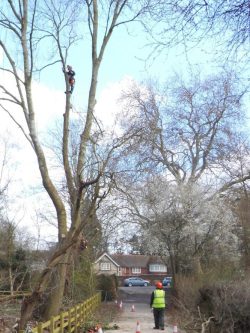
John Buchan, the author and diplomat, spent time in Broughton where his grandparents lived. He became famous for his thriller novel The 39 Steps published in 1915. There is a museum to him in Peebles. The John Buchan Way is a 14mile walking route devised to link Peebles with Broughton.  We decided to follow the first half of the route this morning. It was waymarked with a book motif out of the town up alleys and out into to the open heading for Cademuir Hill. This hill has Iron Age hillforts but disappointingly the route doesn’t visit them. Some of the higher hills in the distance, I think the Pentlands, still had patches of lying snow. Our route descended to a minor road where we were glad to put on waterproofs not just for the rain in the air but to shield us from the biting wind. This is sheep country ‘par excellence’, acres and acres of grassy hills with the newborn lambs released onto.

Hill Forts to the right.

Looking back to Peebles with the Hydro prominent.

A minor col was climbed giving great views of the open Southern Uplands country. We dropped down to meet up with the Tweed again at Stobo.

I had read about the unusual church here so we made a short detour to visit…

Stobo Kirk is an ancient church of the Church of Scotland dedicated to St Mungo. retaining much of the original 12th-century building, including windows, the nave and chancel, unlike many other Roman Catholic churches which were destroyed after the coming of the reformed religion.The porch was added in the late 15th–16th century and is notable for the grooves in the left-hand doorjamb, created by pupils sharpening their slate pencils before class or possibly by the sharpening of arrow heads prior to the weekly after-church archery practice which became compulsory after the disaster of the Battle of Flodden 1513. The 12th-century Norman entrance into the nave has a door made from a single board of cedar wood from the nearby Dawyck estate.On the outer entrance hangs the old Jougs [yokes] used to punish recalcitrant members of the parish until some time in the 18th century.

The church looked a bit of a curiosity to be honest but we had a good look around at the features and then found a seat for lunch in the sun which had fortunately appeared to warm us. Many of the headstones in the graveyard were adorned with scary skull and crossbones, a Memento Mori, a reminder of our own mortality, an aide-mémoire, should it be needed, that you too will die one day. Time to move on.

Evil looking Jougs.

Scraper marks.

We didn’t follow the longer and hillier John Buchan Way continuation. i optimistically thought that the dismantled railway alongside the Tweed would give us an easy walk into Broughton. This was the Symington, Biggar and Broughton Caledonian Railway branch to Peebles, closed in 1966. On OS maps of Scotland paths are shown as black dotted lines but there is no indication as to their privacy or right of way.  The dotted line was promising as we followed the obvious trackbed. Then there was a house and garden blocking our way, this was bypassed by a scramble up to the road. At the next obstacle we bravely walked past their kitchen window, I kept a discrete distance behind JD in case of dog problems. Safely through we enjoyed a long stretch of embankment walking, with the occasional entanglement in vegetation and boggy ground.

All the while the stately Tweed was by our side with views down the valley to the pointed local summit of Tinto, 707m. which was to feature for the next few days, Eventually we parted company with the Tweed and followed Biggar Water, more of a drainage ditch than a river, to Broughton where there was no accommodation but a bus, the ubiquitous 91, took us to Biggar. The curiously named  Elphinstone Hotel, an old coaching inn, was our welcoming stop over. There was apparently a Lord Elphinstone at some point in history. Just call it The Elph.  They looked after us well, the beds were ‘biggar’ than most and the breakfast ‘biggar’ than we could eat.

With a little effort a viable walking route could be established that would link the Tweed to the Clyde utilising the old railway.

*****

THE THAMES PATH – Day 20. To finish at the Barrier.

Rotherhithe to The Barrier,

Back at Rotherhithe I had time to look round St. Mary’s Church where Christopher Jones, the captain of The Mayflower, is buried. There is a commemorative statue to him. The Mayflower set sail from Rotherhithe on its voyage to America with the Pilgrim settlers in 1620 and returned the following year. The Mayflower Pub, one of the oldest on the Thames, is near the departure point. The day started off well alongside the river by converted warehouses and new builds, old wharves still existed and views across the river to Wapping and Limehouse highlighted more development some better than others.

There was a lot of weaving around new apartment blocks. In places marinas have been created in the old wharves. At one point I found myself walking through a riverside hotel.The tide was out with a lot of mud exposed, a display mentioned the 19th century children who would scour the river bed for anything salvageable for a few pence – ‘mudlarks’.

Canary Wharf on the north bank is a glistening financial area rising phoenix like from the wastelands.

The naughty bit –

I was being diverted more and more into the streets away from the river which was frustrating. I was thinking to myself it would have been easier to have hired one of those Boris Bikes but I didn’t have the app. Round the next corner was parked one of those bikes, I was looking at it out of interest and realised it hadn’t been locked, there was no one in sight [honest I double checked] it had been abandoned. So for the next couple of miles I rode the rather unwieldy beast through the streets of Deptford towards Greenwich. A curiosity along the way was a reference to Peter The Great of Russia who in January 1698 came to Deptford to study shipbuilding. A rather odd statue at Deptford Creek marks his visit as well as an old mulberry tree he may have planted. The latter is receiving some care and attention at the moment. 
I cycled on to Cutty Sark, the famous clipper, where I locked up the bike which will be located by satellite. Greenwich was a tourist trap and there was too much to visit on my short transit. I’ve marked it down for a future visit. A former royal palace Greenwich developed as a naval college and is notable for the Meridian 0° longitude.  It is here that the footway under the Thames resurfaces in a small dome – another place to explore.

There was a pleasant cafe in the Old Brewery where I relaxed before the final stage around Blackwall Point and the Millennium Dome [the O2 arena]An area of Georgian Streets was a pleasant interlude before some awful walking. The way forward was blocked by building sites and you end up walking down a busy road towards The Blackwall Tunnel. An effort to get the path back to the river is down a fenced in lane and even when reunited high wire fences separate you from endless development. All fairly depressing.

Blocked path.

Not the best walking.

Even worse.


One building site after another.

Fenced in.

The O2 arena is being swamped by high rise apartments each tempting you to riverside luxury living.The river itself is busy with high speed ‘taxis’ plying between various quays. The far bank is all high rise banks above dockside buildings, so this is where our money goes. Above us the Emirates Cable Cars go back and forth from here to the Royal Victoria Dock on the north side. In the water at this quay is a Gormley installation ‘Quantum Cloud’.  Meanwhile there are fairly regular planes taking off from London City Airport.

Cable Cars, Quantum Cloud and plane.


The barrier comes into view around the bend and a further dreary mile, including a gravel extraction plant full of noise and dust, is accomplished to be alongside it. The high tech Thames Barrier can protect London being flooded from high tides and storm surges from the North Sea. I am happy to finish The Thames Path here although I believe there is now an extension 10 miles downstream to  Crayford Ness but I’ve had enough industrial landscape for now. It is debatable where the Thames actually finishes before becoming part of the North Sea.  Where I am now seems a long long way from the Thames Source trickling out into a field in the Cotswolds.

*****

THE THAMES PATH – Day 19. The South Bank and much much more.

Wandsworth to Rotherhithe.

There is a long list of sights today as the Thames Path weaves in and out of central London so it could make for slow progress and a long post. Iconic bridges cross the Thames at frequent intervals and new developments are everywhere.

The tide was out as I left Wandsworth Bridge this morning, all seemed peaceful and the streets were virtually empty of joggers and cyclists.  The new apartment developments on Brixton Reach took some navigating, signage was out of date and the river could be accessed more than was first obvious. One hopes that eventually it will be complete and that the developers don’t create ‘private’ frontages. Have planning controls been put in place and is anybody watching? In the middle of all this I found a Georgian Church, St. Mary’s. Inside a small choir were practicing and along with the organ filled the church with uplifting music.

The graceful Battersea Bridge is on a sharp bend and has been the scene of many nautical collisions. After Albert Bridge… …Battersea Park was an oasis of green and joggers, cyclists and dogs reappeared from nowhere. Good to see all the children cycling in this large traffic free area. My pit stop was at Pier Point Cafe next to the cycle hire depot.

I thought things were going well when I could continue under the railway bridge into land of the old Battersea power station but I didn’t get far before diversions around it had me in a maze of new apartments and cranes. It was a mile or so before I saw the river again on the Tideway Walk, even this had diversions in place. This is BIG development and I spent a lot of time looking up. Across the river was the more stately Chelsea, I might have been better crossing over to the North bank for a change.

Elegant Chelsea.

Once past the new ‘unfinished’ American Embassy [eat your heart out Mr Trump] access is improved and after Vauxhall Bridge the Albert Embankment can be enjoyed with its Dolphin [actually sturgeons] lampposts.  You squeeze past the austere MI 6 building and then see the headquarters of the International Maritime Organisation which has the bow of a ship bursting out of its frontage – a dramatic piece of art. The big open-top bus stops at Lambeth Palace. Historic St. Thomas’s Hospital brings back many memories and now I’m at Westminster Bridge with the Abbey, Parliament and Big Ben [still under scaffolding] across the water.  I used to cycle over here every morning on my way to college. A lot of this walk is now becoming a trip down memory lane so please forgive any indulgence.

The London Eye looms ahead and distant views down river reveal the changing skyline of London. Tourists have replaced joggers, the pavement is packed and hardly a word of English is heard. I keep bumping into people fixated on their phones. The Eye is extremely popular this morning but what have they done to the adjacent County Hall?  MacDonald’s, Shrek, Horror Dungeon and other paltry amusements – commercialism gone mad since the GLC moved out. Surely some better use could have been found for this stately building.

County Hall in 2005.  Adrian Pingstone

The next bridge Hungerford leading to Charing Cross now  looks spectacular with adjacent cantilevered footbridges.

By Waterloo Bridge is the concrete jungle of Royal Festival Hall, the National Theatre and National Film Theatre.The latter was almost a daily pilgrimage for me to view the old and new classics of cinema. I wonder if they still show ‘allnighters’   Colourful skate boarding has taken over the under belly of the area. ITV’s London Television Centre was new to me and the nearby Art Deco OXO Tower seems to be more difficult to see amongst all the new development, in fact I can’t find my photo of it. The Millennium Footbridge brings hoard of tourists over from the city and St. Pauls and deposits them on the doorstep of Tate Modern. Do you remember shortly after the bridge opened Health and Safety had a fit with its swaying. Popping into the Tate I only had time for a brief look in the great Turbine Hall which was exhibition-less – where is Louise Bourgeois’ Giant Spider?

The out of place Globe Theatre was thronged with visitors. The underground world of streets, tunnels and warehouses near the original Clink are still atmospheric, try them at night. The Anchor [from Shakespeare’s time] was a favourite lunchtime drinking venue of ours but that was in the days when the dockers and market workers still visited it. We used to have a good knees up there in the evenings. Just doesn’t look the same today and I couldn’t even get in the crowded door.Looking up there is a new kid on the block – The Shard – a  95-storey skyscraper designed by the Italian architect Renzo Piano. 309.7 metres (1,016 ft) high, the Shard is at present the tallest in the country.

I’ve never been enthused by the replica – yes it is only a replica dear tourists – of The Golden Hind sat in an old dock on Bankside.  The original Golden Hind galleon was sailed by Sir Francis Drake, sponsored by Queen Elizabeth 1st, around the globe between 1577 and 1580. Actually to give it its due the replica has achieved a similar modern voyage. Passing past Southwark Cathedral and Market onto Borough High Street. forgive me for diverting up St. Thomas Street to look into Guy’s Medical School. What a disappointment, there was construction work in the courtyard, even the statue of the founder Sir Thomas Guy has been removed. I walked in here most mornings for 6 years, I suppose I didn’t tell them I was coming today.  Inside the colonnades a statue of John Keats has been installed and I was able to sit alongside him. The alcove he sits in was from the Old London Bridge demolished in 1831. Keats trained at Guy’s  in that early 19th century period. There is a blue plaque for him but I couldn’t find mine.

The whole of the hospital is now dominated by the Shard.

Escaping through London Bridge Station and Tooley Street I was back besides the Thames wharves and warehouses but they have all been gentrified, mostly successfully, into apartments and coffee shops.

In

Hay’s Wharf where the tea clippers docked.

In the Pool of London HMS Belfast has been a fixture since the 70’s. one of our Naval Cruisers serving from 1938. In the background is Tower Bridge, yet another iconic sight.

The new City Hall has taken over from County Hall as headquarters for GLA. Designed by Norman Foster, former mayor Ken Livingstone referred to it as a “glass testicle” – but he had a grudge to bear.What was Bermondsy, an area of east end dockers, is now mainly converted warehouse apartments – I wonder whether the legendary camaraderie still exists across the balconies. The local pubs will have disappeared and I didn’t see many corner shops, plenty of coffee shops though.  On the other side of the river were more wharves looking like they’ve also been apartmentalised.

Rotherhithe has kept a more local atmosphere within its housing community and the locals are very friendly.

There is a museum, housed in the pumping house, dedicated to  Brunel who helped to create the first tunnel under the Thames which today is still used by the rail network. Further exploration will have to wait until tomorrow.


*****


THE THAMES PATH – Day 18. The world and his dog.

Teddington to Wandsworth. 

As I looked out of my window I spotted a fox skulking through the hotel flower beds. The sun was already strong and it was going to be a beautiful day.

I gave the expensive breakfast a miss but strolled down through the hotel gardens to the river to watch the water gushing out of the weir. Apparently last week the water almost reached the dining room but today was a couple of feet lower.

Recrossing the bridge I became tangled up in the Park Run which used the towpath. This towpath is very muddy but is being upgraded, fortunately no work at the weekend, and further on has been resurfaced as a broad lane. Not particularly sympathetic to the surroundings but no doubt necessary due to the heavy use by foot and cycle. Even after the Park Runners had turned back there was a constant stream of walkers, joggers and cyclists – this was to continue for the rest of the day – we are definitely in London now.

The river curves round towards Richmond and The Star and Garter Home is prominent on the hill, once a luxurious hotel, latterly a care home but recently sold for apartment development.   The beautiful Palladian Marble Hill house was built for Henrietta Howard mistress of King George II when he was Prince of Wales, arcadian life for the royals in the 18th century.

Morning coffee was taken at The Tide Tables cafe under Richmond Bridge, just under £3 and only average but a pleasant place to sit under the plane trees next to the river. The cafe had a relaxed feel to it. Plane trees are common in London and I had already passed the tallest this morning.

Richmond Weir was constructed to form a barrage to keep the water high upriver, Sluice gates hang down from the footbridge to control the flow. There is an adjacent lock which is the last on the river which from now on is at the mercy of the tides.

I am now  beside Richmond Old Deer Park but don’t see much of it. More interesting is Syon House on the opposite bank the last ducal (Northumberland) residence in London.

Kew Gardens came alongside reminding me of regular visits when I was a student in London, must have been free entry or something.

The constant stream of humanity continued and by now the sunshine and warm weather was putting everyone in a good mood. Chiswick Bridge meant I was now following in reverse the loop of the 4mile and 374yd Boat Race course as far as Putney Bridge.  There did seem to be more rowing crews out on the water on this stretch.

At Mortlake the riverside pubs were packed so I ventured up a side street and found the ideal Orange Pekoe cafe for a salad lunch with a large pot of tea amongst friendly people.The impressive display of expensive cars passing by with unnecessary revving emphasises the apparent affluence of the area.

More leafy path and I was under the impressive metal Hammersmith Bridge and Putney Bridge was soon seen round the next curve. The bridges over the Thames become markers on the walk as you pass from one to the next, Each one unique and becoming more iconic as I continue, I could write a blog on the bridges alone.

Hammersmith Bridge.

Craven Cottage football ground on the far bank was hosting a derby match later in the day and nearby was Fulham Palace, home to the Bishops of London from the 11th century until 1973, where are they now?

Following the crowds I was soon in Putney popular with oarsmen, several college boathouses lining the road with lots of activity. Crews who had been training on the river were coming ashore. Some had taken an earlier exit.

The crowds increased and sound levels rocketed dramatically around the pubs. The heavy police presence informed me of the local derby match between Fulham and Brentford this evening. I didn’t linger. There was a small park and then a maze of modern apartments to Wandsworth. The nondescript bridge here was erected in 1940 and painted blue as camouflage against air raids, it still is. As I’d a hotel booked in Putney I caught the train back when things had quietened down.,

*****


THE THAMES PATH – Day 17. The Barge Walk and more.

Shepperton to Teddington.

Hampton Court Palace.

The Barge Walk is the towpath from Hampton Court Bridge to Kingston Bridge around the grounds of Hampton Court, It has been part of the estate for 500 years. Until the late 18th century the easiest way for royal parties to reach the Palace was by elegant state barges. When the palace was opened to the public Queen Victoria and guests arrived by boat. Into the 19th century and till this day this stretch of the Thames has been popular with boaters, walkers, cyclists and fishermen.

This morning I couldn’t resist retracing my footsteps to use the ferry across the Thames. You ring a bell and the boatman appears from the chandlers. Apparently children use it to get to a school on the Weybridge side, a school ferry rather than a bus.The water is still high but landing was no problem although last week the ferry was cancelled as the river was well above the landing stage.

I was pleased I’d come this way as it gave a pleasant walk by the river to Walton rather than road walking through Shepperton. Jays, Parakeets and Cormorants were a strange combination for the river bank, there were no boats on the water and I just realised that I haven’t seen a single fisherman, maybe out of season. I took the opportunity to get out of the cold with a coffee in The Anglers Inn on the old wharf at Walton.

A short distance further was Sunbury lock. A small boat coming upstream, despite the warnings of strong currents, moored up to access the lock. This gave me chance to chat to the two men sailing it as they tried to get the lock to open with no power. They had sailed from Essex into the Thames mouth and were heading for the Kennet and Avon to go to Bristol and hence to Wales, it sounded ambitious to me. Their boat looked very cosy for two, I wished them bon voyage.

A stroll past islands, interesting houses and lots of moored boats brought me into Hurst Park and suddenly hoards of people mainly with children and dogs, it is still school holidays here.

I was recommended several kiosks for lunch but wanted to be inside so I chose the ‘Thyme by the River Cafe’ upstairs in the Molesey rowing club. According to the walls this club has had several Olympic Gold Medal athletes in recent times. The cafe was full of noisy infants, even my waitress seemed stressed by them, so I ended up outside after all. Fortunately  they had a balcony with a view over the Thames. The excess of dogs here was preferable to the noise level inside.

The busy road at Hampton Court Bridge took me by surprise after all the rural walking. People were streaming into Hampton Court Palace but the historic Barge Walk was a pleasant peaceful stroll to Kingston Bridge. A couple of cyclists turned out to be French and were cycling to John o’Groats, they had just started in Brighton this day. They looked a little unprepared for what lay ahead.

A barge moored on the Barge Walk.

Chestnut trees lined the towpath to Kingston Bridge which was heaving with cars, bikes and people. London’s Red buses even made an appearance.

A trip into Waitrose for provisions proved a disaster, too much choice, too high prices and an abominable queue to pay and get out. Fortunately pleasant riverside parks led all the way  to Teddington Lock where pedestrian bridges crossed into the town itself. Teddington Lock is the lowest on the Thames so from now on the river is tidal.

My choice of hotel for the night turned out to be the four star Lensbury complex whose mission statement is “to grow a sustainable leisure and hospitality business, enriched by an exceptional customer service culture delivering Exceptional Experiences”  Feeling like a fish out of The Thames I booked in, explained I was walking The Thames Path only to be asked for my car registration number!

Home

*****

THE THAMES PATH – Day 16. Walking through history.


Old Windsor to Shepperton.

Runnymede – the meadow by the Thames where King John sealed the Magna Carta on the 15th June 1215, the birthplace of democracy?  Runnymede’s associations with democracy, limitation of power, equality and freedom under law attracts a lot of curious visitors aided by the recent 800years anniversary celebrations

Was it the dull weather that dulled my early morning navigation? I seemed to struggle to find the Thames out of  Old Windsor. Once on the muddy path I was soon in Runnymede. Strangely the car parks were empty with only the occasional dog walker for company. I was here last summer. visiting the Commonwealth Air Forces Memorial and indulging in the Sunday Buffet at the Runnymede Hotel.  So today I wanted to see some of the other memorials relating to Magna Carta and its 800th anniversary but unfortunately the fields were flooded making access impossible. They are water meadows after all.

The flood ringed Magna Carta Memorial.

I did get to see The Jurors an art installation by Hew Locke, 12 bronze chairs decorated with images reflecting struggles for freedom and equal rights throughout the world in the past and ongoing. There was much to experience in textures, images and history. I was alone in my exploration as cars sped by on the main road. For more detail look here . I’ve just realised I didn’t actually sit on any of the chairs, I think I was overawed by the whole experience.

Conversely I was soon walking through the nearby slightly incongruous ‘pleasure grounds’ – not much pleasure in today’s cold and damp conditions. However there was an interesting statue of a young looking, Queen with adjacent time lines through history since the Magna Carta 800 years ago.


I couldn’t resist a morning coffee in the Runnymede Hotel, £4.50 is the highest so far but it was worth it for the relaxing sofa and the chatty young staff. Everyone else was in business meetings.

The path ducks under the M25 and as always the underbelly of bridges is fascinating.

As I’ve said the Thames was high, with flood alerts, and I only just got through on the towpath in places. Many of the riverside houses are built or rebuilt raised up to try and alleviate the problems of the inevitable floods.

The next stretch past Staines was not particularly interesting, suburbia by the river. I think it was made worse by nothing moving on the river due to  the strong currents. However to make things more interesting there was a bronze statue by Diana Thomson – The Swanmaster, related to the crowns right of ownership of Mute Swans. And nearby The London Stone marking the once upstream limit of the cities authority on the Thames.

I must have speeded up without realising and was at Chertsey Bridge in fast time. I’d not stopped or eaten so was tempted into The Kingfisher by the bridge where I was able to relax and kill time over a beer and sandwich. A friendly couple talked of the river and showed me pictures of their raised  house on an island I will pass tomorrow.  They have sailed the Thames many times but seemed intrigued with the notion of walking it. Three blokes were walking the path in stages one day a week when the weather allows.

Chertsey Bridge.

A riverside meadow was overrun by dog lovers. There followed an area of houseboats some of them quite creative in design. The strange thing is you never see anybody on these ‘boats’ presumably the owners are working up in the city. Then I was at the ferry over to the far bank where the path continues alongside the river through to Walton.

But I’d booked a night in Shepperton, in retrospect perhaps unwisely, so had to follow the ‘inland’ alternative. The 400 year-old Anchor Inn next to the church in the old part of town turned out to be a good choice.   http://www.anchorhotel.co.uk/

*****


THE THAMES PATH – day 15. An afternoon stroll.

Windsor to Old Windsor.

I’m back in Windsor. The train from Waterloo took about an hour, that represents about 4 days walking back down the Thames Path!

For this late afternoon I’d planned a short walk to Old Windsor. A coffee from the Eliza Coffee Co at the station set me on my way at the cost of £2,50. I’m going to check out prices, high and low as I move into London.

There seems to have been a lot of rain since I was last here. The river is running full and the path turned to mud again. The familiar, once a minute,  planes coming into land are still overhead somewhere in the mist.  On the map there seemed to be a good path all the way on the south bank through Home Park, how innocent I was – this is royal Windsor and security is discrete but high. As I found out us commoners must stick to the roads.

A lane leads past old water works into a small part of Home Park given to the people of Windsor by Queen  Victoria. There are views across the misty meadows to the Castle where preparations are being made for a Royal Wedding next month. In today’s paper it is announced that politicians won’t automatically be invited and money to charity rather than presents from well wishers. Harry and Meghan are trying to appear less ‘Royal ‘ but the cost is still over £30m and how those charities would love to get their hands on that. Windsor Castle – the largest and oldest occupied castle in Europe, protector of the Thames and Royal residence to this day. No wonder the tourists flock here but there were none in the mud with me today.

Victoria’s charity doesn’t go far as at the next bridge (Victoria) further access along this side of the river is blocked.

Victoria Bridge.

The forbidden path, notice the mistletoe in the trees.


Across the road bridge a muddy path follows the Thames for a short distance until forced onto a busy road through Datchet. At least I was making quicker progress than the rush hour traffic along side me. I wouldn’t want to travel that road every night. What a shame that the path through the Royal Castle gardens couldn’t have been used, memo to Harry and Meghan. Security would never allow it with republicans like me about.

Of note since my last foray higher up the Thames is the absence of any Red Kites today and presumably from here on. Also in the intervening time more flowers are in bloom particularly Camellia and Magnolia in people’s gardens.

Another bridge (Albert- spot the theme) took me into Old Windsor and a perfect B and B which bizarrely was situated in the middle of a roundabout but turned out to be excellent, characterful old house in extensive gardens. The hosts being keen walkers helped.                    http://www.manorcottagewindsor.co.uk

Albert Bridge.

                                                                             *****


THE THAMES PATH – Day 14. A morning stroll.

Maidenhead to Windsor.

Today I was going to see Mel who should, if not for his health problems, have been walking with me. I’m hoping to get to Woking from Windsor by train although the service is poor on a Sunday.

Never heard a thing of the live music in the night, bird song woke me. The best breakfast of the trip in the simplest hotel, why can’t those starred hotels do better. Well done the Thames Hotel.

I crossed the road bridge and onto the towpath which then ducked under a railway bridge, not just any railway bridge. The bridge was designed in 1838 by Isambard Kingdom Brunel. The railway is carried across the river on two elliptical brick arches which were the widest and flattest in the world. Where I came through is known as the Sounding Arch, because of its echos.

Being Sunday morning many oarsmen were out on the river, here and further on. This seems a popular stretch for rowing clubs.

Across the river at Bray in amongst the luxurious houses are the renowned restaurants of Heston Blumenthal. They are booked up for months. The Fat Duck was recently closed temporarily following an outbreak of norovirus – if you must eat oysters then this is the risk. Visible is The Waterside Inn another top restaurant, this one run by Alain Roux.

For a while the path was quite rural with cherry and blackthorn trees flowering. Peace was interrupted by the M4 roaring overhead but the arches were quite photogenic.Another road bridge later on had some splendid graffiti/murals. These turn out to have an interesting background. Painted for the 2012 Olympics by Cosmo Sarson “Talking Heads”, apparently if you download an app to your phone and point it at the various faces they ‘talk’ back to you.

Further along an adventure centre was training a group of stand up paddleboarders, this looks a curious unnecessary sport but I liked the guy with the dog.

On my landward side a running race with lots of participants  was progressing around a track adjoining the Eton Rowing Course. This was the basin built for the London Olympics 2012. Across the way was bust Windsor Marina and Windsor horse racing course though no activity today.

This was the largest boat I’ve seen on the Thames…

Suddenly a little church appeared – a flint built structure with a timber tower.St. Mary Magdalene.  Inside the wooden frames of the tower are prominent. The pews look ancient. The base of the church is 12th century the tower being added in the 15th century. It served bargemen on the Thames but now seems a little isolated. A beautiful site nonetheless.

Ahead were the ramparts of Windsor Castle. The whole area whether you live in a ridiculously expensive residence or are purely a tourist is destroyed by the noise of aircraft heading into Heathrow. I timed one every minute. And they are getting lower and lower as they cruise in over the castle. If they are thinking of moving the homeless out of Windsor for a forthcoming wedding will they be rescheduling flights?

I pushed my way past the Japanese tourists to reach the station. Windsor and Eton will have to wait for further exploration. Would you believe it railworks have diverted all main line trains through Staines so I was in Woking within half an hour. Met Mel at the Lightbox to look round the Picasso exhibition. An afternoon of catching up and an evening of indulgence lay ahead. Then I’ll have to return and continue to the Barrier.

*****


THE THAMES PATH – day 13. Mainly mud.

Hurley – Marlow – Maidenhead.

It had rained in the night. I skipped breakfast and bought a sandwich in the little village shop. A bus was leaving for Maidenhead, it would be there in 10mins! Only about 5miles direct whereas I would be doing over 10. One of those beautiful wooden arched bridges took me over to an island at Hurley Lock. There seemed to be channels everywhere with boatyards tucked down side inlets. A boat passing through was heading to the Kennet and Avon. It was good to see more boats moving now the river was calmer. After the next lock, Temple, the path became a quagmire and I was glad of my poles for balance. It continued like this into Marlow. Bisham Abbey and Church looked impressive on the south bank, apparently the buildings and grounds are now used as a National sports training facility. There were oarsmen on the river this morning. The approach into Marlow was stunning and I saw more people out walking by the river than I’d seen all week. 

Marlow was busy with Saturday morning shoppers and I struggled to get a table in Burgers for my morning coffee and croissant. Before leaving I pottered about in the churchyard of All Saints by the bridge where I came across a memorial to T S Eliot who had briefly lived here. The quote from the poem  Burnt Norton, one of his Quartets,  struck a note with me.

A Time past and time future.
What might have been and what has been
Point to one end, which is always present.

A curious walled path, must be an ancient way, twisted and turned through town and then the way by the river was closed for flood prevention measures. One tends to forget how badly some of these Thames towns have been flooded in the last decade. The diversion was badly signed and I ended up climbing over barriers and in even worse mud. Eventually parkland opened up with a popular path running through. The adjacent rugby pitches seemed to have a tournament in progress. The muddy paths continued all the way to Bourne End which was a haven for boaters. People were out tinkering ready for the spring launch. The path was often squeezed between fencing, private houses and gardens to the left and private river frontage to the right.

A footbridge attached to the railway took me to the opposite bank where I had been recommended a diversion to the characterful Bounty Pub. To be honest I was disappointed, it was rather scruffy with unfriendly bar-staff. Obviously for the well healed boaters its quirkiness  must be something out of the ordinary. They did serve the local Marlow Rebellion beer and their terrace must be a great spot to watch the river activity in summer, but can you imagine the crowds.

The next muddy stretch through meadows to Cookham was busy with families. Pretty Cookham is one of the richest villages in Britain with many houses well over a million pounds. Artist Stanley Spencer has a gallery here and author Kenneth Grahame lived here when young deriving inspiration for Wind in the Willows. Ignoring the posh shops and gastropubs I popped into the quaint Teapot Tea Shop, they don’t make them like this any more.

The next couple of miles once back on the river were surprisingly rural. I was amazed at how wide the Thames had become in the last few days. A few more house spotting opportunities and then road takes over into Maidenhead with a flurry of interest at Boulters Lock.

My hotel for the night, right on route, was of course ‘The Thames’, and very good it seems. It took me some time to get the mud off my boots before entering. They are advertising live music every Saturday night so it will be interesting how much noise there is.

*****


THE THAMES PATH – day 12. Posh and posher.

Sonning – Henley – Hurley.

High expectations of a scenic day and the forecast was good, it always seems to be down here.

Over the lovely brick bridge and onto a muddy path along the north side of the Thames. Hand painted signs add a little character to the route. Nothing much happened until Shiplake where there was one of those exclusive schools charging £10,000 a term basic fees. They had rowing facilities on the river naturally. The village itself seemed doomed to mass development with building proceeding everywhere. There was a great corner shop selling coffee and pastries, perfect for elevenses. Posh houses kept the path away from the river for awhile. One particular grand house had a miniature railway through the gardens. Lots of gates and cameras – who lives here?

Back on the river the area around Marsh Lock was fascinating. Wooden bridges weaved in amongst the lock and weirs. Volunteers were busy painting the lock fixtures ready for the season. Marsh and Mill Meadows had popular paths leading into Henley. Rich houses abounded with their boat houses and moored cruisers. No barges here, the size of your house determines the size of your boat. I don’t understand why you would need an ocean going yacht to potter up the Thames. The marina as you enter Henley is full of tourist boats offering river trips  all seemingly run by one organisation – Hobbs of Henley.

I found a basic cafe riverside, Chocolate Cafe, for the usual fillip. It seemed popular with cyclists, maybe the cheapest in town. The town itself was busy with shoppers and all the usual shops – best avoided. There are classic riverside properties. I did peep into the churchyard at Dusty Springfield’s simple grave.

On the other side of the river my onward journey took me past lots of rowing clubs, the Leander is one of the oldest in the world, 1818. The Remenham had a smart clubhouse.This is the site of the annual Henley Royal Regatta races downstream over a virtually straight 2000m course from Temple Island. I assume champagne takes as much importance as rowing. Anyhow I could see the Temple over 1mile ahead of me for the next up river section. Exclusive houses lined the route. At the bend before Hambleden Lock was Greenlands Mansion  once owned by W H Smith of newsagent fame, it is now  the business faculty of Reading University and very nice too. There is a plaque on the lock commemorating the first ever boar race in 1829.

I was diverted, yet again, away from the river into the little village of Aston and then into the Culham Estate. I don’t know what goes on here but they don’t really want you there, lots of officious signs and cameras in trees, woe betide if you step off the path – I expect you would be shot. There is a big house in the grounds and something that looks like a mausoleum on the hill. The deer seem to be white. The sky is full of free flying kites.

Eventually back on the river I escape from the estate and conversely walk through a humble caravan site. Above on the opposite escarpment is a large ostentatious white building, Danesfield House, now a hotel I could have stayed in for £300.

I walk into the quiet village of Hurley to my more modest evening in the 800yr old The Olde Bell, still costing an arm and a leg. The church had been a priory and the whole village has a monastic feel to it. One of the quietest and most delightful villages on the Thames so far.

A jolly evening was spent in the bar of The Olde Bell.

*****

THE THAMES PATH – day 11. Round Reading.

Pangbourne – Reading – Sonning.

I was a little apprehensive about today as the map showed mainly the city of Reading. The morning was also rather dull but I was soon on my way along the meadows by the river, a popular promenade for the Pangbourne dog walkers. Out into the flat countryside the railway was still very close and regular GWR trains flashed by, this continued all day. The trees being leafless showed up the balls of parasitic mistletoe which grows well in the south.

The latest craze of children painting stones and leaving them to be found has reached the Thames.


Hardwick House across the river is thought to have been an inspiration for the illustrations to Wind in the Willows. Mapledurham is a picturesque hamlet inaccessible on the far bank further on. The weir here, as others, has a fish ladder incorporated surprisingly only since the late 20th century. According to plaques they seemed to have been installed with the aid of local sponsors. Before the locks were constructed boats were hauled up basic weirs and took their chances floating down.

A curious walk through the streets of Purley eventually came back to the river and railway at Tilehurst. People are living on boats moored up along the next stretch as they can cycle the towpath, I was disappointed by the amount of rubbish some of them left.

A promenade led towards the outskirts of Reading. At Caversham Bridge I braved the traffic to reach a great little ‘transport’ cafe I’d been recommended, The Gorge. It was worth it for the usual tea and teacake. More of the same promenade continued through parks with varied architecture on view. The junction with the River Kennet was crossed on a horse shoe bridge. That route gives a link into the Kennet and Avon canal system. I passed a Tescos just as a couple appeared with their shopping bags and climbed into a small boat to motor back to their marina base, brilliant. Benches along the way had Thames related poems and stories inscribed.

Tesco shopping at its best.

The suburbs were left and rural walking resumed. Passing by the extensive  grounds of Reading Bluecoat School there was this poignant gate in memory of a drowned master. Sonning was a pretty village, lots of old cottages and an interesting church. Flint is used a lot in the walls. Next to the church is a Lutyens house with a Gertrude Jekyll garden but unfortunately hidden by high walls.

Staying at a The Great House tonight. The accommodation was superb but the dining arrangements poor. One big noisy party room full of pretentious diners and out on the terrace were plastic igloos for some sort of experience, I think food comes second here, who in their right mind would sit in a plastic dome all evening?

At 11pm the phone rang ” This the Olde Bell – are you coming to us tonight?”
“No I’m at The Great House in Sonning, I’m with you tomorrow night.”
I’d mixed up my dates but they were very understanding and re-booked me, fortunately without charge.
Of course when I did arrive the following night there was much hilarity at my mistake.

*****


THE THAMES PATH – day 10. Through the gap.

Wallingford – Goring – Pangbourne.

                                          Heading towards the gap.

The Thames pre ice-age flowed north through the area of East Anglia, when its exit was blocked it forced a way through the chalk at Goring Gap and hence to what is now London. On its north side now are the Chilterns and to the south Berkshire Downs. I had been here before on the ancient Ridgeway Path. Today busy road and railway share the gap with the Thames, frequent high speed GWR trains sped past and there was a constant traffic roar.

A gentle rural stroll out of Wallingford on a frosty morning, the mud was still frozen in the fields. A few oarsmen were out on the river, singles, doubles, coxed and coxless fours and even the odd eight. I watched with fascination as they sculled and rowed rapidly through the water. I have just learned that in rowing you have one oar and in sculling two – it adds up. There were several rowing clubs alongside the river including Oxford University from their state of the art Fleming Boathouse.


Passing under a beautiful bricked railway arch the path was diverted onto roads around schools and private properties. The Ridgeway I remember had a better route on the opposite bank. I dropped back down to the river at The Beetle and Wedge restaurant. They were preparing for a busy lunchtime, expensive riverside eating is popular, but the lads were happy to sell me a decent coffee. I sat outside with my muddy boots before the well healed arrived. The restaurant is in what was the boathouse to the original Beetle and Wedge. The unusual name refers to a beetle, an old term for a hammer used with a wedge to split wood.

From here on the path was a good surface through a well manicured landscape with the gap in the hills visible ahead. Moored boats becoming more luxurious, gardens more ornate and houses impressive. Birds were making their presence known as Spring approaches with lots of noise. The Kites, ever present in the sky, make a more whistling sound than the Buzzard’s cry. The geese, Canada and Greylag, are honking incessantly. Grebes, Cormorants, Coots, Waterhen and Swan get on with life on the water in a quieter manner. Herons seemed less common.

The bridge over the Thames at Goring gives good views of the lock and extensive weirs. I knew of Pierreponts Cafe on the far side and enjoyed a quiche and salad in the sunshine. Chance conversations with strangers, they are curious about the muddy boots and trekking poles, alerted me to the fact that George Michael’s house was just across the road. I couldn’t believe the amount of floral, memorabilia, flags and other tributes adorning the whole of the property.

Back on the river was a popular little promenade for locals and tourists. I was amused by two young au pair girls racing their charges in all terrain baby buggies along the next muddy section, I warned them of tossing the babies into the river. Again the railway was in close proximity.

A diversion away from the river had me walking through mature woodlands on the edge of the Chiltern escarpment. And what was this – a steep hill to climb as the path went higher, all a bit of a shock on the Thames Path. A private road was joined past gated and camera watched houses. This brought me out onto the road into Whitchurch and then down across a toll bridge [ pedestrians are now free ] over the river into Pangbourne.  The evening commuter rush and school run was underway – chaos. in a different age Kenneth Graham author of ‘Wind in the Willows’ was brought up on the Thames and retired to Pangbourne. Shepherd’s illustrations to his book are thought to have been inspired by the local riverside.  And lets not forget ‘Three Men in a Boat’ by Jerome K. Jerome which covered the Thames from Kingston to Oxford. I always was a Kenneth Graham fan when I was 5 or 6,  I think due to the illustrations and later in life felt that ‘Idle Thoughts of an Idle Fellow’ was Jerome’s better work.

My old coaching Inn for the night was bang in the middle of town with the railway on one side and the main road the other. A stroll out reveled a Lamborghini showroom next to a Bentley, next to an Aston Martin one. The local estate agent had houses advertised at over £3 million.

And there was an elephant round the corner, feels like Alice in Wonderland.

*****


THE THAMES PATH – day 9. Back on the trail.

                                                                Distant Dorchester Abbey.

Clifton Hampden – Dorchester – Wallingford.

In May 2016 Mel and I enjoyed a lovely few days walking from the source of the Thames to here. It is with some sadness that I am continuing alone. Mel’s health has deteriorated further and he probably won’t be tackling anything strenuous in future.  My plan is a few more days on the route before visiting him and his wife. I will need some good photos to show them.

Getting back to the thatched village of Clifton Hampden was not as easy as expected, since we were here they have stopped the bus from Abingdon. This hasn’t pleased the locals and I wasn’t that happy about forking out £10 for a taxi.

The day is murky, the Thames is running high but without flooding. The paths are muddy as the recent snow melts. I soon get back into stride alongside the river. There are few people about but within a mile I stop for a chat with a friendly couple walking up the Thames. She’s from Finland and he’s from Oregon they make an interesting pair and have travelled the world including sailing round it!

The moles are on the march also…

Ahead are the Sinodun chalk hills capped by ancient beech trees hence the name Wittenham Clumps, They also were known as Mother Dunch’s Buttocks, named after an unpopular local lady who was Oliver Cromwell’s aunt.  An Iron Age fort tops one of them and there have been other Bronze age and Roman discoveries.

Wittenham Clumps.

In the distance is Didcot power station a landmark we had  passed on the previous trip. It has the unenviable history of a collapse being prepared for demolition in 2016 killing 4 men, Grimly it took 6 months for their bodies to be recovered.

A little further and it’s the first Lock, Days Lock. An environment employee is checking the state of the river, there has been a red warning when no boats are allowed to move as the current is too strong. A vast amount of water is coming through the weir gates where they can regulate the flow to help prevent flooding.

The name Dorchester-on-Thames conjures up a vision of an ancient Wessex city. Iron Age Dykes partially surround it and are very obvious on the ground. It was a Roman town on the navigable river and later a Christian centre with an important Abbey.

Iron Age Dykes.

So I thought I’d better make the short diversion to have a look around. The place was so sleepy, presumably a commuting town now, the shop had closed, the cafe was shut and the old coaching inns had few customers. The highlight was the Abbey.

Back on the river for a while before being diverted annoyingly away onto the busy main road into Shillingford. Here by an old wharf is a wall charting flood levels – 1809, the highest, was about 8ft whilst 1768 beat 1947. Global warming or natural variation. You may need to click for clarity.

Near by some tree surgeons were in death defying situations.

A quiet stretch of river led to a busy mini marina at Benson Lock. The Waterfront Cafe here provided tea and teacakes. It even provided blankets for those wanting to sit outside in the hazy sunshine. Actually that sunshine was stronger than I thought and by the end of the day I was looking a bit red and going to the chemist for sunblock which I hadn’t brought.

It was just a stroll into Wallingford past the remains of a former Norman castle, later a Royalist stronghold eventually destroyed by Cromwell. There is a lot of history in this area. The town, once the largest Saxon fortified town in England, was full of interesting old buildings. A good start to a few days walking.

Seen along the way  – many wartime pill boxes defending us from attacks by boat, the first of many ornate boat houses, the first of very many Red Kites.

My airbnb was a time warp of 60’s music and a shrine to Dusty Springfield [more of her later].

*****


What is happening up on Beacon Fell ?

Quite a lot.

I’m busy today but need a bit of exercise whilst the sun is shining. Beacon Fell is an obvious local choice so I skip lunch and drive up. I park in the free eastern quarry. There are a few dog walkers around the pond. I feel a little disorientated at a path junction where I expected to see the ‘Black Tiger’ sculpture, is it being repaired? Anyhow onwards past lots of storm damaged trees. I check out the ‘The Walking Snake’, I’d heard it was rotting and found there was little left. The same with the nearby ‘Upside Down Bird’, only part intact. Nothing lasts for ever.

Remains of the Snake.

Slowly rotting Upside Down Bird.


I went into the cafe/info centre and asked the delightful volunteer lady what was happening to the sculptures. “Never mind the sculptures have you seen what has happened to the trees?”   I mentioned a few storm damaged seen as I had walked over. “The whole forest was devastated in the arctic storm we had a couple of weeks ago”  Yes it was a wild few days I replied, were you up here then?  “No I was in Lanzarote”  That was another story.  Apparently the tall trees experienced a ferocious wind from the east, not the usual, and with the thin soil hundreds were blown down or literally snapped. There has been a large cleaning up process to safely open up the pathways.There will be an even bigger replanting exercise.   Click to read…

Getting back to the sculptures she told me the Black Tiger had been stolen!!!

The others were rotting and may be replaced, funds permitting. The head of the snake was languishing in the display room. Apparently the new fad of embedding copper coins into wooden structures hastens their demise. So new sculptures will be higher out of reach of vandals, though not necessarily thieves. She mentioned some new installations for me to find, and off I went.

I took the long circuit round to the west and eventually arrived at the ‘Crocodile’ which may be a lizard and found that the tail has gone so perhaps the coins are causing damage. Back up to the dew pond to admire the new Kingfisher beautifully carved to show the grain of the wood. Nearby I found a Frog.

I next went up to the summit for views of the Bowland Fells and Morecambe Bay. Just below the summit is an Owl carving that I’m not particularly fond of, too sterile and more like plastic than wood. There were lots of children on a school educational trip nearby and when I took out my camera general panic ensued with the teachers ordering the children out of the way. I felt embarrassed that I had unwittingly flouted their child protection procedures. I took a quick picture of the average owl and slunk off into the trees feeling chastised and wondering what is happening to our world.

Not a child in sight.

I couldn’t find any other new installations so it gave me an excuse to return to the information desk for more precise directions. The Woodpecker and the Dragon Fly were up in trees so I hadn’t been observant enough.

“Remember to look up at the stars and not down at your feet”.  An appropriate quote from Stephen Hawking who passed away on 14th March, 2018.

With that in mind I soon found the Woodpecker and the Dragonfly.

Walking back to the carpark I was amazed at the damage inflicted by those arctic winds. Could have done with some of those trees for my wood burner.

It was encouraging today to see the number of school children out and about exercising and learning something about our glorious countryside. I don’t particularly want to sour this post with grumbles about litter but there was lots of evidence that those children, here on environmental learning courses, had not learnt about taking their litter home.  Teach them about this as well as the geology and trees. I came back to the car with pockets full of rubbish.


SOUTH PENNINE RING – Marsden/Diggle to Ashton-under-Lyne.


Deja vu today.

This was probably the worst section of the ring, it started off well in the Pennines but became a dreary trudge after Mossley.

The Standedge Tunnel has no towpath so after a good breakfast in The New Inn, Marsden, I caught the bus over to Diggle. It has only just started going into the village after all the snow and ice they’ve experienced up here. This felt like cheating and I should go back one day and work out the route over the summit moors that the canal horses took to connect either end of the tunnel, it would only be about 4 miles. I’m told that in Summer boat trips can be taken through, that would be an experience. Anyhow this morning I’m at the southern gated tunnel entrance and setting off down the Huddersfield Narrow to Ashton. The surface of the canal is lightly frozen over but it is beautiful weather and the dog-walkers are out enjoying the sunshine.

Flights of locks head downhill quickly. This flight has uniquely single paddles top and bottom and on this side side of the Pennines have the suffix W denoting west. Local mills proclaim their names proudly from their chimneys or towers reminding one of the dominance of weaving in these hills. Shout it from the rooftops. Wool, cotton, coal, limestone were transported on the canal. Before long I was down eight locks and passing through Dobcross.

Just past was the old transhipment warehouse for transferring goods to mules prior to the Standedge Tunnel opening. I believe it is now used as the headquarters of the Huddersfield Canal Society. The smaller building was thought to have been a smithy. Also on the other side were old weaving sheds which have been transformed into unique accommodations.A massive railway viaduct looked familiar and further down stepping stones across the River Tame jogged my mind even more  – I had been here recently but couldn’t remember why. Uppermill was passed without realising it, a L&NW marker was a reminder of the railways takeover. A straight section had me alongside Tesco’s in Greenfield where the marina was backed by Alderman’s Hill with its obelisk. Snow patches clearly visible. I definitely had been here before but remember going off to the hills to the East. This time I kept to the towpath.

Woodend Mill and its chimney adjoining a lock at last jogged my memory – I had come out of the woods here on The Tame Valley Way just over a year ago.

At Mossley a mill building above me hissed, moaned, whistled, crunched and groaned like a Schoenberg symphony. apparently it is a timber recycling plant. Worth a listen…


Scout Tunnel could be traversed on a towpath in the dark before the countryside ran out.  The enclosed valley with canal, river, electricity lines, rail and road became increasingly grim. Past industries have left waste lands, an old coal conveyor bridge hangs above the trees in ruins, electric substations all a bit too close, And then you are in or mostly under Stalybridge, a lot of work was needed to reconstruct the canal through the centre of town.Rather grubby urban walking through a corridor of industry and dereliction followed and after a narrow cut the final lock,1W, joined The Ashton Canal at a small basin.  A couple were taking their barge for a spin, 10 years of restoration work on it so far – a labour of love. Disappointingly I was soon diverted away from The Ashton’s towpath as it disappeared underground somewhere. I found myself in an Asda car park with no obvious way out, not the end to the walk I’d imagined. However with a little improvisation and without getting run-over I found a way through and back down to the towpath just as it entered Portland Basin. This was a much more lively and pleasant place with a beautiful bridge over the joining Peak Forest Canal. The Ashton continues into Manchester but I’d walked that section in the past so my circuit of the South Pennine Ring was complete. I’d had 6 days exercise, varied scenery and lots of interest but I think I’ve had enough of canal walking for now.

*****


SOUTH PENNINE RING – Huddersfield to Marsden.


As the train emerged from Standedge Tunnel into Marsden the world changed to white. The roads around Huddersfield were treacherous with the snow that had fallen and frozen. It was all gone by lunchtime. Whilst at Huddersfield station I would recommend the little station buffet on platform 8, used mainly  by railway workers, providing cheap coffee and basic eats. Fortified I retraced my steps down to the Locomotive Bridge over the Huddersfield Broad Canal. The statue of Sir Harold Wilson [local boy made good]  by the station wore a hat of snow.

A short last piece of the Broad Canal took me to Aspley Basin with all its moorings taken. I shared the path with students from the surrounding University and the transition to the Huddersfield Narrow Canal occurs on campus.

Work building the Narrow Canal commenced in 1794 and though it was largely completed some five years later, the construction of 3.1 miles of Standedge Tunnel took a further eleven years. It runs 20 miles to join the Ashton Canal in Ashton-under-Lyne. Passing under the Pennines between Diggle and Marsden, the Tunnel is the longest, highest (above sea level) and deepest (underground) canal tunnel in Britain. The long narrow boats on this canal couldn’t access the shorter locks on the Broad, hence the need at Aspley basin for offloading and transfer. The Canal operated until 1944.  Many sections were infilled by the early 1960s and later developed. What remained of the Canal fell into dereliction. A major effort has restored it to navigable status.

Some of this major restoration has taken place in the city itself with several tunnels being rebuilt. I soon have to take to the streets to avoid one such section where there is no towpath. Heading out now all the usual canal side developments are underway. The River Colne runs alongside and is crossed from time to time. The river provided the power for the mills, supplanting handloom working, and the canals subsequently improved transport before the railways came.

Britannia Mil 1861.


One stretch had been drained to allow workers to repoint the walls, the sad looking canal exposing its normally hidden treasures. This area, not sure where I was, was all a bit run down. Not much civic pride and ne’er do wells hanging about under bridges. I was glad to pass through and head for the hills.

A whole series of narrow locks gained height. A design feature was just one paddle on the upper side yet two on the other end, I couldn’t understand the logic to this, opening one paddle is simpler than two but why not both ends. Incidentally the E on the lock number denotes East side of the system.

Fields opened up at Linthwaite and across the way was the massive woolen mill – Titanic, an iconic building in the Colne Valley. It was built the same year as that fated vessel,1911. It has been restored as apartments and a health spa.

The canal enters Slaithwaite in a narrow channel rebuilt to take it through the village. It has become an integral part of the central area which today was busy with shoppers and visitors enjoying the afternoon sunshine. The old Spa Mill and the Globe Worsted Mill look down on the bustle. There are locks right in the middle of town. All very pleasant and what’s more I was directed to the Handmade Bakery and Cafe in the Upper Mill where I enjoyed soup and a basket of their famous bread. The other half of the mill is occupied by a microbrewery, Empire, which I wisely did not visit as there was more climbing up to Marsden 3 miles away.

The River Colne was always in close proximity with its weirs and mill races. Trains kept rumbling by heading for their Standedge Tunnel.Near Sparth Reservoir, one of ten built to ensure the canal’s water supply, were pleasing cottages and their ruined mill, Cellars Clough.

Marsden, to which I will return to, was glimpsed down below and now in close proximity to the railway Standedge Tunnel was a short distance away. It’s entrance has been described as a Mousehole in the Pennines. The trains to and from Manchester have their own tunnels above. When they were horse drawn barges were ‘legged’ through the tunnel, taking up to three hours. The horses fol owed trails over the hill. The nearby information centre in an old canal warehouse is full of canal history and worth a visit.I walked back down to the surprisingly busy Marsden, a typical gritty Pennine town, to find my accommodation for the night – the welcoming New Inn. Yet another varied walk on this circuit.

*****


SOUTH PENNINE RING – Sowerby Bridge to Huddersfield.

As I stepped off the train in Sowerby Bridge I was face to face with an old climbing friend, Sandy, whom I’d not seen for a few years. A brief chat before the doors closed and he was on his way to Leeds. One of life’s unusual coincidences.

My walking trip around the South Pennine Ring was interrupted last week with the arctic weather which cut off this area.

From Sowerby’s main street the last section of the Rochdale Canal is reached and a couple of locks go down into the town’s basin. This morning I was pleased to see a barge coming up, a couple had taken 6 months leave to follow an ambitious circuit of the country’s canals. In the historic basin itself little moved. This was the beginning of a short section on The Calder and Hebble Navigation which travels to Wakefield and is part canal and part River Calder, hence the name ‘Navigation’. It was engineered by a renowned 18th century canal builder, John Smeaton. The work started in 1759 and the canal opened in 1764, much earlier than the others.

Walking out of town I was surprised by the amount of house building on low ground between the canal and the river- watch this space in a few wet winters’ time!  A long level towpath, popular with walkers and cyclists, brought me to Salter Hebble locks where previously a branch ambitiously climbed up to Halifax. Lots of interesting canal architecture on display as I dropped under busy road intersections to a calmer stretch. An electric guillotine lock lies at the bottom.  Down here are the usual grouping of canal, river, rail and road. There are some impressive arched bridges constructed by the railway companies.  More industrial heritage followed, some ruinous others renovated and reinvented. Balconies on mills mean apartments. I lost my way a bit in Elland where roads have blocked the towpath which swaps sides, a short diversion over a bridge and down Gas Works Lane had me sorted. Elland was noted for the production of Gannex Macs, a favourite of Sir Harold Wilson. More of him later.  High heeled office staff from canalside offices were walking to lunch, I was heading to Brighouse, The river was in close proximity ready to join in the action.

Two tall towers, disused wheat silos of Sugden’s Flour Mill, greet you at Brighouse. They are now unusual climbing walls.  My excellent lunch was taken at the busy No 43 cafe, canals get you to the heart of these Yorkshire industrial towns. The canal basin is alongside shops and car parks. Unfortunately soon my way was blocked and I took to the desert of an industrial estate, is this what keeps Brighouse alive?  Interspersed with the metal sheds were remnants of workers back to back cottages.Where do the workers live now, not in the luxury mill apartment conversions I bet.

Canal trust workers were busy tree cutting and lock mending but I squeezed past to a surprisingly rural section. Up to now the towpath had been a metalled walkway but from here on after the M62 was a muddy path, soon to get worse. Lancashire and Yorkshire Railway markers remind one that as the canals lost their influence the railways took over. The River Calder joined the canal for several sections. The path alongside became dangerous and I had doubts that I could reach Cooper Bridge where the Calder goes off to Wakefield and I would join the Huddersfield Broad Canal heading back up west. Opened in 1776 it was known as Sir John Ramsden’s Canal, a wealthy Huddersfield landowner at the time. Coal was carried from  East Yorkshire to power stations until 1953. A friendly man lives in the lock-keepers cottage at the start of the canal.

The canal immediately starts climbing. Industry reappeared, its never been far away in these valleys, with a mixture of derelict structures and modern sheds.  The light was fading as I entered Huddersfield, dubious characters and graffiti appeared so I cut short the day at the elaborately engineered  Locomotive Lift Bridge, a vertical lifting bridge from 1865 now under electric operation, and climbed past the seven storey Brierley mill to the station for a quick trip back to Manchester. Things will look better in the morning.


A long walk and hence a long post – two canals in one day.


*****


SOUTH PENNINE RING – Todmorden to Sowerby Bridge.

When I was a youngster I would travel alone across the Pennines by rail to stay with an Aunt and Uncle in Manchester. A whole new world would appear to me as the steam train travelled down Calderdale, I have a long lasting vision of steep sided enclosing valleys, running streams and tall weaving houses with mullioned windows. All very atmospheric.  Well I was here again today –  stepping out of the train, albeit a diesel rail car, onto a platform deep in the valley.

Notices told me that Todmorden was Incredible-edible, an initiative focusing on local food and growing vegetables for the community. Throughout the town are plots planted up by locals with information on eating and crops to pick, well there wasn’t much at this time of year. An applaudable venture but I wonder how successful.

Everywhere was quiet as I slipped back onto the towpath in the town centre where there is a watering station for the boaters. Immediately there were boats, I should really be calling them barges, which had been conspicuously rare on the previous sections of the Rochdale Canal in the last two days. A basin full of lived in boats, alternative lifestyles are common in this valley.

Many mills have been demolished and replaced by anonymous industrial sheds.

I caught a glimpse of Stoodley Pike high up on the moor but most of the day was hemmed in by the valley sides, it was bitterly cold when in their shadow.

A canal barge chugged by with jolly occupants, the first vessel I’ve seen in motion. Obviously this area will be busy in the better months with canal traffic. I noticed there were several companies offering canal trips.The river Calder runs alongside the canal and severe damage was caused by the catastrophic floods of Boxing day 2015. A lot of repair work has been carried out in the intervening years.

Approaching Hebden Bridge are Stubbing Locks and Hebble Mill, the workers cottages here are classic ‘back to back’. Hebden Bridge’s centre is a crystals throw from the canal and is thronged with tourists visiting the new age emporiums. Thankfully I find a cafe on the edge, it turned out to be far superior to what its appearance suggested. Cool music, excellent coffee and tasty homemade quiche. Its long list of fancy teas betraying the town’s hippy roots. Back on the canal all was peace and quiet man.       Mytholmroyd was virtually bypassed.  It was the area where counterfeit ‘coiners’ operated in the 18th century, the industrial revolution brought many mills and foundries to the town and it was the birth place of Ted Hughes, the late poet laureate, whose early work was influenced by local nature. A cast iron statue by Kenny Hunter of a hawk  commemorates Hughes’ poem Hawk Roosting and has  connotations to the nearby Hawksclough Mill.        Sympathetically renovated mills and warehouses contrast with the sheds further on.       The canal continues with the River Calder alongside. In the area of Luddenden Foot there must have been vast mill workings judging from the amount of derelict land. A large complex of weaving sheds are being used for other purposes. The surrounding country side is surprisingly green and the canal is a popular recreational pathway in Calderdale.Approaching Sowerby Bridge mills crowd in and then suddenly the canal comes into a town centre car park where I mingled with shoppers. In front is the prominent parish church.The deep Tuel Lane Lock takes the canal under the main road on its way to join the Calder-Hebble canal – but that’s for tomorrow. That prominent Wainhouse Tower in the distance on the edge of Halifax is the tallest folly in the world. The nostalgic Jubilee Refreshment Rooms at the train station provided a good beer whilst I waited for my train.

A couple of extras …

Don’t feed the birds.

Good use of an old mill.                                                                                

***

As I write this the weather forecast for tomorrow is dire. Siberian winds bringing in snow, subzero temperatures and a significant wind chill factor. Maybe the east side of the Pennines isnt the place to be.

***


SOUTH PENNINE RING – Rochdale to Todmorden.

Three lovely  ladies were clearing litter from the tow path this morning.  They do it twice a week and there is always bagfuls.  To cover the optimum length they are riding bikes!       A Canal and River employee is also walking the banks checking for any problems. So it seems that this stretch is well looked after but why are there no boats? Apparently the locks this side of the Pennines are difficult to operate, some moorings are unsafe and there is often low water due to reservoirs previously being sold off. That all seems a shame considering all the work and expense to reopen the Rochdale.  The more you think about it the more audacious does the plan in the late 18th century to take water in a canal over the Pennines become.

Today’s walk had started by a side branch serving the town itself though only a short length remains. Close by is a fine bridge. A few more derelict mills and some housing developments  are passed and then the countryside is reached through bridge 56 with the Pennines in the background.

The inspection man.

This seems a popular stretch. Alongside runs the Manchester to Leeds railway with a boundary stone evident. The towered Firgrove Mill has workers cottages attached… … its redundant steam engine is in the Manchester Museum of  Science and Industry,  watch

Ahead at Clegg Hall there are some well kept former weavers’ cottages and a refurbished mill with apartments.I am heading towards Littleborough but my attention is drawn to a clock tower in the NW, it belongs to the closed Birch Hill Hospital which was built as a workhouse and opened in 1877. It had wards for ‘imbeciles’ and ‘fever’ patients, in addition to an infirmary block.The canal slides past Littleborough but I need a coffee so make the detour into a town bedecked with Lancashire red rose flags, maybe they don’t like being part of Greater Manchester. A busy little place and I find a great little cafe frequented by locals, Rebecca’s, for coffee and toasted teacake. Back streets lead me to the canal where new houses are being built.

I’m now heading for Summit the highest point of the Rochdale Canal by a series of locks in open moorland.There are bays where stone from the quarries was loaded and more mills, mostly derelict. I got chatting to a man who’d worked in Rock Nook Mill, originally a cotton mill but diversifying under Fothergills to high performance textiles.  A fire in 2015 devastated the mill and it now stands forlorn and open to the elements.An abandoned mill further up is unexpectedly the base of a theatrical scenery production firm supplying the whole country.

A few more locks and I arrive at the west end of the Summit basin at 600ft. At the top lock there is a lock-keepers cottage and then the canal widens and contours through rough moorland for about about a mile to the first lock going down the east side of the Pennines.The train line has disappeared into a tunnel.

Passing into Yorkshire 8 locks take the canal down to Walsden, whose church spire is prominent from a distance. The industrial landscape reappears with mills and weaving sheds canalside.

A little group of post war ‘prefab’ bungalows seem out of place. One of their owners, of a similar vintage, is proud they have lasted this long. Nearby are a couple of modern rabbit hutches – wonder how long they will last.At Gauxholme warehouses and boats appear and the canal passes under a cast iron railway bridge with Gothic abutments. More locks drop the canal down quickly passing back to back cobbled streets and then in front of you is ‘The great wall of Tod’. This massive wall of blue brick supports the railway high above, quite dramatic and hidden away from the rest of the world. How many millions of bricks? A Dipper, that iconic northern water bird, was passing up the canal, a Waterhen taking a lift on a plank and a Robin singing its heart out on this sunny day.

The canal entered  busy Todmorden at the main street with an abrupt guillotine-like lock dropping it down on its way, without most of the tourists knowing its there.. I had a train to catch so exploring the town will have to wait.

*****


SOUTH PENNINE RING – Manchester to Rochdale.

This was a 12 mile day full of interest with old mills coming at me thick and fast. The Metrolink tram took me to Piccadilly and I quickly found my way onto the canal basin where the Rochdale Canal emerges from the depths having already passed 9 locks since Castlefield. 3 years ago Sir High and I had braved these subterranean passageways on our Cheshire Ring jaunt.

Today my way was blocked by a locked gate meaning I had to retrace my steps and try again on the opposite side. The numbers on the bridges didn’t seem to tally with my map until I realised I was confusing lock numbers with bridges.  Not a good start, you shouldn’t get lost on a canal!

The Ancoats area of Manchester where the Rochdale Canal next passes through is known, tongue in cheek, as The New Islington because of all the new buildings many which utilise the old mills and warehouses in luxurious conversions. Marinas dot the developments. It is good to see this rather than dereliction, vandalism and demolition. The cranes are busy again with city centre living.

Some famous buildings are passed – Brownsfield Mill the old AVRO factory for aircraft manufacture;  the Royal  Mill a rebuilt 20th century cotton mill now under residential use, originally named New Old Mill a plaque commemorates a royal visit in 1942 and hence the name change;  the Beehive a former cotton mill connected with Sankey’s soap at a later date now earmarked for commercial use. There are many more. Names allude to the past – Cotton Fields, Coal Pits Lock etc.

But before long I’m back amongst average housing, urban sprawl and litter. The honking Canada Geese are everywhere fouling the towpath. Even the graffiti is not up to standard. But the sun is shining, there are few people about and I feel glad to be setting off on a new exploration.

To compensate there is the fine 19th century Victoria Mill canal side, a former cotton spinning mill. It was designed as a 6 storey double mill with a shared central chimney. Now office and residential use.

The next area is Newton Heath which had an industrious past associated with the canal – die works, bleach works, a tannery, rope works, glass works, brick works as well as the textile mills. A row of maisonettes is named after one of the young Man United players killed in the Munich air crash, 1958, I wonder if the other 7 are likewise nearby, I wish I’d looked.

I nip up a side street for a morning coffee with toast and jam in a basic cafe frequented by locals lingering over their fried breakfasts. Modest housing fronts onto the canal in contrast to the large Regent Mill whose brickwork is exquisite.It bears the names of Russell Hobbs and Remington and I believe they are still trading there.

Failsworth arrives with Aldi, Lidl, Tesco and KFC, the latter temporarily closed due to lack of chickens which has almost reached a national disaster according to some news outlets. The canal continue obliviously to pass the large Ivy Mill. This cotton mill was converted for aircraft assembly during WW2 and is now office space.A brief stretch of ‘countryside’ was passed through before the canal is squeezed under the M60 without a towpath, an elaborate foot bridge over the motorway reunited me on the other side heading for the Boat and Horses pub. A name recollecting the passage of hundreds of horse drawn cargo boats, it did not look inviting today having become a rotisserie and carvery for roadside travelers. The  nearby J.W. Lees Greengate brewery has produced real ale since 1828 and is still family run. I couldn’t pass through the area without sampling their product so at the next more modest canalside pub, Rose of Lancashire, I had a quick half. This inn opened in the early 1800’s as the canal was being developed and was a haunt of local radicals and reformers trying to influence parliament to improve the lot of the working class. The Peterloo Massacre 1819, in Manchester, was a defining moment in that struggle. The canal winds its way through the outskirts of Oldham with the railway a constant companion. This is the Manchester to Leeds engineered by George Stephenson and opened in 1841, I was to become well acquainted with its course in the next few days.  In the vicinity the railway crosses the canal on a beautiful cast iron bridge.

Over the River Irk, past the open spaces of Chadderton Park before more locks rise at Slattocks.

The next barrier is the M62 where the canal has been diverted under a culvert with an ingenious floating towpath. The original line is a boggy passage to the left. A lad was fishing for pike with a large lure which he expertly cast down the water. A previous fisherman told me that it was too cold for the fish, there was almost a layer of ice on the water.

The way into Castleton was enlivened by a cheery mural from a local primary school.

Just when you thought you’d had enough mills the massive Arrow appears. Cotton has given way to storage. I’m not sure how the canal goes under the M627 but I was diverted through retail parks to meet up with it for the last pleasant mile into Rochdale where I was accompanied by many dog walkers. Well the canal, despite its name, ironically doesn’t go into Rochdale but skirts the town at a discreet distance. Things have changed in Rochdale since the mills closed.

The train journey back on that line to Manchester Victoria only took 15mins.

*****