FAIR NIGHT ON FAIRSNAPE.

Monday 31st may.     5 miles.       Fairsnape Fell.

The concept is straight forward: walk up Fairsnape, watch the sun set, bivvy, watch the sun rise, walk down.

That is precisely what I did last night. After supper, I drove out to Chipping and parked up under Parlick Fell. I know I should have walked, but it was a last minute decision. Several other cars were parked up, either late off the hill or with the same idea as me.

The lane to Fell Foot, Longridge Fell behind.

I trudged my way around the Western flanks of Parlick and onto the ridge leading easily to the trig point on Fairsnape. 510 m. My suspicions were correct, there were already two tents pitched near the top. A couple of lads out from Preston. A few more people wandered about and disappeared.

Where are you going?

Lengthening shadows.

I found a soft flat spot for my bivvy just east of the summit. Making a careful note in my mind as to its position.

I returned to the trig to photo the sunset over Morecambe Bay and Black Coombe. It could have been better.

I returned to my bivvy for a flask of tea and an early night, I don’t remember it getting really dark. The next thing it was after 4am, and I was awake. I got up and paced about in the cold wind waiting for the sunrise. It could have been better, although the light over Ingleborough was special.


Whernside and Ingleborough, 4.15am.

4.45am.

5am.

I decided to get back into my sleeping bag to get warm before walking down, and before I knew it the clock showed eight. Packed up at last I set off down and used the zigzags towards Higher Fairsnape.  There was nobody about, so I took a more direct line to join the path above Blindhurst Farm and back to Fell Foot. Only near there did I meet the early birds going up.

Top of the Zigzags.

Halfway down

Looking back to my descent.


First met in the morning, they should have had a good day.

Welcome to June. Don’t ask me why I do it.

*****

THE CUCKOO WAY. FIVE.

Tuesday, May 25th,       10 miles.     Killamarsh to Chesterfield.

Rain was forecast for the afternoon, so I boarded the first bus to Killamarsh, it took well over an hour to reach the destination having travelled around most of the Chesterfield district. I’ve become used to sitting for all this time with my face mask on. Calling at the hospital we picked up a drunk who had probably been released from casualty, as could be expected he caused some chaos on board before staggering off in the middle of nowhere.

I alighted at the Canal Bridge stop where I finished yesterday, but it was difficult to make out the bridge as the canal was filled in, encouragingly though was a sign for The Cuckoo Way to Chesterfield. The Greenway runs all the way to Renishaw and is a facility I hope the locals make use of, there were very few on it today.  So I disappeared into the undergrowth on the edge of a housing estate. The line of the canal was just a ditch to my left, at least it doesn’t seem to have been built over. The Cuckoo Way roundels, which I explained yesterday, were a help in navigating where the canal has all but disappeared.

Turning a corner the Trans Pennine Trail cycling route appears to the right following an old railway line. One could walk on the cycleway but I preferred to stay on the “towpath”. All of a sudden there was water in the canal, this section has been a fishery part of the Sitwell Estate. Coming towards me was a gentleman and his hound, he turned out to be the water bailiff for the estate. During the periods when we’ve not been allowed to travel far local fishing became a boom pastime and he was kept busy supervising the waters. He told me of the plans to restore more stretches of the canal, how to save and transfer the fish and how the line of the HS2 was coming through the region adding complications to the scheme. In this age of zoom conferences and working more from home will another railway be needed? The canal reverts to a ditch farther on.

The water bailiff goes on his way.

The line of the canal, the towpath and the Trans-Pennine Trail alongside.

The Greenway continued at times narrow and muddy, at others alongside the redundant canal. The cycle way has gone elsewhere. It passed the outskirts of Renishaw and then as a footpath following the filled in canal across open fields. Good progress was made as the way was clear ahead, although I had no idea of where I really was.

Approaching Staveley the canal originally was carried on a high embankment to cross the River Doe Lea, this is apparent on the ground except at the river itself, Staveley Puddlebank.

Staveley Puddlebank.

A lot of work is being undertaken at Staveley with a new lock and a basin constructed. This is some achievement as much of the labour is voluntary, Chesterfield Canal Trust. It was easy to get lost here with the new works and the many cycle routes.

Lunch was eaten on a bench next to the old Mill Green bridge. Men were fishing in the basin using very lifelike lures. As I sat two vessels came up the canal. The first powering a reed cutter and his mate using a rake to clear the water. In front of my eyes, the raker pulled a bath out of the canal – catch of the day. A little farther along he’d netted a bike and a supermarket trolley or were they art installations?.

Much friendlier than they look.

Catch of the day.

Entertainment over, I set off on the last few miles into Chesterfield. The towpath remained good and  a café was open at Hollingwood Lock.  On this section to Tapton new locks and bridges have already been built, and the canal is viable, although the only two boats I saw were from the Canal Trust used for pleasure trips raising money for the restoration cause. If you had a boat why would you put it on a section of canal only navigable for six miles.

And then there was a mile to go…

The end of the 6mile navigable section is short of the city and the rather dreary water comes to an end by building development sites which were basins in the years of the working canal. There are plans for a new showcase canal basin close to the city centre.

This lady’s not for turning.


First and last lock.

Even if the canal peters out before you get into Chesterfield, the sight of that twisted landmark is inspiring.

On reflection, I think it would be better to walk the way in the opposite direction with a far better finish at the Trent in West Stockwith.

46 miles of varied walking and I only became lost once in the housing estates of Killamarsh. I never heard a cuckoo, but I found a plausible reason for the Cuckoo tag, 

*****


THE CUCKOO WAY. FOUR.

Wednesday, 26th May.      10 miles.     Worksop to Killamarsh.

I found myself changing trains in Sheffield, but all went well and I was in Worksop by 9.30. Getting out of Worksop was more pleasant than getting in on the Eastern side had been – that old adage “West End Girls” comes to mind as I hum the almost Miles Davis like composition, hear that trumpet interlude!. The west ends of many towns and cities in England were usually cleaner and healthier to live in with the prevailing wind blowing the smog to the east ends.

Excuse my indulgence.

Back to the inauspicious start at an enclosed lock under the main street, but then all was lovely and green as this canal walk has been so far. I thought the sign was probably unnecessary.

I’m sure these were Tufted Ducks.

Today was going to be a day of locks, 30 were needed to raise the canal up to the Norwood Tunnel which went through the limestone ridge in the path of the canal between the Trent and Chesterfield, “The Giants Staircase”. Several of them were double or treble locks where there is no basin between the locks, these are quite rare in England. An amazing feat at the beginning of the Industrial Revolution. This stretch has been restored between 1995 and 2003, but the work is ongoing.

Eight locks up and I arrived at Shireoaks Marina, originally a C19th basin for a local colliery -the last coal left here in 1949. I had read about a recent building in the traditional way of a Cuckoo Boat, Dawn Rose, and that she was moored in the marina. I could find no way into the marina so if she was there I was denied a sight which is a shame.

Entrance to Shireoaks Marina.


The marina through the railings.

About this point I started to notice Cuckoo Way roundels. The birds didn’t look like cuckoos to me and I later read that they are choughs borrowed from Retford’s coat of arms and incorporated into the original Chesterfield Canal seal and now used in the Trusts emblem. The diamonds were from Chesterfield’s seal.

It was good to find some of those lovely Peak and Northern signs along the way. Above Shireoaks was the start of more climbing, the seven Turnerwood Locks and some old cottages picturesquely situated on the towpath. It was here I met a man cycling the towpath on a 1970s Claud Butler bike, one of the elite British bikes at the time. We chatted all things cycling and it was obvious he was very proud of his steed. Notice the Shimano gears with down tube shifters.

Around the corner a swan was sitting on her nest, it was only a few years ago that someone shot a pen in the same spot leaving the cob distraught. Why? Let’s hope this bird brings up a successful brood.

I was now at the bottom of the Thorpe series of locks with two triple locks and two double locks, 15 locks in half a mile all in sylvan scenery. I was suitably awestruck.

At the top the canal levels out. On the right is one of those old farms with accumulated junk from 50 years ago. I would have loved to explore deeper into the undergrowth but the whole place had a forbidding atmosphere.

Farther on was a DL – CC boundary stone which I’m still trying to decipher. The canal has the rail line running close by it and just before Kiveton Park station is the wharf where stone quarried nearby was loaded and taken off to London to rebuild the Houses of Parliament after they burnt down in 1834. At Dog Kennet Bridge the towpath changes sides for the short stretch to the blocked Norwood Tunnel. The last turnabout point is rather ornate. The tunnel ran for 2,880 yards before it was blocked by mining subsidence in 1907. I have to walk over the top.

The walk over was quite pleasant first past Kiveton Waters fishery, their café was closed, then through the old reclaimed colliery land where care was needed with the many paths going in all directions. Dropping downhill through fields there was an underpass for the M1 and then slowly water appeared on the left where the Norwood Locks had been. These were a series of 13 in a third of a mile, three treble and one quadruple. They are all filled in now. The way passes extravagant houses with traces of canal stonework in the water channel running alongside. It was whilst looking into the garden of one house that a kingfisher flew straight towards me, landed on a reed and then flew back again showing me all its colours.

Kiveton Fisheries.

Bits of the canal reappeared and then vanished under houses in Killamarsh where land was sold off. I became disorientated in the estates and reappeared at the bus stop 3minutes before the bus came down the hill. I have to get back here tomorrow morning hoping the line of the canal will be more obvious. It has been very short-sighted to build a housing estate here and it will be a major engineering undertaking to connect the two halves of the navigable canal.


Rather than end today on a sour note, here are a few photos of the detail that goes into lock construction.


*****

THE CUCKOO WAY. FIVE.

THE CUCKOO WAY. THREE.

Sunday,  May 23rd.        10.5 miles,     Retford to Worksop.

Today I’m left with vivid memories of abundant greenery along the canal for most of the way. I started off from the Town Lock in the middle of Retford but within minutes I seemed to be surrounded by trees. The canal crossed aqueducts, including one over the River Idle, and then with the King’s Park on the right and a massive manicured cemetery on the left I was in the countryside. A few old wharves were evident and then the West Retford Lock. Close to town was popular with dog walkers, one lady pushing a baby buggy had a little terrier close behind, as she passed me I realised another terrier was having a ride in the babyless buggy – arthritis was her excuse.

Doggy buggy.

I hadn’t gone far when I came across boats moored up and their owners engaged in canal side chat. Most times you pass moored vessels all you are aware of is some smoke from the chimney with the occupants tinkering deep inside out of view. Anyhow, these three were very sociable as we discussed the difficulties of restoring canals. I was able to chip in with the Lancaster – Kendal problem which they seemed to know all about. As with yesterday’s couple drinking wine I’ve  never been offered even a cup of tea  from a canal boat. I’m sure Sir Hugh will have partaken.

Lady Bridge, number 54, had good examples of the grooves cut into the stone by the horses tow-ropes. Nearly all the bridges and locks on the Chesterfield Canal have been given names with past associations, I suspect it was a very sociable trade being a boatman along here.

The next sequence of narrow locks were named after the Forest of Sherwood which extended this far in the C18th. The third one was named Charlie’s after the lockkeeper who live in the adjoining house. More open countryside bordered the canal with rich looking sandy soil. However, there were still a lot of trees bordering the canal, particularly some fine specimens of weeping willow.

Charlie’s Lock.

Today’s corny name.

A stretch of the canal ran alongside the A1 and the noise was only just tolerable, pity the people living  there. The inviting looking pub, The Chequers at Randby, was on the wrong side of the water which was probably a blessing as I had a way to go. The canal twists and turns through the Randby Bends seemingly getting nowhere, but it is only cleverly following the contours.

By the time I reached Osberton Lock I was ready for lunch and luckily found a bench which happened to be a memorial to a gentleman who had lived in the attached lockkeeper’s cottage for many years.

I was now entering the estate of Osberton Hall and I found the towpath changing over to the left-hand bank – the owner of the Hall in the late C18th  had an Act of Parliament keeping the towpath on the opposite side from his house. The landowning toffs have always been up to it, nothing changes. I managed a sneaky shot of the stately pile.

Now it was all semi urban scenery into Worksop. Interest was maintained by the defunct steam driven Bracebridge Pumping Station, for Worksop’s C19th sewerage. The canal then comes alongside a massive factory, apparently a flour mill. There were some pleasant canal side cottages still standing.

Then over the canal in front of me was a warehouse with direct access to canal boats moored below – the trap door is still there. The warehouse was at one time owned by Pickfords of removal fame but now functions as a coffee shop and gym, I had visions of a weight lifter coming crashing through.  It was time to finish for the day.

*****

THE CUCKOO WAY. FOUR.

THE CUCKOO WAY. TWO.

Saturday May 22nd.     6.5 miles.     Clayworth to Retford.

The bus drops me off opposite St. Peter’s Church, this originates from the C13th but was much altered in the C19th. Murals by the arts and crafts artist Phoebe Traquair cover all four walls of the chancel, but there was no entry today. Outside though the churchyard wall contains a large boulder, perhaps unearthed by navvies digging the canal or was it a meteorite landing in the village? The village cottages were bedecked in clematis and all was quiet on the little lane leading to the canal at Otters Bridge, now down to number 68..

This was the start of a delightful walking through open countryside, views across the flat drained fields, lively birdsong and the all-pervading Mayflower scent. A roe deer was seen scampering across an open field, mother mallards shepherding their broods and swans protecting their cygnets. There were long stretches of reed beds and I heard several warblers but only caught sight of the one Reed Warbler.

‘There are boats moored up alongside the headquarters of the Retford and Worksop Boat Club. Much tinkering is going on, but nobody is sailing. Today’s prize for the corniest boat name goes to Goldilocks.

Several canal side pubs were passed, but none looked inviting, plastic children’s play areas and hastily concocted Covid dining areas. One, The Hop Pole, reflected on the acres of hops grown locally in the C18th until the canal ruined their trade by bringing hops from Kent, which had a better taste. Another of interest on the outskirts of Retford, the Packet Inn, was once the terminus for the weekly packet boat from Clayworth bringing people and produce to market. This was a two-hour journey and the return was an alcohol fuelled party. 

Bridge 61 is named Bonemill bridge alongside the building where bones were crushed for use as fertiliser. All these bridges and the older warehouses are constructed with attractive local bricks which have aged well.

Alongside the canal a garden has been furnished with signs and the occupant was all to pleased to chat about them.

After miles without, the first lock of the day was named Whitsunday Pie Lock, this strange title having many dubious origins. It is the last wide lock on the canal.  People were fishing unsuccessfully for perch and a couple had pulled up in their boat having cruised out of Retford for the weekend. They had just opened a bottle of wine and were in no hurry to proceed. This resulted in a lengthy conversation about boating, Covid and the best pubs in Retford. They had named their newish boat Our Lass – they were well and truly Yorkshire born and bred. For some reason I omitted to take a photo.   The next couple walking their greyhound were just as chatty and seemed to have all the time in the day, maybe life is more relaxed around here. Eventually I came into Retford with more old warehouses making an appearance. As is often the case these have been either converted into attractive living accommodation or become cafés or restaurants. so it was pleasant enough as the rural scene turned to urban hustle and bustle. The Town Lock is much narrower than those before, a good place to finish for the day.


*****

THE CUCKOO WAY. THREE.

THE CUCKOO WAY. ONE.

Monday,  May 24th.      10 miles.     West Stockwith to Clayworth.

The bus to W Stockwith went around the houses more than once, at one time reversing the way through Misterton. I have a tight logistical transport plan to enable me to walk linearly and I was beginning to see it go wrong on the first day,  or is it the third? – it is too complicated to explain.

Suffice to say I started the walk at the canal basin next to the River Trent.  Is this the start or the end of the canal, well it depends, but in my case it is the start. 46 miles to go.

The River Trent is wide here and tidal, boats used to access it from or to the basin by the first lock. The canal as far as Retford had locks wide enough to accommodate  the larger River Barges. People are busy tinkering with their boats in the basin and the sign says the lockkeeper is on duty from his converted warehouse.

The River Trent with the old winch which pulled engine-less vessels into the basin.


The river lock and keepers cottage.


1798 warehouse, now the lock-keeper’s office.


A busy basin.

 A few boats were moored up on the first stretch of the canal. The towpath surface to Misterton has recently been improved and there are benches at regular intervals, that’s a good start.  The May Blossom was a delight, often lining both sides of the water, the theme of the day really. The sun was shining and the wayside flowers vying for attention. Life outside Lancashire was good.

The start of the canal.

Alongside Misterton, swans had made their nest on the towpath side, apparently if the male is on the path you had better turn around. Today he was too busy chasing ducks that came near the female on the nest.

The brick bridges are all numbered, counting down from 85, and modern mileposts are in place counting down from 45. I don’t know if any of the original mile markers have survived.

Bridge 82 0f 85.


One mile gone, 45 to go.

The rest of the morning is spent out in open countryside with hardly a habitation to be seen. I chat with a couple of lady dog walkers who tell me about the wild life I may or may not see. Kingfishers and otters are at the top of the ranks. One stretch of reeds is full of the song of Reed Warblers, but I only catch a glance of them. https://www.youtube.com/watch?v=jgFDzVeyg94

The surrounding countryside is flat agricultural land as far as the eye can see, there is nothing here for the fellsman. Having said that I do pass at a distance Gringley-on-the-hill, an ancient village with far-reaching views. I can just spot its church tower on zoom.

Lunch is taken sat on the steps of Shaw Lock. On the adjacent bridge are the initials of the builder and date.  In a field nearby is an old brick works, boats brought coal in to a wharf and took the bricks out.

More wild woods and lush verges followed until I came to the mouth of Drakeholes Tunnel. Here the path goes over the top as did the horses whilst the boatmen pushed the barges through.


At the other end of the tunnel was a small wharf and across the road an Inn due to reopen soon, but will they still serve beer?

The next bridge along is named Face Bridge but the face on the keystone is very weathered. The bridge is ornate as it was the on the driveway to Wiseton Hall. The canal bends around the estate because the owner stated that it should not be built within 200 yds of the hall. The power of the upper classes.

 There had not been much traffic on the canal but in the last mile along comes a boat and two men paddleboarding.

I need to pay attention to the bridge numbers as I leave the canal at no. 68, Otters Bridge, to climb up to Clayworth and the end of my first day. I arrive just as the rain does.

*****

THE CHESTERFIELD CANAL – WALKING THE CUCKOO WAY.

The Cuckoo Way follows the towpath of the Chesterfield Canal for 46 miles, arguably one of the most beautiful and varied waterways in England.

The canal was designed by James Brindley but much of the work was by his assistant John Varley. The line, known locally as ‘Cuckoo Dyke’, opened in 1777, five years after Brindley’s death. It was at the forefront of canal design in its day with a multiple staircase lock flight and the longest tunnel in the country at Norwood. Originally extending 46 miles from the River Trent through Worksop and Retford to Chesterfield. Along the way it negotiated two tunnels and a combination of narrow gauge and broad gauge locks. A decision was made for the canal to be narrow from Chesterfield to Retford, but on a larger scale between Retford and the River Trent to accommodate wider-beam river traffic along that section.

Throughout the 19th Century the canal was very successful, carrying coal, agricultural goods, bricks, iron, timber, pottery and ale. Its most famous cargo was 250,000 tons of stone from local quarries which were used in the construction of the Houses of Parliament. The original cuckoo boats, all horse-drawn, were unique to the canal. Most boat trips were short, this meant that there was no requirement for overnight accommodation and hence no, or only a small, cabin or shelter. The “traditional” canal art was also missing.

The advent of the railways brought a gradual decline that was compounded in 1907 by a collapse in Norwood Tunnel. Although some trade did continue on the canal, the last recorded commercial cargo was in the 1960s. A sizeable section between Stockwith and Worksop remained navigable. In 1976 the Chesterfield Canal Society, now known as the Chesterfield Canal Trust, was formed and restoration completed of the Worksop to Norwood and Staveley to Chesterfield sections. The path apparently follows close to the original line of the canal on the remaining unrestored section.

The Cuckoo Way has the making of an interesting and varied walk in a part of the country I hardly know. Maps and a guide are available from the Canal Trust. After all our problems with the Covid pandemic and the resultant restrictions it is perhaps time I ventured farther afield – so here I go on an easy ‘expedition’ to get me started.

*****

.

THE CUCKOO WAY. ONE.

THE HODDER ABOVE DUNSOP BRIDGE.

Sunday 16th May. 5miles. Dunsop Bridge.

It is rare for me to discover a local path that I have not walked, but I believe I found one today.

Mike phoned suggesting a walk and we agreed on driving a little further in one car to Dunsop Bridge, with the windows open. How risqué.

The plan was to walk up the waterboard road and traverse the boggy watershed between Brennand and Whitendale. Heavy overnight rain made me have a rethink, lets just walk around the Hodder. We found a place in the free [keep it to yourself] car park next to the café. Morning coffees were already being served take away style.

A stroll past the ducks on the green and the ‘Centre of Britain’ phone box and we were striding down the avenue of giant Sequoias leading to Thorneyholme Hall. Before the River Hodder a stile on the left gave access to fields which we were able to follow alongside the water. Not many people come this way, it was my first time. Old trees have outgrown their metal railings.

There is a large pipe bridge taking water from Slaidburn Reservoir towards the Fylde and a little farther on a flimsy looking suspension bridge. We examined it for sturdiness, it wobbled a lot. Continuing up the river bank we had only sheep and lambs for company. Unfortunately we had a short section on the road at Boarsden, in retrospect we could probably have used tracks in the fields with a little trespassing. Anyhow, we were soon back on an indistinct field path passing by a massive quarry which had eaten away a considerable amount of rock from a Limestone Reef Knoll. After a look around the base of the quarry we continued across fields to a suspension bridge identical to the one seen earlier, at least on this occasion we were justified in venturing onto the bridge as the public footpath crossed it. Feeling seasick we crossed another field to come out onto a lane.

I recognised my surroundings now, and we marched along over Giddy Bridge, a solid stone one, not at all giddy like the suspension bridges. The Knowlmere Manor House lies just off the track and is noted for its many chimneys, each room in the past must have had a fireplace – think of their energy rating.

The track rises past Mossthwaite with the Bowland Hills ahead and that first little bridge far below. We witnessed a commotion amongst a flock of jackdaws ahead of us, only when reaching the spot did we see the Sparrow Hawk awkwardly trying to fly off with its kill. I wanted to visit the banks of the Hodder downstream from its confluence with the Dunsop where sandbanks are home to sand martins but today, strangely, there were none.

We walked back upstream to Thorneyholme and crossed the river back to a busy Dunsop Bridge. Those metal kissing gates with the yellow latch are spreading everywhere. A takeaway coffee and cake were obligatory outside the PuddleDucks Café along with all the cyclists.

A lovely sunny morning’s stroll in stunning Bowland scenery.

*****

STILES AND TRIANGULATIONS.


Tuesday, 11thMay.     8miles.    Hoddlesden.

  We were back at the start again outside the Ranken Arms, this time Sir Hugh had control of his car and keys, so we were able to start the walk.     https://bowlandclimber.com/2020/11/05/entwistle-and-wayoh-reservoirs/

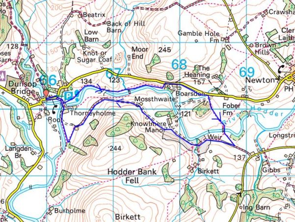
  The plan was to visit three triangulation pillars haphazardly scattered on Sheet 103 of the OS 1:50,000 Landranger map. For the record. Rushton’s Height 324 m, Hog Low Pike 383 m and Rushy Hill 377 m.  Sir Hugh knows these things, I’m not sure how many that leaves to visit. Some of the time we were on The West Pennine Way some time on The Rossendale Way but most of the time on our way, I shall try and make three trigs as glamorous as possible.

  Our trials commenced shortly after getting out of Hoddlesden onto the moors. Stiles were missing, blocked or dangerous. Gates were locked. Waymarking virtually non-existent. It took us much longer than anticipated to reach the first trig point of Rushton’s Height. There were views to the nearby Darwen Tower.

Sir Hugh records RUSHTON’S HEIGHT.

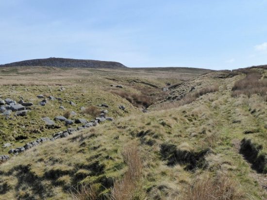
  Getting through the next farm which was spreading like a rubbish dump tried our patience even more, we gave up on our original line and took to some easier tracks to Aushaw Farm. Then we were on the more open moor at last and following little used paths, The West Pennine Way, on rough ground. Small abandoned quarries scattered the moor, what a desolate life it must have been. Ahead of us was a rounded hill sticking out of the moor, we speculated that it may be our next trig point. A little ingenuity was needed to get around Broadhead, we almost took to canoeing the boggy sections. On the map we should have been walking through a forest but it had all been felled. A steep pull up fields, then we had a stroke of luck – part of the moor ahead has been planted with trees and opened up for our enjoyment. It led straight to the trig point of Hog Low Pike. Another group of walkers was just leaving it. Cold weather was blowing in with spots of rain, we didn’t linger, but the backside of Pendle was visible between showers.

HOG LOW PIKE.

  A look at the map for our way forward showed we were on open access land, a glance at the moor showed little paths everywhere so we were able to take a direct route towards the Grane valley, it was steeper than expected but led through newly planted trees. There has been a programme of tree planting in the Burnley and Rossendale areas  where sheep grazing had denuded the slopes. We came upon a deserted farmstead, many were abandoned when the Grane valley reservoirs were established and the land became water catchment. Farming began to decline but many of the smallholdings set up loom shops which kept them going but by the turn of the 20th Century most of the old farms were deserted and the people moved to the rapidly expanding mill towns, We passed many more later when on the Rossendale Way but by then we were in rain and not stopping for pictures. Lunch was taken amongst the mossy ruins to the sound of bird song and some warming sunshine. I later found some history to our resting spot on Haslingdens Blogspot.

Bentley House
Bentley House does have some striking history, especially in regards to “illicit whisky distilling” which took place during the mid , 1800’s – Here is an article published in the Blackburn Standard – May 20th 1857:

ILLICIT DISTILLATION OF WHISKY….. On Saturday at the Court-house, Haslingden, Jonathan Haworth, farmer, Bentley House, Haslingden Grane, was charged by Mr. Ellis Heath, supervisor of the Inland Revenue in the Blackburn Division, with being the proprietor of an unlicensed still for the manufacture of illicit whisky. Mr. Clough, who appeared for the Board of Inland Revenue, stated that this was one of the most compact and connected private distilleries which had been brought to light, at any rate in this neighbourhood; and but for the vigilance of the officers of the Board, it might have been carried on for a length of time without detection. At eleven o’clock on the night of 3rd April last, Mr. Ellis Heath, accompanied by the officers, went to the house of the defendant, which is situated at an unfrequented and isolated part of the township of Haslingden. On going into the house, the officers proceeded to a square weaving shop, but observed nothing there by two pairs of looms. On examining the room above that they found it was a much larger room. They descended again to the weaving shop, and tapped the wall, which defendant said was a gable end of the house. They found the mortar soft, but yet it corresponded with the other walls of the chamber. On looking at the flags they found that they had only breen freshly laid. A few were taken up and after taking up a quantity of earth, an arched entrance cut out of the solid rock was discovered with an aperture just sufficient for one person to enter in a creeping position. On the officers entering the chamber by this, the only entrance, they found a new still and every apparatus requisite for the manufacture of illicit spirits, with a number of tubs, a quantity of wash, &c., which were immediately seized and conveyed to a place of safety. The flue of the fireplace in the room had been cut out of the rock and taken below the floor of the weaving shop and house until a junction was formed with the chimney of the house, so that one flue only could be seen to emit smoke. With the stone cut from the flue the partition wall of the weaving shop had been built so that no material had to be brought to the house, –Mr. Ellis Heath and others proved the case and the bench inflicted a mitigated penalty of £50 and costs, in default of payment to be imprisoned during her Majesty’s pleasure. — On the 7th ult., the defendant had been convicted of being on the premises where illicit whisky was found and convicted in £30 and costs, in default to go to prison for three months. The prisoner then sold ten head of cattle and went to prison. The seizure reflects great credit on the vigilance of the officers and will do much to check illicit distillation in this neighbourhood.

   There was a substantial stone post aside the ruins with a faint inscribed word, again with later research this turned out to be ‘To Bolton’, the farm had been alongside the ancient road.

  As I said black clouds had built up and we were in rain for the next mile as we followed the Rossendale Way past many ruined farms at the head of the Grane Valley, the reservoirs could just be made out in the mirk under the steep quarried heights of Muswell. We safely crossed the busy road and were back on open moor and soon at the last trig point of the day, Rushy Hill. Nearby wind turbines were about all we could see.

Muswell Heights.

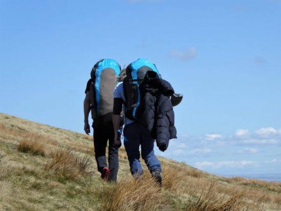
RUSHY HILL. Some sort of ritual.

  A boggy track took us back to the road and on to Pickup Bank. We left the minor road to follow an even more minor lane down the hillside past various farmsteads, many with attached horse paddocks. The lane was steep and rough, I can’t believe I actually tried to drive down here as a shortcut to Hoddlesden on our last ill-fated meeting.

Not recommended for my Mazda.

  Arriving back in the village we passed the remains of the cotton mills which once provided all the employment, now occupied by the usual assortment of ‘dodgy’ workplaces. In the village itself we were surprised at the quality of the stone terraces and cobbled streets, some effort had gone in to making the mill workers’ lives bearable.

The Ranken Arms.


An excellent days outing. What will Sir Hugh come up with next?

   As an aside, my first aid kit came into action on the drive home. Some plastic from my front number plate started flapping alarmingly above the bonnet but a quick stop and application of a blister plaster solved the problem. I wonder how long it will remain there? I did consider an Aspirin in the radiator at the same time.

*****


NOT AN OTTER ON THE HODDER.

JD phoned to suggest a walk by the rivers to try and spot otters which have been present recently. Suffice to say we didn’t see one but had an enjoyable walk nonetheless The stretch of waters we walked by I’ve described so many times in these pages, so I do not intend to repeat it here. We started on the Hodder and walked to its junction with The Ribble and then carried on to Hurst Green, basically part of the  Tolkien trail. Spring flowers were more varied with new species appearing, the bluebells continued to put on a good show and of course the wild garlic was at its best in the damp shady places. Many of you will know the route on seeing this tree, the Winkley Oak.

Midweek is becoming much quieter as many people have returned to work, we met only a handful of dog walkers. A favourite spot is where the Hodder and Ribble join, there is a bench inside a fisherman’s hut which provided a comfortable lunch spot looking out over the rivers. Farther downstream near Hacking Hall the sandy banks provide nesting spaces for Sand Martins which were flying low around us as we passed, lovely to see them back. A thunderstorm with heavy rain caught us on the last stretch to Hurst Green, the sky above Pendle having taken on mysterious dark hues. Pubs are still only able to serve outdoors and because of the rain there were no takers in the Shireburn or Bailey establishments  when we passed.

This was the first time I’d been walking with JD for probably 6 months, thus the lack of Otters didn’t dampen the day, but the rain certainly did try to.

SOUTH OF THE RIBBLE AGAIN – OSBALDESTON.

Friday, May 7th.   8.5 miles.    Osbaldeston.

I’m just about to eat my supper;  wild garlic encrusted fish,  a poached egg and new potatoes. The wild garlic was picked on today’s walk from one of the numerous wooded dells I traversed, my rucksack will smell of garlic for days.

 Two days ago I was in Balderstone and today I’m parked in Osbaldeston, a few houses in a row.  Obviously  ‘balderston’ is the common phrase. I’m off to explore another bit of countryside south of the Ribble bypassed by the busy A59.

The little lanes around here are fairly free of traffic mid-morning, but I suspect will be a different matter at school and work times. As I said Osbaldeston is hardly a village, a row of mixed cottages and affluent houses with large gates, you know the sort. I was soon in fields where one stile led to another making navigation simple. I’ve just realised that hedges and not walls mark the boundaries in this area. The elegant steeple of Balderstone church was always peeping over those hedges and up above Mellor Moor, but more of that later.

I spotted a deer running off up a field and when I passed this dell I heard crying – and there were two very young calves left in the grass. A quick photo and I left as soon as possible, what a start to the day.

The next group of houses, Studdlehurst, were hidden away at the end of a lane. Again large gates and horsey activities were evident. The man mowing the lawn of what was probably the original farmhouse was chatty, mainly about the weather, his massive garden and the state of the footpaths since lockdown.

The next house had distanced itself from the general population behind electric gates, but had provided excellent waymarks, gates and stiles on the public rights of way – what more can you ask?  Mercyfield Wood was full of bluebells, I apologise if I took too many ‘bluebell pictures’ today.

Crossing fields towards the river a new fence was going up but the original stile will be reinstated, the workers told me. At last, I was down by the River Ribble which was flowing quickly after overnight rain. I was on the lookout for Otters but to no avail. All the usual birds were present with Sand Martins making a return.  Across the way was Hothersall Hall and I had a different view of it than from my usual walks.

The RofW path cut across the land to Osbaldeston Hall however a concessionary path was signed by the river so I gratefully followed that. A large group of Swans were paddling about farther on below the Old Boathouse.  At Osbaldeston Hall I was pleasantly surprised to find the footpaths well-marked and the landowners going to a lot of effort to make life easy for the walker. I had only seen this hall from the Ribchester side before so it was good to come close up. A pleasant spot for a snack in the sunshine which had been in short supply until now. The old ‘Boathouse’ on the other side gives a clue as to a former ferry as well as a ford marked on an old map.

One cannot but sympathise with the farmer if his sheep are being worried, I fear that with the vast increase in dog ownership there will be a corresponding increase in irresponsible ownership.

The next mile or so was a switchback in and out of woods and ravines. Again plenty of scope for bluebell pictures and for picking some wild garlic for supper.

Once I approached C17th Oxendale Hall I was being watched by security cameras, the footpath became enclosed circling the property and I could have continued into the woods without seeing the Hall. An unmarked public footpath, not meant to be used, in fact crosses their frontage for a close up view. Of course, I was spotted and asked, or rather shouted at, if I was lost? I wasn’t lost, and I didn’t have the time of day for further conversation so continued on my way.

The next hall, Showley, another Grade II listed C17th but much altered, was something of a difference. The agricultural junk started well before the house and continued in most available directions. They deserve a listing for the amount of junk.  I wonder if they get on with their neighbours at Oxendale Hall.

I picked up a lane taking me back to the A59 and after some time was able to cross safely this busy road. Once on the other side I had a choice of low level field paths back to my start or climb up onto Mellor Moor, the weather had improved and I knew the view from up there was worthwhile. Hence, I started the slow trudge up the lane and onto the open moor. Stopping for breath gave me an excellent view of Pendle.

The top of the moor is marked by a trig point but more unusually by the site of a nuclear monitoring post. A plaque relates its history. The Lancashire Telegraph had this write-up.

Concrete blocks amid the swaying grass are the only outward signs of what used to be a large underground nuclear monitoring post for the Royal Observer Corps, which opened in 1959. It closed just nine years later and has since been sealed.

Three men would have entered the post during times of potential nuclear attack and reported on explosions read off special equipment installed to read blast pressure, power and flash. The bunker, therefore, had its own source of power, ventilation, communications, sanitation, food and water.

The monitoring post was just one of 1,500 across the country which would be able to track and report any nuclear fall out, keeping the local population informed of the level of danger. Thankfully they were only ever used for training and exercises.

In the Second World War, an above ground look-out post was built here, too, by the Royal Observer Corps, for spotting identifying and tracking hostile or friendly aircraft flying over this part of East Lancashire.

A direction indicator has also been installed for the far-reaching 360 degree views across the surrounding countryside, Wales, the Lakes and Yorkshire as well as all the nearby Lancashire hills.   Apparently this was also the site of a Roman signalling station, overlooking Ribchester from around AD 80. Earthworks are marked on the map but I’ve never identified them on the ground.

Pointing to Bowland.

I intended to follow footpaths back down the moor but came across this unfriendly gate. Not one to turn back on a public footpath I entered the grounds leaving the gate ajar in case of a hasty retreat. No hounds appeared so I was able to progress to the next obstructed stile. Why do people buy properties knowing there are rights of way through them only to do their best to keep the public out? Another one for reporting to the local authority.

 More friendly fields took me down and across the A59 again to bring me back into Osbaldeston. Today I was luckier and my friends in Mellor Brook were home so a pleasant glass of wine was enjoyed in their garden before coming home to cook my supper.

*****

THE OTHER SIDE OF THE RIBBLE – BALDERSTONE AND SAMLESBURY.

Wednesday, May 5th    11miles.    Samlesbury.

Where haven’t I been for a while? Well it’s several years since I explored the countryside visible southwards across the River Ribble. In the past I thought that the footpaths were difficult to follow and rights of way ignored on the ground. Time for a revisit. So I found myself parked up in Balderstone;  a school, a church and a couple of houses. I waved to a man delivering hay to one of the houses and then I was off along quiet country lanes. At Lane Ends I visited a trig point, for no obvious reason, at the lofty height of 74 m.

My first objective was to visit Balderstone Hall on the River Ribble and view from this side the former ford across to Alston. I’ve recently been looking at this scene from the Alston side.

https://bowlandclimber.com/2018/11/08/alston-looping-the-loop/

https://bowlandclimber.com/2021/01/08/river-ribble-at-alston/

A pleasant stroll down fields above the river brought me out into the confines of expensive and secluded properties. A right of way was shown on the map but it looked daunting. As it happened a couple of builders whom I knew were working on a wall of the Hall, they said nobody was about and showed me the way through past the rather intimidating signs. I didn’t like the look of the river crossing, maybe in high summer and low water I’d be tempted. The old map marks the ford.

 I retraced my steps and left the exclusive properties for a path past a more run down farm. Crossing fields on the flood plain I bypassed a large farm and climbed back up the escarpment to reach a road heading west to Bezza House. Years ago, when Bezza was a tree nursery, I used to come here with Dor and many of the trees in her and my garden originated from here. One in particular that she bought was the ‘handkerchief tree’ Davidia involucrata, an exotic specimen from China. It takes years to flower and so one spring whilst they were away for the day I went around with a ladder and white paper tissues which resembled the flowers from a distance. Suffice is to say that they were well and truly tricked but the tree had the last laugh by flowering the next year and every year since.                                                                                                               

There are great views from up here of the Thirlmere Aqueduct crossing the River Ribble.

Where the road used to continue bollards have appeared and now only a bridleway continues to Samlesbury. And what a pleasant bridleway it was;  lined with spring flowers, bordering fields full of lambs and having views across the Ribble to Alston, Longridge and beyond.

It was getting near lunchtime so I hurried to reach St. Leonard the Less Church where I expected there to be seats. I was not disappointed, in fact a couple of walkers were already occupying the prime bench. The church unfortunately was closed. It has some very old box pews, apparently. I had to be content with the exterior views of the oldest, C16th, sandstone part and the distinctive tower built at the end of the C19th. In the graveyard was an ancient sundial, 1742,  and a large font, 1769. The adjacent primary school is also of a certain vintage, I’m always cautious taking photos near schools.

A path climbed fields towards a house which turned out to be another religious establishment, the Roman Catholic Church of Saint John Southworth  and presbytery.

An old sunken track high above the busy A59 was a hidden delight to walk. Peace came to an abrupt end when a stile deposited me onto the pavement adjacent to the traffic lights at the busy junction next to the Five Barred Gate motel.  

Once across safely I was happy to follow  the quiet lane past the extensive sewage works. Up and down it went until I was able to take a footpath across to another lane, thus by-passing the Nabs Head  pub which has too many recent memories for me. I was soon on the pavement outside the C15th Samlesbury Hall. What a magnificent building this is and to think it was bought in 1920 for demolition, only to be saved by a local trust. I crept into the grounds for a closed look.

Crossing the busy road I made use of a quiet bridleway, Park Lane, taking me to Mellor Brook. I wished I’d had a bag to collect some wild garlic. From up here I could look across the extensive BAE site and the Ribble Valley to Longridge and the Bowland Hills. 

I took a footpath behind houses where friends live hoping for a cuppa, but they were not at home. This humble little stream, Mellor Brook, once fed a mill pond that supplied water to a cotton mill.

The village deserves a better look with little alleyways and old houses. An unknown lane went under the A59 and out into the countryside. Fields headed back to Balderstone with the church spire always prominent. On the way I passed the grand looking Grange, you could rent its nine bedrooms on Airbnb for £2000 per night. 

Arriving back at the school I was greeted by the man who’d seen me set off this morning. Turned out he was the school caretaker and seemed impressed by my modest mileage. I had time for a look around the outside of St. Leonards Church. It dates from the C16th but was rebuilt in the 1850s, the tower and prominent steeple were added in 1905 by those old favourites of Lancashire church architecture Austin and Paley.

I have had perfect weather for today’s enjoyable amble in this delightful backwater just off the A59. It was worth crossing the Ribble.  Looking at the map I will return and complete another circuit to the east based on Osbaldeston.

AROUND LONGRIDGE WITH THE CHESHIRE SET.

Friday 30th April.   10 miles.    Longridge.

There wasn’t a footballer, TV ‘Celebrity’ or landed gentry in the party that I met up with for today’s walk.

I couldn’t believe that after all my extra careful planning, they were the Cheshire Set after all, that our rendezvous spot had become a closed road this morning. Cary was seen further up the fell as others arrived more or less at the appointed time and place. We then moved all the cars to a better place.

The original ‘Around Longridge Walk’ has become redundant because of all the housing developments taking place and I’m looking to establish a more definitive rural circuit. My Guinea pigs had just arrived.

With black clouds over the Bleasdale Fells we set off in cool weather. Please be sunny and dry I thought, keen to show off the local countryside. They were the Cheshire Set after all. Green fields led down to Lord’s Quarry and the end of the railway that took the stone from all the Longridge quarries to build the towns and cities of the NW.

Mile lane was its usual half mile.

Clay Lane was avoided, too much wet clay, as I expertly navigated through nearby fields. By then it was time for morning coffee and pieces of Martin’s excellent chocolate chip biscuits. The sun shone. The long ridge of Longridge Fell was seen almost in full extent with the village at its lower end.

We were soon on the normally quiet Ashley Lane just as rush hour began and there was strangely almost constant traffic. Despite Alastair and Sue preferring to carry on along the road the rest of us turned off to go through the minor industrial estate of Sandbank. This industrial area was just a warm-up for the massive timber Wyder complex across the road. Floors and roof trusses are constructed here to be shipped off to distant building developments.

Back to country lanes we were then confronted by one of those large modern tractors with just enough room to pass.

Green Nook Lane led to a constricted path through more industrial units and out onto the track of the Longridge – Preston Railway, originally a track for horse-drawn carts carrying stone from the quarries to Preston and afar. Steam trains took over and a passenger service was run until 1930, goods which now included products from Longridge cotton mills continued into the fifties. Farther down the line at Grimsargh a branch line served Whittingham Mental Institution, at one time the largest hospital in Europe. We are left with a gravel track traversing the fields but unfortunately blocked off in places denying the chance to provide a green way from Longridge into Preston. Lack of initiative and planning.

The dog at the next farm was gathered into the owner’s arms as we tramped through their garden. Lunch was beckoning and the multitude of benches in the graveyard at Alston Church proved an ideal convenient and comfortable stopping point. They were the Cheshire Set after all.  Social distancing proved no problem.

The spot we randomly chose was adjacent to the grave of Ginio Ferrari a well known local restaurateur. In his heyday he used to drive around in an open-top Jag with GF 1 plates.   Apparently he had acquired these from the Rolls-Royce previously owned by George Formby, GF 1.

A stretch of pleasant countryside brought us back to the outskirts of Longridge and Tan Yard lane leading back to the quarries. Views from here across the reservoirs to Pendle and the West Lancashire moors.

We skirted the large caravan site hidden in the quarry to arrive back at the cars. One last treat was to look at the overhanging bouldering delights of Craig y Longridge.

We were lucky with the weather – more sun than showers, and I think Lancashire put on a good show for the Cheshire Set. I in turn thank them for making the effort to drive up the M6.

Must get this post out before Martin or I will be accused of plagiarism. [too late] I didn’t take many photos of the surrounding countryside or hills, I’ve enough of those already, but here Is a flavour of the day.

First problem.


Most awkward stile of the day.

Easier European standard ‘stile’ – Conrad


Cary giving us all the lines of the magpie rhyme.


Inspecting Thirlmere’s water supply.


Quiet lanes.


A less than grave lunch.


An introduction to Craig Y Longridge.

*****

I’d noticed this morning a couple of helium balloons stuck in my cherry tree and resolved to retrieve them later. On my return there was a knock at the door from my neighbour asking if he can have his balloons back. He had recently retired and been to a party to celebrate – hence the balloons, they unfortunately escaped from his kitchen last night but didn’t go far. We fished them down and he went home as pleased as punch. Happy retirement Mike.

GOLDSWORTHY ON HIGH.

Monday, April 26th.     8miles.      Quernmore.

I have been up here before to seek out the Andy Goldsworthy ‘Three Chairs’, most recently in 2014.  https://bowlandclimber.com/2014/05/28/out-on-the-loose-again-clougha-pike-and-grit-fell/  when we did virtually the same walk.

There were quite a few cars in the car park this morning when we arrived – early birds or dog walkers. Sir Hugh was just recovering from his head dive last week and I noticed a slight reluctance to turn his neck, however today was only going to be about six miles, well it turned out nearly eight, but there was no problem.

We climbed up onto Clougha Pike using the Rowton Brook path which passes evidence of past cottage industries most notably the C17 cotton mill. The present owner was happy to chat about its history and life in general.


There was no let up in the ascent but the ground was mercifully dry. The trig point, 413 m, was adorned with the most un-Goldsworthy stones. The views over the bay were murky but Morecambe Power station was ever present. In the other direction that other old favourite, Ingleborough, was in the background. 

The easy way.

Clougha Pike summit. 415m.

The obvious continuation track went to Grit Fell, we followed it as the rest is trackless heather. The peat was bone dry and a joy to stride out on with skylarks somewhere overhead. A few grouse were calling gobackgoback. Not recalling that Goldsworthy’s installation was named ‘The Three Chairs’ we spent some time trying to identify three large gritstones fitting that description and marked approximately on the  map.

Grit Fell 467 m.       Can you spot Ingleborough in the gloom?

I did recall this isolated Xmas Tree farther along the ridge.

Once on the shooters’ highway we made good progress back in the direction we had just come from. I was beginning to doubt my ability as a guide when the moors stretched out ahead of us with no sign of quarries or chairs. Sir Hugh thought the day was a failure when suddenly we were there and the installations appeared much larger than I remembered. [marked G on the map] He was impressed – with the statues not my navigation. Do you call them statues, sculptures, installations or piles of stones? That’s where art has its personal interpretations. Piles of stones they certainly are not, these are carefully crafted structures with intricate stone work. Apparently Goldsworthy constructed one each year from 1999 to celebrate the millennium. We speculated whether he constructs them himself or employs a stonemason to help. After the obligatory photos we continued on our way off the fell.

An estate worker’s massive 4X4 passed us – or was it the Duke.

Three cairns appeared on the left which we declined to visit but on the next photo look quite interesting.

I was chatting to Sir Hugh about the Thirlmere Aqueduct which comes this way and an old quarry [marked Q on the map] near Ottergear viaduct ‘discovered’ and climbed in by my friend Pete. We reached the impressive viaduct and almost missed the quarry which I’d expressed a desire to revisit. A chance glance behind and we noticed a couple of blokes in the quarry. They were doing a bit of climbing there as it has been highlighted in a recent supplement to the boulders in this area. That led to a sociable chat about old times climbing.

A sandy path through the heather brought us back to the car park. A perfect little fell day.

*****

CONNECT FOUR ON THE CANAL.


Saturday,  April 24th.      7miles.      Ellel.

I am just beginning to connect up with friends I’ve not seen for months. D and P had arranged a walk with Mike, and they invited me along. I mentioned I’d not visited Ellel Grange estate, close to where I was walking with Sir Hugh last week. I drove round and round looking for our rendezvous spot at Thurnham Church, is it coincidence that Denise’s walks often start at an RC Church?

The church of St Thomas and Elizabeth was consecrated in 1848 and had links with the Dalton family in nearby Thurnham Hall. In the grounds is a mausoleum for the Gillow family, well known local furniture makers, it has elaborate Egyptian columns on one side only. In front of the church is an eroded C19 cross recovered from nearby Cockerham Abbey.

We moved on. The day promised more sunny and warm weather. Along a farm track D and P commented on a new house that wasn’t here a couple of years ago when they last passed.

Fields, thankfully now dry, were crossed towards the Ellel Estate. We detoured up a hill for a view of the Italianate hall with its towers and extensive gardens. It was built in the 1850s for an ex-mayor of Liverpool and has been recently used as a religious retreat, but see below.

Our next objective was a view of Kings Lee Chapel  a Victorian gothic church designed by Joseph Hansom who also designed the impressive St. Walburge in Preston and the Hansom Cab. The church is closed and has been subject to vandalism. If I had been alone I would have been tempted to approach closer up the drive.

Apparently the whole site is for sale with plans for yet another holiday complex. Some estate buildings are already used as holiday lets.    https://www.lancastervision.com/holiday-village-100-bed-hotel-and-vr-experience-plan-for-lancaster-revealed/

We left the estate over their balustraded canal bridge and had a pleasant stroll along the Lancaster Canal.

At the junction with the Glasson canal we took a break outside the lockkeeper’s cottage on a suitable bench. D unexpectedly produced four sandwich buns out of a hat for us.

Onwards though Galgate we eventually left the canal by a path across a field of probably 100 cows. A hill gave us views of the bay and distant Lakeland hills. We took to the road around Condor Green where the old Stork pub is needing renovation.

The little café on the old railway line was doing good business with cyclists and walkers using the route between Glasson and Lancaster. Using the railway track bridge we crossed the creeks looking forlorn at low tide.

From the number of people we had passed we expected Glasson to be very busy, so we cut through to the canal by  Christchurch. There was a little fête on, and I came away with some thick cut marmalade which has turned out to be delicious. We were now on the Glasson branch canal which links to the Lancaster canal by a series of locks. This section seemed to be popular with nesting swans.

I did a series of walks up the Lancaster Canal with D and P back in early 2018 where there is lots more information. https://bowlandclimber.com/2018/01/09/the-lancaster-canal/

We left the canal and climbed fields back to Thurnham Church from where a cavalcade of cars made their way to a nearby garden for more socially distanced but connected refreshments.

*****


SEARCHING FOR RAVEN LUMB FALLS.

I’m fascinated by the history of the countryside. I glean as much as I can from books, maps and the internet. The origin of names: lost houses and tracks: the local industries from way back: family trees and intrigue. So when I come across a reliable source of information to one of my regular walking areas I’m delighted. The area in question is Hurst Green and Stonyhurst and somebody has set up a Facebook page dealing with precisely that.  https://www.facebook.com/hurstgreenandstonyhursthistory

I was alerted to it by a comment from its author on my Stonyhurst crosses walk for which I found it difficult to obtain information. I have some catching up to do with the posts so far, but I did notice one on a waterfall on Dean Brook below Hurst Green – Raven Lumb Falls. Over the years I have scrambled up a few of the brooks coming down from Longridge Fell to the Ribchester and Hurst Green areas, but I was unaware of this location. It didn’t take me long to identify its approximate position on the OS map and this morning I set off to explore.

Hurst Green was busy with walkers, most probably following the Tolkien Trail which I did a few weeks ago. Today I set off down Lambing Clough Lane, there were certainly plenty of lambs about. At the ‘farm’ I took a public footpath, strangely unsigned, down towards Dean Brook where it is joined by Bailey Brook at a footbridge. There is an open green area here,  locally referred to as Pickleholme. I now followed the stream up into Merrick’s Wood.

Celandines and Wood Anemones were still in flower, but as a bonus the Bluebells were just coming into bloom in blue patches under the trees.

There was more water in the brook than I had expected after all this dry weather, I would have been better in wellingtons to walk directly upstream, as it was, I used precarious little tracks with an ever present risk of tumbling down the steep bank into the water.

Anyhow, I made progress until at a bend the fall came into view. The water had carved out a passage through the sandstone cliff. Care was needed boulder hopping here as I don’t think anyone would have found me if I’d had an accident. The grid reference, for anyone foolish enough to follow in my footsteps, SD 6830 3746.

What a delightful spot deep in the woods with a lively flow of water. There was some tat left by gill scramblers from Hothersall Hall. The rope was in bad condition so I removed what I could reach. I need to return when the water level is even lower to try and scramble up the falls.

I sat for half an hour and watched  a Dipper coming backwards and forwards, with grubs in its mouth, to a nest hidden in the rock. A pair of Grey Wagtails, or Yellow?  were flitting about in the stream.

What a pleasant way to spend a morning.

When I arrived back at the Shireburn Alms the beer garden, sorry dining terrace, was full of diners enjoying the sunshine and their freedom to eat out. A far cry from down below.

THE OLD MEN OF TROY.

The Old Man of Hoy is a famous sea stack off the coast of Hoy in the Orkney Isles. As a climb it was first ascended by  Chris Bonington, Rusty Baillie and Tom Patey in 1966. Apparently it could collapse at any time.

We weren’t up there today, that would be stretching the travel limits. No we were still in deepest Lancashire returning to Troy Quarry after many years for some climbing. Apart from the rhyming name the only other resemblance to Hoy is a stack, without any sea, in the middle of the quarry.

The parking area has been severely limited because of the influx of walkers disturbing the locals in these strange times. Of course, we travelled in four separate cars, so you can see how quickly every space becomes blocked. None of us could remember the approach into the quarry, there used to be some large concrete buildings by the track, all now looked quite sylvan. There are some good walks that traverse the hillsides in this upper part of Rossendale. But today we were here for the climbing.

The quarry is large, spreading 30 – 40ft walls of gritstone around a pond. Canada Geese entertained us all afternoon with their calls and territorial chasing across the water. We made a beeline to the South Walls where there were easier climbs. Another pair of climbers were already in situ but soon moved on. They were top roping either for safety or inexperience. We had many years of experience between the four off us, too many to count but were a little rusty. I, for one, don’t want to see the inside of a casualty department, so we opted for top roping too, something I wouldn’t have contemplated in the past – where is the adventure in that. Times change.

After a bit of faffing with slings we had a top rope set up above the Siamese Twins. These are cracks in a steep slab. We climbed the right-hand variation with help of the left crack and the left route with the help of the right crack. Who’s watching?

Rod high on Left Siamese Twin.


Dave in a similar position.

The rock was clean with positive holds, a fine gritstone apparently used in the past for pavement flags in the northwest cities.

A large flake in the centre of the Siamese wall had new cracks running down it, a hollow sound and movement when pulled in certain directions. Water and frost affect the rock formations in these quarries and every so often lumps, small and large, detach themselves. You just hope you are not clutching one when that happens. This particular flake is already doomed. We squeezed in a slightly harder climb to the left but again transgressed into those cracks. 

Fred has the largest lunch box.

I haven’t seen my climbing partners for many months, so we had a good catch up chat over lunch. The sun was pleasantly warm reminding us of many hours playing on the rock walls in these Lancashire holes in the ground. God’s own rock is over the border in Yorkshire, but we are fiercely defensive of our sometimes grotty venues.

We moved the rope along to above a great looking flake line, Stacked Deck, which we all enjoyed lay backing up.

Dave starting the lay back of Stacked Deck.

Alongside was the classic route, Rapunzel. Halfway up is a barred window from which Rapunzel would have let down her hair. The fable around this story is more complicated than I remember. https://en.wikipedia.org/wiki/Rapunzel 

Rod approaching Rapunzel’s window.

Suffice to say she didn’t let down her hair for me today, and I was lowered to the ground to lick my wounds. Ah, well it is the first time I’ve been on a rope this year. Things can only get better – or is that a fairy tale?

Boulderers on the ‘sea stack’

WALKER’S I’TH FIELDS. Galgate/Ellel.


Saturday, April 17th.   7.5 miles     Galgate

The approximate midpoint between me, Longridge, and Sir Hugh, Arnside, is the Galgate junction of the M6 just south of Lancaster University. A meeting was arranged for the first time in 6 months. It nearly got off to a bad start as I parked up on the wrong road. Anyhow, once corrected we set off into those fields trying to escape the motorway noise. This could have been a nothing walk but as things turned out there was plenty of interest. Of course not having met up for all those weeks our conversation meant we were ‘lost’ on several occasions. Sir Hugh’s plotted route, chosen I think with a pin, was flexible enough for us to complete the circuit. It was more undulating than first appeared, and we reached the dizzy height of about 150 m. Any views tended to be to the west over the motorway, although the Bowland Fells were ever present a few miles away. We even visited the upper part of Dolphinholme.

The delay in this posting is partially due to my involvement in local affairs. The field opposite my house has been earmarked for development for some time. All local objections have been dismissed – so here come a couple of hundred houses. What we didn’t expect was intensive piledriving occurring almost adjacent to our properties. We awoke after Easter to vibrations akin to small earthquakes. Cracks started to appear inside our houses. Local authorities were to be honest hopeless and disinterested in appreciating the seriousness of the disruption. Barratt Homes were dismissive of our protestations. My next step was to contact my MP, Ben Wallace, someone I had never voted for. He immediately took up our cause and took on the mights of Barratt. The good news is that they have been stopped from piledriving for now, a victory for the common people. There is some way to go yet, but they are having to look at alternative methods of consolidating the ground which they shouldn’t have been building on in the first place – I hope it costs them a fortune.

A forest of piles, excuse the expression, hundreds of them.


The offending monster being taken away Monday morning, no doubt to disturb someone else’s neighbourhood.

Anyway back to the start…

A massive mushroom farm has mushroomed in the fields next to the motorway. The farms round here are on an industrial scale, the cows have their own mechanised backscratcher. There are some interesting names, as the header photo and this attractive sign. Busy weekend roads were crossed, we couldn’t work out where they were coming from or going to, but we must have travelled them at some time. All looks different on foot. A trig point,136 m, was visited off route, it was next to an impressive stone wall with Grit Fell and Ward Stones just peeping over the top.

Old tracks lead to remote farms, had we strayed into another land?

Another slight diversion took us to an unusual feature marked on the map… … it turned out to be the ruins of a dozen WW2 ammunition holdings with double walls intended to reduce the shock if there was an explosion. But why build them in such proximity?

A lane wandered down to a farm complex, you can see we were at the back of beyond. Children and friendly dogs ran wild. The farm house looked old – it was. 1698 above the door. As was some of the equipment. A lovely valley wound onwards until we became literally fenced in a horsey property. Lunch was taken above a small stream heading into the River Wyre.

Later after more intricate fence climbing we arrived at Four Lane Ends in upper Dolphinholme and much later still we arrived at Five Way Ends, that makes nine, no wonder we were lost.  Ponies were being exercised as we walked down the road, makes a change from all the dogs we see at the moment.

A splendid walk, not bad for sticking a pin in the map – no, thanks for Sir Hugh’s excellent planning.

The day wasn’t over as in the last field to be crossed Sir Hugh executed a superb diving header of the ball into the opponents net, except there was no net and no ball, just a hard landing on his skull. Obviously he survived and I hear is recovering well.

Walkers I’th Fields indeed, where next.

*****


A NATURAL HIGH – FAIR SNAPE.

Thursday 15th April.       6 miles.       Fairsnape.

I feel released at last. Well almost.

I’ve been very good during the Pandemic, self-isolating for my own good, not mixing with my family or anyone else really, not travelling outside my area and living off home deliveries. The latter have been excellent, and I’ve put on a few pounds. Today I went high into the Bowland Fells for the first time in months. I felt strangely anxious, not wanting a helicopter rescue. But I have walked this route hundreds of times, it was once my evening fell run.

I parked in my little slot below Saddle End and walked slowly up the fell. As usual, I met no one going this way and I was so slow others would have overtaken me. Skylarks were in full song, and it was a joy to be on the hill.

I took the manufactured track across the side of the fell, but I had to deviate over the flagstones to take in the highest point, the cairn of Fairsnape Fell, 520 m. One can’t come up here without visiting the top, but apparently many do. I was rewarded in solitude with views over to the three Yorkshire Peaks area where friends were walking today – if they could get parked anywhere.

The beeline to Paddy’s Pole, the other summit of Fair Snape, 510 m, was easy as the peat hags had dried up in the last couple of weeks. You can hardly believe the difference in that time from limb sucking bogs to dry, even dusty, peat. Anyhow, I wasn’t complaining.

There was no one at the cairns or trig point on this westerly bit of Fair Snape Fell. I sat and ate an orange looking out to Morecambe Bay and the hazy Lake District. I spent some time scouting out for a flat area suitable for an overnight bivi. Last year, or the year before, I bivied out on Beacon Fell and Longridge Fell and I want to complete the trilogy which was halted last  year.

Then it was fast walking around the fell rim towards Parlick, not forgetting to spot Nick’s Chair [Martin B]

Earlier in the day I’d spotted parapentes in the sky, launching from the more unusual east side of Parlick. I took the track in their direction hoping for some close up photos, but it seemed to be lunchtime. None were in the air. Some were still making their laborious way up. As soon as I was halfway down they stared appearing in the sky once more. I took the steep way down the fell.

Traversing lapwing fields took me back to the road and my solitary car. I managed to buy some excellent free-range eggs at the end of the lane.

Down came the soft top for an exhilarating drive home. I do feel I’ve been released. On a day like today up there in the Bowland Fells you couldn’t feel any different. A natural high.

And then I read this – https://raptorpersecutionscotland.wordpress.com/2021/04/15/red-kite-shot-in-cotswolds/

*****