Yesterday morning there was a heavy dew, the temperature had dropped to 6°, today it is wet and windy again. I’ve just returned from La Palma where the temperature was in the high 20s – what a shock.
Wandering round the garden there is little to see, a few Asters and Japanese Anemones are giving some faded colour. Round the corner the Nerine bowdenii is suddenly in flower. The delicate Fuchsia magellanica Alba is hanging on.
Autumn colours have only just started but the strong winds, whilst I’ve been away, have already stripped some trees. The blackbirds are eating the holly berries so by Xmas there will be none left.
The clocks go back tonight. Little else to say really.
You will notice that GR131 has not appeared in today’s title. Instead of going back up the mountain, we were going to the seaside. An hour’s bus ride across and through the Island [2.10 euros] and we were changing buses in Los Llanos to go down to Puerto de Tazacorte. I managed to hobble down to the black beach and have a dip in the waves until I realised my leg didn’t want to swim. A hilarious moment happened when we tried to walk across the beach barefoot and realised our feet were actually burning on the black ash, a lot of hopping and jumping onto clothes ensued. A decent fish restaurant served us lunch whilst looking up at the steep path we could have been coming down on the GR131. Ah well, some other time.
The night was spent in the delightful old part of Los Llanos. Tree lined streets were perfect for the relaxed café culture. The trees are 150yr old Indian Laurels, a type of Ficus, and are crying to be climbed.
Santa Cruz was explored the next day. Old narrow streets, flower decked balconies, museums, seafront restaurants, little bars. Not bad for an anticlimax.
A final float in the sea and we were heading home well impressed with La Palma – La Isla Bonito. Hasta luego!
Tropical the island breeze All of nature wild and free This is where I long to be La isla bonita…
I said yesterday’s walk was the Island’s most popular, well maybe for serious hikers as this morning there were crowds heading to the lighthouse. Not Virginia Woolf’s soul searching one. We had a leisurely start after the usual bar desayuno – freshly pulped orange, tomato tostada and a coffee, not bad for 3euro. The coffee on the Canary Islands varies in quality, I think they grow and roast their own which often has an unusual taste.
Navigating out of town was made easier than usual by heading for a black volcano cone. A large visitor centre has been built here, Volcan de San Antonio which erupted 1677. It looked interesting but only accessible through the centre who charge for the privilege.
We followed the fence around it down ash slopes where vineyards have been established.
Ahead was Volcan Teneguia which erupted as recently as 1971, it makes you wonder when the next one will be. [watch the video below] The path alternated between blocky larva flow and very loose ash, all the time aiming for the Atlantic and the two lighthouses at Faro. The last time I’d seen such young rock was on Iceland from where I picked up a specimen only 2 years old.
A few fishing boats were bobbing in the waves off what looked an inhospitable coast. We commented on the fact that you hardly ever see a seagull.
The sea was wet as wet could be, The sands were dry as dry. You could not see a cloud, because No cloud was in the sky: No birds were flying overhead— There were no birds to fly.
By now there was a steady stream of walkers coming down the paths to join the crowds of tourists arriving by car to look around the salt pans at the Faro. The original basalt lighthouse had been decommissioned following tremor damage and replaced with the more modern one in 1985, but this is automated now.
On the larva beach there are extensive salt pans and today men were working in them, not sure how much of a commercial venture this is or more of a tourist attraction.
We retreated to the pleasant veranda above the shops’ hustle and bustle for a beer and tapas, papas arrugadus and cheese croquettes with mojo sauce. We were feeling pleased with ourselves for finishing this difficult four day section of the GR131 and planned the next two days. We had descended from 2426m to sea level and in those days also climbed 2200m if you see what I mean – no easy downhill.
Slowly the place filled up with walkers quenching their thirsts before catching the bus back to their hotel or Fuencaliente. We joined them for the bus trip first along the coast through all enclosing banana plantations to a ghastly looking hotel complex in the middle of nowhere then back up the twisting roads to town. We picked up our rucksacs from the pension, yes we had enjoyed an easy morning unburdened, and caught the next bus up to the east coast, Los Cancajos. Strangely it was only when we alighted here that I realised I could hardly walk for pain in my hip. On that recent trip to Cornwall I had noticed pain with all the steep steps but ignored it prior to coming here. Presuming it was just spasm from sitting I soaked in the bath and had a beer only to find I could hardly walk to the restaurant for supper. Tomorrow was to be another long committing walk down the central caldera from Roque de los Muchachos towards the west coast with no escape possibilities. I agonised over dinner and prompted by JD cancelled the early morning taxi to the summit. Once that was decided we enjoyed a very good local red, Tamanca Negramoll, changed plans and hobbled off to bed.
[ Just a word of praise for our apartment block, La Caleta. The staff couldn’t have been more friendly, they were interested in our exploits and very helpful with our change of plans. The rooms were basic but spacious, lovely pool area, tranquil atmosphere and good dining. https://www.lacaletaapartamentos.com/en/home.html ]
This is the most popular one day walk on the Island following a ridge of volcanoes. Even while we were packing in the dark taxis were bringing walkers to the start. It is Sunday and lots of young walkers passed us throughout the day. Our plan was to get away early and do the climbing before the heat of the day. We had been told that the excessive heat we were experiencing was due to tropical air and dust from the Sahara – the Calima. Ahead of us in the trees were three seizmologists taking readings on the ground. There has been recent activity under La Palma but these three told us that it has diminished, still it was reassuring to have our personal warning team proceeding in front of us.
Slowly we gained the crest and weaved between volcanic cones on black ash paths.
Most of these erupted back in the 15 -16th century though Monte Negro on our right appeared in 1949.
On the left were seas of black larva flows, dramatic geological features set out before us.
Someone must have time on their hands…
Higher up there was a short detour to the rim of the massive crater of Volcan Deseada. Disappointingly we never had the distant views to the other Canary Islands.
Ahead were more volcanic cones but the track wound down into a large ash area with scattered trees, one of these trees gave us shade for lunch – the last of the tuna! Still at 1800m. On and on through the vast ash scenery as the temperature reached the 30’s with little shade from the scattered trees. We marveled at the tenacity of these trees to get a footing in the arid ash. This is dusty walking.
The Walrus and the Carpenter Were walking close at hand; They wept like anything to see Such quantities of sand: ‘If this were only cleared away,’ They said, ‘it would be grand!’
Some awkward larva rock made walking difficult on the final descent into Fuencaliente [Los Canarios], 780m,
At the entrance into town there is a statue celebrating all the walkers who come this way and more importantly contribute to the local economy. Glad to oblige we headed straight to the nearest bar for refreshments. Near the statue we later found plaques recording results from recent Transvulcania Ultramarathons with unbelievable times now below 7hours for the 74km course.
We had a great little pension up a side street for the night. A shower washed off most of the sweat and dirt but when we shook our boots out we were amazed at the amount of black ash that fell out – sorry if we blocked any drains. A hidden restaurant in the lower part of town provided some fabulous food but dubious local wine.
We had heard there maybe a food van at El Pilar where we planned to bivy tonight so set off with high hopes. Today was much easier walking with well graded paths and not so much ascent. Steep zigzags below the refuge brought us back onto the caldera rim, though there were still no decent views into it. A late breakfast was taken sat on a branch of one of those magnificent Canary Pines.
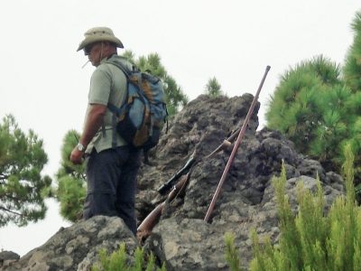
A gun shot scared us, today is Saturday and one is allowed to hunt the introduced Barbary Sheep, a large horned goat, Arruis. All along the rim were hunters, presumably waiting for the prey to be driven up the hillside. Later we saw them driving away in their jeeps – I don’t think it was a successful day.
At Reventon there was a tap and a wall to sit on for lunch, we are slowly eating our way through the heavy load. We spent time watching a group of La Palma chaffinches coming to the font for water.
There was a sign announcing the incorporation in 2008 of the GR131 into the European walking route E7.
From here on a dirt track ran all the way along the ridge to El Pilar but the 131 has been diverted off it through the Laurisilva woods. We walked a bit of both as it was so humid and hot on the undulating ridge.
We were glad to arrive in the recreation area, El Pilar, and enjoyed a coffee from the van. There were lots of families enjoying the day barbecuing on wood fires, free wood seems to be provided. We approached the warden about bivying somewhere later and before we knew it had an official camping permit. Well we didn’t actually have it but we had signed a bit of paper. Supper of veggieburgers from the van was taken on one of the picnic tables, washed down by an unexpected bottle of wine, from the van! We even had time for coffee before he drove off. There were free toilets and showers on site. I had to explain to JD that this did not classify as a real bivi. Once the noise of revelers died down we slept fitfully as the night was so warm, no need for a sleeping bag at1500m.
The moon was shining sulkily, Because she thought the sun Had got no business to be there After the day was done— ‘It’s very rude of him,’ she said, ‘To come and spoil the fun!’
Roque de los Muchachos – Refugio Punta de los Roques.
The taxi deposited us at Roque de los Muchachos, 2426m, the highest point on the Island overlooking the vast Caldera de Taburiente. I felt rather sick from the twisting ascent. There is a car park, a little information hut and a water tap. The road is maintained to serve the numerous Observatories scattered near the summit. At this height clear skies and lack of light pollution provide astronomers with perfect conditions. The trail, with its usual red and white marks starts along the rocky rim in close proximity to the eerie saucers and spheres.
We were expecting cool conditions up here but in fact the temperature was into the 20’s. Heavily laden with 4 litres of water, food and bivy gear we stood out from the tourists exploring the area, exaggerated further when within minutes we passed a bikini clad lass. The views into the caldera were a little obscured by cloud and sightings of other Islands likewise. That would be disappointing to the coach trippers but we were staying high for days so expected better to come.
Volcanoes have rough surfaces to walk on so a feature of the GR131 is that it is bordered by stones defining the way, over time the track itself becomes smoother to use. Along here to avoid the road we were led up little garden paths which seemed unnecessarily rough and steep, after a couple of hours we had hardly covered three kilometres. By the time Pico de la Cruz was reached we were ready for some lunch, the first of our tuna with crisps for me, oatcakes for JD. Whenever we stopped Ravens would appear looking for scraps.
‘A loaf of bread,’ the Walrus said, ‘Is what we chiefly need:
Pepper and vinegar besides Are very good indeed— Now if you are ready, Oysters dear, We can begin to feed!
En route JD was learning by heart Lewis Carroll’s The Walrus and the Carpenter so from time to time I may put in an appropriate quotation.
The path undulated along the crest with surprising amounts of descent and ascent until Pico de la Nieve was reached, we climbed up to its cross but again views down to the caldera were disappointing, however all around were fantastic volcanic rock features in all colours. People were climbing this top from somewhere on the road below.
Better tracks continued down into the Canarian Pines with their burnt and twisted trunks. Zigzags led into a gap, Degollada del Rio, from where a small trail climbed across a rock face to emerge once more on the ridge. By now we were reduced to a snail’s pace and were glad to come round a bend and find the stone Refuge Punta de los Roques, 2040m, next to the path. Before I could appreciate the surroundings I collapsed onto a bunk for half an hour, glad to get the weight off my shoulders. The refuge turned out to be perfect, A kitchen area with tables, sleeping platforms with a few blankets, solar powered lighting and water [needed purifying] in the tank from the roof. Across the caldera rim we had walked could be seen the observatories at Roque de los Muchachos. Way below us in the haze was the town of El Paso which lit up after dark. The night was very warm, probably 15 degrees, but we were too tired to come out for star gazing. We never saw the resident mouse.
Continuing my saga of walking the GR131 through the Canary Islands the next venue was to be the volcanic island of La Palma…
For a start flights from Manchester only go on Thursdays so a week would have to suffice. The route is some 65k long and climbs to 2425m with no real opportunities for restocking or accommodation. I’m not sure I want to carry 4 to 5 days food, plus the necessary water up to those heights. So JD and I came up with a simple plan, have a taxi to take us up to the top, Roque de los Muchachos, and walk down in three and a half days via Refuge de la Roques, El Pilar, Fuencaliente to the Faro [lighthouse]. Then taxi back to the top and walk down to Puerto de Tazacorte on the west coast. Even that idea involved bivouac gear and a substantial weight of food and water.
The first day would end at an unmanned refuge, Roques, at 2000m with no suitable water. The second day at El Pilar, 1500m, with water but no accommodation. We would have a pension on the third night in a village, Fuencaliente 780m. A bus would transport us from the lighthouse back to the east coast ready for the next trip to the summit ready for the shorter second leg. Is that cheating?
Amazingly this is basically the route of an annual 73.3K Transvulcania mountain race with the present record of 6.52.39!
We were booked out of Manchester Airport just as reports of fresh volcanic activity under the Island were being reported, rather dramatically by some of the red tops – panic on La Palma. It last erupted in 1971.
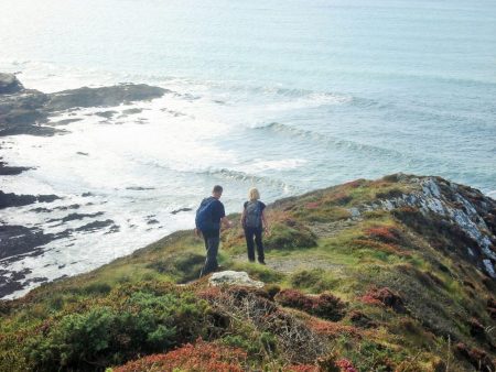
This is the ‘Newly wed and Nearly dead’ season according to the locals which explains the large number of tourists still out and about. The two villages linked have a high profile, Port Isaac is Doc Marten country and Padstow is TV cook Rick Stein’s domain, not without controversy. They are both pretty ports best visited in the evenings when the coach parties have gone. Boat trips and shopping have taken over from the fishing industry although local catches are still available but on the whole commercial tourism has taken over.
Walking through the sleepy village, without a sight of the Doc, I picked up a coffee and croissant and carried them up to a seat on the headland overlooking Port Isaac. A great place for breakfast on a sunny morning. The harbour was below me and looking across the bay Tintagel Head could plainly be seen. The first couple of miles was a real roller coaster with the path clearly visible ahead in the rugged scenery. Varley Head and Kellen Head were crossed on muddy paths slippy from yesterdays rain.
Round the corner the inlet of Port Quin was entered. People were parking up and heading for the coastal paths unfortunately the mobile tea van hadn’t opened yet.
On Doyden Point was a folly built by an 19th century merchant to entertain his friends. Nearby were two fenced off mineshafts, previous silver mines. Vapour was rising from one of them and on peering down the sound and smell of the sea came up, the shaft had obviously reached sea level maybe 25m down.
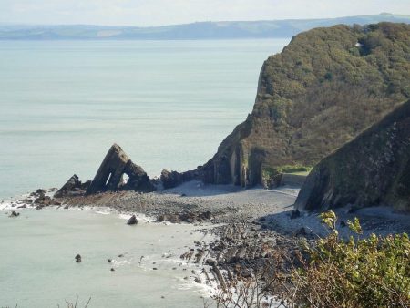
A little further I had a break by a dramatic sea arch, Lundy Hole.
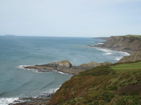
Grassy paths wandered through gorse and people seemed to be coming from everywhere, looking at the map I realised there were many circular walks from nearby Polzeath. A gentle circuit of the rocky Rumps Point and Pentire Head gave good views of rocky islets with speed boats whizzing around. From the point i could see right back up the coast to Hartland Point and Lundy.
Then I was into Polzeath on Hayle Bay with the usual surfing crowd in the waters.The first cafe I came to was in a side street, an old fashioned establishment with home made drizzle cake.The elderly couple gave me a sample of rocky road cake which I’d never come across, very rich and chocolatey. Apparently popularised by Nigella Lawson – another TV link. Next door was a beach house based on an old railway carriage. Third class strangely from the Rhondda and Swansea Bay Railway closed in the 60’s.
Walking past seaside houses I arrived on the beach of Daymer Bay the site of the treacherous Doom Bar now famous as the name of one of Cornwall’s beers. There were lots of people strolling along the beach but as the tide was coming in I kept to the higher signed path up through the sand dunes for a final flurry to the quay at Rock. The small ferry to Padstow arrived and before I knew it was elbow to elbow with tourists shopping in the narrow streets. I had a bus to catch so will leave exploration till next time.
Accommodation was expensive in Padstow so I’d booked into a pub in nearby Wadebridge from where my 10 hour journey back to Lancashire would begin tomorrow. Eight great days of coastal walking are behind me and the legs remind me of the strenuous nature, time for a rest. Not sure when I will be back to finish to Lands End.
The forecast was dire – rain by 2pm and wind all day. So I set off expecting the worst, you never think about not going. Within 20 mins I was hiding behind a wall at the clifftop YHA putting on full waterproofs. The wind was ferocious and I was very wary of getting too near the cliff edges.The start of the route was above slate quarries and wet slate was not the best footing.
Slate quarries and Gull rock.
Approaching Trebarwith Strand.
On reaching Trebarwith, all of 2 miles, I dived straight into The Port William pub for a coffee out of the wind. Quite an expensive place to stay in, the chatty barmaid said in a whispered voice that you paid over a £100 for the view, obviously way out of her budget. She had walked parts of the coastal path and wanted to do more.
From the steep steps behind the pub I could have a breather and watch the waves in the bay.
There was more evidence of slate quarrying in the next valley.
The route continued in the same difficult manner in and out of small coves. The wind made it difficult on some of the exposed ridges and I was glad to take shelter in one of the bays just above the pounding sea.
A small snail hitched a ride on my rucksack and another had to make its own way.
Back into the wind and rain I battled over more headlands whilst the waves crashed below. I was beginning to enjoy myself. Port Isaac could be seen ahead.Reaching a road I walked into the little harbour of Port Gaverne, i was dripping wet and didn’t feel I could go into the many starred hotel. So I pushed on into Port Isaac and found a quiet cafe in a side street for my favourite toasted teacake and coffee.
Ignoring the rest of the village I just wanted to get to my airbnb and have a bath. The Coop provided a cheap supper as I couldn’t be bothered to go back down to the restaurants.
Today’s plan was simple – enjoy a good early breakfast, climb the high hills over to Boscastle where I’d lunch in a cafe and then enjoy the afternoon’s stroll into Tintagel. Somehow I staggered into my hotel at 6pm.
As usual the first obstacle of the day was a steep climb up a headland – why did I eat such a large breakfast? Looking back though revealed the amazing convoluted strata of the cliffs at Crackington.
Onwards up to the highest cliff in Cornwall where the only bench for a rest and the best view was occupied by a lady. She happily shared it and we exchanged conversations far and wide. She was walking to Boscastle where she had left her car. Not wanting to interrupt her day I wandered on but as I was always stopping to admire the views and take pictures we kept passing each other.
A little further and she was taking lunch, she warned me about some steep sections before Boscastle but I continued expecting an early lunch. She knew something I didn’t. It was a beautiful day and there was lots to see and yes lots of climbing. The feral goats on Beeny Cliff appeared on schedule ready for their photo opportunity. More than one ascent of 200 steps had me puffing.
Eventually I dropped into Boscastle. What a shock, packed with tourists and gift shops. The cafes by the quay were all full so I walked into the village and found a less twee place who did me beans on toast.
Leaving about 3pm I met up with the lady again as she walked out of the port to collect her car, she wished me well for the ‘short’ stretch into Tintagel. Motto, Always listen to the locals. I missed out the diversion to Willapark headland with its white lookout post. Valley streams were crossed on footbridges, steps climbed and rocky sea stacks seen. Ahead was the headland at Tintagel, the castle I could see was a hotel not the famous ruins.
A feature along this stretch were the Cornish walls of well crafted stones often in zig zag patterns, ‘curzyway’.
Passing a prominent caravan site I started meeting people walking back from a day in Tintagel they had varying estimates of the distance I had to go. First into the steep attractive Rocky Valley with its stream heading to the sea and then another dip with steps, I never seemed to get closer. Perhaps I should have taken a short cut into the village but I found myself back on the beach under Tintagel Head. The castle grounds were closing for the day, all was Arthurian but there is little to substantiate the claims but who cares in the pursuit of commercial tourism.
A trail up to the village and I was installed in a room in the appropriately named The Cornishman. It was soon dark, there are no easy days on the SW path.
The bus services between some of these Cornish villages is fairly regular which may explain the number of people enjoying this stretch of the path today, the weather was good too. First thing this morning I was drawn by the aroma of freshly baked bread into a bakery for a coffee and pasty. I was not impressed with Bude last night but this morning as I wandered out through the old town and past the canal area things improved. I passed The Bude Light, which is illustrated on the OS 190 Map cover, a millennium project to commemorate an early oil lamp invented by Sir Goldsworthy Gurney in the mid 1800’s. Apparently this multicoloured monument is lit internally at night, shame I didn’t realise. After a long chat to a sprightly Octogenarian I began the climb up to the prominent Storm Tower on Compass Point. This gave a view back over Bude Bay to yesterday’s walk and views ahead to more and more headlands.
To be honest the walking this morning to Widemouth Bay was easy, more Downlike than rugged Cornwall. A road ran alongside and I was soon walking through car parks in the bay. there wasn’t much activity in the sea but plenty of dog walkers out. They all seemed to head for the cafe I took morning coffee in, the result was chaos with constant barking and unruly dogs knocking over tables and drinks. The walk now changed character with some of the steepest sections I’d come across, unrelenting all the way to the end. There wasn’t much happening in sleepy Wanson where I took to a steep road for awhile. A couple of blondes in an open top Merc stopped for a chat to pass the time. Back on the headland path I met a man walking the whole LEJG route, he was taking short cuts and diversions away from the coast to make his journey easier. Up here a couple of parapenters were making the most of the thermals. They had views back over Widemouth Bay and even distant Dartmoor. The only place to sit for lunch was on a stile and this prompted a steady stream of walkers to disturb me. Several were staying in Bude and having forays each day onto the coastal path using buses to link up. A family were making slow progress because of the father’s knee problems, the steep ups and more so the downs are not knee friendly and this section had some really steep climbs. There was a green interlude at Dizzard in oak woods, this is NT land as are many sections of the coast which I had forgotten to mention. Then three more headlands and valleys to negotiate, I lost count of the number of steps.From the last high point, Pencannow, Crackington Haven eventually came into view and a lovely rake took me down to holiday cottages and my hotel for the night. The tide was out and people were enjoying teas in the cafes before departing. That is the good thing about this path and finding accommodation on it – in the evenings the places revert back to their quiet existences.
I’ve met some lovely couples today all enthusing about this coast. It is good to see so many people out walking and appreciating our national heritage. The stairs up to my room, the final steps of the day, in the Coombe Barton Inn were creaky and my room a bit lopsided. I’m looking forward to some good Cornish beer and food.
A leisurely breakfast was taken after the night before [beer festival]. I was in no rush to leave the comfortable pub as it was misty and forecast to rain. Faff and talk. Waterproofs on from the word go. Once I was back on the coast the ups and downs started but I was in mist and could only have glimpses of the coast, no idea what was happening inland. There was no wind only a strange world of silence, just the sound of the pebbles on the beach being washed out to sea and then back in again. In this silence was the background sound of bird song – most of which I don’t recognise. Eerie.
The slabby climbing areas of Higher and Lower Sharpnose passed mostly unnoticed.
Next thing I was face to face with a high security fence with dire warning notices. I had lost the path and stumbled into a GCHQ listening compound. There were radar domes and dishes which pointed east and west, I guess we are in the middle now, Trump and Kim Jong-un. I retreated to the coast.
In the mist headlands and valleys came and went. There were views down to distant beaches and all the time this strange silence.Relief came in one of the valleys, Sandymouth, in the form of a great little cafe but I managed to spill most of my tea.The terrain evened out but not much of Bude bay was seen till the end as the mist slowly cleared. Looking back along the coast was dramatic. Beach huts announced the arrival of the seaside holiday resort with a few hardy souls on the beach.
Bude looked grim as I walked in with wet and dreary families heading home, my hotel was even grimmer.
A cliff top walk of the highest calibre. I had been warned about the section from Hartland to Bude, 16 miles and 4500ft of ascent/descent so taking my decrepit state into consideration I looked for alternatives. The map showed a PH at Morwenstow, half way, and phoning them I secured a bed for the night. The only problem the landlord warned me of was that they were hosting a beer and cider festival – even better but that’s another story.
The morning at Hartland Quay was perfect, the previous nights storm had vanished and I enjoyed a pre-breakfast stroll to admire the dramatic coast. Visible distant headlands would soon be reached but it is what they hide that makes the SW path challenging. Side valleys coming from the hinterland contain lively streams cutting down through the cliffs, often ending in a waterfall onto the beach, giving so much character and diversity to the walk. I wanted to explore all these enchanting valleys inland – so little time. Today there were a lot of these. In one of the first campers were scrambling down to the beach for some early morning surfing.
After that there was a good level cliff top section when I had time and breath to admire the views back to Harland Quay and Lundy, there was even a perfectly placed picnic bench to have a snack whilst doing so.
Then the ups and downs kicked in with lots of steps. Somewhere along here was an old coast lookout dedicated to Ronald Duncan a local poet who lived nearby, 1914 – 1982.
And then into Cornwall, or Kernow its Cornish name. Recent strimming from here on suggests Cornwall has a higher priority or budget for the path than Devon. The spectacular scenery continued and looking back Hartland Quay was still visible as was Lundy Island.
After more steep valleys the church tower at Morwenstow came into view but first I had to visit Hawker’s Hut. Parson Hawker occupied the vicarage from 1834-74 and being the eccentric character he was built himself a little hut from driftwood, here high on the cliff he would contemplate the Atlantic. I spent some time doing the same.
A path led into the village by the vicarage where Hawker had erected chimneys representing the steeples of his previous churches. The Norman church was just above.
Then a path led me directly to the Rectory Tea Rooms where a Cornish cream tea was indulged in, well you have to.
I then made my way to The Bush Inn for the night. A traditional inn which hasn’t changed much over the years; possibly, along with others, one of the inspirations for Jamaica Inn. Murderous wreckers were common on this coast. Oh and did I mention the beer and cider festival?
Hartland Point used to be described last century in tourist brochures as ‘furthest from the railways’ at that time Bude and Bideford, it is even further now. It feels a remote spot on the NW Devon coast marking the place where the path swings from a west to a south direction, the Bristol Channel becomes the Atlantic and the scenery becomes more dramatic.
I’d left Clovelly before it was awake and walked through parkland initially to reach to reach the Angel Wings an old estate carved wooden shelter. A couple walked past doing the path.
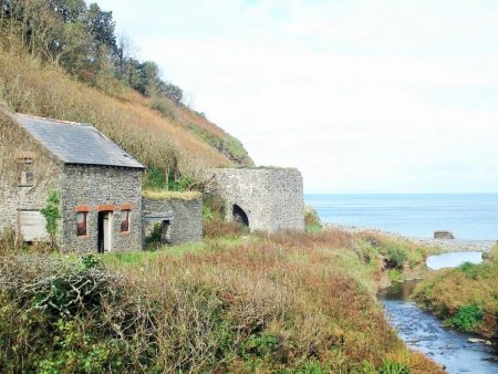
I resisted a walk to a viewpoint as I wasn’t sure one could continue and so dropped down through woods to Mouth Mill Bay with views ahead to Lundy Island, a place of so many memories for me. Remains of mills and lime kilns in the valley and rocky bay were a reminder of past labour and prosperity. Limestone was brought in by boat and processed into lime for agriculture inland.
Steep steps into NT woodland and then zig zags back down into a valley before the inevitable climb back up and over Windbury Point. From here there were dramatic views back to the hollow arch of Blackchurch Rock which I hadn’t realised was on the beach round the corner at Mouthmill. A memorial plaque to a Wellington bomber crash of 1942 was passed. Further on was another memorial, this time to a ship torpedoed by a U-boat in 1918. Both are well tended.
Ahead was a radar dome which was being decommissioned and the path was diverted inland on quiet lanes to Titchberry, no hardship.The walking couple caught me up [we would leapfrog the next few days] – they had been seduced by that viewpoint sign which was as suspected a dead end. By now the wind was increasing and I was glad to reach the great little refreshment shack by a car park. A pleasant young man served me a good coffee and homemade cake, what a treasure.
The lighthouse at Hartland Point was out of bounds but the cliff edge by the CG lookout gave dramatic views. A switchback route went in and out of green valleys to arrive opposite the dramatic cliff of Dyers Lookout. I’d seen pictures of James Pearson climbing impenetrable looking rock to produce Walk of Life, E9 6c or harder. In real life this looked impossible.
More steep ups and downs and eventually a grassy headland passing an old tower framing Stoke Church and then down to the dramatically situated Hartland Quay Hotel. By now the wind was gale force and the rain troublesome. The hotel was a welcome refuge and a wonderful place to spend the night listening to the waves.
I’ve not been Clovelly for over 60 years and things have changed, a new intrusive visitor centre and more commercial development, but tonight I’m staying in The New Inn in the centre of the village after all the visitors have gone. There is no traffic down the cobbled street and I’m able to explore the lanes and cottages from a time past. Everything is brought in by sledge. Going back those 60 years to touring in the SW with my parents I remember collecting triangular car stickers from all the popular villages. Simple pleasures, must look in the attic.
It’s not been an easy day, a 1000m ascent and descent over 12miles. The ups and downs of the coastal path kick in and remind my leg muscles of whats to come.
The bus trip had me tuning into the friendly local accents once more. With its name taken from the novel by Charles Kingsley, Westward Ho! is the only place in Britain with an exclamation mark in its name. An easy but dull walk out of Westward Ho! with references to Rudyard Kipling, a one time resident, extracts from his ‘IF’ poem are embedded into the promenade alongside some fine beach huts.
At the end of the promenade was the spooky deserted haunted house pointed out to me by a local resident.
The ‘Haunted House’
Soon the climbs start, down steps and then back up more. Lundy Island is prominent out to sea. Ahead Hartland Point is visible with the white cottages of Clovelly reaching down to the coast. Looking back I make out the Woolacombe headlands.
Clovelly in the distance.
In places the path disappears into tunnels of gorse and thorn, an Alice in Wonderland experience. Whole armies could pass here unnoticed.
For lunch I sat on an uncomfortable stone above Peppercombe Beach, as is usual within 1/4 mile there was a picnic bench above the real Peppercombe.
Peppercombe. Back to Braunton and Woolacombe.
Up and down in woods and fields above red cliffs, the path slippy from recent rain, a glimpse of holiday houses at Bucks Mills which turned out to be a great little harbour with lime kilns from times past. An unexpected coffee from a window was very welcome. A waterfall on the beach, a lady shrimping in the sea, an artists hut – I was in no rush.
Then steeply back up into the woods on arduous muddy tracks.
Salvador Dali beeches.
Eventually and thankfully I join the estate track which gives easier contoured walking arriving high above Clovelly.It was late in the day and only a few tourists were dragging themselves back up to the car park. I walked down the cobbles past lovely cottages to the quayside and back to my traditional inn for a peaceful night.
Sometimes reaching the start of a walk can be an interesting day in itself.
At the very moment I was being picked up to be taken to the station half a dozen sheep appeared in my garden, this led to a few frantic minutes of attempted sheep rounding up. I made the station on time but I’ve no idea what happened to the sheep.
Ironically given my destination my morning coffee was purchased at the West Cornwall Pasty Company kiosk, I resisted their ‘traditional’ pasty as I’m sure there will be more to come.
The waiting room and buffet at Preston Station has interesting information relating to when it was at the hub of troop transport in WW1.
Back in Barnstaple I had time to explore more of the town and was amazed at their covered Pannier Market, in use for 160years, and the adjoining Butchers’ Row previously populated with rows of adjoining butchers’ shops. A reflection of the importance as a port and market town Barnstaple has been.
My hotel for the night was further from the centre than I’d hoped but luckily round the corner was the friendly Reform Inn with their own brewed Barum beer at £2.50 a pint, that was the last I’d see of those cheap prices in touristy Cornwall.
It turned out two gents staying at the same hotel were on their last leg to Lands End having ridden on strange Monkey Motorbikes from John O’Groats in 6 days.
I’m here for a week to complete another section of my John O’Groats Lands End walk using mainly the SW Coastal Path in this region as it gives spectacular walking. Feels as though I’ve done a day’s walking already.
I’ve been away most of September and the garden is looking neglected, but to continue my year’s diary…
Hedges need trimming and plants cutting back. Not a lot has changed since the end of last month and we are now slowly drifting into Autumn.
Sedums come into their own at this time of year.
As do Michaelmas Daisies [asters]The Monkshood [Aconitum carmichaelii] seem to have grown taller this year, they are probably the most poisonous plant in the garden.Cimicifuga simplex racemona brightens up a shady cornerand a late flowering Phlox paniculata Norah Leigh does the sameThe less showy Physostegia virginiana, the Obedient Plant named because it will stay in any position you twist it to, makes an effort to flower.
Otherwise it is seeds and berries.
The Cornus kousa fruit soon goes off but apparently can be used for making wine – next year.The birds love the Cotoneaster berriesand my Monkey Puzzle tree has started producing ‘cones’
If you go down to the woods today you may be in for a big surprise.
Today was another short walk taking advantage of a sunny afternoon and celebrating the plastic bagman‘s birthday. The real reason was a birthday curry buffet at a favourite restaurant, Bangla Spice in Leyland. One of my sons joined us for the laugh, the day before I’d been on the streets of Stretford following a jumble sale trail with my other son and family.
Cuerden Valley was our venue having never really explored here before. The area was popular with dog walkers and families all enjoying the space and sunshine. We had a rough map of the park and set off along a path that soon had us crossing the busy M6 motorway, not a peaceful start.
But before long we were walking in a strange walled path towards the hall, we imagined the masses walking to work in the past.
The hall itself, not an edifying building, was approached. This is the centre for the Sue Ryder Charity. We found in the stables area of the hall several good charity shops – books, brickabat and clothes – all for a good cause, neurological care and support to local people and their loved ones.
Onwards past hidden housing estates, the offices for Lancashire Wildlife Trust and a walled garden to the woods where a Gruffalo hunt had been underway. Thankfully this was over and the big G had gone home. Plastic bag man still felt a little uneasy, mouse-like, as we entered the mature woodland. There was a wide range of trees planted by the estate a century ago.
Going into an interesting looking nature reserve we were accosted by a volunteer suggesting there was no entry, we didn’t argue [there is always another time to explore unnoticed.] We meekly walked down to the bridge over the River and followed the masses and their dogs. Another carpark was reached and we crossed the road to continue down valley, it was here we got bored and hungry and decided to retrace our steps. What lies down the valley will have to remain for another visit. The whole area is worthy of further exploration.
Above us on the return was the new visitors’ centre, an impressive Eco-designed building, which will be worth a visit soon. Further on was the fishing lake, an old lodge.
Paths took us back to our carpark and that tasty curry. ***
I’ve spent a couple of rather fraught days planning and booking up and coming trips and this afternoon I felt the need to break free and walk up the fell. The weather since I’ve returned from France has been atrocious but today there are blue skies in between the showers.
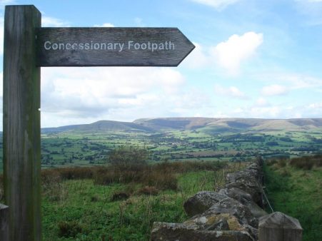
I park up at Cardwell House on Jeffrey Hill. The signpost at the fell gate says ‘concessionary path’ but is clearly marked on the OS map as a public footpath. My mind immediately goes into conspiracy theory mode made worse by the newly erected grouse shooting butts nearby. Anyhow the path, concessionary or not, leads up the fell. Fields in the Vale of Chipping below are flooded. Ahead clear visibility shows Penyghent and later Ingleborough.
The best of the heather colour has gone and the ground is wet, I’ve seen worse but not necessarily in September. There is a lot of water flowing from the little spring passed on the way.
The air is fresh, north westerly. As I walk up to the trig point views open up in all directions. What a great sense of freedom up here, why don’t I do this every evening? At one time when my resolve was stronger I did.
Walking back down a different way I was pleased with new forest clearings and planting of some deciduous trees making the area more attractive.
The car park on return was quite busy yet I saw no one on the fell, strange. Less than an hour’s stroll but all that fresh air has put me in a far more positive mood. Tomorrow evening…
Back in the Lot valley for a couple of weeks to ease me into Autumn. When we arrived the air temperature was up in the high 20s and more importantly was the pool temperature. As the days slowly passed the temperatures dropped but I was still swimming on the last day. This was the usual combination holiday of work and pleasure, heavily biased to the latter. My oldest grandson joined us for a week and it was great to reacquaint him with the pleasures of rural France, think food and wine. It was a bus-man’s holiday for him being on lifeguard duty by the pool! Despite the usual post flight colds we managed a few local walks and cycles incorporating fruit picking, he was on guard as I picked. Bad example to the innocent younger generation. Light relief came from boules, table tennis, crosswords and whist – boring old farts.
Anyhow to get back to the subject of this post there was a lot of work going on at nearby Hauterive Chateau with the plums they grow alongside the vines A machine washed and cleaned the ripe plums, trays of plums are then loaded into ovens to dehydrate them into our breakfast prunes. As well as our boxes of wine we came away with handfuls of plums which provided desserts for many nights. Grape picking occurs later at the end of September.
The fields in the vicinity of the house had been harvested earlier and now they were being ploughed and harrowed. The size of modern machinery is staggering, the tractor turns up with a trailer which then proceeds to unfurl its long wings making quick work of the large fields. The last run must have been seeding as within a few days green shoots of Barley appeared.
One morning I woke to find a man on the roof cleaning the chimney in the traditional way. Apparently one needs an annual certificate of this work being carried out for insurance purposes.
We had our own work repairing the sit on mower but thankfully the helper is an experienced engineer. It did work later.On my daily circuit of the wooded hill and combe I spotted some trees that had their bases tarred and sticks placed against them, not as traps but possibly as markers for any boar or deer movements. The woods are hunted regularly. No one was able to give a satisfactory explanation.
Every night a deer came down the garden to feed on fallen apples so in an attempt to get a closer view I rigged up my hammock and laid in wait but of course I drifted off to sleep, too much wine, so probably missed all the action. There was a full moon which lit up the garden in the early hours.
 Yesterday morning there was a heavy dew, the temperature had dropped to 6°, today it is wet and windy again. I’ve just returned from La Palma where the temperature was in the high 20s – what a shock.
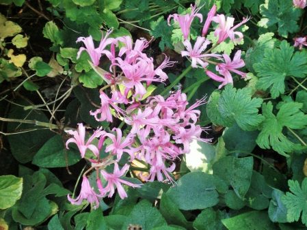 The delicate Fuchsia magellanica Alba is hanging on.