THE SPEYSIDE WAY. Nethy Bridge – Cromdale.

It rained all night. The superb breakfast was enhanced by the tales from the three crazy bird watchers . The whole region is busy with twitchers hoping to see the Osprey and the Capercaillie.  Suitably fortified we wandered down beside the River Nethy to join the old Speyside Railway.

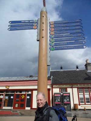
This section of the railway has not been reopened, although the enthusiasts would like to extend the steam route to Grantown. The railway originally started in 1863 and linked Aviemore to Forres.  This line was heavily used by the whisky distilleries that set up beside it. Beeching closed the passenger line in 1965. Goods continued till 1968. The well graded route gives good walking and we were soon on the outskirts of Grantown crossing the Spey on an old bridge.

The morning had been rather dull but as we walked up into town the rain started, fortunately we soon reached the welcoming Chaplin café.

Too cold for ice cream but we had lovely toasties and pots of tea whilst we dried out. Forcing ourselves to leave we braved the afternoon rain with a superb walk through the Anagach Woods. These woods are home to the Capercaillie but of course we never saw any.

Crossing the Spey by a metal bridge we see an enthusiastic fisherman casting in the river, no doubt at great expense.

Past the old picturesque Cromdale station …..

……and soon we were in the unpretentious but friendly Haugh Inn in Cromdale. What a great little hotel. Good room, good food, friendly staff from the Wirral and a fine selection of beers and whisky. Whilst Mel sampled the Windswept 6% Dark beer from a new micro brewery I started on the single malts from the Spey we had walked so far.

THE SPEYSIDE WAY. Aviemore to Nethy Bridge.

I must confess to not having any knowledge of The Speyside Way until  searching for an annual pub-to pub walk with an old mate. We decided upon this trail because it offered an interesting [and non arduous downhill!] route, 68miles following the River Spey, from Aviemore to Buckie on the Moray coast. It was conceived in 1981 and is waymarked with the thistle logo.

Miraculously we met on the train from Edinburgh and arrived in Aviemore to a sunny evening with the background Cairngorms resplendent in alpine condition.

The next morning dawned crisp and sunny so we set off from the centre of Aviemore in high spirits.

We were confident that the way marking would be obvious and soon found ourselves trying to find a way out of a housing estate on the edge of town.

As housing estates go, this couldn’t be bettered with lovely countryside on it’s doorstep and the Grampian mountains in the background. [don’t mean to be patronising to housing estates] Once extricated we had a great mornings walk through heather and birch upland with  views back to the Cairngorms.

The walk was made more interesting with a steam train passing on the adjacent Speyside Railway [more later].

Soon we were in Boat Of Garten and enjoying first a coffee and cake stop outside the excellent convenience store and then a pint at the Boat Hotel. We happened to be here on the day that a new sculpture was being erected  the railway representing the wildlife and railway juxtaposition. An impressive 15ft Osprey feather constructed from a metal from the railway.

See  http://www.boatofgarten.com/community/our-heritage-project/

Also by the same metalworker was a horse and cart, to be installed, to show how the railway was central to the early distribution network.

All very impressive and with the artist Michael Job of Black Ox Arts to chat to very informative.  Dragging ourselves away we crossed the Spey on a bridge replacing the ferry of old – hence the name Boat  of Garten.

Walking through pine woods next to loch Garten [famous for its Ospreys] was delightful on a warm afternoon.

Soon we were in Nethy Bridge and ensconced into one of the best B&B I’ve stayed at, a wonderful  friendly and helpful hostess in a fantastic situation. Enjoyed an evening at the local hotel.  Deuchars 80 shillings ale was perfect.

  Quite a full day.

A DAY TRIP TO SPAIN!

I was out several days at the end of April walking with a pack to try and achieve some fitness for a further trip along the GR7 in Spain. I am hoping to finish the route this year. After May it gets too hot in Spain for comfortable walking. So last week my son dropped me off at Manchester airport [he only lives 10 mins away] for an early morning Jet2 flight to Alicante.

I have to say flying with Jet2 is far more pleasurable than with some other well known cheap airlines. Friendly staff, sensible boarding routine and good legroom. As usual the plane was full of noisy stag and hen parties on their way to Benidorm, they drank the plane dry! My sympathies go out to the air hostesses who have to cope with this crowd, but I do wonder about the wisdom of all the commercially driven alcohol sales in the airport and on the plane. I was mentally comparing my imminent trip into the mountains with theirs into the clubs.

We arrived on schedule, thankfully no trumpets, and I caught the cheap bus into town. It stops at the train station so I bought my rail ticket for the afternoon train to Xativa.

Wandered into the town to a useful climbing shop I know  to buy some gas for my stove. [www.elrefugiodeportes.com]  Then found a café for lunch and realised I wasn’t feeling too good, hot and flushed with a racing pulse. I hadn’t been rushing around so couldn’t explain why my pulse wouldn’t go below 100. Returned to the station and sat outside, but my pulse wouldn’t come down. When the departure time came I decided against travelling to the relatively remote interior.   What to do next?  Stay in Alicante for the night and possibly have to seek medical advice or get back to England tomorrow. Whilst I was sat there along came the airport bus and on impulse I Jumped on and was soon buying an expensive ticket back to Manchester! Fortunately there was an evening flight. My pulse eventually returned to normal. The new terminus at Alicante is quite comfortable for waiting around in.

Alicante Airport

Landed in Manchester at 9pm and returned to my bemused son’s house. Quite a day really – but one I could have done without. Back to square one and apparently no worse for wear.

*****

To get back to an outdoor theme it was a lovely bank holiday weekend, who needs to go to Spain. At a loose end, and with the garden up to scratch, I did some local walks through the fields which are starting to green up.

Longridge Fell with Pendle behind.

I always find something to complain about on these local walks – not the scenery or the wildlife – usually the abuse of the environment by persons unknown.

Quite a collection.

With the weather being so dry and warm I couldn’t resist some bouldering despite my painful toe. I thought a short session would do me no harm. So had a trip up to Kemple End quarry for some morning sunshine, actually very warm on Bank Holiday Monday. The rock was in perfect condition for some traversing and easy soloing – felt much better for that.  ‘Feeding the rat’  if you know the connection.

A bit of a mixed post but next week off to Scotland so should be more interesting.

CHANGEABLE WEATHER. A RURAL REPORT.

Since my return from Spain I don’t seem to have achieved much.

I missed the March  snow. The weather at the beginning of April was very cold but dry, perfect conditions for bouldering at Craig Y Longridge, 5 mins up the road. This proved great for quick [I only need half an hour there!] visits in the afternoon. Lots of others were venturing out after winter to test their fitness. Some are fitter than most….

Adam Jeeworth. Cruising 8b

I always seem to climb better after time away trekking so was pleased with my moderate regimes on the crag. And the sun shone.

The irony of this dry spring weather is that most of last year the fields were waterlogged and unwalkable. I arrange a Spring sponsored walk for a local charity [Bushell House Residential Home — to give it a plug] raising money for extra benefits for the elderly residents.

Bushell House.

At the beginning of the year I decided to postpone the event till later in the summer in view of the state of the dire paths. On one of the recent sunny days I went out for a walk around my planned route and all the paths were in near perfect condition — too late now to rearrange. Enjoyed the walk and was pleased to see some rotten stiles had been replaced, well done the local authority. So no great problems but why do people dump building rubbish in the country, this lot was on the right of way…

….and you don’t mess with this chap

Most of the barns around here have been converted into expensive living properties. Passed one in the process of conversion.

Presumably, the ‘window’ disguised as a wall was to comply with planning regs. I wonder how long it will be before it is opened up or am I just cynical.

Whilst passing a woody vale I was lucky to see a pair of Roe deer with a fawn, they all rushed off as I retrieved my camera. Further on a fox stood for seconds in the path ahead, again no picture.

Hopes of continued good weather surfaced as I passed this cottage with it’s cheery cherry blossom.

Deepest Lancashire.

The next few days brought gale force winds, so it was back to the climbing wall. A long strenuous day at Stockport played havoc with my arthritic toe and at present the thought of a rock boot makes me go pale. So have been resting up, sorting out the garden and taking short local walks. Nothing much of interest except the new born lambs  appearing in the fields.

Racial harmony.

Within a couple of miles of my house I feel I’m back in South America

Local Alpaca

The alpaca has eye lashes to die for…..

                                Live flash – the swallows are back.

By now it has started to rain again — for how long we don’t know.

Anyhow, I’m as happy as a pig in a …

THE GR7 BACKWARDS! Vuitena i última part

Colldejou – Tivissa

March 26 -27th.

I knew today was a long way so was up early, having some coffee and cake in the hotel lobby. The owners had also kindly left me a wrapped sandwich. Went out about 6.30 to rendezvous with the turbine man. His pickup was still parked so knew I hadn’t missed him.

He duly arrived and I was back up at Colldejou by 7am, still nobody about.

A good track led out of Colldejou past the usual barking dogs locked up in  small holdings. The morning was sunny again.  The Coll del Guix, 625m, was soon reached with good early morning views back to Colldejou and the coast.

On the forest track down the other side I met this rather sleepy chap, a good 6 inch of fat toad going somewhere.

Out of interest in the eight days of walking I didn’t meet another walker on the GR7.           Soon I was climbing on an old path up to Lo Portell, 800m, a pass over the shoulder of the hill near the golfball. Sandy tracks led down through gorse and then into the village of Llaberia, houses seemed renovated but nobody here. ?weekenders.

Llaberia

Sat by the font and ate my donated sandwich. Tracks led out of the bottom end of the village and dropped into the impressive Barranc de Torto. A long line of 40-50m limestone cliffs with some impressive tufas. Spotted one line of bolts so some climbers must venture here despite its isolation.

Tracks wandered through the forest and onto a lane by a river, I was becoming a little disorientated and the map not good enough to sort things. As usual I just follow the markers which are very good. Another problem is that my altimeter has given up the ghost today [battery?] and I tend to rely on it to aid mountain navigation.

I now followed a minor road for a few kilometres until a sign sent me up a side valley on a pretty awful steep stony path. At the top great views of cliff-ed and wooded hillsides confused me even more. This is a wilderness!

Widerness

Followed yet another valley down past a ruined house to meet up with a forest road at the bottom. Could have sworn I should turn left here, from my intuition and the map, but no, the signs pointed right! Seemed to walk on this rough road for ages going in what I thought was maybe the wrong direction. But the red and white marks kept appearing. There was eventually an old sign pointing to Tivissa but I did for a while consider just walking on to the nearer village of La Sena d’Almos and getting out from there.

Nearly there.

All the distances this afternoon seem to have magnified. Felt I was in a time warp not really getting anywhere. Obviously tiring. Onwards through more gorges and wooded hillsides, past abandoned farms, desperate for the red and white markers. The time on the last sign 1hr30min was way out and I was relieved to reach my last col at fields of cultivated hazel nut trees. A little patch colour from wildflowers seemed to say the worst was over.

Over the next rise I was glad to see Tivissa only a few kilometres away. It’s backing of cliffs was familiar to me from my last visit here on the GR7 in Oct last year [see post – The mighty mosquito……  conclusion of GR7 trip. Oct 2012]  The weather seemed to be changing, with rain in the air. Having said that my new [see post — The rain in Spain…….     GR7 part3. Oct 2012]  waterproof past its test with flying colours — never once having come out of the rucksack in 152k !!

       Within an hour I was in the town and as I’d arrived a day behind schedule I was keen to get out tonight to Reus for my plane tomorrow. A quick call for a taxi and it appeared, like a genie, pleased to see the same driver who had transported us last year to the coastal rail line. Everything happens quickly once you are on the move. Soon on a train to Tarragona, then a bus to Reus and installed in a hotel by teatime, or in this case coffee time. A little bit of modernism in this vibrant city the next morning then back to freezing Liverpool.

THE GR7 BACKWARDS! CATALUYA Setena part

Coll de la Teixeta – Colldejou.

March 25th

Sign on the windy ridge!

Breakfast was at the Catalan time of 9am. David was going out to his fields first and would be back later to take me back up to the coll. Perfect sunny morning for breakfast on the terrace!

Leaving the road I was glad to be underway at 11am.

It was a very windy morning but I was sheltered from the worst by the Serra del Pradell hillside I was traversing under. The hillside consisted of a lower red sandstone conglomerate topped by the limestone escarpment.

The track, lined with gorse, rosemary and tree heathers, dropped into a village, l’Argentera. Small place but a few people about and I arrived at the bar just as it was opening for my Morning coffee! From here I had to climb back up onto the ridge passing abandoned mines – silver – hence the name of the village. As I gained height there were views back over l’Argentera to Reus and the coast.

On the ridge, Serra de l’Argentera, was the largest wind farm I’ve seen. The original trail across the ridge had been disturbed by the road for the turbines so it was easiest to use the latter. There was a constant whirring noise and I had visions of one of the blades detaching itself and decapitating me.

The wind was gale force making walking difficult but interestingly the turbines turned at the same speed as in yesterday’s breeze, must have some regulating system to stop the bearings burning out. A white pickup passed me on the top, checking on the turbines. I was feeling rather battered as the road wound down to meet a public road at a col under the Mola hill, 859m and to its left I could see a ‘golfball’ communications installment on the hill behind La Miranda 919m.

Mola and ‘golfball’

Leading off the road an old path wound down to Colldejou where everything was shut at 3pm. There is no accommodation here, so I was hoping for a bar from where I could arrange some transport down to the town of Mont-roig. Decided to hitch down but very little traffic about. Had just got onto the road when the white pickup appeared and stopped for me. The turbine worker was going home to Reus via Mont-roig – perfect. He explained about the turbines and said there were 200 under his remit. He dropped me off at an hotel in Mont-roig, this is where he leaves the works van and goes home in his own car. He did say he would be going back up the 10k in the morning about 6.30 – sounds rather early. First things first was to book in at the  hotel, a modern building run by a delightful couple. The room was fine and there was a lounge with drink making facilities. However I went out to the cafe round the corner for a coffee and ordered a tortilla bocadillo for tomorrow’s lunch. Asked about taxis to Colldejou and was quoted 20euro so thought I would probably get up early and catch my lift. Tomorrow was a long day’s walk anyhow so an early start wouldn’t go wrong. Came back out to the bar in the evening for a beer and a ‘plato combinado’ which was very filling for 5euros. These are never high cuisine but always good value when walking.

Plato combinado

Told the hotel I would be leaving early and was in bed by 10.

THE GR7 BACKWARDS! CATALUYA Sisena part

Arboli – Coll de la Teixeta

March 24th

Was feeling really fresh this morning, had to wait till 9am for breakfast in the bar. The F1 motor racing from Malaya was on the wide screen and a couple of blokes were installed for the duration – already through their first bottle of wine  and ordering food. Alonso the local favourite has just crashed out!  Thanked my hosts and staff for their help and kindness, and was away about 10am. Climbers were arriving in the village [its a Sunday] for a coffee before heading to the local cliffs. Fancied a climb myself.

Arboli climbing

Small tracks led out of the village and down terraced, cultivated, fields into a valley and ford by an old mill. The day was sunny and warm.

A forest track wound around the hillside taking forever to hit the road at Coll d’Alforja. A cyclist from Reus was struggling up the hill and proudly announced he was 60 – I said nothing. A rough forest road was signed to Sanctuary de Puigcerver 6k away. Effortless walking for the next hour and a half as the road snaked through the forest. There were good views back to the Musssara cliffs of a couple of days ago. A couple of mountain bikers whizzed past going down.

Arrived at the sanctuary about 1 and pleasantly surprised to see it was open [Sunday] with a cafe/bar. Felt I had to patronise them, I was the sole visitor, and have a coffee and piece of tortilla. Got chatting to the volunteer workers, it turned out the woman’s sister lived in Preston. She is married to someone from the university – I got a contact number thinking there may be a possibility of some Spanish conversation lessons. Had a look around the rather spartan chapel [17 century] and was on my way again.

Sanctuary de Puigcerver

Inner Sanctuary

Happy Volunteers

An unmarked track seemed to be going downhill in the right direction with views to Reus, Tarragona and the Med.

Costa Durada

I was walking towards a group of wind turbines which were soon reached and navigated between with way marks taking me down to the Coll de la Teixeta.

I could see the busy road through the col and a lot of complicated roundabouts and a confusion of interlinking minor roads.   Think spaghetti junction.

The accommodation I’ve arranged is in the village of Pradell  about 5k to the west and I was intending to walk down the road to it. Looking at the speeding traffic that idea didn’t look so good and I was not going to be able to hitch easily. So I phoned the casa and eventually was able to explain where I was – Coll is not pronounced col and as for Teixeta! Within minutes an old battered car pulled up with the David and Marta, we stopped on the way back to the house to gather fire wood.

David and Marta

The village of Pradell has about 150 inhabitants but seems a lively place – shop, bakery and bar! It is in the Priorat wine area and there are a lot of hazel nuts grown in the area. Had a wander around, popped into the community centre for a coffee where the locals were putting the world to right. Lots of little public areas and parks, no doubt paid for with European money but they give the place a homely feel. That’s the other thing you notice in Spanish villages – lots of young children out playing without the restraint we succumb to in Britain.

David is basically a farmer with vines, hazel nuts and his own vegetables. The house he has done up as a casa rural was from the family. It is massive with about 8 guest rooms and lots of lounges etc. Marta has decorated in an early 20th century modernistic style with lots of original pieces. Not to everyone’s taste but it gives a certain atmosphere to the house. More like a museum!

They were very welcoming and I ate a good Catalan supper with them, accompanied by their own wine. Had  a tour of the cellars later.  Couldn’t have had a more peaceful night’s sleep.

This place is made for relaxation, though they work hard all the time — a Catalan characteristic. These are the unique places I find myself in and are the reason I love rural Spain.

THE GR7 BACKWARDS! CATALUYA Cinquena part

Mont-ral to Arboli.

March 22 – 23rd

I knew today would be a long walk but was looking forward to it as it traversed the Serra de la Mussara where I had often climbed. Was up fairly early, at least before the French lads. The guardian had left me breakfast as he had gone off even earlier to work as a mountain guide. Lots of coffee and bread/jam. Left some for the late risers.  Good sunny clear morning – I always seem to be lucky with the weather on these trips. Not so lucky with the navigating early on, got lost on the multitude of paths leaving the village. Didn’t feel right in the head somehow.

Leaving Mont-ral

Soon I was ascending steeply through trees to gain the ridge and had to be attentive to the red and white waymarks. I was now on the Serra de la Mussara, maintaining a height of 1000m for several kilometres, but views were restricted by the trees. At one point I climbed up for better views and was rewarded by a superb vista to the East with Mont-ral prominent.

Onwards along the forest track with lots of cliffs to the right.

The forest road kept to the ridge but no views were to be had and it seemed to go on forever. At one point new forest clearings had altered the track considerably and way marks were obliterated.

GR7 ?

After a long time on the ridge the path started to drop down towards a road I could hear. Crossing this and then quickly going down to the left towards a valley.

I was ready for a rest and somehow I’d got it into my mind there  was no accommodation in the next village, Arboli.  Sat for a while and contemplated my situation over a banana! Nothing I could do but continue and hope things would work out but the day and my pace was affected by my mood. Dropped down further into a gorge with dramatic falls and some awkward scrambling in the depths.

El Gorg.

Steadily the track improved as it climbed out of the gorge. Ahead was a large ruin of an old farmstead on the col at 900m, this must have been a grand place at one time. Last inhabited in the 1960s.

Gallicant

From this ridge there were views across the valley to the cliffs and village of Siurana, another climbing area visited in the past.

Now it was all downhill on an old paved track into the small village of Arboli……

…..with my doubts about accommodation bothering me again as I was feeling shattered. Was I glad on rounding a street corner to see a Hostal open.

L’Hostalet

After a  coffee I rested up in my room and by the time supper time came around realised my stomach and guts were in a bad shape. Maybe water from the fonts?? No wonder I had struggled all day. Managed a small bowl of soup and was flat out for the night. Next morning was no better, so I arranged to stay another night and spent most of the day in bed. Ventured out late afternoon and found a climbers bar for coffee and cake. By evening I was on the mend and had an enjoyable meal with a couple from Reus. What a difference the rest made!

                                          It was my birthday after all.

THE GR7 BACKWARDS! CATALUYA Quarta part.

Vilaverd to Mont-ral.

March 21st

A good nights sleep on the adjustable orthopaedic bed and I was ready for the off. First there was the small matter of breakfast. Carlos, my host thought it highly necessary that I ate well for the day’s walking. There was a healthy bowl of fresh fruit and natural orange juice. Then Carlos gave a demonstration of how to prepare the perfect pa amb tomaquet toast rubbed with garlic and tomato, dribbled with lots of olive oil and then converted into an entrapan [sandwich] with goats cheese.

Carlos

This is a Catalan special – I was stuffed and could taste it all day. Followed by coffee, croissants and home made jam! Certainly no need to pack any lunch for what should be  a short walk.

Luckily the first 100m walking was only down to the bus stop to catch a bus back to Vilaverd where I would rejoin the GR7.

The bus was busy with chatty women shoppers going down to Reus for the day. Bus fares are very cheap in Spain and the service excellent. Didn’t seem to be anybody about in Vilaverd  as I crossed the river onto the original way down valley.

Peaceful Vilaverd.

A well constructed limestone path wound between shrubs. Met an old man picking herbs to make country soup, but didn’t stop to enquire which — kicked myself later. In 3k I was crossing the busy road into the small town of La Riba where I found a friendly café for a coffee. The day was by now hot and sunny as I started the uphill bits. La Riba has built itself on paper mills established in the 18th century because of a good water supply. You pass many old ones, as well as modern units, as you climb steeply through the town and into the open countryside.

Looking Back to La Riba and beyond.

Looking Back to La Riba

The track gained height and there was a view across the valley to crags of La Riba which I’ve climbed on in the past when visiting the Costa Durada. In fact the next few days will take me past many of the well known crags of the area, memory lane.

La Riba Crag

Topped up with fresh water at Font Pasqual  — “flavour of the rock, pine, lavender and rosemary from the depths of the mountain”

Font Pasquel

The track now left the forest road and headed straight into the thick, prickly, undergrowth. Seemed to just plough it’s way through on stony ground — not very pleasant at all. There were signs of wild boar activity but unfortunately [or perhaps fortunately] one never see them in the day. Hot and sweaty, with few views.

 After about an hour of this I came up against a rock spire given the name of Castell Dalmau.

Castell Dalmau

This was apparently one of the first climbing venues in the Prades mountains, over 50 years ago. There are the remains of rusting bolts and pitons visible, and some of the largest name plaques I’ve ever seen on rock. Suspect a lot of the climbing would have been artificial in those days.

 Wouldn’t think anyone ventures here nowadays.

 Battling on through the never ending forest I eventually came out at a col onto a forest road which dropped into a valley and a confusion of other rough roads. None of these seemed to fit with the map so I needed to be careful not to miss the faint waymarks at junctions. Came past an isolated holiday house and a handy font somewhere along the way. Didn’t see a soul!

Expected to keep following the forest road out but the path kept heading off into the scrub and re-emerging onto road. I’m fairly sure it was the same rough road all the way and I could have followed it. The day seemed to be getting longer and I was glad to see the church spire on its hill at Mont-ral. Here there was a climbers’ refuge [Refugi Muste Recasens] which I knew was open and it didn’t take long to find it in the small village.

Refugi Muste Recasens

A friendly warden and it looked like I had the dormitory to myself. Rested up and then enjoyed a simple refuge supper of omelette, beans, salad and chips. Just as I was going to retire two young French climbers came in for the night so chatted to them about the climbing in the area. Not a noise in the night.

THE GR7 BACKWARDS! CATALUNYA Tercera part.

Cabra del Camp – Vilalaverd                                                                                                 March 20th

Was up early and made breakfast before leaving the casa which had been home from home. Rather cloudy morning and cool to start, was glad of that extra thin fleece I’d packed. I must say the GR  signing in Catalunya has been good and even getting out of the villages in a morning has been easier than usual. Walking towards the hills I had to pass under the motorway via a tunnel with excellent graffiti.

Motorway tunnel


From here my ‘up to date’ guide and map said turn left but the GR7 way marks said right so that’s the way I went. I learn quickly to follow the signs despite my ‘up to date guide’.

Early mist on the Serra de Jordn

\view back to Cabra and the wind turbines.

Soon I was on an obvious track going round the north of the Serra Carbonaria. Views started to open up across the wine country of Barbera de la Camp and up to Montblanc [my hotel for tonight]


Montblanc in the distance.

The forest track climbed and then traversed above the village of Prenafeta, now below some impressive looking limestone cliffs. I think this area gets a higher than average rainfall …

….the track continued to traverse around the hillside and then dropped abruptly into the village of Lilla. There was nothing open here, but I stopped for a snack below the village.


Lilla

Setting off again the signs don’t match with the map — so I follow them religiously on an unlikely path through  a quarry and on down the ‘wrong’ side of the valley. This proves to be the right way and soon approaches the reason for the change of route — the new high-speed train route goes across the hillside. The high-speed routes are fenced off completely, so you have to find a permitted way across or below them.

As I continued down into the valley I knew there was a train at about 14.50 from La Riba to Montblanc, it was obvious I wasn’t going to make it. I approached another town, Vilaverd, and I banked on there being a station there.

Approach to Vilaverd

Luckily there was and the train [not the high-speed version] arrived within 5 minutes.

I was soon wandering into the maze of the old town of Montblanc to find my hotel.


Hotel Fonda Cal Blasi

What a great place it turned out to be. Friendly hosts, comfy room with orthopaedic adjustable mattresses  and great food. After a rest I had a wander around the walled town, quite impressive with all the main gates into the town well preserved.


Walls of Montblanc

It is said that in front of the tower of Sant Jordi that St. George killed the dragon! There were good views over the town from the ruined castle on top of the town.


View south over Montblanc.

Back at the hotel a good evening’s Catalan meal was taken along with conversation with a delightful Canadian couple exploring the hills in the area.

THE GR7 BACKWARDS! CATALUNYA Segona part.

Bellprat – Cabra del Camp.

March 19th

No hablo Catalan.

Having returned to Igualada I had to work out transport options back to the GR7. A taxi would be prohibitive but there was a bus back to Santa Coloma. The timetable at the bus stop showed two morning buses 06.45 and 08.15, had asked two drivers the night before and they assured me they both ran. But there was an asterisk against the later bus and I couldn’t interpret the footnote. You can get away speaking Castellon Spanish in Catalunya but everything written down is in Catalan which is impossible. The hotel desk couldn’t help. I decided to get up early  Foregoing breakfast I was sitting in the cold waiting  for the first bus to be sure of catching one. It arrived and, despite going a different route which had me concerned, I was soon back in Santa Coloma, the driver explained that there was no later bus because it was the Easter holidays. Thankfully there was a bar open. I was able to get coffee and croissants, order a taxi and warm myself next to the strange heating apparatus in the centre of the bar.

Bar heater.

Turns out it is fuelled by the olive stones from the local oil crop. Very efficient. With the aid of the map I was able to explain to the taxi driver where I wanted to be, but when we got there I couldn’t understand his insistence we go elsewhere. Turned out he was giving me a guided tour of some local beauty spots at no extra cost!

He drove into a deep gorge with a unique Moresque, three sided tower and a church perched atop a small village, Santa Perpetua. [population 3]

Sancta Perpetua

Then he soon had me back to the GR7 and I walked through fields to Pontils another small village with nobody about except barking dogs. Had a second breakfast by the font. The day was warming and redstarts were everywhere alongside me as I climbed a forest track up to 750m. There were great views back to the Pyrenees.

Well signed GR7.

Now it was downhill through limestone bluffs to another ancient deserted village, Vallespinosa.

Vallespinosa

There was a font with drinking water so I took the opportunity for an early snack lunch and a water refill, relaxing in the sun. Houses here had been renovated, presumably for weekend and holiday use. Walking out of the village I was attacked by a, thankfully small, dog — ski sticks prove their worth in these situations.
The way went up a valley on a lovely old path just inside the trees to reach the Coll  De Valls 720m the hills opposite were crowned with wind turbines which were to become a common feature in the week. Smaller paths took me steeply over Coll de Romigueres and on through fields and then vines to the village of Cabra del Camp where I had booked a casa rural for the night.

Camp wine fields.

The wines of this area are DO Conca de Barbera and the village of Cabra has its own wine cooperative. Called in there to buy  a bottle of the local dark red  [Tempranillo, Garnatxa and  Merlot grapes.] to accompany my own cooked bean pasta.

Modernistic cooperative.

Went into the local bar for a coffee and it turned out that the man stood next to me owned the house I was looking for – saved me a lot of wandering.  Whilst in the bar I was given a bowl of ‘music’ a Catalan serving of raisins, almonds and hazel nuts accompanied by a glass sweet muscatel. Delicious. Arrived at my rented house for the night in a little side street.

My casa on the left.

It proved to be a large house with god knows how many rooms. The owner was very helpful and had lit a log fire for me [little did he know of my escapades with fires]  I settled in, cooked supper, enjoyed the wine and had an early night.

Warming the wine!

THE GR7 BACKWARDS! CATALUNYA. Primer part.

Clariana – Bellprat

March 17 – 18

Plane, bus, train and taxi….. and then walk

Left Liverpool in the early morning on my ‘favourite’ airline to arrive in Barcelona, caught the cheap airport bus into the centre of the city. The Barcelona marathon was just finishing so the place was packed with athletes in various stages of recuperation, clutching water bottles. No time for sight seeing as I disappeared underground to catch a train to the nearby town of Igualada. This is where I had planned to start an eight day trip along the GR7, 150K. For reasons of transport and accommodation availability I was walking back south to Tivissa, my last stage – see previous posts October 2012.

So my first night was in Igualada a town built on the leather industry. This is where your luxury handbags originate, as well as your Buff headgear!

Enjoyed the semi luxury of a four-star hotel …

…. and ordered a taxi [20 Euro] for the next morning to get me to the start of my walk at a diminutive hamlet called Clariana. Straight away found a GR7 signpost and set off in high spirits.

GR7 Way-marker.

For navigation I had maps from the latest edition of the Federacio de Catalunya for the GR7. So following these I disregarded the red and white way-marks down the road and soon found myself confronted with definite no passage signs as opposed to the common no hunting signs.

No way.

Private Hunting

I’ve only been back on route this year 10 minutes and have forgotten the golden rule – always follow the red and white markers of the GR7 no matter what your intuition or inaccurate map tells you!! So back down the road for half a kilometre and sure enough there was a sign off to the right for the GR7. Who’s to say why this differs from my map! Now on tracks through the fields and the sun was getting warm. Buzzards flying above. After a further navigational error [NW instead of SW!] I managed to get myself onto the minor road leading to Bellprat. Passed the turning to the small hamlet of Fillol, decided there would not be much in that place. Now there were great views back to Montserrat above Barcelona and to the east end of the snow-covered Pyrenees.

Fillol and the Pyrenees.

Montserrat in the background..

Walked on to the hamlet of Bellprat where nothing stirred.

Bellprat

From the road here I managed to hitch a lift into the larger town of Santa Coloma de Queralt. The hotel here had closed down. Just missed the 13.45 bus back to Igualada so passed some time in the interesting old town, mainly drinking coffee in the square.

Santa Coloma Placa

Hake and black spaghetti.Caught the 15.30 bus back to Igualada. I was glad of an easy 14k first day and a good night’s meal and rest in the hotel.

Hake and black spaghetti.

A sunny afternoon stroll near Chipping.

In an effort to get fit for a forthcoming Spanish GR7 trek I had a couple of hard days walking at the weekend and am now suffering in the toe and hip. Cracking up. Decided not to make things worse by going to  the climbing wall today. A new waterproof arrived this morning to replace the one which disintegrated last year in Spain. Alas, despite being a bargain,  it proved to be too tight a fit and had to be returned. The company I bought it from had no larger sizes so I had a quick trawl on the internet for a replacement, found one and ordered, but at an extra £25. Sent back the small one and hope the larger is delivered soon. I’m very impressed with the efficiency of mail order these days. Lots of people going round in vans!

So it was lunchtime before I knew it. The day started very cold but sunny and looked to be continuing the same way. A quick lunch and a drive out to Chipping. Decided on a gentle stroll to ease my joints. Walked out on a concessionary path in the grounds of Leagram Hall.  Pendle looked impressive with a sprinkling of snow.

Pendle.

Walked up a lane past a sheep farm advertising Sheep’s Cheese.

Quite tasty so have come home with some. Here are the new lambs…

Walking on up to Park Gate farm you are under the Fairsnape/Totridge fells. Whoever thought to plant squares of conifers on these hillsides?

One passes remote working farms in the hills where life hasn’t changed much in the last 50 years –

Despite being surrounded by peaty gritstone fells this little area of Bowland is limestone with characteristic knolls and outcrops of the white stuff. There are little quarries everywhere and small kilns which  produced lime for the land. In other areas of the valley commercial kilns served the blossoming building trade.

Flocks of returning birds were landing in the fields aptly demonstrating their two common names – lapwing and peewit. Unable to get a photo, so this will have to do – cautionary sign in any case.

Walked on past the pleasantly named, renovated hamlet of Dinkling Green, with its magnificent situation below the Totridge Fells.

Lanes through the limestone knots lead to the splendidly isolated and landmark red phone box near Lickurst Farm. How long will it survive in these days of mobile phones?

On past Higher Greystonely Farm where I was hoping for a brew with friends, who were unfortunately not at home. A lane takes you over a ford and on past a significant lime kiln near an extensive limestone quarry.

Soon back on the lane to Chipping and feeling very satisfied with the afternoon’s excursion. A hot soothing bath will get all those muscles relaxed ready for the exertions to come in Catalonia.

FROM THE OLD TO THE NEW.

The weather had remained dry for over a week, a rarity these days, and latterly the temperature had started to creep into double figures! Most days, whilst it was still cold, there was lots of bouldering activity up at Craig Y Longridge. Almost a party atmosphere at the busy weekend.

From the easy to the hard

The forecast for Tuesday was even better with the promise of warm sunshine after a frosty, misty start. Motored leisurely over to Settle with the temperature showing only 3degrees. When we arrived the mist was still down, so we retired to the cafe for coffee until hopefully things improved – had we made a mistake, or rather had the forecasters??  No shortly before 12am the sun appeared and it was a rush up to the crag  – Giggleswick Scar South. This is a low lying, limestone, scar just above the road and golf course. It is well sheltered for visits in the winter and gets all the sun going after late morning – perfect. The  parking lay-by was already full, partly because of some selfish parking, and from there it was a simple stroll up to the climbing areas.

There has been climbing here since the 70’s when a number of traditional routes were done by likes of Allan Austin and friends. The crag subsequently became unpopular and slipping into obscurity as the vegetation took over. However in the 90’s further exploration and extensive cleaning in the search for new rock, along with the use of bolt protection on the blank walls, has brought new life to the place. Sports climbing became of age. At first the older recorded routes were spared the bolt gun and new harder routes were created in the blank spaces between. This meant that some of the classic, albeit, easier lines were ignored and unclimbed. Inevitably, as exploration continued this distinction became a little blurred without any great detriment to the crag – some would use the term improvement; purely in the climbing experience.

I personally have embraced the idea of bolted routes in the correct environment. [What is the correct environment however is a big topic for debate!]

Four decades of guides.

Climbers were already swarming up the routes in the sunshine as we walked along the edge to our chosen sector at the far left of the escarpment.

Sector Golf

Sector Golf

The area we arrived at is called Anchor Buttress after one of the original climbs. The steep face is under 20m height but is clean and fairly solid with  relatively lower grade routes. Since our last visit here several “new” routes have been cleaned and bolted mainly based on old 70’s lines. This gives us some extra purpose for the day to climb these old classics in a modern bolted style. Now it just so happens today that I’m climbing  with Dave Miller who actually shared the first ascent of one of these with Allan Austin in 1972. To be precise March 5th  – exactly 41years ago to the day! We hadn’t realised that coincidence when we set off.

QUIVERING TIMBER Dave Miller Allan Austin [alt]   5.3.72
From the 1974 guide.

We did a few smaller routes and then Dave re-led Quivering Timber, now sadly renamed the inferior Bramble Jelly in its new bolted guise. Started by a fierce layback and then more delicate climbing to the top lower off.   5 shiny new bolts. Now given a sports grade of rather stiff 5+

Dave high on BrambleJelly. 5.3.2013

The afternoon was pleasantly warm so we continued climbing the routes on the buttress till well after 5pm. On our way out we came across more teams including Dave Cronshaw and Angela Soper who had also been active here in the 70’s  —  yet more coincidences.    Great to see these people are still active and enjoying their sport. Perhaps the modern bolting policy here is helping!

BOWLAND HISTORIC RAMBLE AND RANT.

Sunny Wednesday was a day made for the hills. After several dull and damp days recently, often spent laboriously at a climbing wall, it was good to be driving out to Bowland. I parked in the small village of Dunsop Bridge, which has been designated as at the centre of the Great Britain. The 100,000th BT phone box, on the green, proclaims this. Parking is now pay and display but £1 for 4hours didn’t seem extortionist, and Ribble Valley Borough Council seem to be keeping the place tidy. I do however feel these pay and display machines seem out of place in countryside car parks. They are everywhere now and I’m not sure what one does if needing an overnight stay for an extended camping trip.

The walk I set off on today is partly one of the sections of my Longridge Skyline Walk, see previous posts, leading out of the Hodder Valley over the little trodden Kitcham Hill on Birkett Fell.

Crossing the Hodder by a bridge brings you to the houses of Thorneyholme opposite where the river Dunsop joins the Hodder. A delightful stroll south by the river soon had me in good spirits, with clear views over to Totridge Fell and Mellor Knoll. Despite the ground frost the ground was still fairly boggy.

Totridge Fell and Mellor Knoll across the Hodder.

Soon I was climbing alongside a beck in Fielding Clough above Burholme, despite the low air temperature I was soon sweating in the sunshine. The rough climb in heather, up alongside the wall, onto Kitcham Hill [283m] made things worse and I was glad of a break at the top to admire the 360degree views and get my breath back. The top is marked with a few stones near a stunted lone pine. I always enjoy time spent up here enjoying the peace and wandering in the pine and beech trees surrounding the summit. Today a pair of buzzards were crying and circling above me. Ingleborough and Penyghent were just visible in the haze to the north.

From the hill top I went south on rough ground, this whole area is access land created under the 2000 CRoW act, see the latest OS maps for areas covered. As one reaches the plantation to the south the access land finishes 200m before a public right of way/footpath. This is one of the annoying anomalies of some areas of access land – you end up trespassing to get out of them! Not that worries me as I end up climbing walls to reach the footpath into the plantation. Already, though, because of this problem I feel a little annoyed. Will write to Ribble Valley about it.

Looking back to Kitcham Hill.

 Once onto the public footpath things get worse, there have been a lot of trees blown down, presumably this last winter, making the path almost impossible to follow by most people. My climbing skills were needed to force a way through. Another letter to the Ribble Valley.

Jungle

Once through, at great risk to my appendages, there is a lovely stretch across open hillside with views to the north. I was now approaching Crimpton Farm and was confronted with signs suggesting a rather lengthy, muddy, diversion around the premises but in small print stating that the right of way still existed onto the lane through the ‘farm’. Now I knew this property was of historic and architectural interest and used the right of way to look at it.      After the reformation a wooden image of Our Lady Of White Well was brought to the isolated Crimpton for safety. Hence, the farm was well known to Roman Catholics as ‘Our Lady Of The Fells’. Apparently there is also a sulphur spa here with miraculous healing powers, so the locality has historic importance. Also the building is grade 2 listed with interesting seven hand loom weaving windows.  I ask why a diversion is being suggested, apparently with official approval, away from this important house. A third letter to Ribble Valley!!

  I would ask that anyone else following this public right of way ignores any suggestion of diversion and writes to the authorities in protest. John Dixon in his excellent Aussteiger Guide book to Bowland is of the same persuasion. Such was my anguish that I forgot to photo the interesting house and the parked up obligatory Range Rover! While on my high horse how did they get planning permission for the ‘porch’  extension on  a GRADE 2 LISTED BUILDING.  I have little faith in the planning authorities.

Crimpton.    John Dixon

Progressing onto the old Roman road  across Marl Hill I took off to the left on a wild path down to Birkett Farm and down to Giddy Bridge over the brook. What was the purpose of the stone projections on either side below the bridge?

Giddy Bridge

 Now I  was able to follow a well signed concessionary path through the grounds of Knowlmere Manor  [a contrast to the restrictions at Crimpton].  Try counting the chimneys on the manor….

Knowlmere Manor

Onwards in the sunshine brought me above the Hodder River back to Thorneyholme where I came across a chain saw massacrer [artist]  working on a tree stump to create a Rodin masterpiece. A lengthy chat ensured about art, recession, medicine and the state of the world. This bloke is very talented.

Masterpiece in the making.

Back through the tall Wellington Pine avenue  gets me to the car within the 4hour, £1, fee!!  It shouldn’t have to be like this.  A day of stunning scenery and spring weather to hopefully come. But there  are some sour tastes left regarding access. I’ll get over it.

LONGRIDGE FELL _ ON MY DOORSTEP.

Sunday. What a beautiful day dawned  – cold, clear and sunny. Perfect for walking. Hadn’t arranged anything with my walking mates so after a lengthy caffeine top up I decided on a full traverse of Longridge Fell. Able to do this from my doorstep! This is the definitive full crossing of the fell starting in Longridge itself. The route I did today includes parts of previous posted walks and is the last leg of The Longridge Skyline Walk in reverse.  [see posts – Tolkien Country.  Crosses, Stoneyhurst and the Hodder.   Fungi on the fell.  Longridge Skyline Walk.]

Set off up the road out of Longridge past the golf course for a couple of miles to the parking spot at Cardwell House. Here took to the fell on a pathway marked with small stone pillars.

Onto Longridge fell

This traverses nicely above the Thornley Valley and then rises gently to the wall leading up to Longridge Fell trig point. Several people were already up there admiring the views – wish I had been up earlier as the Three Peaks were in good clear visibility then.

Longridge Fell trig point in the distance.

From the trig point the way goes along a forest road and then dives into the woods on a clear path.

This path continues along the ridge meeting up with the forest road further on and then arrives at Sam’s View Point overlooking the Hodder Valley and the Bowland Hills.

Carrying on along the ridge you enter forest again on a muddy path with no views, today was eerily quiet.

Towards the end of this section there is a large area where the trees have been felled and already after a couple of years thousands of natural pine seedlings have sprung up like a miniature bonsai forest.

The path continues clearly down the ridge to emerge onto the road at Kemple End with its views of Clitheroe and Pendle. The gateway onto the road has had its metal gate stolen, as have several others in the area, presumably for scrap.   To complete the traverse I walked down the road to Higher Hodder bridge at the base of the fell. From here one can make your way back in fields either north or south of the fell. Today I chose the latter and walked through the grounds of Stonyhurst College and into Hurst Green.

Spring is in the air.

Called in at The Bayley Arms for a pint and a rest before dropping down an old lane to the delightful Dean Brook. The presence of at least two old bobbin mills bear witness to the cottage-industry that was once here.

The path goes over an old bridge and up a bridal way to the 17 th century Greengore hunting lodge with its abutments and camping barn.

  Soon the road on the fell is reached and access to a lane leading back up onto Longridge Fell. There was an interesting photo as I reached the top road.

Maybe the farmers don’t know the difference between beef and horse!!! Topical problem in the news at present.  From here  it is all downhill to Longridge itself and completed a rewarding traverse of  Longridge Fell.  On the way down a tree is passed that gives an idea  of the prevailing winds.

It’s grim up north.

*****

GRAN CANARIA CLIMBING – TRES

Following on from yesterdays failure we were determined to get some climbing done today. Deciding it was better to stay in the south of the island we headed back up to SORRUEDA where we knew from our last visit there were lots of good routes to do.

Sorrueda

We headed straight into the barranca for the buttresses on the left side. Goats were being herded up the river bed. Dropped our sacks under an impressive slab, sector Salon, but as it was in full hot sun we looked around the corner and found another good looking buttress, sector Charco. This gave us an easy V blocky wall and a strenuous but short 6a.

                                                               Primera Base V

When we returned to our sacks the place was full of climbers – all friendly locals. They were cruising everything, some of the girls were rather impressive. What a difference it must make to be introduced into climbing on warm rock with bolts! [Wash my mouth out] One can see how quickly, if one has a bit of talent, you will progress into the higher grades. I well remember my early days on rock – gripped up on some poorly protected VD in the rain. Character building but not conducive to good movement.  Anyhow I’ve survived and can now enjoy all these lovely bolted routes in the sun in my dotage. I’m digressing. Back to some climbing. Watch the ladies….

La Placa del Godo 6a+

Lajilla Town 6b+

Back to our own efforts. Two straight forward V’s despatched after lunch. Then we moved onto the impressive slab of sector Salon. Rod pulled out all the stops to get up a V+ up the centre of the face using an insecure crack.

Nameless V+

Nameless V+

Another insecure V to its right and we were ready to call it a day. Crossing the river Rod fell in and we were able to relax in the hot sun while he dried himself out! Another good night in the hotel and we were ready for our last days climbing.

Decided on another trip up the motorway to the north coast. The sea was still rough with surfers out catching the waves. Now we knew the way we were soon at BARRANCA DE MOYA. Had my eye on a few routes on sector Cantonera Grande. When we reached it there were two German teams in situ. But soon we climbed a IV, V and a 6a above the water channel. Satisfied we returned to the car to drive to another crag. With a bit of luck and intuition we found ourselves at QUINTANILLA. This was a series of buttresses above the north coast road. I took the opportunity to follow the new staples on a fine slab, Quintanilla V.

Quintanilla V

We did another V just to the right, this seemed more serious with suspect rock but was a satisfying route in the end. walked back to the car and retired to the bar on the rocky coast.  Sat and enjoyed a cortado overlooking the wild Atlantic. This area is a backwater, tourist wise, but the bar was doing a great trade in Sunday lunches for the locals fresh from the carnival in Las Palmas..

The next day was our last. Spent the morning wandering round a small underdeveloped coastal resort, Arinaga, south of the airport. Relaxing in the warm sunshine we walked along the sea walls and promenade. People were emerging and getting the best spots on the small beaches. At the end of one quay were some ancient limestone kilns which were being upgraded to an interpretation site. Found ourselves a sea front bar for lunch, lovely pez espada [swordfish] with salad for me and  Ropa Vieja [mixed meat with chickpeas] for Rod. Great end to our Gran Canaria Trip. Only then we couldn’t find our little hire car parked up in some long forgotten  side street!! Panic over and back to the airport for destiny with the four and a half flight back to a chilly Manchester.

Thoroughly enjoyed this winter climbing trip. The barranca crags gave excellent climbing but we would soon run out of routes at our grade. The climbing up at Tamadaba is certainly worth a revisit in better weather, but I would stay up at Artenara for a few days to make life easier. Gran Canaria is a very scenic mountainous island and there must be lots of good walking trails. The lure of a temperate climate will I think be too much to resist in the future. Anyhow back to the climbing walls in the UK.

GRAN CANARIA CLIMBING – DOS.

Looking out of the hotel window this morning its dull, the palm trees are waving in the north wind, unseasonal weather and the locals are ‘muy frio’. After a good breakfast we decide to head up to the north coast to a low lying crag. The motorway quickly takes us up and through Las Palmas [looks a nice city] and on along the north coast. The sea looks dramatic with high waves breaking onto the rocky coast. New roads mean the guide book description is out of date and frankly useless. Lost – calling in at a cafe for coffee and info they can’t help, but send us up to Moya to a tourist bureau. The people here draw us a lovely map to reach the parking for BARRANCA DE MOYA. We quickly retrace our route and find the way. Park up below the new roads which must have cost a fortune!

A short walk up the barranco alongside the water channel brings us to the first buttresses. The rock looks rounded and smooth! Start  on a IV which proves to be awkward and ends with a jump to the chain! Not what we were expecting. An easier IV and a slabby V restore confidence. After a lunch we walk up and out of the wild barranco on a rather indistinct track through prickly undergrowth to drop back into a sector, Paraiso, with lots of good climbing.    Climb a lovely rounded slab at a IV grade and then a steeper V wall. This end of the Barranco is like a lost world.

The weather had changed and it was overcast with the odd drop of rain as we walked out of the barranco to the car for our trip back to Vecindario. Before supper I had a walk along the main shopping street in town. This is when the Spanish do their promenading, shopping and cake eating. All the bars were busy and long queues were forming outside the panaderias and pastelerias selling delicious sugary concoctions, all smelling irresistible. Not so sure about the buns displayed below and there affect on your digestive tract!

Further along the street every evening the older gents gathered to put the world to right, though they are not having much success with the Spanish economy.

According to the guide book there is a very extensive and quality climbing area in the mountains in the NW of the island, TAMADABA National Park. This is an extensive pine forest at just over 1100m with several canyons within giving the climbing areas. To quote the guide book – climbing here during the summer can be very hot. The best season is winter,but it can be very cold if covered by clouds  So despite the fact that it had been cloudy yesterday we imagined from the forecast that the weather was improving and set off on the long drive up and over the central mountains. Within half an hour of departing we were driving up the beautiful Barranco de Guayadeque with its famous cave houses. The scenery became more dramatic the higher we went until suddenly the road gave out [despite being marked on all the maps and directed there by a local] so back to the start to find another route. Driving in Spanish towns is never easy as direction signs are very rare, especially where you really need them. A lot of circling around and  backtracking is usually needed to exit a town on the correct road.     We quickly gained height this time on a narrow winding road but unfortunately we just drove into the cloud. This made driving difficult and we lost all the views. Having started at sea level in 19degrees we watched the temperature plummet and when up at 1700m a scary warning bleep was heard from the dashboard as the temp was down to 3.5 – possible icy roads! The way then went downhill and some blue sky appeared, our spirits were briefly lifted. The scenery being dramatic.

Roque Bentaiga

When we arrived at the parking spot the cloud was down again. With no hope of climbing we nevertheless went off in search of one of the climbing sectors, Lomo Caraballo, which took some finding in the trees on the edge of a steep canyon.  The rock looked great and the views down the canyon and out to the Atlantic would be stunning! Another time. Now it was time to retreat to a warm bar in the nearby village of Artenara for a hot coffee and some tasty  Truchas de Navidad. These are little pasties with a variety of filings – potatoes, almonds or fruit. They were being made fresh by two girls in the back room of the bar. Traditionally eaten at Xmas and the carnival before lent.

Fortified we set off all the way back to the different world of Vecindario and our hotel. In retrospect  we obviously chose the wrong day to go high, but it must be difficult to judge the prevailing mountain conditions when you are down on the coast. Mountains the world over have their own micro climate. I think on a future occasion, if there was more settled weather, it would be preferable to stay up at Artenara for a few days to give easy access to the Tamadaba crags. Watching the news that night saw that Spain was having quite a lot of snowfall in the cold weather. So it still is an awful lot better here!

GRAN CANARIA CLIMBING – UNO.

Sitting here this morning watching the snow come gently down – no I’m not in the Canary Islands, but just back home from our most recent climbing trip there. Got the fire lit so the house is beginning to warm up. Following on from our visit to Tenerife before Xmas I realised that these islands offered far better climbing weather in winter than our usual haunts in southern Spain. So another flight was booked. Not sure about my carbon footprint these days, more of a boot-print. Landed in Gran Canaria airport the first week in February and drove off in our hire car down the motorway to the town of Vecindario on the East side of the island. This busy, non-tourist, town is a maze of illogical and confusing one way streets. Getting to our simple hotel [hotelavenidadecanarias.com  –  to give it a plug] proved difficult and time-consuming throughout the week we were there! A bonus was the free underground parking.

The next day dawned sunny, bright and warm, we were in high spirits driving to the nearest crag. What looked like a quick 25k drive took  almost an hour as the roads into the mountains were narrow and twisty. Beautiful scenery around every bend.

Thankfully we parked up in the valley, the guide book directions were accurate, and strolled down the dirt track to enter the barranco of SORRUEDA.

Found ourselves a sunny slab area to get started on a few easy IVs, good to feel warm rock again after all those days in the climbing walls. There are only the two of us on this holiday so difficult to get decent climbing photos.

La Rampa IV

After a pleasant morning on the slabs on slopy holds we crossed to the other side onto steeper walls where I had a fight to get up a steep pocketed wall at V+. The pockets were all sloping with a hard move into an overhung recess – some continental pulling on quick draws was needed to get to the chains! Retired defeated. Back to Vecindario.

The two star hotel turned out to be excellent, very friendly staff and tasty Spanish food in the evenings. There was a mixture of businessmen, groups of workers and the odd tourist. Again in the morning the ‘desayuno’ was more than ample to fuel us for a day’s climbing. Off we went the next day to another crag up in the mountains, some great views from the miradors on the winding mountain road. Having parked up above a dam in a steep barranco we could see our crag below, FATAGA.

Crossing the dam we made our way down the far from solid concrete steps on the dam wall to follow the dry water channel to the base of the routes. They were already in shade, which was good as the sun was strong. The rock here had a reddish hue to it and was much blockier and rougher than yesterday, making the routes feel more secure. Spent a good day here on lots of routes from IV to 6a. There were several other teams doing the same, mainly locals but also a group from Holland and Germany. We never met any Brits all week.

La Princessa IV

La Pachorra V

By 4pm we’d had enough and all we had to do now was climb back up the dam stairway to reach the car. Huff and puff!

Fataga dam.

Soon back at Vecindario. We’ve  had two great days climbing to start the week with the temperature in the low 20’s – perfect for February.

LONGRIDGE SKYLINE WALK.

Today was cold but sunny so there was no excuse not to get out in the countryside. All the snow from last weekend had disappeared, though this morning’s frost had firmed up the fields.

There have been some recent footpath diversions north of Longridge and these were affecting a route of mine, The Longridge Skyline Walk. I therefore took the opportunity to walk some of these paths to update my route description.

Parlick with Fairsnape brooding in the background.

Having brought my route description up to date I felt it was time to re-publicise this excellent route. I would love to see one of you keen fell walkers complete the circuit in a day! Here is my original, rather lengthy article………
                             LONGRIDGE SKYLINE WALK.
 Standing anywhere in the Loud Valley [The Vale of Chipping] north of Longridge one is aware of the beautiful surrounding scenery. Out to the west is space towards the coast but the remaining skyline consists of hills. Starting in the northwest is the well known Beacon Fell, and going clockwise around the horizon are Parlick, Fairsnape, Totridge, Birkett, Waddington and Longridge Fells. You will notice that these hills are all named using the northern word Fell, it is an interesting fact that Longridge Fell is the most southerly named fell in Britain.
Skyline and horseshoe walks have a fascination and draw for fell walkers, think of the many well known examples in our mountainous regions. They are usually fairly obvious in conception and provide a ready made visual and physical challenge. So it was for me, for many years living within sight of this round, and I have taken up its challenge on several occasions in the past, from the 70’s onwards. I soon realised the beauty, variety, relative isolation and rewarding views this walk provides.
However there was always a problem with my rounds, I was often trespassing!  Large tracts of the moorland areas in the east were private, often with shooting interests, with limited rights of way. So the walk was for private consumption only, but always very satisfying allowing one  knowledge of these ’hidden secrets’ of our northern hills.
However times change and with the implementation of the CRoW act nearly all the walk was either on Public Rights of Way or the newly created Access Areas. With the publication of O.S.maps showing the newly opened areas I was able to revisit more freely some areas of the walk and realised that a challenging circuit was now more feasible in design and description, if still no easier in physical execution.
Thus the 60Km / 37.5miles Longridge Skyline Walk  [LSW] was reborn.
Much of the Forest of Bowland is designated as an Area of Outstanding Natural Beauty and rightly so. Hence many areas are well known to walkers and country lovers alike, but you will find following this round many new corners to be enthralled by and whole areas of rough fell rarely walked in the last few decades. When were you last on Kitcham Hill or Waddington Fell?
Bowland’s diverse landscape – heather moorland, blanket bogs, wooded valleys and lowland farms – make not only for interesting walking but also provide a rich habitat for flora and fauna. The area is nationally renowned for its upland birds, so providing one with an opportunity of sighting many species on the walk. Red Grouse, Golden Plover, Lapwing, Curlew, Short Eared Owl, Ring Ouzel, Redshank, Merlin, Peregrine, Kestrel and the Hen Harrier. The latter has become the symbol of The Forest of Bowland. Take a small pair of binoculars.
By the nature of the ground to be covered, this walk should not be undertaken lightly, access land in the AONB offers some of the roughest and most remote walking in Lancashire. A sound experience of rough fell walking and the relevant navigational  skills are needed. Several miles are trackless and heavy going in the peat bogs. These areas are particularly difficult in the wetter months and are possibly best avoided at those times, not only for your progress but to lessen damage to the fragile terrain. Clear weather is a must really to help with navigation and to enable you to fully enjoy the outstanding views that the walk provides. The access areas may have seasonal restrictions which will be posted locally or found in advance from the usual sources. [Try Lancashire County Council] It would not be possible to take dogs on the whole route.
If the walk is started in Longridge the village of Dunsop Bridge makes a good halfway stopover if split into two days. There are limited bus services in the rural areas but Dunsop  Bridge is serviced from Clitheroe. Other smaller stages  over three or four days can be planned with the limited B&B accommodation in the area.  Completing the walk within a day would be a severe challenge for the fittest of walkers and maybe not the best way to appreciate the scenery. There are a few refreshment stops notably Beacon Fell Visitor Centre, Dunsop Bridge Café/PO, Bashall Barn and of course Longridge itself.
Longridge — Beacon Fell.  10km / 6m
Starting from the Millennium Cross in Longridge one is soon out into the countryside with early views of the skyline task ahead. After a short stretch of road walking the route goes onto a series of pleasant paths through farming land, both arable and stock. The agricultural changes in recent years are evident with the loss of hedges, expensive barn conversions, diversification with fishing lakes and a new golf course. As the ground rises to Beacon Fell views open up across the Fylde. Beacon Fell was opened in 1970 as one of Lancashire’s first Country Parks and has proved very popular with its easy access and good tracks suitable for all. The information centre is worth a visit as you pass on the way to the summit [266m] with its viewfinder. This summit is the first of the day and hopefully the weather will be clear for the extensive views.
Beacon Fell — Fairsnape Fell.  7km / 4.5m
Northwards the land now begins to change to rougher pastures approaching the higher fells, again the paths are clear and fairly well used. A wonderful area in spring for the sound and sight of Lapwings. Soon the bulk of Parlick is in front of you, but a winding old peat-sledge track takes you up the quieter side of the fell. The area is popular for gliding, parapenting and model planes so there is usually something in the sky to keep you distracted on the climb. Once at the top the fells stretch out before you and a good walking surface, enjoy it while you can, enables an easy section up to Fairsnape Fell with its shelters and trig point [510m] although the true summit [520m] is further on to the northeast.
Fairsnape Fell — Dunsop Bridge.  10.5km / 6.5m
The enjoyment of the next couple of hours along the ridge to Totridge Fell [496m] will depend on recent rainfall. Although there is a fence to guide you most of the way do not underestimate the difficulty underfoot and detours around the worst peat bogs are unavoidable. On a day of good visibility this is an exhilarating stretch with views to the Lakeland Hills, the vast uninhabited area of desolate fells to the north, the Three Peaks area, Pendle and the Lancastrian Fells to the south. The last legs of this walk over Waddington and Longridge Fells become clear. At the end of the ridge the beauty of the Hodder below you can be appreciated before the steep descent into the valley. The Trough of Bowland road can be busy at weekends but fields lead past a pheasant breeding farm to follow the River Dunsop into the village by its bridge. This a popular destination and after the solitude of the fells the number of trippers can come as quite a surprise, but the ice cream is great!
Don’t forget to look at the unique telephone box celebrating being at the centre of Great Britain.
Dunsop Bridge — Waddington Fell.  9.5km / 6m
This section of the walk covers new ground for most people and being trackless in parts will feel longer than the map suggests. It starts pleasantly along by the idyllic Hodder and then climbs to the exquisite wind blown, untrodden and heather clad top of Kitcham Hill [283m] From here rough moors are crossed to emerge through trees at the historic farm of Crimpton [Our Lady of the Fells] More rough trackless ground is crossed over Marl Hill [311m] heading for the mast [if you can see it!] on Waddington Fell. At one point navigation is helped by an old ditch once serving as a deer boundary for the important Browsholme Estate. Reaching the summit of Waddington Fell [395m] is a relief and most of the harder work is behind you. Once again you have stunning views from an unusual angle particularly good westwards down the length of the valley you have navigating round.
Waddington Fell — Higher Hodder Bridge.  9.5km / 6m
Downhill all the way! From the trig point you follow the obvious ridge southwards by the wall and continue down the mapped access area until it stops 0.5km short of the next Public Right of Way. Having overcome this problem field paths lead to the delightful Talbot Bridge, on past an old packhorse bridge and close to the old Bashall Hall. Soon you will be enjoying refreshments in Bashall Barn, the type of farm diversity I appreciate. More field paths bring you to The Higher Hodder Bridge.
Higher Hodder Bridge — Longridge Fell.  5.5km / 3.5m
A short stretch by the River Hodder and then you climb up to Kemple End a well known viewpoint over the Ribble Valley and Pendle. Now for a contrast you enter the sometimes gloomy forest leading uphill. Clearings are reached overlooking the Loud and Hodder valleys for relief until eventually you reach the final top of Longridge Fell [350m]. From the trig point enjoy the views northwards of patchwork fields below and the background of the route you have followed.
Longridge Fell — Longridge.  8km / 5m
The long descent to complete the round. If you have been blessed with good weather you will be able see Snowdonia ahead and pick out the Isle of Man Hills across Morecambe Bay with a background of the setting sun. Or then again it may be raining! Following the very edge of the fell you will come to the road at Jeffrey Hill car park. Here there are interesting  information boards about the area. There is the suggestion that the river Ribble may have reached the sea through the vale of Chipping at one time, being diverted by glacial deposits to it’s present more circuitous route to the south of Longridge Fell. The road has to be followed past the golf course for a couple of kilometres until you can take field paths towards Longridge. Near the end join the route of the old railway line which took stone from the extensive quarries to supply many Lancashire cities. Soon you are back at the Millennium Cross and maybe enjoying a pint in the Townley Arms reflecting on the last 60km!
Contact me if you would like detailed directions.