Haredon rook connects with Langden Brook which connects with the Hodder just after the River Dunsop, itself formed from the Brennand and Whitendale waters, has joined in. In this part of Bowland there is a lot of water flowing off the hills down the Hodder towards the Ribble. So much water that I couldn’t safely cross the stepping stones at Whitewell this morning. Walk number 14 of Mark Sutcliffe’s Cicerone Lancashire.


The day promised the best weather of the week – sunny,mild and dry. And it was. I adjusted and parked up at Burholme Bridge a little farther up the Hodder.
The climb up the quiet road was a good warm-up before taking the footpath through the field. It felt good to see Lapwings flying around and a couple of Curlews in the distance. I was in limestone country and all around were little outcrops and caves, I have explored some of these in the past so was content to walk by. The lane leads into the hills and a far off farm under Totridge Fell, but the bridleway goes off right into the woods. At one time there were numerous hen houses scattered about, true free-range poultry, but today there only seemed to be one shed left standing.

Unnamed limestone caves.

The ‘last’ Whitmore hen house.
The path through these woods, Lower Fence, has always been boggy but since recent felling matters have improved somewhat. As height is gained views open up into the heart of Bowland above Dunsop. Leaving the firs a contrasting beech wood is entered. I have always enjoyed this high woodland stretch – beautiful beech trees with Totridge Fell towering above and views down through the trees to the twisting Hodder where I had parked. The farm below has hosted off-road motorbike trailing for some time, but it was confined to the lower fields and contrived obstacles. Inch Perfect Trials. There is now evidence that they are riding higher up into these ancient woods causing erosion and damage to the tree roots. Their promotional video illustrates this clearly. No doubt the land belongs to the organisation but, call me a spoil sport, I don’t feel this is appropriate in the wild surroundings. Worryingly they seem to have received several Lancashire tourism awards. We don’t need that sort of tourism. Let’s not forget we are in the Forest of Bowland, a recognised Area of Outstanding Natural Beauty. I certainly would not like to walk this Public Bridleway when they are out to play. Who should I complain to? The King, if this is Duchy land? Now I’m home and writing this I am even more incensed – they are going to destroy that beautiful beech wood.

How it should remain.

Encroaching trails.

The Hodder Valley below.

What it is becoming.

Erosion…

…erosion

Destruction.
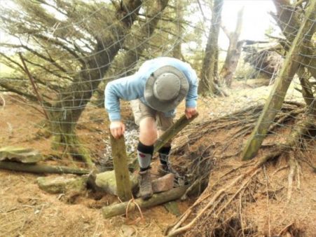
Maybe my mind was distracted, but I went astray at the col between Totridge and Mellor Knoll. It is easy to do so on the featureless ground. But basically all routes lead down to Hareden in the end. Incidentally if you are up here it is easy to gain the 344 m summit of Mellor Knoll, although there are no rights of way. Why wasn’t it included in the CRoW act’s open access land?

Mellor Knoll.

Off track.

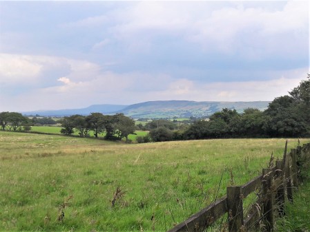
Haredon, can you spot the car on the trough road?
At the farm a trailer was full of sheep presumably off to market. When I asked the little girl with her mother if they were her sheep she proudly said yes. the mother quickly intervened to say that they were going on holiday. Very diplomatic.

Going on holiday!

Haredon Farm. 1690.

Always a warm welcome.
it was flat walking down the valley into Dunsop Bridge, but the weather had clouded over and become much colder, don’t we have a mixed climate. Mark’s route fortunately brings you past Puddleducks café, still functioning as an outside venue, I enjoyed a coffee.

Hareden Brook, haunt of Dippers.

Langden Brook.

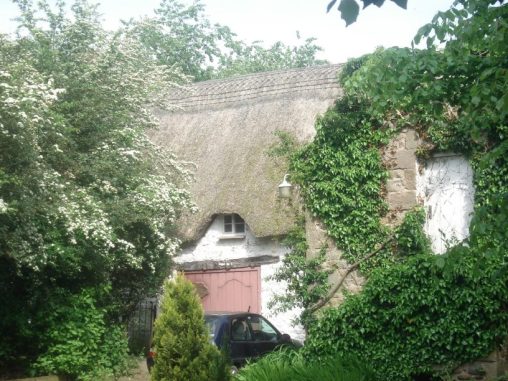
Puddleducks in the old post office.

On past that 100.000th BT phone box often considered the centre of Great Britain. Down the avenue of tall Redwoods to Thorneyholme Hall, once owned by the Townley family of Burnley, known for breeding race horses. Their land agent Richard Eastwood had success in the 1861 Derby with Kettledrum. It is believed that St. Hubert’s Church in the village was partly financed though the horse’s winnings. More of that later.

The path down the valley alongside the Hodder, now joined by the Dunsop and Langden Rivers, is always a joy surrounded by all those familiar hills. This is a good place to watch Sand Martins but of course they haven’t returned yet. The river bank in parts is being eroded, and the path has been changed with the introduction of those modern metal kissing gates which I don’t feel are very sympathetic with our countryside. That is the last of my gripes.

Langden Brook joining the Hodder under the watchful eye of Mellor Knoll.

What’s wrong with the old one?
Since I was last along here the farm at Burholme has had its rendering removed exposing lovely warm sandstone. The farmer busy with his lambs tells me it has C14 origins. Their Lonks are not to be messed with.

By the time I was back at the graceful Burholme Bridge the sun was shining again.

I then drove back along to Dunsop Bridge to have a look at St. Hubert’s which I had become more aware of through this blog. All the history is there to read and I won’t repeat it. See also its listed building entry. The church sits squatly by the road leading to the Trough of Bowland. The striking feature externally is the large white marble angel guarding the Towneley family vault. Inside I found very little lighting to fully appreciate the fittings. The exquisite stained-glass windows however showed up really well. Their leaflet describes a painting of Kettledrum, but I was unable to locate it. Mary Towneley of more recent equestrian fame is also buried here.


A good walk in the best Bowland scenery, which in truth I have done many times before at all times of the year, but never get tired of. (I did exactly the same walk on May 1st 2019.) If you are intending to follow the Cicerone route in full come when the river is down so the stepping stones can be traversed and maybe a pint taken in the Inn at Whitewell. There is a concessionary path off the road from near Burholme Bridge directly back to the Inn at Whitewell which would save some of the repetition of his route.