Monthly Archives: July 2014

LONGRIDGE TOWN “PLANNING”

  • LONGRIDGE.    “8000 friendly people, wonderful countryside and a great social life!  What else do you need?” — a quote taken from their own website. That at present is quite true, but there is trouble afoot. Due to a lack of forward local planning, developers are highlighting areas of land around our villages to appease the Government’s hypothetical and unrealistic targets for housing needs in the next decade. The map above shows the problem with up to 2500 houses projected [in red]. Roads, Schools, Doctors, Sewers — where are those plans? There is a genuine feeling of anger in the village over the proposals, but the councils seem unable to call a halt to these Developers’ speculative plans.     

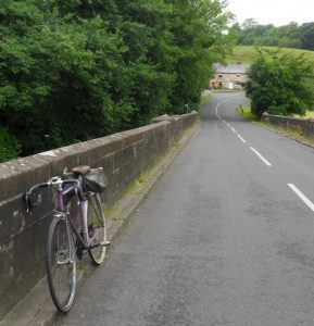
To celebrate the millennium, Ribble Valley produced leaflets and waymarked six excellent walks in and around Longridge exploring the diverse landscape and heritage. [Available from our thriving local library] One of these is a 6-mile circular tramp around the village making use of tracks through the surrounding green spaces, these are the very same spaces that are now highlighted in red in the above plan. So today I thought it was an opportunity to repeat and enjoy this walk before all the changes. Bowland Homes have already filled in one corner of the Eastern rural approach to Longridge. Across the road from there are lovely fields earmarked by Taylor Wimpey so destroying this atmospheric entrance into the village. 
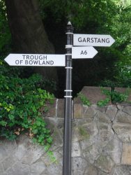
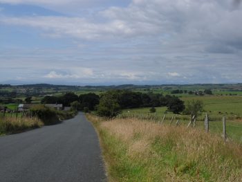
I followed the green lane up the side of this area into the quarried part of Longridge, with views over several reservoirs. Across the road into fields and one has the most wonderful views over Chipping Vale with the Bowland Fells behind. Surely this must be saved for our dependents.  The next area under attack, from Barretts, is all the fields around the cricket pitch on the road in from Chipping. This again will totally change a rural entrance into the village. The old neglected  ‘Gypsy Lane’ goes through fields onto Inglewhite Road and a field path leads to Halfpenny Lane. Here Gladmans have been given permission to develop the green fields across to the village. No buffer zone in the form of farming land any more. What is nature losing?  A few hundred yards around the corner and  Urbanregen  [how ugly a word is that?] have already started to prepare the destruction of Green Nook Lane! 
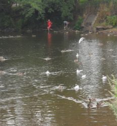
Further on the walk, in Pinfold Lane, United Utilities have decommissioned a reservoir to produce a wetlands environmental area with public hides for observing the wildlife. Highly commendable, but at the same time they are hoping to develop a housing estate on the north side of the site. Double standards or am I being cynical?  One has to be where land, development, planners, government and money are all involved. So my pleasant rural circuit around Longridge is complete — but for how long will you be able to experience these few countryside hours in the proximity of the village?  There are too many question marks in this post and I’m too afraid of the answers.

As one ages, it is said you don’t easily adapt to changes — count me in on that.

.

111111

CYCLING THROUGH ‘THE TROUGH’

It had to be done. This is the classic ride from the Preston area. After recent trips on my bike, slowly building up strength, I knew that the next challenge was to cycle through The Trough of Bowland. Had not done this for 20 years, too busy climbing and walking. Set off today at lunchtime. The fells which I had to circumvent had ominous black clouds above them as I left Longridge. Was soon into Garstang and on to Scorton where the traditional stop at The Priory for coffee and cake was duly taken.   Got chatting to a fellow cyclist [I have put myself into that bracket now] turned out he was staying in Longridge for a couple of days and had escaped the family to ride today. I was glad of the cake as I followed twisting, undulating lanes towards the fells.

One particularly steep little hill climb caught me out and had me standing on the pedals. Once on the Trough road at Marshaw I just had to keep going at a steady pace and I was at the summit before I knew it. Set at 968ft is the Grey Stone of Trough marking the pre1974 boundary between Lancashire and West Riding of Yorkshire.

Heading towards Marshaw.

Wonderful scenery abounds up here in the Bowland Fells and today the conditions were perfect, clear warm and sunny and most important – no wind.  Great swooping descent to Dunsop Bridge.

Onwards by the Hodder to Whitewell, with it’s celebrated Inn.

The River Hodder.

I enjoyed the trip down the valley to Chipping and the short stretch back to Longridge in the late afternoon sunshine.

Feeling rather smug tonight with my modest achievement and dreaming up longer and longer cycling days.  LE to JOG?  Hang about — I’d better try 50 miles tomorrow first!

BLAZING SADDLE. A PHOTOGRAPHIC PUB CRAWL.

The heat wave continues!  I mentioned in my last post how I was inspired to cycle once more through The Trough of Bowland. I felt I had to get some miles under my belt first to achieve a modicum of two wheeled fitness. So today cycled out to Shard Bridge on the Wyre and back, almost 40 miles. The tarmac was melting in places and I had the wind against me all the way home. Good training, The title Blazing Saddle was appropriate by the time I finished in the afternoon heat. Talking of saddles, the picture below shows my well-used and worn Brooks leather saddle, at least 60yrs old. Complimenting it is my old Carradice Saddle bag. Both are still in production, for a price, — good design and craftsmanship always win out. Shows my vintage!

Picture taking whilst cycling is different to when walking. First it is advisable to stop before shooting, so nothing is spontaneous, and often there is only a winding road to focus on. I made a decision today to just take pictures of the interesting pubs I passed. There is some logic there as whenever you ask directions you get the reply — ‘turn at the pub’ etc. That is a good reason not to change pub names, they are a historical document.  Have a good selection of names here, all will be familiar to Lancastrians in the area. Not sure of my results, maybe next time I’ll choose the equally imposing village churches.

ALSTON ARMS.LONGRIDGE.

HORNS INN AND GENTS LOO ON RIGHT OF ROAD.

REOPENED GREEN MAN ON VILLAGE GREEN INGLEWHITE.

THE ROEBUCK AT BILSBORROW. MORE RESTAURANT THAN PUB.

OWD NELLS – CANALSIDE PUB.

THE FRIENDLY GRAPES IN ST. MICHAEL’S.

SHARD BRIDGE INN – NOW THE UPMARKET ‘SHARD’ ON THE WYRE.

THE SHIP AT ELSWICK. ANOTHER ‘GASTRO PUB’.

THE DERBY ARMS, OLD MOTORING PUB AT INSKIP – LOOKS CLOSED!

THE BROUGHTON INN, NOT EXACTLY A COUNTRY PUB!

THE STAGS IN GOOSNARGH.

Mission completed, next cycling trip should be around The Trough.

THE WYRE WAY. UP TO THE TWO BOWLAND SOURCES.

Again I have a late start, parking up in Dolphinholme. This was an important mill village at one time with many interesting buildings. Today I’m more interested in the vegetable gardens near the bridge. A man is erecting a new greenhouse to complement his vegetable beds – all very neat. I’m quickly away up into the fields of freshly cut grass, a smell so evocative of childhood summers. The Bowland Fells remain as a backdrop all day. Through woods I come down to cross the River Wyre ………..and follow it’s north bank to a pumping station and a memorial to the people who lost their lives in the explosion of May 1984. There is little water today on the dramatic overspill of Abbeystead Reservoir, opening photo. Abbeystead Village is its usual sleepy self.  There are two Wyres from here on, the Tarnbrook Wyre coming from the Ward’s Stone / Brennand Fells and the Marshaw Wyre coming out of the Trough of Bowland.  The WW does a loop around them. In this upper part of the walk there are frequent WW markers expertly carved from stone and depicting local interests, I wonder who was responsible for them? 

Fields, with abundant lapwings calling, are crossed to reach the hamlet of Tarnbrook and a reuniting with the Tarnbrook Wyre. Chatted to an elderly man in one of the 18th-century cottages, he had lived here all his life and is now the only permanent resident. I crossed the Tarnbrook Wyre for the last time at Gilberton Farm.The afternoon was very hot and sticky but I had clear wide open Bowland vistas as I crossed the watershed, Hind Hill, between the two tributaries. The Trough of Bowland road can be seen. I found the track down to Tower Lodge, originally the gatehouse to the abandoned and now derelict Wyresdale Tower. The walk back down the Trough road next to the Marshaw Wyre passed pleasantly until I was back in riverside fields again. The thought crossed my mind that I should do the classic cycle ride through The Trough again, will have to get a bit fitter on the bike first. Further down the valley one gets glimpses of the grand Abbeystead House and gardens, Lancashire home for the Duke Of Westminster. The two Wyres have united at the reservoir and it’s alongside here in the trees that the path becomes boggier and awkward, crocodile country. From the weir I left the previously walked WW section and followed indistinct field paths back to near Dolphinholme. I had been out for six hot hours, and so arranged to meet a friend living close by for a pint at The Fleece Inn. We met to find it closed Mondays/Tuesdays!  The Plough in Galgate provided suitable alternative refreshments within its sunny beer garden.

*****

Today’s walk has been a very satisfying conclusion to The Wyre Way, brilliant scenery and interesting locations. My rather scathing criticism of the first leg of the walk may need to be tempered, would probably be great if you follow the correct way, at the right tides and when the vegetation is low!  So I would highly recommend THE WYRE WAY for a few days varied walking.

THE WYRE WAY. A QUIET INTERLUDE, ST. MICHAEL’S – SCORTON.

Dull and misty this morning, so I was in no rush to get out. Enjoyed a lazy breakfast with one of my sons who is staying over. He intended a  cycle ride over Longridge Fell and round the local lanes, I didn’t feel I could keep up with him so I set off for more of the Wyre Way.

This time I had a decent scaled map showing the route and I was determined not to proceed without a WW sign. Things went well out of St. Michael’s on a good path by the River, well-used by dog walkers. For some reason the signs soon had me back on the main road for a noisy stretch, motorbikes ++, before rejoining the river bank. Surely a better way could be negotiated nearer the river. Himalayan Balsam has taken over on the river banks on this stretch. I was glad I hadn’t stripped down to shorts yet as the path vegetation was quite aggressive, though at one point near Land House farm someone had done a good stretch of strimming, thank you. The village of Churchtown provided  a pleasant diversion with its church and old houses. Between here and Garstang I felt I was in ‘no man’s land’, quiet country lanes and field paths either side of the A6. Glad to see one farmer clearing up the usual junk into at least one pile. Nothing much moved, not even the gigantic wind turbine at the cheese factory which is a prominent sight whilst driving the A6 north of Preston.  The way creeps up on Garstang and you suddenly find yourself on the Lancaster Canal by a small basin. Here there is a tempting pub, on this hot day, unfortunately on the wrong side of the water. The Wyre is rejoined by climbing down steps from the canal  at an interesting Aqueduct. Soon, one is in Garstang’s [advertised as the World’s first free trade town??] main street. A small diversion would take you round the interesting parts of this attractive market town, but as I have done precisely that many times I took the early turn off to the riverside path again. This path is a favourite of the residents and visitors alike, and today was busy with families enjoying the weather. Ice creams were being consumed, a cricket match was in progress, kids were in the shallow waters and lots of dogs were being exercised. As one leaves the town a newish flood barrier has been developed. To prevent flooding further downstream in Churchtown and St. Michael’s, this can be closed and the excess water fills the flood plain above. On a day like today this area is open fields with pedestrian access providing good leisure facilities and a sculpture trail. The Wyre is by now reduced to stream size. The railway and M6 are crossed quickly ….….and then leaving the river, an old cobbled path leads through woods to the outskirts of Forton with its prominent Church Steeple. I was last here a few weeks ago whilst climbing Nicky Nook to Dolphinholme and returning by the WW – http://bowlandclimber.com/2014/05/31/nicky-nook-and-wyre-way/

ON THE WATERFRONT – THE WYRE WAY, KNOTT END TO ST. MICHAEL’S.

This turned out to be a bad day for myself,  whom I took to be an experienced walker. No one else has that assumption. Having become interested in the Wyre Way, which I had encountered further up near its source I ‘planned’ a few days walking its 41 miles. Today I intended to explore upstream from the river mouth at Knott End/Fleetwood. Buses were taken from St. Michaels via Poulton to deliver me at Knott End on a beautiful sunny day. What better relaxing way to start the day than with tea and toasted teacakes in Knott End Cafe. This building was originally part of the station at the end of the Garstang-Knott End Line and has many interesting old related photos on the walls. Eventually I set off as the ferry was coming across the Wyre from Fleetwood with the Lakeland Hills in the background.

Knott End Ferry.

I had hit upon low tide and as this exposes lots of mudbanks the river did not look at it’s best. Flocks of waders were feeding at the edges, mainly Dunlins and Oyster Catchers I thought.  Crossing a golf course I arrived in seaside bungalow suburbia which I found difficult to navigate out of. No signs for the WW which I thought would be in abundance,  I only had with me the old 1:50000 map and I had not marked on it the line of the route.   Big mistake no.1.  Soon I was out into the fields on a good path which eventually deposited me off route in Preesall on the main road I had just travelled.  No problem I connected via paths back to the coast and onto the sea ‘wall’ A minor Burrows Lane, never met a car, was followed to the yacht mooring’s at Wardley’s Pool.

Mud births at Wardley’s.

From here I had a run-in with another holiday park which I felt lucky to escape from to the river again. The path now seemed to follow the marshy waters edge towards the new Shard Bridge. Sea-lavender was very profuse and colourful on this stretch. After all my delays the day was passing and the tide was coming in once more – had never given that a thought.  Big mistake no. 2.   Reached the Shard Bridge pub with dry feet just! The last time I was here there was still the old toll bridge and it always seemed a bit of an adventure to visit this pub. Was glad to find they were serving Bowland Brewery ‘Hen Harrier’ on draught so I relaxed over a pint in the sunshine on their patio overlooking the river. The route was signed straight from the pub along the water’s edge and  I stepped straight onto the, by now waterlogged, path.  Big mistake no. 3.

Things became quickly worse as the tide rose further and I was fighting my way through sea grasses in a foot of water. By now there was no sign of a path and survival became uppermost on my mind [but strangely not to turn back]. When my floundering in the water became dangerous/comical I managed with difficulty to scale the brier and nettle covered embankment and threw myself across the barbed wire fence into the sanctuary of the higher field. Trespassing along the first field boundary was no problem but having yet again climbed over barbed wire I now found myself in a head high maize crop – jungle warfare. This repeated itself for many a field with only crop rotation providing easy or difficult progress. Nothing fit on my map [without field boundaries] and the afternoon became hot and sticky. Salvation seemed to be close as I reached a recognisable farm on the marsh edge. Stopping to ask for advice I was immediately attacked by two overgrown  ‘pit bulls’, a mastiff and the usual terrier. The farmer came to my rescue, of course saying they wouldn’t bite me. We ended up having a pleasant chat about the area, the river and the fact that the tides had been at their highest. He reassured me that as now the tide was retreating there would be no problem following the path through the marshes. So on I went, now with the occasional WW waymark there had been none before as I was mostly off route. Stopping to check my position I realised I had lost my fairly useless map but I thought I could manage without it now the going was easier with occasional way markings.   Big mistake no. 4.   The walking across the marsh was indeed easier for awhile. Jellyfish were a common sight either high and dry or isolated in saltwater pools. Before long the path became overgrown and I was once again fighting through reeds, tripping over and generally lacerating my legs and pride. The occasional tantalising waymark drew me into worse territory. It was with relief that I staggered onto a road. By now my sodden boots and socks seemed to have dried out! The lack of a map meant I couldn’t pick up any WW footpaths and none were signed so I trudged along the riverside lanes. The last mile I was able to take to the river defences for a pleasant walk into St. Michael’s,  the river now contained between the fields.

I finished battered and bruised at the bridge over the Wyre next to the church and close to the Grapes Inn where I enjoyed a Timothy Taylor  ‘Landlord’ as payment for my parking all day in their carpark.

Cottages and pub St. Michaels.

I’m sure I made even more mistakes than highlighted above but the day has turned out to be quite an adventure and once I’ve bought another better map I will continue on the Wyre Way.  One bonus of today I have not mentioned were excellent views of the Bowland Hills across the Fylde. It is in these hills River Wyre originates and where I will be heading towards next.

As a postscript, I do have to comment that the route is not well waymarked and apparently little walked.

A TRIP INTO BRONTE COUNTRY.

The e-mail message said South  Pennines grid ref. 018 362 at 9.45am.

Twisty roads over from Colne made me late into the car park.  I wasn’t too sure of my whereabouts, but a huge white sign on a hill ahead spelt out Welcome to Yorkshire – the Tour de France had been through last weekend. The other five were booted up and ready to go. Two are from Yorkshire, so the score is 4 – 2 in favour of Lancashire. A long straight track took us onto Haworth Moor and then a descent into a pretty valley at The Bronte Bridge and waterfalls, mentioned by Charlotte in 1854. Everything around here has a connection, true or fabricated, to the Bronte Sisters. Today the stream was running empty, so the waterfalls were disappointing. Signs directed us up towards Top Withens – this is the first time I’ve noticed Japanese characters on a sign post in England, obviously reflecting the Brontes’  popularity with those tourists. The farm is now mostly ruined, though one room has been restored and wooden benches added to serve as a refuge on The Pennine Way, which we were now following. The situation is said to have been used by Emily in Wuthering Heights. Lovely open space walking led across the moor and down to Walshaw Dene Reservoirs. As it was the PW, the path had been flagged through the peaty terrain. An early lunch break was called at the emptied middle reservoir. Time for a debate as to our onward route and much map gazing.

Four men and a map.

Refreshed, we climbed over Wadsworth Moor and down to the attractive hamlet of Walshaw. Then up again past old farms and down to Paddock Beck on sketchy paths. A long  ascent of the old Hebden to Haworth road proved to be very sweaty in the afternoon heat. We had actually been walking most of the day in Lancashire, but we then descended steeply to the Leeshaw Reservoir back in Yorkshire. Yet another uphill took us back to the car park, the walk planner was getting some stick by now for all the descents/ascents [2700ft] packed into what was a relatively short walk [11miles]

We needed a visit to The Friendly pub up the road in Stanbury to restore our composure with a pint of Goose Eye Brewery’s Maillot Jaune, a blonde summer ale produced to celebrate the tour in Yorkshire. Delicious.  Out of interest other local breweries have come up with the following imaginatively named special tour brews — On Yer Bike,  Le Champion and Saddle Sore.

Get them whilst you can.

FAIRSNAPE FELL – ONCE MORE.

Parlick and Fairsnape across Chipping Vale.

If I had a pound for the number of times I’ve climbed Fairsnape I  ….  so here I go again. I have one of my grandsons staying with me and need to keep him occupied and off his smartphone, certainly smarter than mine. He was keen to have a day’s walking and preferred reaching a summit rather than just rambling. So a circuit of the fells above Chipping was hastily planned, there was no rush, being a teenager he wasn’t up till well after nine. We parked at Chipping and walked up past the old Kirk Mill with its delightful mill pond and resident ducks. Soon we were into fields and suffering hay fever together from the long grasses – a family allergy. I displayed my knowledge of the area by getting slightly lost on farm tracks and then on rough ground before reaching Burnslack Farm. This isolated farm now seems to be converted into the formula country house or two, though an original well pump remains. Would be interesting to see how they would cope with a severe winter up here. As a child, I lived on an isolated farm and in the exceptional winter of 1947, my family spent days trying to dig out the track to a road, have photos of 8ft snowdrifts! No helicopter ‘rescues’ in those days. Soon we were up Saddle Fell and on to the good track leading to Fairsnape’s highest point 520m. This is now approached on a flagged path reminiscent of the Pennine Way. After several weeks of good weather the peat hags had dried up and were a joy to walk on making the short journey to the Fairsnape trig point, 510m, effortless.

The views across Morecambe Bay and back to Yorkshire’s three peaks was good. No sign of Wales though. Our onward walk to Parlick was accompanied by several gliders picking up the thermals at great speed.

Nick’s Chair.

Then down onto lanes into a valley with old mills. By now the fit young grandson, who can easily cycle 100miles in a day, was fading and had to be refreshed with ice cream in the wonderful Cobbled Corner Café in Chipping. Made me feel what is 50 years difference if you are still keen and able. Home to watch the end of today’s Tour.

LE PETIT DEPART.

Cycling fever pitch is rising this weekend with Le Grand Depart of the Tour de France in Yorkshire.

To ease my left big toe pain I ended up doing a few short cycling trips  whilst in France last week.  After my last forays on my old road bike in the local hills I decided I needed lower gearing, so whilst I was away I had the front rings replaced to improve matters. The last couple of days I’ve been out on my bike again in Lancs. Many of the roads nearby are ‘classified’ as quiet country lanes – not that that makes much difference to the boy racers or the posh 4×4 brigade.

There has been an effort in the last few weeks to resurface some of the worst potholed sections which I have to be grateful for. Enjoyed a pleasant, short, circular ride today out to Bashall Eaves and back via Chipping in rather dull weather but it never rained. The hamlet of Walker Fold passes by in a flash, even at my speed.  The bridge over the River Hodder is the lowest point on the ride and today the river is running low. Uphill to Bashall Barn, a popular cafe developed in the need for farm diversification. The hamlet of Bashall Eaves is only a few scattered properties. The pub is sadly only open now at weekends, rural pubs are having a hard time round here. Called The Red Pump it has a history of a mysterious, unsolved murder in 1934.

Once past Browsholme Hall with its Tithe Barn [another cafe!] and the small hamlet called Cow Ark I was onto an old stretch of Roman Road, Watling Street linking Chaster to Carlisle. It can be traced over Longridge Fell visible down Chipping Vale.

Passed an old cheese press near a dairy. Chipping Vale produces a lot of Lancashire cheeses to this day.Quicker progress was made down the lanes into Chipping with its narrow streets. I resisted the café as I was home in 15 mins with no sprint finish.

A LOT HAPPENING IN THE LOT.

The end of June usually finds me in The Lot valley in France. This year the weather was a vast improvement on last year’s dampness, we ‘endured’ temperatures in the thirties most days, so a lot of time was spent in the pool!

Most mornings I was off for a short walk from the house before the rest had stirred. This is the time to see deer in the adjacent woods. The flora seemed more advanced this year and the orchids were past their best. However there were wild sweet peas alongside the paths.

Longer walks needed to be completed before lunch to avoid the fierce heat.  The cooler evenings are a good time for cycling on the deserted local lanes. Spotted a couple of rusting Renaults to add to my collection – a 4 and a 12 I think.

A couple of visits were made to the nearby Chateau Hauterive for degustation of their range. The demi-sec Rose was the favourite for lunchtime and the Prestige Red for evenings.

One afternoon we watched as they bottled 4500 roses in a semi mechanised fashion. Apparently they distribute into England now through the Wine Society. No visit to the premises is complete without a tasting of Mr. Filhol’s prune eau de vie and I always seem to come away with a bottle of the fiery stuff.

Obligatory visits to the restaurants in Duravel and Puy l’Eveque meant that calorie balancing needed even more exercise.

So three of us found a new walk starting in nearby Castlefranc which proved to be of interest. The village is a ‘bastide’ town centred on the market square and built in a rectangular fashion. A steep climb up the hill behind took us between neat box hedges past stations of the cross to the statues on the top – ‘Calvare’.

Overgrown sign to ‘Calvare’

There were excellent views down to the Lot Valley. Old pathways led us through Cahors vineyards …..….with the occasional old Gariottes or Cazelles, dry stone shelters for the agricultural workers.

Down through oak woods and on to the old railway linking Cahors to Fumel taking us back into Castlefranc over the River Vert with its mills. The walk finished conveniently at a bar by the bridge.

The last day of the holiday was made more interesting as a massive machine harvested the crop from the adjacent fields. As the machine moves through the field red kites flocked down to presumably pick out the mice etc disturbed. Good entertainment.

Spot the Kite.

We flew home despite the usual French Air Traffic Controllers strikes.

Can’t wait to return. Bonne vacance!