Category Archives: Lancashire.

SOUTH OF THE RIBBLE AGAIN – OSBALDESTON.

Friday, May 7th.   8.5 miles.    Osbaldeston.

I’m just about to eat my supper;  wild garlic encrusted fish,  a poached egg and new potatoes. The wild garlic was picked on today’s walk from one of the numerous wooded dells I traversed, my rucksack will smell of garlic for days.

 Two days ago I was in Balderstone and today I’m parked in Osbaldeston, a few houses in a row.  Obviously  ‘balderston’ is the common phrase. I’m off to explore another bit of countryside south of the Ribble bypassed by the busy A59.

The little lanes around here are fairly free of traffic mid-morning, but I suspect will be a different matter at school and work times. As I said Osbaldeston is hardly a village, a row of mixed cottages and affluent houses with large gates, you know the sort. I was soon in fields where one stile led to another making navigation simple. I’ve just realised that hedges and not walls mark the boundaries in this area. The elegant steeple of Balderstone church was always peeping over those hedges and up above Mellor Moor, but more of that later.

I spotted a deer running off up a field and when I passed this dell I heard crying – and there were two very young calves left in the grass. A quick photo and I left as soon as possible, what a start to the day.

The next group of houses, Studdlehurst, were hidden away at the end of a lane. Again large gates and horsey activities were evident. The man mowing the lawn of what was probably the original farmhouse was chatty, mainly about the weather, his massive garden and the state of the footpaths since lockdown.

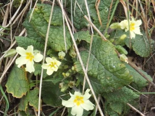
The next house had distanced itself from the general population behind electric gates, but had provided excellent waymarks, gates and stiles on the public rights of way – what more can you ask?  Mercyfield Wood was full of bluebells, I apologise if I took too many ‘bluebell pictures’ today.

Crossing fields towards the river a new fence was going up but the original stile will be reinstated, the workers told me. At last, I was down by the River Ribble which was flowing quickly after overnight rain. I was on the lookout for Otters but to no avail. All the usual birds were present with Sand Martins making a return.  Across the way was Hothersall Hall and I had a different view of it than from my usual walks.

The RofW path cut across the land to Osbaldeston Hall however a concessionary path was signed by the river so I gratefully followed that. A large group of Swans were paddling about farther on below the Old Boathouse.  At Osbaldeston Hall I was pleasantly surprised to find the footpaths well-marked and the landowners going to a lot of effort to make life easy for the walker. I had only seen this hall from the Ribchester side before so it was good to come close up. A pleasant spot for a snack in the sunshine which had been in short supply until now. The old ‘Boathouse’ on the other side gives a clue as to a former ferry as well as a ford marked on an old map.

One cannot but sympathise with the farmer if his sheep are being worried, I fear that with the vast increase in dog ownership there will be a corresponding increase in irresponsible ownership.

The next mile or so was a switchback in and out of woods and ravines. Again plenty of scope for bluebell pictures and for picking some wild garlic for supper.

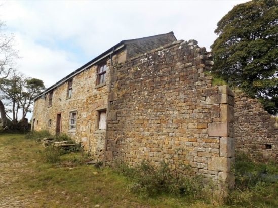
Once I approached C17th Oxendale Hall I was being watched by security cameras, the footpath became enclosed circling the property and I could have continued into the woods without seeing the Hall. An unmarked public footpath, not meant to be used, in fact crosses their frontage for a close up view. Of course, I was spotted and asked, or rather shouted at, if I was lost? I wasn’t lost, and I didn’t have the time of day for further conversation so continued on my way.

The next hall, Showley, another Grade II listed C17th but much altered, was something of a difference. The agricultural junk started well before the house and continued in most available directions. They deserve a listing for the amount of junk.  I wonder if they get on with their neighbours at Oxendale Hall.

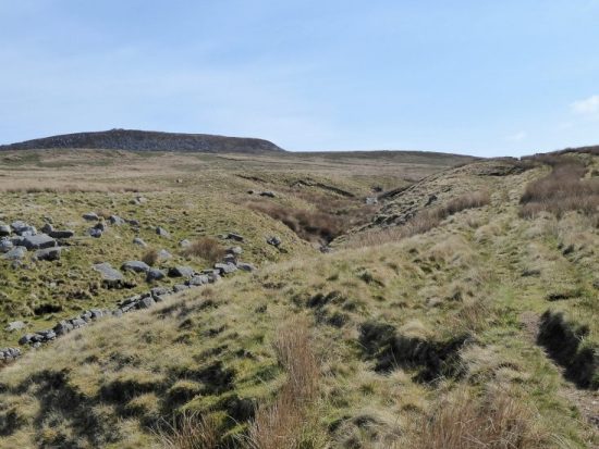
I picked up a lane taking me back to the A59 and after some time was able to cross safely this busy road. Once on the other side I had a choice of low level field paths back to my start or climb up onto Mellor Moor, the weather had improved and I knew the view from up there was worthwhile. Hence, I started the slow trudge up the lane and onto the open moor. Stopping for breath gave me an excellent view of Pendle.

The top of the moor is marked by a trig point but more unusually by the site of a nuclear monitoring post. A plaque relates its history. The Lancashire Telegraph had this write-up.

Concrete blocks amid the swaying grass are the only outward signs of what used to be a large underground nuclear monitoring post for the Royal Observer Corps, which opened in 1959. It closed just nine years later and has since been sealed.

Three men would have entered the post during times of potential nuclear attack and reported on explosions read off special equipment installed to read blast pressure, power and flash. The bunker, therefore, had its own source of power, ventilation, communications, sanitation, food and water.

The monitoring post was just one of 1,500 across the country which would be able to track and report any nuclear fall out, keeping the local population informed of the level of danger. Thankfully they were only ever used for training and exercises.

In the Second World War, an above ground look-out post was built here, too, by the Royal Observer Corps, for spotting identifying and tracking hostile or friendly aircraft flying over this part of East Lancashire.

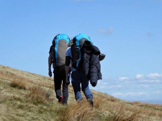
A direction indicator has also been installed for the far-reaching 360 degree views across the surrounding countryside, Wales, the Lakes and Yorkshire as well as all the nearby Lancashire hills.   Apparently this was also the site of a Roman signalling station, overlooking Ribchester from around AD 80. Earthworks are marked on the map but I’ve never identified them on the ground.

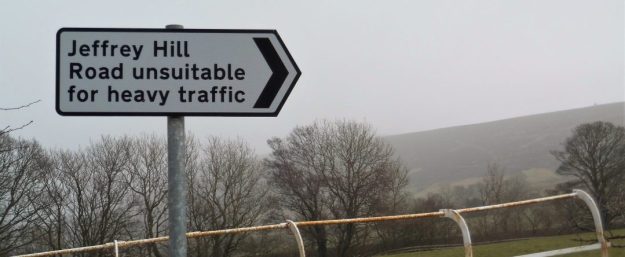
Pointing to Bowland.

I intended to follow footpaths back down the moor but came across this unfriendly gate. Not one to turn back on a public footpath I entered the grounds leaving the gate ajar in case of a hasty retreat. No hounds appeared so I was able to progress to the next obstructed stile. Why do people buy properties knowing there are rights of way through them only to do their best to keep the public out? Another one for reporting to the local authority.

 More friendly fields took me down and across the A59 again to bring me back into Osbaldeston. Today I was luckier and my friends in Mellor Brook were home so a pleasant glass of wine was enjoyed in their garden before coming home to cook my supper.

*****

THE OTHER SIDE OF THE RIBBLE – BALDERSTONE AND SAMLESBURY.

Wednesday, May 5th    11miles.    Samlesbury.

Where haven’t I been for a while? Well it’s several years since I explored the countryside visible southwards across the River Ribble. In the past I thought that the footpaths were difficult to follow and rights of way ignored on the ground. Time for a revisit. So I found myself parked up in Balderstone;  a school, a church and a couple of houses. I waved to a man delivering hay to one of the houses and then I was off along quiet country lanes. At Lane Ends I visited a trig point, for no obvious reason, at the lofty height of 74 m.

My first objective was to visit Balderstone Hall on the River Ribble and view from this side the former ford across to Alston. I’ve recently been looking at this scene from the Alston side.

https://bowlandclimber.com/2018/11/08/alston-looping-the-loop/

https://bowlandclimber.com/2021/01/08/river-ribble-at-alston/

A pleasant stroll down fields above the river brought me out into the confines of expensive and secluded properties. A right of way was shown on the map but it looked daunting. As it happened a couple of builders whom I knew were working on a wall of the Hall, they said nobody was about and showed me the way through past the rather intimidating signs. I didn’t like the look of the river crossing, maybe in high summer and low water I’d be tempted. The old map marks the ford.

 I retraced my steps and left the exclusive properties for a path past a more run down farm. Crossing fields on the flood plain I bypassed a large farm and climbed back up the escarpment to reach a road heading west to Bezza House. Years ago, when Bezza was a tree nursery, I used to come here with Dor and many of the trees in her and my garden originated from here. One in particular that she bought was the ‘handkerchief tree’ Davidia involucrata, an exotic specimen from China. It takes years to flower and so one spring whilst they were away for the day I went around with a ladder and white paper tissues which resembled the flowers from a distance. Suffice is to say that they were well and truly tricked but the tree had the last laugh by flowering the next year and every year since.                                                                                                               

There are great views from up here of the Thirlmere Aqueduct crossing the River Ribble.

Where the road used to continue bollards have appeared and now only a bridleway continues to Samlesbury. And what a pleasant bridleway it was;  lined with spring flowers, bordering fields full of lambs and having views across the Ribble to Alston, Longridge and beyond.

It was getting near lunchtime so I hurried to reach St. Leonard the Less Church where I expected there to be seats. I was not disappointed, in fact a couple of walkers were already occupying the prime bench. The church unfortunately was closed. It has some very old box pews, apparently. I had to be content with the exterior views of the oldest, C16th, sandstone part and the distinctive tower built at the end of the C19th. In the graveyard was an ancient sundial, 1742,  and a large font, 1769. The adjacent primary school is also of a certain vintage, I’m always cautious taking photos near schools.

A path climbed fields towards a house which turned out to be another religious establishment, the Roman Catholic Church of Saint John Southworth  and presbytery.

An old sunken track high above the busy A59 was a hidden delight to walk. Peace came to an abrupt end when a stile deposited me onto the pavement adjacent to the traffic lights at the busy junction next to the Five Barred Gate motel.  

Once across safely I was happy to follow  the quiet lane past the extensive sewage works. Up and down it went until I was able to take a footpath across to another lane, thus by-passing the Nabs Head  pub which has too many recent memories for me. I was soon on the pavement outside the C15th Samlesbury Hall. What a magnificent building this is and to think it was bought in 1920 for demolition, only to be saved by a local trust. I crept into the grounds for a closed look.

Crossing the busy road I made use of a quiet bridleway, Park Lane, taking me to Mellor Brook. I wished I’d had a bag to collect some wild garlic. From up here I could look across the extensive BAE site and the Ribble Valley to Longridge and the Bowland Hills. 

I took a footpath behind houses where friends live hoping for a cuppa, but they were not at home. This humble little stream, Mellor Brook, once fed a mill pond that supplied water to a cotton mill.

The village deserves a better look with little alleyways and old houses. An unknown lane went under the A59 and out into the countryside. Fields headed back to Balderstone with the church spire always prominent. On the way I passed the grand looking Grange, you could rent its nine bedrooms on Airbnb for £2000 per night. 

Arriving back at the school I was greeted by the man who’d seen me set off this morning. Turned out he was the school caretaker and seemed impressed by my modest mileage. I had time for a look around the outside of St. Leonards Church. It dates from the C16th but was rebuilt in the 1850s, the tower and prominent steeple were added in 1905 by those old favourites of Lancashire church architecture Austin and Paley.

I have had perfect weather for today’s enjoyable amble in this delightful backwater just off the A59. It was worth crossing the Ribble.  Looking at the map I will return and complete another circuit to the east based on Osbaldeston.

AROUND LONGRIDGE WITH THE CHESHIRE SET.

Friday 30th April.   10 miles.    Longridge.

There wasn’t a footballer, TV ‘Celebrity’ or landed gentry in the party that I met up with for today’s walk.

I couldn’t believe that after all my extra careful planning, they were the Cheshire Set after all, that our rendezvous spot had become a closed road this morning. Cary was seen further up the fell as others arrived more or less at the appointed time and place. We then moved all the cars to a better place.

The original ‘Around Longridge Walk’ has become redundant because of all the housing developments taking place and I’m looking to establish a more definitive rural circuit. My Guinea pigs had just arrived.

With black clouds over the Bleasdale Fells we set off in cool weather. Please be sunny and dry I thought, keen to show off the local countryside. They were the Cheshire Set after all. Green fields led down to Lord’s Quarry and the end of the railway that took the stone from all the Longridge quarries to build the towns and cities of the NW.

Mile lane was its usual half mile.

Clay Lane was avoided, too much wet clay, as I expertly navigated through nearby fields. By then it was time for morning coffee and pieces of Martin’s excellent chocolate chip biscuits. The sun shone. The long ridge of Longridge Fell was seen almost in full extent with the village at its lower end.

We were soon on the normally quiet Ashley Lane just as rush hour began and there was strangely almost constant traffic. Despite Alastair and Sue preferring to carry on along the road the rest of us turned off to go through the minor industrial estate of Sandbank. This industrial area was just a warm-up for the massive timber Wyder complex across the road. Floors and roof trusses are constructed here to be shipped off to distant building developments.

Back to country lanes we were then confronted by one of those large modern tractors with just enough room to pass.

Green Nook Lane led to a constricted path through more industrial units and out onto the track of the Longridge – Preston Railway, originally a track for horse-drawn carts carrying stone from the quarries to Preston and afar. Steam trains took over and a passenger service was run until 1930, goods which now included products from Longridge cotton mills continued into the fifties. Farther down the line at Grimsargh a branch line served Whittingham Mental Institution, at one time the largest hospital in Europe. We are left with a gravel track traversing the fields but unfortunately blocked off in places denying the chance to provide a green way from Longridge into Preston. Lack of initiative and planning.

The dog at the next farm was gathered into the owner’s arms as we tramped through their garden. Lunch was beckoning and the multitude of benches in the graveyard at Alston Church proved an ideal convenient and comfortable stopping point. They were the Cheshire Set after all.  Social distancing proved no problem.

The spot we randomly chose was adjacent to the grave of Ginio Ferrari a well known local restaurateur. In his heyday he used to drive around in an open-top Jag with GF 1 plates.   Apparently he had acquired these from the Rolls-Royce previously owned by George Formby, GF 1.

A stretch of pleasant countryside brought us back to the outskirts of Longridge and Tan Yard lane leading back to the quarries. Views from here across the reservoirs to Pendle and the West Lancashire moors.

We skirted the large caravan site hidden in the quarry to arrive back at the cars. One last treat was to look at the overhanging bouldering delights of Craig y Longridge.

We were lucky with the weather – more sun than showers, and I think Lancashire put on a good show for the Cheshire Set. I in turn thank them for making the effort to drive up the M6.

Must get this post out before Martin or I will be accused of plagiarism. [too late] I didn’t take many photos of the surrounding countryside or hills, I’ve enough of those already, but here Is a flavour of the day.

First problem.


Most awkward stile of the day.

Easier European standard ‘stile’ – Conrad


Cary giving us all the lines of the magpie rhyme.


Inspecting Thirlmere’s water supply.


Quiet lanes.


A less than grave lunch.


An introduction to Craig Y Longridge.

*****

I’d noticed this morning a couple of helium balloons stuck in my cherry tree and resolved to retrieve them later. On my return there was a knock at the door from my neighbour asking if he can have his balloons back. He had recently retired and been to a party to celebrate – hence the balloons, they unfortunately escaped from his kitchen last night but didn’t go far. We fished them down and he went home as pleased as punch. Happy retirement Mike.

GOLDSWORTHY ON HIGH.

Monday, April 26th.     8miles.      Quernmore.

I have been up here before to seek out the Andy Goldsworthy ‘Three Chairs’, most recently in 2014.  https://bowlandclimber.com/2014/05/28/out-on-the-loose-again-clougha-pike-and-grit-fell/  when we did virtually the same walk.

There were quite a few cars in the car park this morning when we arrived – early birds or dog walkers. Sir Hugh was just recovering from his head dive last week and I noticed a slight reluctance to turn his neck, however today was only going to be about six miles, well it turned out nearly eight, but there was no problem.

We climbed up onto Clougha Pike using the Rowton Brook path which passes evidence of past cottage industries most notably the C17 cotton mill. The present owner was happy to chat about its history and life in general.


There was no let up in the ascent but the ground was mercifully dry. The trig point, 413 m, was adorned with the most un-Goldsworthy stones. The views over the bay were murky but Morecambe Power station was ever present. In the other direction that other old favourite, Ingleborough, was in the background. 

The easy way.

Clougha Pike summit. 415m.

The obvious continuation track went to Grit Fell, we followed it as the rest is trackless heather. The peat was bone dry and a joy to stride out on with skylarks somewhere overhead. A few grouse were calling gobackgoback. Not recalling that Goldsworthy’s installation was named ‘The Three Chairs’ we spent some time trying to identify three large gritstones fitting that description and marked approximately on the  map.

Grit Fell 467 m.       Can you spot Ingleborough in the gloom?

I did recall this isolated Xmas Tree farther along the ridge.

Once on the shooters’ highway we made good progress back in the direction we had just come from. I was beginning to doubt my ability as a guide when the moors stretched out ahead of us with no sign of quarries or chairs. Sir Hugh thought the day was a failure when suddenly we were there and the installations appeared much larger than I remembered. [marked G on the map] He was impressed – with the statues not my navigation. Do you call them statues, sculptures, installations or piles of stones? That’s where art has its personal interpretations. Piles of stones they certainly are not, these are carefully crafted structures with intricate stone work. Apparently Goldsworthy constructed one each year from 1999 to celebrate the millennium. We speculated whether he constructs them himself or employs a stonemason to help. After the obligatory photos we continued on our way off the fell.

An estate worker’s massive 4X4 passed us – or was it the Duke.

Three cairns appeared on the left which we declined to visit but on the next photo look quite interesting.

I was chatting to Sir Hugh about the Thirlmere Aqueduct which comes this way and an old quarry [marked Q on the map] near Ottergear viaduct ‘discovered’ and climbed in by my friend Pete. We reached the impressive viaduct and almost missed the quarry which I’d expressed a desire to revisit. A chance glance behind and we noticed a couple of blokes in the quarry. They were doing a bit of climbing there as it has been highlighted in a recent supplement to the boulders in this area. That led to a sociable chat about old times climbing.

A sandy path through the heather brought us back to the car park. A perfect little fell day.

*****

CONNECT FOUR ON THE CANAL.


Saturday,  April 24th.      7miles.      Ellel.

I am just beginning to connect up with friends I’ve not seen for months. D and P had arranged a walk with Mike, and they invited me along. I mentioned I’d not visited Ellel Grange estate, close to where I was walking with Sir Hugh last week. I drove round and round looking for our rendezvous spot at Thurnham Church, is it coincidence that Denise’s walks often start at an RC Church?

The church of St Thomas and Elizabeth was consecrated in 1848 and had links with the Dalton family in nearby Thurnham Hall. In the grounds is a mausoleum for the Gillow family, well known local furniture makers, it has elaborate Egyptian columns on one side only. In front of the church is an eroded C19 cross recovered from nearby Cockerham Abbey.

We moved on. The day promised more sunny and warm weather. Along a farm track D and P commented on a new house that wasn’t here a couple of years ago when they last passed.

Fields, thankfully now dry, were crossed towards the Ellel Estate. We detoured up a hill for a view of the Italianate hall with its towers and extensive gardens. It was built in the 1850s for an ex-mayor of Liverpool and has been recently used as a religious retreat, but see below.

Our next objective was a view of Kings Lee Chapel  a Victorian gothic church designed by Joseph Hansom who also designed the impressive St. Walburge in Preston and the Hansom Cab. The church is closed and has been subject to vandalism. If I had been alone I would have been tempted to approach closer up the drive.

Apparently the whole site is for sale with plans for yet another holiday complex. Some estate buildings are already used as holiday lets.    https://www.lancastervision.com/holiday-village-100-bed-hotel-and-vr-experience-plan-for-lancaster-revealed/

We left the estate over their balustraded canal bridge and had a pleasant stroll along the Lancaster Canal.

At the junction with the Glasson canal we took a break outside the lockkeeper’s cottage on a suitable bench. D unexpectedly produced four sandwich buns out of a hat for us.

Onwards though Galgate we eventually left the canal by a path across a field of probably 100 cows. A hill gave us views of the bay and distant Lakeland hills. We took to the road around Condor Green where the old Stork pub is needing renovation.

The little café on the old railway line was doing good business with cyclists and walkers using the route between Glasson and Lancaster. Using the railway track bridge we crossed the creeks looking forlorn at low tide.

From the number of people we had passed we expected Glasson to be very busy, so we cut through to the canal by  Christchurch. There was a little fête on, and I came away with some thick cut marmalade which has turned out to be delicious. We were now on the Glasson branch canal which links to the Lancaster canal by a series of locks. This section seemed to be popular with nesting swans.

I did a series of walks up the Lancaster Canal with D and P back in early 2018 where there is lots more information. https://bowlandclimber.com/2018/01/09/the-lancaster-canal/

We left the canal and climbed fields back to Thurnham Church from where a cavalcade of cars made their way to a nearby garden for more socially distanced but connected refreshments.

*****


SEARCHING FOR RAVEN LUMB FALLS.

I’m fascinated by the history of the countryside. I glean as much as I can from books, maps and the internet. The origin of names: lost houses and tracks: the local industries from way back: family trees and intrigue. So when I come across a reliable source of information to one of my regular walking areas I’m delighted. The area in question is Hurst Green and Stonyhurst and somebody has set up a Facebook page dealing with precisely that.  https://www.facebook.com/hurstgreenandstonyhursthistory

I was alerted to it by a comment from its author on my Stonyhurst crosses walk for which I found it difficult to obtain information. I have some catching up to do with the posts so far, but I did notice one on a waterfall on Dean Brook below Hurst Green – Raven Lumb Falls. Over the years I have scrambled up a few of the brooks coming down from Longridge Fell to the Ribchester and Hurst Green areas, but I was unaware of this location. It didn’t take me long to identify its approximate position on the OS map and this morning I set off to explore.

Hurst Green was busy with walkers, most probably following the Tolkien Trail which I did a few weeks ago. Today I set off down Lambing Clough Lane, there were certainly plenty of lambs about. At the ‘farm’ I took a public footpath, strangely unsigned, down towards Dean Brook where it is joined by Bailey Brook at a footbridge. There is an open green area here,  locally referred to as Pickleholme. I now followed the stream up into Merrick’s Wood.

Celandines and Wood Anemones were still in flower, but as a bonus the Bluebells were just coming into bloom in blue patches under the trees.

There was more water in the brook than I had expected after all this dry weather, I would have been better in wellingtons to walk directly upstream, as it was, I used precarious little tracks with an ever present risk of tumbling down the steep bank into the water.

Anyhow, I made progress until at a bend the fall came into view. The water had carved out a passage through the sandstone cliff. Care was needed boulder hopping here as I don’t think anyone would have found me if I’d had an accident. The grid reference, for anyone foolish enough to follow in my footsteps, SD 6830 3746.

What a delightful spot deep in the woods with a lively flow of water. There was some tat left by gill scramblers from Hothersall Hall. The rope was in bad condition so I removed what I could reach. I need to return when the water level is even lower to try and scramble up the falls.

I sat for half an hour and watched  a Dipper coming backwards and forwards, with grubs in its mouth, to a nest hidden in the rock. A pair of Grey Wagtails, or Yellow?  were flitting about in the stream.

What a pleasant way to spend a morning.

When I arrived back at the Shireburn Alms the beer garden, sorry dining terrace, was full of diners enjoying the sunshine and their freedom to eat out. A far cry from down below.

THE OLD MEN OF TROY.

The Old Man of Hoy is a famous sea stack off the coast of Hoy in the Orkney Isles. As a climb it was first ascended by  Chris Bonington, Rusty Baillie and Tom Patey in 1966. Apparently it could collapse at any time.

We weren’t up there today, that would be stretching the travel limits. No we were still in deepest Lancashire returning to Troy Quarry after many years for some climbing. Apart from the rhyming name the only other resemblance to Hoy is a stack, without any sea, in the middle of the quarry.

The parking area has been severely limited because of the influx of walkers disturbing the locals in these strange times. Of course, we travelled in four separate cars, so you can see how quickly every space becomes blocked. None of us could remember the approach into the quarry, there used to be some large concrete buildings by the track, all now looked quite sylvan. There are some good walks that traverse the hillsides in this upper part of Rossendale. But today we were here for the climbing.

The quarry is large, spreading 30 – 40ft walls of gritstone around a pond. Canada Geese entertained us all afternoon with their calls and territorial chasing across the water. We made a beeline to the South Walls where there were easier climbs. Another pair of climbers were already in situ but soon moved on. They were top roping either for safety or inexperience. We had many years of experience between the four off us, too many to count but were a little rusty. I, for one, don’t want to see the inside of a casualty department, so we opted for top roping too, something I wouldn’t have contemplated in the past – where is the adventure in that. Times change.

After a bit of faffing with slings we had a top rope set up above the Siamese Twins. These are cracks in a steep slab. We climbed the right-hand variation with help of the left crack and the left route with the help of the right crack. Who’s watching?

Rod high on Left Siamese Twin.


Dave in a similar position.

The rock was clean with positive holds, a fine gritstone apparently used in the past for pavement flags in the northwest cities.

A large flake in the centre of the Siamese wall had new cracks running down it, a hollow sound and movement when pulled in certain directions. Water and frost affect the rock formations in these quarries and every so often lumps, small and large, detach themselves. You just hope you are not clutching one when that happens. This particular flake is already doomed. We squeezed in a slightly harder climb to the left but again transgressed into those cracks. 

Fred has the largest lunch box.

I haven’t seen my climbing partners for many months, so we had a good catch up chat over lunch. The sun was pleasantly warm reminding us of many hours playing on the rock walls in these Lancashire holes in the ground. God’s own rock is over the border in Yorkshire, but we are fiercely defensive of our sometimes grotty venues.

We moved the rope along to above a great looking flake line, Stacked Deck, which we all enjoyed lay backing up.

Dave starting the lay back of Stacked Deck.

Alongside was the classic route, Rapunzel. Halfway up is a barred window from which Rapunzel would have let down her hair. The fable around this story is more complicated than I remember. https://en.wikipedia.org/wiki/Rapunzel 

Rod approaching Rapunzel’s window.

Suffice to say she didn’t let down her hair for me today, and I was lowered to the ground to lick my wounds. Ah, well it is the first time I’ve been on a rope this year. Things can only get better – or is that a fairy tale?

Boulderers on the ‘sea stack’

WALKER’S I’TH FIELDS. Galgate/Ellel.


Saturday, April 17th.   7.5 miles     Galgate

The approximate midpoint between me, Longridge, and Sir Hugh, Arnside, is the Galgate junction of the M6 just south of Lancaster University. A meeting was arranged for the first time in 6 months. It nearly got off to a bad start as I parked up on the wrong road. Anyhow, once corrected we set off into those fields trying to escape the motorway noise. This could have been a nothing walk but as things turned out there was plenty of interest. Of course not having met up for all those weeks our conversation meant we were ‘lost’ on several occasions. Sir Hugh’s plotted route, chosen I think with a pin, was flexible enough for us to complete the circuit. It was more undulating than first appeared, and we reached the dizzy height of about 150 m. Any views tended to be to the west over the motorway, although the Bowland Fells were ever present a few miles away. We even visited the upper part of Dolphinholme.

The delay in this posting is partially due to my involvement in local affairs. The field opposite my house has been earmarked for development for some time. All local objections have been dismissed – so here come a couple of hundred houses. What we didn’t expect was intensive piledriving occurring almost adjacent to our properties. We awoke after Easter to vibrations akin to small earthquakes. Cracks started to appear inside our houses. Local authorities were to be honest hopeless and disinterested in appreciating the seriousness of the disruption. Barratt Homes were dismissive of our protestations. My next step was to contact my MP, Ben Wallace, someone I had never voted for. He immediately took up our cause and took on the mights of Barratt. The good news is that they have been stopped from piledriving for now, a victory for the common people. There is some way to go yet, but they are having to look at alternative methods of consolidating the ground which they shouldn’t have been building on in the first place – I hope it costs them a fortune.

A forest of piles, excuse the expression, hundreds of them.


The offending monster being taken away Monday morning, no doubt to disturb someone else’s neighbourhood.

Anyway back to the start…

A massive mushroom farm has mushroomed in the fields next to the motorway. The farms round here are on an industrial scale, the cows have their own mechanised backscratcher. There are some interesting names, as the header photo and this attractive sign. Busy weekend roads were crossed, we couldn’t work out where they were coming from or going to, but we must have travelled them at some time. All looks different on foot. A trig point,136 m, was visited off route, it was next to an impressive stone wall with Grit Fell and Ward Stones just peeping over the top.

Old tracks lead to remote farms, had we strayed into another land?

Another slight diversion took us to an unusual feature marked on the map… … it turned out to be the ruins of a dozen WW2 ammunition holdings with double walls intended to reduce the shock if there was an explosion. But why build them in such proximity?

A lane wandered down to a farm complex, you can see we were at the back of beyond. Children and friendly dogs ran wild. The farm house looked old – it was. 1698 above the door. As was some of the equipment. A lovely valley wound onwards until we became literally fenced in a horsey property. Lunch was taken above a small stream heading into the River Wyre.

Later after more intricate fence climbing we arrived at Four Lane Ends in upper Dolphinholme and much later still we arrived at Five Way Ends, that makes nine, no wonder we were lost.  Ponies were being exercised as we walked down the road, makes a change from all the dogs we see at the moment.

A splendid walk, not bad for sticking a pin in the map – no, thanks for Sir Hugh’s excellent planning.

The day wasn’t over as in the last field to be crossed Sir Hugh executed a superb diving header of the ball into the opponents net, except there was no net and no ball, just a hard landing on his skull. Obviously he survived and I hear is recovering well.

Walkers I’th Fields indeed, where next.

*****


A NATURAL HIGH – FAIR SNAPE.

Thursday 15th April.       6 miles.       Fairsnape.

I feel released at last. Well almost.

I’ve been very good during the Pandemic, self-isolating for my own good, not mixing with my family or anyone else really, not travelling outside my area and living off home deliveries. The latter have been excellent, and I’ve put on a few pounds. Today I went high into the Bowland Fells for the first time in months. I felt strangely anxious, not wanting a helicopter rescue. But I have walked this route hundreds of times, it was once my evening fell run.

I parked in my little slot below Saddle End and walked slowly up the fell. As usual, I met no one going this way and I was so slow others would have overtaken me. Skylarks were in full song, and it was a joy to be on the hill.

I took the manufactured track across the side of the fell, but I had to deviate over the flagstones to take in the highest point, the cairn of Fairsnape Fell, 520 m. One can’t come up here without visiting the top, but apparently many do. I was rewarded in solitude with views over to the three Yorkshire Peaks area where friends were walking today – if they could get parked anywhere.

The beeline to Paddy’s Pole, the other summit of Fair Snape, 510 m, was easy as the peat hags had dried up in the last couple of weeks. You can hardly believe the difference in that time from limb sucking bogs to dry, even dusty, peat. Anyhow, I wasn’t complaining.

There was no one at the cairns or trig point on this westerly bit of Fair Snape Fell. I sat and ate an orange looking out to Morecambe Bay and the hazy Lake District. I spent some time scouting out for a flat area suitable for an overnight bivi. Last year, or the year before, I bivied out on Beacon Fell and Longridge Fell and I want to complete the trilogy which was halted last  year.

Then it was fast walking around the fell rim towards Parlick, not forgetting to spot Nick’s Chair [Martin B]

Earlier in the day I’d spotted parapentes in the sky, launching from the more unusual east side of Parlick. I took the track in their direction hoping for some close up photos, but it seemed to be lunchtime. None were in the air. Some were still making their laborious way up. As soon as I was halfway down they stared appearing in the sky once more. I took the steep way down the fell.

Traversing lapwing fields took me back to the road and my solitary car. I managed to buy some excellent free-range eggs at the end of the lane.

Down came the soft top for an exhilarating drive home. I do feel I’ve been released. On a day like today up there in the Bowland Fells you couldn’t feel any different. A natural high.

And then I read this – https://raptorpersecutionscotland.wordpress.com/2021/04/15/red-kite-shot-in-cotswolds/

*****

ANOTHER DINKLEY ROUND.


A peaceful Sales Wheel.


Wednesday, April 14th.    6 miles.    Ribchester,

A perfect Spring morning, sunshine and no wind.

Looking back I did this walk in 2019 on a similar April day https://bowlandclimber.com/2019/04/11/more-of-the-ribble-way-and-dinkley-bridge/ and on many other occasions.

We set off from the car park of the Ribchester Arms, which later today will be serving food and drink outside following the latest easing of lockdown. Some, new to us, paths lead away across fields from Stydd Lane. The signing was better than usual, a side effect of the pandemic with the farmers trying to guide all the extra walkers through their fields as safely as possible. We were intrigued by some old banking alongside Duddell Brook which seemed to have been designed to prevent flooding of some fields that would have been a natural flood plain. One wonders if this channelling of the stream goes towards the flooding that regularly occurs farther down where it meets the Ribble. Never mess with nature. I’m not sure whether the banking shows up on my photo.

An innocuous looking Duddell Brook.

The Ribble Way was joined and followed pleasantly along the river bank. There is always flood debris on this stretch but today it was mostly vegetation and wood, perhaps someone has a had done a litter pick of all the usual plastic. It is a shame that the footpath gets diverted away from the river [fishermen only!] but at least from the higher elevation there is always a  panoramic view of the Ribble Valley with Pendle on guard and of course now the new Dinckley Bridge.

Mike had not visited since the new bridge was erected in 2019, hence today’s route. The previous suspension bridge was damaged beyond repair back in the floods of December 2015, Storm Frank. Its centre span was previously destroyed by flooding in 1981, but cables and parts were salvaged and the deck rebuilt.  Prior to the bridges a ferry used to cross here linking Hurst Green to Dinckley and Langho.

Old suspension bridge. Wikimedia.

Today the river was very low under the bridge and the sandy beaches farther downstream were accessible. We were surprised there were not more people out and about enjoying the warm sunshine. In the woods the wild garlic was coming into season reminding me that I must pick some for cooking – perfect with a poached egg. The celandines, wood anemones and sorrels were all putting on a good show.

Again the path is diverted away from the river, so we just walked pleasantly along the quiet lane to cross the stately Ribchester Bridge back into the village and home for lunch.

*****

YOU FAT BASTARD.

                                                                         Sweden Quarry.

We, us old farts, used to climb with a fit young lad who shall remain nameless. Regular evening visits to Lancashire quarries in the summer months provided good sport. He was pushing his grade, as a young man should, but often was lowered to the ground defeated by a high crux move which one of us old timers could easily demonstrate to him. Chastened he would apply himself to the next problem with often the same result.

It was only in the pub afterwards that an analysis of the evenings climbing took place. Typically, we focused on his failings and inevitably came to the conclusion he was carrying too much weight. This lead to, and I apologise as from now, describing him as a ‘fat bastard’. We did have his interests at heart as this insulting banter resulted in him disappearing, dieting and training to re-emerge the next week to climb as good if not better than us.

Someday I will write about climbing trips with this youth in question to places far from Lancashire and the resulting adventures. I will of course need his permission first.

Anyhow, today the boot, or climbing shoe, is on the other foot. I used to climb in a quarry high on Longridge Fell hidden in the conifer plantations – I called it Sweden for no other reason than the trees. Only I and a few others knew about it, and slowly it became overgrown as these places do. But it was there at the back of my mind and when social distancing became the norm, and I was wary of climbing in crowded Craig Y Longridge …

A crowded Craig y Longridge.

… I revisited Sweden.

Basically it is a large hole in the ground. The walls tend to be damp and uninviting but on an upper level there is a clean wall getting the sun all day. A few days getting rid of the vegetation that had encroached in the intervening years, and I was ready to try the problems that I had recorded 25 years ago. Armed with my tatty guide from then I began to repeat the problems. They were much harder than I remember and also apparently much higher despite the use of a modern day crash mat.

So it is back to square one – you fat bastard.

ABUNDANT POSITIVITY.

Wednesday 7th April.   4 miles.   Longridge Fell.

Last week, or was it last month? I’m beginning to lose track, I wrote of the litter left on Longridge Fell. https://bowlandclimber.com/2021/03/31/lets-stay-positive/ 

I went back the next night and collected a bag full of litter; cans, bottles, crisp packets, coffee cups and of course dog poo bags. A satisfying outing.

Today I thought it was time to repeat the exercise following the influx of Easter visitors. I parked at the usual spot on Jeffrey Hill and set off on my regular walk up to the trig point on Longridge Fell and was pleased to see there was very little litter – have I a competitor picker? I still managed to fill a carrier bag with mainly dog poo bags.

The highlight of the walk however was the number of couples I passed who thanked me for the effort and how they should do the same. I thus had several conversations of a varied nature.

A Bangladeshi family were not so much interested in the litter picking but were keen to seek directions for the best paths, this was the first visit for them. They seemed adventurous so I sent them on a circular walk through the trees which they seemed to have enjoyed when I bumped into them later in the afternoon. We recalled days in Blackburn where I used to visit for Asian groceries and little backstreet cafés serving Dahl and chappatis to immigrant workers, my grounding in authentic curries.

A couple from down the road thought we should all get together on Facebook and have organised clean-ups, I ignored that idea but we discussed all things Longridge.

A couple from Blackpool were walking several little dogs, all sensibly on the lead. It turned out they owned a hotel in Blackpool and obviously had done virtually no business in the last year. They were not hopeful for a quick return to business this summer, opening to less than full capacity with all the costly restrictions, having to take staff back on etc and then to find themselves closed again within weeks. That must be a recurring dilemma for the catering and hospitality sector.

I mention that they had their dogs under control as a little further on were two young women with dogs running wild over the fell side. I politely mentioned that all dogs should be on a short lead at this time of year as is clearly signed at all access points. “Nobody told us that” was their response – I suggested they read the notices at the gate where they had come from on their return. They did however put the dogs on leads, at least while I was in view.

As I neared the finish of my round whilst my hands were freezing, did I mention the sleet flurries we had from time to time? I met a hardy soul who had walked up from Longridge, he does it most days. As is usual when we meet we discuss the wildlife that is around, he doesn’t miss a thing. His hope is that when the lockdown eases the hordes that have been parked up on Longridge Fell will disperse and leave us in peace.

I’m not so sure. That’s not very positive is it.

*****


FARTHER AND FURTHER AROUND LONGRIDGE WALK.

Monday 5th April.   7 miles.      Longridge.

I wrote about the ‘The Round Longridge Walk’ back in February…

THE ROUND LONGRIDGE WALK.

Today I went out to try and improve the route by avoiding too many main roads and keeping outside the circle of ever-increasing hosing developments. I also had a new camera which I wanted to play with, it has far too many features for me to come to terms with quickly.

What a beautiful Easter Monday, blue skies, lots of sunshine and a cold wind. Perfect. Well not quite – they have taken out all the hedges on a new development. Our slate artist has summed it up nicely on a Hedge Sparrow triptych. [Richard Price – see transcript at end of post.]

 I linked up with the route on Pinfold Lane where several parties were scanning the wetlands with binoculars.

I had a brief look, there is a digger in the background, and carried on my way down towards Bury’s Farm. A farmer was rolling his field – a picture from the past.

I found a better, more rural, route around Alston and on across the main road. I found my way through peoples drives and gardens back into fields before picking up the old rail Preston – Longridge line and onto home ground. The blackthorn and cherries were blossoming.

It has been a walk of contrasts – trying to balance the rural with the creeping urbanisation. It’s time for the hills.

*****

 *****

You don’t see many hedges these days, and the hedges you do see they’re not that thorny, it’s a shame, and when I say a hedge I’m not talking about a row of twigs between two lines of rusty barbed wire, or more likely just a big prairie where there were whole cities of hedges not fifty years ago, a big desert more like, and I mean thick hedges, with trees nearby for a bit of shade and a field not a road not too far off so you can nip out for an insect or two when you or the youngsters feel like a snack, a whole hedgerow system, as it says in the book, and seven out of ten sparrows say the same, and that’s an underestimate, we want a place you can feel safe in again, we’re social animals, we want our social life back, and the sooner the better, because in a good hedge you can always talk things over, make decisions, have a laugh if you want to, sing, even with a voice like mine!

Richard Price


LET’S STAY POSITIVE.

Tuesday 30th March. 5 miles. Longridge Fell.

Lockdown eased yesterday but from the pictures of rubbish in the Lake District perhaps for some a few days earlier, I am concerned about our ability to come out of lockdown safely and it is not helped by what I see today.

The hottest day of the year so far as I walk up to the trig point on Longridge Fell. Within yards of the car park I come across litter in the form of bottles and cans, masks and yes, dog poo bags all recently discarded.

It was only last year that barbecues set light to this area, we were lucky the fire brigade dealt with it so quickly and efficiently. When will it happen again?

I became irritated and even more so when I see a lady with four dogs running loose, dogs must be on a leash from March 1st because of ground nesting birds. Calling her she answers that she has badly strained her ankle and is trying to hobble back to the car park. I wonder if she ever had the dogs on lead in the first place, but give her the benefit of the doubt and wish her well getting back.

The top of the fell is reached without further problems apart from deep mud. A charming Japanese man with his daughter and friend are admiring the views, he remarks on the tranquilly of the scene. I have to agree and also enquire how he kept his trainers so clean walking up through the peat bogs.

Onwards into the woods and out onto the path past the grandiose gate to the kennels.

There were two heads bobbing up and down along with the frogs in the small reservoir lower down, the two ladies have swum all winter, today is the first without wetsuits.

As I was walking back up through the plantation I watched a barn owl quartering the open areas, they seem to be a common sight this year.

On the way home I called into a local shop to buy myself a ‘litter picker gadget’ so tomorrow if I venture up the fell, I usually do, I can positively improve the environment. I will pack the litter into a plastic bag and then on the way home I can chuck it over a fence like this lot…

*****

THE TOLKIEN TRAIL AGAIN.

Saturday  27th March.     6.75 miles.      Hurst Green.

I expected Hurst Green to be full of cars this morning, but we were able to park up outside the Bailey Arms with no trouble. I think we stole a march on most people by being away early. A new signpost has been erected near the Shireburn Inn to get you on the right track. Dropping to join the River Ribble seemed muddier than normal, a lot of people have come this way in the last few months. To start with we had the riverside path to ourselves with wide-ranging views. Only as we approached Winkley Farm did a steady stream of people start appearing from the opposite direction. Fishermen were wading in the Ribble just upstream from where it joins the Hodder. A new path, not particularly aesthetic, gives a dry way across a particularly muddy field. A lot of people were milling about at Cromwell’s Bridge and on the path alongside the Hodder, we couldn’t work out how some of these groups were constituted with no social distancing in evidence – I suspect people are coming out of lockdown of their own volition. Up at Hodder Court Gandalf is staring out over the Ribble Valley, although his hat seems ready to fall off. We walked on through the grounds of Stonyhurst College to a now busy Hurst Green. I dread to think what this walk will be like after April 12th when people can travel further.

Here are a few photos…

A deserted Bailey Arms, I wonder whether it will survive.

We were glad of our poles in the mud.

Aqueduct over the Ribble taking water to Blackburn.

Distant Pendle.

Hodder and Ribble meet – spot the fisherman.

That Winkley Oak.

The new ‘bypass’

Trail walkers with Stonyhurst in the background.

Cromwell’s Bridge.

A wooden Gandalf.

*****

For more comprehensive views of this walk please have a look at

THE TOLKIEN TRAIL.

TO CATCH A SALMON.

ANNIVERSARY BIRTHDAY PICNIC.

Tuesday,  March 23rd.     9 miles.    Longridge.

My birthday happens to coincide with the date Lockdown commenced last year. There seemed quite a fuss about this [not my birthday], whilst I have every sympathy with the thousands of families affected by Covid deaths and they should not be forgotten, I am not one for lighting candles or creating memorial days for an event we have not dealt with very satisfactorily. I would almost go so far as to say they are devious attempts by the government to distract our attention from the failings and flag wave for our vaccine successes. Dangerous tactics.

Back to today’s walk, which I have completed many times recently, to make an occasion of it I took a picnic with me to enjoy higher up. Last year I visited the limestone quarry  opposite Arbour Farm occasionally for its wildlife so as I pass today I have a look in. There are a couple of roe deer scampering away and a hare following. It’s too soon for any significant flowers but there a few mallards on the water and pheasants taking cover. In the past this area has been used as a shoot and the birds fed in the season. All around are spent shotgun cartridges. I take particular note as I’ve just been reading a DEFRA report of the latest attempts to ban lead ammunition.   Lead ammunition could be phased out under government plans to help protect wildlife and nature, Environment Minister Rebecca Pow announced today (23 March).  There has been a wealth of evidence that lead is damaging to humans, wildlife and the environment and yet a large amount of lead ammunition is discharged every year. Apart from the yearly slaughter of birds there is research showing wild fowl ingest lead pellets, mistaken for food, causing considerable deaths from poisoning.   The Government have been slow to do anything about it and a voluntary transition by the shooting industry has not worked. A recent review showed the majority of game birds sold to the public had been killed using lead shot. So all change then – well not quite – the Government is proposing a two-year review of the evidence and then public consideration. A typical fudge when the hunting and shooting brigade are involved. Why don’t we just get on and ban it now.  [In Denmark, hunters have had to use alternatives since 1996, when lead shot was banned]

Spring display.

Arbour Quarry.

Moving on I made my way up onto the fell and found a sheltered spot for my simple Birthday picnic in a little quarry nearby.  I have recently started climbing in here again after many years, there is a small wall suitable for bouldering away from the Covid crowds that are making themselves unwelcome at the usual bouldering spot, Craig Y Longridge. It is up here that I have been regularly seeing Barn Owls flying around at dusk. Today a kestrel was hovering not far from me and a pair of Buzzards were wheeling high in the sky. Nice place for a picnic in the sun.

I wander home down the switchback lane. I had various texts etc appear on my phone from absent friends and family and in my porch a box of beer and a single malt. Not such a bad birthday after all.

*****

THE BEST OF LAST WEEK.

Tuesday. 16th March.    6miles.    Chipping.

We drive the 4 miles to Chipping and meet up in the village hall car park. I had promised Mike it would be sunny for him to have a morning away from the builders working on his garage. He is pitching the roof, adding solar panels, electric charge point and enlarging his drive with stone sets etc. etc. I think it is a larger job than he had first envisaged, though he should know. Anyhow there was no sign of the sun, in fact it was grey and cold when we set off at 9.30.

This is a walk we have done many times, but it makes use of, on the whole, well surfaced farm tracks in the foothills of the Bowland Hills. The snowdrops in the grounds of Leagram Hall had finished flowering which was a shame though there were primroses on the lane banks. From Laund sheep farm we cut across to renovated Park Gate where the only field of the day linked up with tracks at the empty Park Style. This whole area is rough upland and the Lapwings and Curlews were in good evidence today. They get a chance to breed up here as the fields don’t get cut until later in the year, if ever. A pair of Buzzards are soaring high above. Down one of the tracks we see a stoat in its white winter coat running ahead of us, quite exciting. At Lickhurst  we meet up with the bridleway coming from Saddle Side, not taken today because it is very boggy in parts. There were notices on the gate warning people not to take vehicles along it. This is the first time I’ve seen this but apparently during lockdown 4X4s have been coming out in the night on these lanes. Of course most of them have been registered in Manchester/Liverpool, often with no tax or insurance. There  are a group of people who think they can do what they like and escape notice during lockdown.  The track has been severely damaged by these morons.

We walk on down the road and over three bridges which have replaced fords in the time I’ve lived in the area,  Lickhurst could be impossible to reach after heavy winter rain in the past. I show Mike the long single span clapper bridge, 6 metres of solid grit stone, and we wonder how they handled it here. It must have been brought here from some distance as all is limestone in the vicinity. Upstream is a fish ladder I’ve not noticed before.

We walk on past that isolated iconic red phone box…

We have friends living in the next group of houses and we have a chat and an illicit coffee over the garden wall. Sheila has a heavenly glow in the photo. The bridleway leading onwards crosses the beck encountered  before at a ford, fortunately there is a footbridge just up stream, [Greystoneley Brook which soon joins the Hodder at Stakes Farm near the stepping stones] This whole area has had its trees harvested last year and looks very bare, but thousands of new trees have been planted so it will be interesting to see how it matures.

The lane passes close to a large almost intact lime kiln in an extensive quarry, another detour. At the end of the lane we meet a chatty horse rider.

On the road back Mike met a retired school teacher who was responsible for getting his children off to a good start. More catching up chat ensues. With all the ‘delays’ we don’t get back to the car till nearly 2pm by which time the sun has come out.

*****

*****

Whilst mentioning the birds we saw today I should also like to report that most evenings while I’ve been bouldering up on the fell a pair of barn owls have been quartering the open areas, a majestic sight as they fly past close by without a sound. The days are getting noticeably longer and there have been some beautiful sunsets to coincide with the Spring equinox.


THERE IS MORE THAN ONE WAY TO CLIMB LONGRIDGE FELL.

Tuesday 9th March.     11miles.    Longridge Fell.

My last walk, at the weekend with Mike, was through the fields and lanes of Chipping Vale with a little nibble at the west end of Longridge Fell. All very repetitive, so much so I didn’t take a single  photo but the conversation must have been good. A couple of days have been spent festering, you know how it is. Today started slowly until I made the effort to get going and put some mileage under my belt. Starting from home the obvious way to increase my mileage was to continue along the road to the north of Longridge Fell before striking to the top. I noticed a few more roadside signs on the way.

Leaving Longridge.

Lee House Church.

Exquisite carved trough.

?origin.

C17th Thornley Hall.

Entering Chaigley. Note the rake as a notch in the fell side woods.

I did consider going all the way to Higher Hodder Bridge but as I hadn’t set out till 1pm I thought it a little ambitious. [another time] I left the road at Rakefoot Farm and climbed the steep rake from there up onto the fell east of the summit. Once on the ridge I threaded my familiar way through the trees and into the open at the trig point. There was nobody else about. From up here one gets a bird’s eye view of the Thornley road below which I’d walked earlier.

It is all downhill from Jeffrey Hill to Longridge, a good way to end the afternoon.

*****

JEFFREY HILL.

Wednesday.  3rd March.     8.5 miles.    Longridge.

The last couple of days I’ve been out bouldering in all that lovely sunshine.  My arms and shoulders are now rebelling. I felt like a longer walk so planned this one on roads for today. It was grey and cold this morning, so I managed to faff around until after a light lunch, brisk walking was then the order of the day. The road through Thornley doesn’t always have a pavement so dodging from side to side on the corners is necessary. I passed Lord’s Lane and Birks Brow, two regular ways up onto the fell and continued on past Thornley Hall to climb the steep lane up Jeffrey Hill, this part of Longridge Fell. [see inserted map and elevation graph]

Even today there were plenty of cars in the car park by Cardwell House, but they would not have any views as the Bowland Hills were in cloud.

Cutting through Cowley Brook plantation, my latest discovery, avoided a little of the road to the Newdrop. I was then on the switchback road heading down to Longridge. It wasn’t a day for taking pictures or for meeting people so I was soon back home but glad of the exercise.

I wonder if they have published the minutes yet.

The steep bit.

Misty parking at Jeffrey Hill.

Cowley Brook Plantation.

*****

A GRIMSARGH/WHITTINGHAM CIRCLE.

Sunday.  28th February.    6 miles.   Whittingham.

Spring has arrived for a simple circuit making the most of the unspectacular Whittingham countryside. A route through fields was planned checking out some stiles that Mike had had difficulty with recently.

We started in Cow Hill again. It was busy with cyclists and family groups walking around the block, all looked over by the ginger cat. At the bottom where Savick Brook was crossed,  with three buzzards wheeling overhead, we took the Bridleway up the hill behind the strangely quiet kennels. We knew about the fierce hound that stalks the yard of Seed Hill Farm. The way has been diverted around barns to avoid the farmyard and dog. From here a lane leads up to and crosses Haighton Green Lane into soggy fields that we followed towards Whittingham. There were no waymarks so prior knowledge was of great help. A wooden footbridge has been washed away but fortunately there is a brick farm bridge close by. The path goes through the farmyard of Whittingham Hall Farm which was previously part of Whittingham Psychiatric Hospital where inmates would have work. In a barn today there was a remote robotic cleaner going round the cows, I’ve never seen one of those before.

Lost bridge.

Robotic yard brush.

At one time there were over 2500 patients with its own railway, telephone exchange, church, post office, reservoirs, gas works, brewery, orchestra, brass band and ballroom. It has been closed since 1995, many buildings have been demolished and planned housing developments have stuttered. We walked around the back of some new houses and the church which is boarded up onto the main road. The footpath sign shown in the header photo dates from the old hospital days.

Fortunately there is a footway on the road to Withy Trees where we took to the fields once more. This took us through an Alpaca Farm, but today there  were only sheep and three donkeys. Across the way Harrison’s Farm is a metal recycling plant and the footpath is diverted around it.  It was near here that one of the broken stiles was encountered and was very awkward to cross – or are we getting old. Duly reported to the Local Authority – not our age but the state of the stile. It will be interesting to see if anything is done about it, a lot of organisations are hiding behind Covid rules. Normally Lancashire is very good at footpath repairs. In the fields here is the clear course of the railway which served Whittingham Hospital.

Railway embankment.

Railway trackbed.

Better tracks through Dixon’s  brought us onto Grimsargh Green and back to Cow Hill.

                                               The Cow Hill Cat.

*****

The walk seemed longer than the measured 6 miles, Mike uses ‘Strava’ but he usually forgets to switch it on and off  leaving some of our walks without a beginning or end.