Tag Archives: Canals

LANCASTER CANAL 3. Garstang to Galgate.

My friend Peter from Forton got wind of my travels up the canal and volunteered to accompany me on the next stretches, he has a wealth of historical local knowledge so I readily agreed. I came away far better educated but with less photographic evidence due to all the chatting!

As I descended from the bus, there is an excellent service linking Preston with Lancaster on the A6, he was there and understood my need to retrace my steps along the Wyre to the aqueduct to regain the canal up the steps. Nearby they were dredging the canal, a continuous task I presume, some of the detritus was on display.

On the far side was Garstang Basin, now a marina. The Tithe Barn building, converted to a pub, predated the canal and was brick built.

A pipe bridge carries water from Barnacre reservoir to Blackpool.

The canal was busy with a few boats moving about between the smart marinas and moorings, the towpath also seemed popular with dog walkers. Not all boats are equal.

Peter was keen to find the site where the Garstang to Pilling railway line crossed the canal – I think we found it at bridge 65, now demolished. This line was known as the Pilling Pig from a locomotive whose whistle squealed like a pig. It connected the agricultural land of this part of the Fylde with the railway network until the 1960’s. The remains of the bridge…

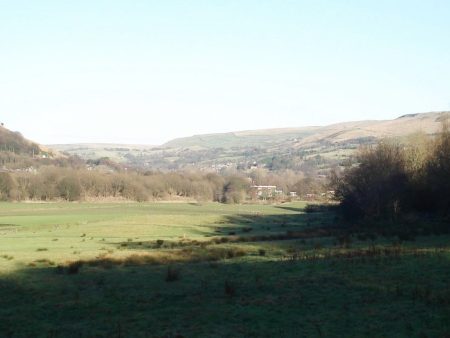
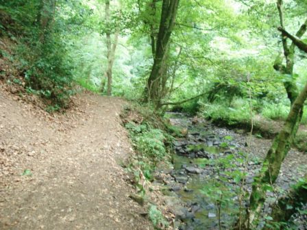
We were soon into pleasant wooded countryside, lots of curves guided us through the nebulous area of Cabus. All very pleasant. Despite the temperature being just above zero we were soon taking off layers as there was no wind and hence no chill. We reached Ratcliffe Wharf another busy marina but at one time important for shipping of coal and lime. Just north are mounds, the ‘obvious’ remains of lime kilns responsible for this trade.

Forton lies a mile southeast of Bridge 79. Apparently it became the richest village in England due to the payments received when the M6 motorway was built. The small basin at Richmond Bridge was constructed for transporting stone from the nearby quarry, which is now disused.

The bridge leading to Ellel Grange is more ornate in keeping with its stately surroundings. There is a strand of lovely trees by the canal at this point – all very picturesque.

A little further, the miles go quickly on this flat terrain even with my poorly hip, is the junction with the Glasson Branch. This links via 6 locks to Glasson Basin and into the sea through Glasson Dock. This was a vital link into the canal when Glasson was an important port, superseded by Preston in due course. I should return sometime and walk this section. At the junction a graceful bridge carries our towpath over the branch. Close by is the lock keeper’s cottage and today his wife was tending the garden and gave us a potted history of the area in that lovely Lancashire drawl.

Soon we were in Galgate, another canal basin, and waiting for the bus home, the pub by the bus stop sadly closed as is the lot of many village inns these days. Galgate was the unfortunate scene of severe flooding of the river Condor just before Xmas and many of the cottages are drying out – a long process.


Corniest boat name of the day…


LANCASTER CANAL 2. Woodplumpton to Garstang.

Overnight frost has frozen the surface of the canal, ducks are flying in and giving impromptu off balance ballet displays. Sets me thinking about hard winters when thick ice would have closed down commercial travel on the canal. The sodden towpath is a little firmer though. From the start this is countryside walking with the canal weaving its way on its 70ft contour. There has been little need for cuttings or embankments. To the east are the rounded Bowland Hills, when will I be back up there looking down on this landscape?

The peace is broken now and then by cars using their horns on the approach to the humped  narrow canal bridges, I’ve never really understood this – why not just drive slowly in the first place. A few bridges show signs of damage where there has been a collision with speeding honking motorists.

There have been several designs of bridges with variation in the pitch of the arch. All are in local stone and some have railings on the parapets. Some have been built as a purely functional road bridge. There are a few wooden swing bridges serving farms and fields. As mentioned they are all numbered in sequence from the south.

An hour’s walking brings me to Guy’s ‘thatched hamlet’ with its eateries and leisure facilities, somewhere to be avoided in the warmer months when it is overrun with families. Today is all peace and quiet as I pass by on the now well surfaced and well used towpath through Bilsborrow  to arrive at the next tourist trap, Barton Grange garden centre, marina and the new ice rink in construction. The latter looks completely out of place and scale next to the canal, though the pink insulation will be covered in more sympathetic cladding.

From now on the canal runs in close proximity to the A6 road, the main railway line and the motorway so there is constant noise. Also in this communications corridor are many power lines, the anglers attention is drawn to them by signs on the bank. I am surprised at the number of lines encountered and presumably hardly noticed in daily life.

So far today the canal has used three aqueducts to cross over rivers coming down from those Bowland hills. Each has its own unique architecture and I marvel at the ingenuity of the early canal engineers. The three arched Hollowforth over Barton Brook…  the larger Brock…

and the plain Calder…

The canal has some gentle curves and passes attractive woodlands as it loops around to pass Greenhalgh Castle before entering the suburbia of new housing.I escape at a final aqueduct over the River Wyre, dropping down to pass under the canal arch to follow the river through converted mills to catch my bus in Garstang.


Corniest boat name of the day…


LANCASTER CANAL 1. Preston to Woodplumpton.

As the crow flies this section would only be about three and a half miles but the canal does a large loop towards the Fylde, an extension to Fleetwood was originally planned. My plan was for an easy level walk on the towpath and this worked well until out in the country where the boggy terrain was extremely troublesome, why didn’t I anticipate that. I was trod in lightweight trainers which quickly became sodden as I slithered around in the mud cursing my stupidity. But the sun shone and it was a glorious day to be out so the benefits outweighed the negatives.

Dismissing the Ribble Link and the Tramway across the Ribble the canal now starts in Aqueduct Street, that’s a clue to its former route through Preston Town centre. Some inauspicious steps lead to a grubby basin with no room to swing a cat never mind turn a boat. I guess no one comes this far on the water. A finger post gives distances, there is only one way.

The towpath is on the left bank and I think remains so for the length. On the far side are waterside houses. In the background is the iconic St. Walburge church spire, the third tallest in England. Housing lines the cutting and above is another iconic Preston site Tulketh Mill with its towering brick chimney – cotton was king.

The first bridge is numbered 11 so a lot have been lost. I creep under Blackpool Rd. reputedly a good place to see kingfishers and on to the edge of Haslam Park. Bridge 13 is the first aqueduct, here above a diminutive Savick Brook which remarkably hosts the Ribble Link further on whose basin and locks are soon encountered. I’ve been this way before.

More pleasant housing on the right bank is passed, I could well imagine canal side living with a canoe to take me shopping. Bridge 17 gives access to a lovely cafe and the busy UCLAN sports grounds. Massive housing developments are taking place on the far side, Cottam. At last open countryside is reached. a former farm swing bridge has been removed with little trace. Salwick Hall is seen across the fields to the right, what must they have thought of the construction of Springfields BNFL plant nearby. One of my climbing partners spent most of his working life there producing Nuclear Fuels. ‘Reassuringly’ signs by the canal tell you what to do when there is a nuclear catastrophe.

A cutting takes me safely past and at bridge 26 is The Hand and Dagger Inn, not yet open this morning and I suspect with a change of name no longer a canalside pub but an eating ‘place’. The mud kicked in by now as I ducked under the busy M55 with distant views of the Bowland Fells.

The milestones are not all intact but those that are prove useful.


Further on there is a marina hiring out and selling boats, a friendly worker is busy cleaning his stock. Further on a dog walker and I agree grumpily about the devastation all the excessive house building, often on flood plains, is having on the local area. I dare not mention fracking.  Crossing Woodplumton Aqueduct I drop down to examine Rennie’s design, apparently no two aqueducts on the canal are alike. At one point I’m listening to a tuneful bird call I don’t recognise, eventually I spot high in the branches a tree-creeper. I then struggle in the mud to complete the section to bridge 35 near Woodplumpton and a bus. Enough for today, if my hip is OK I’ll be back tomorrow.


Corniest boat name of the day…


THE LANCASTER CANAL. The Black and White.

As I said in my last post ‘I have a plan’.

I like a challenge and an objective. Since the beginning of November I’ve shelved trips abroad because of painful musculature around my left hip – brought on by excessive stress on the Cornish coastal path and in La Palma mountains last year.  My physio appointment today was positive and I’m armed with exercises to re-balance my muscles. So fingers crossed.

The Lancaster Canal is a good project in the circumstances. Flat walking and easily accessed from public transport. Walking on the flat seems to be no problem so over the next couple of weeks I hope to explore this canal system in easy sections..  I’ve never walked the full length so why not complete now.

The Lancaster Canal was a project from the 18th century to connect Kendal and Lancaster to Preston and ambitiously to the rest of England’s canal system. At the time Preston was a major port and the link north would provide coal and supplies to booming industries and limestone in the opposite direction, hence its nickname The Black and White. By 1797 a lock-less 42-mile section of the canal was constructed from Preston to Tewitfield. John Rennie was the engineer.  The extension to Kendal was completed in 1810 and a spur to Glasson Dock added in 1826. Passenger traffic on this section was much quicker than stage coach.  The southern link was complicated by the River Ribble, a tramway was built across it to gain access to the  Leeds – Liverpool system and thus an aqueduct was never built. As trade declined the last cargo was transported in 1947. The canal at its southern end now terminates in Ashton basin with a section lost in Preston’s housing. At the northern end the canal terminates effectively at Tewitfield locks as the M6 has disrupted further progress, a short-sighted but economical decision. The line of the canal can be followed northwards to Kendal.  This whole isolated canal was finally connected to the rest of the English canal network in 2002 by the opening of the Ribble Link.

https://en.wikipedia.org/wiki/Lancaster_Canal

https://www.lctrust.co.uk/the-canal/history


LEAFY SURREY.


An interesting weekend.

For the last 20 or so years Mel, a friend from school days, and I have completed an annual ‘pub to pub’ walking week on various long distance trails. We walked a stretch of The Thames Path last year and had hoped to continue this year but he has been in ill health so we didn’t make it. Instead to keep in touch I arranged to travel down to Woking for a weekend in Surrey, it turned out to be quite a busy few days.

First we walked a pleasant flat mile along the canal into Woking centre, rehabilitation exercise for him. This is the Basingstoke Canal which originally linked Basingstoke with the River Wey navigation and hence the Thames and London. Agriculture, coal and timber were transported from the end of the 18th until the early 20th century. Now a few pleasure boats use it but the towpath provides a pedestrian and cycle route between communities. The wildlife is reputed to be outstanding, we saw a couple of ducks. Linking the Living Planet centre, UK office for the WWF, to the town centre is the pedestrian Bedser Bridge built to commemorate the famous local cricketing twins, Surrey regulars in the 50’s. On either side of the bridge are statues of the pair, Alec bowling to Eric, but where’s the ball – lots of people were keen to point it out high on the wall of the nearby Civic Offices.

Our reason for crossing the bridge was to get to the Lightbox a gallery and museum centre. After paying our respects to H. G. Wells the author of The War of the Worlds, the Martians had landed on nearby Horsell Common, we enjoyed a coffee in their cafe. Short of time we omitted the main galleries with still life and sculptures in favour of the history of Woking. This fascinating exhibition highlighted Woking Palace, The Shah Jahan Mosque – the first purpose built mosque in the UK, Brookwood Cemetery – famous for being the London overflow cemetery during the 19th Century, Brookwood Mental Hospital, the importance of the railway to Woking, local heroes and commerce eg. Kenwood Mixers. All brilliantly laid out and explained – a worthwhile hour.

I walked wide eyed through the bustling shopping centre with its stalls of international street food and sculptures. 

‘Surrey Hills’
Sarah Holmes.
A local artist Inspired by 2012 Summer Olympics.

It is unusual for an arcade to be so alive. the afternoon drifted on but the evening was spoiled by a poor quality Indian Restaurant.

A sunny start next day and we were pottering on his allotment, The whole site was colourful and productive with plenty of keen gardeners doing their thing. I did some token weeding whilst Mel sprayed his heavy crop of tomatoes and as a bonus I came away with some nice fresh vegetables.

Another place where Mel could do some gentle flat walking was in Savill Gardens and that’s where, after a coffee in their extensive and crowded cafe, we found ourselves. We were almost the only ones wandering in the garden itself, don’t know where the other thousand people from the car park and cafe/shop ventured. The main event here is the spring Rhododendrons but I found plenty to enthrall me today. They have a splendid wild flower display for starters and the summer bedding was a blaze of colour. On the way were infinite colours of Hydrangea macrophyllia.

Next stop was the Air Forces Memorial, a memorial dedicated to some 20,456 men and women from air forces who were lost during WWII. Those recorded have no known grave anywhere in the world, and many were lost without trace. The name of each of these airmen and airwomen is engraved into the stone walls of the memorial, according to country and squadron. There is a complementary register with more individual details. This solemn and thought provoking site was opened in 1953 by Queen Elizabeth II and has an outstanding position above the Thames and Runnymede. Today there was scaffolding around the building and the upper terrace was blocked off but we still had views of Windsor Castle, the river Thames, a busy Heathrow and Wembley Stadium. An absorbing experience.


A late Buffet lunch was taken in the Runnymede Hotel on the river and what a buffet – everything you could think of was on offer, all first class quality – at a price. A lovely restaurant to relax in and watch the world go by on the Thames, the closest we got to walking the Thames Path this year.

It was in this vicinity that in June 1215 King John signed the Magna Carta giving political reform that has more or less survived the last 800 years. Hence a lot of tourists mingling along the riverside.

Home for a rest.


THE BURNLEY WAY. Day Two.

Hapton to Briercliffe.

I must have been somewhat dazed when I left Hapton Station as within 15mins I was lost and heading back almost to where I started but once orientated I made a direct route into Padiham where I stumbled into an unexpected cafe [the Belly Buster] for coffee.

Anyhow after the coffee break my brain kicked into action and I was soon following the River Calder out of Padiham and into the Grove Lane Greenway. All peace and birdsong, it is difficult to imagine this area amongst the trees  hosted a coal colliery relatively recently . Across the fields was Burnley F.C. training ground and also Gawthorpe Hall. The latter is the end of The Bronte Way from Bradford which I hope to complete with Sir Hugh later in the year when he is fully recovered.

River Calder.

What looked on the map like a riverside path turned out to be a tarmacked lane so I made good progress. The day was overcast and warm, I seemed to be sweating profusely and not feeling good.  For no obvious reason I started to have a longing for chips. Were the two connected?

At a bridge across the Calder near an old ford, lots of sand-martins flying low, I met up with the said Bronte Way and also the Pendle Way [completed not without interest 20 years ago – another story involving the Mountain Rescue when I didn’t need rescuing.] Climbing steeply out of the valley the paths seemed to be little walked but the signing remained good and I kept on course. Mention of Pendle made me realise I had not seen this dominating hill today in the poor visibility but there across the valley it appeared out of the mist.

A series of horsey fields were traversed and suddenly I was looking down into the sprawling mass that is Burnley. Urban parks by the river led past a Holiday Inn, a holiday in Burnley? and down to join the towpath of the Leeds Liverpool Canal. This goes into the heart of Burnley and an area named the Weavers’ Triangle – a collection of 19th century mills and warehouses from when the town was a major cotton-weaving centre. There are ruined buildings and alongside renovated ones providing office and living spaces. Several weaving sheds were still visible with their distinctive sawtooth roofs giving Northern light. A covered wharf appeared and next to it a pub in a converted warehouse, The Inn on the Wharf. Despite the fact that I was carrying lunch the craving for chips got the better of me and I was soon sat with a pint of Copper Dragon, a salad sandwich and a portion of home made chips.

Burnley appears out of the murk.

Back on the canal after a couple of turns and more derelict wharves and mills you come to the ‘Straight mile’ where the canal runs along an embankment 60ft above the town. Easy walking with views to the new developments in town to the left and Turf Moor football stadium to the right. I am reminded of the former great days of Burnley FC with the outspoken Bob Lord at the helm, they won the league in 1960 – oh happy days. What struck me most about this stretch of the Leeds – Liverpool Canal was that there were no boats which is at odds with most stretches of our inland waterways. At the end of the embankment the canal crosses the river Brun [said to be the origin of Burnley’s name –  Brunlea]  A double back under the canal takes you into the Brun Valley Park a greenway leading out of town. A large part of this area was a former colliery though you wouldn’t know it today with all the mature trees in new parkland. Rather crudely carved wooden marker posts served this stretch of the Way bringing me out at Netherwood Bridge though there seemed a multitude of alternative tracks through the muddy woods. Hereabouts I took a more direct line up to the equestrian farm, busy with girls grooming horses and mucking out vast pile of manure. Further up the hill the Burnley way was rejoined for a stretch downhill into a hidden valley, orchids were plentiful on the damp meadows. At the bottom there was a little footbridge over the River Don, a stream really. What a lovely spot for a lazy Summer’s day – oh I had forgotten it is Summer.

A series of old stone flagged steps lead out of the valley, these steps go by the local name of Ogglty Cogglty whose meaning has been lost in time. At the top of the steep slippery ascent indistinct field paths go up towards Queen’s  Mill in Harle Syke. This large mill in a side street apparently is the last working steam powered mill but it all looked very closed to the public today.

To be continued…

BACK IN SOMERSET.

Last year  http://bowlandclimber.com/2016/08/16/somerset-ways/  I started to fill in missing sections of ‘my’ LEJG trail, then I was heading N to Bath this time I’m heading SW. I find myself back in Bridgwater a rather seedy town I do not take to – everyone to their own. I march past my previous unsavoury lodgings and connect up to a canal, Bridgwater to Taunton,  heading wisely out of town. It is a couple of miles walk to my B and B for the night, it is a pleasant evening and soon Industrial sites are left behind and rural scenery takes preference. There are more cyclists than walkers as the towpath is part of the national cycle network. An old bridge takes me across to the canalside Boat and Anchor.

The forecast is dry for the week but a cold easterly wind is blowing – I had thrown in an extra fleece.

My map shows several paths going in the appropriate direction for the next few days, I can mix and match  Macmillan Way, Somerset Way, Coleridge Way and eventually the SW Coastal Path.

View from Boat and Anchor bedroom.

TAME VALLEY WAY. 2 Stalybridge to Stockport.

The cobbled steps down into Stalybridge were icy, I crossed the River Tame and continued on the Huddersfield Canal. There is something about canals as they pass through towns, graffiti and rubbish unfortunately abound and here was no exception. The canal has been restored, no doubt at great expense, as part of a millennium project and should be a great asset to the town but sadly it provides a haven for ‘ne’er-do-wells’. Enough said, but we have moved on from…

Dirty Old Town – YouTube

The river and canal are in close proximity, but the route favours the towpath just because of its existence. Crossing from one to the other I used The Alma road bridge constructed in the same year, 1854, as the first major battle of the Crimea War. On the outskirts the usual light industry flourishes and there always seems to be a background hum from the units reminiscent of the sound track from some old Sci Fi movie. Relief came at Portland Basin where the area has been gentrified with living accommodations  and boat trips. Here is a junction with the Ashton Canal heading into Manchester and the Peak Forest Canal coming from Derbyshire – what a network. I had a feeling of deja vu and it was only sitting down with the map I realised I was on The Cheshire Ring which I walked last year Rivers lose there character hemmed in and stagnating through towns and industry  but when I next joined the Tame it was in pastoral green fields. Amazingly these have been created from  what was the largest refuse tip in the area! All that tranquility was soon disturbed by  passing under the thunderous M67 whose six lane highway has replaced a two lane main road. What will we need in another 25 years?  The remaining few miles into Stockport were all surprisingly rural in country parks and close to the River Tame. The problem was with so many well trodden paths and poor signage one had to sometimes make an educated guess as to the route, keeping close to the river seemed to be a good idea. At the end of all these fields I emerged into Reddish Vale where the world and his dogs were congregating, there was a nearby carpark. The ducks were showing their skills at walking on water. A dismantled railway  gave fast walking, I had a train time in sight, before dropping to the River Tame for its finale. Under the M60, as it bypasses Stockport, one would never normally know that the Tame joins the Goyt at the end of its journey down from the Pennines. Having congratulated myself on reaching this point in good time I was dismayed by the length of traffic dodging streets up to the station to catch that train back to Preston. Another two day route completed in perfect winter conditions, apart from the dazzling low sun, and a good start to 2017.

TAME VALLEY WAY. 1 Denshaw to Stalybridge.

Denshaw, Delph, Dobcross, Uppermill, Mossley, Heyrod –  not names familiar to all. Its freezing and I’m stood outside the Junction Inn on the edge of the Pennines, think ‘Last of the Summer Wine’ country. I find a small waymark and set off down the Tame Valley Way. I love two day mini long distance walks, enough variety and an overnight stay. It’s taken me 5 difficult hours by public transport to arrive here. The metro tram took me out of Manchester to Oldham Mumps Interchange, a grand image which turned out to be a desolate street with a couple of bus stops. I escaped eventually on a local bus into the Pennines. Free at last to set off walking. The infant Tame is a trickle through flooded meadows and yet mills soon appear, they must have been water powered at one time.  Going through the yard of one mill I hear working machinery and looking inside see raw wool being fed into a carding machine and subsequently spun and dyed. Everywhere things were whirling.

I contemplate mill life in the last couple of centuries before most mills have been demolished or used as storage or one man garage workshops. Before conversion of the manager’s  house into a gated luxury property and the humble mill workers’ cottages into desirable commuter residences. There was ample evidence of those in today’s walk.

These valleys have almost a secret existence these days

Of course, I had to get into conversation with an allotment and whippet devotee. One suddenly arrives along the river in Delph, a busy Pennine village of solid stone houses. The chip shop dates back to 1769 – not sure it was serving chips then. Disappointingly my ‘bag’ of chips for eating along the way comes in a polystyrene carton. I’m sure the central library/art gallery was a subject for one of Lowry’s paintings…Anyway onwards along the river through more small settlements with many reminders of their history.The Huddersfield Narrow Canal was joined on the outskirts of Uppermill and the Tame crossed on stepping stones to reach refreshments in the Saints Cafe tucked away in a cobbled weaving square. In the bustling town there is an evocative statue of Ammon Wrigley [1861-1946] a woolen mill worker who won fame for his prose.For most of the afternoon the Huddersfield Canal was followed with the River Tame in close attendance. Short stretches of abandoned railways were also used through reclaimed industrial land, gas works and mining areas. As Stalybridge is approached river, canal, road and railway are hemmed in together, even now the oppressive industrial atmosphere prevails and I was glad to escape to my B & B in Heyrod overlooking the valley.   During the clear day the temperature had not risen above 5° and was plummeting fast. A mistake was to walk north to south into the low winter sun which had me squinting all day. Presumably the same tomorrow.

Reflection of plane's jet stream in the canal.

                             Reflection of plane’s jet stream in the canal.

A weekend walking by water.

One can’t always be in exotic areas, Lancashire is enough. Mel was up for a few days, my planning had been delayed by other arrangements, so on the hoof we enjoyed the following days.

Thursday. 11.30 Pick up at Preston station .                                                                                     12.00 lunch at the five star RK Sweet Centre – masala dhosa £2.50.

14.00 a walk around the reservoirs in Longridge visiting the shops to purchase delicacies and drink for tonight’s home cooked Italian meal.

Longridge reservoir.

A Longridge reservoir.

Friday. A late start saw us in a compulsory Chinese buffet in Southport.

After the Egyptian Room in the Atkinson Gallery we spent time looking at the eclectic historical exhibits relating to the Sefton coast –  lifeboats, Bootle Docks, shrimping, Dan Dare, Meccano.

On the spur of the moment we drove down the coast to Crosby to view Antony Gormley’s ‘Time and Space’. It was mid tide so the figures ranged from full bodies to heads barely visible in the sea.

Crosby beach.

Crosby beach.

Saturday. Another late start, shan’t tell you why, and we were following the Ribble Link canal towards the Ribble. We didn’t go all the way but cut across a golf course to the Lancaster Canal which we followed back towards Preston, stopping off at a cafe in the UCLAN sports ground. We skirted Haslam Park and continued along the surprisingly green route into the centre of Preston where goods from the canal were transferred to trams to cross the river and join up with the Leeds/Liverpool canal. The modern Ribble Link strives to do the same but I wonder how many boats use this facility.     A glorious sunny day.

Lancaster Canal in Preston.

Lancaster Canal in Preston.

End of the line in Preston.

End of the canal in Preston.

The excellent  Egyptian cafe in Preston provided food as good as Cairo in the evening.

Sunday. The weather remained good. Another ‘watery’ walk, taking in Cockersand Abbey, coastal walking, Glasson Dock, another canal and Thurnham Hall, was enjoyed in the sunshine.

Cockersand Abbey.

Cockersand Abbey.

Glasson estuary with the damaged Plover Scar light.

Glasson estuary with the damaged Plover Scar light.

Glasson Dock.

Glasson Dock.

Link canal with Bowland Fells in the distance.

Link canal with Bowland Fells in the distance.

Back home it was time for an ‘Indian’.

Monday. Take Mel back to the station until we meet again next Spring on the Thames Way for some more ‘watery’ walking.

http://www.rksweets.com/

http://www.gourmethouserestaurant.co.uk/

http://www.theatkinson.co.uk/

http://www.lolaegyptiancuisine.co.uk/

http://www.hamadanrestaurantlongridge.co.uk/

A long day of Somerset wandering.

Compton Martin – Tunley.

My b and b continued to surprise, a man in his pyjamas and stocking feet gave me one cup of tea, previously ordered scrambled egg and promptly disappeared [presumably back to bed] never to be seen again. I let myself out. It had rained all night and back on the wooded slopes of the Mendips the luxuriant undergrowth was damp a pleasant feeling after the last three days heat. Monarch’s Way was encountered for a few fields. Buzzards were a constant sight and sound. Little villages were encountered, West Harptree having a rare shop where I was able to buy a fresh sandwich. Even at this stage of the day I was making silly navigation mistakes through not concentrating, maybe I was tiring. A steep hill brought me up to  Prospect Viewpoint and seat with the Chew Valley lake below, I was joined by a couple of dog walkers and a cyclist. A short distance further and I couldn’t resist a morning coffee in the Ring o Bells pub, Hinton Blewett. I looked behind me and there were 20 -30 cyclists arriving, desperate for beer and food, the place was heaving. A large sociable group had come from Bristol.

Prospect viewpoint.

Prospect viewpoint.


I then had difficulty finding my way out of the village, coffee only I assure you, and I had now walked off my OS Explorer map and onto my photocopied bits of paper. At one point the path through a couple of fields had been freshly mown – thank you. In the next barley field there was a constant popping sound which I couldn’t trace  – must have been seed pods of some plant in the field.    

Walking up a lane a couple climbed a stile to my right which I would have missed, this led to a high traverse above a valley with hundreds of anthills. Then I became lost walking out past a farm onto a road, the paths just didn’t fit but I pressed on into more fields with no stiles, out came the compass, I don’t have GPS, and I realised I wasn’t at all sure of my whereabouts, I’d walked off my map. It wasn’t helped by my the fact that my photocopied map was disintegrating from sweat in my pocket. I had only one choice, knock on the door of the only cottage in sight and ask “can you tell me where I am?” The young lady was so helpful and pointed me in the right direction and after some creative walking within 30mins I was back on route.A surprise section in a deep wooded gorge brought me onto a disused railway and then a disused canal at Timsbury Basin. This was the terminus of the Somerset Coal Canal running to Bath, parts of the basin are still evident and I walked a stretch of the canal towpath. Elsewhere I used the disused railway which replaced the canal. There had been many collieries in this area, all now assimilated into the landscape. I remember reading an account of William Smith’s contribution to  geology and this was highlighted by his observations whilst surveying in this area for the canal. He recognised  from fossils that the earth was laid down in strata and this was replicated throughout the country. He published the first Geological map which went against the current religious thinking that the earth was only a few thousand years old. He suffered for his forward thinking, became bankrupt and discredited and only later recognised as the ‘father of geology’.

If a public footpath comes through your garden what do you do?  In the next mile I came across two frustrating solutions and their occupants.                                                                                           1. Ignore it.  The first delightful garden was entered on a signed way but then I was left to wander about looking for an exit. The pleasant man pointed out a gate exit. We had a long chat about the canal, dieting, immigration, bees etc but it had never occurred to him to put an arrow on the gate to get people off his property.                                                                                                2. Divert it.  A little further at a gate guarded by three friendly dogs the sign said go straight through but there was an obvious way round. The owner appeared and agreed that hundreds of people used this route, he had provided a simple ‘unofficial’ diversion but not signed it. He did not want to pay for an official diversion and I did  not want to walk through his garden.

Someone's garden.

Someone’s garden.

Both these examples show the owners’ resistance to public rights of way across their properties and their ineffectual ways of dealing with the problem. They knew about the footpath when they purchased but have buried their heads in the sand.  Come on be reasonable. Both gentlemen were pleasant enough and it was good to meet them but how simple is to resolve the problem and make life easier for all. I shall be writing to the relevant highways authorities.

Moving on I followed the Cam valley further and then climbed the steep hill to my wonderful Airbnb near Tunley with views south across the valley.  Another day without rain.


SHARP HAW – Skipton.

Sharp Haw.

Sharp Haw.

Sharp Haw is not quite the Matterhorn of Skipton but it is an eye catching shapely fell standing like an island in the Aire Valley. Driving across from the west this morning its numerous peaks promised a day of exploration. Dragging The Pieman away from his garden we parked at the start of the track saving a couple of miles walking in the day. On our last visit we had just walked out of his house in Skipton but I think we were both feeling lazy today. Instead of following the bridleway over Flasby Fell we headed over rough ground to the rocky ridge overlooking Gargrave to make the most of the views. All around are familiar hills, nearby is the Embsay/Crookrise/Rylstone ridge whilst Waddington Fell, Longridge Fell and Pendle are prominent to the west. There is a birds eye view down the Aire Valley with its enclosing hills. As we made our way along the crest gritstone boulders littered the ground and there was evidence of chalky visits, UKC now lists over 200 boulder problems for this fell. The Pieman showed me a particularly nice slab which he used to solo as he passed on his regular fell run. A quick ascent had me pleased. Next stop was across some boggy ground to the shapely summit and trig point, this was already occupied by two girls so we dropped down through the woods and found a classy metal bench for lunch and putting the world to right. [Memorial to a Helen Handley a local artist and politician].

Pendle, Longridge Fell and Waddington Fell with Gargrave below.

Pendle, Longridge Fell and Waddington Fell with Gargrave below.

Coming out of the woods we went through Flasby hamlet, all of six houses, and into the parkland of the Hall. All well manicured English scenery.  A short stretch on the road took us past the stately Eshton Hall  where my guide for today had attended when it was a school, he thinks it is apartments now. After a few fields we were on the towpath of the Leeds – Liverpool canal for a couple of miles back towards Skipton. A friend lives on a barge here but I think the other side of Gargrave. Uphill lanes were followed through the scattered houses of Thorlby and Stirton where most of the farms have been upgraded to exclusive living. More interestingly by the road side is a ‘Tin Tabernacle’, a disused Methodist chapel built with corrugated iron probably at the beginning of the 20th century. The Pieman can remember his father auctioning off the harvest festival products for chapel funds many years ago. I wonder how long this building will last and if it is listed, you don’t see many now.

Eshton Hall.

Eshton Hall.

So if you are in this area maybe eschew the higher hills and explore this rocky island.


A Saturday afternoon stroll out of Preston.

I’ve lived in the Preston area for over 40 years but never been into Haslam Park. That was rectified this weekend, my friend Mike was researching a short walk for his walking group and thought the park and adjoining canals would be suitable.

The Preston City Council website says –

Formerly open pastureland, Haslam Park was donated to the Borough by Mary Haslam in 1910. She commissioned the parks design and construction in memory of her father, John Haslam, who was the owner of a cotton mill on Parker Street, Preston. Miss Haslam’s main ambition for the park was to ensure that ample space was made for the children, and to this end she donated additional money for the development of the park. From this generous donation landscape designer (or garden architect as he preferred) Thomas H Mawson was contacted. From his designs the park was finished and opened in 1912.

The historic features from this design include wrought iron entrance gates (these were restored in 1999 with a grant from the Heritage Lottery Fund), an avenue of lime trees, cast iron drinking fountain (this no longer works) and the lake and cascade from the Lancaster canal, still a popular part of the park. Also included in the original design was an arboretum and grass lands to encourage wildlife and flowers.

In 1915, Mawson amended his plans to include swimming baths, but due to the lack of funds and the First World War the plans were shelved. The baths were constructed in 1932 when Mr J Ward donated money for the baths and an aviary. Sadly both of these features no longer exist with the baths closing in 1987 and subsequently demolished.

We set off down that lime tree avenue past the drinking fountain and onto the Lancaster Canal. This was a quiet stretch with not much boat activity, in fact none at all. Walking past the ‘new’ town of Cottam we realised development was still proceeding at a pace, pity the local roads.

Canal towpath, quiet lanes and a golf course saw us onto the Ribble Link, a new navigation linking the  Lancaster Canal to the River Ribble and hence into the national network. It was opened in July 2002 but has had several closures due to flood damage and the need for dredging. I wonder how much use it gets.

At the basin connecting to the Lancaster Canal there are steep locks and a strange statue.

We completed a 4 mile or so circuit just as the rain started again. A short walk a short post.

Never been here before….

The ‘plastic bag’ man* and I have walked together in Lancashire  for years, I’ve stopped counting. Today on a short walk in the hills and vales of central Lancashire our most used phrase was the title of this post. OK so we did get lost within a mile of the start but allowing for that we seemed to visit parts of OS sheet 287 where we had ‘never been here before‘. I didn’t have time for a full day out and he is coaxing his  knees back into running, or rather walking, order. So the plan was a fairly level walk on lanes and canals, chatting however lost us in sodden fields of agricultural s…!  Back on track we walked through the reclusive and no doubt exclusive properties of Ollerton Fold and onto the towpath of the Leeds – Liverpool Canal, nothing much stirred in the early morning. The above mentioned OS map has a large chunk taken out by its explanatory panel and that is where we struggled for the second time today. The man whom we asked for directions to Heapey happened to live there so we were soon on the correct way. A hidden valley with horses, old mills, industrial workings, rail lines and footballers’ houses was a pleasant diversion. There were signs of recent flood damage and there is still a lot of water about. We magically arrived back at the car by the millpond in Brinscall. This whole area is worth further exploration.

* A  term of endearment.

The map gives some clue as to our whereabouts…

CHESHIRE RING WALK. Southern section – Day 4.

Middlewich – Acton Bridge.

Surprisingly another clear sunny morning, with an horrendous afternoon forecast, but couldn’t get away early because breakfast is 8am at weekends! Quick marching soon led me out of Middlewich and into rural Cheshire. The first few miles had the added attraction of the River Dane on the left, meandering at times up against the canal and then across the fields.Mock Tudor mansions with large well kept grounds were securely on the other canal bank. These expensive looking estates certainly were in prime settings – it is Cheshire – think footballers. A black mink slipped into the water next to this house. A kingfisher flashed by. As you can see from the picture starlings were doing what starlings do best, congregating in mass flight from the trees.This whole area was previously a vast salt mining site and subsidence has been a problem for the canal, in parts there are large flashes alongside creating a lake-like atmosphere. In some places the canal has had to be rebuilt altogether and the concrete sides stand out. You can see from the clouds the gathering storm.New marinas were being constructed further along and I wondered whether they were making use of these flashes.The established marinas were full of boats at this time of year.

The names on the boats are a fascinating study, ranging from the whimsical….


to the corny….

to the functional….


Back to industry as I passed right through these chemical works and on past the old Lion Salt works which is now a museum. More of the canal’s industrial past came round the next corner in the shape of the famous Anderton Boat Lift. The River Weaver 50ft below navigates into the Mersey at Frodsham and originally salt and coal were sent down on chutes and inclines from the canal. As traffic increased the lift was designed and opened in 1875, working on a double hydraulic system until updated to electric at the beginning of the 20th century. It was declared  structurally unsafe in 1983 but eventually has been restored, this time using a hydraulic oil system, and was reopened in 2002. An amazing feat of engineering.By now the threatened rain and wind had arrived but my saviour for the day was a great little cafe hidden away in their visitor centre which deserves a mention. What’s more is that they had a sale on in their bookshop. Looks a good trip here with the grand-kids when the lift is operating.

Two canal tunnels followed, the Barnton, 572yds and the Saltersford, 424yds, apparently some of the first attempts at canal tunnelling. They are both narrow and there is a rota system for boats to pass through, I of course went over as there is no towpath.Between the two is an idyllic basin where I came across this chap fishing in the pouring rain. I don’t usually find fishermen particularly chatty as they are concentrating on the line. My response from him when I tried to start a conversation was a terse  “better than sitting at home”.

In a couple of miles I had completed the Ring at Acton Bridge, if I’d carried on a little further I might have come across the section of trekking pole I lost in January. Drying out over a drink in the nearby Leigh Arms i had time to contemplate  this enjoyable four day canal walk. Full of interest both places and people, an insight into our industrial past, a good surface for walking at this time of year whatever the weather – all in all better than staying at home.                                                                      On guard!

CHESHIRE RING WALK. Southern section – Day 3.

Kidsgrove to Middlewich.

Clear blue skies welcomed the day but heavy rain was forecast for the afternoon, so I won’t be hanging around. The canal basins in Kidsgrove were navigated and the correct towpath chosen, it’s not that difficult to set off on the wrong canal. The Trent and Mersey is a much larger canal and for the most part has double locks. I was rather dismayed at its ‘mustard’ colour this morning, suspecting pollution, but I was told later that it was rust from the Kidsgrove Tunnel. As countryside was reached, now back in Cheshire, there was a view of Mow Cop Castle a folly built in 1754, again a reminder of my previous Gritstone Trail walk. The mile posts on this canal are metal in contrast to the stone on the Macclesfield, giving a different feel to the banks. Still they prove so useful in determining your whereabouts and progress.Locks were being repaired and stretches of the canal closed so there was not much boat life today and I made quicker progress. Double locks dropped the canal down further and the countryside improved. In parts there were badger sets in the earth on the far bank, I wonder whether Badgers can swim. Pretty canal side cottages were passed.The busy M6 crossed overhead, a complete contrast to down here. At Wheelock I was ready for a sit down and a brew, the pub didn’t open till 4pm but today’s saviour came in the shape of Liz’s Plaice down the road where a mug of tea was 60p. Deserves a mention. Skirting Sandbach the signs of old abandoned chemical works and salt mining became more evident and the landscape took on a flat desolate appearance. Some areas were being redeveloped for masses of Belway housing [other builders are available] but they were hemmed in by industry and train lines – not ideal. But I did think this more upmarket housing by the canal was attractive.The walk deteriorated with a busy main road running alongside and more dereliction on the way into Middlewich. A fairly miserable few miles which I passed through quickly with one eye on the weather. At least I had a ‘welcoming committee’ on the outskirts of town.The canal in Middlewich was busy with locks, boat yards, wharves and holiday cruisers moored up, must be hectic in the summer. Within 15mins of arriving at my lodgings the heavens opened and did so most of the night.

Centre of Middlewich.

Centre of Middlewich.


CHESHIRE RING WALK. Southern section – Day 2.

Macclesfield – Kidsgrove.

Yesterday I had walked past Macclesfield for 2 or 3 miles to make today shorter., My taxi back to that point was waiting for me at 7.30am, a nice bloke – Polish of course. He had started work at 6am having driven from his home town of Bury. His main complaint with working in this country [he’d been here for 6 years] was our regional accents, he has difficulty with Scousers and thinks Glaswegians sound Chinese. I can sympathise.

The Macclesfield Canal has some lovely features. The original milestones were hidden in the war to confuse any invaders. The Canal Trust has restored as many as possible as well as some 1/2 mile stones. 

The canal is known for its several ‘roving bridges’ with spiral ramps for the horses to avoid unhitching when changing tow-path sides. Also known as ‘snake bridges’ they are of beautiful construction. Just think about the logic behind their beautiful design.Rural Cheshire countryside passed by but the surrounding hills of Macclesfield Forest were invisible. Several properties had their own moorings. I got to thinking whether when they wanted a shopping trip do they take the boat or a canoe down to Tescos?

Soon I was at the top of the12 Bosley Locks taking the canal down 118ft. Bosley Cloud from where the stone was quarried was in the cloud somewhere. The locks had an ingenious function of half emptying into side tanks which saved water when refilling for the next boat. The urban side of Congleton appeared out of the mist. My hope for a hot drink was dinted when I realised the town centre was a good distance, however when I emerged onto the road there was a sandwich shop and they kindly found me a seat whilst I enjoyed tea and a freshly baked pastry. They were very friendly and were baking some wonderful food for the steady stream of customers coming to take away. Deserves a mention.

There was a fine aqueduct and restored wharf as I left Congleton.The countryside round here is undulating and one has to marvel at the canal engineers skill of keeping dead level for miles. Quite a few aqueducts are crossed looking down onto roads or streams far below. One cannot really appreciate their architecture from up here but to drop down at every one for a better view – well I haven’t got all day.

A row of drilled  stone stanchions  borders the canal, presumably connected by wire hawsers at one time. Further on are the more elegant railings at Ramsdell Hall where the canal cut across their front lawn, a kind of Ha-Ha. They have recently been restored to their former glory.The Macclesfield Canal continued for another 5miles, I was offered free coffee and biscuits at a canal side cottage, I must have been looking bedraggled. On through one small last lock to eventually cross the Trent and Mersey Canal  [which I’ll follow for the next couple of days]  and did a dog leg into complicated basins in Kidsgrove. Think I have walked into Staffordshire – the accents are different.

The larger Trent and Mersey Canal.

The larger Trent and Mersey Canal.


CHESHIRE RING WALK. Southern section – Day 1.

Marple – Macclesfield.

I walked with Conrad 3 days of the northern section of this trail earlier this year and I now hoped to complete the circuit on the Macclesfield Canal and then the Trent & Mersey Canal.

Catch up on our walk along the Bridgewater, Rochdale, Ashton and Peak Forest Canal sections  – https://bowlandclimber.com/category/cheshire-ring-walk/

Murky weather greeted me at Marple where I was reunited with the last set of locks on the Peak Forest Canal leading up through the town to join the Macclesfield Canal. A brief detour found me in AngkorSoul, a Cambodian cafe fortunately serving good coffee with an eclectic background music mixture, had to tear myself away. Next time I would love to try their food. As a blue plaque states don’t miss Marple!

The Macclesfield Canal, surveyed by Thomas Telford as a direct route between the Potteries and Manchester,  was one of the last narrow canals to be built, opening in 1831 just as the railways were starting. Goyt Mill is encountered early on, an impressive brick building spinning cotton till the 60’s when the Far East took over. Now, as many of these old mills do, it houses small businesses. On the outskirts of towns other small industries exist on the canal banks, they all look a little run down and usually involve breaking something.

I was now striding out along the tow-path. This area seems popular with both permanent and passing canal boat types. They all seemed keen to chat and I discovered the intricacies of mooring rules – 48hr, 2 weeks and more permanent moorings. Apparently satellites can now track your boat and where and for how long you moor up, somehow takes the romance out of the carefree life most of these people signed up for. A pleasant surprise came at bridge 15 – Bailey’s Trading Post, a chandler selling everything for the boat owner but more importantly serving coffee. Several walkers were resting up here so I joined them for the usual interesting chat. Long may these places thrive, deserves a mention. I had only gone 4miles and the morning was disappearing. Across the way I could see ‘The Cage Tower’ in Lyme Park, something to do with hunting, and further on ‘White Nancy’, commemorating the Battle of Waterloo, on a hill above Bollington.

The Cage in distant Lyme Park.

The Cage in distant Lyme Park.

I remember walking along the ridge between them many years ago on, I think, the Gritstone Trail. Wherever I go these days my past seems to catch up with me.

Further down the pleasant rural canal I came across two fishermen. The first was a stately Heron who allowed me unusually close before drifting off…..….. the second was an excited man who had just caught a 12lb pike, what a beauty it was too but I wouldn’t like to get too close to its teeth.Two more large mills were passed as I strolled into Bollington, the Clarence and the Adelphi. They were originally cotton but have since had chequered histories, both now host small businesses but have been involved in silk, parachutes and car safety belts. Near here in 1912 the canal broke it’s banks flooding the town with water and fish.

Onwards to Macclesfield the canal passed an extensive modern industrial area belonging to AstraZeneca pharmaceutical firm, the modern face of Macclesfield. Previously famous for silk weaving,  treacle, canals, railways, Hovis, and Joy Division. [all depicted at the station]

The 'Hovis' mill.

The ‘Hovis’ mill.

There is a choice of restaurants tonight ?Indian ?Thai ?Italian and about fifty pubs – it is that sort of town.


WEST CRAVEN WAY – Barnoldswick Thornton East Marton.

The friendly people at The Fountain Inn produced a perfect breakfast for a walking day and I was away about 9. Rather a grey start to the day. In the market square the stallholders were setting out their goods, mainly cheap clothing I’m afraid, but there was a fruit and veg stall from where I bought a couple of bananas. Soon I was onto the canal towpath, Leeds-Liverpool, and passing The Anchor Inn. This is an old turnpike inn which later became a canal-side attraction. In its basement cellar is an amazing and unexpected stalactite display.

Anchor Inn cellar.

Anchor Inn cellar.

There were a few boats moored up but no canal traffic. After a short stretch I took to the fields towards Kelbrook Moor and was soon climbing alongside the delightful Lancashire Ghyll with the mighty Pendle Hill and the diminutive Blacko Tower in the background.

The next farm’s warning signs were all too accurate…

The Pendle Way was followed for a short distance, this is a 45mile route I walked over 2 days a few years ago only to find on my completion a note on my car from a ‘countryside warden’ worrying about my whereabouts. He had been on the point of calling out the mountain rescue. It is always a dilemma when you leave your car for a backpacking trip, putting a note on the windscreen advertising your absence has never seemed sensible. I am circumspect now where I park.

The next couple of miles were through rich pastures and not well signed, I was glad of my leaflet’s directions. The way took me towards Lothersdale, a whole new world of rough moorland fields. This was the perfect territory for Lapwings/Peewits displaying their wavering flight and plaintive call. Trying to photograph one in flight was almost impossible.

To the west Earby town lay below and Weets Hill dwarfed Barnoldswick at its foot.

Weets Hill, Barnoldswick and Earby.

Weets Hill, Barnoldswick and Earby.

Dodgson Lane followed a clough down the hill and into the farmyard of an isolated and abandoned property. This was in an idyllic situation but with no suitable track to it has so far escaped the developer’s eye. The area here is steeped in old farming traditions, the stone walls a testament to their labours and everywhere reminders of the past.

The pretty village of Thornton was a contrast to the moors. Here I joined The Pennine Way [walked 50 years ago as a teenager with a heavy pack and tent]  I was now back into the lush farmland and met a farmer, the only person encountered today, checking his fences. We chatted of old times, his older than mine, shared acquaintances and places. These people are a pleasure to spend time with and full of local knowledge and worldly wisdom. A short stretch back on the Leeds – Liverpool canal and I was back in East Marton. I had time to look around St. Peters Church, with a Norman tower, which I had never visited.  Apparently in the churchyard there are memorials to some of the navvies who built the canal – but I couldn’t spot any. The next disappointment was that The Cross Keys pub in the village was closed for refurbishment. At least there were no notes on my car windscreen.

I’ve enjoyed this varied walking route and stayed dry for the trip, although the sun was shy and those cold winds persist. I am surprised that no one else seems to be out on the long-distance trails.

CHESHIRE RING WALK – Northern Section, day 3

Manchester City Centre  –  Marple.

In the mist an almost ghostly early journey on the Tram brought us back to Piccadilly. We disappeared underground where we had popped out last night, a few drunks were still staggering about from their all night session. In the depths water was rushing around us in numerous leats and escaping from leaky locks – audibly very similar to a caving trip in the Yorkshire Dales. Things improved when we left the Rochdale Canal and doglegged into the Ashton. New canalside developments seemed habitable, warehouse conversions or twee town houses with all the usual little balconies. This is Manchester – how often do you sit and sip your cocktails in the evening?

The freezing mist persisted. I was disappointed not to see much of the Etihad Stadium or the Velodrome and attached BMX course where one of my Grandsons would be trying to break something on his bike or himself.

This is a part of Manchester I don’t know and we passed quickly through the suburbs past a series of locks towards Dukinfield. There were no boats using this stretch and because of the mist we didn’t see very much. The Portland Basin at Dukinfield where we branched onto the Peak Forest canal looked popular, there was a cafe and museum, but as they were on the opposite bank and we were on a tight schedule we pressed on. More people started appearing, mainly dog walkers, as we contoured high above the wooded Tame valley. Our lunch stop sat on a stone wall coincided with the start of a snow storm! Old walled bridle ways linked up with unseen 19th century industrial sites below. A quick visit to a road above in ??Hyde [the home of Harold] produced an Aldi and The Cheshire Ring pub. After bypassing a tunnel we were now walking above the attractive Goyt Valley and more people [and their dogs] were taking their Sunday exercise. The Marple Goyt Aqueduct was the next attraction, a hundred foot high, with an exposed canalside. Probably best seen from below.Thinking we were dropping into Marple we were surprised to find a series of 9 locks taking us up to the road near the station. Our train wasn’t due for an hour so we hopped on a bus to Stockport and another to Altrincham and another to Timperley, didn’t cost us a penny!

Thanks Conrad.  I’m keen to complete the circle now but that will have to wait till I arrive back from hotter climes.