Tag Archives: Canals

WAINWRIGHT’S WAY. 7. HAWES BRIDGE TO MITCHELLAND, B5284.

Westmorland Country.

Sir Hugh and I are progressing on our Wainwright Way journey, over halfway now. We’ve been able to do at least one trip a week between other commitments and weather windows. Today we pass through Kendal, AW’s hometown from 1941 to his death in 1991, featured prominently in his Westmorland Heritage book, 1974. Then we climb Scout Scar one of AW’s The Outlying Fells, 1974, “ a pictorial guide to lesser fells .. of Lakeland written primarily for old age pensioners…”  We were hoping for good views from this fell into Lakeland and in particular the Kentmere fells leading to High Street our objective in a couple of day’s time.

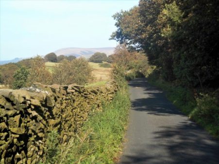
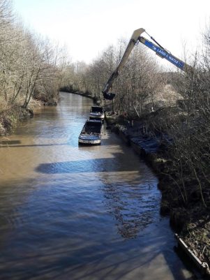
The day starts well with a gentle stroll along the River Kent into Kendal, we chose a riverside option over the suggested canal route which we have both very familiar with. Perfect, sunny and clear, boding well for the day ahead. The filled-in Lancaster Canal was joined on the edge of town as it headed for defunct wharves and warehouses at the heart of a previously industrial Kendal, the coming of the canal improved the supply of coal from Lancashire to those industries. However today we were diverted up past an enormous cemetery to visit what remains of Kendal Castle on its elevated hill. AW, when he first moved here lived in a council house just to the north-west of here.

Castle Grove AW’s first house in Kendal.

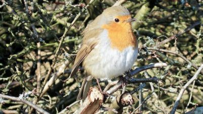
Many of Kendal’s dog walkers were up here this morning enjoying the weather and views, Scout Scar was prominent to the west whilst looking north to the Lakes there were some ominous clouds on the summits. The castle has guarded over Kendal since the C12th and has apparently strong links with Katherine Parr, the 6th wife of Henry VIII.

A Wainwright. 1975.

Heading down we walked through neat Victorian terraces, crossed the River Kent on a footbridge and joined the crowds on Kendals high street. The town hall where AW was Borough Treasurer stands proud at the top of the street.  When I explored Kendal recently I was unable to find Collin Croft one of the sites sketched by  AW in his Westmorland Heritage, I tried a little harder today and we found our way into a hidden maze of alleys typical of the town.

We then walked up leafy streets heading out of town. A sign above a gateway alluded to links with a previous Presbyterian Chapel. An obelisk appeared without any information. 
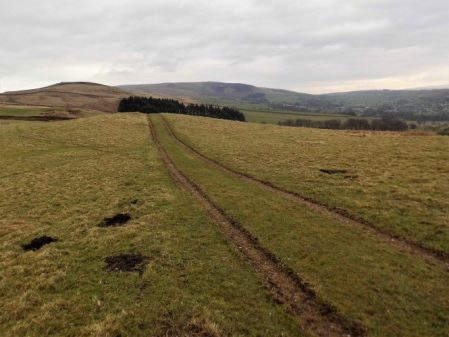
Over the Kendal bypass, interesting milepost,  we entered fields that are marked as an old racecourse and also the start of the Lake District National Park. The sky was clouding over despite the optimistic forecast. Scout Scar, or more correctly Underbarrow Scar, is a limestone escarpment popular with the people of Kendal and today walkers and joggers appeared from all directions.  We arrived onto the ridge near a large cairn with the trig point to the north. It was then that the heavy rain hit us, views disappeared and we walked on grimly towards the ‘mushroom’  shelter. Any semi-shelter was already taken and it was too cold to hang about so we just carried on to the end of the fell, a slight anticlimax to what should have been a memorable situation. The shelter was erected in 1912 in recognition of George V’s coronation. It has a 360-degree indicator which I had been interested in viewing but all that was lost in our haste to get off the fell.

A Wainwright. 1975.

Calmer sunnier conditions returned as we walked off nearby Cunswick Scar on Gamblesmire Lane, a bridleway we followed down into a different landscape. Undulating green fields, stone walls, sheep, whitewashed squat farms all make up the Cumbrian landscape, of course in AW’s time it was Westmorland. Gamblesmire Lane, almost Quagmire Lane in parts continued through this landscape. In sections it was a unique, hedge defined rollercoaster.

We eventually found somewhere to sit and eat and then it was field after field heading towards an isolated tower. A farmer was sorting out his sheep for market and seemed keen to chat, he must lead an isolated life up here. Eventually, we reached the restored bell tower of the C17th St. Catherine’s Church, the rest of the church was demolished and a new one built a short distance away, seen in the picture below.

A Wainwright. 1975.


More idyllic fields were traversed and we were soon back at the car and a drive home in lovely low sun.

*****

WAINWRGHTS WAY. 6. HOLME TO HAWES BRIDGE [NATLAND]


A bit of limestone.

This walk gets better and better. We are lucky today with the weather, sun and heavy showers. We only had a few of the latter, whenever Sir Hugh put his waterproofs on the sun came out. The walk out of Holme was easy along a couple of quiet lanes which brought us to Holme Mills the linen mill I mentioned in my last post. A delightful spot with its mill pond but we had taken the wrong way and were well off course. Rewind back into Holme and we started again, this time picking up the path alongside Holme Beck with a series of squeeze stiles. These iconic stones become a feature of the day linking fields together.

We then had a few flooded fields to negotiate to reach the A6.

Safely across the floods with Farleton in the background.                                         

Now little lanes, between occasional characterful cottages, ran parallel to the A6 but in a different time zone. This is limestone country.


We passed the fortified farmstead of Beetham Hall, built to defend the locals from marauding Scots.

A Wainwright. 1975.

Next, we were in Beetham, a little hamlet with a long history from the Doomsday Book. I didn’t know about the village stocks until today but I’ve spent many hours in the village pub, the C17th Wheatsheaf Inn. What made Beetham prosperous was the corn mill dating from the C12th and we passed it on the River Bela.

What followed was a promenade through the parkland of Dallam Tower with its Fallow Deer wandering freely. We exited by a bridge over the River Bela before it slides into the Kent Estuary.

Milnthorpe was bypassed on an enclosed path climbing a little ridge with superb views of the Kent Estuary and the Lakeland fells ahead. Across the way was St. Anthony’s Tower a ‘folly’ erected in 1832 as a memorial to the passing of the Great Reform Act, they did things like that in those days. A folly to remember ‘Brexit’  would be very appropriate – but where would you erect it?

A Wainwright. 1975.

We popped out onto the A6 and walked down the pavement until a lane going right. Paths were followed into Heversham, crossing at one point the disused Furness rail line linking Arnside to the main west coast line at Hindcaster. We passed Dallam school, a well-respected establishment. Lunch was taken on a seat in the churchyard of St. Peter’s. There was an ancient cross [?C8th] in the porch but the inside of the church was uninspiring Victorian, having been ‘restored’ by the Lancaster firm of architects Sharpe, Paley and Austin. They were responsible for a large amount of work on churches and country houses in the north-west.

Avoiding the A6 surprisingly steep paths over little hills gave good views down the Kent Estuary, ahead to Scout Scar above Kendal and distant Kentmere with the HIgh Street range we have to tackle. Eventually, we dropped down to Levens Hall, its topiary hedges hidden behind high walls. I was looking forward to the walk alongside the River Kent in Levens Park as I have passed it so many times without venturing away from the car. It didn’t disappoint. It was a delight. Competing with Dallam Park the path climbed above the winding river through mature trees, Bagot Goats walked past us and Black Fallow Deer sprinted by.

Don’t get in my way.


Leaving the park we had a short stretch on the line of the Lancaster Canal with its incongruous field bridges. We left the canal at the aqueduct and skew bridge in Sedgwick visited on another occasion.

Today we walked down past Sedgwick Hall, the previous home of the Wakefield family, of gunpowder fame, to rejoin the River Kent.

A Wainwright. 1975.

A lane brought us onto its banks at a suspension bridge. The original bridge here was built in 1858 to take workers across the river to the gunpowder works on the west bank [now a caravan site] it was washed away and replaced by the current bridge,1875.

The river could be heard roaring ahead and soon we were above a gorge with great views down to the rushing waters.  The river then had a short peaceful passage before rushing once again under Hawes Bridge, all very exciting and a fitting end to today’s walk.


A Wainwright. 1975          

For videos of the river in spate have a look at Sir Hugh’s http://conradwalks.blogspot.com/2019/10/wainwrights-way-holme-to-crowpark-bridge.html

*****

WAINWRIGHT’S WAY. 5. HORNBY TO HOLME.

Let it rain.

The good weather had to end – it had been raining all night and I was half expecting a ring from Sir Hugh to call off today’s walk. No, not really, he is far more resolute than that. And anyhow it would be drier by late morning, I do miss Dianne Oxberry giving us the NW forecast but there are some interesting successors.


The River Wenning in Hornby was probably running a good two feet higher than when I finished my last walk.

Hornby was short-lived and we were on a lane passing the motte and bailey of  Castle Stede, C10th, somewhat obscured by trees and rain. Down below was our first view of the River Lune which we crossed on the graceful Loyn Bridge. Wainwright sketched thsese in his Lune edition. It was here we left Bowland which has provided some excellent walking in a thankfully relatively unknown backwater.

A Wainwright. 1980.

We splashed our way through soggy fields, struggled over slippy awkward stiles, jumped or waded through little temporary rivers; all the time the rain came steadily down. Everywhere was drowning.  After the Gothic style Storrs Hall a tarmacked lane gave some respite although it was more like a river in parts [damp heading photo]. It climbed over pleasant hills but the views were minimal, vaguely ahead was Hutton Roof an area of limestone outcrops which we regularly climbed on. My camera was safely stashed most of the time.

Unhelpful.

Storrs Hall.

I’d never heard of the River Keer before although I must have crossed it many times by road, rail and canal as it winds its short way onwards through Carnforth to Morecambe Bay. Today it was a raging stream barring our progress but hidden in the trees was a small bridge. Unfortunately, a sign stated it was closed as it had been partially washed away in floods, we had no option but to trust it as we couldn’t have waded the fast-flowing water.  I sent Sir Hugh across first.

Pleased with ourselves for overcoming that problem we were nearly run down by a train whilst crossing the Morecambe to Leeds line.

Oh! and it was still raining into the early afternoon. More importantly, we had just left Lancashire and entered Cumbria, formerly Westmorland. Westmorland was a county of the Lake District until in 1974 it along with Cumberland and bits of Lancashire became Cumbria. Wainwright must have had a soft spot for Westmorland because he brought out an academic book on its history and villages – Westmorland Heritage, 1975, now out of print and expensive second hand.

More ups and downs followed on paths that receive very little usage. Eventually, there was a glimmer of blue sky as we reached a better path on a ridge, it was nearly two before we found somewhere dry to sit and eat a spot of lunch.  Here our topic of conversation turned from Brexit to Sir Hugh’s flask which he was convinced was not his, maybe the top was but certainly not the body. It seemed to pray on his mind as he was still debating it as we started on our way.

My camera had not been used much in the wet weather but now as things cleared we had views of Morecambe Bay, Arnside Knott and the southern Lakes. When I use the term ‘Lakes’ I am really referring to the Lake District and particularly its hills, odd that we use such a  contraction.

The distant ‘Lakes’.

Arriving at a familiar road leading out of Burton up to Hutton Roof, we are less than a mile from the former but WW climbed a wall and took us on a circular tour of the land around Dalton Hall [which we never glimpsed]. There didn’t seem to any logic for this but I suspect Nick Burton is taking us on a voyage of discovery based on AW’s Westmorland book. No complaints, except the extra mile, as the estate was quintessential English parkland of a certain era. A wonderful selection of trees planted way back when.

Dalton Old Hall Farm.

A pair of ‘kissing trees’.

We eventually arrived in Burton-in-Kendal, to give it its full name. People drive, too quickly, through its narrow main street, I’ve probably been guilty of that, but on foot you realise the wealth of architectural buildings in the village. At one time Burton was an important stopping off point on the Lancaster to Kendal carriageway. It became an important corn market in the C17-18 and its wealth is reflected in its houses. The canal and then the railway took all its trade to Kendal and it has not really improved since then. I was sorry to see the Royal Hotel, in the centre next to the market cross, looking closed and derelict, we used to drink a pint or two here after a climbing evening on Hutton Roof or Farlerton.

A Wainwright. 1975.

Our next objective was to join the Lancaster Canal for a mile or so into Holme. We followed a lane signed from when Burton had a station, the mainline trains just fly through now……as does the motorway with Farleton Crag above.

We took to the more sedate towpath of the Lancaster Canal for our final mile into Holme. I have walked this stretch before and the towpath was just as muddy. No boats use this northern section which has been cut off from the rest of the system by the motorway. Below us at one point is Holme Mill with its lake, at one time a flourishing C19 linen mill with flax grown locally. On the other side of the canal are some well-preserved coke ovens.

At bridge 149 we climbed out into Holme which we will have more time to explore on our next stage of WW. Apart from some dampness of my socks I had coped with the day’s rain and floods which had given us an extra perspective to a simple walk.

*****


WAINWRIGHT’S WAY. 1. BLACKBURN TO WHALLEY.

Escaping the city.

My train was full of lively pre-match Blackburn supporters. Most didn’t have tickets and exited the station somehow, I was glad I wouldn’t be on their train after the match. AW was a lifelong Rovers supporter.

Outside the station, as I gathered my bearings I was struck by the number of expensive-looking cars, with modified exhausts and booming stereos, cruising around aimlessly at high speeds. I refrain from comment.

I began the long walk up Audley Range. Mills at the lower end near the canal have gone and been replaced by budget shopping units. From the canal upwards AW would have had almost a mile of two-up, two-down terraced housing. There has been demolition in parts giving little cul-de-sac estates. a mosque and many Asian shops but the higher you get the more you are attuned into AW’s time when he trudged up and down from the centre to number 331, his birthplace and where he lived until 1931 when he married. Until 1935 a tram ran halfway up before going to Queen’s Park.

I couldn’t resist calling in at one of the little Asian ‘Sweet Shops’ to buy a couple of samosas for my lunch.

Fittingly there is a plaque on 331 to commemorate Wainwright though I wonder whether any of the Asian population hereabouts will realise the significance. Opposite his house is an open space formerly a brickworks producing the millions of bricks for the housing and mills.

I reached busy roads on the edge of town. Up here AW attended primary schools, now demolished under ring roads and Tescos. I was glad to turn down to the Leeds – Liverpool Canal at Gorse Bridge. The canal would have been lined by warehouses and mills and here is one of the last, the derelict Imperial Mill once employing 300 until closing eventually in 1958. Many of the mills diversified into minor industries after cotton had crashed.

The canalside walk took me past the Whitebirk Estate, shops and car salerooms, and under the maize of roads connecting with the motorway system. One always sees things differently from a canal and then the next time I drive around these roads I’ll reminisce to myself and try and spot the canal. I ate my samosas as I walked the towpath and realised they had quite a kick to them.

Before long I was in a more rural landscape and leaving the canal to climb steeply up onto the ridge of Harwood Moor. An old bridge is crossed, this is the line of the former Blackburn to Padiham railway. The industrial landscape is left behind and suddenly you have a view of Longridge Fell, the Bowland Hills, Yorkshire peaks and Pendle. It was these northern edges of Blackburn that AW  explored as a youngster and subsequently with work colleagues. A certain Harry Green wrote a regular walking column in the newspaper and produced some guidebooks to the area and into the Ribble Valley and Longridge Fell.  One of AW’s walking companions, Lawrence Wolstenholme, kept a diary of Harry Green inspired walks and his descendants still have a copy of Rambles by Highway, Lane and Field Path. H Green 1920. So it is certain that they walked these trails out of Blackburn.

I entered a farmyard patrolled by a bull and hesitated before rushing to the other side and safety. All the fields up here seemed to contain frisky bullocks so I did a little creative road walking to get me on my way. I was soon on a higher ridge with even more extensive views.

Looking back to Blackburn.

Longridge Fell and the distant Bowland Fells.

Down a reedy path to the Dean Clough Reservoirs with Pendle in the background and then I make my own way up above them to come out onto Moor Lane above Langho, it was only last week that I visited The  Lord Nelson Inn here for lunch. Its a very basic but friendly pub with good beer and a limited home-cooked menu,  a couple came in and asked about dining “have you a gluten-free option?”   “No!” was the simple answer.

I didn’t have time today to call in for a pint but marched off along the virtually traffic-free Moor Lane. At one point I glimpsed a deer eyeing me through the trees. Whalley Nab is at the end of the lane directly above Whalley and the River Calder. The River Calder flows through Whalley to join the Ribble, leaving behind its industrial hinterland where in the distance can be seen the Martholme Viaduct which carried the aforementioned Blackburn to Padiham railway. I had a birds-eye view of the Ribble Valley and Whalley, making out the street plan and the more famous railway viaduct over the Clitheroe – Blackburn line I travelled this morning. The Ribble Valley was one of AW’s many sketchbooks done in later life, Nick Burton has illustrated his text with some of these sketches.  It will be interesting to compare AW’s views with my own as I proceed.

A Wainwright 1980

Before I knew it I was crossing the Calder into the busy main street. The impressive 13thC church was closed. Whilst waiting for my bus I had a very short time to look round the Abbey ruins, free entry today – Heritage Week or something. They deserve more so I’ll return for a longer visit.


I’ve finished the first stage of Wainwright’s Way and I’m looking forward to the rural walking to come.

*****

NORTHING 438. SALTAIRE TO HORSFORTH [LEEDS]

What could have been an uninspiring day in the hinterland of Bradford and Leeds turned out to be almost a green corridor of pleasant walking. It was not difficult to keep close to our lateral line with the proviso from Sir Hugh to incorporate a visit to his primary school in Thackley.

From the rail station in Saltaire we quickly reached the Leeds – Liverpool Canal to follow it off and on throughout the morning. At first all was industrial, historically relating to the canal with some fine mill buildings brought into the 21st century.

There were a few scattered sculptures including this one which was a pun on the Salt Mill connection…Hanging on the wall of my garage is an Ellis-Briggs cycle frame, probably 40years old, so I was delighted to pass their establishment which has been building steel frames since 1936. The cycling scene was booming in the 1930’s and the other notable established builder was W.R. Baines, whose factory was based at Thackley, see above and further into the walk. Coincidentally I rode a 1950’s Baines ‘Flying Gate’ cycle for many years.


Some nondescript scenery followed enlivened by some dubious and unsuccessful canal boat manoeuvering, it is difficult to do a three point turn.

Climbing away from the canal on cobbled paths above railway tunnels we entered Thackley, a mixture of old stone houses and modern estates, and found Sir Hugh’s school still open and extended since his time. Up here was the local cricket club with a very challenging sloping pitch, Sir Hugh’s father had been a member.

From the map we were not sure whether we could access the canal towpath from open country but thankfully there was a bridge. Soon we were sat on a bench looking down locks near Apperley Bridge, this was a busy stretch with pedestrians but no boat movements.Crossing busy orbital roads took time unless there were lights. We switched from the canal to follow the River Aire alongside the sports grounds of Woodhouse Grove School. The river continued through remarkably rural scenery despite being close to the railway and new housing developments.

Pleasant suburbs gave us twisting streets heading for Hawksworth Park which turned out to be a wooded valley. More parkland and upmarket housing and we arrived at our excellent budget hotel for the night.

*****

NORTHING 438. OLDFIELD TO SALTAIRE.

There were several unexpected highlights on today’s walk and despite heading into the congested Aire Valley we enjoyed rural walking throughout on one of the warmest sunniest February days I remember.

Continuing our straight line walk meant once again logistics of two car parking. Sir Hugh suggested Saltaire as a finishing point so we arranged a rendezvous in the large free car park there, all went well with my journey until I became stuck in early rush hour traffic, not the best of starts for a day’s walking. With the late start and more traffic problems we drove back to our last point in the Ponden Valley.  Sir Hugh seemed to know all these intricate Pennine roads and little villages or at least the lonely Public Houses where he spent his money when living in the area as a young man. We were stunned when the lane up to our isolated parking spot was closed necessitating back tracking and finding an alternative route on what was becoming a frustrating morning.

At last we set off down a bridleway high above Ponden Reservoir only for Sir Hugh to realise he’d left his phone on the car, fortunately we hadn’t gone far. This initiated a conversation on things left behind on walks and the cut off distance where one is prepared or able to return. Poles, passports, waterproofs, cameras and particularly hats were prominent on the list. We ran into problems with unmarked, difficult to follow and blocked paths in the Oldfield area and at West House farm admitted defeat and took to the road for a while. None the less there were many interesting houses passed.

High above Ponden Reservoir.

Before he’d realised his loss.

We were concerned with our poor progress after the delayed start on what would be a long day but as often happens things suddenly improved and remained so all day. We encountered a deep gorge not apparent on the map and decided to take the old flagged path alongside down to the River Worth which was then followed for a mile or so through green fields. We reached a road at an old mill that had been restored to provide modern living accommodation. There were several pack horse type bridges on this stretch reflecting the days when the valley was thriving with small riverside mills.

On the edge of Haworth I had noticed on the map a ‘Railway Children’s Walk’. The Railway Children by Edith Nesbit, published in 1906, was set in Yorkshire and a 1970 film used The Keighley and Worth Valley Railway as a backdrop. I remember watching a BBC TV series back in the 50s. Thus Haworth’s tourism benefits from both the Bronte connection and the preserved steam railway.  We followed the lane across the Mytholmes railway tunnel made famous in the film …

… I regret now not going the extra few hundred yards to view the authentic Oakworth station featured prominently in the film. No trains today so we climbed up the steep hill to the busy Cross Roads and would you believe it – halfway up a steam train came into view way below us in the valley, bad timing. Up on the road the stone houses all bore that blackened look of the industrial past.

At Barcroft we reached high open countryside and enjoyed marching out with distant views to Bingley. In the fore ground was a prominent rocky tor, Catstones, and we speculated on the climbing possibilities and the height of the faces.

A bench below was perfect for lunch, I didn’t have the energy to ascend to the rocks. An inscription was dedicated to a Cllr. Ron Senior who pioneered a circular walk around Cullingworth, Senior Way. We felt well qualified to follow it.

We ended up just using the pavement through Harden but then entered St.Ives country park for a popular woodland walk to the edge of Bingley. The park is yet another old estate taken into council ownership providing a wide range of activities, we only skirted the edge.

A lane dropped down to bridges and fords at Beck Foot, a site of old mills, all very picturesque in the sun. An ecyclist proudly showed us his bike and extolled the virtues of battery powered leisure, not sure what it is doing for his fitness.

The River Aire, on its way into the industrial Leeds, was followed through fields to give another aspect to this day’s walk. Surprisingly rural although there was rubbish evident. A last stretch of woodland linked to the Leeds Liverpool Canal which took us into the heart of Salts Mill at Saltaire. Formerly a textile mill, now an arts centre, built by the philanthropic Sir Titus Salt in 1853, along with the adjoining Saltaire village in the hope of improving the conditions for working people. The whole complex is worthy of a day’s exploration. We found our car as the sun was setting and joined the heavy traffic home.

*****

NORTHING 438. BARROW TO NELSON.

We are out walking our Northing 438 line again. A lane leads steeply out of Barrow through mainly new housing, ribbon development if ever I saw it. Crossing the busy A59 we continued climbing into Wiswell, an interesting little hamlet with a famous gastropub. A van was delivering organic vegetables to houses, one of these expensive subscription ideas where you probably finish each week with a box still full of potatoes and carrots. From here the route became moorland onto a ridge which was really an outlier of Pendle Fell, the mast marked on the map seems to have disappeared. We had climbed 500ft in a mile and were beginning to steam in the mild weather. Sabden could be seen in the distance. Below us was the large hidden valley of Sabden Brook and we slowly made our way down to pick up tracks into the village. I mentioned the famous Sabden Treacle Mines of which Sir Hugh had no knowledge, sadly they are no more and I will leave those with curiosity to investigate. We followed lanes to the 19th-century church and then out past a farm from where a pipe led into the fields. This pipe actually came out of the midden slurry tank and snaked into the fields, a tractor pump was starting up to inflate the pipe which we followed almost hypnotically for several fields. Eventually, the pipe seemed to connect up with another tractor with spreading machinery, but nothing happened. By now we realised we were off track so diverted back onto a rough farm road. This led to the 16th century Dean Farm with its wonderful mullioned windows and incongruous 19th-century extension.  Muddy fields and rough reedy grass below the ridge of the so-called Forest Of Pendle led us to lunch on the wall of Tinedale House. A climb onto the grandly named Rigg of England which was mainly equestrian farms. Up here were good views back to the massive bulk of Pendle and across to Newchurch in Pendle which we had visited on The Lancashire Witches Walk. Below to the south was the industrial Burnley – Nelson – Colne corridor. It didn’t look too bad from up here. Ancient tracks down the hillside brought us into Fence alongside the White Swan pub where I recalled a seasonal wild garlic meal.  Where do these memories unexpectedly come from?

We made a mistake in trying to follow footpaths parallel with the busy road, we were hemmed in by unnecessary plastic ‘hedging’ on the boundary of more equestrian enclosures. Escaping eventually into a large graveyard, where we were surprised by the number of Muslim graves. We started dropping down into the valley alongside a small beck. Surprisingly green paths led us into the heart of the Lomeshaye Industrial Estate. At the large Wellocks complex we enquired what  ‘The perfect ingredient‘ was but unfortunately only Polish was spoken. Subsequently, we discovered that it was a high-end food distribution firm to the restaurant trade founded originally by a potato merchant whom Sir Hugh had known from his Yorkshire days. It was pleasant to enter Nelson through Victoria Park with its bandstand and paths alongside Pendle Water.

Under the motorway, over the canal and then a steep road heading up into Nelson town centre where we found the modern bus station which gave us a busy ride back to Barrow.

*****


SOUTH PENNINE RING – Marsden/Diggle to Ashton-under-Lyne.


Deja vu today.

This was probably the worst section of the ring, it started off well in the Pennines but became a dreary trudge after Mossley.

The Standedge Tunnel has no towpath so after a good breakfast in The New Inn, Marsden, I caught the bus over to Diggle. It has only just started going into the village after all the snow and ice they’ve experienced up here. This felt like cheating and I should go back one day and work out the route over the summit moors that the canal horses took to connect either end of the tunnel, it would only be about 4 miles. I’m told that in Summer boat trips can be taken through, that would be an experience. Anyhow this morning I’m at the southern gated tunnel entrance and setting off down the Huddersfield Narrow to Ashton. The surface of the canal is lightly frozen over but it is beautiful weather and the dog-walkers are out enjoying the sunshine.

Flights of locks head downhill quickly. This flight has uniquely single paddles top and bottom and on this side side of the Pennines have the suffix W denoting west. Local mills proclaim their names proudly from their chimneys or towers reminding one of the dominance of weaving in these hills. Shout it from the rooftops. Wool, cotton, coal, limestone were transported on the canal. Before long I was down eight locks and passing through Dobcross.

Just past was the old transhipment warehouse for transferring goods to mules prior to the Standedge Tunnel opening. I believe it is now used as the headquarters of the Huddersfield Canal Society. The smaller building was thought to have been a smithy. Also on the other side were old weaving sheds which have been transformed into unique accommodations.A massive railway viaduct looked familiar and further down stepping stones across the River Tame jogged my mind even more  – I had been here recently but couldn’t remember why. Uppermill was passed without realising it, a L&NW marker was a reminder of the railways takeover. A straight section had me alongside Tesco’s in Greenfield where the marina was backed by Alderman’s Hill with its obelisk. Snow patches clearly visible. I definitely had been here before but remember going off to the hills to the East. This time I kept to the towpath.

Woodend Mill and its chimney adjoining a lock at last jogged my memory – I had come out of the woods here on The Tame Valley Way just over a year ago.

At Mossley a mill building above me hissed, moaned, whistled, crunched and groaned like a Schoenberg symphony. apparently it is a timber recycling plant. Worth a listen…


Scout Tunnel could be traversed on a towpath in the dark before the countryside ran out.  The enclosed valley with canal, river, electricity lines, rail and road became increasingly grim. Past industries have left waste lands, an old coal conveyor bridge hangs above the trees in ruins, electric substations all a bit too close, And then you are in or mostly under Stalybridge, a lot of work was needed to reconstruct the canal through the centre of town.Rather grubby urban walking through a corridor of industry and dereliction followed and after a narrow cut the final lock,1W, joined The Ashton Canal at a small basin.  A couple were taking their barge for a spin, 10 years of restoration work on it so far – a labour of love. Disappointingly I was soon diverted away from The Ashton’s towpath as it disappeared underground somewhere. I found myself in an Asda car park with no obvious way out, not the end to the walk I’d imagined. However with a little improvisation and without getting run-over I found a way through and back down to the towpath just as it entered Portland Basin. This was a much more lively and pleasant place with a beautiful bridge over the joining Peak Forest Canal. The Ashton continues into Manchester but I’d walked that section in the past so my circuit of the South Pennine Ring was complete. I’d had 6 days exercise, varied scenery and lots of interest but I think I’ve had enough of canal walking for now.

*****


SOUTH PENNINE RING – Huddersfield to Marsden.


As the train emerged from Standedge Tunnel into Marsden the world changed to white. The roads around Huddersfield were treacherous with the snow that had fallen and frozen. It was all gone by lunchtime. Whilst at Huddersfield station I would recommend the little station buffet on platform 8, used mainly  by railway workers, providing cheap coffee and basic eats. Fortified I retraced my steps down to the Locomotive Bridge over the Huddersfield Broad Canal. The statue of Sir Harold Wilson [local boy made good]  by the station wore a hat of snow.

A short last piece of the Broad Canal took me to Aspley Basin with all its moorings taken. I shared the path with students from the surrounding University and the transition to the Huddersfield Narrow Canal occurs on campus.

Work building the Narrow Canal commenced in 1794 and though it was largely completed some five years later, the construction of 3.1 miles of Standedge Tunnel took a further eleven years. It runs 20 miles to join the Ashton Canal in Ashton-under-Lyne. Passing under the Pennines between Diggle and Marsden, the Tunnel is the longest, highest (above sea level) and deepest (underground) canal tunnel in Britain. The long narrow boats on this canal couldn’t access the shorter locks on the Broad, hence the need at Aspley basin for offloading and transfer. The Canal operated until 1944.  Many sections were infilled by the early 1960s and later developed. What remained of the Canal fell into dereliction. A major effort has restored it to navigable status.

Some of this major restoration has taken place in the city itself with several tunnels being rebuilt. I soon have to take to the streets to avoid one such section where there is no towpath. Heading out now all the usual canal side developments are underway. The River Colne runs alongside and is crossed from time to time. The river provided the power for the mills, supplanting handloom working, and the canals subsequently improved transport before the railways came.

Britannia Mil 1861.


One stretch had been drained to allow workers to repoint the walls, the sad looking canal exposing its normally hidden treasures. This area, not sure where I was, was all a bit run down. Not much civic pride and ne’er do wells hanging about under bridges. I was glad to pass through and head for the hills.

A whole series of narrow locks gained height. A design feature was just one paddle on the upper side yet two on the other end, I couldn’t understand the logic to this, opening one paddle is simpler than two but why not both ends. Incidentally the E on the lock number denotes East side of the system.

Fields opened up at Linthwaite and across the way was the massive woolen mill – Titanic, an iconic building in the Colne Valley. It was built the same year as that fated vessel,1911. It has been restored as apartments and a health spa.

The canal enters Slaithwaite in a narrow channel rebuilt to take it through the village. It has become an integral part of the central area which today was busy with shoppers and visitors enjoying the afternoon sunshine. The old Spa Mill and the Globe Worsted Mill look down on the bustle. There are locks right in the middle of town. All very pleasant and what’s more I was directed to the Handmade Bakery and Cafe in the Upper Mill where I enjoyed soup and a basket of their famous bread. The other half of the mill is occupied by a microbrewery, Empire, which I wisely did not visit as there was more climbing up to Marsden 3 miles away.

The River Colne was always in close proximity with its weirs and mill races. Trains kept rumbling by heading for their Standedge Tunnel.Near Sparth Reservoir, one of ten built to ensure the canal’s water supply, were pleasing cottages and their ruined mill, Cellars Clough.

Marsden, to which I will return to, was glimpsed down below and now in close proximity to the railway Standedge Tunnel was a short distance away. It’s entrance has been described as a Mousehole in the Pennines. The trains to and from Manchester have their own tunnels above. When they were horse drawn barges were ‘legged’ through the tunnel, taking up to three hours. The horses fol owed trails over the hill. The nearby information centre in an old canal warehouse is full of canal history and worth a visit.I walked back down to the surprisingly busy Marsden, a typical gritty Pennine town, to find my accommodation for the night – the welcoming New Inn. Yet another varied walk on this circuit.

*****


SOUTH PENNINE RING – Sowerby Bridge to Huddersfield.

As I stepped off the train in Sowerby Bridge I was face to face with an old climbing friend, Sandy, whom I’d not seen for a few years. A brief chat before the doors closed and he was on his way to Leeds. One of life’s unusual coincidences.

My walking trip around the South Pennine Ring was interrupted last week with the arctic weather which cut off this area.

From Sowerby’s main street the last section of the Rochdale Canal is reached and a couple of locks go down into the town’s basin. This morning I was pleased to see a barge coming up, a couple had taken 6 months leave to follow an ambitious circuit of the country’s canals. In the historic basin itself little moved. This was the beginning of a short section on The Calder and Hebble Navigation which travels to Wakefield and is part canal and part River Calder, hence the name ‘Navigation’. It was engineered by a renowned 18th century canal builder, John Smeaton. The work started in 1759 and the canal opened in 1764, much earlier than the others.

Walking out of town I was surprised by the amount of house building on low ground between the canal and the river- watch this space in a few wet winters’ time!  A long level towpath, popular with walkers and cyclists, brought me to Salter Hebble locks where previously a branch ambitiously climbed up to Halifax. Lots of interesting canal architecture on display as I dropped under busy road intersections to a calmer stretch. An electric guillotine lock lies at the bottom.  Down here are the usual grouping of canal, river, rail and road. There are some impressive arched bridges constructed by the railway companies.  More industrial heritage followed, some ruinous others renovated and reinvented. Balconies on mills mean apartments. I lost my way a bit in Elland where roads have blocked the towpath which swaps sides, a short diversion over a bridge and down Gas Works Lane had me sorted. Elland was noted for the production of Gannex Macs, a favourite of Sir Harold Wilson. More of him later.  High heeled office staff from canalside offices were walking to lunch, I was heading to Brighouse, The river was in close proximity ready to join in the action.

Two tall towers, disused wheat silos of Sugden’s Flour Mill, greet you at Brighouse. They are now unusual climbing walls.  My excellent lunch was taken at the busy No 43 cafe, canals get you to the heart of these Yorkshire industrial towns. The canal basin is alongside shops and car parks. Unfortunately soon my way was blocked and I took to the desert of an industrial estate, is this what keeps Brighouse alive?  Interspersed with the metal sheds were remnants of workers back to back cottages.Where do the workers live now, not in the luxury mill apartment conversions I bet.

Canal trust workers were busy tree cutting and lock mending but I squeezed past to a surprisingly rural section. Up to now the towpath had been a metalled walkway but from here on after the M62 was a muddy path, soon to get worse. Lancashire and Yorkshire Railway markers remind one that as the canals lost their influence the railways took over. The River Calder joined the canal for several sections. The path alongside became dangerous and I had doubts that I could reach Cooper Bridge where the Calder goes off to Wakefield and I would join the Huddersfield Broad Canal heading back up west. Opened in 1776 it was known as Sir John Ramsden’s Canal, a wealthy Huddersfield landowner at the time. Coal was carried from  East Yorkshire to power stations until 1953. A friendly man lives in the lock-keepers cottage at the start of the canal.

The canal immediately starts climbing. Industry reappeared, its never been far away in these valleys, with a mixture of derelict structures and modern sheds.  The light was fading as I entered Huddersfield, dubious characters and graffiti appeared so I cut short the day at the elaborately engineered  Locomotive Lift Bridge, a vertical lifting bridge from 1865 now under electric operation, and climbed past the seven storey Brierley mill to the station for a quick trip back to Manchester. Things will look better in the morning.


A long walk and hence a long post – two canals in one day.


*****


SOUTH PENNINE RING – Todmorden to Sowerby Bridge.

When I was a youngster I would travel alone across the Pennines by rail to stay with an Aunt and Uncle in Manchester. A whole new world would appear to me as the steam train travelled down Calderdale, I have a long lasting vision of steep sided enclosing valleys, running streams and tall weaving houses with mullioned windows. All very atmospheric.  Well I was here again today –  stepping out of the train, albeit a diesel rail car, onto a platform deep in the valley.

Notices told me that Todmorden was Incredible-edible, an initiative focusing on local food and growing vegetables for the community. Throughout the town are plots planted up by locals with information on eating and crops to pick, well there wasn’t much at this time of year. An applaudable venture but I wonder how successful.

Everywhere was quiet as I slipped back onto the towpath in the town centre where there is a watering station for the boaters. Immediately there were boats, I should really be calling them barges, which had been conspicuously rare on the previous sections of the Rochdale Canal in the last two days. A basin full of lived in boats, alternative lifestyles are common in this valley.

Many mills have been demolished and replaced by anonymous industrial sheds.

I caught a glimpse of Stoodley Pike high up on the moor but most of the day was hemmed in by the valley sides, it was bitterly cold when in their shadow.

A canal barge chugged by with jolly occupants, the first vessel I’ve seen in motion. Obviously this area will be busy in the better months with canal traffic. I noticed there were several companies offering canal trips.The river Calder runs alongside the canal and severe damage was caused by the catastrophic floods of Boxing day 2015. A lot of repair work has been carried out in the intervening years.

Approaching Hebden Bridge are Stubbing Locks and Hebble Mill, the workers cottages here are classic ‘back to back’. Hebden Bridge’s centre is a crystals throw from the canal and is thronged with tourists visiting the new age emporiums. Thankfully I find a cafe on the edge, it turned out to be far superior to what its appearance suggested. Cool music, excellent coffee and tasty homemade quiche. Its long list of fancy teas betraying the town’s hippy roots. Back on the canal all was peace and quiet man.       Mytholmroyd was virtually bypassed.  It was the area where counterfeit ‘coiners’ operated in the 18th century, the industrial revolution brought many mills and foundries to the town and it was the birth place of Ted Hughes, the late poet laureate, whose early work was influenced by local nature. A cast iron statue by Kenny Hunter of a hawk  commemorates Hughes’ poem Hawk Roosting and has  connotations to the nearby Hawksclough Mill.        Sympathetically renovated mills and warehouses contrast with the sheds further on.       The canal continues with the River Calder alongside. In the area of Luddenden Foot there must have been vast mill workings judging from the amount of derelict land. A large complex of weaving sheds are being used for other purposes. The surrounding country side is surprisingly green and the canal is a popular recreational pathway in Calderdale.Approaching Sowerby Bridge mills crowd in and then suddenly the canal comes into a town centre car park where I mingled with shoppers. In front is the prominent parish church.The deep Tuel Lane Lock takes the canal under the main road on its way to join the Calder-Hebble canal – but that’s for tomorrow. That prominent Wainhouse Tower in the distance on the edge of Halifax is the tallest folly in the world. The nostalgic Jubilee Refreshment Rooms at the train station provided a good beer whilst I waited for my train.

A couple of extras …

Don’t feed the birds.

Good use of an old mill.                                                                                

***

As I write this the weather forecast for tomorrow is dire. Siberian winds bringing in snow, subzero temperatures and a significant wind chill factor. Maybe the east side of the Pennines isnt the place to be.

***


SOUTH PENNINE RING – Rochdale to Todmorden.

Three lovely  ladies were clearing litter from the tow path this morning.  They do it twice a week and there is always bagfuls.  To cover the optimum length they are riding bikes!       A Canal and River employee is also walking the banks checking for any problems. So it seems that this stretch is well looked after but why are there no boats? Apparently the locks this side of the Pennines are difficult to operate, some moorings are unsafe and there is often low water due to reservoirs previously being sold off. That all seems a shame considering all the work and expense to reopen the Rochdale.  The more you think about it the more audacious does the plan in the late 18th century to take water in a canal over the Pennines become.

Today’s walk had started by a side branch serving the town itself though only a short length remains. Close by is a fine bridge. A few more derelict mills and some housing developments  are passed and then the countryside is reached through bridge 56 with the Pennines in the background.

The inspection man.

This seems a popular stretch. Alongside runs the Manchester to Leeds railway with a boundary stone evident. The towered Firgrove Mill has workers cottages attached… … its redundant steam engine is in the Manchester Museum of  Science and Industry,  watch

Ahead at Clegg Hall there are some well kept former weavers’ cottages and a refurbished mill with apartments.I am heading towards Littleborough but my attention is drawn to a clock tower in the NW, it belongs to the closed Birch Hill Hospital which was built as a workhouse and opened in 1877. It had wards for ‘imbeciles’ and ‘fever’ patients, in addition to an infirmary block.The canal slides past Littleborough but I need a coffee so make the detour into a town bedecked with Lancashire red rose flags, maybe they don’t like being part of Greater Manchester. A busy little place and I find a great little cafe frequented by locals, Rebecca’s, for coffee and toasted teacake. Back streets lead me to the canal where new houses are being built.

I’m now heading for Summit the highest point of the Rochdale Canal by a series of locks in open moorland.There are bays where stone from the quarries was loaded and more mills, mostly derelict. I got chatting to a man who’d worked in Rock Nook Mill, originally a cotton mill but diversifying under Fothergills to high performance textiles.  A fire in 2015 devastated the mill and it now stands forlorn and open to the elements.An abandoned mill further up is unexpectedly the base of a theatrical scenery production firm supplying the whole country.

A few more locks and I arrive at the west end of the Summit basin at 600ft. At the top lock there is a lock-keepers cottage and then the canal widens and contours through rough moorland for about about a mile to the first lock going down the east side of the Pennines.The train line has disappeared into a tunnel.

Passing into Yorkshire 8 locks take the canal down to Walsden, whose church spire is prominent from a distance. The industrial landscape reappears with mills and weaving sheds canalside.

A little group of post war ‘prefab’ bungalows seem out of place. One of their owners, of a similar vintage, is proud they have lasted this long. Nearby are a couple of modern rabbit hutches – wonder how long they will last.At Gauxholme warehouses and boats appear and the canal passes under a cast iron railway bridge with Gothic abutments. More locks drop the canal down quickly passing back to back cobbled streets and then in front of you is ‘The great wall of Tod’. This massive wall of blue brick supports the railway high above, quite dramatic and hidden away from the rest of the world. How many millions of bricks? A Dipper, that iconic northern water bird, was passing up the canal, a Waterhen taking a lift on a plank and a Robin singing its heart out on this sunny day.

The canal entered  busy Todmorden at the main street with an abrupt guillotine-like lock dropping it down on its way, without most of the tourists knowing its there.. I had a train to catch so exploring the town will have to wait.

*****


SOUTH PENNINE RING – Manchester to Rochdale.

This was a 12 mile day full of interest with old mills coming at me thick and fast. The Metrolink tram took me to Piccadilly and I quickly found my way onto the canal basin where the Rochdale Canal emerges from the depths having already passed 9 locks since Castlefield. 3 years ago Sir High and I had braved these subterranean passageways on our Cheshire Ring jaunt.

Today my way was blocked by a locked gate meaning I had to retrace my steps and try again on the opposite side. The numbers on the bridges didn’t seem to tally with my map until I realised I was confusing lock numbers with bridges.  Not a good start, you shouldn’t get lost on a canal!

The Ancoats area of Manchester where the Rochdale Canal next passes through is known, tongue in cheek, as The New Islington because of all the new buildings many which utilise the old mills and warehouses in luxurious conversions. Marinas dot the developments. It is good to see this rather than dereliction, vandalism and demolition. The cranes are busy again with city centre living.

Some famous buildings are passed – Brownsfield Mill the old AVRO factory for aircraft manufacture;  the Royal  Mill a rebuilt 20th century cotton mill now under residential use, originally named New Old Mill a plaque commemorates a royal visit in 1942 and hence the name change;  the Beehive a former cotton mill connected with Sankey’s soap at a later date now earmarked for commercial use. There are many more. Names allude to the past – Cotton Fields, Coal Pits Lock etc.

But before long I’m back amongst average housing, urban sprawl and litter. The honking Canada Geese are everywhere fouling the towpath. Even the graffiti is not up to standard. But the sun is shining, there are few people about and I feel glad to be setting off on a new exploration.

To compensate there is the fine 19th century Victoria Mill canal side, a former cotton spinning mill. It was designed as a 6 storey double mill with a shared central chimney. Now office and residential use.

The next area is Newton Heath which had an industrious past associated with the canal – die works, bleach works, a tannery, rope works, glass works, brick works as well as the textile mills. A row of maisonettes is named after one of the young Man United players killed in the Munich air crash, 1958, I wonder if the other 7 are likewise nearby, I wish I’d looked.

I nip up a side street for a morning coffee with toast and jam in a basic cafe frequented by locals lingering over their fried breakfasts. Modest housing fronts onto the canal in contrast to the large Regent Mill whose brickwork is exquisite.It bears the names of Russell Hobbs and Remington and I believe they are still trading there.

Failsworth arrives with Aldi, Lidl, Tesco and KFC, the latter temporarily closed due to lack of chickens which has almost reached a national disaster according to some news outlets. The canal continue obliviously to pass the large Ivy Mill. This cotton mill was converted for aircraft assembly during WW2 and is now office space.A brief stretch of ‘countryside’ was passed through before the canal is squeezed under the M60 without a towpath, an elaborate foot bridge over the motorway reunited me on the other side heading for the Boat and Horses pub. A name recollecting the passage of hundreds of horse drawn cargo boats, it did not look inviting today having become a rotisserie and carvery for roadside travelers. The  nearby J.W. Lees Greengate brewery has produced real ale since 1828 and is still family run. I couldn’t pass through the area without sampling their product so at the next more modest canalside pub, Rose of Lancashire, I had a quick half. This inn opened in the early 1800’s as the canal was being developed and was a haunt of local radicals and reformers trying to influence parliament to improve the lot of the working class. The Peterloo Massacre 1819, in Manchester, was a defining moment in that struggle. The canal winds its way through the outskirts of Oldham with the railway a constant companion. This is the Manchester to Leeds engineered by George Stephenson and opened in 1841, I was to become well acquainted with its course in the next few days.  In the vicinity the railway crosses the canal on a beautiful cast iron bridge.

Over the River Irk, past the open spaces of Chadderton Park before more locks rise at Slattocks.

The next barrier is the M62 where the canal has been diverted under a culvert with an ingenious floating towpath. The original line is a boggy passage to the left. A lad was fishing for pike with a large lure which he expertly cast down the water. A previous fisherman told me that it was too cold for the fish, there was almost a layer of ice on the water.

The way into Castleton was enlivened by a cheery mural from a local primary school.

Just when you thought you’d had enough mills the massive Arrow appears. Cotton has given way to storage. I’m not sure how the canal goes under the M627 but I was diverted through retail parks to meet up with it for the last pleasant mile into Rochdale where I was accompanied by many dog walkers. Well the canal, despite its name, ironically doesn’t go into Rochdale but skirts the town at a discreet distance. Things have changed in Rochdale since the mills closed.

The train journey back on that line to Manchester Victoria only took 15mins.

*****


SOUTH PENNINE RING – A CANAL WALK.

I can’t get away from canals at present. Family duties will see me down in Manchester for a few days so I decided to look at this circuit which I’ve had on the back boiler for awhile.

The South Pennine Ring is a 71mile circuit north of Manchester combining parts of the Rochdale, Calder & Hebble, Huddersfield Broad and Narrow and Ashton Canals.

Completion of the circuit by boat has only been possible since 2002 with the restoration of the Rochdale and of the Huddersfield Narrow. Enthusiastic and dedicated pressure groups made this feasible but major engineering work was needed, particularly where motorways crossed the defunct system. Money came from many sources and various plaques reflect the Millennium  Lottery Charity funding.There are a large number of locks, needed to cross the Pennines twice, and the highest and longest tunnel [Standedge] in Britain. The original canals played an important role in the area’s industrial and weaving heritage. Several interesting towns are visited and  there are reminders of the past everywhere. Obviously the only canal traffic now is pleasure boats but the towpath gives the additional benefit of a long distance circular walk.

The Canal & River Trust was launched in 2012, taking over from British Waterways, to oversee    canals, rivers reservoirs and docks in England and Wales. Throughout the walk there will be much evidence of their work, aided by volunteers, to maintain this important heritage.


I had previously walked most of the Ashton from Piccadilly to Portland Basin three years ago.  So the plan was to walk the rest in a clockwise direction over a few days using my son’s house in  Stretford as my base, taking public transport at the beginning and end of each day. An economical and fairly practical way of completing the ring. This would be another step towards my fully fit walking rehabilitation since overuse damage to my left hip’s ligaments last year.

An excellent map is available –


MY ANNUAL SERVICE AND MOT.

“Your car will be ready about 4pm, we’ll phone you”

I’m in one of the outlets on the vast ‘motor village’ out by the docks in Preston where one can buy just about any make of vehicle. It was just after 9am in the garage reception area, more like a lawyers office than a garage but the mechanics must be hiding somewhere. Last year I took the opportunity to cycle round the Preston Guild Wheel but I’m limited to easy walking at the moment. The day was perfect, blue skies and winter sun.  I had to make the most of it so I planned on walking a 7 mile stretch of the Guild Wheel, its NW segment. But first a free coffee and a read of the paper – I had a lot of time to fill.

I knew from past experience that I wouldn’t enjoy the first noisy mile alongside the main road but as soon as this was crossed and left behind peace and tranquility returned. One’s mind becomes clearer and the rural calm helps with those nagging problems. The sun always helps.

I found myself on the Ribble Link which gives access at long last from the Lancaster Canal to the rest of the network once across The River Ribble. On a whim I decided to follow it towards the river but after a short distance and a couple of locks the the ‘path’ was too boggy for my trainers. As it is a new structure, 2002, there was no need for a traditional towpath. This link is basically Savick Brook which has been widened and equipped with locks to make it navigable. At a nearby bridge I watched some regular dredging going on and was able to chat about the Link with the Canal Trust workers. I have never seen a boat on this length before and wondered about its usefulness but they assured me 300 boats passed through last year.

Through the UCLAN sports grounds and  alongside housing at Cottam on maturing paths, dog walkers, pram-pushers, runners and cyclists all sharing and happy in the sunshine.

Soon one wanders into new developments appearing everywhere in north Preston like the pox. Their names are fanciful. They never come up with Muddy Meadows, Crowded Copse, Restricted View, Non-environmental Nook, Flooding Fields, Ruined Manor…

Broughton village however has recovered its relative tranquility since the long awaited by-pass has opened. The road is barely recognisable. Where’s the traffic queue? Probably somewhere else but they deserve a bit of peace for awhile.In a slower mode I noticed for the first time a stone ‘pinfold’ [where stray animals were held until collected] by the path and also a war memorial.

I walked on crossing the new road, named in honour of a local man awarded the Victoria Cross in the WW1. I was eager to see what has become of the cycle route along Durton Lane since the road works, again it is a changed world. There is no longer any through traffic but engulfing housing will eventually destroy its character.

A couple of snippets from this area …

The sign says No fly tipping.

Wouldn’t like to learn to swim here,

I let my phone guide me through the residential streets near the hospital and then on familiar ground down Plungington Road to enjoy a late lunch in my favourite south Indian cafe, RK Sweets. Vegetable thali for £5.

Rather than catch a bus just yet I wanted to put more miles into the lovely day so on I walked through the University area and past the international cafes of Friargate. What an opportunity to look at the newly refurbished market hall which though not yet fully running could give some life back into Preston city centre. I don’t come into town very often and I ended up in Wilkinson’s Camera shop spending money on an impulsive purchase of a replacement compact. Nearby was the bus station which is also being refurbished as part of Preston’s improvements.  The crowded bus dropped me a mile short of the garage so in the end I’d walked about 13 miles by the allotted 4pm

“Everything is OK and you’ve passed the MOT”     So all’s well.


LANCASTER CANAL 8. Sedgwick to Kendal.

For our last day the sky was blue, the ground hard with frost and the surroundings covered in snow – magic. Of course this was all planned.

We were soon back up to the line of the canal and making good progress through the fields on the edge of Sedgwick which seemed to have some pleasant housing tucked away from modern hectic life. The village first enlarged due to the nearby gunpowder works on the River Kent, subsequently residential properties have been built in what was probably the estate of Sedgwick Hall mentioned in my last post. The canal crosses a road on a skewed aqueduct in the middle of the village, these were built for strength.

Lovely countryside was traversed with drumlins to our right, isolated bridges and then woodland giving variety.

Looking to the east above St. Marks Church in Natland was an attractive Fell I didn’t recognise, looking on the map it is named The Helm and has an Iron Age Fort [Castlesteads] at its southern end. Yet another place to explore on a return visit.

Onwards under more isolated bridges with the lower Kentmere fells  in the background. This area is well walked being just a stroll out of town.One can see why Kendal is a popular place to live – a lively historic town in beautiful surroundings.

And then we were into the streets and parks of Kendal, the line of the canal still walk-able with frequent signs. A walking cycling corridor out of town. Passing behind the leisure centre the site of old coal wharves has been utilised by local schools to provide environmental studies. 


One renovated bridge had iron work alluding to the history of rope-making  hereabouts.

A crossover bridge is encountered and duly crossed, there have only been three on the whole of the canal. Obvious old mills are passed, the castle is up to the right somewhere. More filled in wharves at Lound, with informative interpretation boards,  and then the main terminal basin is reached, now only identified by warehouses. These are now used for other purposes though some have links back to the past. A small building is signed as being the original ticket office for the packet passenger boats. In the last warehouse, now modernised, is the head quarters of Gilkes manufacturing turbines on this site since 1856. Apparently inside are some original features of the basin.One can only imagine the industry and flow of goods right in the centre of Kendal in the 19th century. A return visit is needed to explore this industrial heritage further.

Below is an old aerial shot of the terminal basin [Stricklandgate House Trust]


Our way across Gooseholme Bridge was closed due to flood damage, so we braved the traffic on a road bridge to reach Baba Ganoush for a welcome bowl of delicious soup. This was followed by the three of us ‘running’ to catch the 555 bus, thanks to the driver for waiting for us.

So my journey up the canal from Preston is completed. It has been a very pleasant stroll helping my hip ligament rehabilitation but more than that has been full of interest and kindled my desire to explore this area further.


LANCASTER CANAL 7. Holme to Sedgwick.

We were the only ones stood waiting for a bus on the deserted slip road off the busy A590 roundabout but sure enough the 555 appeared and took us back to Holme and bridge 149 on the canal. Driving up the motorway this morning the snow covered Lakeland mountains looked majestic, blue skies and bright sun promised a good day – on the Lancaster Canal not those mountains.  I have just realised we are now walking in Cumbria so ignore my tagging of Lancashire, somebody moved the boundaries.

Today’s stretch is along isolated truncated parts of the canal which in its demise suffered at the hands of the road builders, notably the M6. Despite this there were some beautiful stretches of countryside as well as awful noise from the motorway.

The start on the edge of Holme is dominated by Farleton Fell to the East. we could trace defunct tracks used to bring limestone down from quarries to the canalside basins. Over to the west the cliffs of Whitescar were prominent with the Coniston range behind. Soon the canal was blocked by the M6. A diversion through fields alongside the motorway to a crossing meant backtracking, for the sake of completeness, to the point where the canal emerges from a culvert under the road. Swans were starting to nest build on this watery cul-de-sac. I recall the kingfisher that flashed past somewhere back near Galgate, haven’t seen much else but ducks, oh and the odd Heron.

Through Farleton remains of one of the stables used for the ‘fast’ packet boats was passed, horses were changed every 5 to 7 miles to maintain momentum. Remember, as the cars speed by on the M6 and trains on the nearby main line, the 57miles from Preston to Kendal took passengers 8 hours. The industrial haulage was more like a week for the round trip.

A little further on and there was an aqueduct over Farleton Beck, I dropped down to view the structure and found what appeared to be a fish ladder next to the beck, but I think is just an overflow from the canal.  Notice the first use of beck, a Norse word for stream used mainly in the north of England.

Another stretch by navigable water ended at a culvert under the A65, we used the underpass and again a short while later at the M6 again. There is no way the Northern Reaches of this canal will be restored. History is littered with bad, short sighted planning decisions. We are still making plenty of them unfortunately. In between on the short section of canal swans glide regardless of the situation. 

From here on to Stainton the canal is navigable if you can get a boat into it. The only craft we saw was the Lancaster Canal Trust’s small boat moored at Crooklands. The main canal feeder from Killington Reservoir enters, disappointingly as a mere trickle through a fence bordering an industrial unit. Killington Lake is known to many for its M6 service station on the way south. Up to 17 million gallons of water a day enter the canal here!

There is an aqueduct over the Peasey Beck which supplied the gunpowder factory mentioned below and is interconnected to the Killington supply. In the vicinity we passed a canal side coal wharf and the larger Wakefield’s wharf which was connected by a tram-way to a nearby gunpowder factory at Gatebeck, yet another place to explore. Saltpeter and sulphur came from foreign lands but the charcoal and water power were local.

Wakefield’s Wharf.

Lunch was taken at the Canal Trust’s restored packet stables but was interrupted by a short hail storm  on an otherwise sunny cold and clear day. Looking back on our meandering route Farleton Fell looked surprisingly close.

The section northwards was through glorious English countryside and would be a joy to canoe.

Another small feeder comes in and then an aqueduct over Stainton Beck. Storm Desmond two years ago caused serious damage to the stonework and repairs will be costly.

The semi functioning canal finishes  finally at a damn where the water no longer exists. The next length of canal, optimistically named First Furlong, is being cleared and re-puddled with the hope of returning to water. But a few volunteers will be no match for the hundreds of navvies working two centuries ago.

A dry section can be followed to the entrance to Hincaster Tunnel, the only one on the canal, When built to go under the hill there was no towpath so horses had to be taken over on the path we now follow. There is much interesting stonework associated with the canal structures here and the modern railway goes overhead. How often do the railways parallel the canal? Down the otherside is another packet stable.

A short stretch by the dry overgrown canal course is made interesting by installations of models, figures and other artifacts introduced no doubt by some local children who may have been involved in the clearing of the ‘towpath’. A nice touch much appreciated.

The canal has been demolished by the A590 and a lane is taken. Below is the estate of Levens Hall, which is well worth exploring. A short climb brings us up to the course of the canal, now in filled, and a field crossed to the obvious isolated canal  bridge,177. We are above the interesting Gothic like Sedgwick Hall which was previously a school and now converted to individual living accommodations.

Our car is not far away leaving us a short section of ‘canal’ to complete into Kendal.

Corniest boat name of the day category. We only saw one boat all today … Waterwitch, it will have to do.


LANCASTER CANAL 6. Carnforth to Holme.

A highlight of the day was a flash of turquoise – the first Kingfisher I’ve seen for a year.

Progress up the canal is being made slowly with my self imposed limit of 8miles flat walking, however there is no deterioration in the hip ligaments which are improving with my physio exercises. fingers crossed. I have just realised that in 60 years of walking and climbing this was the first time I’d sought the help of a physiotherapist.

Today’s companions were Peter and Denise again. My car was left at Holme and the bus taken back to Carnforth. I’m making good use of my bus pass on this walk, maybe this could be developed into a theme. There is one blogger I’ve come across who ticks off the Wainwrights using only public transport, well not the summits themselves but just getting to the areas.

We meander out of Carnforth with interesting road and railway bridges. The first bridge as we leave the town has been sympathetically widened at some time to accommodate more traffic. Bridges under the motorway are more brutal.

Rural calm returns as we reach the aqueduct over the River Keer, the converted mill below has a restored waterwheel and was coincidentally almost purchased by Peter and Denise when they moved to the area. Looked a bit dark and damp to me. Old milestones are visible along this stretch, 17miles to Kendal!

At nearby Capernwray we were entertained by a tractor trying to manoeuvrer a mammoth caravan down the lane under the railway bridge. The attached holiday site is in an old limestone quarry, Wegber, with cranes still visible and a little further a short canal branch into the quarry area for loading the limestone.

We passed by Borwick Hall, just visible through the trees on the other side, an Elizabethan manor house. And then we were at Tewitfield a significant location on the canal. So far I’ve walked 42 miles dead level on the 70ft contour but today things change and the canal, now defunct, rises 75ft in half a mile. This northern section to Kendal was opened in 1819 and was closed in 1968 with the building of the M6. 8 locks lifted the canal from the basin before level going to Kendal. The basin where the canal navigation now ends is a holiday complex with not particularly well-designed apartments.

END OF THE NAVIGATION.

Creeping alongside the motorway we reach the start of the ascending lock system. Plans have been muted for years to restore this northern section but they have come to very little.

At the top of the lock system the motorway delivers the final ‘coup de grâce’ …

We find a way across the M6 and resume our stroll along the towpath as if nothing had happened. Ahead was the distinctive outline of Farleton Fell, once one of our popular evening climbing venues on less than solid limestone.

Passing the settlement of Holme Mill we saw the millpond supplying a once industrious linen mill. Flax was grown in the area for the production of linen before King cotton took over.

We didn’t enjoy the boggy stretch of ‘towpath’ ahead…

However, there was a final triumphant flourish on arriving in Holme with the appearance of well-preserved coke ovens on the far bank. I mentioned these in my last post when we were unable to identify any. The ‘beehive’ ovens were used to produce better firing smokeless fuel from coal for the use of blacksmiths and bakers, and later for iron smelting.

Turned out to be an interesting day. Will be back to bridge 149 as soon as possible to complete the journey.

There were few boats on this section of the canal so my ‘Corniest boat name of the day’ has become ‘corniest boat of the day’

‘Sheds R Us’

LANCASTER CANAL 5. Lancaster to Carnforth.

Another change of personnel today,  JD joined Peter and I on a windy morning. The highlight of the day was crossing the Lune Aqueduct on the edge of Lancaster. The walk from the pedestrian bridge [103] in town was through the rather dull suburbs but by the time we reached the aqueduct open countryside was visible, or at least a golf course. Rennie’s aqueduct opened in 1797, after 5years construction, to much acclaim. There are five arches scanning 70ft 50ft above the Lune. Recently there has been a significant refurbishment with improvements to the lining and the stonework. We should have descended the steps to view the structure from the river bank. Instead  we strolled over the exposed towpath made safer by the ornate balustrade. Lancaster castle was glimpsed downstream. Lunesdale upstream.

The next landmark was the new ‘milestone’ bridge carrying the M6 relief road to Morecambe.  This was a massive structure compared to the usual arched stone bridges. One of the latter in the vicinity has been widened more sympathetically to accommodate the road, a date of 1921 is visible.

Along side the canal every 6-7 miles or so were stables for the fleet of horses enabling the ‘fast’ passenger boat from Preston to Kendal, done in 8 – 9 hours. The masonry remains of one is next the towpath, easily missed.

Through Hest Bank and Bolton-Le-sands we seemed to hover drone-like above the houses with views across Morecambe Bay. At one time ships would harbour on the Morecambe Bay coast here with goods to be transferred up to the canal, the opening of the Glasson Dock branch in 1826 superseded this. Somewhere between the two villages is a good example of a swing bridge, now leading to private houses. We contemplated on how it would be interesting to withdraw access to unwanted visitors by a swing of this bridge.

I was on the lookout for old coke ovens at two sites into Carnforth, bridges 125 and 127, but disappointed with the outcome. No real sign of the beehive structures across the other bank, the low sun making visibility difficult. The ovens were used to produce better firing smokeless fuel for blacksmiths and bakers and later for iron smelting. They are supposed to look like this…

The basin to the south of Carnforth was busy with boats and dog walkers but before we knew it we were back in a rural setting before the children’s playground announced bridge 128 on the Kellet road. Time to find a bus back.

Corniest boat name of the day…

LANCASTER CANAL 4. Galgate to Lancaster.


Today Peter’s wife, Denise, joined us for a shorter walk along the canal into Lancaster. It didn’t turn out as short as expected. Having completed our walk we caught an early bus back from Lancaster. As we were leaving the city several police cars, ambulances and a fire engine overtook us with lights flashing and sirens blaring. There was obviously trouble up ahead, possibly on the motorway but soon we were stopped and the A6 closed due to a serious accident. We were going nowhere. Students alighted from the bus and started walking up a side road and cycle path into the University. There was no choice but to follow and soon we were wandering through the extensive campus hoping to bypass the closure and walk into Galgate. This proved an interesting diversion, even getting a close up view of the silk mill there. The Air Ambulance helicopter was in action so I hope those involved in the accident are not seriously injured. Will donate to their charity on the next occasion.

Anyhow to get back to the start. Smoke was drifting up from several residential boats moored in the basin at Galgate. I noticed on a wall a bank of post boxes for the boaters, I suppose you need some sort of address for communication if you are permanently living on a barge. The usual gentle meandering walk took us into the countryside on what was a dull day so views to the hills were limited. Conditions under foot varied. Occasional roundels indicated we were sharing the route with a named walk, A Breath Of Fresh Air, which takes in interesting areas of the Lune, coast and canal around Lancaster. http://soulfulhorwich.org.uk/abofa/index.shtml

After just over a mile we entered the wooded Deep Cutting which takes the canal through glacial deposits to avoid a long detour, quite a contrast to the open land. Apparently this is the place to see kingfishers but not today.

At its northern end the outskirts of Lancaster are reached. On the left at the entrance to a new development, Aldcliffe, the old gate house has been left to rot, shame. On the contrary there are some splendid houses on the other bank. Glimpses of the castle came into view. After passing under the main railway line city centre wharves were  reached. On the right was the converted boat house where packet boats were repaired after being lifted into the upper floor. On the adjoining ex British Waterways yard are new developments with the old crane preserved. The tall chimney is the hospital incinerator. At one point we have to cross over to the other bank for a short distance, the bridge is constructed to allow the horses over without unhitching. Student accommodation has been built alongside the canal and with a few pubs in old warehouses the area has a good ambience. A lot of money has been spent in Lancaster in the last few years and by look of things quite wisely. There is a fine bridge bearing the name of a local blacksmith at the time, 1876, when the bridge was widened.Leaving the canal at a pedestrian bridge, we wander through streets to board the ill fated bus.


The Silk Mill back at Galgate …


Corniest boat name of the day…

The forecast is not good for the next few days so I’m not sure when I’ll be out again for episode 5, anyhow I think my hip needs a rest. I’ll just stick to the exercises my physiotherapist has given me.


And for completeness our homeward detour…