Tag Archives: LEJOG

SW COASTAL PATH – SOUND OF THE SEA.

Morwenstow – Bude.

A leisurely breakfast was taken after the night before [beer festival]. I was in no rush to leave the comfortable pub as it was misty and forecast to rain. Faff and talk. Waterproofs on from the word go. Once I was back on the coast the ups and downs started but I was in mist and could only have glimpses of the coast, no idea what was happening inland. There was no wind only a strange world of silence, just the sound of the pebbles on the beach being washed out to sea and then back in again. In this silence was the background sound of bird song – most of which I don’t recognise. Eerie.

The slabby climbing areas of Higher and Lower Sharpnose passed mostly unnoticed.

Next thing I was face to face with a high security fence with dire warning notices. I had lost the path and stumbled into a GCHQ listening compound. There were radar domes and dishes which pointed east and west, I guess we are in the middle now, Trump and Kim Jong-un. I retreated to the coast.

In the mist headlands and valleys came and went. There were views down to distant beaches and all the time this strange silence.Relief came in one of the valleys, Sandymouth, in the form of a great little cafe but I managed to spill most of my tea.The terrain evened out but not much of Bude bay was seen till the end as the mist slowly cleared. Looking back along the coast was dramatic. Beach huts announced the arrival of the seaside holiday resort with a few hardy souls on the beach.

Bude looked grim as I walked in with wet and dreary families heading home, my hotel was even grimmer.


SW COASTAL PATH – INTO CORNWALL.

Hartland Quay – Morwenstow.

A cliff top walk of the highest calibre. I had been warned about the section from Hartland to Bude, 16 miles and 4500ft of ascent/descent so taking my decrepit state into consideration I looked for alternatives. The map showed a PH at Morwenstow, half way, and phoning them I secured a bed for the night. The only problem the landlord warned me of was that they were hosting a beer and cider festival – even better but that’s another story.

The morning at Hartland Quay was perfect, the previous nights storm had vanished and I enjoyed a pre-breakfast stroll to admire the dramatic coast. Visible distant headlands would soon be reached but it is what they hide that makes the SW path challenging. Side valleys  coming from the hinterland contain lively streams cutting down through the cliffs, often ending in a waterfall onto the beach, giving so much character and diversity to the walk. I wanted to explore all these enchanting valleys inland – so little time. Today there were a lot of these. In one of the first campers were scrambling down to the beach for some early morning surfing.

After that there was a good level cliff top section when I had time and breath to admire the views back to Harland Quay and Lundy, there was even a perfectly placed picnic bench to have a snack whilst doing so.

Then the ups and downs kicked in with lots of steps. Somewhere along here was an old coast lookout dedicated to Ronald Duncan a local poet who lived nearby, 1914 – 1982.

And then into Cornwall, or Kernow its Cornish name. Recent strimming from here on suggests Cornwall has a higher priority or budget for the path than Devon. The spectacular scenery continued and looking back Hartland Quay was still visible as was Lundy Island.

After more steep valleys the church tower at Morwenstow came into view but first I had to visit Hawker’s Hut. Parson Hawker occupied the vicarage from 1834-74 and being the eccentric character he was built himself a little hut from driftwood, here high on the cliff he would contemplate the Atlantic. I spent some time doing the same.

A path led into the village by the vicarage where Hawker had erected chimneys representing the steeples of his previous churches. The Norman church was just above.

Then a path led me directly to the Rectory Tea Rooms where a Cornish cream tea was indulged in, well you have to.

I then made my way to The Bush Inn  for the night. A traditional inn which hasn’t changed much over the years; possibly, along with others, one of the inspirations for Jamaica Inn. Murderous wreckers were common on this coast. Oh and did I mention the beer and cider festival?


SW COASTAL PATH – ‘FURTHEST FROM THE RAILWAYS’

                                                                  Hartland Point.

Clovelly – Hartland Quay.

Hartland Point used to be described last century in tourist brochures as ‘furthest from the railways’ at that time Bude and Bideford, it is even further now. It feels a remote spot on the NW Devon coast marking the place where the path swings from a west to a south direction, the Bristol Channel becomes the Atlantic and the scenery becomes more dramatic.

I’d left Clovelly before it was awake and walked through parkland initially to reach to reach the Angel Wings an old estate carved wooden shelter. A couple walked past doing the path.

I resisted  a walk to a viewpoint as I wasn’t sure one could continue and so dropped down through woods to Mouth Mill Bay with views ahead to Lundy Island, a place of so many memories for me. Remains of mills and lime kilns in the valley and rocky bay were a reminder of past labour and prosperity. Limestone was brought in by boat and processed into lime for agriculture inland.

Steep steps into NT woodland and then zig zags back down into a valley before the inevitable climb back up and over Windbury Point. From here there were dramatic views back to the hollow arch of Blackchurch Rock which I hadn’t realised was on the beach round the corner at Mouthmill.  A  memorial plaque to a Wellington bomber crash of 1942 was passed. Further on was another memorial, this time to a ship torpedoed by a U-boat in 1918. Both are well tended.

Ahead was a radar dome which was being decommissioned and the path was diverted inland on quiet lanes to Titchberry, no hardship.The walking couple caught me up [we would leapfrog the next few days] – they had been seduced by that viewpoint sign which was as suspected a dead end. By now the wind was increasing and I was glad to reach the great little refreshment shack by a car park. A pleasant young man served me a good coffee and homemade cake, what a treasure.

The lighthouse at Hartland Point was out of bounds but the cliff edge by the CG lookout gave dramatic views. A switchback route went in and out of green valleys to arrive opposite the dramatic cliff of Dyers Lookout. I’d seen pictures of James Pearson climbing impenetrable looking rock to produce  Walk of Life, E9 6c or harder. In real life this looked impossible.

More steep ups and downs and eventually a grassy headland passing an old tower framing Stoke Church and then down to the dramatically situated Hartland Quay Hotel. By now the wind was gale force and the rain troublesome. The hotel was a welcome refuge and a wonderful place to spend the night listening to the waves.

View from my window.


SW COASTAL PATH – LOVELY CLOVELLY.

Westward Ho! – Clovelly.

I’ve not been Clovelly for over 60 years and things have changed, a new intrusive visitor centre and more commercial development, but tonight I’m staying in The New Inn in the centre of the village after all the visitors have gone. There is no traffic down the cobbled street and I’m able to explore the lanes and cottages from a time past. Everything is brought in by sledge. Going back those 60 years to touring in the SW with my parents I remember collecting triangular car stickers from all the popular villages. Simple pleasures, must look in the attic.

It’s not been an easy day, a 1000m ascent and descent over 12miles. The ups and downs of the coastal path kick in and remind my leg muscles of whats to come.

The bus trip had me tuning into the friendly local accents once more. With its name taken from the novel by Charles Kingsley, Westward Ho! is the only place in Britain with an exclamation mark in its name. An easy but dull walk out of Westward Ho! with references to Rudyard Kipling, a one time resident, extracts from his ‘IF’ poem are embedded into the promenade alongside some fine beach huts.

At the end of the promenade was the spooky deserted haunted house pointed out to me by a local resident.

The ‘Haunted House’

Soon the climbs start, down steps and then back up more. Lundy Island is prominent out to sea. Ahead Hartland Point is visible with the white cottages of Clovelly reaching down to the coast. Looking back I make out the Woolacombe headlands.

Clovelly in the distance.

In places the path disappears into tunnels of gorse and thorn, an Alice in Wonderland experience. Whole armies could pass here unnoticed.

For lunch I sat on an uncomfortable stone above Peppercombe Beach, as is usual within 1/4 mile there was a picnic bench above the real Peppercombe.

Peppercombe. Back to Braunton and Woolacombe.

Up and down in woods and fields above red cliffs, the path slippy from recent rain, a glimpse of holiday houses at Bucks Mills which turned out to be a great little harbour with lime kilns from times past. An unexpected coffee from a window was very welcome. A waterfall on the beach, a lady shrimping in the sea, an artists hut – I was in no rush.

Then steeply back up into the woods on arduous muddy tracks.

Salvador Dali beeches.

Eventually and thankfully I join the estate track which gives easier contoured walking arriving high above Clovelly. It was late in the day and only a few tourists were dragging themselves back up to the car park. I walked down the cobbles past lovely cottages to the quayside and back to my traditional inn for a peaceful night.


SW COASTAL PATH – GETTING BACK THERE.

Preston – Westward Ho!

Sometimes reaching the start of a walk can be an interesting day in itself.

At the very moment I was being picked up to be taken to the station half a dozen sheep appeared in my garden, this led to a few frantic minutes of attempted sheep rounding up. I made the station on time but I’ve no idea what happened to the sheep.

Ironically given my destination my morning coffee was purchased at the West Cornwall Pasty Company kiosk, I resisted their ‘traditional’ pasty as I’m sure there will be more to come.

The waiting room and buffet at Preston Station has interesting information relating to when it was at the hub of troop transport in WW1.

Back in Barnstaple I had time to explore more of the town and was amazed at their covered Pannier Market, in use for 160years, and the adjoining Butchers’ Row previously populated with rows of adjoining butchers’ shops. A reflection of the importance as a port and market town Barnstaple has been.

My hotel for the night was further from the centre than I’d hoped but luckily round the corner was the friendly Reform Inn with their own brewed Barum beer at £2.50 a pint, that was the last I’d see of those cheap prices in touristy Cornwall. 

It turned out two gents staying at the same hotel were on their last leg to Lands End having ridden on strange Monkey Motorbikes from John O’Groats in 6 days.

I’m here for a week to complete another section of my John O’Groats Lands End walk using mainly the SW Coastal Path in this region as it gives spectacular walking. Feels as though I’ve done a day’s walking already.


WESTWARD HO!

Appledore  –  Westward Ho!

Westward Ho! was a novel written in 1855 by Charles Kingsley featuring the port of Bideford in a seafaring adventure. When a town was being developed on this part of the coast a few years later it was thought that linking it with the novel would help promote tourism. Hence the name and the exclamation mark. I remember an area in the NE that started putting up signs ‘Catherine Cookson Country’ for tourism, I felt that it was inappropriate at the time and I don’t know if they are still there. At least they didn’t christen any new town or village with the moniker. Anyhow today I heading appropriately west.

Again it was raining heavily so I lingered over my superb breakfast and talked amongst other things of travel and carpets with my hostess, she had once imported oriental rugs and the house is still full of them. Eventually I had to leave as my schedule was tight today with a train to catch home later. The streets of Appledore still looked attractive in the wet but on the quayside the tide was out exposing a lot of mud.

Lanes out of Appledore brought me to the entrance to Northam Burrows Park, a few cars were driving to the car park.  It was not pleasant with mist, wind and rain. but they were mainly dog walkers with a routine. The dunes of Saunton and the Croyde headland could just be made out. I short cut across the dunes towards the point, one minute I was on rough ground the next on a perfectly manicured golf course which I had not recognised in the conditions, fortunately those same conditions were too bad for golfers and I scuttled off towards the sea.

What golf course…

… oh that one.

A sandy path of sorts above the beach sufficed to bring me to the remarkable black pebble bar which stretches down to Westward Ho! There was not much to delay me and I was soon on the road and catching a bus to Barnstaple for my onward journey home.


A murky pebble bar and distant Westward Ho!

It will be awhile before I return and head towards Lands End, shall miss the salty air and the friendly soft Devon lilt.


DEAD LEVEL THROUGH BARNSTAPLE.

Braunton  – Instow/Appledore.

It was raining hard so I was happy to chat with my sociable B and B host over breakfast, So It was almost eleven when I was on my way. After a bit of clever navigating through streets and parks I was on the old railway track into Barnstable. Today was going to be virtually all walking on old railways, the Tarka Trail follows the same route. At first there were new houses built close to the track and then Chivenor Royal Marine barracks. Plenty of joggers and cyclists were using the flat track for their exercise.  Somewhere along the line the sun came out and suddenly I was alongside the Taw estuary which at low tide wasn’t very attractive.

Walking quickly I was soon under the new Taw Bridge into Barnstable and having lunch at the great little cafe attached to the railway station. 

When I set off again it was hot and sunny, the weather has been so changeable this week. There is a cycle hire depot at the station so lots of cyclists of all shapes and sizes were using the old railway line. It was good to see whole family groups out and everyone seemed in a cheerful mood. A girl coming towards me was walking Land’s End to John o’Groats, she was just getting into her stride after two weeks on the trail. The tide was coming in and I was amazed at how quickly the channels filled with water. The old station halt at Fremington Quay has been converted to a cafe and was doing a great trade with the cyclists most of whom went no further. They were so busy I didn’t stop but was lucky to come across a mobile coffee stall further along. A young man had packed in his job bought the tricycle and set up shop. He’d obtained a license to trade and was hoping for a good summer, his coffee was excellent! The walking along the railways has not been as boring as I thought.

How many miles?

Fremington Quay.

At Instow I took to the beach for a stretch with plenty of activity happening in the water. The sand dunes at Braunton were visible and a yacht race was in progress on the open water. I was now alongside the mouth of the River Torridge with Bideford downstream, just across the water was Appledore. I didn’t fancy the long detour down river to the first bridge and was in luck as the ferry was operating, it only does two hours either side of high tide. So for £1.50 I was soon stepping onto the quay in Appledore, the journey across delightful in the afternoon sunshine. The ice cream sellers were doing a roaring trade.

Approaching Appledore.

This old fishing and shipbuilding village was a delight with tiny houses in traffic free narrow winding streets. Most of the tourists disappeared in the early evening, so I enjoyed an exploratory stroll around in the warm sunshine with clear views across the coast.

Looking back to Instow.

A decent pub meal for a change and back to my stylish B and B for an early night.

BAGGY POINT, CROYDE AND SAUNTON BAYS.

Woolacombe  –  Braunton.

It was going to be hot today but as I left, rather late, spots of rain were falling and people were coming off the beach. Somehow I managed to get onto the sand dunes which were heavy going,  Herb Elliot comes to mind. I retreated to the firmer sand on the beach as the tide went out. It’s a long beach. Climbing out on a lane I looked back at Woolacombe.

Sand dunes along Woolacombe beach with Baggy Point in distance.

Back to Woolacombe.

At the far end of the bay was Putsborough Sands which seemed popular with surfing groups under instruction. Now onto open land I began the traverse to Baggy Point high above the beach. I was looking forward to this renowned climbing area which I’d never visited. Lots of people were walking out from Croyde Bay. At the point I could look down onto the loose slabs on which there are some classic climbs , always fancied Kinky Boots. There was no climbing today as a bird ban was still in progress. I examined the metal belay stakes and imagined the exploratory abseil down into the abyss.

Main climbing area at Baggy Point.

A made up path, popular today. took me directly into Croyde and a cafe primarily for surfers. Tea and panini. People were setting off excitedly on surfing and coasteering [a new ugly term for an unusual pastime thought up by commercial organisations]. Again I extricated myself from soft dunes and arrived back on the coastal road by a monstrosity of a  building project, don’t they have planning controls down here?

Croyde bay.

A path above and  parallel to the road proved really pleasant with lots of flowers and views. a seat provided the perfect lunch spot. It came to an end on the main road above Saunton beach and its busy car parks but I found a path back up onto the open heath populated with sheep. This super highway eventually brought me back down to earth near a little chapel and I walked along the road as a short cut into Braunton, it was very hot and I had no desire to do the longer route.

Saunton bay.

Braunton from on high.

Fish and chips at the famous Squires sufficed me before reaching my B and B. This latter turned out to be interesting in that it is run by a garden nursery, or rather propagator, man. Long discussions ensued on horticultural topics. The accommodation was first class. www.escallonia.co.uk

Inanda B and B.


DEVON MIST, A DAY OF TWO HALVES AND TWO LADIES.

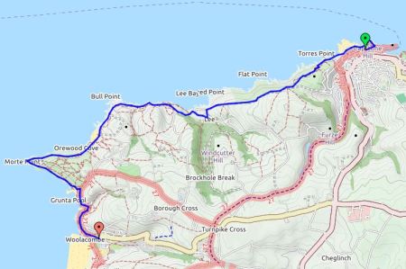
Ilfracombe  –  Woolacombe.


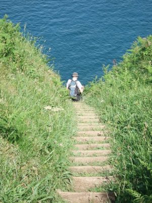
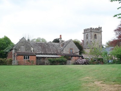
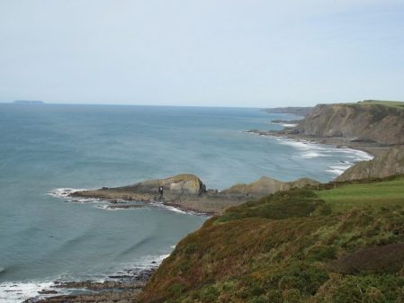
The lady serving breakfast said she had been over at Woolacombe yesterday evening to catch the good surf conditions and for the next few days I felt out of place without a wet suit and board, mind you I would have looked ridiculous on the Torrs which was my first objective for the day. Reading about Ilfracombe later I found there was lots of interest there worthy of a further visit. I had walked into town following footprints and on the way out had posh finger tiles. The morning was misty and damp and not one for hanging about so I was quickly following the Victorian pathways cut into the hillside, above tunnels leading to hidden bathing beaches. Flowers brightened the way and I was soon up to the summit of the Torrs where there was an elaborate viewfinder but no views.


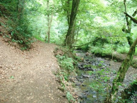
Onwards onto open farmland the paths were difficult to follow but all seemed to go in the right direction, there is one rule in coastal walking – keep the sea on the same side. Out of the mist would appear herds of cattle whose sex I couldn’t identify which didn’t help my ‘taurophobia’.

This elaborate sign said –                                          PUBLIC PATH. PLEASE KEEP TO IT.

?Hidden danger.

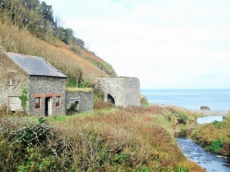
Sunken lanes lead into Lee Bay a delightful little hamlet. The hotel has seen better days and looks unlikely to reopen but across the beach was a little cafe. I was glad to get under shelter and have a hot drink. I got into conversation with a Swiss lady, from Montreux, who was out walking whilst her husband did deals for Nestlé. We talked of the Swiss Alps, gardens, families, chocolate and of course she quizzed me on Brexit, an hour or so went very pleasantly and by the time I set off the rain had stopped and the sun came out – thanks to a bit of détente!

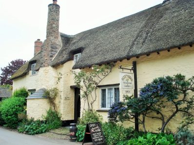
Cafes are becoming a theme on this walk.


The next stretch of coast was undulating in and out of little bays with a few families making the best of the day. A couple were watching their girls searching the pools. They come to this area where they were married 12years ago, their reception was in that hotel which closed shortly after – they didn’t feel it was a bad omen.

At Bull Point was a lighthouse, there are some treacherous rocks on this coast. A local man said seals were often spotted along here but I failed to see any.

Bull Point.

View back to Bull Point lighthouse.

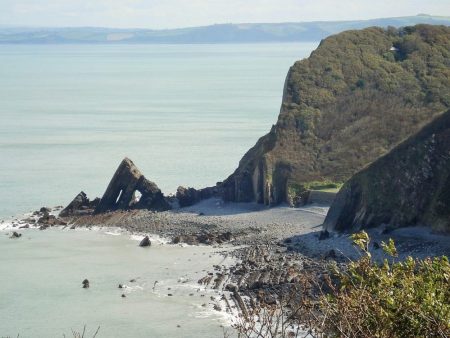
A long hot tiring trudge round Mort Point was enlightened by my first sight of Lundy Island. Lundy has special memories for me. In 2002 I spent time there climbing with a good friend Tony [and others] we did all the classics and he was delighted to lead The Devil’s Slide and particularly Diamond Solitaire a classy VS on a flying buttress coming straight out of the sea. After a great climbing trip we parted, I went off to the Alps for a month and on my return he was dying of cancer. Sobering thought.

Morte Point and distant Lundy Island.

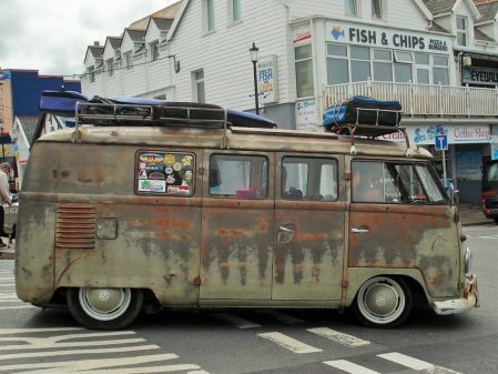
Anyhow heading south again more and more people were met walking the paths out of Woolacombe. Most of the coast headlands today have been managed successfully by the National Trust. The beach seen ahead was one mass of people, mostly children on body boards but also well out into the higher breaking waves surfers who didn’t seem to having too much success. The car park had a lot of camper vans favoured by the surfing community. Ice creams and fishnchips seemed high on families’ priorities.

Heading to Woolacombe.

Distant headlands…

My hostel for the night, The Beach House,  was in a side street amongst the busy shops and cafes nowhere near the beach.  I’d booked into a bunk room which turned out to be very smart and clean. I bought a cider and relaxed in their garden. Asking about food, they had a good menu, I was told everywhere just about booked up but they would fit me into a table later. Into the cozy bunk room walks the American lady, she has no worries about sharing being a fellow coastal walker. We compare notes, share the dinner table, watch the sunset and drink wine. Another interesting meeting with wide ranging conversation, she is avoiding America whilst Trump in power by working and touring in Europe. A talented lass fluent in several languages and with varied careers.

Think I spent more time chatting today than walking.
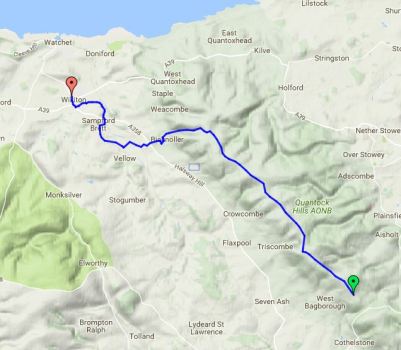


HIGH POINT OF THE SW COASTAL PATH.

Heddon’s Mouth  –  Ilfracombe.

The dawn chorus woke me in this secluded hotel, there was no other noise, and the sun was already bright.  A good breakfast fortified me for the steady climb back up onto the cliffs. A well graded track led up through the gorse and heather with the bracken growing fast. Stopping for a break on a convenient stone was a mistake as I was immediately attacked by several ticks, this was tick city up here. Managed to remove them all before they had settled but was on the alert for the rest of the morning, I know I am stupid to be walking in shorts.On the way up there were good views back down to Heddon’s Mouth beach and yesterdays descending path. Looking back up the wooded valley there was no sign of my hotel. Patches of mist were coming and going in the valleys. Way down below were many inaccessible coves. This was good open walking with views up the coast past many unknown headlands and not forgetting to look back at previous points. Ancient stone walls capped with vegetation bordered the fields, Devon Hedges, with stones laid on edge. These are a superb habitat for lichens and plants.. Typically there was a loss of height down into a little valley before the long ascent onto the highest point of the SWCP Great Hangman Hill 318m, its cairn was already occupied by a couple of youngsters looking at their phones rather than the view. They were the forerunners of a large jolly party from Liverpool staggering up from the other side. More walkers were evident today enjoying the good weather, a Dutchman was walking the whole route.

Great Hangman ahead.

On the way down I avoided the ascent of Little Hangman and on a cliff path was able to hear the sea once more. Sea kayaks and speed boats were nosing into rocky coves and then I was looking down into Combe Martin beach packed with families.

Wild Pear Beach.

Wet suited people with boards were in the streets and the paraphernalia of seaside holidays for sale everywhere. I managed to find a cafe with a shaded balcony above the hubbub and enjoyed a late lunch featuring crab.

A fellow coastal walker finding it hard going.

Leaving after three I still had a long way to go and it was very hot and sunny. Little lanes and flower lined paths avoided for the most part the busy coastal road. I was never far from little beaches and busy campsites, this is a popular area. The natural harbour of Watermouth was  interesting but at low tide all the boats look forlorn. A family passed me on the way to a beach only to find it was ‘private’ there seem to be lots of those about.

Valerian, ox eye daisy and orchid.

Approaching Watermouth.

Watermouth harbour with Great Hangman behind.

The beautiful Widmouth Headland seemed to be hard work in the heat with lots of steep stepped sections. The bays of Ilfracombe were getting closer, and then I was onto a nasty stretch on the busy road. As you approach the town SWCP  ‘footprints’ are supposed to guide you along but I kept losing them. Again being low tide the harbour looked a bit cheerless… Since I was last here 10 years ago to catch the ferry to Lundy a statue by Damien Hirst, who lives in Combe Martin apparently, has been erected at the harbour mouth. ‘Verity’ is certainly very conspicuous at 20m tall, a pregnant lady with half her innards showing holding aloft a sword and referring to truth though the relevance to this Victorian seaside resort remains a mystery to me. The unusual theatre looking like two cooling towers is no doubt another attempt to update the town… A dated hotel in the backstreets sufficed me for the night. I was tired after a long day of ups and downs amongst stunning scenery,


BACK WALKING ON THE DEVON COAST.

Lynmouth  –  Heddon’s Mouth.

SW Coastal Walker at Lynmouth.


I have a great admiration for Devon’s bus drivers. We are winding our way along narrow steep lanes from Barnstable to Lynton and at times seem to have only inches room either side but it doesn’t seem to slow the driver. Thatched cottages in the little villages add to the character of the area along with the thick accents of my fellow passengers. I take the funicular railway 500ft down the cliff to Lynmouth harbour. This link was opened in 1890 as tourism was expanding and many arrived by boat, local goods could also be transported more effectively than by pony up the steep hillside. The cars are powered by a simple water system, 700gallons are pumped into the top car which is linked by cable to the lower and gravity does the rest. Talk in the quayside cafe where I had breakfast was of boats, engines and tides.


Back up the hill I walked on the SW Coast Path. A popular terraced path leads dramatically across the exposed hillside high above the sea towards the far end of The Valley of Rocks. The poet Robert Southey visited in 1799 commenting  “the very bones and skeletons of the earth” and that is an apt description today. Goats were scrambling across some of the higher places, Just above the path was a large buttress of good sedimentary rock which called out to be climbed – turned out to be the Devil’s Cheeswring with several 45ft climbs, no time today. Lanes continued past an impressive Christian Centre, Lee Abbey, a large estate on a headland. I was feeling a bit miffed that some good looking walking paths were denied to the public – most unchristian. All was forgiven [almost] when a great little garden cafe appeared. Run by volunteers at the centre this was one of those places you couldn’t walk past.

Lee Abbey estate.

The cafe.

The next headland, Crock Point, was accessible but I regretted the long detour and lots of ascent and descent involved. Back on the road I circumvented Woody Bay but could hear children playing on the beach below. A long pull up onto the next hill rewarded me with views across to south Wales and back to Foreland Point beyond Lynmouth, visited a few weeks ago. I kept coming across a pleasant chatty knowledgeable couple and they turned out to be staying at the same hotel tonight,

Looking back up the coast.

Heddon’s Mouth.

I could see right down into Heddon’s Mouth cove below and as I had time I diverted to it on the way into the valley. A lively stream finds its way to the coast, it looked a likely spot for dippers but I saw none. Apparently otters visit this area. Above the pebble beach was an old lime kiln, large quantities of limestone and coal were shipped from south Wales, kilns were built on harbour sides to avoid the need to transport raw materials over land. Families were just ending their day on the beach and wandering back up the valley, one of many places on this coast managed by the National Trust. The Hunters Inn was doing a roaring trade but I’d booked into the Heddon’s Gate Hotel which turned out to be  a mile up a 1in4 hill. The situation on the edge of Exmoor with glorious gardens, a lovely sunset and a gourmet dinner in good company were worth the climb.

What a great short day’s walk in outstanding scenery.

Seen today, not all sign posts are as helpful as others…


SOMERSET INTO DEVON ON THE COAST PATH.

Porlock Weir – Lynmouth.

The sun is shining and by the time I leave after a hearty breakfast the temperature is more pleasant than the last few days. People are wandering round the quayside in holiday mood. The coastal path soon rose into the woods and contoured along nicely. There was only the sound of birds as the sea seemed so far below and was only occasionally visible. A group of three women appeared, they meet up at weekends for walking and are just starting on the coastal path – it will take them years. They skipped along happily chatting and laughing and I was somehow reminded of ‘Three little maids from school’, the tune from The Mikado. Guess what I was whistling all morning.

Not far along I spotted a church tower below in the woods and took the short detour to explore. It turned out that a service was just about to start – chaplain, organist and churchwarden were preparing and two parishioners appeared. The churchwarden, a local farmer, chatted to me in the sun about the church and several other topics until he was needed. The church is in the parish of Culbone although it is in the middle of nowhere. I was told it was the smallest complete parish church in England, for more information – https://en.wikipedia.org/wiki/Culbone_Church


I think I crossed into Devon at Coscombe Stream… Close by was Sister’s Fountain fed from a spring and topped with a cross. I’m not sure of the history of this place but the cool water was delicious. The track continued winding its way with occasional views of the inaccessible beaches below. More people were out strolling as well as the coastal path regulars, one lady carrying her little terrier who didn’t like walking. I decided to take the longer way round Foreland point, the most northerly part of Devon. A small locked bothy was passed on the path. There were extensive views back up the coast to Hurlstone Point. At the end there was a lighthouse and then a narrow exposed path, perched just above the cliffs, continued round the headland. The Coastal Path was rejoined at Countisbury where there was a small church and a busy looking pub. The path ran parallel to the road down into Lynmouth. A local taxi man was advertising by the road for anyone too weary for the last mile or so. Eventually I reached sea level at a lovely little sheltered beach.  Lynmouth is infamous for the serious flooding of 1952 killing 32 people and devastating properties. My hotel for the night was close to the meeting of the two streams which being in steep sided valleys couldn’t cope with the 9inches of rain coming off Exmoor. A later stroll round the harbour area gave perfect views in the evening light.

I had planned another three days or so but my wretched cold and sinusitis showed no signs of abating so next morning it was a bus out to Barnstaple and a long train journey home. Can’t wait however to return and continue in this beautiful area.

START OF THE SW COAST PATH.

Minehead – Porlock Weir.

Today I would follow the SW Coastal Path, a National Trail which covers over 600 miles from Minehead to Poole Harbour  –  wow. But first I couldn’t resist  a look around the station of the West Somerset Railway. The platform is in period style, stalls are selling railway memorabilia and coaches are waiting for an engine for the first trip of the day. Along comes 6960 Raveningham Hall to be hitched up and passengers start arriving for their 40 mile round trip. I tear myself away, railway nostalgia is deep in my soul having been brought up in Darlington and hearing the distinctive whistle of the Gresley A4 Pacific’s as they hurtled north every day,

On the promenade there are signs for the start of the coastal path. A couple with heavily laden sacks are just departing, they turn out to be New Zealanders just recovering from their first ‘full English breakfast’ They are here for a couple or so months to complete the trail.

Before long the path starts climbing on well graded loops up through the trees and ferns to reach the open moorland high above the sea, old tracks take me to the highest point, Selsworthy Beacon 308m with blurry views into Exmoor. Onwards easy leads towards Hurlstone Point where I meet a young scouser setting off on an adventure round the coastal path, I suspect to discover herself. On her arm she has a tattoo of an acorn [the National Trail Waymark] which she says is for motivation.  I leave her as I drop off the trail and traverse round the point on an exposed path with good coastal views. Round the other side past an old lookout I meet up again with the main route and head into a pleasant garden cafe in Bossington, the NZ pair had already found it. Tea and toasted teacake seemed perfect. Old narrow paths deposit me into Porlock village for a bit of shopping, I’m growing tired of pub meals so buy some salad and fruit to eat in my room tonight. There is a sign pointing to Porlock Weir through the woods, still on the Coleridge Way. This turns out to be a pleasant way walking alongside some beautiful rhododendron gardens in full bloom. Greencombe Gardens I find out. Later I pass one of those ‘Tin Tabernacles’ from the late 19th C, still having services.

The lane eventually drops into Porlock Weir and to my most expensive B&B, The Cafe. I enjoy a pint of Exmoor Ale in the quayside bottom Ship Inn although it upsets me when in a pub every bar table is reserved for diners. I know this is how they earn their money but what about us drinkers?


SOMERSET – meandering to the coast.

Williton – Minehead.

It was bright but there was still a cold easterly wind blowing as I left Williton. The sandstone church on the edge of town seems much younger than most of the Norman churches passed so far. A little lane was signed to a Bakelite Museum, outside the building were random exhibits – miniature egg shaped caravans, bikes,etc. Unfortunately it didn’t open till 10.30 so after a quick external peep I was on my way. The paths hereabouts seem to be part of an estate with walled sections and bridges over driveways. The lanes in the area have a reddish tinge to them caused by the farm vehicles from the red clay fields. The way was undulating to say the least with constantly changing scenes, tiny hamlets dotted the landscape, compass work was needed to navigate the network of unsigned narrow lanes. On paths, often the Macmillan Way, the vegetation was already high with nettles, the shorts I’d been tempted into today didn’t seem such a good idea now.

I arrived in Withycombe ready for a rest but was attracted to the squat towered church. To my surprise inside there was coffee and tea making facilities available to visitors so I enjoyed a sit down and refreshments. Thank you. The interior itself was interesting with some fine woodcarving. Two stone carved effigies, one of a lady with a dog at her feet and one of a man wearing a hat. There were also 15C stone carvings depicting ‘green man’ – these figures are apparently common in SW churches  All in all a worthwhile stop.

Effigy with dog.

Effigy with hat.

One of the Green Men.

I found a sign pointing up a lane, Dunster 2½ miles via Withycombe Hill. Soon I was up on top with views to Minehead, the Bristol Channel and into Exmoor, and behind back to the Quantocks. Further along the ridge was Bats Castle an Iron Age fort whose ramparts and ditches were clearly visible.

The Quantocks of yesterday.

Bats Castle and distant Exmoor.

I was glad to loose height out of the cold wind into forestry on the edge of Dunster. Until now I had seen nobody all day but suddenly there were car parks, signed ways and hordes of people. Dunster is a picturesque village with the added attraction of its castle. First though a visit to the Chapel House Tea Rooms for cheese scone and tasty tomato chutney, cream teas seemed popular with other tables. I wandered through the crowded streets and into the castle grounds but felt I didn’t have enough time for the castle itself so don’t know what I’ve missed.

I was keen to find lanes taking me to the coast for the last few miles. The tide was going out so I enjoyed an exhilarating walk along the sands rather than on the golf course above. All to soon I was passing a busy Butlins complex and checking into my cosy B and B in Minehead.


ALONG THE QUANTOCKS.

West Bagborough – Williton.

Thank you Charlie, from Bashfords Farmhouse B and B, who gave me a lift back up that steep lane to Birches Corner to continue my progress along the Quantocks. I find I’m following a waymarked Macmillan Way West from the car park. A couple are just emerging from their van having slept up here, they are on their way back to Cornwall after a trip to Glastonbury to buy a brimmed hat for him. Three ladies set off with their dogs on a school reunion weekend, I follow discretely behind their nonstop chat. This is proper open heathland, yellow gorse and skylark country. Additionally beech trees border what must have been an old drove road. There are tracks everywhere but it is simple to follow one along the crest to the highest point, a trig point at 386m, curiously named Wills Neck. The visibility is poor unfortunately. Onwards easily along the undulating crest for another three miles or so with that freezing wind behind me. Lovely wooded slopes and valleys drop off both sides.

My way down Bicknoller Coombe could easily have been missed, there are no signs. Once out of the wind I stop for a snack, a cuckoo is heard [first of the year] and then seen in a nearby tree, buzzards fly overhead and sounds of a whistle from the steam railway below drift up. A small stream is followed all the way into Bicknoller village, some lovely little thatched cottages with tidy gardens, wisteria and roses complete the ‘English’ scene. A particular climbing rose with tight small yellow flowers is popular, I was not aware of seeing it before – probably Lady Banks.

I walk straight into the community store and order a coffee which is enjoyed in the sunshine. Just about everything can be bought in this little shop run by volunteers, hope it survives. As I walk small lanes through agricultural land I hear an approaching steam train and arrive just in time to see it pass. This is the restored West Somerset Line running over 20miles from Minehead to Bishops Lydeard run again by volunteers. I notice signs for The Coleridge Way, a feather quill pen, he wrote some of his major works whilst living in this area of Somerset.

The next village Sampford Brett has more picture postcard cottages and an unusual orientated

Church. A few fields later and I am entering the busy little town of Williton and booking into my comfortable accommodation for the night, the Mason’s Arms.

Macmillan Way West.

Coleridge Way.

FASCINATING RURAL SOMERSET.

Bridgwater – West Bagborough.

I used quiet country lanes for a couple of miles, my attention was drawn to the roadside flora which was a few weeks ahead of our northern lanes.


Ragged Robin.

Horse Chestnut.

Hawthorn.

Comfrey and Cow Parsley.

I entered North Petherton via a series of alleyways and was unexpectedly confronted by a magnificent church. A 15th century minster with a highly decorated tower, Inside are some fine wooden furnishings and a replica of a gold Alfred Jewel said to have been found after the dissolution, the original is in the Oxford Ashmolean Museum. Opposite the church was a perfect little coffee shop – Truly Scrumptious – it was.

I now started climbing towards the Quantock range of hills, an area I had never explored. Kings Cliff woods were popular with dog walkers, the cliffs of sandstone looked very precarious. Oak and beech woodlands followed the steep valley running west to east, the bluebells were spectacular. Slowly I gained height in the valley and it opened up into farmland with some exclusive properties scattered on the hillsides.The stream coming down the valley had been dammed in many places to produce ponds and mill races. I spotted a fox walking towards me but despite my stillness he ran off before I could get a decent view or photo. At the top of the valley was the village of Broomfield and the NT Fyne Court. There is much to interest you here – an old church, schoolrooms, estate houses and the remnants of the estate. The estate was owned by the Crosse family whose most famous son was Andrew, the mystical ‘thunder and lightning’ man,who in the 19th century carried out complex electrical experiments using wires strung out through the trees in the estate.Little is left of the property which burnt down in 1894 but the NT have a wonderful little cafe in one of the surviving buildings. If you like home made cakes and scones this is the place! Whilst chatting to the staff I was given helpful instructions on how to proceed for the afternoon without having to loose much height. I took these with a pinch of salt as they only recognised  walking on roads and I didn’t want to miss Cothelstone Hill.  I was given a lovely hand penned map to help me on my way. But first I would explore some of the well marked trails through the estate – embarrassingly, I managed to get seriously lost! So I thought after all that their helpful advice could be useful and followed their more than adequate map along quiet, twisting  and undulating lanes. I found the path going off to Cothelstone Hill,332m, and was soon walking up open heathland. Exmoor ponies graze this area and they were posing for photographs at the Seven Sisters beech plantation  towards the top. There were good views down to the Bristol Channel, Wales and the Minehead headland. I passed an obvious burial chamber and then headed down through bluebell woods back to a road, Following my paper map I was soon heading steeply down into West Bagborough on the edge of the Quantocks. I’ve thoroughly enjoyed today’s variety.

I enjoyed an excellent B and B at Bashfords Farmhouse, they took pity on me as I was now in the middle of a nasty head cold – a long luxurious soak in their large bath.

The local pub was overrated and expensive, this is very much a riding and hunting area.

BACK IN SOMERSET.

Last year  http://bowlandclimber.com/2016/08/16/somerset-ways/  I started to fill in missing sections of ‘my’ LEJG trail, then I was heading N to Bath this time I’m heading SW. I find myself back in Bridgwater a rather seedy town I do not take to – everyone to their own. I march past my previous unsavoury lodgings and connect up to a canal, Bridgwater to Taunton,  heading wisely out of town. It is a couple of miles walk to my B and B for the night, it is a pleasant evening and soon Industrial sites are left behind and rural scenery takes preference. There are more cyclists than walkers as the towpath is part of the national cycle network. An old bridge takes me across to the canalside Boat and Anchor.

The forecast is dry for the week but a cold easterly wind is blowing – I had thrown in an extra fleece.

My map shows several paths going in the appropriate direction for the next few days, I can mix and match  Macmillan Way, Somerset Way, Coleridge Way and eventually the SW Coastal Path.

View from Boat and Anchor bedroom.

Well wet before Bath.

Tunley – Bath.

I knew it was going to rain but all I expected was a bit of southern drizzle but no it rained and I was well soaked when I jumped on the train to head home. I had started early because of the forecast and the need to catch a reasonable train. Back down to pick up the Limestone Link and then mainly followed the River Cam which is really a stream.

 Cam valley gloomy in the rain.

Cam valley gloomy in the rain.

I was walking on the edge of fields and soon was soaked from the knees down. Halfway across one of the fields I was confronted by two snarling dogs with their owner way ahead. Bared teeth or wagging tails – which do you trust?  I walked on with sticks at the ready. The owner gave the usual response and I marched past without a comment, what self control. I think that distracted me and I went off the wrong way on the next road and had to retrace after half a mile. I’ve not been doing too well with navigation on this trip partly because I didn’t have the relevant maps. Another lesson learnt. From then on I followed the waymarks more carefully through rolling wooded hills and even spotted the point where I left the Link to head towards South Stoke.  It was here I met a backpacker who had walked from John o Groats and was on his last section. The church in the village was dedicated to St. James and there was a stone carving featuring his emblemm a scallop shell. Most of the buildings of South Stoke used that cream coloured Cotswold limestone. Before I knew it I was in the streets of Bath [or Baaaath as they pronounce it down here] I was expecting Georgian terraces but mostly modern housing accompanied me into the centre and railway station. I caught the 12 o’clock to Bristol and was back in Preston by 5pm. It was still raining.


A long day of Somerset wandering.

Compton Martin – Tunley.

My b and b continued to surprise, a man in his pyjamas and stocking feet gave me one cup of tea, previously ordered scrambled egg and promptly disappeared [presumably back to bed] never to be seen again. I let myself out. It had rained all night and back on the wooded slopes of the Mendips the luxuriant undergrowth was damp a pleasant feeling after the last three days heat. Monarch’s Way was encountered for a few fields. Buzzards were a constant sight and sound. Little villages were encountered, West Harptree having a rare shop where I was able to buy a fresh sandwich. Even at this stage of the day I was making silly navigation mistakes through not concentrating, maybe I was tiring. A steep hill brought me up to  Prospect Viewpoint and seat with the Chew Valley lake below, I was joined by a couple of dog walkers and a cyclist. A short distance further and I couldn’t resist a morning coffee in the Ring o Bells pub, Hinton Blewett. I looked behind me and there were 20 -30 cyclists arriving, desperate for beer and food, the place was heaving. A large sociable group had come from Bristol.

Prospect viewpoint.

Prospect viewpoint.


I then had difficulty finding my way out of the village, coffee only I assure you, and I had now walked off my OS Explorer map and onto my photocopied bits of paper. At one point the path through a couple of fields had been freshly mown – thank you. In the next barley field there was a constant popping sound which I couldn’t trace  – must have been seed pods of some plant in the field.    

Walking up a lane a couple climbed a stile to my right which I would have missed, this led to a high traverse above a valley with hundreds of anthills. Then I became lost walking out past a farm onto a road, the paths just didn’t fit but I pressed on into more fields with no stiles, out came the compass, I don’t have GPS, and I realised I wasn’t at all sure of my whereabouts, I’d walked off my map. It wasn’t helped by my the fact that my photocopied map was disintegrating from sweat in my pocket. I had only one choice, knock on the door of the only cottage in sight and ask “can you tell me where I am?” The young lady was so helpful and pointed me in the right direction and after some creative walking within 30mins I was back on route.A surprise section in a deep wooded gorge brought me onto a disused railway and then a disused canal at Timsbury Basin. This was the terminus of the Somerset Coal Canal running to Bath, parts of the basin are still evident and I walked a stretch of the canal towpath. Elsewhere I used the disused railway which replaced the canal. There had been many collieries in this area, all now assimilated into the landscape. I remember reading an account of William Smith’s contribution to  geology and this was highlighted by his observations whilst surveying in this area for the canal. He recognised  from fossils that the earth was laid down in strata and this was replicated throughout the country. He published the first Geological map which went against the current religious thinking that the earth was only a few thousand years old. He suffered for his forward thinking, became bankrupt and discredited and only later recognised as the ‘father of geology’.

If a public footpath comes through your garden what do you do?  In the next mile I came across two frustrating solutions and their occupants.                                                                                           1. Ignore it.  The first delightful garden was entered on a signed way but then I was left to wander about looking for an exit. The pleasant man pointed out a gate exit. We had a long chat about the canal, dieting, immigration, bees etc but it had never occurred to him to put an arrow on the gate to get people off his property.                                                                                                2. Divert it.  A little further at a gate guarded by three friendly dogs the sign said go straight through but there was an obvious way round. The owner appeared and agreed that hundreds of people used this route, he had provided a simple ‘unofficial’ diversion but not signed it. He did not want to pay for an official diversion and I did  not want to walk through his garden.

Someone's garden.

Someone’s garden.

Both these examples show the owners’ resistance to public rights of way across their properties and their ineffectual ways of dealing with the problem. They knew about the footpath when they purchased but have buried their heads in the sand.  Come on be reasonable. Both gentlemen were pleasant enough and it was good to meet them but how simple is to resolve the problem and make life easier for all. I shall be writing to the relevant highways authorities.

Moving on I followed the Cam valley further and then climbed the steep hill to my wonderful Airbnb near Tunley with views south across the valley.  Another day without rain.


Somerset Levels and Polden Hills.

Uploading…

Bridgwater – Street.

The sign above my Bridgwater b and b stated “simple home comforts for hard working folk”. Most of the hard working folk here are Eastern European and they are up and about all night. Makes me realise what a sheltered life I lead in my Lancashire village. Bridgwater is an old port and the constant screaming of seagulls give it a nautical air. 

It took a while to walk out of and I was glad to be in the rural Levels, a flood plain that has been drained to provide agricultural land, both arable and pastoral. A lot of the fields are divided by ditches rather than hedges. The paths were poorly marked and overgrown, a large scale OS map was essential to find the little plank bridges spanning the dykes. 

 The walking was of course level as I made my way between small hamlets – Chedzoy, Parchy, Sutton Mallet and Moorlinch. Interesting  squat Somerset churches were visited. The one in Sutton being particularly fine with its wooden box pews. In the church yard I sat on a seat donated by the BBC after shooting an episode of The Monocled Mutineer, a historical drama I had missed.

Behind were the Quantocks and ahead I slowly climbed into The Poldens. There was a messy section through farmland where you were made to feel unwelcome. Any  Samaritans Way signs had been a rarity.

Public Footpath.

Public Footpath.

At last I was on open ground past the conspicuous Windmill Farm and onto the highest point Walton Hill 82m!  A nearby viewfinder from 1940 has been made redundant by tree growth. In other areas there were good vistas across the Levels and to the north up popped the strange Glastonbury Tor. 

All downhill now to Street which came as quite a shock – a shopping extravaganza and a busy outdoor pool resembling the seaside, the temperature was in the high 20s. Cider and fish and chips seemed appropriate.