Tag Archives: LEJOG

JOHN O’GROATS TRAIL. 6 Golspie to Brora.

A perfect walk.

Breakfast was shared with a man from France who was taking a dog and a cat over to Orkney – that is a long story. The day was perfect – fresh and clear. The trail went out of town past the houses of the former Sutherland estate with their Duke’s statue looking down on them. In the close up photo below the quarry used for stone for the base can be made out. Onto the dunes  and a path towards Dunrobin Castle the largest house in the Highlands and once owned by the notorious Duke Of Sutherland. I saw it from below and it did look impressive, I was too early for their falconry display. A bit further on and I diverted up to Dun Liath broch expecting I’d be the only one there but a mini bus pulled in and discharged a group of tourists who were mainly interested in taking selfies of themselves. After they departed I wandered round the 2000 year old ruins in peace. After regaining the shore I dropped onto the beach as the tide was out. There were some interesting rocks covered in seaweed, one reminding me of Dougal the dog from The Magic Roundabout. 
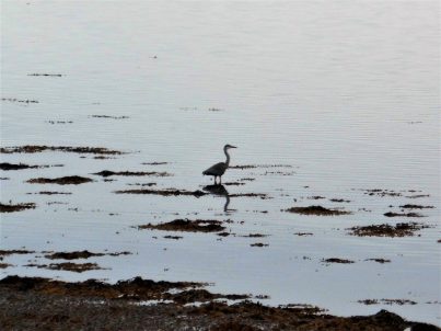
There were seals on the rocks and exposed sandbanks, their calls were hauntingly human. 
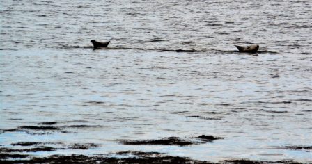
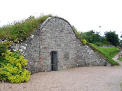
I arrived into Brora by the harbour area where a few fishing boats were preparing to go out to their lobster pots. Nearby was the old ice house used when the harbour was more prosperous. This coast was famous for its herrings which would have been smoked locally. 
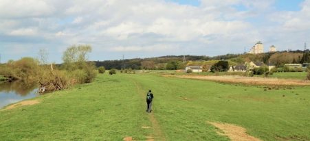
Up the road was a clock war memorial of unusual design. I lunched in the delightful Linda’s Cafe and enquired about a taxi who could pick me up if I walked a few more miles up the coast, none was available but they suggested I would be able to catch a bus back. So off I went again over the golf course onto the perfect beach for two or three miles. A swim was needed halfway to cool me down. At the end of the golfcourse I clambered over the railway and landed on the A9 where I managed to flag down a bus back to Brora.

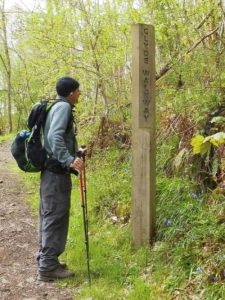
Notice Trail waymark.

Brora Golf Course.

Endless sands.

My airbnb was good with plenty of time for stimulating conversation with the hostesses and the Jack Russell. There was a private episode in my bedroom when becoming concerned I may have a tick attached to my derrière.  I attempted to locate it without the benefit of mirrors with no success until I came up with idea of a selfie from my phone. Eventually I focused in to the right area, a false alarm as it happens, but I hate to think what Google may have done with my images.  Now all I have to do is persuade someone to drive me back up the A9 in the morning which will make for an easier day’s walk to Helmsdale.

*****

JOHN O’GROATS TRAIL. 5 Embo to Golspie.

Around the Fleet.

Ex-Little Ferry on the Fleet.

Crossing the Fleet today on the bridge far left.

At one time there was presumably a ferry service at the Little Ferry marked on the map but now a detour is needed to get round the estuary using the A9’s bridge.   It was refreshingly cool when I left Embo across the dunes which are apparently threatened by another golf course development. People were out dog walking and it is interesting to see how many are English who have moved up to this part of our land for peace and quiet. Everyone I met had warnings about the local tick population. Before long I’d joined the track of an abandoned railway which gave easy walking. This became tarmacked with the ruined C14 Skelbo Castle visible ahead on an outcrop above the Fleet. It was along this stretch that I also became aware of the prominent monument on Ben Bhraggie which overlooks Golspie. This is the statue to The Duke Of Sutherland who became notorious for the clearances forcing the population to resettle in favour of sheep. Apparently it is 100ft high and was erected in 1837 after the Duke’s death. The monument was a constant landmark for the next couple of days.

Railway hut and distant monument.

Typical makeshift JO’G Trail stile.

Typical cattle.

Ben Bhraggie and Sutherland Monument.

The road now followed the coast and there were ample opportunities for seal spotting as they lay up on the exposed sanbanks. These are Common Seals and have a head and tail up posture on land. They have probably just finished rearing their pups. After that pleasant interlude the trail came up against the A9 and entered woodland above the rocky shore. As it is in the making the route was very overgrown and vegetated, I stopped briefly and realised the place was teeming with ticks. I moved on quickly but became paranoid about any slight itch on my exposed skin.

Typical tick terrain.

The busy A9 had to be joined to cross a bridge over the River Fleet and was rather dangerous with a narrow verge. Looking down I was thrilled to see salmon leaping from the water. Once over I was glad to escape into a lovely wooded area on a well-marked path which if I had followed all the way would have brought me to the foot of a rock climbing venue, bolted routes on conglomerate rock. Looking back whilst I ate lunch I could see climbers in action and I regretted not having visited. I was back beside the railway line which was followed through fields to a level crossing.

Crossing The Fleet.

Missed crag.

A long narrow road headed back to the coast and into a forest park where I followed a nature trail. Another golf links was crossed on the outskirts of Golspie and then a gentle stroll along the dunes into town.

Deep in trouble.

Golspie.

My homely b and b was on a quiet backstreet and on their recommendation I walked into town to the Fish and Chip restaurant. There were queues in the street for takeaways and the restaurant was full, apparently people come from miles around and I suppose there are a lot of holidaymakers about. Not wanting to wait for ages I visited the reliable Co-op shop for some sandwiches to be eaten on a bench overlooking the harbour.   Back at my room a couple of ticks were removed from my legs.

*****

JOHN O’GROATS TRAIL. 4 Tain to Embo.

A day of two halves.

Two halves scenically and weather wise. It drizzled in the morning but was hot and sunny for the afternoon.

Dornoch Firth.

Breakfast in The Royal was excellent and made entertaining by a group of plonkers on a nearby table. On some sort of group activity holiday the 30somethings were engrossed in laptops and tablets and ignoring the staff. Their ‘leader’ announced that they had to leave at 9am and went off to rouse a couple of late risers. After 8.30 they eventually switched off, almost, their electronic devices and put in complex orders for the cooked breakfast. Not surprisingly they started getting frustrated with the slightest of delays and complaints were put to the waitress who dealt with the little darlings with restrained Scottish aplomb and a wry smile.

After passing the Glenmorangie Distillery little estate lanes were used before dropping down to another brush with the A9 to get across the Dornoch Firth – 30 minutes of fumes and speeding cars. I was glad to clamber down a steep bank onto the shore. The track eventually swung away from the coast onto a road past farms. Bulls guarded the fields and there was some equine presence at some stables. It was along here it started drizzling, so off with my shirt and on with the waterproof. A little further the JO’G Trail was signed into Camore Woods, pine woods standing on a gravel ridge from the ice age. Within this area were several obvious mounds which are the remains of hut circles and chambered cairns 3000 yrs old. A standing stone was seen in a field on the right seemingly reflecting the steeple of Dornoch Cathedral. As an aside I noticed for the first time the sound of rain falling on different trees – almost silent on the pines but waterfall like on the larger deciduous  leaves.

Dornoch was busy with tourists, I visited the cathedral with its beautiful vaulted ceiling and then found a little cafe in the square behind for a light lunch. The rain had now stopped, the sun was out and fortified I walked down to Dornoch Royal golf course which has been used for the open in the past. The fairways were narrow between the sand dunes and the bunkers looked horrendous. The track on the edge of the course was directly above the sandy deserted beaches and I couldn’t resist a paddle which turned into a brief refreshing swim.

I was dry by the time I walked through a large camping/caravan park and into the little village of Embo. This was made up of streets of small houses presumably a fishing industry in the past. My B and B for the night was comfortable and peaceful.


*****

JOHN O’GROATS TRAIL. 3 Invergordon to Tain.

Quiet roads.

It was only in the morning as I left that I noticed all the wall murals in town depicting the history and culture of the area. There is also a distillery on the edge of town, a part of Whyte & Mackay producing grain spirit for the blending industry.

The B817 road along Nigg Bay was almost absent of cars and for some of the way I could use the beach. Oil rigs were prominent in the bay.The villages passed had no facilities so I pushed on and found even quieter lanes inland. The odd cyclist passed me with a cheery greeting [not all cyclists are odd!] A petrol station appeared and an ice cream was purchased.

The A9 was perishingly close but I was able to continue on an old road which was slowly being reclaimed by nature. At its end it was a short hop across the main road to reach the rather isolated Shandwick Arms where I rested over a Belhaven ale and sandwich. Despite being refreshed I soon ran into blocked ways and escaped to fields and barbed wire crossings. Then all was all plain sailing on little used lanes passing small crofts. I didn’t try to join up with the JO’G Trail in the forests which I had heard was difficult. So I was soon dropping into Tain a prosperous looking town just above the Dornoch Firth. It was only in the last few hundred yards that I touched the JO’G Trail. An uneventful day’s walk through very pleasant scenery.

On the outskirts of town today a Highland gathering and games were taking place. My hotel was central and the games continued into the night by the sound of it.


*****

JOHN O’GROATS TRAIL. 2 Culbokie to Invergordon.

Over and along the Cromarty Firth.

After a breakfast of fresh farm eggs I took the lane dropping down to the Cromarty. The causeway bridge carrying the A9 was plainly visible, it looked a long way across. The traffic was heavy and fast but there was an adequate footway on the verge for my 30 minute crossing. As well as the traffic hazards terns were dive bombing me at the far side. I couldn’t wait to leave the road on the other side and I probably took the wrong path which led me up to the railway but no further. I resorted to trespassing along the line, The Far North Line, for a distance until I reached the level crossing I should have been on.  These private level crossings were a frequent feature across the single line railway, there aren’t many trains per day.  My track went up to a house and then onto a quiet country lane high above the water so there were good views all morning. The only people using the lanes were cyclists, many on a LEJOG trip. Groups of them were using backup transport which meant they could travel light. The busy A9 was somewhere out of sight and sound.

I arrived in sleepy Evanton at coffee time and the Novar Arms duly obliged. The B817 road was a bit busier but immediately out of the village was a signed cycle path in the trees alongside the road so the continuation was quite pleasant. Interestingly most cyclists persisted on the fast road leaving me to enjoy their cycle route. This gave me time to take in the views and high above me on a hill was the Fyrish Monument. Built in 1782 for Sir Hector Munro lord of the area who had served in India. It represents the Gate of Negapatam, a port in Madras, which General Munro took for the British in 1781. At the time the local population was being cleared off the lands they had worked for centuries to make way for profitable forestry and sheep. Survival was a problem and it is said the folly was built to help keep the locals in labour. The view from up there must be good but no time today. Along the road were signs of the Novar Estate, Sir Hector’s home. now concentrating on tourism of the shooting and fishing variety, somewhere in there is the big house. Out of interest his two sons were both killed in India one by a tiger and the other by a shark!  His daughter married and the estate passed into new hands.

The cycle path ran out leaving a stretch on a boring footpath adjacent the busy but safe road into Alness. A thriving little high street on which I found the basic Cafe Picante for a cheese toastie. I got the impression that most of the staff were central European as well as many of the clients. Oh and why do all these villages have so many, mainly Turkish, barbers?

Wanting to lengthen the day I pushed on a further 3 miles or so to Invergordon. This meant leaving the route of JO’G Trail, not that there had been much evidence of signage throughout the day. Again I was lucky as there was a cycleway out of town parallel to the road. I dropped down past the renowned Dalmore Distillerry to the shores of the Cromarty which I followed pleasantly into town. Along here I passed a standing stone marked as a Symbol Stone on the map. This is the Bronze Age Thief’s Stone which has three C6th or C7th  Pictish symbols carved on it, I couldn’t make them out. Looking back up the Cromarty I’m fairly sure that is Ben Wyvis in the back ground.

The views down the water were dominated by oil rigs in for repair. They looked strange with their legs up in the air.

Invergordon was an unpretentious town with a wide high street. It was at one time an important naval base and there are masses of old fuel tanks still on the edge of the houses. Aluminium smelting works closed and the oil rig business was a saviour. As I found later when wandering down to the harbour Cruise ships now call here because of its deep waters. One was being piped out this evening on its way further north.

The Marine Hotel where I stayed benefits from the cruises by the bus drivers and guides staying here, It was basic but friendly.

What had appeared to be a day on lanes turned very pleasant and interesting.

*****

JOHN O’GROATS TRAIL. 1 North Kessock to Culbokie.

The Black Isle lanes.

A delightful day’s rural walking.

Munlochy Bay.

The day started dull and moist but before long brightened up with ever increasing temperatures. From the tranquility of the waterside I ducked under the A9 and followed lanes up onto the Black Isle. It’s not an isle at all, just a peninsula and there doesn’t seem to be an adequate explanation of the ‘black’ bit either. Walking along I had time to award a top 5 of discarded cans in the ditches – Iron Brew, Dr. Pepper, Lucozade,  Red Bull and Tenants in that order. Wild flowers also drew my attention in a more positive way. There were wooden signposts which I wasn’t sure related to footpaths or roads. The road I was on soon became a dirt track anyway to isolated farms. At the first the farmer explained to me that the dominant crop on the Isle was potatoes, which weren’t doing well in the draught conditions, there was ample evidence where they went to.

Further on was a croft where the man expressed surprise at my presence, he proceeded to tell me how he existed in this remote place as buzzards wheeled overhead. His 4 wheel drive vehicle was backed up by several identical scrapped versions lying around – “for spares”. He proudly showed me the onward path down to the bay which he personally mows for his own route to the pub. It was therefore a pleasant stroll down to the water’s edge where I met up with the real JO’G Trail which had come through the forests. My hostess had warned me about ticks and in the high vegetation I was becoming paranoid about their presence.

Oyster catchers and Shelducks congregated on the bay. By the time I reached Munlochy village I was hot and sweaty and ready for a drink so the Allangrange Arms was irresistible. The locally brewed [Cromarty Brewery] Happy Chappy pale ale was perfect with a salmon bagel. In the village was an impressive church, unfortunately locked, with its presbytery alongside.

I followed a sign for forest footpaths, birch and pine, to the Clootie Well, a place of pilgrimage where a cloot or rag belonging to a sick person is hung in the hope of a cure. I wasn’t prepared for the vast amounts of rags deposited within a 50 yard radius of the well itself, every tree was festooned.

I used small lanes passing crofts and cattle but no traffic to take me over the hill to Culbokie, a small hamlet with a shop and a part time pub. I stocked up with salad items before going down to my evening’s B and B. This proved to be a characterful lodging with sociable hosts and dogs, lovely rooms and a view over the Cromarty Firth and distant Ben Wyvis. Whilst watching the sunset I got to sample Steve’s home brewed beers which were every bit as good as many a micro brewery.

*****


JOHN O’GROATS TRAIL. [Episode1] Inverness to Helmsdale a start.

There’s a new trail being developed up the coast north of Inverness, partly to keep ‘end to enders’ off the maniacal A9. This venture also hopes to highlight the magnifcent scenery in NE Scotland.

In some ways the route consists of two halves. The southern week’s walking is mainly flattish along the shoreline whereas the second  half north of Helmsdale is rugged walking over high cliffs.

The next few posts are of the first half from Inverness.

*****

The beginning of how to avoid the A9.  Inverness to North Kessock.

As part of my ongoing Lands End to John O’Groats exploits another week was looming. We are having such hot weather down here i thought Scotland could give some relief. A few weeks ago JD and I filled the gap in the Scottish Lowlands leaving me only a section north from Inverness. I had heard horror stories of people walking on the A9 and was determined to avoid it if at all possible. A little eleventh hour research came up with the John O’Groats Trail, a coastal route from Inverness.  Before I knew it, most of my trips are last-minute decisions, I was stepping off the train in Inverness. I was not impressed by the city – too many tourists, too many drunks and beggars, too many cheap high street shops. I was therefore glad I had booked a B and B across the river for the first night, this gave me an easy 4 miles evening walk to help me on the way and escape the city. I didn’t even stop for a coffee.

The official start of the trail is outside the castle where there is a fine statue of the Jacobite heroine Flora MacDonald, the one of Bonnie Prince Charlie fame. I did find a waymark for the JO’G Trail. Pleasant walking initially alongside the River Ness led into industrial estates where the only building of interest was Cromwell’s Tower – this is all that remains of a great fort here completed in 1682, It seemed incongruous in the industrial setting.

Once alongside the Beauly Firth the massive Kessock Bridge carrying the A9 made itself present. A scramble up the banking onto the pathway felt illegal. The way across was scary up close to thundering traffic which seemed to be ignoring the 50mph limit. It was a long way down to the water and my search for dolphins was futile.

Thankfully off onto quieter lanes at the far side life became tranquil once more. My B and B on this north side was a haven of peace overlooking the Beauly Firth. I slept well anticipating some interesting explorative walking.

*****

A WEE DONDER. 8 Glasgow to Milngavie.

Change of plan – Milngavie to Glasgow, the Kelvin Walkway.

I’m still not absolutely sure, and it was my idea I think, why we changed our direction for today. An early morning train was taken from the Exhibition Centre to Milngavie.It was years since I’d been here and I was surprised at the amount of signage for the obviously popular West Highland Way. Several groups of backpackers were setting off on that journey. There was no mention of The Kelvin Walkway and we realised the River Kelvin didn’t even come through here. We set off on paths marked on the map and our first sign after a while was for the Allander Way which we’d never heard of. Still it seemed to be going in the right direction so we moved on, we had a train to catch later in the day and didn’t want too many problems. The Allander was more of a drainage ditch than a river but gave easy walking through a dull landscape.

We began to notice on the river banks a large yellow flowered plant which turned out to be the American Yellow Skunk Plant. A garden escapee which apparently has an unpleasant odour as it matures.

The river was narrow and meandering, at one point a very substantial girder bridge had been installed by the Royal Engineers, it should last forever. That is more than can be said for ‘Stan’s seat’  We didn’t really notice where the Kelvin joined forces. Our next landmark was the Balmuildy Pipeline Bridge which deposited us on a rather busy road. The map showed nearby evidence of the Antonine Wall and Roman Forts but our brief diversion revealed nothing. The Antonine Wall was built in AD 142 between the Forth and Clyde. It didn’t last long and the Roman Legions retreated to Hadrian’s wall.  As it was built mainly of wood and turf there is not much apart from its course to see on the ground.

Some pleasant riverside walking followed until we were suddenly diverted away onto roads near Maryhill. Left high and dry we followed our noses once more across Dawsholm Park and luckily [skillfully] rejoined the river. Now in a gorge and a more urban setting there seemed to be a plethora of abandoned railway bridges and at some stage we must have gone under the Forth-Clyde canal aqueduct of 1790. I wish we’d known as steps take you up to see Maryhill locks.

Signs for Glasgow appeared although I suppose we were already in it. The grounds of the Botanical Gardens were on the opposite bank and next an old flint mill site was passed.  Kelvin Bridge was an impressive structure with some ‘homeless’ camping under its arches, not the best of campsites. Also beneath the bridge in the water a Heron was waiting patiently.

Kelvin park was next. The Highland Light Infantry memorial remembered those men who died in the Boer war. We looked into here yesterday evening when the place was packed with sunbathers – pale skin and ginger hair don’t make for tanning.  All around are university buildings, churches and museums suggesting that Glasgow is definitely worth an extended cultural visit.

After all that the Kelvin runs into the Clyde almost unnoticed.

We had time for a celebration meal and drink in the Counting House, an interesting old bank-house a Wetherspoons acquisition, near Queen Street. The Modern Art Museum nearby was disappointing. Then on the train home to Preston.

So we had accomplished our venture, the Lanarkshire Link,  to join up the Pennine Way with the West Highland Way. The journey was more interesting than I had envisaged, thankfully as JD had come along. It would be good to see in the future an official Tweed – Clyde linkup,  it is 70% viable now.

*****


A WEE DONDER. 7 Uddingston to Glasgow.

The Clyde enters the big city.

The trains were back to normal this morning and we had a quick journey back to Uddingston. We dropped down to the Clyde and crossed a pedestrian bridge but immediately we were taken away from the river on undulating paths and roads through what looked like old mining or industrial areas which are slowly being developed with housing estates. Not particularly attractive. We eventually rejoined the Clyde near an abandoned railway bridge just upstream from an attractive weir, I think we were in Carmyle.  Somewhere along here was the stork’s nest on a lamppost. One benefit of the urbanity was a nearby supermarket whose well known value cafe we visited for morning tea and snacks. 

We crossed another old railway bridge onto the north bank of the river where we remained all day. On this side we came across new signs which detailed the route in minutes. The M74 was ducked under and then there were surprising stretches of pleasant countryside as well as modern housing. Somewhere we passed near by Parkhead and Celtic Park the home of Celtic FC.

Along here we were brought into conversation with [accosted by]  a well known Glaswegian on a bike with his dog. Tales of the slums of Glasgow,  a Barras stallholder, working with the London privileged in the 60’s [he showed us the scar on his hand from a bite from Christine Keeler’s dog!!] some sort of ongoing protest about a drugs/jewellery raid on his house many years ago and his subsequent life as an artist. James Donnelly, all is documented on the internet. For a flavour watch …

Anyhow onwards around a towering wall hiding old water treatment works. The cycle way we were sharing became busier with families out cycling and we spent a lot of time dodging bikes. Now into the parkland of Glasgow Green which houses the Peoples Palace Winter Garden glasshouse and Templeton’ s Carpet Factory brick facade. Through the park, today busy with families, is an obelisk built to honour Horatio Nelson.

Bridges come thick and fast now as we approach the centre. across the way was once the infamous Gorbals tenements. The route stays alongside the Clyde all the way but mostly with a busy road adjacent so there are no riverside developments or cafes to enjoy. Having just returned from the Thames Path through London I feel Glasgow has missed a trick. We could have easily diverted into the busy centre of Glasgow and all its historic buildings. The river also seems to lack any boat traffic.

The most interesting section on the river is the Exhibition Area in the west. Lots of modern designs are highlighted in this area as well as restored dock side relics. There is the Finnieston Crane and on either side of the river Rotunda which once housed lifting equipment for the passenger tunnel, closed in 1980.  The old tower and pump-house has been converted into a distillery. On the far bank is the BBC Studios, a science museum and an old paddle steamer.

This all culminates at the Riverside Museum with its Tall Ship alongside.

It is here where the Clyde Walkway finishes and the River Kelvin enters the Clyde. Tomorrow we will follow that river to Milngavie to complete our week.

*****

We could have been singing this as we walked the last few days. All together now –

*****

A WEE DONDER. 6 Dalserf to Uddingston.

On and off the Clyde.

There were two obstacles today: the large towns of Motherwell and Hamilton straddling the Clyde and a complicated motorway system where I had read that it may be necessary to catch a bus around major roadworks. We found more problems in the streets of Blantyre.

From our morning bus we recrossed Garrion Bridge and sped up the hectic road to seek The Clyde Walkway going off down a lane. it wasn’t signed, waymarks and posts have a mysterious habit of disappearing from roads. The traffic noise faded and soon we were in beautiful woodland and showing our, or at least my, lack of knowledge at tree identification.

We continued to see a garlic-like plant we had noticed for the last few days growing prolifically in the shade alongside the river, it looked introduced and invasive. Research showed it to be the Few-flowered Garlic, Allium paradoxum, which we had never seen before and is obviously a nuisance. I have in my garden the bluebell like Three-cornered Garlic Allium triquetrum a similarly invasive species which although attractive I am constantly battling with.

Most of our walk along the Clyde here was on a flood plain with lots of evidence of previous high waters, there were in fact signed alternatives for when the river was high. On the hill above us were high rise flats in the vicinity of Motherwell, are these the ones you see driving north on the motorway? But generally the towns had little impact on the walk. All seemed rural and peaceful especially looking back to our old friend Tinto Hill.

Around us was the old Hamilton Estate but to be honest we didn’t see any of the remaining ruins. If we had had more time it would have been interesting to explore some of the obviously popular paths around Dalzell House in the estate. There was a nature reserve, Barons Haugh, with observation hides over the marshes but without binoculars all we could see were the flats.

The  railway Ross Viaduct was a landmark high above us.

Heading for Strathclyde Loch and Country Park. we could hear it before we saw it. One minute this…

…the next this.

The boom boom of loudspeakers was an intrusive element of the day and totally unnecessary in a ‘country park’ but it was good to see people out enjoying themselves. We followed the masses alongside the artificial loch which was centrepiece for the 2014 Commonwealth Games water sports venue.

At the North end of the loch the River Clyde had disappeared somewhere and we ended up on roads to a restaurant at the Innkeepers Lodge where we enjoyed a coffee in the sun and discussed our options for onward travel. The bus transfer was still advertised but the new pedestrian bridges and walkways through the motorway complexes had literally just been opened days before so we followed our noses on a carousel of paths. I’m not sure what we crossed over or where we ended up but the Bothwell Bridge over the Clyde appeared  and at its far side a way-post down to the river path. Unfortunately this didn’t last long and soon we were back up on the roadside following our instincts. This we did through a good part of Blantyre urban area. A cyclist approached us looking for a cycle shop to buy inner tubes, he’d had a lot of punctures. We couldn’t help which was a shame as he also was on a LEJG journey. We eventually realised we must have missed something so before entering a huge shopping complex decided to strike off down a side street and under the railway to luckily join up with Clyde Walkway on a newly surfaced path which had come from we know not where.

Soon we were at The David Livingstone Centre. This includes the listed building of his birth, surrounding parkland, and a 3,000 piece David Livingstone collection. We managed unintentionally to miss it all, I presume it may have been closed.

An elegant iron cantilevered suspension bridge, built in 1952 but rebuilt more recently in 2000,  took us onto the north bank of the Clyde for our final stretch. And what a delightful stretch. woodland, bluebells, sparkling river, dippers and a kingfisher. Suddenly ahead up in the tree covered banks was a red sandstone castle looking impregnable. Boswell castle was started in the 13th century and played a major roll in the Scottish Wars of Independence.

We diverted off the route into a place named Uddingston to find the station only to find no trains running but there was a replacement bus which eventually arrived and took us into Glasgow for our two nights of accommodation.

*****

A WEE DONDER. 3 Broughton to Carmichael Visitor Centre.

The bit in the middle.

Our plan was to link up the Tweed with Clyde. The old railway line is a public footpath from Broughton to Biggar and after that we thought minor roads would suffice. So it was back to Broughton on a number 91 bus. A signed track went past Broughton Brewery the first microbrewery in Scotland, 1979. Unfortunately or perhaps fortunately they hadn’t opened when we passed by.

The walking along the old railway line through a flat landscape was not inspiring so we were soon back in Biggar. Having said that we met more groups of walkers on this section than we had seen all week.

A light lunch was taken in one of the cafes on Biggar High Street. The place still has a market town feel to it with independent shops and fine buildings in the wide main street, ‘biggar’ than most.

Spurning the opportunity to visit the Gasworks Museum, a Victorian Puppet Show or the more interesting Albion Motors display we passed an unusual installation of a stainless steel snowplough.   Having given the world the likes of television, pneumatic tyres, golf, mackintosh raincoats, tarmac and the telephone, the Scots have a fair reputation as inventors and pioneers. James Archibald Cuthbertson was the inventor of the high lift snowplough, celebrated here, as well as rubber vehicle tracks and unusual wheels for Land Rovers and amphibious vehicles. His engineering firm continues production in Biggar.  We wandered out of town by an old mill and ford. A ScotWays [Scottish Rights of Way and Access society] sign gave us the chance to keep to paths and avoid roads for a good section to Thankerton. This was undulating sheep country interspersed with small farms and those typical compact Scottish cottages. The bridge at Thankerton was over the Clyde but we weren’t to see it again until later tomorrow. 

The weather was not great with a cold wind and moisture in the air. To put a few more easy miles into the day we pushed on via a small lane to Carmichael House Visitor Centre under a misty Tinto. From here we were able to get yet another 91 bus, from a different operator, back to Biggar.

Mission accomplished. No more ‘Biggar’ jokes please.

*****


A WEE DONDER* a walk from the Southern Upland to the West Highland Way.

Innerleithen to Milngavie.

I finished the Pennine Way at Kirk Yetholm 50 years ago and started the West Highland Way in Milngavie 15years later. So as part of my humble protracted Lands End – John o’Groats I could fill that gap.  I’ve done K.Yetholm to Melrose on St. Cuthbert’s Way, and Melrose to Innerleithen on Southern Upland Way so I’m left with Innerleithen to Milngavie. Out with the maps and I realise by a combination of old railways and riverside paths I could have an easy week’s  walking. I’ve called it the Lanarkshire Link.

That highlighted a problem as rights of way are not shown on the OS maps of Scotland. There is no definitive map of rights of way as there is in England and Wales and no single place on the web where you can find out about them. Paths are marked with black dotted lines but that is no indication of whether they are passable. Finding out about footpaths through Scotways [Scottish Rights Of Way & Access Society] is cumbersome for a non local so we will just have to see how things work out on the ground. Interestingly ‘rights of way’ in Scotland can be lost if there is no evidence of their use over 20 years which seems heavily biased towards the landlords.

I happened to mention my plans to JD, of Canary Island GR131 fame, who jumped at the chance of a bit of exercise and within hours he’d booked a train heading north. Cost less than £15 for Preston to Galashiels via Edinburgh.  Finding accommodation in the various villages en-route wasn’t too big a problem although that will be more expensive.

So we found ourselves on an afternoon bus from Galashiels asking for a ticket to  Innerleithen, which we couldn’t pronounce. Even in the Borders the Scottish accent is going to be a problem.


*
DonderTo walk in a slow and carefree manner, not really concerned with how long it takes to arrive at one’s destination. Scottish slang.

That is a good maxim to follow.


A WEE DONDER. 5 Lanark to Dalserf.

The Clyde Walkway through the ‘orchards of Scotland’

We were on a roll now as there was a waymarked trail, The Clyde Walkway, it was signed from Lanark’s centre. We even had a useful app for the phone giving directions and points of interest. For a change it was warm and sunny. After a brief section by the river out of Lanark we had to cross over and follow the road through Kirkfieldbank before a lane led to a barrage at Stonebyres power station and a decent riverside path. The fourth of the Clyde Falls was downstream but we didn’t have a good view because of the tree foliage which is in its full flush of green.

Gentle strolling through open countryside along the banks of the river felt right for the warmer weather we were enjoying.

Are we in the wrong field?

Approaching Crossford there was extensive housing development near old properties of the Carfin Estate, looked like it would be a gated estate. This estate in the 19th century was extensive with orchards and gardens. Their old Iron Bridge across the Clyde was closed for repairs. We came out at the elegant stone road bridge just as an MG sports car rally drove across. The pub was closed and asking a local about a cafe suggested there was one close-by but after walking half a mile back towards Lanark we gave up and sat on a park bench with a banana and water – far healthier.

Where’s the cafe?
Oh and have you seen any MG’s?

The fields onwards were famous at one time for orchards and on the opposite bank were several garden centres doing a roaring trade. If we had been more observant we might have spotted an occasional apple tree. To give variety we had some ups and downs through woods on the Milton Lockhart estate.

More people were met as we neared the road, families out enjoying the sunshine. Two backpackers stopped to chat, they were from Manchester and doing a Dover to Cape Wrath journey! They quickly disappeared into the distance.

Off to Cape Wrath.

I meant to say that the Clyde Walkway markers had taken on Brobdingnagian proportions [word of the day]

Ahead was Mauldslie Bridge which with it’s elaborate gatehouse used to form the entrance to one of Lanarkshire’s oldest hunting estates.

Again across the river was sighted Dalserf church with its unusual clock tower. A ferry once operated across the Clyde at Dalserf, although this has long since been superseded by the nearby Garrion bridge.

We meandered with the Clyde and suddenly popped out onto a very busy road. This is where we diverted for our bus stop, walking thankfully down a pavement as the traffic hurtled by. The complicated two bridge roundabout at Garrion was traffic hell.

Stood in no-mans land at a solitary bus stop is a sobering experience: is the bus running today? did I read the time table correctly? how do I get a taxi?

Anyhow we made it back to Lanark and a good Italian meal.

*****


A WEE DONDER. 4 Carmichael to Lanark.

The Carmichael Estate, The Falls of Clyde and New Lanark – interest throughout the day.

The number 91 bus dropped us back at the entrance to the Carmichael Estate, the ancestral home of Clan Carmichael for 800 years. Luckily there is a series of marked trails through the extensive grounds which are farmed for beef and venison.  Carmichael House was built in 1754 on the site of an earlier castle. In 1952 the roof was removed to avoid property taxes and death duties, a short sighted action, and it is now a substantial ruin surrounded by woodland. We found our way up to it – what a place it must have been in its heyday. We were surprised the public are allowed to wander in and out of the decaying buildings in these days of health and safety. Our path leading west traversed the once substantial gardens and even went through a pets’ graveyard.

Once out of the estate we made our own way on quiet country lanes passing yet another abandoned railway and over The River Douglas. The small town of Douglas was only 5 miles away, Clan Douglas has associations there and JD’s ancestors were hereabouts. Tinto that pointed hill still loomed over us to the south.

Bridge over the River Douglas.

We were making good progress towards the Clyde and only had to worry about a lane leading to a possible river crossing. Gates across the lane looked ominous but we squeezed by onto the banks of the Clyde and yes there was a way across the bridge at a water extraction barrage. Thankfully we didn’t have to risk the older crossing.

We were now on a waymarked trail visiting the Falls of Clyde. The Falls of Clyde is the collective name of four linn (waterfalls) on the River Clyde. This afternoon we would pass Bonnington Linn, Corra Linn and Dundaff Linn, Corra Linn is the highest, with a fall of 84 feet.  [The lower falls of Stonebyres Linn would be seen tomorrow] I had previously never heard of this area so was delighted when we entered a wild sandstone gorge with waterfalls round every corner. Despite the river level being low, blame that water extraction plant, this was spectacular. We passed a peregrine lookout but apparently they haven’t nested here for a few years which is a bit strange, is there persecution occurring in the area?

At a viewing point overlooking the falls there was a series of interpretation boards – the most interesting related to William Wallace. Thats what happens if you lead a rebellion against England, take note Nicola Sturgeon.

To complete a great day we entered New Lanark, founded in 1786 by David Dale who built the mills with Richard Arkwright to take advantage of the water power of the waterfalls on the River Clyde.  Dale built the cotton mills and housing for the mill workers. With his son-in-law, Robert Owen, a social reformer, New Lanark became a successful business and an early example of a planned village environment. The New Lanark mills operated until 1968. Thankfully most of the buildings have been restored and the village has become a major tourist attraction and a UNESCO World Heritage Site. You come round a corner and there in front of you is the mill complex which was far bigger [not another Biggar joke]  than I had imagined. Large water power powered mills with workers cottages perched above. I was impressed. We wandered around but didn’t pay to go into the various sites but we did visit the cafe in one of the old mills. As well as reaching the Clyde we were now on the Clyde Walkway which should take us into Glasgow.

Resisting the road up into Lanark we followed the river for another half mile through delightful woods before a steep ascent up into Castlebank Park and to our wee b and b.

Lanark was an odd place with an even odder road system which seemed designed to kill pedestrians. We were here for two nights and would be using buses to help with logistics – surely not another number 91.

St. Nicholas Parish Church Lanark.

*****

A WEE DONDER. 2 Peebles to Broughton.

The 39 Steps…

John Buchan, the author and diplomat, spent time in Broughton where his grandparents lived. He became famous for his thriller novel The 39 Steps published in 1915. There is a museum to him in Peebles. The John Buchan Way is a 14mile walking route devised to link Peebles with Broughton.  We decided to follow the first half of the route this morning. It was waymarked with a book motif out of the town up alleys and out into to the open heading for Cademuir Hill. This hill has Iron Age hillforts but disappointingly the route doesn’t visit them. Some of the higher hills in the distance, I think the Pentlands, still had patches of lying snow. Our route descended to a minor road where we were glad to put on waterproofs not just for the rain in the air but to shield us from the biting wind. This is sheep country ‘par excellence’, acres and acres of grassy hills with the newborn lambs released onto.

Hill Forts to the right.

Looking back to Peebles with the Hydro prominent.

A minor col was climbed giving great views of the open Southern Uplands country. We dropped down to meet up with the Tweed again at Stobo.

I had read about the unusual church here so we made a short detour to visit…

Stobo Kirk is an ancient church of the Church of Scotland dedicated to St Mungo. retaining much of the original 12th-century building, including windows, the nave and chancel, unlike many other Roman Catholic churches which were destroyed after the coming of the reformed religion.The porch was added in the late 15th–16th century and is notable for the grooves in the left-hand doorjamb, created by pupils sharpening their slate pencils before class or possibly by the sharpening of arrow heads prior to the weekly after-church archery practice which became compulsory after the disaster of the Battle of Flodden 1513. The 12th-century Norman entrance into the nave has a door made from a single board of cedar wood from the nearby Dawyck estate.On the outer entrance hangs the old Jougs [yokes] used to punish recalcitrant members of the parish until some time in the 18th century.

The church looked a bit of a curiosity to be honest but we had a good look around at the features and then found a seat for lunch in the sun which had fortunately appeared to warm us. Many of the headstones in the graveyard were adorned with scary skull and crossbones, a Memento Mori, a reminder of our own mortality, an aide-mémoire, should it be needed, that you too will die one day. Time to move on.

Evil looking Jougs.

Scraper marks.

We didn’t follow the longer and hillier John Buchan Way continuation. i optimistically thought that the dismantled railway alongside the Tweed would give us an easy walk into Broughton. This was the Symington, Biggar and Broughton Caledonian Railway branch to Peebles, closed in 1966. On OS maps of Scotland paths are shown as black dotted lines but there is no indication as to their privacy or right of way.  The dotted line was promising as we followed the obvious trackbed. Then there was a house and garden blocking our way, this was bypassed by a scramble up to the road. At the next obstacle we bravely walked past their kitchen window, I kept a discrete distance behind JD in case of dog problems. Safely through we enjoyed a long stretch of embankment walking, with the occasional entanglement in vegetation and boggy ground.

All the while the stately Tweed was by our side with views down the valley to the pointed local summit of Tinto, 707m. which was to feature for the next few days, Eventually we parted company with the Tweed and followed Biggar Water, more of a drainage ditch than a river, to Broughton where there was no accommodation but a bus, the ubiquitous 91, took us to Biggar. The curiously named  Elphinstone Hotel, an old coaching inn, was our welcoming stop over. There was apparently a Lord Elphinstone at some point in history. Just call it The Elph.  They looked after us well, the beds were ‘biggar’ than most and the breakfast ‘biggar’ than we could eat.

With a little effort a viable walking route could be established that would link the Tweed to the Clyde utilising the old railway.

*****

A WEE DONDER. 1 Innerleithen to Peebles.

An easy half day on the Tweed Valley Railway track.

The bus from Galashiels deposited us in Innerleithen, book shops, printing workshop and historic woollen mills. More importantly, the high street Whistle Stop Cafe, [appropriate name considering today’s walk] favoured by cyclists, gave us a lunchtime soup. We wandered off to find the old railway track which has been utilised as a walking and cycling route to Peebles alongside the River Tweed.

Innerleithen.

We didn’t have time to visit Trachair House out of sight on the other side of the river,  a hunting lodge owned by the kings of Scotland. It later became the home of the Earls of Traquair and is still lived in by their descendants. It is known as the oldest inhabited  house in Scotland.

The walking was straight forward on the surfaced track. Originally part of The Peebles Railway Company who extended their Edinburgh to Peebles line as a single track to Galashiels, [or Gala as everyone calls it apparently] it closed in 1962. As we walked there were many reminders of the railway in the form of fences, bridges cuttings etc and even a small station which has survived and now runs as a café, Nashy’s. A pleasant surprise which we took advantage of for a coffee out of the cold wind.

The station was in the village of Cardrona which seemed to be set out as a model village all well ordered and clean. We later found out it had been built in 1999 – 2002 by a local farmer speculator, Tom Renwick. Further on was a fine looking golf course.

Cardrona.

We continued alongside the River Tweed, a lone fisherman was casting in the water. All around were the rounded hills characteristic of the Southern  Uplands.  Fields that were a giant flood plain led into Peebles where Wetherspoon’s Cross Keys Inn was more than adequate for the night.Peebles was a buy spot with a typical Borders high street of solid buildings, Initially a market town, it played a role in the woollen industry during the 19th and early-20th centuries. In the 19th century health tourism flourished with hydropathy centres, Peebles Hydro Hotel survives but was out of our price range.

It’s good to be back in Scotland.

SW COASTAL PATH – THE TV COAST.

Port Isaac – Padstow.

This is the ‘Newly wed and Nearly dead’ season according to the locals which explains the large number of tourists still out and about. The two villages linked have a high profile, Port Isaac is Doc Marten country and Padstow is TV cook Rick Stein’s domain, not without controversy. They are both pretty ports best visited in the evenings when the coach parties have gone. Boat trips and shopping have taken over from the fishing industry although local catches are still available but on the whole commercial tourism has taken over.

Walking through the sleepy village, without a sight of the Doc, I picked up a coffee and croissant and carried them up to a seat on the headland overlooking Port Isaac. A great place for breakfast on a sunny morning. The harbour was below me and looking across the bay Tintagel Head could plainly be seen. The first couple of miles was a real roller coaster with the path clearly visible ahead in the rugged scenery. Varley Head and Kellen Head were crossed on muddy paths slippy from yesterdays rain.

Round the corner the inlet of Port Quin was entered. People were parking up and heading for the coastal paths unfortunately the mobile tea van hadn’t opened yet.

On Doyden Point was a folly built by an 19th century merchant to entertain his friends. Nearby were two fenced off mineshafts, previous silver mines. Vapour was rising from one of them and on peering down the sound and smell of the sea came up, the shaft had obviously reached sea level maybe 25m down.

A little further I had a break by a dramatic sea arch, Lundy Hole.

Grassy paths wandered through gorse and people seemed to be coming from everywhere, looking at the map I realised there were many circular walks from nearby Polzeath. A gentle circuit of the rocky Rumps Point and Pentire Head gave good views of rocky islets with speed boats whizzing around. From the point i could see right back up the coast to Hartland Point and Lundy.

Then I was into Polzeath on Hayle Bay with the usual surfing crowd in the waters.The first cafe I came to was in a side street, an old fashioned establishment with home made drizzle cake.The elderly couple gave me a sample of rocky road cake which I’d never come across, very rich and chocolatey. Apparently popularised by Nigella Lawson – another TV link. Next door was a beach house based on an old railway carriage. Third class strangely from the Rhondda and Swansea Bay Railway closed in the 60’s.

Walking past seaside houses I arrived on the beach of Daymer Bay the site of the treacherous Doom Bar now famous as the name of one of Cornwall’s beers. There were lots of people strolling along the beach but as the tide was coming in I kept to the higher signed path up through the sand dunes for a final flurry to the quay at Rock. The small ferry to Padstow arrived and before I knew it was elbow to elbow with tourists shopping in the narrow streets. I had a bus to catch so will leave exploration till next time.

Accommodation was expensive in Padstow so I’d booked into a pub in nearby Wadebridge from where my 10 hour journey back to Lancashire would begin tomorrow. Eight great days of coastal walking are behind me and the legs remind me of the strenuous nature, time for a rest. Not sure when I will be back to finish to Lands End.


SW COASTAL PATH – AN EXHILARATING DAY.

Tintagel – Port Isaac.

The forecast was dire – rain by 2pm and wind all day. So I set off expecting the worst, you never think about not going. Within 20 mins I was hiding behind a wall at the clifftop YHA putting on full waterproofs. The wind was ferocious and I was very wary of getting too near the cliff edges.The start of the route was above slate quarries and wet slate was not the best footing.

Slate quarries and Gull rock.

Approaching Trebarwith Strand.

On reaching Trebarwith, all of 2 miles, I dived straight into The Port William pub for a coffee out of the wind. Quite an expensive place to stay in, the chatty barmaid said in a whispered voice that you paid over a £100 for the view, obviously way out of her budget. She had walked parts of the coastal path and wanted to do more.

From the steep steps behind the pub I could have a breather and watch the waves in the bay.

There was more evidence of slate quarrying in the next valley.

The route continued in the same difficult manner in and out of small coves. The wind made it difficult on some of the exposed ridges and I was glad to take shelter in one of the bays just above the pounding sea. 

A small snail hitched a ride on my rucksack and another had to make its own way.

Back into the wind and rain I battled over more headlands whilst the waves crashed below. I was beginning to enjoy myself. Port Isaac could be seen ahead.Reaching a road I walked into the little harbour of Port Gaverne, i was dripping wet and didn’t feel I could go into the many starred hotel. So I pushed on into Port Isaac and found a quiet cafe in a side street for my favourite toasted teacake and coffee.

Ignoring the rest of the village I just wanted to get to my airbnb and have a bath. The Coop provided a cheap supper as I couldn’t be bothered to go back down to the restaurants.


SW COASTAL PATH – NO EASY DAYS.

Crackington Haven – Tintagel.

Today’s plan was simple – enjoy a good early breakfast, climb the high hills over to Boscastle where I’d lunch in a cafe and then enjoy the afternoon’s stroll into Tintagel. Somehow I staggered into my hotel at 6pm.

As usual the first obstacle of the day was a steep climb up a headland – why did I eat such a large breakfast? Looking back though revealed the amazing convoluted strata of the cliffs at Crackington.

Onwards up to the highest cliff in Cornwall where the only bench for a rest and the best view was occupied by a lady. She happily shared it and we exchanged conversations far and wide. She was walking to Boscastle where she had left her car. Not wanting to interrupt her day I wandered on but as I was always stopping to admire the views and take pictures we kept passing each other.

A little further and she was taking lunch, she warned me about some steep sections before Boscastle but I continued expecting an early lunch. She knew something I didn’t. It was a beautiful day and there was lots to see and yes lots of climbing. The feral goats on Beeny Cliff appeared on schedule ready for their photo opportunity. More than one ascent of 200 steps had me puffing. 

Eventually I dropped into Boscastle. What a shock, packed with tourists and gift shops. The cafes by the quay were all full so I walked into the village and found a less twee place who did me beans on toast.

Leaving about 3pm I met up with the lady again as she walked out of the port to collect her car, she wished me well for the ‘short’ stretch into Tintagel. Motto, Always listen to the locals. I missed out the diversion to Willapark headland with its white lookout post. Valley streams were crossed on footbridges, steps climbed and rocky sea stacks seen. Ahead was the headland at Tintagel, the castle I could see was a hotel not the famous ruins.

A feature along this stretch were the Cornish walls of well crafted stones often in zig zag patterns, ‘curzyway’.

Passing a prominent caravan site I started meeting people walking back from a day in Tintagel they had varying estimates of the distance I had to go. First into the steep attractive Rocky Valley with its stream heading to the sea and then another dip with steps, I never seemed to get closer. Perhaps I should have taken a short cut into the village but I found myself back on the beach under Tintagel Head. The castle grounds were closing for the day, all was Arthurian but there is little to substantiate the claims but who cares in the pursuit of commercial tourism.

A trail up to the village and I was installed in a room in the appropriately named The Cornishman. It was soon dark, there are no easy days on the SW path.


SW COASTAL PATH – A BUSY STRETCH.

Bude – Crackington Haven.

The bus services between some of these Cornish villages is fairly regular which may explain the number of people enjoying this stretch of the path today, the weather was good too. First thing this morning I was drawn by the aroma of freshly baked bread into a bakery for a coffee and pasty. I was not impressed with Bude last night but this morning as I wandered out through the old town and past the canal area things improved. I passed The Bude Light, which is illustrated on the OS 190 Map cover, a millennium project to commemorate an early oil lamp invented by Sir Goldsworthy Gurney in the mid 1800’s. Apparently this multicoloured monument is lit internally at night, shame I didn’t realise.     After a long chat to a sprightly Octogenarian I began the climb up to the prominent Storm Tower on Compass Point. This gave a view back over Bude Bay to yesterday’s walk and views ahead to more and more headlands.

To be honest the walking this morning to Widemouth Bay was easy, more Downlike than rugged Cornwall. A road ran alongside and I was soon walking through car parks in the bay. there wasn’t much activity in the sea but plenty of dog walkers out. They all seemed to head for the cafe I took morning coffee in, the result was chaos with constant barking and unruly dogs knocking over tables and drinks. The walk now changed character with some of the steepest sections I’d come across, unrelenting all the way to the end. There wasn’t much happening in sleepy Wanson where I took to a steep road for awhile. A couple of blondes in an open top Merc stopped for a chat to pass the time. Back on the headland path I met a man walking the whole LEJG route, he was taking short cuts and diversions away from the coast to make his journey easier. Up here a couple of parapenters were making the most of the thermals. They had views back over Widemouth Bay and even distant Dartmoor. The only place to sit for lunch was on a stile and this prompted a steady stream of walkers to disturb me. Several were staying in Bude and having forays each day onto the coastal path using buses to link up. A family were making slow progress because of the father’s knee problems, the steep ups and more so the downs are not knee friendly and this section had some really steep climbs. There was a green interlude at Dizzard in oak woods, this is NT land as are many sections of the coast which I had forgotten to mention. Then three more headlands and valleys to negotiate, I lost count of the number of steps.From the last high point, Pencannow, Crackington Haven eventually came into view and a lovely rake took me down to holiday cottages and my hotel for the night. The tide was out and people were enjoying teas in the cafes before departing. That is the good thing about this path and finding accommodation on it – in the evenings the places revert back to their quiet existences.


I’ve met some lovely couples today all enthusing about this coast. It is good to see so many people out walking and appreciating our national heritage.  The stairs up to my room, the final steps of the day, in the Coombe Barton Inn were creaky and my room a bit lopsided. I’m looking forward to some good Cornish beer and food.