
Its four years since I last did this walk. https://bowlandclimber.com/2020/07/07/the-ribble-between-mitton-and-clitheroe/
I’m up early. Seth, my cat, demands his breakfast at 6am.. Out of the kitchen window the Weigela shrub is looking splendid in the morning sunshine, a good start to the day.

 Too good to go back to bed. I’m motivated to get out there and do a walk. This one springs to mind.

I’m parked in Mitton by 9am, a record for me. This time I walk the route clockwise. Leaving the road down a tree tunnel and I’m into open meadows. The grass is still damp from the overnight dew. Vast open blue skies surround me and entice me onwards, it’s that sort of morning. The way is not clear but I follow my nose between the occasional stile. Glimpses of Kemple End vie with the view of Waddington and Easington Fells ahead of me. Territorial fishing interests keep me away from the Ribble at this stage.


The public footpath comes to an end on a little lane, ahead is a busy road but fortunately a concessionary path has been established to meet up with the Ribble and follow it into Clitheroe. (shown only as a black dotted line on the OS map) The signage says head for the yellow circle which unfortunately I can’t see. Heading in the right direction it becomes apparent at a gate next to the ‘bear chair’, which is looking worse for wear.


The path drops steeply down through the woods to run alongside a loop of the Ribble. I haven’t met anybody so far but spot dogwalkers on the opposite bank which I’ll be following shortly. 


Out through the damp woods to the road at Edisford, Pub and Bridge. The signage is rather strict and restrictive but at least the concessionary path exists – too many of our river banks are no go areas. 


This stretch of river, on the outskirts of Clitheroe, is a popular picnic spot due to nearby parking and also an adjacent camp site. Even early today there are people in the water, which incidentally has just received DEFRA designated bathing water status – whatever that means. There are more dogs in the water than humans however. 

 The path now continues back along the true left bank of the river. I’ve seen Kingfishers here, but not today. One is soon away from the razzmatazz of the picnic area only to find oneself on the busy little road to Clitheroe’s Waste Recycling centre. Past this there are only a few houses before the road ends and one is back into fields close to the river. I notice a reminder of the Covid restrictions and on the water Canada Geese are protecting their young whilst fishermen discus the best spot.


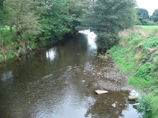
The river is very calm along this stretch with only one weir for measuring the flow.
The cows are back in the fields but seem very docile, too intent on chewing the new grass. Pendle Hill doesn’t look far away, synonymous with the Ribble Valley.
I’m approaching the end of the walk and the path climbs up onto a promontory above the river. This sandy cliff is home to hundreds of Sand Martins at this time of year and they fill the sky, too fast to photograph. There are lots in the photograph below.
Across the river are the Church and Hall of Great Mitton and then I arrive at the road next to the Aspinall Arms, before they open for the day and too soon for a pint. Once a coaching inn known as the Mitton Boat. A ferry boat operated across the River Ribble before the present road bridge was built in the C19th. This was the border between Lancashire and Yorkshire before the reorganisation.

I re-cross the river on another fine stone bridge and this is where you get that long view of the River Ribble winding its way under the gaze of Pendle. A view I never tire of. 
Once safely over, it is a busy road, I climb up the hill to admire the old Hall. 
The Three Fishes across the road has reopened as a fine dining venue, out of my price range I fear.
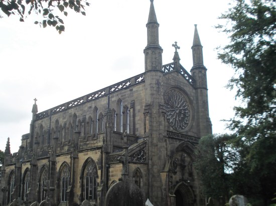
And there, next to where I parked my car, is All Hallows Church, dating from the C16th. 
It has an interesting interior which I had been denied before, but the church was open today so I got to explore – but I think I will leave that to another post on a rainy day, along with Dandy, the black dog of Clitheroe!
This has been an easy four and a half mile walk in perfect weather with lots of variety, which I’m sure most of you would enjoy.


 As we leave the forest a stark metal silhouette of Chained Witches, (Peter Naylor) being marched from Pendle to Lancaster. I am impressed with the detail imparted by a few strips of metal, a reflection of the artist’s skill.


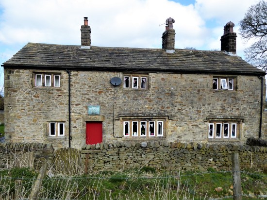
 We now follow the quiet lanes for a mile or so, at the high point Pendle comes into view again. There are lots of cyclists, presumably from east Lancashire clubs, using this switchback route. A majority of the properties seem to be holiday lets, is this the only future for English farming? See below.


 From this elevated position the Three Yorkshire Peaks are just visible but too hazy to photograph. It is a slightly better view down the Ribble Valley towards the Parlick and Fairsnape group of Bowland. And of course you can’t get away from Pendle in these parts.
 Soon we are on the return leg, again on quiet lanes, through the hamlets of Howgill, Newby and Stopper Lane. Lots of interesting buildings are passed and we guess at their original purposes.


 Here abouts is the village institute hall, a good half mile out of the village proper. But it does have an information board which tells us, all too late, about the Heritage Trail we have almost followed.


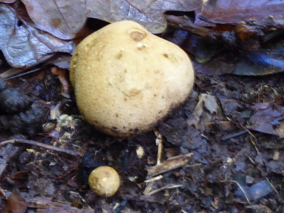
 Jim led us out into the reserve, and we had only gone a few metres before he stopped on a grassy verge. A keen eye was needed to spot the tiny fungi, Blackening Waxcaps, They slowly revert to a black mess. I would have walked straight past them or even worse squashed them. The more studious followers were making notes.


 Entering the woods of Billinge Hill we pay particular attention to the guide’s directions. There are paths everywhere up here, some I recognise, but mainly I am ‘lost’ blundering about in a hopeful direction. Using a bit of creative thinking we follow the steep and slippery paths down alonside a ravine. Mike is not happy, any of his group who may have made it this far would be now struggling.


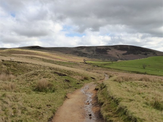


 A new path has been fashioned from the top of the Barley steps to the trig point. I must admit it blends as well as possible into the plateau and must save a lot of erosion. There is also a new stone shelter built into the nearby wall. Once through the wall as if by magic everybody disappears, and I have the whole of Pendle Moor to myself. There is no wind today, so it is almost perfect silence apart from all those soaring skylarks.


