Category Archives: Bowland Fells.

SOCIAL DISTANCING WALK – Mark III.

The other half of Bleasdale.

I felt more and more anxious as I drove a few miles this morning. I was shocked by the interview I heard on the radio the other night with an A and E specialist from Manchester. https://www.bbc.co.uk/sounds/play/p0877mb2?fbclid=IwAR3vAf2InWHLrkSV5t5vMWedzZYA0VR5ykZKvzz7IWmrp5po4hUqJQhZTx8   His message was simple and fairly to be vigilant with social distancing, stay inside if possible and avoid unnecessary journeys. Yet here am I driving ‘unnecessarily’. I won’t be doing it again.

My attempts to exercise whilst socially distancing in the vicinity of my house have proved mixed – busy roads, too many people walking and flooded fields. I was, therefore, prepared to drive a short distance today to reach unfrequented lanes for a circular walk. I was having second thoughts and drove extra carefully to avoid any accidents, as it was there were few cars on the road and all appeared to be driving slowly.

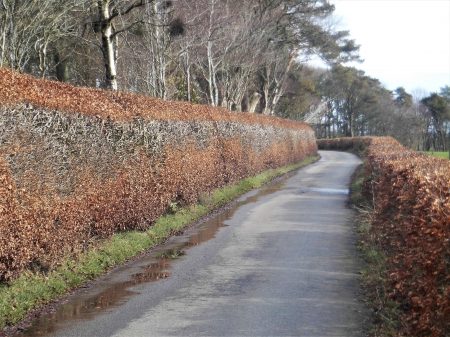
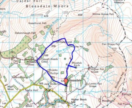
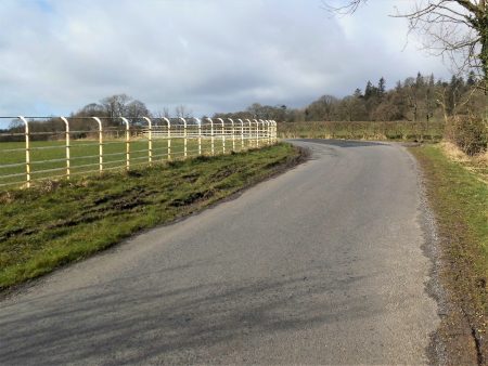
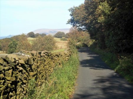
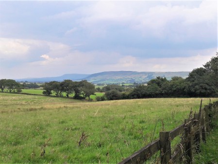
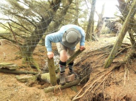
I park up near the access road to Bleasdale Tower and Estate. I had an enjoyable walk around part of the estate last week, so will complete the other half today. The morning is superb – blue skies and bright sun. My mood improves a little as I walk along the empty road. As I gain height I convince myself the exercise is doing me some good. A cyclist passes me zigzagging up the steep hill. The walk continues along deserted estate roads, passing a couple of cottages and going by Bleasdale Tower which is well secluded behind walls and hedges.  The house was built in the early C19th by the Garnett family from Salford who greatly improved the estate land. It was a descendant who established the North Lancaster Remormatory School on the estate which I described in that previous post. The surrounding modest hills looked majestic in the sunshine, I wonder when I’ll be on them again.

Today’s photos don’t do the area justice and somehow seem incidental to my general mood.

I was soon on the road by the gatehouse, having successfully met no-one and I’m now back home in lockdown mode. I’m expecting a letter from Boris telling me to stay in for at least 12 weeks. Not sure if I’ll still be able to walk for exercise without risk to myself or the public. None of us has experienced anything like this situation before and we certainly don’t know how it will pan out in the next few weeks and months. I fear the worst.

My neighbour has just brought me some homemade leek and potato soup, left on the doorstep. It will go well with my practice loaf of bread that I made a couple of days ago.

Since I wrote this I’ve accepted that I shouldn’t be doing any unnecessary driving to go for a walk so from now on will be walking from home only.  23/03/2020.

*****


SOCIAL DISTANCING WALK – Mark II.

I’m trying to exercise whilst social distancing and at the same time reduce driving to a minimum. Yesterday I was on roads all the way and didn’t really enjoy the experience, today I’ll attempt another walk direct from home but this time avoiding busy roads so I’ll need to get my boots dirty.

So off we go. It is another beautiful day, the Spring Equinox. I’m soon into fields, yes they are boggy but I’m enjoying the bird song. For the record, I see Deer, Hares, a Stoat and lots of lambs. The lambs photographed better than the rest.


All around me are hills – the Bowland Fells, Waddington Fell and Longridge Fell.

I pass a deserted country inn, the catering trades are having a hard time. Such a shame as everything is looking so good in the spring sunshine.

Towards the end of my walk, I use an old track to cut a corner off the road but wish I hadn’t as it was virtually impassible with mud and branches.

On the last stretch of road, I spot this beast waiting for restoration.

So today was more acceptable than yesterday but I still ended up with some road walking and the fields were very unpleasant in places.

Body count today, one pedestrian and one runner, both on the roads. Nobody was out in the fields despite the perfect weather. I think it is going to have to be all off-road but on decent tracks until the ground dries or we are all grounded.

*****

SOCIAL DISTANCING WALK – Mark I.

If you don’t meet it you won’t catch it.

Engaging in a healthy diet [if you can buy it in the chaos of our supemarkets] and exercising regularly are both recommended to keep a high immunity and a positive mental approach during this worldwide crisis. There are scores of articles out there detailing methods for survival. In my last post I shared the British Mountaineering Club’s sensible advice which may well change in the coming days. Today dawned the perfect walking day, bright sunshine and clear crisp air. Time to put my boots on – but where to go?  I thought to keep it local and risk-free – don’t want to put a burden on Mountain Rescue teams or ambulances and casualty.

So a walk around the roads from my house seemed sensible. I peer out to check nobody else about, I am highly vulnerable you need to know. I set off at a brisk pace down the lane and immediately bump into a neighbour who wants to chat, it is embarrassing trying to keep 2metres away.

At last, I’m out of the village but I hate the main road I’m on with cars and lorries flashing past within 2 feet never mind 2 metres – have they not heard the government advice.

I didn’t reach a calm space until branching off up Back Lane and into Ashley Lane. Along here I caught up with another walker who crossed the road to avoid me, people have been doing that for years so I wasn’t surprised. Along this stretch birds were singing and some gathering nesting material, Buzzards were flying overhead, it felt great to be out in the open and worries disappeared.

At the road junction, the Bowland Fells appeared in the distance with Beacon Fell, Fairsnape, Parlick, Birkett Fell, Waddington Fell and Longridge Fell all lined up in a splendid panorama.

As I walked into Longridge the dismal sight of traffic jams caused by new developments greeted me. Gloom descended once more.

I won’t use this route again because of the traffic on the roads. I will endeavour to come up with a better alternative for tomorrow’s Social Distancing walk.

Potential viral persons encountered   5.

*****


THE BLEASDALE CIRCLE AGAIN.

Bleasdale Circle with Fairsnape and Parlick looming above.

Another of my winter favourites. This circuit is mainly on lanes and good tracks but takes one right into the hills. I’ve written about it many times but today I have come across some interesting new facts.

For a start, Bleasdale School dating from 1850 where I park is now closed. It soldiered on since the Millenium with about a dozen pupils from the surrounding farms but when the number dropped to two or three its fate was inevitable.

Up the lane, the Parish Hall is heated using a wood pellet boiler with a wind turbine to generate electricity, forward-thinking for a small community. Further on is the uniquely named St. Eadmer Church.

The lane then heads into the hills past a few farms. A footpath diverts to visit Bronze Age Bleasdale Circle. Originally two circles of wooden posts with ditches and a central burial chamber. The wooden posts of the inner circle have been replaced by concrete posts but still are evocative of the site. There is the usual speculation as to the uses of these circles and their positioning. Burial urns from the site have been on view at the Harris Museum in Preston.  The whole site has been planted with a circle of trees which are visible from many parts of Bleasdale. The outer circle, obstructed by the trees, was possibly from an earlier Neolithic era. Ritual sites are often reused over the ages. I visited it today and got my feet very wet in the approach fields.

themodernantiquarian.com

Further into Bleasdale, there is a section of boggy ground before the next farm tracks which come in from the west, like crossing a watershed. All around are good views of the surrounding hills. As well as the Curlew and Lapwings a small flock of Pied Wagtails entertain me flitting along the wall tops. I’m now approaching the properties of the Bleasdale Estate. The estate is now run as partly agricultural and partly a shooting concern but I’ve just unearthed some of its history.

In the C19th a Mr Garnett lived in nearby Bleasdale Tower, he was an agricultural reformer and philanthropist and in 1857 founded The North Lancashire Reformatory School constructed on the estate. It catered for over a hundred boys who worked on the land and in trades such as tailoring and shoemaking as well as receiving an education

“In November 1857, a few weeks after its opening, three boys escaped from the institution due to the fence wall having not been completed. They were all apprehended in Preston the same evening and returned to the Reformatory.”

“Of the 51 discharges for 1865 thirty-three were doing well, twelve convicted, one dead and five missing”

As I walked down the lane today I crossed over Clough Head Brook on a substantial stone bridge which apparently was constructed by the boys. Stonemasons’ tools are depicted on the parapet.

The lane goes through the original school buildings which are now used as cottages and workhouses for the estate. The school enlarged over the years and eventually closed in 1905. A map from 1893 shows the school

In a wall on the corner is a King Geoge V post box [1910 -36]

Taking the shorter route on tarmac brought me past Brooks Farm where an arched ‘packhorse’ bridge is visible over the River Brock. Despite its appearance, it was never built for horses with steep steps at either end. It is not on a known packhorse trail and didn’t appear on maps till 1893. It has been suggested that the bridge was built to provide access from Bleasdale Tower to Bleasdale Church, I wonder if those reform boys built it.

In the wood nearby are some new, not particularly attractive, chalet type holiday lets, a sign of the estate diversifying.

My way back to the school was enclosed by smart beech hedging for which the estate is renowned.

I took this photo of the Bleasdale hills on my way home, St. Eadmer’s church is right of centre.*****

*****

This walk was completed two days ago and since then advice about walking and climbing during the coronavirus emergency has been sensibly updated. As I’m in the vulnerable group I’m taking heed. We are all responsible for limiting the seriousness of the situation in the next few months.

BMC Advice.  18/03/2020

  • People need access to the countryside for their health – both mental and physical.
  • Follow the most current NHS advice regarding health and distancing. Currently Public Health England’s advice is: “you can go for a walk outdoors if you stay more than 2 metres from others.”
  • Consider your means of travel and distance – close to home is best and, despite the environmental impact, it’s better to be in personal cars than public transport at the moment.
  • Stick to familiar areas and low-risk activities.
  • Reduce your risk. Be very aware that medical and rescue services and facilities are going to be extremely stretched and overwhelmed. It would be socially irresponsible to be taking risks at this time that could place an additional burden on medical and emergency services.
  • Do not assume that Mountain Rescue will be available. There is a real possibility of reduced or even no cover for rescue in some areas as this develops.


CURLEW COUNTRY, STANLEY FELL.

I’ve set the bar high with trying to keep my feet dry in the wet weather we’ve had. But I’ve found another walk which takes me on lanes into the rough fell country between Chipping Vale and the Bowland Fells, namely Stanley Fell. There is nothing more evocative of this wild habitat at this time of year than the cries of the Curlew and the Lapwing. They were both present in voice and vision whilst in the gale-force winds unable to be photographed, but you all know what they look like.

Walking up the road there was little traffic. More hens out on the loose than cars. White railings were used on corners of country lanes to improve visibility. I turned off into the Leagram Estate and passed the dell where snowdrops were in profusion last week. The next farm has a surfeit of sheep and lambs under roof all looking very healthy, they breed BlueFaced Leicesters here..

I love these tree roots.

Lanes continue to more remote farms many now upmarket residences. Ahead is proud Parlick. I’m getting into the hills.

I come out onto a road where Saddle End Farm is up the hill, I’m not going that way today but buy a half dozen free-range eggs at the end of their lane. I wonder if anyone is up on Fairsnape in this gale.

Saddle End Farm.

Turning right I follow the last of the tarmac which leads to the remotest farm, Burnslack. A culverted stream runs alongside. I recall coming here with my young children and exploring through the concrete pipes, admittedly not in flood conditions, to emerge higher up the stream – nine out of ten for child cruelty.

The way in…

A bridleway heads into the hills where the curlew are calling. On the way, a gate hangs on across the track, not even baler twine will save this one.

There is an old ford over a lively stream, I often feel an urge to follow these waters up to their hidden source, an endless task. This is remote country, not a coronavirus insight. As I come over the watershed there are the limestone knolls of Dinkling ahead and in the background Birkett Fell and Warrington Fell. Expansive uplifting scenery.

The track drops down to Lickhurst Farm, now a complex of stone residential conversions. Below is a little valley, a motorist parked up asks me where the Forest of Bowland is – I tell him he is in it and direct him through Little Bowland to the Inn at Whitewell. An old limekiln is passed…

… and a little further a low bridge over a stream, this used to be a ford and alongside is the original stone clapper bridge. This is unique in being a single stone over 15ft long. [Now guarded by wooden handrails.] All evidence of a way of living long past.

The road goes on by that often photographed and isolated red phonebox.

I have friends living in the Higher Greystoneley farm buildings so a cup of tea is very welcome. From there another stoney bridleway drops down to a ford, with wooden footbridge, and through limestone country to my car. I drive home in the gale knowing my feet remained dry and looking forward to poaching one of those farm eggs for lunch.

*****

.

RAPTOR PERSECUTON.

The Hen Harrier is an iconic bird of the Bowland  Fells, one I saw regularly in Croasdale but now, rare indeed. It even features as a logo on the roadsigns for the Forest of Bowland. [Some wit has suggested replacing it with a grouse.}

On the Radio Lancashire news yesterday there was an appeal to the public regarding the shooting of a Hen Harrier on the Bowland Fells between Slaidburn and Clapham. The unusual nature of this appeal from the police is that the shooting took place in October 2019. I wondered how seriously the police take these criminal acts if they are only now asking for information.

A little research comes up with the following post. As well as questioning the police response to this incident they publish a depressing list of about 30 Hen Harriers believed to have been illegally killed since 2018.

No further comment. Please read.

https://raptorpersecutionscotland.wordpress.com/2020/03/05/hen-harrier-shot-in-north-yorkshire-police-appeal-for-info-5-months-later/

A QUICK WALK AROUND BEACON FELL.

Longridge Fell is usually my quick fix hill for some fresh air and views but the tracks up onto it will be muddy, to say the least. I choose instead Beacon Fell with its well-made tracks,  it is no further to drive. Longridge Fell Is reputedly the most southerly named fell so Beacon Fell must be the second being only one mile further north. I can ascend both of them easily from my house for longer walks but this afternoon I only have an hour or so spare.

As I arrive in the quarry car park a pair of Roe Deer stand and look at me but quickly disappear when I open the car door. I thought I had a photo of the male but nothing shows up.

I walk briskly in a circle around the hill on familiar paths. I’ve never come to terms with the waymarking here.

There are a few dog walkers out, the cafe is strangely quiet. Everywhere seems green and moss-covered, a sign of a mild and very wet winter.

As I’ve mentioned on previous visits up here storms have taken their toll on some areas of the forest with a lot of tree felling taking place to tidy things up. Perhaps this is a blessing in disguise as the fell has a more open feel to it now and some of the new plantings are of native deciduous trees. Also, wood carvers have been busy creating new pieces.  I add a few more to my collection. There are ‘Green Men’ carved on some trees… … but today I find something a bit different – a ‘Green Woman’ or has someone taken a fancy to one of the lady volunteer rangers?

An obligatory visit to the trig point and I notice that the views to Fairsnape and Parlick are becoming obscured by growing firs – time for another storm?

I’m back at the car within the hour feeling much refreshed.

NICKY NOOK. Calm before the storm.

As I arrived at the summit of Nicky Nook, a modest 215m, the wind was strong enough to make photography difficult. It was mid-afternoon, I hadn’t set off very early and Storm Ciara is on her way.  This hill, I don’t know the reason for its name, is just across the fields from my walk to Calder Vale the other day.

There were crowds coming up Nicky Nook from Scorton, or rather from cars parked everywhere on the lanes leading up to the fell, all to save half a mile of uphill. Traffic chaos prevailed. If this was the lakes these lanes would have double yellow lines to preserve peace and quiet for the local residents. I’d come a different way creeping round the back. A little lane off the main road gave sensible parking and I set off walking by St. Peter’s Church, the one with the pointy spire seen from the motorway heading north.

[Squire Peter Ormrod, who had made his money from the  Lancashire cotton mills, there was one in Scorton, built  Wyresdale Park in the mid-C19th. He died in 1875 and his brother James built the Church in his memory. All the family are buried here.  The architects were Paley and Austin of Lancaster, who designed many beautiful local churches. Interestingly the cut sandstone came from Longridge quarries.]

The road leading south from Scorton is narrow and busy and as a Millenium project a raised pathway was constructed to avoid the traffic. You feel rather hemmed in but I made good use of it today between the road and the River Wyre. Soon I was crossing fields with the prominent westerly stone tower of Nicky Nook visible above.

Footbridges crossed both the rail line and motorway giving close up views of the speeding trains, now in a new livery, and the traffic on the motorway with that well-known view of the spire of St. Peters.

A vague path crossed more damp fields to the complex of houses at Throstle Nest. Signage was poor and one had the feeling of being unwelcome close to the expensive properties. Even the stile leading to the road was low key and not signed from the highway. Normally most paths in the Wyre District are well marked. Feeling grumpy I was distracted and set off along the lane in the wrong direction!

After correcting my mistake I arrived at the entrance to Grizedale, a deep wooded valley coming out of the Bowland Fells. I made good progress up the well-used track, most people were coming the other way having already descended from Nicky Nook. A seat in the valley took my attention – one wonders about the stories behind these inscriptions.

Rest awhile and think of Vicki – drinking coke and looking pretty. 1990-2004.

The fell above was cloaked with rhododendrons which seemed at odds with the birch and oak forest I was walking through. A reservoir was reached, Grizedale Reservoir built in the mid – C19th along with others nearby to serve the Fylde with water from the Bowland Hills.

The steep climbing started up steps and a made-up path, it is a very popular hill. On the way up a tower was seen to the left and I went to investigate, probably for surveying when the reservoirs were constructed.

As I said the wind was already troublesome on the top and I didn’t linger long. Since I was last here Lancashire Red Roses have been stencilled on the trig point. Views to the Bowland Fells, towards the Lakes and Morecambe Bay were a little hazy. The most obvious visible features were man-made – Morecambe power Station, the motorway and several large caravan parks.

A wide track set off down towards Scorton but my attention was taken by another tower off to the west. It turned out to be a memorial to Queen Victoria’s Jubilee and gave a birds-eye view of Scorton. Its makeshift pole has gone askew.

Back on the main track, the hordes were returning to their parked cars. I slid off onto a delightful little path in the woods above Tithe Barn Brook taking me back to my parked car.

A pleasant two and a half hours’ exercise. Storm Ciara came and went but little did I realise the storm to come, Covid-19.

*****

CALDER VALE.

Calder Vale is a hidden village tucked away from the world to the east of the Bowland Fells. Quakers Jonathan & Richard Jackson founded Calder Vale realising the River Calder would provide water power and in 1835 the Lappet mill was built to spin cotton. At the same time, they provided for their workers and their families by building houses on site. A further mill was built downstream for weaving the fabrics. The waste from these mills was transported to Oakenclough further up the Calder where the same family had established a paper mill. Most of the mills have long since closed but the Lappet mill has survived by specialising in the production of Arab head shawls!  Those red or blue and white shemaghs for protection from the sun as well as windblown sand.   Time for a revisit.

I waited this morning for the mist to disperse, and I waited. By 12am I decided to set off hoping the sun would appear as promised. I am not far away as the crow flies but the lanes in this area are a maze. Eventually, I found a parking place by Sandholme Bridge on the Calder. I wanted to walk into Calder Vale from above to fully appreciate its position. The quiet lane rose up above the river heading towards the Bowland Hills [which were in the cloud]. I was directed off the lane towards Cobble Hay Farm, a working farm that also hosts a popular café and gardens. Guess what, it has been closed all winter but is reopening tomorrow, so no coffee today. The original farm is dated 1681.

Once through the farm, one is onto open pastureland which today was a quagmire, and I was concerned about becoming stuck as my boots sank further and further into the mud. Up above a couple of buzzards were wheeling around and crying. I approached the next farm cautiously, thinking there may be dogs at loose, but I was greeted by this friendly face.

I’m now on the edge of the Bleasdale Fells [Bowland], there used to be a pub up here, The Moorcock, now closed and a private house. I was aiming for the little St John’s Church,1863, the parish church high above the village.  It was closed today but apparently has some fine stained-glass. Next to it is the little village school serving a wider area than just Calder Vale, I wonder how many children walk up from the valley each morning.

Reversing their route through the woods I met up with the River Calder down below. A pleasant stretch alongside the lively water brought me to a weir where water was taken off to a large millpond which previously supplied the Lappet mill. The mill is no longer water-powered but it is interesting to follow the original leats.

Now deep in the valley, the first row of Calder Vale workers’ cottages are passed and how delightful they look today but car parking is obviously a modern-day problem. [heading photo]

The Lappet Mill is massive and the sounds of weaving can be heard outside. Let’s hope the demand for headscarves continues.

Just past the mill is an old farmhouse, a sheepdog rushes out to greet me. The farmer appeared, and we had a long chat on all things rural, meanwhile, the dog rounded up all the hens in the yard – ‘showing off’ said the farmer.

More cottages were reached over a footbridge. Alongside the river, there was very little sign of the lower mill, only a few stones and water channels here and there.

The track climbed out of the valley and crossed fields to a country lane. A man was practising with a parapente on an easy slope, he never got off the ground.

Once on the road, I walked quickly back to the car with the weak sun in the west and the rumble from the motorway becoming intrusive. I stopped to buy half a dozen farm eggs towards my tea.

*****

ANOTHER VISIT TO ROEBURNDALE.

I ‘discovered’ Roeburndale whilst walking Wainwright’s Way between Dunsop Bridge and Hornby a couple of months ago. The route I was following dropped into the valley and climbed out just as quickly. I thought there must be a better way to explore this valley of natural woodlands. Research on the web showed some permissive paths but even those didn’t link up completely. When Sir Hugh was wanting to complete his WW trail in the area I was only too keen to revisit and investigate paths in the valley. The plan was to leave one car at Hornby, drive to the foot of Salter Fell and walk back down the hidden valley. Simple. Come the day and we struggle to negotiate the ice on the narrow steep road, expert driving by Sir Hugh. Shaken after skidding up that steep hill we consider what to do. I became nervous about returning up the hill in my car later in the day and having two cars stuck. We decided unanimously to get the hell out of here as soon as possible, so Sir Hugh in first gear retreats. The skid marks on the road were still there later in the day – good decision. The road is much steeper than the picture suggests.

Now parked up in Wray our option is to walk up Roeburndale and somehow [all a bit vague] find a circular route back. Wray is a quiet village of stone cottages which hit the headlines in August 1967 when the Rivers Roeburn and Hindburn flooded causing loss of properties, bridges and livestock but thankfully no villagers. The way out of the village is by Kitten Bridge over the River Roeburn, this was the way for workers going to Wray Mill [wool and silk] now converted into accommodation. Looking back over the village Ingleborough was prominent.

We picked up a track leaving the road at a small building and followed it into the woods quite high above the river. The path was intermittent and hidden beneath all the Autumn leaves.  In about a third of a mile, it started descending steeply and remains of wooden steps in places suggesting we were on track. Once down level with the river, there was some boulder hopping to be done and lots of fallen trees to get around. A truly hidden valley.

A meadow was then traversed to the bridge I had crossed before in the middle of those apple orchards. This time we followed the permissive footpath signs along the valley. The vague path climbed away from the river ending at a belvedere overlooking the river. Onwards we went, picking up the odd waymark and guessing, intelligently, where the path would go. We spotted a diversion to the wire bridge across the river and went to explore the other side. The bridge was exciting – slippery, creaking and swaying.   A camping barn was marked on the map and we found it after one false alarm. We gained access from the outer stairs which led into the bunk room, all very cosy. Down a ladder, we were in the kitchen with all you would need for a night’s stay. I wonder who owns/runs this place. Once back over the bridge……we pick up the permissive path once more as it contours high in the valley just in the edge of the woods. The day was passing, there was no sign of a thaw and we didn’t have a plan. My thought of returning along the fells to the east was slipping away with the daylight.  We decided to follow blindly the permissive path and cross the river by the bridge Sir Hugh had found the other day. Lots of undulations in the trees before we came out into open fields and started dropping down to the river. A muddy track led us to ‘Sir Hugh’s bridge’  which was sturdier than the last one. The path seemed to go away from the river so we made the decision to climb up to the road which would be our quickest way back to Wray. [It would have only been another quarter of a mile to Barkin Bridge and thus completing a stretch of Wainwright’s Way wholly in this delightful wooded valley.]                                                                                                                                             In parts the road was an ice rink and as I said our tyre marks were still visible from this morning. This otherwise pleasant stroll down the lanes was enhanced by views to Ingleborough, Whernside, the Howgills and the Lakeland tops.

They were just starting carol singing when we arrived in Wray.

*****

WAINWRIGHT’S WAY. 4. DUNSOP BRIDGE TO HORNBY.

The heart of Bowland.

I knew this would be a long arduous day so I did it out of sequence in the good weather mid-September. I used devious tactics to complete the walk but I’m happy to write it up as it should be.

Head of Whitendale. A Wainwright. 1981.

Following a coffee at Puddleducks Cafe,  I set off along the lane out of Dunsop Bridge heading into the fells. A gentle stroll, alongside the Dunsop River, leads to the prominent Middle Knoll where the water board roads divide, one going left into the Brennand Valley the other going right into Whitendale. Wainwright’s Way follows the latter but I know a better way.  Cross the river and follow a path up the right bank before climbing into Costy Cough and picking up a level path all the way to Whitendale Farm.

Middle Knoll.

Costy Clough.

Whitendale Farm.

There is lots of interest along this path but today the highlight was seeing a Hen Harrier rising from the valley and fluttering up the fell. This is a rare sight these days as their population over grouse moors has been drastically reduced by foul means. Bowland should have a decent population of Hen Harriers, a book well worth seeking out is Bowland Beth by David Cobham which highlights major issues in UK conservation.

At Whitendale Farm, part of the Duchy of Lancaster, paths go in several directions. WW goes up the valley following the Whitendale River. The dogs in the kennels give you a good send-off. This is shooting country and bred pheasants are everywhere. The grouse shooting this year has been restricted due to the Heather Beetle devastating large areas. It is usually a squelchy route up the valley and today is no different. A few random boardwalks don’t really help but the waymark posts keep one in the right direction. I plod upwards in the heat with the occasional submerged leg.

Side valleys often have Ring Ousels and Dippers but none today.  A post on the Hornby Road beckons and I’m soon sat on a convenient rock for a snack, I could probably sit here for hours before another person appeared.  This old road over Salter Fell has been described as one of the best moorland walks in England. The Romans came this way en route from Manchester to Carlisle and then the packhorses, bringing salt to Lancashire and wool to the coast. The Lancashire Witches were dragged across to Lancaster Court for sentencing and hanging. I’m surprised that WW comes up Whitendale, a difficult route rather than the easier way from Slaidburn, AW was familiar with both. His Bowland Sketchbook from 1981 illustrates the area well and he had a certain respect for relatively unknown Bowland, not much has changed from his time.

I set off along the good track, below on the left is the head of Whitendale and way above the rocks of Wolfhole Crag. All is wild and remote. the track follows the slopes of Salter Fell for a good way before views open up to the west. The infant Roeburn River gradually gains volume running west, To the north Ingleborough and its neighbours stand out, a little hazily in the afternoon sun. The silence is only disturbed by a couple of motorcyclists making the through trip.

Upper Roeburndale.

A lone cyclist comes the other way. The track goes on and on and slowly loses height towards Higher Salter Farm. There are hazy views of the Lakes, Howgills and the Barbon Fells. The last time I was up here was on The Lancashire Witches Walk which at Higher Salter veers off to Littledale and Caton Moor.


Higher Salter Farm.

Higher Salter Farm.  A Wainwright. 1981.

Today I carry on past Middle Salter to Lower Salter where there is a small Methodist chapel. Built in 1901 it will have been a meeting place for the far-flung farms in Roeburndale. It was open so I rested a while in its plain interior.                                                                                                                                                                               Looking back up the Salter Fell Road Mallowdale Pike is prominent, described by AW as “one of the few fells in Bowland with a graceful outline”  It is an outlier of the Clougha Pike/ Ward’s  Stone range. The road drops further to cross the Roeburn, a river of hidden delights. WW follows the road for almost a mile with the bonus of good views to the Northeast but I notice concessionary paths possibly by the river, I haven’t time to explore today but make a mental note to return.

Reaching Back Farm the way goes steeply down into the heavily wooded valley on a path that gets little use. There are signs of occupation: yurts, sheds, coppicing, vegetable plots, orchards between the trees. Looks like an organic environmental settlement but there is nobody about. http://www.middlewoodtrust.co.uk/

A narrow wooden bridge crosses the river into more orchards. There is still no sign of anybody about. I suspect that one of those concessionary paths would bring you here without the road walking. Anyhow, I gain a cart track leading up through the woods and fields to arrive at a small road heading back down to a converted mill. Wray Mill started as a woolen mill but adapted to produce silk, cotton a nd bobbins, it closed in the 1930’s.  Kitten Bridge, nice name, crosses the Roeburn and a little track leads straight into Wray.

This bridge was washed away in the August 1967 floods along with cottages at the lower part of Wray. I’m not sure that I’ve ever been in Wray before, it’s off the beaten track. Anyway, the Main Street off the main road is a pleasant collection of cottages with a homely feel to it. There aren’t many buses so I have to continue a further mile through fields to Hornby. Ingleborough is over my right shoulder all the way and ahead is Hornby Castle, its C13 base obliterated by a C19 Gothic building. I join the River Wenning for the last stretch into the village.

A Wainwright 1980.


Shares
26

WAINWRIGHT’S WAY. 3. LONGRIDGE FELL TO DUNSOP BRIDGE.

Across Chipping Vale.

Here I am back at the trig point on Longridge Fell, it is a beautiful, cold but sunny Autumn day. Sir Hugh has joined the fun and we’ve taken one car to Dunsop Bridge and driven back to park below the fell. I’m sorry we are not keeping to AW’s use of public transport.

A warm-up walk and a catch-up chat soon sees us on the ridge with the compulsory visit to the summit trig. A few people are wandering about up here not wanting to miss the good weather. After a photo session and orientation of distant hills, mainly the Fairsnape ridge, Bowland and the Three Peaks, we find the steep rake dropping down into the Vale of Chipping, spread out below us. Our distant destination of Dunsop Bridge visible in the folds of the fells. This brings us to the road next to the Bradley Hall complex of buildings. WW says to go through the complex but our more modern map says go round the diversion to the left. This is the start of troublesome field navigation for the next mile or so. The waymarks run out, the paths run out, the stiles disappear, the fields get boggier and we are left to our own devices, no fences were damaged, no wires cut when we finally stumbled down a ladder stile onto the road next to Doeford Bridge. I think it took us longer than we realised.

A sign tells us we are entering the Queen’s land which we enjoy for the rest of today

.

This beautiful sandstone bridge spans the Hodder just downstream from where the River Loud joins having come out of Chipping Vale. The bridge is sketched in AW’s Bowland book.

Doeford Bridge. 1981. A Wainwright

There was a good volume of water today after several days of heavy rain. Having crossed another field we dropped down to the Hodder which had looped round a different way.  I wanted to have a look at the stepping stones next to Stakes farm so we made the short diversion, there was no way you could have crossed the river here today. Luckily we found a bench overlooking the river and stopped for lunch.

AW?

Behind us was Stakes Farm an early C17th house with mullioned windows and a plaque in Latin, translation please. Amazingly a brick extension has been built into the angle between the two wings.

We follow fields just above the river. The area between Longridge Fell and the Bowland fells is beautiful and unknown countryside, especially in today’s sunny weather, backed by the dark hills. Across the river used to be a ‘Wild boar park’ but it has closed recently. We cross the road into more fields running above the Whiewell Gorge where the river runs deep in the woods. [It is on the opposite bank that you can find the Fairy Hole caves.] Views into the Bowland Fells surrounding Dunsop Bridge keep us going.

I think we are following one of the aqueducts taking water out of the to industrial Lancashire, the distinctive Waterboard gates accompany us. We drop down past a graveyard and pop out onto the road next to the famous Inn at Whitewell. There is time to have a look into the adjacent Church of St. Michael with its striking stained glass window.  We resisted calling at the inn as time was drifting on and I think once seated it would have been difficult to get going again. A permissive path close to The Hodder leads deeper into Bowland with the next feature sketched by AW – Burholme Bridge.

Above us on the right was the distinctive Birkett Fell scene of one of our recent struggles. Our pace was slowing and instead of the familiar track by the river to Thorneyholme we crossed the pipe bridge, erected by Blackburn Borough Waterboard in 1882. with its unusual turnstile gates at either end. The way along the river was convoluted as we bypassed Root Farm famous for Kettledrum, a Derby winner bred hereabouts. Our arrival into Dunsop Bridge was unfortunately too late to have tea at Puddleducks Cafe.

Dunsop Bridge.   A Wainwright 1981.

We reflected on this wonderful crossing of Chipping Vale, Lancashire at its very best but wondered why 8 miles seemed so far. I was glad I’d divided this stage of WW into two enjoyable days, days to be savoured.

Here is an evening photo of the rake we descended from Longridge Fell early in the day.

Possibly Sir Hugh may have a different view of the day.   http://conradwalks.blogspot.com/

*****

WAINWRIGHT’S WAY. 1. BLACKBURN TO WHALLEY.

Escaping the city.

My train was full of lively pre-match Blackburn supporters. Most didn’t have tickets and exited the station somehow, I was glad I wouldn’t be on their train after the match. AW was a lifelong Rovers supporter.

Outside the station, as I gathered my bearings I was struck by the number of expensive-looking cars, with modified exhausts and booming stereos, cruising around aimlessly at high speeds. I refrain from comment.

I began the long walk up Audley Range. Mills at the lower end near the canal have gone and been replaced by budget shopping units. From the canal upwards AW would have had almost a mile of two-up, two-down terraced housing. There has been demolition in parts giving little cul-de-sac estates. a mosque and many Asian shops but the higher you get the more you are attuned into AW’s time when he trudged up and down from the centre to number 331, his birthplace and where he lived until 1931 when he married. Until 1935 a tram ran halfway up before going to Queen’s Park.

I couldn’t resist calling in at one of the little Asian ‘Sweet Shops’ to buy a couple of samosas for my lunch.

Fittingly there is a plaque on 331 to commemorate Wainwright though I wonder whether any of the Asian population hereabouts will realise the significance. Opposite his house is an open space formerly a brickworks producing the millions of bricks for the housing and mills.

I reached busy roads on the edge of town. Up here AW attended primary schools, now demolished under ring roads and Tescos. I was glad to turn down to the Leeds – Liverpool Canal at Gorse Bridge. The canal would have been lined by warehouses and mills and here is one of the last, the derelict Imperial Mill once employing 300 until closing eventually in 1958. Many of the mills diversified into minor industries after cotton had crashed.

The canalside walk took me past the Whitebirk Estate, shops and car salerooms, and under the maize of roads connecting with the motorway system. One always sees things differently from a canal and then the next time I drive around these roads I’ll reminisce to myself and try and spot the canal. I ate my samosas as I walked the towpath and realised they had quite a kick to them.

Before long I was in a more rural landscape and leaving the canal to climb steeply up onto the ridge of Harwood Moor. An old bridge is crossed, this is the line of the former Blackburn to Padiham railway. The industrial landscape is left behind and suddenly you have a view of Longridge Fell, the Bowland Hills, Yorkshire peaks and Pendle. It was these northern edges of Blackburn that AW  explored as a youngster and subsequently with work colleagues. A certain Harry Green wrote a regular walking column in the newspaper and produced some guidebooks to the area and into the Ribble Valley and Longridge Fell.  One of AW’s walking companions, Lawrence Wolstenholme, kept a diary of Harry Green inspired walks and his descendants still have a copy of Rambles by Highway, Lane and Field Path. H Green 1920. So it is certain that they walked these trails out of Blackburn.

I entered a farmyard patrolled by a bull and hesitated before rushing to the other side and safety. All the fields up here seemed to contain frisky bullocks so I did a little creative road walking to get me on my way. I was soon on a higher ridge with even more extensive views.

Looking back to Blackburn.

Longridge Fell and the distant Bowland Fells.

Down a reedy path to the Dean Clough Reservoirs with Pendle in the background and then I make my own way up above them to come out onto Moor Lane above Langho, it was only last week that I visited The  Lord Nelson Inn here for lunch. Its a very basic but friendly pub with good beer and a limited home-cooked menu,  a couple came in and asked about dining “have you a gluten-free option?”   “No!” was the simple answer.

I didn’t have time today to call in for a pint but marched off along the virtually traffic-free Moor Lane. At one point I glimpsed a deer eyeing me through the trees. Whalley Nab is at the end of the lane directly above Whalley and the River Calder. The River Calder flows through Whalley to join the Ribble, leaving behind its industrial hinterland where in the distance can be seen the Martholme Viaduct which carried the aforementioned Blackburn to Padiham railway. I had a birds-eye view of the Ribble Valley and Whalley, making out the street plan and the more famous railway viaduct over the Clitheroe – Blackburn line I travelled this morning. The Ribble Valley was one of AW’s many sketchbooks done in later life, Nick Burton has illustrated his text with some of these sketches.  It will be interesting to compare AW’s views with my own as I proceed.

A Wainwright 1980

Before I knew it I was crossing the Calder into the busy main street. The impressive 13thC church was closed. Whilst waiting for my bus I had a very short time to look round the Abbey ruins, free entry today – Heritage Week or something. They deserve more so I’ll return for a longer visit.


I’ve finished the first stage of Wainwright’s Way and I’m looking forward to the rural walking to come.

*****

KEEP IT SIMPLE.

Beacon Fell.

Beacon Fell, Brock Bottoms and Kemple End.

It’s the summer holidays and I’m entertaining my youngest grandson for a couple of days, that’s all he has in his busy diary. I think of some local walks that will keep him interested and not be overdemanding. When I was his age, 11years, I could cover 20 miles no problem across rough moorland, alone and while smoking a few Woodbines.  Maybe not, but I think the generations have softened the Human Spirit. While he stays with me there is an unplugged mentality regarding mobile devices, I try to explain that nothing will happen whilst he is off line. He is not convinced.

He arrives with his stepmother, both keen to explore the local countryside. I’ve devised a route up onto Beacon Fell that is interesting, short and easy. They seem happy with it as we arrive at the cafe in time for lunch. On the way we passed Barnsfold Reservoir where his great grandad used to fish and paint piscatorial images for the fellow fishermen. I’ve often wondered what happened to those skilled canvases.  We marvelled at the size of two Buzzards wheeling overhead and we wondered about unusual tree fungi, a white bracket on a beech tree which I’ve been unable to identify.

We walked past a farm where the family have diversified into a hair salon what was previously a cowshed, good on them.

We passed more fishing lakes this time part of a recreational complex with holiday chalets. The original farm, Wood Fold, is grade II listed but has been submerged by ancillary housing.  I never realised how much-hidden developments there were in the area.  There was only a minor footpath diversion through this development.

Onwards, with grandson navigating, we followed my route of the other day through Crombleholme Fold and up the fields and into the woods to the honey spot of Beacon Fell.

All smiles.

We were probably the only people that had walked here, all be it only a  couple of miles. A trio of elderly cyclists arrived and clattered into the cafe, they had come through the hills from Lancaster. We enjoyed soup and sandwiches. On our way back we had time for an attempt at climbing the new snake from tail to head and then we were out of the woods and back at the car. There were some new wood carvings of leafy Green men, a pre-Christian symbol. Incidentally, there is a Green Man Pub in nearby Inglewwhite.

I hope that a few navigational skills have been absorbed.

The afternoon was spent pruning bushes in my garden and the more exciting shredding of those branches which provided lots of laughs. A competitive game of boules anticipated our imminent family trip to France.

Refreshed by Thursday morning our next jaunt was to Brock Bottoms just below Beacon Fell. We were one of the first cars parked up in the popular picnic spot.  It is years since I’ve been along this stretch of the River Brock. Memories of early forages with my own young children keep coming back. The river is low, we see no kingfishers or dippers which I was hoping for.

The highlight of this walk was going to be Brock Mill but alas time has taken its toll on the ruins of the mill. Where there had been substantial buildings there were only stones with little evidence of the mill race, waterwheel or the mill itself.

Brock Mill was once a thriving water-driven cotton spinning mill with up to twenty cottages in the valley for the workers.  The mill was probably built in the 1790s. After a chequered history and two reincarnations as a roller making factory, and then a file making factory the mill finally closed in the 1930s. For some time the ground floor of the mill operated as a café, whilst the top floor was used for dancing on Saturday nights!

It took some imagination to see the ruins of the cottages.

Slightly disappointed we retraced our steps. Having given my grandson a lecture on watermills I drove back via Chipping where there is a water wheel attached to a house, a former corn mill and then converted to a restaurant with the wheel turning.

I cut the lawn whilst he caught up on ‘social media’, he hates it when I call it ‘antisocial media’

The weather remained sunny and dry and the plan for the afternoon was some bouldering up on Longridge Fell. Again keeping it low key I bypassed the tough Craig Y Longridge and settled for Kemple End. We dropped into the secluded heather bowl that is the old quarry. We were out of the sun and spent a couple of hours trying some of the easier problems. He realised that outdoor climbing is so different to the climbing walls he has been visiting. At the end of the session, I’m not convinced I’ve converted him into a proper climber. I was so busy spotting him that I didn’t take any photos – next time.

I don’t know who was most tired by the time his father came to take him home. See you in France.

BEACON FELL FOR LUNCH!

I can see the tree-covered summit of Beacon Fell from home [photo above], only just as new houses spring up. Last night I thought it a good idea to walk from home up to Beacon Fell, have lunch in their excellent cafe and walk home again, The Grand Old Duke of York comes to mind.

This is a regular walk and I don’t need a map, which is fortuitous as I didn’t take one.  I rely on my phone for local mapping. This route to Beacon Fell is the one I use for the start of my Longridge Skyline Walk, LSW.  I faffed about this morning with various things, one of which was my camera’s lens cover which keeps getting stuck. WD 40 may not have been the best idea but I tried it and realised that it would take some time to clear itself. So I leave the camera at home and use my phone for pictures.  It was 11am when I left my house and bumped into a neighbour. He is used to my eccentricities and enquired where I was going  – “Beacon Fell for lunch”  “Oh!” was all he could say.

The fields were high in summer growth and at every stile I was faced with a barrier of nettles, brambles, Balsam and that sticky plant. I spent a lot of time bashing down the undergrowth. Shorts were not the best idea.  I was getting nowhere and becoming increasingly hot and sweaty.

Worse was to come when I reached what were previously open fields but now were transformed into parcels of equestrian land, paddocks I suppose, by electric fences. Large fields with footpaths and open access were now a no-go zone.  I was fuming at the lack of thought for us humble walkers. This was more like an obstacle course than a rural wander. After limbo dancing under some live electric fences, I started to become rebellious detaching the wire where I could, they were live! Knowing I was on a Right of Way  I ploughed through, Sir Hugh will understand. The last obstacle to a bridge was dealt with and I was on someone else’s land. On a serious note, I will be reporting this blatant obstruction of footpaths to Lancs County Council once the dust has settled using their excellent MARIO web site.

By the time I reached the fishing lakes at Horns Reservoir I was well behind schedule. I thought of curtailing the day, but no my obstinacy carried me forward. Exiting the field by the narrow Right of Way was impossible but I knew a way around. Later exchanging pleasantries with the landowner I couldn’t come to say “why don’t you clear the footpath?”  Writing this now I feel I should ride out there tomorrow and ask him.

Things improved and I made good progress through well-known fields. Lovely green grass hid a hare which set off at speed when I approached.  I was impressed at a stile where not only was the correct signage clear but there was also a small map showing the Rights of Way in the surrounding area. Brilliant. I can never understand why some farmers make it difficult to cross their land – why not sign the way and be done with us.

So much more helpful than ….A barn at Whinneyclough had some unusual, obviously historic, features and I was caught trying to get some close-up photos. Note the finials on the roof, the covered mullioned window and the dated door. The owner seemed insensible to my curiosity. The nearby farmhouse is also of architectural interest but was out of bounds.

On through the golf course where the trees have matured in the years I’ve been coming here. Nobody seemed to be playing at the moment. There were signs indicating ‘footgolf’ –  whatever next.

The diversion around Fir Trees Farm seems less irritating as the years go by. I still have no faith in the Planning  Authorities who allow it. The brick fronted farmhouse is Grade II listed.

Well trodden paths through Higher Barker and the burgeoning complex at the former  Cross Keys Inn.  When I first moved to this area this was a favourite place to drink, pre breathalysers, with the beer being served in the farm parlour. The way onwards is always boggy, you will be cursing me if following this route. But now Beacon Fell is there above. A couple of awkward fields and then a long traverse of green pasture brings me out on the road at Crombleholme where there is an impressive C17th house, today splendid with its colourful garden.

Up to the fields and into the woods and suddenly I’m in the main carpark of Beacon Fell. There are people everywhere enjoying the summer sunshine. I present myself at the cafe counter sweaty and dishevelled, probably the only person to arrive here under his own steam. The tea and sandwiches are perfect as I sit at one of the outside tables and watch humanity. Curiously I didn’t take any photos, battery running low but this what it was like.

Aa I didn’t visit the summit, it was all downhill to home. Away from the crowds the paths are eerily quiet. Concessionary paths have been established down to Carwags where a quiet road takes you onwards. Views open to Parlick behind and to Pendle and Longridge Fell ahead. by now my phone was running out of juice hence few photos and no map to follow. An even more rural lane with grass down the middle comes out at Loud Higher Bridge.

I follow the infant River Loud through fields some of which may be trespassing, no map remember, but I eventually come out at a deserted Loudscales Farm. I  know the way home from here. up the lane to the road and down to a junction of paths. Take the middle one up to Withinreap Farm, pass the ‘figure of eight’ ponds and arrive at Lancaster Farm where fields lead to Higher House Farm. From here there are more views to Beacon Fell, the Bowland Fells.

The football match down the road is notable for its spectators’ foul language drifting across the town. Welcome home. It is five o’clock when I turn down my road with a knowing nod to that neighbour.

*****


A RURAL RAMBLE FROM BASHALL EAVES.

28 years ago I remember a footpath above the River Hodder coming to an abrupt stop where a bridge was falling down. My son Chris and I were on a backpacking trip around the old Lancashire boundary. We had left Mossley, East of Manchester, and worked our way through high Pennine country, Pendle, Ribble Valley, and now we were heading north through Bowland towards Arnside. After getting through the no access, closed and danger barriers we balanced precariously across crumbling masonry high above a stream and carried on our way. Do I have a photo somewhere of that day?  I often wondered what happened to that bridge above Mill Brook. Today I set off to find out.

I parked next to the village hall in Bashall Eaves and set off along a farm track to Mason Green Farm. This turned out to be one of those almost industrial sized complexes. By chance I found a way around it and across fields, full of cows, in the right direction towards Agden Farm which seemed to be a Land Rover hospital. Numerous varieties of the marque were lined up in various states of repair, from a barn there were sounds of restoration.

The overgrown path dropped into a gully, the first of many today, and climbed out steeply on recently installed steps. Somebody must come here. I was now in pastures surrounded by all the familiar fells, Pendle, Longridge Fell and the Fairsnape group. I disturbed a few deer as I dropped into the next gully in Paper Mill Woods. This steep and rather slippery descent took me onto the banks of the River Hodder, full from the last few days’ rain. This is about the only access to the Hodder between Doeford Bridge upstream to Higher Hodder Bridge below. It makes me think that I must be on The Hodder Way a route devised by Clitheroe Ramblers and one I walked in recent times – I have no recollection of this demanding stage.  There was no bridge across the stream but it was no problem to hop across.

Climbing away from the river I pass three magnificent oaks. In the next field of long grass, my only objective is an ash tree on the horizon. Then it is down once more into woods and a difficult descent of a bluff to reach that bridge from years ago, now converted to a wooden structure spanning the stone abutments. There are references to Roman times but I think that is unlikely even though they passed by quite closely. This is a deep ravine, Mill Brook, and the new wooden bridge, rebuilt in 1997, is more impressive than in the photo.

A vague path climbed up through the woods to emerge into fields with open views of the fells. These were crossed and a final dip overcome to reach a track which follows a Roman road, Ribchester to Kirkby Lonsdale. It had taken me two hours to cover three miles and I was ready for a break and a snack.

Onwards I followed the lane to Lees House Farm, now supporting several developments. It’s called diversification. Steep paths lead down to a stream, Mill Brook once again.  Coming up the other side into an overgrown field was not easy if there was a path I didn’t find it.

From here to Micklehurst Farm was straightforward though I managed to herd a lot of sheep in front of me. This morning it had been all cows and now sheep everywhere. Barking dogs, thankfully chained, followed my progress through the farmyard. I’ve passed the road end to Micklehurst Farm many times, I think they are distant relations,  I never realised how far off the road they are.

On the corner is one of the entrances to Browsholme Hall, South Lodge, I sneaked a photo of the gatehouse and cottage.

Now I was onto little-used roads through woodlands some of which are described as nature reserves. I met a couple leisurely ambling down the lane, they had been out birdwatching.

Further on an old Alvis Speed was parked up. It was in fantastic condition. The owner working in a field nearby was obviously proud of the vehicle,1932,  – “all original bodywork”. He admitted that the engine wasn’t firing correctly, hence the bonnet was up for tinkering.

I continued down the lane to reach Saddle Bridge which I mentioned in a recent post.  It is always good to look at things from a different angle and I can’t resist a photo of a packhorse bridge.

Returning up the path, Rugglesmire is passed, I trespassed a little to try and see the grade II farmhouse.

Into the hamlet of Bashall Eaves, a few cottages with evocative names – The Old School House, The Vicarage, The Old Forge, The Post Office etc.

The Old Forge.

There is also an old Lancashire Cheese press.

Just down the lane is The Red Pump, now a thriving inn/restaurant, but it has a dark history. In 1934 a farmer, Jim Dawson, was shot whilst walking home from the Edisford Bridge Inn at Clitheroe and died later of his wounds. Investigations were hampered by a “wall of silence” from the villagers and the mystery has never been solved. There is talk of ghosts…..

I usually show a map of my wanderings below and I would suggest that any local readers of my posts try this unknown area. The first half of the walk is particularly scenic and interesting – the best of rural Lancashire, and the paths could with a bit more footfall.

*****


TOTRIDGE FELL, BOWLAND.

 Last night after a bouldering session at Craig y Longridge I drove up the fell and took in the familiar view over Chipping Vale to the Bowland Hills. In front of me were the Fairsnape, Wolf, Saddle, Burnslack and Totridge Fells. How many times have I photographed this scene?  I’ve not been on the easterly of these for several years so there and then I decided on a full traverse of the range today. For every 100 visitors to Fairsnape there is probably only one on Totridge.

I can’t explain why I sat in bed with a couple of coffees delaying my departure. Sloth had taken control and it was with a great deal of difficulty that I finally emerged and started the walk at 11am. By then I realised a full traverse and return of 13 miles or so was impractical and I opted for a shorter 9miles from Saddle End, missing out Fairsnape. The heat of the last few days was diminished by a westerly breeze. Old tracks rise up from Saddle End farm and soon the open moor is reached. A steady metronomic pace is tapped out by my walking poles as I gain ground. There is not a soul in sight.

Saddle End Farm and fell.

On the 26th March 1962 three siblings left home and travelled by bus to Chipping and
walked over the fells, maybe to Langden Castle, on their return over Saddle Fell they were caught in a blizzard which resulted in the two brothers losing their lives due to hypothermia. Their sister survived to raise the alarm at Saddle End Farm. There was no Mountain Rescue Team in the area at that time so police and locals searched with BAC loaning a helicopter to help. Shortly after this tragedy two Mountain Rescue teams were formed in the area, the forerunners of Bowland Pennine MRT.

I mention the above because it is thought the boys may have sheltered in a small stone hut. I remember early walks on Saddle Fell in the 70’s the hut being by the track I’m on today, its roof was almost intact. Now it is a pile of stones but with a tragic history which I recollect every time I pass.
Reaching the wild top of Saddle Fell ignoring the track to Fairsnape I turned east at the watershed to follow the fence towards Totridge seen a couple of miles away. This stretch of fell is usually one of the boggiest in the area, I’ve been pulled out of the depths on one occasion,  deciding which side of the fence is the least hazardous often means crossing repeatedly without any real advantage. Today however the peaty ground was bone dry and I could just enjoy the scenery without any risk of sinking, the wooden poles placed to give buoyancy in wet conditions totally unneeded. [By the way the best ‘path’ is on the left of the fence.]

The views are far stretching over the Bowland area and all the hills and valleys I’ve been walking recently are identifiable. The Yorkshire Three Peaks are in the hazy background. Difficult to capture on camera.

Up here in this bleak wilderness one plant brightened up the peat bogs – the yellow starry flowered Bog Asphodel.

All I had to do was follow the fence, there is one pond to navigate found and a short section above Whitmore where you leave the fence at a tangent and take off into the peat to regain a wall in a short distance before rising onto Totridge and a final open track to the trig point at 496m. The trig pillar is looking decidedly unstable as the peat below it erodes, it will topple before long.

From the top a small path, not marked on the map, heads NE to drop steeply off the fell towards Mellor Knoll. If the correct line is taken zigzags descend quite pleasantly, not so pleasant ascending.  Halfway down today I found a place to sit, eat my sandwiches and contemplate the views over the Dunsop and Hodder valleys. In the distance over Mellor Knoll was a glimpse of Stocks Reservoir I walked around last week and closer at hand, above the Hodder, the tree capped Birkett Fell again climbed recently.

Over Mellor Knoll to Stocks and Yorkshire.

Birkett Fell, Waddington Fell and distant Pendle.                                                       

I dropped down to the fell wall and joined the bridleway coming from Hareden which goes into woods of beech and chestnut where I met the first people of the day, three gents enjoying the area.

My way back was on a series of bridleways and paths linking remote farms in the limestone country below the fells. Higher Fence Wood, Dinkling Green and Lickhurst. From the latter the track went further back up into the fells than I remember and I speeded up a little as bad weather was coming in.

Lickhurst Farm.

I used to cycle these ways when my children were getting into mountain biking, I don’t remember these stepping stones by a ford below Burnslack.

I arrived back at the car just as the rain did, my dilatory start almost catching me out.

*****


STOCKS RESERVOIR WALK.

  A couple of years ago I ended up walking around Stocks Reservoir almost by mistake from Slaidburn and realised too late there was a new path courtesy of NW Water actually crossing the dam wall to complete a shorter circuit. Today along with JD and Sir Hugh we enjoyed this shorter circuit of Stocks Reservoir.

We met up at a lonely spot on the road from Slaidburn to High Bentham. This is one of my favourite routes into Yorkshire, a little further from where we rendezvoused is Cross of Greet Bridge over the infant Hodder and from there the road goes up to a lonely pass between White Hill and Catlow Fell. Then a sweeping descent over the Tatham Fells into High Bentham, passing on the way The Great Stone of Fourstones, a glacial erratic, perfect for bouldering on. I digress.

Our remote car park.

We were soon on the well waymarked trail, but with no sign of the reservoir. A flagged path through fields took us down to the Hodder, where a footbridge has replaced the original stepping stones. I realise all too late that at the centre of my camera lens is a blob of suntan cream – an amateur mistake which will plague me all day.   There is a memorial plaque to a Gil Moorehead for which I can find no information.

Chatting faltered as we climbed the steep slope to the ruins of New House, one of the many farms abandoned when The Fylde Water Board purchased land for water catchment in this valley around the time of WW1. From up here, we had our first sight of Stocks Reservoir which is named after the village of Stocks which disappeared underwater when the dam was built and opened officially in 1932, flooding the valley. The adjacent Gisburn Forest appropriated more farming land. The history of the whole enterprise of constructing the reservoir is detailed on a fascinating website, Dalehead and Stocks in Bowland.

As we walked down towards the water a trio of fell runners passed us coming up the hill only to be encountered once again later in the day as they completed their circuit. We agreed that this is a ready-made perfect little run.

The path was varied with sections of woodland and open meadows. The latter were full of flowers at this time of year, orchids, foxgloves and many varieties of grasses.

There are birdwatching hides, and we visited one overlooking the water. Below we could see many geese, cormorants, ducks and gulls, but the posted lists from more proficient ‘twitchers’ were extensive with over 50 species seen some days.

Down at the main car park are the remains of St. James Church, which was demolished and rebuilt on higher ground. We speculated on the origin of a nearby spectacular Weeping Beech.

Onwards a new path has been created to avoid the road until we reached the causeway, here mountain bikers swooped out of Gisburn Forest. But almost immediately we were back on a concessionary path above the reservoir and missed out seeing the resited St. James Chapel. We walked through meadows with good views over the water to the Bowland Fells, little boats carried fishermen to various parts of the Reservoir.

At the dam we crossed over the Hodder culvert and had lunch sat on top of the dam embankment watching fishermen cast into the waters with the occasional catch of rainbow trout.

The café for fishermen didn’t look inviting, so we pushed on.

We were now walking on an old railway line up to a quarry where stone was supplied to the dam construction team.

We were soon back at the cars, ready for a slow journey home…

*****

BIRKETT FELL, A BOWLAND JEWEL.

 I can see tree-covered Kitcham Hill on Birkett Fell from my kitchen window, not many people visit it so when Sir Hugh fancied a walk in Bowland I suggested it with a caveat of possible difficult terrain. As a SAS induction course the day went well  – gentle stroll, steady ascent, demanding ascent, open warfare, wire entanglements, jungle terrain, interrogation, trespassing, orienteering, bullfighting and more Jungle warfare. That’s a breeze compared to the Duke Of Edinburgh’s Silver aspirants out on the hill at the same time.

It wasn’t meant to be like this, I’d had a hard day previously on Middle Knoll up the road. Today’s hill was lower and there was only a bit of rough ground to reach its summit, after that it would be good footpaths.

The stroll by the Hodder was as pleasant as always.

The path alongside Fielding Clough was much drier than usual and then we branched off into tussocky reedy ground and steadily made our way up Birkett Fell and into the trees on Kitcham Hill, 283m.

I had previously made a cairn of a few stones at the summit on my LONGRIDGE SKYLINE WALK, LSW and I was pleased to find them. We admired the view down to the Fylde and the twisted pine and beech trees around the summit.

Open ground gave easier walking to the plantations but this was deceptive as there has been much wind damage that has caused problems accessing the woods.  One of my markers for the LSW was visible on a fallen tree. We had fun getting through wire fencing on the edge of the plantation, this is not a public footpath but soon we were on one going through the woods but it was not much better because of the fallen trees.

I remember vaguely some diversions around Crimpton Farm from previous visits and think I wrote to the appropriate authority to complain. Today the farmer was digging ditches and was keen to bemoan all his problems to us. We escaped and walked through his ‘forbidden’ farmyard wondering how planning permission had been given for an incongruous porch on a Grade 2 listed building below the mullioned loom windows. There is more history to this property –  after the reformation a wooden image of Our Lady Of White Well was brought to the isolated Crimpton farm for safety and hence the farm was well known to Roman Catholics as ‘Our Lady Of The Fells’.

The below picture shows Crimpton Farm with its unnecessarily long alternative route in red, we stuck to the ROW in blue.


We emerged using the existing ‘right of way’ onto the roller coaster of a road heading to Newton. Our views of the three peaks were obscured by low cloud. Lunch was taken in a farm yard with another encounter with an only mildly grumpy farmer.

Now on a FP what could go wrong – well we managed to lose it and spent half an hour staggering through reeds in difficult terrain. At the bottom of the field our correct path made an appearance and then disappeared again, however after we crossed the stream a better path headed towards the busy Birkett Farms. Before we reached them we came across a sheep who had pushed its head through a gate and become trapped by its horns. Some complex manoeuvres were needed to free it. In the same field was a large bull I was keen to avoid.

The day seemed to be ticking away by the time we joined the good lane to Knowlmere Manor with its many chimneys. Delightful countryside, made better in the sunnier pm, above the Hodder took us back to Dunsop Bridge where we had a final battle with vegetation.

I felt I had to treat Sir Hugh to a drink in the Puddleducks Cafe.

*****