Category Archives: Bowland Fells.

STOCKS RESERVOIR WALK.

  A couple of years ago I ended up walking around Stocks Reservoir almost by mistake from Slaidburn and realised too late there was a new path courtesy of NW Water actually crossing the dam wall to complete a shorter circuit. Today along with JD and Sir Hugh we enjoyed this shorter circuit of Stocks Reservoir.

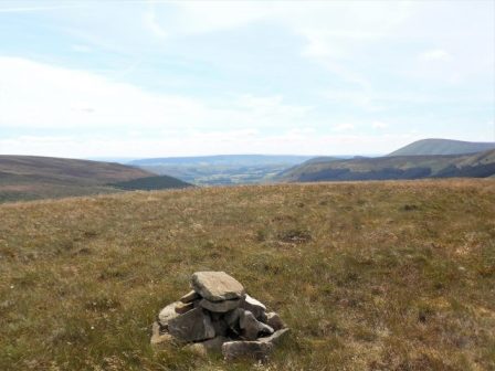
We met up at a lonely spot on the road from Slaidburn to High Bentham. This is one of my favourite routes into Yorkshire, a little further from where we rendezvoused is Cross of Greet Bridge over the infant Hodder and from there the road goes up to a lonely pass between White Hill and Catlow Fell. Then a sweeping descent over the Tatham Fells into High Bentham, passing on the way The Great Stone of Fourstones, a glacial erratic, perfect for bouldering on. I digress.

Our remote car park.

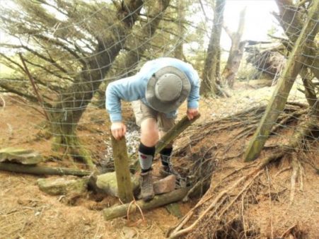
We were soon on the well waymarked trail, but with no sign of the reservoir. A flagged path through fields took us down to the Hodder, where a footbridge has replaced the original stepping stones. I realise all too late that at the centre of my camera lens is a blob of suntan cream – an amateur mistake which will plague me all day.   There is a memorial plaque to a Gil Moorehead for which I can find no information.

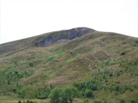
Chatting faltered as we climbed the steep slope to the ruins of New House, one of the many farms abandoned when The Fylde Water Board purchased land for water catchment in this valley around the time of WW1. From up here, we had our first sight of Stocks Reservoir which is named after the village of Stocks which disappeared underwater when the dam was built and opened officially in 1932, flooding the valley. The adjacent Gisburn Forest appropriated more farming land. The history of the whole enterprise of constructing the reservoir is detailed on a fascinating website, Dalehead and Stocks in Bowland.

As we walked down towards the water a trio of fell runners passed us coming up the hill only to be encountered once again later in the day as they completed their circuit. We agreed that this is a ready-made perfect little run.

The path was varied with sections of woodland and open meadows. The latter were full of flowers at this time of year, orchids, foxgloves and many varieties of grasses.

There are birdwatching hides, and we visited one overlooking the water. Below we could see many geese, cormorants, ducks and gulls, but the posted lists from more proficient ‘twitchers’ were extensive with over 50 species seen some days.

Down at the main car park are the remains of St. James Church, which was demolished and rebuilt on higher ground. We speculated on the origin of a nearby spectacular Weeping Beech.

Onwards a new path has been created to avoid the road until we reached the causeway, here mountain bikers swooped out of Gisburn Forest. But almost immediately we were back on a concessionary path above the reservoir and missed out seeing the resited St. James Chapel. We walked through meadows with good views over the water to the Bowland Fells, little boats carried fishermen to various parts of the Reservoir.

At the dam we crossed over the Hodder culvert and had lunch sat on top of the dam embankment watching fishermen cast into the waters with the occasional catch of rainbow trout.

The café for fishermen didn’t look inviting, so we pushed on.

We were now walking on an old railway line up to a quarry where stone was supplied to the dam construction team.

We were soon back at the cars, ready for a slow journey home…

*****

BIRKETT FELL, A BOWLAND JEWEL.

 I can see tree-covered Kitcham Hill on Birkett Fell from my kitchen window, not many people visit it so when Sir Hugh fancied a walk in Bowland I suggested it with a caveat of possible difficult terrain. As a SAS induction course the day went well  – gentle stroll, steady ascent, demanding ascent, open warfare, wire entanglements, jungle terrain, interrogation, trespassing, orienteering, bullfighting and more Jungle warfare. That’s a breeze compared to the Duke Of Edinburgh’s Silver aspirants out on the hill at the same time.

It wasn’t meant to be like this, I’d had a hard day previously on Middle Knoll up the road. Today’s hill was lower and there was only a bit of rough ground to reach its summit, after that it would be good footpaths.

The stroll by the Hodder was as pleasant as always.

The path alongside Fielding Clough was much drier than usual and then we branched off into tussocky reedy ground and steadily made our way up Birkett Fell and into the trees on Kitcham Hill, 283m.

I had previously made a cairn of a few stones at the summit on my LONGRIDGE SKYLINE WALK, LSW and I was pleased to find them. We admired the view down to the Fylde and the twisted pine and beech trees around the summit.

Open ground gave easier walking to the plantations but this was deceptive as there has been much wind damage that has caused problems accessing the woods.  One of my markers for the LSW was visible on a fallen tree. We had fun getting through wire fencing on the edge of the plantation, this is not a public footpath but soon we were on one going through the woods but it was not much better because of the fallen trees.

I remember vaguely some diversions around Crimpton Farm from previous visits and think I wrote to the appropriate authority to complain. Today the farmer was digging ditches and was keen to bemoan all his problems to us. We escaped and walked through his ‘forbidden’ farmyard wondering how planning permission had been given for an incongruous porch on a Grade 2 listed building below the mullioned loom windows. There is more history to this property –  after the reformation a wooden image of Our Lady Of White Well was brought to the isolated Crimpton farm for safety and hence the farm was well known to Roman Catholics as ‘Our Lady Of The Fells’.

The below picture shows Crimpton Farm with its unnecessarily long alternative route in red, we stuck to the ROW in blue.


We emerged using the existing ‘right of way’ onto the roller coaster of a road heading to Newton. Our views of the three peaks were obscured by low cloud. Lunch was taken in a farm yard with another encounter with an only mildly grumpy farmer.

Now on a FP what could go wrong – well we managed to lose it and spent half an hour staggering through reeds in difficult terrain. At the bottom of the field our correct path made an appearance and then disappeared again, however after we crossed the stream a better path headed towards the busy Birkett Farms. Before we reached them we came across a sheep who had pushed its head through a gate and become trapped by its horns. Some complex manoeuvres were needed to free it. In the same field was a large bull I was keen to avoid.

The day seemed to be ticking away by the time we joined the good lane to Knowlmere Manor with its many chimneys. Delightful countryside, made better in the sunnier pm, above the Hodder took us back to Dunsop Bridge where we had a final battle with vegetation.

I felt I had to treat Sir Hugh to a drink in the Puddleducks Cafe.

*****

THE BOWLAND MIDDLE KNOLL.

The Puddleducks cafe was just opening as we parked up in Dunsop Bridge so coffee was taken on their outside terrace. The plan today was to ascend Middle Knoll, a hill above Whitendale that neither JD or myself recollected visiting. On a recent walk here I was surprised to see how rocky the eastern slopes of Middle Knoll appeared and I was keen to investigate closer at hand a feature on the map marked Blue Scar.

After a gentle stroll up the waterboard access road we took the left fork leading to Brennand Farm but immediately branched off on a path through the heather on the slopes of Middle Knoll. As we gained height we herded a few cattle in front of us. At some point we mutually agreed to start the steep climb up pathless ground to the summit, for about 500ft we staggered laboriously upwards trying to to keep to the easiest ground. This was one of those convex hills where you never see the top, you just have to keep going. The summit at 395m was marked with a few stones. The best views were southwards towards the Fylde Plain.

We crossed a nearby wall and ate our lunches in its shelter. Descending we were soon on the top of Blue Scar a steep shaley feature, a few little rock buttresses stood out but it all appeared loose and dangerous.

Curiosity satisfied we descended to the col but failed to find the path coming up from Brennand and stumbled about in high bracken and reeds for some time. Heath Bedstraw was in profusion. Eventually we came steeply down to Whitendale Farm.  From down here Blue Scar was prominent. Those familiar Peak and Northern Footpath Society signs pointed in several directions, we chose the pleasant path leading down above Whitendale River to the luxuriant Costy Clough.

After that we rejoined the outward route on the road alongside the River Dunsop. We thought that the beech trees down the valley had an unusually rich crop of nuts on display this year.

Feeling weary from the heat and the steep trackless terrain on Middle Fell we were glad of a pot of tea at the cafe.

*****

A SUNDAY MORNING STROLL.

I can’t say much new about Longridge Fell.

Over coffee I was plotting a route from Brock Bottoms when the phone rang. it was Dave asking if I fancied a walk on Longridge Fell. I couldn’t say no. I’ll put the river walk on hold.

I’ve not seen much of Dave since my PMR episode put rock climbing on hold, and anyway he is abroad most of the time. A quick turn around and we met up at Cardwell House car park at 10am.  He was not familiar with this western end of the fell so I had hoped to give him a good tour. We caught up on our recent relevant excursions. He has just had a successful three week’s climbing trip to the south of France, I’ve mainly been at the doctors. As I waited at the car park I tried out the panoramic mode on my camera with the Bowland Fells over Chipping Vale.

He seemed to be enjoying the route I took trough the forest until we hit an area of tree felling across the track, the next 200m was tedious to say the least. He likened it to anti tank defence terrain from the 2nd WW.

We eventually emerged onto a familiar track up towards the summit but a blocked path forced us onto another rough section.

The views from the trigpoint were exceptional but we didn’t linger as we had already taken much longer than anticipated.

The way back to the car traversed the fell overlooking the Vale of Chipping again on a track he had never used.

It was good to catch up.

*****

The weather was so good that I decamped to Craig Y Longridge on the way home for a bit of bouldering and more catching up with friends who were there, it was busy.Just across the road on a small reservoir a pair of great crested grebes have set up home in reeds within sight of the road. The female is sitting on three eggs so far and the male fussing around extending the nest.

DUNSOP VALLEY AND BURN FELL, ANOTHER BOWLAND TOP.

Burn Fell seen on the approach along the Hodder Valley to Dunsop Bridge.

On the 2nd of January 1945, just before I was born, a Consolidated B-24 Liberator, an American heavy bomber crashed on Burn Fell. The aircraft was being ferried from Seething in Norfolk to Warton near Preston, most of the passengers were a second aircrew who were going to fly another aircraft back to Seething. The crew had become disorientated in low cloud and snow showers, they obtained a radio fix on Warton and the pilot turned onto the appropriate heading to get to Warton and while flying at just 1500ft the aircraft flew into the top of Burn Fell, slewed round demolishing a stone wall and bursting into flames. Most of the aircraft was reduced to ashes, fortunately of the 19 aircrew onboard 15 of them survived the crash and subsequent fire. People from farms below the crash site came to rescue the survivors from the snowy hillside with makeshift stretchers and human strength.

I  passed the site of this disaster on today’s walk in Bowland.

A bright sunny morning, and I was parked up in Dunsop Bridge before most people had stirred. The walk up into the Dunsop Valley is familiar and the water board road gives access to both the Brennand and Whitendale valleys, with the hill of Middle Knoll [not to be confused with nearby Mellor Knoll] between them. Where the roads split there is a small footbridge across the river which takes you onto a track up into Whitendale above the water.

Middle Knoll.

At Costy Clough the track gives way to a narrow path, This is delightful walking with the hills beckoning ahead whilst the water tumbles below. The farm at Whitendale comes into view, part of the royal Duchy Estate. By now I was in fairly remote hill country and using trods through the heather, A sign post erected by the Peak and Northern Footpaths Society showed my options just above Whitendale Farm. I’ve never quite known who they are. From this area I had a view to the southern face of Middle Knoll and was surprised to see how steep and rocky it looked. The lambs around here looked almost newborn, very unsteady on their legs. A zig zagging track started to climb out of the valley onto Dunsop Fell, mainly to visit some shooting butts, but it gave me an easy way up to the watershed especially as the peat was less squelchy than usual. Suddenly there were people ahead of me, I caught them up at the top as they took in the views. A family group from Wigan who seemed to know the area well. Oh, and here is another one of those signs. Where the three went down I contoured and found a path of sorts leading to the trig point on Burn Fell, 431 m. Over to the east were the Three Peaks, Yorkshire’s finest. Below was Stocks Reservoir, Waddington Fell with its mast and behind that the big end of Pendle. I followed the wall past the trig with Totridge Fell ahead and the Hodder Valley stretching out towards Longridge Fell, these Bowland Fells group themselves closely together, I could clearly see the line of my Longridge Skyline Walk coming off Totridge Fell, over Mellor Knoll down to the Hodder, over Birkett Fell to Waddington Fell before dropping to recross the Hodder and finish over Longridge Fell.

Over to Yorkshire with Stocks Reservoir.

A few 100 m past the summit I came across the remains of the B-24, bits of molten metal and glass. A cross has been erected and there is a stone memorial to the four airmen who lost their lives.

A track of sorts through the boggy heather slowly brought me off the fell and down a grassy rake towards Beatrix Farm. It was here that I started to encounter boxes/tunnels designed to trap stoats etc. as I neared pheasant breading copses. Inside each box was a strong spring-loaded trap. I’m not sure of the legality of these traps as any prey would suffer a horrible death. The remains of a ?rabbit in one showed that they are not regularly checked. It was surprisingly how vicious they were when a stone was accidentally dropped onto a trap.

A lane down into Dunsop Bridge gave easy walking after the rough stuff on the fells. Bluebell woods welcomed me into the hamlet at the centre of the Isles. Cups of tea at the café beckoned before my drive home. Today I had seen or heard wagtails, skylarks, oyster catchers, cuckoos, curlews, buzzards and whilst getting into the car a dipper on the stream below.*****


WHIN FELL – ANOTHER BOWLAND CIRCUIT.

Sorry about the photos.

Set off today after lunch and parked at Smelt Mill in the Trough of Bowland, this is the headquarters of the Bowland Pennine Mountain Rescue  team.

Smelt Mill with Mellor Knoll behind.

On the 1:25,000 map I noticed a track leaving the road and zigzagging up  Staple Oak Fell. I found it and was able to follow it through rough ground to a fence just below the 415m summit. I hopped across the fence and went to the highest point, I’m not sure why. It was all much of a sameness. Views kept opening up in all directions and I took loads of photos of the surrounding Bowland Fells. I then simply followed the fence to meet up with the bridleway from the Trough over to Brennand. In the past this was a regular mountain bike route for me taking the thrill a minute ride down Ouster Rake to the Duchy’s farm deep in the Brennand valley. I couldn’t resist a slight diversion today to view that descent, it did look dramatic.

Returning to the col I decided to follow another fence up to the trig point of Whins Brow 478m on Whin Fell. There were some boggy peat haggs to negotiate before the summit. Views to Morecambe Bay, the three Yorkshire Peaks, Pendle, Longridge Fell and the nearer Bowland Fells above Hareden and Langden Valley where I was tramping a few days ago. Splendid.

The Trough of Bowland with Totridge Fell prominent.

I took a beeline off the summit down steep grassy slopes into Rams Clough to meet up with that bridleway coming down from Whin Fell. A winding lane followed the valley down to the Trough Road near a barn. As I walked down the road I recognised a gate leading to the Trough of Bowland Quarry, an esoteric climbing venue I’d not visited for 20 years. The cliff looked remarkably clean and very steep. I recognised some of the lines taking ramps across the face to an unfortunate loose top. I even spied an old peg! I wondered if it was still in the Lancashire Climbing guidebook, yes it is though I doubt many people climb here anymore shame really as it has a lovely situation for a summer’s evening in peace and solitude. It was whilst I was in the quarry that my camera started flashing “memory card damaged” – how could it be. But no it refused to take any more photos and more annoyingly will not download any of today’s pictures.  This cheap camera, a Praktica L212, has always had a problem with the memory card losing the occasional pictures. Wilkinson’s Cameras, Preston, have failed to resolve the problem and I will be down there tomorrow with the latest complaint. Annoyed at loosing some fantastic views today. Took some pics with my phone but even those are poor, not my day.

Trough of Bowland Quarry…

…and nearby lime kiln.

Wandered down the road past Sykes Farm and then the Langden parking spot as the tea van was packing up. Soon back at Smelt Mill.

Sykes Farm.

Trough tea van.                                                                                                                  

PS. The memory card was unreadable but Wilkinson’s gave me a replacement free despite well out of guarantee. Local shop 1 Internet 0.

So my camera back in action but those photos lost forever – a good excuse to repeat what was an outstanding walk.

*****

CICERONE’S LANCASHIRE – LANGDEN AND HAREDEN.

I was so inspired by my last walk in the Bowland Area that I started looking for more  routes around Dunsop Bridge, I soon had several loops that looked promising. Time to try one I haven’t done for years, I enrol JD for some exercise. Simply this is up the Langden Valley, then Bleadale, over a bit of a hill and down Hareden Valley. It happens to be walk 6 in the upcoming Walking In Lancashire guide by Mark Sutcliffe, although I didn’t know it at the time.

The morning was dull and drizzly but promised to improve as we parked up on the Trough road at noon, not a soul about. A relaxing stroll up the valley  gave me a chance to catch up with JD’s recent exploits in various parts of the country – Lakes, Wales and Malham.

We disturbed a pair of Greylag Geese with their clutch of youngsters. There seemed to be plenty of Pheasants about but not much else.

Spot the chick.

On the map two ‘castles’ are marked; Holdron Castle which turns out to be a rocky outcrop and Langden Castle which is a shooting hut. We made for the latter for a place to sit for a bite to eat. The outer ends of the hut are open but despoiled by sheep and humans, the central room is now locked and shuttered although in the past I have bivied in it when my children were young, I remember getting a roaring fire going in the hearth.

The path continues up by Langden Brook into Fiendsdale and over a boggy col to Bleasdale, but today we turn south to enter Bleadale, confused?  The stream crossings here can be hazardous but to-day with all the dry weather we hopped across with ease.

The path up into Bleadale is squeezed in by the stream with a little scrambling in parts but is better than I remember it.

Again this valley could be followed all the way over Saddle Fell and down into Chipping, but we strike off again to climb Zig Zags in a subsidiary clough leading over Hareden Fell.

Higher a path of sorts is found between the peat hags helped by some marker posts near grouse butts, these fells are shooting territory and the estates have come in for some criticism lately for illegal raptor prosecution. We don’t see any birds of prey all day whereas in the past Peregrines, Merlins and Hen harriers were fairly common. [Later in the day we meet a couple of RSPB wardens on patrol, so there must be nesting raptors about.] This is a remote desolate place, and we are glad of the good visibility.

We meet up with the estate Land Rover track leading down into Hareden. Below us to the right is a very steep-sided valley of Hareden Brook and the lower wooded parts are the home to Ring Ousel, I suspect I spotted a female but couldn’t be sure as it flew swiftly past.

We wander down and enjoy a rest by the river just before it enters water treatment plants. The worker’s cottage and garden is obviously well looked after, all is neat and tidy. The bird boxes in the shelter belt of trees are all marked BASC, ironically The British Association for Shooting and Conservation who are generally more focused on shooting.

We passed the houses at Hareden Farm as I had done a couple of days ago, the dogs were still barking. Just after the farms a concessionary path follows the Langden Brook back upstream avoiding the road giving a fitting end to our day of linking brooks. I’m already planning my next Bowland circuit.

*****

MELLOR KNOLL AND THE HODDER.

Totridge Fell and Mellor Knoll from Burholme Bridge at the start of the walk.

Mellor Knoll is a 344m lump in Bowland, I didn’t actually climb it but I came close.

I was in my dormouse mode this morning and stayed in bed with my second coffee looking at maps whilst the day warmed up. Eventually, I stirred and drove out to park at Burholme Bridge on the River Hodder. Early morning cyclists were already returning from their Trough of Bowland circuit, a popular ride with Lancashire cyclists: one of the most prominent I met later in the day. I last cycled it 5 years ago.

A quiet lane leads up into the limestone area of Bowland with its Reef Knolls and caves.  A footpath brought me onto the farm track to Whitmore, a lonely farm at the base of Totridge Fell. In the past there were free-range hens wandering about although today the scattered wooden hen-houses looked deserted.


Welcoming committee.

A bridleway takes off towards the woods on a track that was always muddy but tree felling has opened up the landscape and things are improved. This bridleway cuts through between the cone of Mellor Knoll and the parent fell of Totridge. Contouring the hillside was a joy with bluebells and fresh green beech leaves; views down to the snaking Hodder and the little known Birkett Fell, Waddington Fell and distant Pendle; towering above me was Totridge Fell with stone walls going straight up the steep slopes.

With all this excitement I wandered off course at the col and was heading the wrong way into Hareden Valley, it wouldn’t have mattered on this open ground but I traversed back to the correct track. Up here the hardy sheep only seem to have one lamb as opposed to their lowland softies with twins and triplets. Oh and this is how to mend a wall…

I was now looking down on the farms of Hareden with the Trough of Bowland in the background. The hounds at the farm always give you a greeting long before you arrive.

Crossing Hareden Brook [dippers were seen] and then Langden Brook brought me onto a short stretch of The Trough of Bowland road.

Looking up the ‘Trough’ road.

I followed this for a short way before I could continue across fields to the water board road following the River Dunsop past cottages to the hamlet.

I’m sure these weren’t designed for outdoor seating.

Mellor Knoll above the new houses in Dunsop Bridge.

This is a popular walking area and lots of families were out enjoying the sunny weather and the delights of Dunsop Bridge hamlet – often cited as the geographic centre of Great Britain, although different measurements give different results. I passed the BT phone box which celebrates this fact.

A line of tall pines leads to Thornyholme Hall and farm over a bridge on the Hodder. The last time I passed here in 2013 a chain saw artist was just beginning rendering a stump into a statue of the thinking man and the results were seen today.


There is a lovely stretch along the River Hodder, ducks and their ducklings were swimming by the bridge and further on I watched sand martins going back and forth to their holes in a sandbank. If you click and enlarge the photo I actually caught some of them in flight and at the nest entrances. It was on this stretch I met an elderly couple walking towards me on a short river ramble, somehow the conversation turned to cycling and it transpired that the 80yr old gent was Dave Brown. He had been a prominent racing cyclist with impressive time trial results over all distances, only retiring after he had passed 70yrs. https://www.lancashiretelegraph.co.uk/sport/3829912.east-lancashire-cyclist-retires-after-53-years/  He told me he had written a weekly cycling column in the Lancashire Telegraph for 40 years until they recently decided to scrap it!  We swapped tales of cycling in the past, what a lovely chance encounter.

Soon I was back at Burholme Bridge having completed an interesting, if modest, 7 mile circuit feeling privileged to be living within this beautiful Bowland area.


*****


ZIG ZAGGING UP FAIRSNAPE.

The way to the zig zags.

From Bleasdale if the light is right one can see a zig zag track going up the southern slopes of Fairsnape. Today, Easter Sunday, the sun was strongly shining onto that slope and the way was not obvious but a look at the satellite map shows the track clearly from Higher Fairsnape Farm..Fairsnape is usually climbed from the outskirts of Chipping following tracks over Parlick but I have not used these zig zags and I thought today would be a good time to avoid the crowds. Sure enough when I reached Fell Foot the were already a dozen cars parked up, this is the spot where the paragliders start their trek up the hill. An insignificant footpath pointer on the corner led me into rough fields  where few go, but stiles some more substantial than others link up a pathless route which traverses round below Parlick to above Blindhurst farm.The sound of Lapwings and Curlews was everywhere, a hare popped up directly in front of me before disappearing into the distance. There seem to be an abundance of Orange Tip butterflies this year. There are new-born lambs and in the sky early paragliders. To my right is open access land [rough poor land that the landowners were happy to allow to be designated in the CRoW act] and it struck me that the colour of the land resembled the brown colouring on the 1:25,000 maps.

I dropped into a valley with a tributary of the River Brock and passed a green spot that would be ideal for a wild camp with my youngest grandchild if I could get him off his iPad. There was nobody about at Higher Fairsnape farm except new-born lambs. The buildings look old with mullioned windows and one wonders about the hardships of farming these remote places in the past and even now.

A signpost pointed the way on a concessionary path to reach the start of my zigzags. Once on the open fell I enjoyed a leisurely ascent up the well graded tracks, I always assume these tracks were for bringing peat down from the fells.

At one of the turns was the remains of a building, perhaps a shelter for the workers.

Years ago I can remember a similar structure with a disintegrating roof on the way up nearby Saddle Fell, it has now become a pile of stones but perhaps hides a sombre history.

On 26th March 1962 three siblings left home and travelled by bus to Chipping and walked over the fells, maybe to Langden Castle, on their return over Saddle Fell they were faced with severe winter conditions which result in the two brothers losing their lives due to hypothermia. Their sister Sheila survived to raise the alarm at Saddle End Farm. The brothers probably took shelter in the hut.  There was no Mountain Rescue Team in the area at that time so it was left to the police and locals to search, British Aircraft Corporation loaned their whirlwind helicopter to help. Shortly after this tragedy a South Ribble Rescue team was set up, now the local Bowland Pennine team.

  Above me were paragliders soaring the thermals and lots of people coming up the route from Parlick, I had seen nobody for two hours. My track came onto the plateau only a few hundred yards from the summit. Up here there is a cairn with Paddy’s Pole, a wind shelter and the trig point, 510m. I had a quick look around for a suitable bivi spot in the near future.

I was able to take a summit photo of a couple on their first ascent of Fairsnape and pointed out that the true summit, 520m, was half a mile away NE and that today conditions were perfect for visiting it as the peat hags that guard it have virtually dried up. I met up with them there later. the views were hazy – no Lakeland Hills or Three Peaks, Pendle and Longridge Fell were a blur.

520m summit.

A romp down the wallside and round Parlick. Looking back across Bleasdale towards Fairsnape showed no evidence of my zig zags. I walked below the popular spots for launching parapentes and many were still in the air. I passed a late starter walking up with his load.

The day was finished before lunch back at the road at Fell Foot.

*****


NORTHING 438. INSKIP TO LONGRIDGE.

January 27th.    7 miles.

This is long distance walking in easy stages designed for winter exercise. Todays stage actually finishes in Longridge, my home town, which is convenient for me if not for Sir Hugh who has to travel from Arnside, but it was his idea in the first place. At least today we meet up in the agreed destination, a good start. We are walking by 9.30 on a clear sunny morning with a strong cold wind at our heals. There must have been a lot of rain last night judging by the pools on the road – an ominous sign. We take to footpaths as soon as we can and end up in deep mud similar to where we left off last week. The stiles around Singletons Farm are virtually impassable, blocked by hawthorn, but we push through.Crossing a field we are confronted by the next stile leading into a lake, no way we can go that way so we retreat and hit the minor lane to Cuddy Hill [sounds Scottish] and the well-known Plough Inn. After all the frustrating obstacles I was ready for a drink but of course they hadn’t opened. Eventually we find the onward path and emerge onto a lane which took us over a canal. In the past we have both walked the The Black and White, Lancaster Canal.    but we didn’t recognise the location,

We were on the A6 for a short distance before crossing over onto tracks to end up in fields,  navigational errors had us back tracking to reach Jepps Lane. The A6 seemed like the transition from the flat floodplain of The Fylde to the pleasant countryside of the Ribble Valley. The wind by now had intensified and many of Sir Hugh’s pearls of wisdom were lost. I had never been down the lane to Barton Old Hall before, but it conveniently crossed the motorway for us. The Old Hall was hidden behind trees and the cluster of houses and conversions at the hall were rather depressing.

I think we were deterred from the actual path through the properties, but still found ourselves in rolling countryside alongside the proverbial babbling brooks. Time passed as we weaved our way through the pleasant Lancashire countryside. The Bowland Fells rose in the background and ahead was a glimpse of Longridge Fell.

We passed the stately Goosnargh Lodge, joined some local routes and reached Goosnargh Mill, not the best of conversions.

I was now on home ground and confidently marched across fields finding hidden stiles until we reached one that was in such a dangerous state we had to retreat yet again and find an alternative way. Worse was to come as what had been open fields was divided up by permanent electric fencing, the sort used for equine enclosures, with no regard for any public rights of way. Attempts at crawling under on the wet ground were not pleasant, so we took to dismantling the top wires to step over, there was fortunately no electric current. Reports to LCC  are on their way. A rather sour note towards the end of the day.

He who dares – SAS training.

Just before Longridge we passed Sea View cottages,  and yes you could just about see back to the coast where we had started SD 38.The road into Longridge is now surrounded on all sides by new housing developments, the Fell can just be glimpsed above the roofs. It is no longer the attractive, honest, little town that I moved to all those years ago.

*****

A MISTY BEACON FELL.

Normally I can see Beacon Fell from my house – but not this morning. A freezing mist hung over the landscape. Not to be deterred I wanted to walk up there and back, in deference to the weather and my late start I took the car some part way. I know these footpaths well as I often do this walk or a variation, it is in fact the first section of my Longridge Skyline Walk.

The snow was disappearing from the fields as I set off. Soon I was walking through the first of several developments where an original farmhouse with its surrounding barns has morphed into an expensive looking ‘hamlet’. This one is based around Higher Barker.

Familiar field paths [I didn’t need a map today] lead to the Cross Keys Inn where holiday type units have been built around the site, none ready for occupation in what is a speculative development. The Cross Keys was a farm-cum-basic pub run by brothers and known affectionately and ironically by locals as The Dorchester. What of its future?

The lane ahead is always soggy and today was no exception. I could hear a woodpecker in the trees of Whitechapel.

The sun was trying to break through the mist as I crossed fields to Crombleholme Fold another group of houses old and new. The sheep were surprised to see me emerging from the gloom.

Still no view of Beacon Fell which I knew was looming up above me.  The trees were soon reached and as I entered them a small herd of Roe Deer passed in front of me seconds after taking this picture.

The car park at the visitor centre was virtually empty and I was the only one in the cafe where I enjoyed a good coffee. To reach the summit I followed the latest version of the walking snake, this one is expertly crafted from stone so should be more durable than the previous wooden sculpture.

I had the summit to myself with tantalising glimpses of Parlick and Fairsnape Fells through the mists.

A newish path, there are many since the storms of last year, and a concessionary bridleway through deciduos plantings took me out of the park.

A field footpath led me down to the fishing lake/holiday homes of Woodfold, another development which seems to be enlarging every time I pass this way. Do these places go under the planning radar?

My next aim was Barnsfold Farm environs where more sympathetic conversions were carried out decades ago.

Then it was muddy fields to Bullsnape Hall and back to my car just as the sun finally burst through. The final stile was a challenge.

An enjoyable day from nothing.

*****

WINTER ARRIVES ON MY DAILY WALK.


The moon was still bright and large while I was having my reviving first coffee, always the best of the day.

Overnight an inch of snow had softly fallen and now in the morning sunshine all was glistening white, time for that short walk before going out for lunch. I try to put in a few miles most days even if it is only my  daily walk cum shopping trip.

Out past the white cricket pitch and up the lane with views to the Bowland Fells, rabbits had been out much sooner than I.

Fields take me onto the toe of Longridge Fell, around the icy reservoir road with views to Beacon Fell.

I arrive for a peep into Craig Y Longridge. Despite the snow the rock was in perfect condition in the sunshine and if I hadn’t other appointments I would have been tempted back later for some bouldering.

I was soon down through the town, a quick supermarket dash and home for a second coffee. Oh and the lunch at The White Bull in Gisburn was excellent, I think I had worked up an appetite.

*****

CROASDALE/BULLSTONES WALK.

                                               Looking down a murky Croasdale.

One seldom meets another person in upper Croasdale, but today the Salter Fell track was busy with contractors making repairs to a steep section of the road above New Bridge. The road, also known as Hornby Road, dates from Roman times as Watling Street, which ran from Manchester to Carlisle.  It was along this road that the Lancashire Witches were taken from Clitheroe to Lancaster, and in fact, the last time I walked it was following a long distance walk called the Lancashire Witches Walk from Barrowford to Lancaster. Back to today, I was with JD, both of us needing some exercise. A lorry was taking stone up to the repairs, and the driver told us of the cost to Lancs. County Council, who apparently are obliged to maintain the highway, for whose benefit I’m not sure. An awful lot of potholes around Longridge could have been repaired for less. The repairs were extensive and thorough but not lot of work seemed to getting done today. More stone was being extracted from the higher quarry which in the past had been used for the construction of Stocks Reservoir dam in the thirties.

Track repairs with one of the Lancashire Witches Walk tercet waymarkers.

It took longer than usual to reach the top gate where we left the track and headed uphill through the heather. Looking westwards are views of upper Whitendale and remote Wolfhole Crag, this is wild Bowland country. I found the tiny sheep trod that traversed to the first group of Bull Stone boulders where we had our refreshments. The day was rather dull but there was no wind and silence prevails up here. Looking down the wide valley of Croasdale a misty Pendle rose in the distance. I had resisted bringing up my rock shoes but now regretted it as the conditions were perfect. Big boots would not have stuck to the friction slabs.

Sketch of the same scene from the Bowland Beth book mentioned below.

For a taste of the bouldering up here, have a look at  https://vimeo.com/183222521

We wandered on below more rocks, all bringing back memories to me, though JD had never been here. So it was a great pleasure to show him the massive stone trough carved on the hillside.

We found the little trod heading down valley, and at the ford we decided to continue down rough marshland to look at the bothy and surrounding sheep-pens. About ten years ago, I spent a couple of nights here with my teenage grandson whilst we explored the surrounding fells. In those days, Hen Harriers were a common sight on these Bowland fells, which were an important breeding ground for these beautiful birds. Things have gone downhill since then, with more and more persecution of raptors on grouse moors where the shooting lobbies run roughshod. I have just been reading a little book about the short life of Bowland Beth, born near this spot. A thoughtful analysis of the plight of wildlife on shooting estates.

Bowland Beth. The life of an English Hen Harrier.   David Cobham.     William Collins.

The bothy was unlocked, but animals had soiled the flagged floor. It did not look an attractive proposition for an overnight stay now, but would soon clean up.

Onwards down the valley with a few stream crossings and then we climbed back up the road passing on the way the remains of the House of Croasdale, a 17th century farmhouse built on the site of an ancient hunting lodge. It would have witnessed the witches being taken across the fells.

Remains of House of Croasdale.

An interesting circuit as usual, although a little sunshine would have helped with the photos.

*****

THE WAY OF THE CROW. Fourth day, Lentworth to Postern Gate, Quernmore.

                                                               Clougha Pike.

Serendipity – whilst we were looking for ways into the extensive private Quernmore Hall estate blocking our ongoing straight line a car drew up and out stepped the daughter of the owners! A pleasant chat ensured and we had their contact phone number for possible further progress on another day. But I’m getting ahead of myself.

Today should be easy walking , paths and lanes keep close to our ‘line’. Last night I’d been kept awake by heavy rainfall, frequent showers and gales were forecast but we set off and enjoyed sunshine and a bracing breeze. A quiet lane climbed away from the Wyre valley giving us a gentle warmup. Opposite the Quaker Friends Meeting House a carved stone was placed close to the stile we needed, we conjectured as to its antiquity. Once across a couple of swampy agricultural fields,  we approached a ramshackle farmyard, Low Moorhead, with trepidation, dogs and obstructions looked imminent. Another carved stone took our attention. As it happened the friendly farmer was busy nearby and we ascertained that he and his wife had created the stones rather than some medieval mason, we congratulated him on their artistry.

Most of the day we traversed Daleslike farmland below Grit Fell and Clougha Pike, gritstone moors above with Morecombe Bay spread out below. Our incursion onto the rough fell, boggy reeds, was not succesful and we were glad to hit the road and subsequently return into pheasant woods. The ‘beast from the east’ had been active here and we picked our way through the fallen trees.

Our incursion onto the rough fell, boggy reeds, was not succesful and we were glad to hit the road and subsequently return into pheasant woods. The ‘beast from the east’ had been active here and we picked our way through the fallen trees.

The last mile or so was along a supposedly quiet lane leading to those private woods above Postern Gate, the only highlight apart from a rainbow above the green valley was Quernmore Church.

*****


THE WAY OF THE CROW. Third day, Arbour to Lentworth Hall.

Distant Ward’s Stone Fell.

First a moan…                                                                                                                                             The Countryside and Rights of Way Act of 2000 ( the CROW Act, not the crow we are following )  gives a public right of access to land mapped as ‘open country’  known as open access land. A large area of the Bowland Fells are so designated which should give some degree of freedom to roam on the moorlands. However not all is as it seems. The 1:25,000 OS maps highlight open access land with  orange shading but the areas do not always link up with the public rights of way, creating a problem of reaching the access area in the first place. There are actually some ‘islands’ of access land with no access! This morning we are faced with one of these dilemmas, the lane back to Arbour is private for the first kilometre [red dots] so the logical way into the access area is denied legally. Who came up with these walker unfriendly ideas? I’m afraid those powerful landowners had too much influence when the plans were being drawn .Anyhow here we are back at the Arbour shooting lodge in its remote setting, ready for another ‘up and over’. Today we have to climb over Stake House and Grizedale Fells. There is still no sign of the rhino. We take the opportunity of some shelter by the lodge to divest of some clothing before the sweaty climb. A vague track is lost and then found as we puff up the steep slope alongside a series of very posh shooting butts. This track in fact takes us to the unmarked summit of Stake House, 402m, where we can admire views of Morecambe Bay, the Clougha Pike, Grit Fell, Ward’s Stone and Wolfhole Fell group with  the Trough Of Bowland spread out below. We take a compass bearing to a pond which should be near the start of the track at Grizesdale Head. We are in the middle of a wilderness here though the going is better than we’d anticipated, short heather and not too much bog. The weather is changeable!

A hazy Morecambe Bay with another storm coming in.


Wilderness – on a compass bearing.


Out of nowhere a gate in the boundary fence appears and this gives us easy access to the landrover track we are relying on to take us off the moors. We do so in swoops down the hillside as the weather takes a turn for the worse, wind and hail. At the road we are glad to hide behind a wall for lunch and watch the lazy antics of some contractors trying to offload fence posts. I do not envy their work outside in these conditions.

Opposite is a private lane to Catshaw Farms which is right on our route line, we wave enthusiastically at farm workers who pass us but nobody seems bothered by our presence. Once at the large farm complex we are back on public rights of way. Catshaw Hall Farm dates from the 17C, grade II listed with mullioned windows. There was work going on today.Muddy fields drop down towards the River Wyre where many trees are down from recent storms.   At a side stream the path has been washed away leading to some undignified bum sliding to reach the newly reconstructed footbridge. The bridge over The Wyre is made of sturdier timbers.  I realise have been here before.

Steep slippy steps bring us into fields belonging to Lentwoth Hall, now divided into apartments.

The final lane with ‘walking’ trees.

This whole area of Abbeystead is part of the Grosvenor estate owned by the Dukes Of Westminster. It holds the record for the biggest grouse bag in a day. On 12 August 1915, 2,929 birds were shot by eight shooters. We have survived the day through their estate and will carry on no doubt to trespass further estates on our straight line. I’m glad we finished when we did as the weather became atrocious, it’s the first day of winter tomorrow.

*****


THE WAY OF THE CROW. Second day, Bleasdale to Arbour, Calder Valley.

JD seemed worried when I described the next leg of our straight line way – “it is extremely rough going, the game keepers are unfriendly and there are rumours of a wild rhinoceros”. Despite all that he agreed to join us on his recommended shortened version. The picture above was taken from his house when I picked him up in the morning, The Bleasdale Fells which we had to cross are to the left of the higher Fairsnape group. Beacon Fell is far left.

The car park at Bleasdale Church was busy with Sunday worshippers.

It was a glorious sunny morning as we used field paths into the heart of Bleasdale discussing our individual Saturday night’s exploits, I probably had the largest hangover, Sir Hugh had been consructing a cat flap and JD entertaing his family.

Donning extra layers when we realised how cold it was.

No that’s not the rhino but pretty scary anyhow.

After the isolated Hazelhurst Farm we found the beginnings of a land rover track that would, via a series of zigzags, take us steeply into the open access area and onto the fell top. We puffed our way up with frequent stops to admire the views over the nearby Fairsnape/Parlick fells with Bleasdale and  the Fylde below. Surprisingly and fortunately another quad track led to the remote trig point, 429m, of Hazelhutst Fell. We are on grouse shooting moors up here and much has been written about the persecution of other wildlife in this vicinity to try to promote the shooting fraternity. Whatever one’s opinions about grouse shooting I am strongly against the wilful and unlawful killing of our protected species. On this stretch of the walk we came across several loaded Fenn Traps which are legally only allowed for stoat trapping [killing] but are known to trap other species. These are lethal looking spring-loaded traps which could almost take the tip off your walking pole.

From the trig point there were hazy views across Morecambe Bay to Black Combe and Barrow. Taking a compass bearing we set off across the heather in a NNW direction and fortunately found another quad bike track taking us down past shooting butts so avoiding all the heavy going. After what I’ve said about the grouse shooting land owners we were thankful for their tracks. The final descent was vertiginous. The surroundings were reminiscent of a Scottish Glen and we found the bridge over the Calder to the Victorian shooting cabin of Arbour. This must be one of the best kept secrets of Lancashire.

We found a sheltered spot out of the cold east wind for lunch. There were no windows into the shooting lodge to see the rhinoceros head. The story goes that a rhino escaped from a train near Garstang and had to be shot, it’s trophy head being mounted in the lodge.

By now all the excitement was over and we had an easy walk out on the track alongside the River Calder.  We were back at Sir Hugh’s car much sooner than we’d planned because of those good moorland tracks. We will have to walk back in next time to rejoin our line.

*****


THE WAY OF THE CROW. First day, Longridge to Bleasdale.

I was apprehensive, walking in a straight line as possible would take us on unfrequented paths, would the way be feasible. We left the village down overgrown Gypsy Lane and shortly after found a gate secured by a cord, a veritable Gordian Knot. Out came Sir Hugh’s, I’ll blame him, Swiss Army Knife and we were through.

‘Gypsy Lane’

We passed the ponds, ‘figure of eight’ where my children used to go fishing without much success but I’m sure they had an adventure away from parental supervision – they never drowned so I must have been doing something right.

The next farm-yard, where I’d previously climbed walls to escape, was now well signed and we even had a resident directing us to the hidden stile ahead though the accompanying foot plank, couldn’t call it a bridge, didn’t inspire confidence.

The slippery plank.

We reached a farm gate on a public footpath which was securely padlocked, no Swiss Army knife could cope, but as if on cue a lady drove up in her battered pick-up and opened up for us. Remonstrating about obstructed footpaths didn’t seem to be appropriate. All was pleasant rural scenery with scattered farms, some in better condition than others.

The next problem was of our creation, contentedly walking along the tiny River Loud we were almost in someone’s back garden when we realised we’d missed our path but fortunately a gate allowed our escape onto the road.

The infant Loud.

Things improved as we headed closer towards the Bowland Hills and Bleasdale. We passed the small rural Bleasdale School and headed for the church where our car was parked. We were last here in gale force Ali. A group of fell runners were just setting off for a quick few miles and we exchanged pleasantries. Walkers, climbers , cyclists, runners tend to have a common background.

Is that an Ofsted verdict?

We had completed the first leg of our project with very little deviation from the straight and narrow and to be honest no serious obstacles except a lot of slippery stiles. Our way ahead over Hazelhurst Fell could be seen, the fell runner is pointing the way, but will there be any paths?

Yet another slippery stile.

***** 

THE WAY OF THE CROW. LONGRIDGE TO ARNSIDE.

My good friend Sir Hugh  [http://conradwalks.blogspot.com/ ] inhabits that lovely village Arnside whereas I have to put up with the gross overdevelopment of Longridge. For the last few winters we have had projects to keep us active in the shorter days. He has emailed once or twice with suggestions for this year but nothing has struck me as original, boringly I seem to have walked most of the Long Distance Paths in the NW. I came up with a counter suggestion – why don’t we draw a straight line between our houses and follow it as closely as possible. I know this idea has been used before, particularly successfully  by Nic Crane on his straight line Two Degrees West journey from Berwick-on-Tweed to The Isle of Purbeck. I seem to remember he gave himself  a kilometre leeway either side but had a lot of media support, I wonder if we could be even stricter. True to form Sir High has taken the bait and the line has been drawn.

It is the wrong time of year for backpacking so we will split the route into day walks. The distance as the crow flies is 26.5 miles but we will be lucky to keep it under 35 miles. No rules except keeping as close to the line as possible preferably on footpaths or quiet lanes, legal ground or not. There are some obvious obstacles in the way – the fells of Bleasdale, the Rivers Wyre and Lune, Quernmore Hall Estate and the M6. It will be a challenge overcoming them, lets get started.

THREE AGAINST ALI – AROUND BLEASDALE.

Most of the photos taken on my phone today are blurred. I was struggling to stand up in a 40-50mph gale, trying to keep my hood on as well as pointing the phone in the general direction of companions Sir Hugh and JD who couldn’t stand up either. After what I said in my last post about choosing the fine days to venture out, especially in the hills, today’s choice was obviously dubious in view of the forecast above. However unsteady my companions appear they have a resolution and resistance to be celebrated, we marched into the eye of the storm named Ali without a flicker of doubt.

Up and over the prominent steep Parlick along the ridge to the highest point of Fairsnape. So far so good, breezy but clear views. A newly flagged path soon disappears as we head into the peat bogs and evasive action is often taken to avoid the worst mires on the ridge. At the lowest point a vague path disappears down Fiendsdale towards Langden Castle, I think we’ll leave that adventure to another day. Our route westwards was again extravagantly flagged for some distance down the rake towards the bowl of Bleasdale. You could see the rain coming in on the storm and it hit us hard for the next hour, the wind was excessive straight at us and the rain in the air stinging on the face. Winter conditions within minutes and a good test for the waterproofs. It seemed a long way down. The usual erudite conversation from my companions was missing as we disappeared into our own worlds of survival. Salvation arrived in the valley as the worst of the rain passed, we could cope with the wind. We had more difficulty coping with some of the precarious stiles en route, Sir Hugh has two artificial knees and wasn’t happy with the contortions necessary to overcome them. Some situations when he was mid stride but hooked up to barbed wire became a mixture of uncontrollable laughter and panic as to his survival. We made it to Bleasdale church where a sheltered bench was gratefully used for sandwiches.

Vague paths across the bowl of Bleasdale led us to Blindhurst Farm through the usual stinking slurry and an outstanding farmhouse amongst the trash.

Despite our misguided attempts to reclimb Parlick we found some traversing sheep ‘tracks’ back to the car. The wind increased in intensity for our finale just to prove a point.

Not unsurprisingly we were the only car parked up.

Remind me next time to forge ahead and take some pictures from the front!

A day not to be missed.

*****

The map below is doubly important today, not only to show you the reader our whereabouts but also to give Sir Hugh an idea of where he had been.

MY DAILY WALK, [well almost daily].

The weather has not been good since my return from France, I feel Autumn is upon us.

It’s noticeable how often I comment on the state of the weather at the start of a post. Is that a British trait, am I obsessed with the climate or does it just reflect the close connection of conditions with my pastimes?  I remember when I was younger and outdoor time at a weekend was precious we would sally forth on walks or climbs whatever the weather. That would result in a fair share of days with no views and a good soaking on the hill or gripping climbs on cold slippery wet rock. Many of those occasions are vivid in my memory, proof of the importance to me of outdoor adventures and the companionships they bring. Character building was a phrase used. Now I take more heed of the forecast and try to choose the better days for my enjoyment or more likely head abroad to avoid the worst of our winter weather.

I’ve rambled off the subject.  I intend, now I’m free of the PMR stiffness, to  do a regular local walk most days to build up my fitness once again. How often have I said that? I have a 4mile circuit on my doorstep that suffices. Not only does one get some healthy exercise but also some physic benefits thrown in.  There are countless literary quotations extolling the virtues of walking, one of the simplest  –  “I have two doctors: my left leg and my right leg.”  G M Trevelyan.

I complain a lot, and will continue to do so, about the housing developments in Longridge destroying the character of the town but I’m still able to do this walk from my house into the country. Why drive anywhere in mixed weather when a walk can be accomplished from home.   A stroll down the road takes me past the cricket ground where today there was a match which I can stand and watch for a few overs. There’s something special about village cricket which makes it almost hypnotic to engage in, I think it is something to do with the enthusiasm of the players and the gentle clapping of the handful of spectators. Long may it be so. The lane I usually take up onto the fell gives a lovely view back across Chipping Vale to the Bowland Hills. The view is different with the seasons but gives a sense of space and nature within half a mile of leaving home. Today this was heightened by a pair of Buzzards wheeling and mewing above me. Time just goes by whilst you stand and watch. A glance over the reservoir at any other bird life – usually ducks and grebe. And a glance into Craig Y Longridge to see if anyone I know is climbing, not today with the damp conditions. My return down the town’s main street is more mundane but gives the opportunity for social engagement and grocery shopping.

A perfect little circuit, I’m off to do it again today when things will be different.

*****