Category Archives: Chipping Vale

AN AFTERNOON WITH MERLIN.

P1040752

No not the Welsh Magician from the Arthurian myths, but the Merlin Bird ID app uploaded to my phone. This very clever app, as if by Merlin’s magic, lets you listen to a bird’s song and quickly identifies it for you, 95% accurate. You can also upload other details or photos for identification. I know the vast majority of birds if I spot them, but have always been poor with their songs. I’m aiming to improve matters by regular use of the sound ID function. Practice makes perfect. Hence Merlin came out with me today.

I nearly didn’t bother with a walk as it rained all morning and didn’t promise much better for the afternoon. But come the stoke of one pm and some optimistic brightening I am ready to go at the top of the village. My plan is to simply walk around the familiar fell road, avoiding the sodden fields and moor.

As I climb the fell road I keep stopping to listen to the birds in the hedgerows and trees. Merlin does the rest. My leisurely progress gives me time to look at my surroundings, particularly the stone walls marching alongside me. A stone placed on the verge a few years ago has started to develop a pronounced mossy growth, whereas the ancient walls are completely enveloped in vegetative growth.  P1040753P1040754P1040755

Higher up the road the north facing wall is completely different to its south facing companion.

P1040760

Dropping down to the weir at Cowley Brook I leave the road to wander up through my favourite plantation. Even the noise of the fast flowing brook doesn’t stop Merlin picking out the bird song. Straight away it identifies a Gray Wagtail and there in front of me is the tail wagging bird. I might have missed it without Merlin’s prompting.

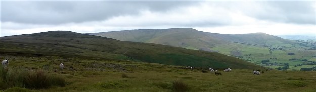
There is water gurgling from every nook and cranny but I know how to avoid the worst bits. At the top of the plantation I rest awhile on a tree stump looking out over the Ribble Valley although all the tops including Pendle are in mist. I’ve been lucky so far as there has been some brightness and the rain has held off. I celebrate with an orange. P1040769

P1040770

P1040773

P1040772

Hitting the road to Jeffrey Hill I change my plan on a whim. Rather than just walk back on the road why not go up to the trig point of Longridge Fell 350m. the most southerly named ‘fell’ in England. Having set out on a road walk to avoid the mud here am I heading off up one of the squelchiest  tracks at this time of year. P1040779P1040790

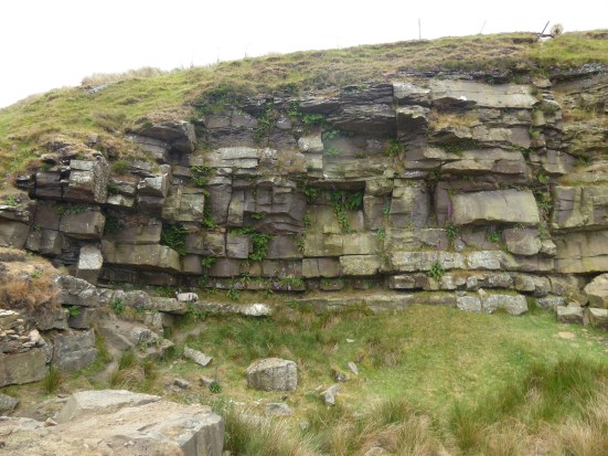
There is something different about the walk alongside the wall, a tracked vehicle has been up here. I then notice the drainage ditch that they have been excavating. Why I ask? Surely not just for us walkers. Are there plans afoot to plant more trees?  I ponder this as I walk on and then notice they have dug a similar ditch on the other side of the wall. I can’t believe what I see – one of my favourite trees, the solitary Scots Pine I christened ‘Its Grim Up North’ from its windblown appearance, has been uprooted for the sake of the ditch and is lying on its side. I almost cry. How could they have done this? P1040780P1040782P1040783

P1040785

P1040792

I have alluded to it many times on walks up here and have a folio of photographs of it as it wasDSC02518

Screenshot 2024-03-12 222257Screenshot 2024-03-12 215732

I plod on rather dejected. There are more drainage channels going in other directions. (is this the same work you saw above the Dog House Clare?)

I take that narrow tunnel through the trees. I’m expecting problems at its end as the last time I came the other way I couldn’t get through because of fallen trees. They are still there blocking the way but it looks like people have started to find a way round or more correctly through them. Only just, P1040796P1040798P1040800

I emerge near the fell wall and head up to the trig point. It is fast disappearing in the thick cloud, and is that rain I can feel? Have I misjudged the time and conditions by adding on this detour? What time does it get dark? A quick march up and then I’m heading back down through the mirk, no sign of the Bowland Hills or even Chipping Vale down below. It is excessively boggy on this stretch.  I am however rewarded by Skylarks singing joyfully overhead. Merlin and I can hear them, but there is no chance of seeing them in the mist which is getting worse. It is good to see the appropriate slate poem by the gate is still intact. Needless to say I don’t meet a soul, there isn’t even a car parked up at Jeffrey Hill, a rare occurrence given its popularity with dog walkers.

It’s just a long walk down the road now but I am getting gradually drenched. My phone with Merlin is buried in my deepest pocket. No one at the golf course which has been closed for many days this year due to a combination of flooding and mist. I still manage to find a couple of wayward golf balls in the verge, they will go to my son whom seems to loose a lot himself. There are some newborn lambs in the field, the first I have seen this year.

I am back at the car by 5pm, seven and a half miles under my belt, more than I had anticipated and I’m  ready for a good long soak in my bath.

***

For the record here is a list of the birds Merlin recognised, I only actually saw a fraction of them but I’m getting better at recognising a Robin’s song  from a Wren’s or a Chaffinch.

Robin; Blue Tit; Collared Dove; Carrion Crow; House Sparrow; Goldfinch; Rook; Starling’ Fieldfare; Chaffinch; Gray Wagtail; Coal Tit; Long tailed Tit; Wren; Great Tit; Jackdaw; Skylark; Blackbird; Goldfinch; Pheasant; Greenfinch; Dunnock. P1040874

Here’s the Robin.

***

Screenshot 2024-03-12 182528

BASHALL EAVES CIRCULAR.

P1040422

On the map this looks like a nice gentle rural walk, perfect for Mike’s training schedule before flying off to Madeira’s sunny adventures. I agreed to join him, secretly knowing the true facts from a relatively recent visit.

Another route he had chosen from Clitheroe Ramblers’ Walks in the Ribble and Hodder valleys. Today it was the Hodder.

The cloud was down on the Bowland Fells which is a shame as there is a fell race up there today. Even Longridge Fell stayed under mist as we drove alongside to park in Bashall Eaves.  We had a window of dry weather until about three this afternoon. Better get a move on.

All started well along a farm track, the guide’s instructions just said follow a waymarked route through the farm and cross five fields. Of course there were no waymarks and we had to ask the farmer the way out of his yard. He looked us up and down and delivered the fateful “there is a lot of water in the fields” before sending us into those fields. The first was the worst, a glutinous shaking morass. It was best to keep sidestepping the worst and not linger as your boots were being sucked down. To make things worse the stiles, if you could find them, were rotting and held together with string. Not a good start to the day and I knew things were to become far worse. Not many people come this way. P1040381P1040382

If we are going to have to become accustomed to water logged ground in the future I think I need to invest in some good walking Wellingtons.

Agden Farm was a Land Rover graveyard, at least the cows are kept inside,. The path, as it was, disappeared into undergrowth before tackling a steep ravine on muddy steps. This was the first of several cloughs we encountered today, steep and slippery down and steep and slippery back up.P1040390P1040386P1040393P1040398

Guesswork and some dodgy stiles delivered us to the next roller coaster, Paper Mill Wood, where at the bottom a fast flowing stream had to be forded. There was a brief respite alongside the River Hodder, the scenery idyllic. This is fishermen’s territory and there isn’t a lot of public access.P1040403P1040404P1040406P1040407P1040411P1040415

Open fields above the Hodder, with the instruction to head uphill to the three oaks. That was easy enough, they were unmistakable. Now head for a lone ash. This brought on a discussion on identifying trees in Winter mode, a skill neither of us had, I may go on a course I see they are running at Brockholes Nature Reserve.  Drop down to a stile wasn’t very helpful as we couldn’t see one. But there was the faintest evidence of a path, the first today. Not many come this way.P1040420

I was telling Mike about the next bridge, at one time erroneously marked as ‘Roman Bridge’ but more likely a mill packhorse bridge, we were heading for. How maybe 35 years ago my eldest son and I arrived at it on a walk to find it taped off and in a dangerous state. We recklessly crawled across the crumbling stonework with a large drop below us. I had returned a few times after it was rebuilt as a wooden structure in 1997. But the bridge we came to today didn’t look very impressive, perhaps my memory is playing tricks.  P1040425

No we weren’t there yet. Dropping farther into the woods we eventually arrived at the deep ravine of Mill Brook and the dramatic ‘new’ bridge. It was an impressive, as I had remembered it, and no doubt expensive, piece of engineering. The brook is 40 feet below. Having not met a single person since the first farm, a spaniel trotted across the bridge in front of us, soon to be followed by his master. The conversation that ensued turned out to be between two architects, one practising and the other retired. I listened in. He, the practising one, had just come from Lees House where he had been responsible for recent renovations. He warned us of more slippery paths to come and then posed on the bridge for his photo.P1040426P1040428

P1040434

The way onwards and upwards was indeed awkward through a series of fallen trees. Not many people come this way, get the idea.P1040435

The guide book has you continuing across fields to pick up the road for a while before doubling back to Lees House. A rather pointless exercise as there is on the map a lane direct to the house from the edge of the woods. All right, it may not be a public right of way but we were happy to risk it and we were soon through the buildings without encroaching on their privacy and back on track.

On track meant a narrow hemmed in path past Lees House and a slithering descent through the woods to yet another footbridge over Mill Brook. (I wonder if a direct way could be found alongside the brook from the near the ‘Roman’ bridge). I have never found an easy way up from this latest footbridge, often ending up in impenetrable Elephant grass. Today we staggered steeply upwards through the mud and low tree branches. Not many people come this way. The grass has not started its growing season yet, but was lurking in the background.  Eventually we were in the open fields heading to salvation. In hindsight, a wonderful thing, I think I might know a better way next time. P1040438P1040440P1040443P1040445

Salvation was reaching the farm track at Micklehurst Farm in the middle of nowhere. It was great to hear and see Lapwings flying over these fields.  Some of the caged working dogs were noisy but probably harmless, but the brown one on a short chain looked particularly menacing. How strong are those chains?

We didn’t quite make the entrance to Browsholme Hall. The seldom travelled side road took us through felled plantations, now being resurrected as nature reserves. That often in these parts is an equivalent for pheasant breeding and shooting grounds.

I diverted from the direct way back to Bashalls to show Mike the Saddle Bridge below Rugglesmire Hall. Probably from the C17th but restored, by public conscription in 1954. It is known locally as Fairy Bridge, said to have been built one night by fairies to help an old woodcutter who was being pursued by witches. A delightful spot. P1040455

In the hamlet of Bashall Eaves, maybe a dozen cottages, is a preserved Lancashire Cheese press worth a picture.P1040478

A delightful walk, all great fun. Those six miles took us over four hours. Come prepared for a testing time, but enjoy the unspoilt environment and wildlife of Bowland.

P1040451

Across the fields to Longridge Fell.

***

Screenshot 2024-02-17 165506

BEYOND THE PALE, STANLEY.

P1020925

I was up here a  few days ago in the frosty weather when I talked about the Leagram Deer Park. Today was all blue sky and not an icy patch to tread warily on. I’d already walked the pleasant mile along the quiet road from the site of Leagram Mill, passing some of those iconic railings sited to give visibility on the bends. Are they just a Lancashire thing?P1020856P1020858

Now I was entering the ancient laund of Leagram.  There was once an extensive deer park here in the 15 -16th centuries, l’ll  come to Stanley shortly. The pale was a ditch sometimes ‘fortified’ with hawthorn hedging demarcating and protecting the deer hunting area.  Parts of it can be seen on the present day estate where I am walking. From this we acquired the phrase “beyond the pale” – outside the bounds of acceptable behaviour. This how you find it with todays technology video.

Lovely parkland with Longridge Fell ‘beyond the pale’

P1020861P1020867P1020877

I walk on past the blue faced sheep and decide not to take the way to Park Gate as a tractor is muck spreading across the field. I walk on with Parlick up ahead. But I’m not heading for the high Bowland Fells, I’m going to skirt around under them on the track to Lickhurst.P1020892P1020897P1020899

First I stop to buy half a dozen free range eggs from the lane that leads to Saddle End Farm. P1020901

The Public Road ends short of the lane to the isolated Burnslack and the byway heading east is open to traffic but there are warnings to potential 4X4 users. Soon I’m at the ford over Leagram Brook, now provided with large stepping stones. Onwards becomes open moor named on the map as Stanley. P1020903P1020904P1020906P1020909P1020911P1020917

Edward Stanley, it turns out was keeper of Leagram deer park in the Royal Forest of Bowland between 1487 and 1523, and a soldier for both Henry VII and Henry VIII. The deer park died out in the C17th and the land passed into the Townley family. That’s how you inherited or were bestowed land in those days. It remained under the Townley family until 1938 when The Duchy Of Lancaster purchased much of the land. P1020950

Tipping my hat to to the duke or whoever I cross over Stanley and drop into Lickhurst. Remote farms, when I was working in the area, but now gentrified country properties made more accessible by bridges where there were previously fords. Having said that I got talking to a tradesman working on one of the properties who said they got caught out with the sudden snow and freezing conditions last week and spent two hours trying to get back up the hill to civilisation. P1020928

We are in Limestone country now, lots of coral reefs and more than one lime kiln along the way. I’m always impressed by the length of the single span stone across the brook here, now balustraded for health and safety.P1020932P1020935P1020939

Then there is that isolated red phone box, worth a post of its own. It is still functional but I wonder how many times it has been used in the last year. P1020941P1020948P1020944P1020958P1020953P1020968

One of the reasons I’m here is to visit friends at Greystonely. They are in so I enjoy an excellent coffee and them we join forces for the ongoing walk. P1020969P1020974

The bridleway down to another ford is looking worse from wear and tear, sat navs have led the unwary down this way, or rather ‘no way’. The bridleway improves past houses and eventually bring me back to my car on the road where I part company with my friends as they find another way back home.

I can repeat this walk as many times as I like – there is something special about it and the old Royal Deer Park. Here’s to Stanley.

***

Screenshot 2024-01-28 220733

Sadly a mere three weeks after my visit the lady pictured above had died of cancer of the pancreas. I still can’t believe it.

A CHILLY CHIPPING.

P1020238

This is not the day I had intended. The weather, is it really only the English who are obsessed about the weather? has at last changed from that dreadful rain to frost and sun for the next few days. I was ready for it. Spent time yesterday replacing a punctured inner tube with a brand new one. Cycling gear donned this morning – Glasson here I come. Not so fast laddie, the tyre has deflated overnight. I hadn’t the will to start again with the wheel, it is always the awkward back one. The bike is unceremoniously dumped back in to the garage for another time and I head in for an extra coffee.

Surely I can’t waste another day, I have missed too many this holiday season either from the persistent gloom affecting the weather and my mood.

My usual short winter walk from Chipping is on the lanes circling Leagram Hall. I love the approach up the drive with the prominent oaks, alas some have gone missing in the last few years’ storms. The snowdrops will soon be making an appearance in that copse over the wall. This land was once a Royal deer park in Medieval times. Names on the map, Laund Farm, Park Gate and Pale Farm, bear reference to its origins and there is an interpretation board telling me all. The background is Longridge Fell and Pendle. Now sheep are the main source of meat. P1020223P1020224P1020231

P1020227P1020232

P1020233

The lane is quite slippy in parts where the overnight frost persists, the air temperature is just above zero but as there is no wind feels pleasant enough. More than pleasant really with the sun shining, a perfect Winter’s afternoon for walking. And the good citizens of Chipping are making the most of it – a steady stream of friendly walkers encountered all the way around. 

I’m heading towards the hills, Parlick, Fairsnape and Wolf Fell, but then skirt round the base of them before dropping down to the site of Wolfen Mill. This was a water powered mill built in the 16th Century. Historically the mill made spindles and bobbins for the local spinning mills, closing production in the 1920’s. All changed now with luxury holiday accommodation.  P1020239P1020243P1020245P1020240

I walk down the lane above the tumbling Chipping Brook, which powered Wolfen Mill and several more down its course through the village. Kirk Mill, originally cotton spinning, being the largest My very last picture shows a waterwheel which was restored several years ago at a property in the centre of the village. P1020246P1020248

I take a signed but rather enclosed footpath on the outskirts of the village which brings me down a lane of houses, Broad Meadow. Friends lived here in the late C20th years, both deceased now, a trip down memory lane. A lot of the old properties from the C17th in Chipping are listed and the quaint streets and pubs are popular with visitors. I’ve written about them many times before. Slowly newer housing is encircling the village but the heart remains the same.  P1020254P1020258P1020260P1020261P1020268

A simple stroll on good surfaces with plenty of interest which I highly recommend to local readers. Ideal for families. 

Screenshot 2024-01-08 152429

THE FESTIVE SEASON.

P1020097

I’ve been up the fell, as usual, this time hoping to get a festive shot for you. I failed. Maybe JD should have worn a Santa hat. We missed that photo opportunity.

It turned out to be a better day than we had envisaged. I promised sunshine all day, but the morning started misty and damp. Our first phone conversation at 9.30 am ended by “let’s speak again at 10.30” Time for another coffee in bed for me and time for him to complete the Times Cryptic Crossword in record time. By 10.30 there was blue in the sky, at least at my end of Longridge. He can see the Bowland Fells from his house and said they were clearing.

We drove up to the parking at Intack. There were lots of cars on the road side. We settled for the rough spot above Crowshaw Quarry, no climbing today in the greasy conditions. A large pile of retrieved doggy bags by the gate greeted us, lovely. At least somebody, I imagine the foresters, are collecting them for later disposal. Let’s not get bogged down with environmental problems – it is the season of good will. My good will extended to the half dozen dog walkers (all dogs are innocent) we passed in the first half mile, after that we never met a soul.

We left the main track to get us to the modest trig point, but what a view as we crested the ridge and peered down into Chipping Vale with the Bowland Hills stately in the background. OK we encountered a bit of mud on the way. The last time we attempted to follow the ridge eastwards fallen trees were a problem. (I can’t remember the name of the storm) They still are, be prepared to take lots of diversions in the forest. Blue dots have appeared intermittently on trees showing a way of sorts.

Eventually we emerged from the trees onto the forest road. It was good to see that this has now been reopened and the the timber cut up ready for collection. Easy walking took us around the loop before plunging down the little path through new growth, more Christmas Trees than you could imagine. The beech wood was looking a bit bedraggled with recent topplings and decay which had me hunting down fungi once more. P1020100P1020099P1020101P1020104

As we strolled back along the road clouds were coming in  – we had had our window of sunshine.  The forecast is poor to say the least so I don’t think I will be out much before Christmas therefore …

All the very best to anyone reading and here’s to a more peaceful 2024.

*

Screenshot 2023-12-20 100526

TWO BRIGHT DAYS.

20231130_135009xThe temperature is hovering just above zero, but we must be under a high pressure there is no wind and the sun is shining. Perfect. I don’t carry a camera for these two days, I’m trying out my new phone.

Wednesday I join that walking group who put up with my irregular appearances. I’m not really a walking group type of person, a miserable old bugger and proud of it. The meeting place is strangely the Capitol Centre in south Preston. Perhaps the whole thing is a subterfuge for some Christmas Shopping. But no, once we all assembled we are marched off into no man’s land of Walton-le-dale and Lower Penwortham. Old railways and tram tracks wander through light woodland and surprisingly green fields. I keep seeing cycleway signs, so I must look them up for further exploration, there is no such thing as a wasted walk. The talk generally is about the state of the nation in particular the NHS, we are all of an age when most are afflicted.

20231129_111619

On our way.

20231129_114843

Cheeky chap.

20231129_122918

Safely back at the shops

Time passes quickly, I have no idea where I have been but the leader sensibly hands out a map of our route for perusal later.  P1010908

The highlight of these walks is the pub lunch at the end. Today it is Hunters. Being smart I looked up their website the night before and memorised their own map of  the locality. So once we were back in the car I proudly said I knew the way. We all seemed to drive off indifferent directions. Ten minutes later we realised there was no pub at our destination. Out with the phone to plot another route, this time putting in the name of the road – Hennel Lane. Another ten minutes and we were parking up in what appeared to be tacky family fun road house. It was, but the food was ok and they had some decent beers. Should I tell them of their website error or just let other people find out the hard way as we did. You can see the two sites on the map below, take your pick.Capture

*

Thursday, another day of frost and sun. The usual procrastinating and I end up with a walk up Longridge Fell, nothing wrong with that. I realise I have not had my breakfast which is a bit strange. Being on my own I can dawdle and take pictures of frozen grasses. 20231130_131451

When I set off there are few cars in the carpark but later in the afternoon it is quite busy, dog walkers mainly taking advantage of the good weather. I take my usual route contouring the lower fell – the ‘panorama route’ I call it because of the views over Chipping Vale and the background Bowland Fells of Fair Snape and Totridge. I walk up to the trig point on Spire Hill. The boggy areas are semi frozen making life easier but still giving way on the wetter sections. I have the place to myself, there is not a sound or a drop of wind. The three Yorkshire peaks are clear in the distance, I head back down through the trees first and then reverse my upward route. I meet a mountain biker making the best of the conditions.P101089720231130_134954

P1010900

A lady is setting up her easel to sketch the scenery in front of her. Unashamedly I interrupt her saying ” I wish I could do that”. She is very modest and replies she struggles to produce anything worthwhile. I’m sure she is underplaying her talents. I find out the name of the gallery in Ribchester where she exhibits and promise to visit. 20231130_142518

A little farther on I meet a friend who spends his time photographing wild life, particularly birds. He is out to see the barn owls that quarter the fellside most evening. I should come up tomorrow to do the same as there is also a short eared owl about. His camera is a foot longer than mine. What envy? 20231130_131355

Two contrasting walks!

Lets hope for more days like this and the winter will feel much shorter.

BLUE SKIES OVER THE FELL.

P1000623

By now you will know that if I just say ‘the fell’ I’m referring to Longridge Fell. However there is a new restaurant in town simply called Fell – not been yet, rather pricy. Saving it for a special occasion. 

I was going to get my hair cut when a phone call came from the ‘slate poem lady’, Clare, wondering if I fancied a walk up the fell as the day was perfect. Of course I did.

We were accompanied by Zola, an Australian Kelpie. This breed, possibly descended from our Collies  are working dogs and need a lot of exercise. Whilst we walked three or four miles I think she did ten. There was a moment of panic when a Roe Deer bounded out of the trees and shot across the heather, Zola picked up the scent and was off. Fortunately cheese snacks dragged her back.

We had already taken a slightly different route up the fell because the paragliders* in the sky were spooking the dog. Normally they are launching themselves off Parlick across the valley, but occasionally if the winds change they congregate up here, using  the steep scarp for launching. P1000620

It all looked very exciting and the views from up there must be great but I was happy to keep my feet on the ground. Some of that ground was very boggy today but we made it to the trig point, yes we could see Ingleborough and Pen-Y-Ghent and the Hodder Valley spread below us, the sky was so clear, before we disappeared into the woods. I love this passage down the tunnel of light. P1000631

A bit of boggy walking, more boggy than I had expected, sorry, on past the tree that I christened ‘It’s Grim Up North’ years ago.P1060060 (2)

Back at the road I took a hidden track into Cowley Brook Plantation for some further circular exploration. We found some unidentified fungi and peered into the deep hole in the ground, Sweden Quarry. After some awkward bracken bashing we were again on the road not far from our parked cars, the paragliders were still enjoying the updraft.. The sun shining bright, these are the autumn days to be enjoyed and praised.

P1000618

* I hesitated to put up a picture of a paraglider. Three Palestinian PEACE protesters have been arrested in London for displaying such an image – apparently now associated with the dreadful Hamas invasion of Israel. Three women deny showing pictures in support of Hamas – BBC News


What strange times we live in.

Next time I will get a photo of Zola.

A SUNDAY STROLL AROUND BLEASDALE.

P1000336

This is one of my favourite walks for the wetter months. Virtually dry underfoot the whole way and yet in touch with the imposing Fells of Bowland. I’ve been walking these paths for 50 years since moving to the area. We used to push our two young sons around in a double buggy in the early seventies, remember those. CaptureBuggy

I keep returning and have since introduced my grandchildren to the delights.  But looking back at my recent traverses, there have been many on here, I always seem to have walked anti-clockwise from Bleasdale Church. Time for a change.

I am always looking for somewhere new to explore locally. Today, despite the clocks going back and giving me an extra hour in bed, I’m not really up and going till midday. I have missed my chance to cycle the Fylde Coast or even the Guild Wheel, it will be dark or gloomy before five. So I fall back on the tried and trusted – Bleasdale Estate. But let’s look at the map and why not go clockwise for a change or even for the first time for years, unlikely though that seems.

The mention of Bleasdale Estate may jog memories in some of you of the disastrous court case in 2018 of their gamekeeper, James Hartley, accused by the RSPB of raptor persecution. Technicalities ruled the damming video evidence of his crimes inadmissible. I still question the partiality of the judge. Is Mr Harley still employed on the estate? Have a read for yourself – Case against Bleasdale Estate gamekeeper collapses as RSPB video evidence ruled inadmissible – Raptor Persecution UK

Putting that all aside I park near the Lower Lodge, I’ve always wanted to live there, it’s so cute. The road is still marked Private, but pedestrians seem allowed, I’ve never been challenged, famous last words.  Now that the estate have introduced a ‘Glamping’ site quirkily called ‘Lantern and Larks‘  on their property (more of that later) there is more traffic up and down the private lane. P1000304

I must say that everything about this estate, maybe apart from their raptor persecution problems common with most shooting estates, is immaculate. They obviously take a pride in their appearance. The driveway past the lodge is newly mown either side to perfection. The Bleasdale Fells are in the background of every view on this walk. Since I was last here there has been a lot of clearance of the mixed plantation on the right which was becoming invaded with the dreaded rhododendrons. It will be interesting to see how they develop it further with plantings. P1000306P1000305P1000311P1000310

Across the way, as I walk down the manicured lane, Bleasdale Tower, built in the early 19th century sits at the base of the fells. The sun is not quite making an appearance, but the temperature is high for almost November. There is not a drop of wind and all is silence as I stroll up towards the Tower. Well not quite because a delivery van keeps passing backwards and forwards looking for some address.  It won’t be easy out here when the post code covers a vast area. A lady dog walker helps him out – hopefully as he speeds past me to the remotest of houses. P1000308

P1000312P1000313

I walk on past the buildings that at one time in the C19th served as a Reformatory School for Preston.   North Lancashire Reformatory for Boys, Bleasdale, near Garstang, Lancashire (childrenshomes.org.uk)  P1000314

The lady with the dog catches me up as I’m taking photographs of stone walls. I’m reading a book by Angus Winchester all about Dry Stone Walls, recommended by Walking Away,  and I’m keen to put it into practice. I would hazard a guess that these walls are mid C19th when the estate was being established. Her dog photo bombs my picture of an old ‘gate’. P1000315P1000316P1000321P1000323P1000325

The lady lives in a property on the estate and tells me she was born at Vicarage Farm along the way. That brings back memories of my attending that house in the middle of the night, when GPs did home visits. I’m talking about the late 70s or early 80s. She recalls her mother telling her of an occasion requesting a visit to her ailing aunt in this remote farm and the doctor saying put on all your lights, and I’ll be able to find you. That was probably me. What a small world.

She talks of living out here and attending the local school and church. The school is now closed, but the church, St Eadmer, is open and has a service once a month. She disappears into a farm to meet a friend but tells me to look out for the original site of the school marked by some stones along the way.

On the old track, now grassed over, and in my own world I startle to hear a bike bell ringing behind me. A cyclist is taking a shortcut home to Chipping. He dismounts, it’s muddy anyway, and we walk together chatting about all things cycling. I forget to look for the old school foundations after the vicarage, next time. We also pass the diversion to Bleasdale Circle, though I doubt I would have taken it as the fields are so waterlogged. At the little school I take the estate road going west, and he pedals off down the main track. P1000328P1000329P1000330

P1000332P1000333P1000334

P1000331

It is along this stretch of lane are the Glamping pods, Lantern and Larks. They don’t look the most attractive, a cross between a shed and an awning from this vantage point. Turns out they are part of a National Group with other locations. As you can imagine they are not on the cheap side of accommodation, but where is nowadays? In their blurb they talk about the wild life to find in the surrounding area and highlight the Hen Harrier. It is these grouse shooting estates that are responsible for most of the deaths of the Harrier, a mixed message there.P1000335P1000340P1000338

Just past here on the right over the infant Brock is an old packhorse bridge said to have been on the way from the estate properties to the church and school. I would like to know more. Cutting across some fields I’m soon back at the car from there.  P1000341P1000342

Well that has been a very satisfying round.

***

CaptureBleasdale.

CHANGING SEASONS.

20230918_152136

You will have noticed we are moving from Summer to Autumn, although the seasons are not what they were. Heavy rain forecast for today and yes it arrived this morning. Soup and bread for lunch which will become the norm from now on, ditching the salads. I make lots of nutritious soups from cheap, out of date vegetables, from the supermarket and my freezer is full of them.

Come early afternoon it looks brighter. From my house I can view the westerlies coming in over the Fylde plain. Should be OK for an hour or so. I walk down past the cricket ground watching the clouds scudding across Fairsnape. It feels quite warm in the sunshine. 20230918_145655

Up Mile Lane (it is nowhere near a mile) meeting a few dog walkers on the way. We are all trying to dodge the showers. The spire of our village’s St. Wilfred’s Church always prominent on the horizon.20230918_151226

My mood is improving with every few more moments of sunshine. Exercise and sunshine are great healers, especially as we enter the darker months. By the time I pass through the park into the village I’m positively humming. Time to pop into our local Sainsbury’s for some more spinach destined for the freezer as soup. That’s nearly three miles under my belt before the next band of rain. Let’s hope tomorrow will give some breaks in the weather.

Now have I taken any photos on my phone?

CICERONE’S LANCASHIRE – ?FORBIDDEN BOWLAND.

P1020180Sat alone on the isolated true summit of Fairsnape, deep in Bowland, I’m poking at one of my sandwiches, egg and tomato, made a month ago. They went into the freezer when hot weather and circumstances cancelled an outing at the last minute only for them to re-emerge this morning. there is a distinct unappetising taste.  Should you freeze hard-boiled eggs? I’ve just traversed some of the loneliest hills up here and am in need of some sustenance.  The morning has been misty on the fells, however with a welcome cooling breeze. Distant views are restricted from my lofty perch, most of you will never have been here. Only a few curlew and grouse share my space. I poke again at the sandwich and decide to toss it into the heather for probably the seagulls, who now also patrol these heights, to scavenge.

As I say the day started off murky and cool with low cloud, quite the opposite of the mini heat wave we have been enduring. Ideal for a tramp across these Bowland hills. For a start don’t take Mark’s advice to leave your car in the Delph Lane car park, it’s none too safe and leaves you with quite an uphill walk before you start. There are suitable lay-byes nearer Stang Yule. Walk number 2 in the Cicerone’s Walking in Lancashire  book.

The way starts at a gate leading onto open access land. Welcome. On closer examination a notice says ‘No open access – temporarily closed at the land manager’s discretion’ Not a  good start at all. But wait, the date is 2021. This sign has not been removed or updated for two years. So much for the land manager.

P1020163P1020274

I try not to read too much into this as I stride boldly onto the access land. Nobody will see me in the mist. I’m enjoying the heather under foot, there is a path of sorts but not many come this way, put off by that notice possibly. Slowly I gain height and pull away from the plantation onto the open fell side, A track takes me across the slopes of Hazelslack Fell, a rarely visited spot. The last time I was up here was with Sir Hugh and JD on our straight line adventure between our homes. It’s as remote as I remember. P1020165

P1020169

The views back to the Fylde are supposed to be good.

P1020183

Approaching Hazelhurst Fell.

P1020186

Looking back with the track skirting below the summit of Hazelhurst.

I don’t bother with the 429 m trig point this time as I’m probably going higher shortly. The track dips down and climbs the contours gradually onto Winny Bank. The raison d’être for this track becomes obvious with the appearance of shooting butts. Not only the butts but also the small mammal  traps, thankfully decommissioned. The highlight of my week, if not the month, was witnessing a family of Stoats crossing a road on Longridge Fell. Distinctive with their black tipped bushy tails. Who would want to trap and kill these beautiful animals?? P1020188P1020189P1020197

Along the way is a stark memorial to airmen lost on these hills in WWII, I have a book somewhere  listing all these crashes and giving their accurate sitings. P1020196

The track starts to descend, and I have to be alert to pick up the ongoing path to Fairsnape otherwise I would be floundering, I know not where. The path begins somewhat unlikely with a few steps leading off a turning place. The stone flags don’t go far and one is left following intermittent white posts through the morass of peat. You will be glad you came here in dry weather, preferably a draught, also not a good place to be in thick mist. Stick with it, and you will arrive at a fence corner euphemistically named  Webster’s Meadow. (if you miss it you would be in ‘Dickey’s Meadow’) This is also known as Fiensdale Head, the way through from Langden to Bleasdale. A partially flagged path shows the way. it’s a long time since I’ve been down Fiendsdale, a good spot to see ring ousels. No idea who Webster was or Dicky for that matter.

P1020199

Turning spot.

P1020200P1020201

P1020205

The way down to Fiendsdale.

United Utilities have an information board explaining the work being carried out to try and reverse some of the peat erosion. When I was last up here they were helicoptering bags of stones in to be incorporated into ‘dams’, stopping further erosion from run off and re-wet the surrounding peat. Evidence of that work is all around with stone and fibrous matting in the peat cloughs. One does wonder how much we can do to repair the damage which must be on a vast scale in Bowland alone. Are you still able to buy peat based compost – I hope not? P1020204

P1020214P1020216

A few more flags are encountered, showing a way down to Bleasdale and ahead to Fairsnape. Then you are on your own again with the fence for company. The book talks of ‘hard going’ in the peat hags – ‘hopping over to the other side of the fence may help’ Today that is not necessary as it is as dry as it is going to get, but there are still boggy morasses you wouldn’t want to fall into, perhaps the re-wetting is working. Knees are allowed for climbing out of the deepest hags. P1020213P1020208P1020221

Anyhow, I’m soon sat at the 520 m summit contemplating my lunch. There is another informative board up here telling the same story. Some of the funding came from the EU, pre Brexit. How much will our own DEFRA run by Thérèse  Coffey put into environmental schemes? P1020222

It’s a dry run over to the other summit of Fairsnape, the one with the shelters and trig point. I’ve not seen anybody all day so far and can’t believe I’m the sole person at this popular top. Only when I get closer to the shelter do two heads pop up – a young couple having some private time to themselves. P1020228

The mist has lifted a little allowing the gliders from the club down below to take to the thermals, spookily and silently sliding past out of the thin cloud. P1020226

The way off, by a cairn, is down some zigzags into Bleasdale. I have always assumed these to be part of a sledging route for bringing cut peat off the fell. Beautifully constructed and a joy to walk whichever direction, up or down. Few people used them as most are linking Fairsnape with Parlick along the ridge. But Mark knows this area well, covering Bowland in detail, the secret is out. P1020230P1020232P1020241

P1020243

P1020259P1020273

What a contrast from the northern side of the fells – endless peat and heather as far as the eye can see and down here in Bleasdale with the green pastures stretching to Beacon Fell. The guide book takes you on tracks that would give access to Bleasdale Circle, but I’ve been there many times and at the moment it is a bit of a mess following storm damage to the trees, so I take a slightly different route through Bleasdale, past remote farms, past the old reformatory school buildings and past Bleasdale Tower. North Lancashire Reformatory for Boys, Bleasdale, near Garstang, Lancashire (childrenshomes.org.uk)

P1020278

That little lay-by.

The little blue car was waiting for me in that lay by, as a Duke Of Edinburgh group were going through, staggering in the heat under massive rucksacks. I wonder who had the better day?

***Capture Hazelhurst (2)

TOMORROW STARTS TODAY, A LONGRIDGE LOOP.

P1020116 (2)

It is a month since I have done a ‘long walk’. Health issues combined with all that heat kept me in doors. I’ve only managed a few walks of a couple of miles or so, enjoyable nonetheless in their own rights. Tomorrow I hope to take up the cudgel of another possibly strenuous Cicerone’s Lancashire walk. So I had better have a gentle warmer up to get my legs back into shape.

From my header photo you can see that the hawthorn flower has given way to the elderberry.

Juggling with the weather I need to get going before the afternoon rain comes in, our gardens need it. (it never arrived)

Let’s keep it simple and walk up the lanes from the village onto Longridge Fell. I’m only out for the exercise after all. Park at the little reservoir, Upper Dilworth, stop to watch the female tufted duck with her brood and then a brisk walk-up past the golf course onto Jeffery Hill. I can’t resist a look into Cardwell Quarry to see if the barn owl is still there. A couple of weeks ago I looked in and took a hurried photo of the roost which showed up the owl’s legs but nothing more! Today nothing at all. I sat for a while taking in the view over Chipping Vale and remembering all those summer evenings climbing up here with Longridge mates. It’s banned now due to some unfortunate contretemps between the landowner and some selfish youths. It doesn’t take much to destroy all the goodwill built up in the past. P1020112P1020115P1020128P1020130

P1010903

Two weeks ago – spot the legs.

Close by here the Roman Road was thought to have come up from Ribchester before a turn to head through the hills towards Newton, and then over to Lancaster. It is marked on the OS map, and today I can make out the line of it just below the modern road. P1020119

P1020132 (2)

Surprisingly there is only one car parked up on Jeffrey Hill where the walk-up onto Longridge Fell starts. I never meet the occupants. Taking the ‘balcony path’ along to the spring and then heading towards the ridge, it is bone dry. I am tempted to carry on up to the trig point, but sense tells me to go easy and besides I can see rain coming in across the Fylde Coast. Back down alongside the wall, past the ‘grim up north’ tree. 

P1020125

P1020134

Straight across and alongside the upper trees of Cowley Brook Plantation. This plantation is becoming a favourite of mine for an evening stroll, and today I cut down through it meeting up with the brook where it disappears under the road. P1020137P1020138P1020140P1020143

This road takes me eventually, there are lots of ups and downs, back to the village, passing the lower side of the manicured golf course this time.

P1020155P1020156

P1020158

Job done, now let’s see what the forecast is for tomorrow.

CaptureLOngridge Fell.

NEW WAYS ON THE EAST END OF THE FELL.

P1010924

The heat goes on, we somehow have avoided the thunderstorms rattling around the North West. Lethargy is the order of the day. But there is a breeze from the east, so some solace may be found up on the far end of Longridge Fell. Not again I hear you say that’s the third time in a week up there, but I’ve approached  from three different but well-used directions.  The lethargy prevents me going farther afield and the heat limits my delicate body’s distance and exertion. And anyhow I like my local fell. 

When I moved to Longridge over 50 years ago few people used the fell for recreation. The forest tracks were constructed, but I don’t think the public were encouraged onto the land. I remember the spruce trees looked relatively young, as was I at the time. A few public footpaths criss-crossed the once open fell sides which must have been planted up in the late 60s to 70s. The 7th Edition, One inch to the mile, map of 1969 shows only a few scattered plantations with no forestry tracks. There was a way up from Jeffry (Jeffrey) Hill to the trig point, then 1148 feet (now350 m) but few went farther along the ridge. This involved for  the most part delicate, muddy and pathless walking between the young trees. 

CaptureLOngridge fell 1964

Compare with the modern map.

CaptureLongridge fell

Over the years, thanks to intrepid walkers, a path developed along the ridge from the trig point all the way to Kemple End where the fell drops steeply to the Hodder. This was mainly in the new forest planting and could be very muddy in the winter. Mountain Bikers started using the forestry tracks and signage eventually appeared on the public right of ways. Old walls started to crumble but were still good orientation points. It has now become a popular walking and cycling destination. But come full circle and some areas are being harvested and the devastation that that brings can often wipe out the unofficial paths that had developed. On top of that recent storms have brought down many trees and affected paths can be difficult or impossible to follow. Clearance is for some reason slow paced. 

My planned walk today would complete a trilogy of routes up Longridge Fell, from the West, South and now East. I would be walking some of those ‘unofficial’ paths and encountering both forestry and storm damage.

From the rough parking at Kemple End the main forest road traverses the fell, but I want to see how the little path in the trees to the north had survived. Starting on the left, SD 689406, down the road from the parking. The path looks well-used and the few trees that had blown down seem to have been cleared, all very promising. Buzzards circle overhead and blue butterflies flit around my feet. There is not much breeze although most of the time I’m in the shade. Steady progress uphill. At the first junction I know I could go left and regain the main forest road, but I go right to keep to the ridge. The path narrows and is enclosed in the trees, I recognise familiar landmarks. Before long though it comes up against some forestry work from a couple of years ago, a large area of felled trees on the northern scarp. People have escaped back left to the forest road. and that’s what I do. After 200 m on that road I spot an orange arrow on a tree at the edge of the destruction, is this a way back to the original path? After some haphazard wandering through orange dotted trees I give up and escape into the felled area onto a track of sorts used by logging vehicles. It leads me in the right direction westwards close to where the old path ran and if people use it will become an established way. Somewhere at the end where it joins with a forest road, more felling here, used to be a viewpoint (Sam’s View, I never found out who Sam was) but with new growth on the scarp it is no more. All in all a right mess. The latest OS map no longer tells the truth.

P1010916

A good start.


P1010918

Pushing on.


P1010922

The old way through the trees on the ridge…


P1010931

…soon disappeared in forestry devastation.


P1010933

New trees have already been planted.


P1010945

Orange hope?

P1010938

Sam’s view?

I don’t feel like tackling the still obstructed way up to the trig point so simply follow an established path down to the forest road. I turn left and saunter back down to the car with the bulk of Pendle ahead. 

P1010940

No farther.

P1010941

Escape path.

P1010944

The main road.

P1010946

Proud Pendle.

Last year there was a good crop of orchids along here but nothing to show at present. The Bird’s Foot Trefoil, Mouse-ear Hawkweed and ‘Fox and Cubs’ are all flowering.  What delightful traditional countryside names.

You may wonder why I’ve not yet included a route onto the fell from the north, well have a look at those contours. Longridge Fell is a ‘cuesta’ with a steep escarpment to the north and a gentle slope to the south. I have come up from the north many times but any ascent at the moment would be punishing in the heat. I will leave it to you to plan your own way up those footpaths from the Chipping side. 

I fear for the fells as we have had no rain for weeks. One careless cigarette or a disposable barbecue, the weapon of choice for moorland fires, and we will be loosing a valuable habitat once more. Go careful out there.

***

  Capture Kemple End..JPG


CaptureESRI

Latest ESRI.

LONGRIDGE FELL – THE TRADE ROUTE.


20230610_150136 (2)

Every fell has an easy and hence popular way up it. The Victorians talked of ‘Tourist Routes’ up the Lakeland Fells, I have a copy of a 1960s Baddeley’s Lake District, a Ward Lock Red Guide aimed at the new tourist who wanted to explore the fells without any serious mountaineering. Wainwright popularised the fells, but give him his due he did seek out the less populated ways. A trade route or tourist way is the most frequently used route for ascending and descending a hill or mountain. Farther afield the term the “Yak Route” was used for climbing Mount Everest on a commercial expedition, you have seen the pictures of the queues on the South Col.

Well I’m not in the Himalayas or even the Lakes but on the humble Longridge Fell. I’ve been up it three times this week already, it’s in my backyard so to speak, trying to build up my fitness again after an enforced lay-off. There are three main entry points for climbing the fell. a path from Jeffrey Hill car park, my usual way. The forest track up from the lower fell road parking above Crowshaw. And the forest track from Kemple End at the far end of the fell road. Judging from the amount of cars parked up the middle option is the favourite, a simple march up the made up and wide forestry track.

So that was my option today,the hottest of the year so far. Despite my stating this to be the most popular way there were very few people about. Too hot for most and down in Longridge it was field day. Field days years ago were a community gathering, my children on many a themed float. A family day out. Nowadays, it has become a bit of a rebel rouser with the riot police usually in evidence later in the day. One to be avoided. English society has taken a downturn in the last decade. 

That links me into the ‘trade route’ up Longridge Fell. I almost changed the title of this post to ‘the irresponsible dog walkers’ route. I came across a dozen discarded dog poo bags within the first hundred yards from the road. And there were more sporadically as the track gained height. Trying to be impartial, who do these people, it’s not the dogs, think will clear up the mess? Not a good start to my walk. 20230610_150200

The shade I had hoped for was lacking due to recent forestry operations but once on the open ridge there was a cooling easterly. Before long I plunged back into the trees for the tricky section through windblown trees from the ‘beast from the east’, was it really 2018? Nothing much has been done to restore the path, in fact due to exposure more trees have come down since then. I’m beginning to know the best way through now. 20230610_151350

20230610_153638

20230610_154447

20230610_155203

Onwards down a track through naturally regenerating forest from harvesting a decade or so ago. I love this stretch past some of my favourite oak and beech trees. Although one of the ageing giants has fallen. 20230610_15591820230610_16061320230610_16064820230610_160955

If you know it there is a shady path back avoiding walking on the road. 20230610_145421

So a trade route up but a more adventurous way back down. Plenty of variety in three miles. Did I take any photos on my phone?  Just a few. I was glad I had some water to drink back at the car. It may thunder tonight, I hope it will. in fact, it is right now.


Longridge Fell.

A LITTLE LONGRIDGE LITTER.

20230605_144203

The gardening can wait. It’s hot and stuffy and my hay fever is irritating. Time to escape to higher ground not to far away. A quick lunch and I’m parked on Jeffrey Hill. It’s not rained for days and the ground is looking parched. What is usually a boggy path is now bone dry and trainers are all I need. There is a welcome breeze, and I’m soon ‘walking on sunshine’ with the familiar panoramic Bowland Fells stretching out above the vale of Chipping. Newly cut meadows adding to the patchwork. Yorkshire’s three peaks are in the far haze.

20230605_140336

All very idyllic you will think, but I also choose to do a litter pick at the same time. I thought there was less rubbish than usual on the path to start with, but by the time I’d completed my 3-mile circuit my sac was full. Dog poo bags, tissues, empty water bottles, cans and strangely a pair of underpants. I declare the fell litter free – but for how long?

20230605_144952

As an afterthought on the way home I called into our local bouldering Craig Y Longridge to check out any litter there. I’m pleased to say there were only a couple of bottles to remove and these had probably been thrown from the road above. Well done climbers for looking after their own environment. By now the crag was in the shade and I enjoyed a bit of exercise on some of the easier problems.

Back to the garden and those weeds. 20230605_173554

***

CaptureLongridge Fell

IN LIKE A LION…

DSC00304This week I have been alternating short walks and flat cycle rides with nothing of note to report. Everything came to a standstill yesterday with the collision of cold winds from the north with a front from the south. Amber warning. My son cancelled a lunchtime visit from Manchester and I watched the snowflakes falling in the afternoon. During the night things must have turned nasty as today I woke to a couple of inches of snow. (The radio told of far worse conditions in the Pennines) It was interesting to try and identify the  tracks across my back garden, one doesn’t know what transpires in the night. Something I should resolve either with sitting up into the wee hours or more likely installing a motion detecting camera.

By mid-morning the sun had appeared and traffic started using my road. Time to get out and about. The tossed coin said walk. So I did. A brand-new pair of lightweight boots had arrived in the post. Helly Hansen and looking perfect for summer walking – right let’s try them out in some snow. Living in Longridge I am lucky to be able to walk from my doorstep into the open countryside or as I did today up onto the fell. The route on roads was one of my regular runs way back then. I knew it would give me good Bowland views with the minimum of hassle.

Once out of the village ‘Forty Acre Lane’ gave me those promised views. I’m not sure which side the ‘forty acres’ are on but never mind the vista across Chipping Vale to the hills is uplifting. The snow on the south slopes was visibly melting as I walked but showed up the features of the Parlick, Fairsnape and Totridge Fells in great detail. Virtually no cars passed me, the road was just thawing enough for them. There were still drifts in the gateways. The golf course was closed, perhaps prematurely as the afternoon was perfect.

DSC00306 DSC00305

DSC00303

The usual crowd of cars was parked up at Jeffrey Hill. From up here the northern slopes of Pendle Hill were plastered with snow – they usually have it worse in East Lancashire. I was in two minds to take to the fells with the rest of them and visit Spire Hill, instead keeping to the road but no sooner had I decided this I was tempted off into Cowley Brook Plantation. My favourite getaway place. It was a joy to tread virgin snow through the trees. Silence was everywhere except for those little birds singing unseen. DSC00310

Back out on the lower road I trudged back along the switchbacks to Longridge as the temperature started to fall again. The roadside gorse was a brilliant yellow.DSC00302

How good that sunshine must have done for my endomorphins.

***

CaptureLongifdge fell

KEEPING IT LOCAL.

DSC00142I may have used this title for a post in the past. Whilst fellow bloggers are exploring Manchester, White Nancy, Covid and Wildlife crimes I’m content with a walk around my local lanes. After my drubbing, is that a word, the other day on the Guild Wheel cycle route contentment is the prime objective. I live on the edge of the countryside, but only just with all the new developments, so for many walks I don’t need my car – just set off from the front door.

The road out of the village past the cricket ground is far busier than I ever remember it, a speedway to Chipping. That is why for my cycling these days I prefer the off-road routes. Anyhow, I’m walking today. Storm Otto blew itself out here in the morning and now the sun is shining. As I was saying the road is busy and after a stretch where the footpath ends I resort to evasive action crossing and recrossing to have a straight view of the traffic and hopefully them me. All along are views of the Bowland Hills tempting me to the north. Past that archetypal country inn.

DSC00143

Is that a Kestrel in the tree?

DSC00145

I survive to where I turn up a side lane heading for Longridge Fell. Those white railings, sited on corners for better through visibility, are slowly disappearing – a rural crime.

DSC00148I stop to talk to a farmer about the winters we never have these days. (tempting fate I know). Along comes a car which stops to reveal a dog walking friend fresh off the fell and heading for a nearby farm café, a good catch up ensures. I’m then admiring the hedge layering skills along the way and am lucky enough to come across the skilled labourer himself. A chain saw now makes the labour easier, but he has to be careful with the final close cut. A bill hook finishes off the branch severing, leaving a slender life giving, bent over, horizontal, stem for further growth. The whole process is to keep the hawthorn hedge thick at the base and stock proof in the future.  He seems happy in his work and as he says ” jobs a goodun”

DSC00150

DSC00152

DSC00154

DSC00151

There is a steep hill ahead of me but I have no problem which is reassuring after my last outing mentioned above. (my Covid test was negative by the way)  On the way up my mind wanders to future projects – Simon Armitage’s Stanza Stones, finishing off my Cicerone series, getting back on the rock, visiting friends afar not seen since before the lockdown and dare I hope getting back to the Canary Islands. Dreams. Inshallah.

DSC00156 (2)

I scan the reservoir for grebes, but the water is too rough today, I’m hoping to catch them in their courting display this year after last year being entertained by the chicks being carried on their mother’s back. DSC00157

Down through the housing estates and I call in at JD’s for a welcome coffee and plans. A ghostly barn owl quarters across the remaining fields in front of his house. He alerts me to this signage along the road which I had not noticed before – see me after school.

DSC00159Not bad for a local walk of 5 miles.

Capturethornley

A GENTLE SIDE TO BOWLAND.

DSC00117

Forget the rugged and isolated high tops of the Bowland Fells with their difficult peaty ways. This walk is for children, dogs and geriatrics like me.

Mike, or should I bestow on him a blog monicker of ‘metal Micky‘ used by his nearest and dearest after his second hip replacement, is going walking in the Canaries and is keen to get some miles under his belt. I put him off yesterday whilst I had a well-earned rest from our walk around the wells of Silverdale. No pun intended and no excuse today, I even went for an early start, so he could be home by 3pm for the televised rugby. We juggled a couple of routes and plumped for what is called locally the Little Bowland area. CaptureLittle Bowland.

A gentle start into the Leagram Estate with a peer over the wall at their extensive snowdrop dell which I managed to gain entry to last year. The fallen oak in the parkland from then has been cleared.

DSC00107

A drift of snowdrops.

DSC00108

A stately Leagram Oak.

The farm at Chipping Lawn (lawn derived from ‘laund’, a Medieval grassy area for deer) was heaving with lambs of all ages, weaned off their mothers. The mothers can then continue to be milked for Bowland Ewes Cheese. The youngsters meanwhile suck on dummy dummies for powdered milk. That is the evolved technical face of farming today.

DSC00112

A mob of lambs.

DSC00111

Suckling station.

We move on up the fell, passing Birchen Lee where a couple are busy laying flags. They are happy to chat about the locality. I know he crafts handmade furniture from seasoned oak which I would like to see, but I’m reluctant to distract him from his labours. We move on.

I have no spare coins to buy some free-range eggs at the Saddle Side farm road end. We move on up the lane going nowhere except a couple of properties at isolated Burnslack in the bosom of Bowland. We don’t go that far but turn off on an ancient bridleway along the base of the fells to Lickhurst, another isolated group of farmsteads now being gentrified as is the norm. I could tell some stories of these farms 50 years ago when reaching them in winter was an epic journey. Let’s leave them in peace, I don’t even take a picture, but there are some on my posts somewhere if you care to look.

DSC00115

Our high bridleway over Stanley to LIckhurst.

Let’s extend the walk and give us both a bit more exercise. So instead of following the lane down over fords we cross a little footbridge, and suddenly we are in limestone country. Coral atolls out of an ancient ocean floor, from whichever period, producing Limestone Reef Knolls. They are very obvious around here.

DSC00118

Coral reefs ahead.

DSC00128

Dinkling Green farmsteads our are turnaround point, we could have continued over the hills to Whitewell and beyond. We are in a beautiful green bowl of meadows below the high gritstone fells and the adjacent Limestone knolls. We meet a couple who live here who expound the virtues of their natural environment, there is no denying it.

DSC00120

Dinkling Green

DSC00124

The green side of Bowland. 

DSC00125

Local residents heading home for lunch.

Then that iconic red phone box in the middle of nowhere. It must have been essential at one time.DSC00131

We couldn’t walk past our friends’ house at Greystoneley without a knock, next thing we are seated in their kitchen enjoying conversation, coffee and cake. That’s what friends are for. They have had problems in this area with off-road vehicles.DSC00132

The 3 o’clock deadline is getting closer as we continue down the bridleway, over the ford and past the giant limekiln.  We opt for a hopefully quicker finish along the quiet road rather than the difficult to follow field paths.

DSC00134

Back in the parkland.

The exercise has done us both good, I’m relaxing in the bath whilst presumably ‘metal Micky’ is watching England thrash the Italians – or are they?

This circuit is recommended for anybody wanting to explore the foothills of Bowland and its farming communities. Just follow the map.

CICERONE’S LANCASHIRE – LONGRIDGE FELL NEVER EASY.

DSC03107

Up on Longridge Fell we were doing OK until the guide, walk no 23 of Mark Sutcliffe’s book, said to take a jink right in the trees. We already had jinked right awhile back as the fallen trees from last year’s storm Eunice?, blocked our tracks. But others had come this way recently, in fact quite a path had developed. We bushwhacked on. For once, I wasn’t the leader, Phreerunner was running but not as phree as he thought.

When Martin (aka Phreerunner) had included in his Friday walks Longridge Fell I couldn’t refuse to accompany him. I secretly knew the problems ahead but didn’t want to spoil the fun, it’s not Cicerones fault. I thought it a good idea to bring JD into the mix for some local support.

We had left Hurst Green alongside the delightful Dean Brook with its bobbin making history. The stream bed was carved by the water into Daliesque shapes. Resisting the urge to take another photo of Greengore we move on and across fields I don’t usually travel. Lanes and then a boggy path brought us out onto the top ridge where a simple stroll led to the summit trig point, 350 m. The light on the Bowland Hills was flitting from one area to another, but the three peaks never put in a show. Time for coffee and snacks.

DSC03096

Shireburn Alms Houses.

DSC03097DSC03098

DSC03101

The onward path disappears into a dark plantation, and already we start meeting obstructions. When I was up here early last year I found it impossible to make safe progress. It was slightly better today as Martin forged forward bent double to avoid the branches. We made it through to more open ground and then found with the use of our phones a path going in the right direction. It is fairly chaotic up here at present, a shame that the forestry workers can’t spare a day with a couple of chain saws to clear a way.

DSC03105

As we left Hurst Green earlier this morning we passed the Shireburn Alms Houses and I related as to how they were originally built higher up on the fell in the earlyC18th and subsequently moved stone by stone down into the village around 1946. Well now we were above their original site on the fell next to the ‘blue lagoon’ reservoir. It wasn’t blue today in the rather dull conditions. The foundations can still be seen if one looks around, we didn’t.

Across the road, over a wall and down some fields, the directions lacked clarity here. We ended up in someone’s garden with a couple of wild eyed dogs snapping at our heels. We escaped and found our way down a ravine, the correct stile now visible behind us. It always amazes me, and I’ve said it too many times, that landowners don’t put signage up through their property and maintain the stiles – it’s not asking too much. If you buy a country property you will be well aware of any rights of way coming through it. Time to start issuing fines, I know that will never happen.

We skirted around Stoneyhurst School, admiring the architecture and the long stately drive. I think this was all new for Martin, and I shall be interested in his write-up for the walk on his blog. Soup and rolls back at Chez BC completed an excellent ‘Friday Walk’  May meet up again when he moves his troops to Silverdale in a couple of weeks time, or should I make the effort and travel down to Cheshire for somewhere new?

DSC03112

I didn’t take many photos, it was all too familiar, or so I thought, and we were busy chatting. There is a better report here.

***

tempsniphurst green

SPY IN THE FIELD.

DSC02928

I came across this temporary CCTV installation on my walk across the fields this morning. Notice how blue the sky is.DSC02927

Placed in a field next to tracks leading to isolated farms and a back way into Ferraris Country Hotel. Four solar-powered cameras pointing around the compass. Have there been recent burglaries or fly tipping? I am sure it’s not to watch the animals or ramblers. Further enquiries are needed.

I was out for a short brisk walk in the countryside behind my house, there had been overnight light snow which always gives a different atmosphere to the familiar, making the fells look higher and more majestic. There was a satisfying crunch underfoot, mine were the only footprints. Though there were prints of rabbits, hare, deer, and the odd bird who had passed by earlier. The snow was rapidly melting in the fields but compacting to an icy danger on the lanes.

DSC02925

The Bowland Fells.

DSC02922 (2)

Longridge Fell.

                                                                                                                                                          Soon I was heading up an icy Mile Lane back into the village for a bit of shopping.DSC02933

The remaining snow had a rosy glow in tonight’s Turneresque sunset.

DSC02964

***

Capturegill bridge.