DEAD LEVEL THROUGH BARNSTAPLE.

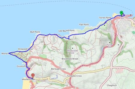
Braunton  – Instow/Appledore.

It was raining hard so I was happy to chat with my sociable B and B host over breakfast, So It was almost eleven when I was on my way. After a bit of clever navigating through streets and parks I was on the old railway track into Barnstable. Today was going to be virtually all walking on old railways, the Tarka Trail follows the same route. At first there were new houses built close to the track and then Chivenor Royal Marine barracks. Plenty of joggers and cyclists were using the flat track for their exercise.  Somewhere along the line the sun came out and suddenly I was alongside the Taw estuary which at low tide wasn’t very attractive.

Walking quickly I was soon under the new Taw Bridge into Barnstable and having lunch at the great little cafe attached to the railway station. 

When I set off again it was hot and sunny, the weather has been so changeable this week. There is a cycle hire depot at the station so lots of cyclists of all shapes and sizes were using the old railway line. It was good to see whole family groups out and everyone seemed in a cheerful mood. A girl coming towards me was walking Land’s End to John o’Groats, she was just getting into her stride after two weeks on the trail. The tide was coming in and I was amazed at how quickly the channels filled with water. The old station halt at Fremington Quay has been converted to a cafe and was doing a great trade with the cyclists most of whom went no further. They were so busy I didn’t stop but was lucky to come across a mobile coffee stall further along. A young man had packed in his job bought the tricycle and set up shop. He’d obtained a license to trade and was hoping for a good summer, his coffee was excellent! The walking along the railways has not been as boring as I thought.

How many miles?

Fremington Quay.

At Instow I took to the beach for a stretch with plenty of activity happening in the water. The sand dunes at Braunton were visible and a yacht race was in progress on the open water. I was now alongside the mouth of the River Torridge with Bideford downstream, just across the water was Appledore. I didn’t fancy the long detour down river to the first bridge and was in luck as the ferry was operating, it only does two hours either side of high tide. So for £1.50 I was soon stepping onto the quay in Appledore, the journey across delightful in the afternoon sunshine. The ice cream sellers were doing a roaring trade.

Approaching Appledore.

This old fishing and shipbuilding village was a delight with tiny houses in traffic free narrow winding streets. Most of the tourists disappeared in the early evening, so I enjoyed an exploratory stroll around in the warm sunshine with clear views across the coast.

Looking back to Instow.

A decent pub meal for a change and back to my stylish B and B for an early night.

BAGGY POINT, CROYDE AND SAUNTON BAYS.

Woolacombe  –  Braunton.

It was going to be hot today but as I left, rather late, spots of rain were falling and people were coming off the beach. Somehow I managed to get onto the sand dunes which were heavy going,  Herb Elliot comes to mind. I retreated to the firmer sand on the beach as the tide went out. It’s a long beach. Climbing out on a lane I looked back at Woolacombe.

Sand dunes along Woolacombe beach with Baggy Point in distance.

Back to Woolacombe.

At the far end of the bay was Putsborough Sands which seemed popular with surfing groups under instruction. Now onto open land I began the traverse to Baggy Point high above the beach. I was looking forward to this renowned climbing area which I’d never visited. Lots of people were walking out from Croyde Bay. At the point I could look down onto the loose slabs on which there are some classic climbs , always fancied Kinky Boots. There was no climbing today as a bird ban was still in progress. I examined the metal belay stakes and imagined the exploratory abseil down into the abyss.

Main climbing area at Baggy Point.

A made up path, popular today. took me directly into Croyde and a cafe primarily for surfers. Tea and panini. People were setting off excitedly on surfing and coasteering [a new ugly term for an unusual pastime thought up by commercial organisations]. Again I extricated myself from soft dunes and arrived back on the coastal road by a monstrosity of a  building project, don’t they have planning controls down here?

Croyde bay.

A path above and  parallel to the road proved really pleasant with lots of flowers and views. a seat provided the perfect lunch spot. It came to an end on the main road above Saunton beach and its busy car parks but I found a path back up onto the open heath populated with sheep. This super highway eventually brought me back down to earth near a little chapel and I walked along the road as a short cut into Braunton, it was very hot and I had no desire to do the longer route.

Saunton bay.

Braunton from on high.

Fish and chips at the famous Squires sufficed me before reaching my B and B. This latter turned out to be interesting in that it is run by a garden nursery, or rather propagator, man. Long discussions ensued on horticultural topics. The accommodation was first class. www.escallonia.co.uk

Inanda B and B.


DEVON MIST, A DAY OF TWO HALVES AND TWO LADIES.

Ilfracombe  –  Woolacombe.


The lady serving breakfast said she had been over at Woolacombe yesterday evening to catch the good surf conditions and for the next few days I felt out of place without a wet suit and board, mind you I would have looked ridiculous on the Torrs which was my first objective for the day. Reading about Ilfracombe later I found there was lots of interest there worthy of a further visit. I had walked into town following footprints and on the way out had posh finger tiles. The morning was misty and damp and not one for hanging about so I was quickly following the Victorian pathways cut into the hillside, above tunnels leading to hidden bathing beaches. Flowers brightened the way and I was soon up to the summit of the Torrs where there was an elaborate viewfinder but no views.


Onwards onto open farmland the paths were difficult to follow but all seemed to go in the right direction, there is one rule in coastal walking – keep the sea on the same side. Out of the mist would appear herds of cattle whose sex I couldn’t identify which didn’t help my ‘taurophobia’.

This elaborate sign said –                                          PUBLIC PATH. PLEASE KEEP TO IT.

?Hidden danger.

Sunken lanes lead into Lee Bay a delightful little hamlet. The hotel has seen better days and looks unlikely to reopen but across the beach was a little cafe. I was glad to get under shelter and have a hot drink. I got into conversation with a Swiss lady, from Montreux, who was out walking whilst her husband did deals for Nestlé. We talked of the Swiss Alps, gardens, families, chocolate and of course she quizzed me on Brexit, an hour or so went very pleasantly and by the time I set off the rain had stopped and the sun came out – thanks to a bit of détente!

Cafes are becoming a theme on this walk.


The next stretch of coast was undulating in and out of little bays with a few families making the best of the day. A couple were watching their girls searching the pools. They come to this area where they were married 12years ago, their reception was in that hotel which closed shortly after – they didn’t feel it was a bad omen.

At Bull Point was a lighthouse, there are some treacherous rocks on this coast. A local man said seals were often spotted along here but I failed to see any.

Bull Point.

View back to Bull Point lighthouse.

A long hot tiring trudge round Mort Point was enlightened by my first sight of Lundy Island. Lundy has special memories for me. In 2002 I spent time there climbing with a good friend Tony [and others] we did all the classics and he was delighted to lead The Devil’s Slide and particularly Diamond Solitaire a classy VS on a flying buttress coming straight out of the sea. After a great climbing trip we parted, I went off to the Alps for a month and on my return he was dying of cancer. Sobering thought.

Morte Point and distant Lundy Island.

Anyhow heading south again more and more people were met walking the paths out of Woolacombe. Most of the coast headlands today have been managed successfully by the National Trust. The beach seen ahead was one mass of people, mostly children on body boards but also well out into the higher breaking waves surfers who didn’t seem to having too much success. The car park had a lot of camper vans favoured by the surfing community. Ice creams and fishnchips seemed high on families’ priorities.

Heading to Woolacombe.

Distant headlands…

My hostel for the night, The Beach House,  was in a side street amongst the busy shops and cafes nowhere near the beach.  I’d booked into a bunk room which turned out to be very smart and clean. I bought a cider and relaxed in their garden. Asking about food, they had a good menu, I was told everywhere just about booked up but they would fit me into a table later. Into the cozy bunk room walks the American lady, she has no worries about sharing being a fellow coastal walker. We compare notes, share the dinner table, watch the sunset and drink wine. Another interesting meeting with wide ranging conversation, she is avoiding America whilst Trump in power by working and touring in Europe. A talented lass fluent in several languages and with varied careers.

Think I spent more time chatting today than walking.


HIGH POINT OF THE SW COASTAL PATH.

Heddon’s Mouth  –  Ilfracombe.

The dawn chorus woke me in this secluded hotel, there was no other noise, and the sun was already bright.  A good breakfast fortified me for the steady climb back up onto the cliffs. A well graded track led up through the gorse and heather with the bracken growing fast. Stopping for a break on a convenient stone was a mistake as I was immediately attacked by several ticks, this was tick city up here. Managed to remove them all before they had settled but was on the alert for the rest of the morning, I know I am stupid to be walking in shorts.On the way up there were good views back down to Heddon’s Mouth beach and yesterdays descending path. Looking back up the wooded valley there was no sign of my hotel. Patches of mist were coming and going in the valleys. Way down below were many inaccessible coves. This was good open walking with views up the coast past many unknown headlands and not forgetting to look back at previous points. Ancient stone walls capped with vegetation bordered the fields, Devon Hedges, with stones laid on edge. These are a superb habitat for lichens and plants.. Typically there was a loss of height down into a little valley before the long ascent onto the highest point of the SWCP Great Hangman Hill 318m, its cairn was already occupied by a couple of youngsters looking at their phones rather than the view. They were the forerunners of a large jolly party from Liverpool staggering up from the other side. More walkers were evident today enjoying the good weather, a Dutchman was walking the whole route.

Great Hangman ahead.

On the way down I avoided the ascent of Little Hangman and on a cliff path was able to hear the sea once more. Sea kayaks and speed boats were nosing into rocky coves and then I was looking down into Combe Martin beach packed with families.

Wild Pear Beach.

Wet suited people with boards were in the streets and the paraphernalia of seaside holidays for sale everywhere. I managed to find a cafe with a shaded balcony above the hubbub and enjoyed a late lunch featuring crab.

A fellow coastal walker finding it hard going.

Leaving after three I still had a long way to go and it was very hot and sunny. Little lanes and flower lined paths avoided for the most part the busy coastal road. I was never far from little beaches and busy campsites, this is a popular area. The natural harbour of Watermouth was  interesting but at low tide all the boats look forlorn. A family passed me on the way to a beach only to find it was ‘private’ there seem to be lots of those about.

Valerian, ox eye daisy and orchid.

Approaching Watermouth.

Watermouth harbour with Great Hangman behind.

The beautiful Widmouth Headland seemed to be hard work in the heat with lots of steep stepped sections. The bays of Ilfracombe were getting closer, and then I was onto a nasty stretch on the busy road. As you approach the town SWCP  ‘footprints’ are supposed to guide you along but I kept losing them. Again being low tide the harbour looked a bit cheerless… Since I was last here 10 years ago to catch the ferry to Lundy a statue by Damien Hirst, who lives in Combe Martin apparently, has been erected at the harbour mouth. ‘Verity’ is certainly very conspicuous at 20m tall, a pregnant lady with half her innards showing holding aloft a sword and referring to truth though the relevance to this Victorian seaside resort remains a mystery to me. The unusual theatre looking like two cooling towers is no doubt another attempt to update the town… A dated hotel in the backstreets sufficed me for the night. I was tired after a long day of ups and downs amongst stunning scenery,


BACK WALKING ON THE DEVON COAST.

Lynmouth  –  Heddon’s Mouth.

SW Coastal Walker at Lynmouth.


I have a great admiration for Devon’s bus drivers. We are winding our way along narrow steep lanes from Barnstable to Lynton and at times seem to have only inches room either side but it doesn’t seem to slow the driver. Thatched cottages in the little villages add to the character of the area along with the thick accents of my fellow passengers. I take the funicular railway 500ft down the cliff to Lynmouth harbour. This link was opened in 1890 as tourism was expanding and many arrived by boat, local goods could also be transported more effectively than by pony up the steep hillside. The cars are powered by a simple water system, 700gallons are pumped into the top car which is linked by cable to the lower and gravity does the rest. Talk in the quayside cafe where I had breakfast was of boats, engines and tides.


Back up the hill I walked on the SW Coast Path. A popular terraced path leads dramatically across the exposed hillside high above the sea towards the far end of The Valley of Rocks. The poet Robert Southey visited in 1799 commenting  “the very bones and skeletons of the earth” and that is an apt description today. Goats were scrambling across some of the higher places, Just above the path was a large buttress of good sedimentary rock which called out to be climbed – turned out to be the Devil’s Cheeswring with several 45ft climbs, no time today. Lanes continued past an impressive Christian Centre, Lee Abbey, a large estate on a headland. I was feeling a bit miffed that some good looking walking paths were denied to the public – most unchristian. All was forgiven [almost] when a great little garden cafe appeared. Run by volunteers at the centre this was one of those places you couldn’t walk past.

Lee Abbey estate.

The cafe.

The next headland, Crock Point, was accessible but I regretted the long detour and lots of ascent and descent involved. Back on the road I circumvented Woody Bay but could hear children playing on the beach below. A long pull up onto the next hill rewarded me with views across to south Wales and back to Foreland Point beyond Lynmouth, visited a few weeks ago. I kept coming across a pleasant chatty knowledgeable couple and they turned out to be staying at the same hotel tonight,

Looking back up the coast.

Heddon’s Mouth.

I could see right down into Heddon’s Mouth cove below and as I had time I diverted to it on the way into the valley. A lively stream finds its way to the coast, it looked a likely spot for dippers but I saw none. Apparently otters visit this area. Above the pebble beach was an old lime kiln, large quantities of limestone and coal were shipped from south Wales, kilns were built on harbour sides to avoid the need to transport raw materials over land. Families were just ending their day on the beach and wandering back up the valley, one of many places on this coast managed by the National Trust. The Hunters Inn was doing a roaring trade but I’d booked into the Heddon’s Gate Hotel which turned out to be  a mile up a 1in4 hill. The situation on the edge of Exmoor with glorious gardens, a lovely sunset and a gourmet dinner in good company were worth the climb.

What a great short day’s walk in outstanding scenery.

Seen today, not all sign posts are as helpful as others…


FAIRSNAPE FELL.

The phone rang shortly after 7am. It was going to be a very hot day and Dave suggested a walk over Fairsnape, above Chipping, early on. I grabbed a drink and my camwera and we were soon climbing the old track up Saddle Fell with a lovely breeze keeping us cool. I can only surmise that this track was for sledging down peat from the cloughs above. Crossing a fence before the watershed the track has been ‘improved’ with stones and gives a good walking surface to the true summit of Fairsnape, 520m. The last few yards of bog have been paved with slabs though today everything was so dry one could walk anywhere. Taking out my camera to record the summit I found the battery completely flat hence no pictures to accompany this post. The above photo taken later from Longridge Fell shows Parlick and Fairsnape to the left with Saddle Fell central. Below is the village of Chipping and lower right you can see the Steam Fair site which is open all Spring Bank weekend and attracts visitors from far afield.

The walk along the ridge was as dry as I have known it, we cut downhill before the trigpoint. Skylarks were singing and fluttering high above and several pairs of Curlews were flying past with their haunting call. A small brown bird flew up from under my feet and there in the heather was the most perfect round little nest lined with grass and containing four brownish eggs, probably Meadow Pipit. I cursed the lack of my camera.

Skirting round the west side of Parlick we avoided the worst of the steep descent and contoured back under the fells to Saddle End and the car. We were back home for lunch before the hottest part of the day. Only the next day did I discover a tick embedded in my groin which I quickly and cleanly removed with my extracting device. These little menaces seem to be becoming more common in sheep rearing areas and as they have the potential to carry Lymes Disease care should be taken to avoid them. I was asking for trouble walking in shorts.


THE GARDEN IN MAY.

I was away the first week or so of this month and noticed how many plants had come into bloom and soon past their best. I was able to photo the ordinary red Peony but my splendid yellow Tree Peony was finished.

As you can see from my header photo everywhere is very green at this time of year. The Hostas add to the verdancy.

Rhododendrons and Azaleas in full bloom in May, I haven’t had time to label everything …

Alliums are springing up everywhere and the larger ones give a good dried display when the foliage dies back later in the year. Of course the more humble chives I grow in a pot are in the same family

In the pond and damper areas delicate iris flowers never seem to last long Free colour is provided by the number of Aquilegia variants that I allow, can’t stop, to spring up in the borders. Geraniums are beginning to flower in all parts of the garden, they seem to thrive in the NW.

I’ve a varied selection of Euphorbia with their diverse and unique floral structures.

Of course it’s Lilac time

Other shrubs are showy

Viburnum plicatum Mariessii

Laburnum watereri vossii

Choisya ternata.

Cornus kousa Gold Star.

My Clematis are not doing well, too much winter cutting back but Nelly Moser always puts on a good display.

Each day you walk round the garden something new appears

Papaver bracteatum

Gladiolus byzantinus and Libertia formosa.

Roses are just beginning to bloom but they will be better in June…

THREE DAYS IN MAY. 3 – CLIMBING AT POT SCAR. Almost perfect.

Third time lucky. Things have changed in the tiny hamlet of Feizor where you always felt you were intruding into the residents’ private territory. Someone has opened a tea room which is proving very popular. The added benefit of this is that lots of parking spaces have been provided in a yard whereas in the past parking was fraught. Honesty box for the Air Ambulance, you never know when you might need them.  It’s a short pleasant walk up to the limestone crag of Pot Scar in the midst of classic Dales scenery, rolling green fields and all those stone walls. In the background is Ingleborough and across the valley distant Pendle and the Bowland Fells. Wary of the polished routes on the main face  [I recall climbing here 40 years ago and witnessing that polish developing gradually on the classic lines of Nirvana, Addiction, LSD etc, there was a name theme here]   we head left to a little buttress with routes suitable for us oldies. The sun is shining and the day warms up quickly despite there still being a brisk wind. The first easy climb is on perfect cracked limestone with no hint of polish, maybe nobody climbs this end. For the second climb I become entangled in trees and vegetation on what would have been a good line, Dave admonishes me for all the delay gardening. Lunch is taken in the sunshine looking at the scenery with the occasional party of walkers going through to Stainforth, no other climbers appear. I next enjoy a steep crack climb with quite reachy moves and the usual grassy mantelshelf near the top. Despite warnings of loose rock Dave quickly climbs a crack, a tree and a flake, as I follow a lot of the holds disintegrate. Another steep crackline and we are ready for home but well satisfied with the day’s climbing. Next time we will visit the cafe and then try the polish.


Half way up Domino.

Out of the tree on Periwinkle.

Finishing Feizor with Domino to the right. Notice the blue sky.

For the record…  Fingers Climb D,  Dodger VD.  Domino S.  Periwinkle VS.  Feizor S.

THREE DAYS IN MAY. 2 – CLIMBING IN WILTON. Too wet.

The prow, Wilton 1.

Jonathon is a busy family man but he thought he could fit in this Saturday climbing. Mid week we made arrangements for a trip to maybe the Lakes or Derbyshire as the weather had been dry. Friday night when I checked the forecast I was dismayed to see rain forecast by lunchtime throughout the area. He knew the same so in the morning we decided on  more local rock to get a few routes done to salvage the day. A quick drive down the motorway and by 10am we were stood under the prow in Wilton One. I realise what a large and impressive face this is. The sky had already clouded over.

He had not done Fingernail so that would be our warm up route, both being a bit rusty. There was a bit of a struggle to get off the ground and lasso the metal hook but then he was away despite taking the direct layback line into Horrock’s Route at the top. I also dithered at the bottom, glad of a rope above. The holds seemed small and slopey  despite being clean and dry. In the niche I didn’t fancy the layback so traversed round the arete onto the exposed delicate slab the correct way, I had forgotten how exposed and delicate! There is some debate as to the correct grading of this climb Severe 4a to VS 4c I incline towards the latter.

Starting Fingernail.

The ‘direct’ finish

As we descend carefully from the prow spots of rain darken the rock. Back at the foot of the climbs we get into the familiar ritual – it’s just passing over, lets give it a bit longer, it will soon dry etc. Well it didn’t and the heavens opened, by the time we were back at the car we were thoroughly soaked. Our only consolation was that if we had driven anywhere further afield we would have done nothing and anyhow, as his wife said giving us hot tea, Jonathon would be able to do some more work on the house.

THREE DAYS IN MAY. 1 – CLIMBING AT ATTERMIRE. Too cold.

Sitting in Dave’s garden this morning drinking coffee in the warm sunshine  – what  a great day it was going to be. We decided on a trip to Yorkshire with a visit to Attermire Scar for an outing on limestone.

Neither of us had climbed here for years although at one time I was exploring here regularly with my cousin from Skipton, long evenings and walking out in the dark. There was often a bull in the field! I remember also an occasion, ?20 years ago, achieving 1000ft of climbing in a day as part of a sponsored event to raise money for a climbing wall in Clitheroe. That was a lot of routes. Each sector has its own character and memorable climbs Hare’s Wall, Fantasy, Brutus, Red Light, Flower Power.

When we parked up there seemed a change in the weather, the sun had gone and there was a northerly wind. But relying on the good forecast we were not unduly concerned, though I did throw in an extra fleece. It’s a great approach walk as when you breast the rise the whole extent of the scar is displayed in front of you reminding me of a set from a Western cowboy movie, I half expect to see Apache warriors appearing on the tops of the crags ready for an ambush.

Today we make the long traverse to the SW end passing under Legover Groove area, all the climbs here are tough. There is one line of weakness, Ginger VD, this will be our warm up. As I climb lovely big holds up the steep start I realise my hands are freezing, the temperature has dropped and the wind is blowing strongly across the face. A committing blank move left at half height on more compact rock has me thinking. Then it is simple to the top as the angle eases, grassy top outs are common here and care with choice of belays in the blocks is needed. The wind was even stronger up here and I was glad Dave climbed quickly. Back at base more layers were added and hot tea drunk.

The slab in the middle is Ginger.

We moved along the crag but could not get out of the wind. As I climbed the next route, Wrinkle Slab VD, Dave gave commentary on a cloud that tantalisingly hid the sun whilst all around the sky was blue. I was constantly having to warm my fingers to feel the small flaky holds. I wasted time by going left rather than right at half height which meant reversing and faffing with runners. By the time Dave came up his fingers were white and we knew it was time to retreat, we never did warm up.

Unlucky choice of crags and weather.

Under Wrinkle Slab, ready to go home.

SOMERSET INTO DEVON ON THE COAST PATH.

Porlock Weir – Lynmouth.

The sun is shining and by the time I leave after a hearty breakfast the temperature is more pleasant than the last few days. People are wandering round the quayside in holiday mood. The coastal path soon rose into the woods and contoured along nicely. There was only the sound of birds as the sea seemed so far below and was only occasionally visible. A group of three women appeared, they meet up at weekends for walking and are just starting on the coastal path – it will take them years. They skipped along happily chatting and laughing and I was somehow reminded of ‘Three little maids from school’, the tune from The Mikado. Guess what I was whistling all morning.

Not far along I spotted a church tower below in the woods and took the short detour to explore. It turned out that a service was just about to start – chaplain, organist and churchwarden were preparing and two parishioners appeared. The churchwarden, a local farmer, chatted to me in the sun about the church and several other topics until he was needed. The church is in the parish of Culbone although it is in the middle of nowhere. I was told it was the smallest complete parish church in England, for more information – https://en.wikipedia.org/wiki/Culbone_Church


I think I crossed into Devon at Coscombe Stream… Close by was Sister’s Fountain fed from a spring and topped with a cross. I’m not sure of the history of this place but the cool water was delicious. The track continued winding its way with occasional views of the inaccessible beaches below. More people were out strolling as well as the coastal path regulars, one lady carrying her little terrier who didn’t like walking. I decided to take the longer way round Foreland point, the most northerly part of Devon. A small locked bothy was passed on the path. There were extensive views back up the coast to Hurlstone Point. At the end there was a lighthouse and then a narrow exposed path, perched just above the cliffs, continued round the headland. The Coastal Path was rejoined at Countisbury where there was a small church and a busy looking pub. The path ran parallel to the road down into Lynmouth. A local taxi man was advertising by the road for anyone too weary for the last mile or so. Eventually I reached sea level at a lovely little sheltered beach.  Lynmouth is infamous for the serious flooding of 1952 killing 32 people and devastating properties. My hotel for the night was close to the meeting of the two streams which being in steep sided valleys couldn’t cope with the 9inches of rain coming off Exmoor. A later stroll round the harbour area gave perfect views in the evening light.

I had planned another three days or so but my wretched cold and sinusitis showed no signs of abating so next morning it was a bus out to Barnstaple and a long train journey home. Can’t wait however to return and continue in this beautiful area.

START OF THE SW COAST PATH.

Minehead – Porlock Weir.

Today I would follow the SW Coastal Path, a National Trail which covers over 600 miles from Minehead to Poole Harbour  –  wow. But first I couldn’t resist  a look around the station of the West Somerset Railway. The platform is in period style, stalls are selling railway memorabilia and coaches are waiting for an engine for the first trip of the day. Along comes 6960 Raveningham Hall to be hitched up and passengers start arriving for their 40 mile round trip. I tear myself away, railway nostalgia is deep in my soul having been brought up in Darlington and hearing the distinctive whistle of the Gresley A4 Pacific’s as they hurtled north every day,

On the promenade there are signs for the start of the coastal path. A couple with heavily laden sacks are just departing, they turn out to be New Zealanders just recovering from their first ‘full English breakfast’ They are here for a couple or so months to complete the trail.

Before long the path starts climbing on well graded loops up through the trees and ferns to reach the open moorland high above the sea, old tracks take me to the highest point, Selsworthy Beacon 308m with blurry views into Exmoor. Onwards easy leads towards Hurlstone Point where I meet a young scouser setting off on an adventure round the coastal path, I suspect to discover herself. On her arm she has a tattoo of an acorn [the National Trail Waymark] which she says is for motivation.  I leave her as I drop off the trail and traverse round the point on an exposed path with good coastal views. Round the other side past an old lookout I meet up again with the main route and head into a pleasant garden cafe in Bossington, the NZ pair had already found it. Tea and toasted teacake seemed perfect. Old narrow paths deposit me into Porlock village for a bit of shopping, I’m growing tired of pub meals so buy some salad and fruit to eat in my room tonight. There is a sign pointing to Porlock Weir through the woods, still on the Coleridge Way. This turns out to be a pleasant way walking alongside some beautiful rhododendron gardens in full bloom. Greencombe Gardens I find out. Later I pass one of those ‘Tin Tabernacles’ from the late 19th C, still having services.

The lane eventually drops into Porlock Weir and to my most expensive B&B, The Cafe. I enjoy a pint of Exmoor Ale in the quayside bottom Ship Inn although it upsets me when in a pub every bar table is reserved for diners. I know this is how they earn their money but what about us drinkers?


SOMERSET – meandering to the coast.

Williton – Minehead.

It was bright but there was still a cold easterly wind blowing as I left Williton. The sandstone church on the edge of town seems much younger than most of the Norman churches passed so far. A little lane was signed to a Bakelite Museum, outside the building were random exhibits – miniature egg shaped caravans, bikes,etc. Unfortunately it didn’t open till 10.30 so after a quick external peep I was on my way. The paths hereabouts seem to be part of an estate with walled sections and bridges over driveways. The lanes in the area have a reddish tinge to them caused by the farm vehicles from the red clay fields. The way was undulating to say the least with constantly changing scenes, tiny hamlets dotted the landscape, compass work was needed to navigate the network of unsigned narrow lanes. On paths, often the Macmillan Way, the vegetation was already high with nettles, the shorts I’d been tempted into today didn’t seem such a good idea now.

I arrived in Withycombe ready for a rest but was attracted to the squat towered church. To my surprise inside there was coffee and tea making facilities available to visitors so I enjoyed a sit down and refreshments. Thank you. The interior itself was interesting with some fine woodcarving. Two stone carved effigies, one of a lady with a dog at her feet and one of a man wearing a hat. There were also 15C stone carvings depicting ‘green man’ – these figures are apparently common in SW churches  All in all a worthwhile stop.

Effigy with dog.

Effigy with hat.

One of the Green Men.

I found a sign pointing up a lane, Dunster 2½ miles via Withycombe Hill. Soon I was up on top with views to Minehead, the Bristol Channel and into Exmoor, and behind back to the Quantocks. Further along the ridge was Bats Castle an Iron Age fort whose ramparts and ditches were clearly visible.

The Quantocks of yesterday.

Bats Castle and distant Exmoor.

I was glad to loose height out of the cold wind into forestry on the edge of Dunster. Until now I had seen nobody all day but suddenly there were car parks, signed ways and hordes of people. Dunster is a picturesque village with the added attraction of its castle. First though a visit to the Chapel House Tea Rooms for cheese scone and tasty tomato chutney, cream teas seemed popular with other tables. I wandered through the crowded streets and into the castle grounds but felt I didn’t have enough time for the castle itself so don’t know what I’ve missed.

I was keen to find lanes taking me to the coast for the last few miles. The tide was going out so I enjoyed an exhilarating walk along the sands rather than on the golf course above. All to soon I was passing a busy Butlins complex and checking into my cosy B and B in Minehead.


ALONG THE QUANTOCKS.

West Bagborough – Williton.

Thank you Charlie, from Bashfords Farmhouse B and B, who gave me a lift back up that steep lane to Birches Corner to continue my progress along the Quantocks. I find I’m following a waymarked Macmillan Way West from the car park. A couple are just emerging from their van having slept up here, they are on their way back to Cornwall after a trip to Glastonbury to buy a brimmed hat for him. Three ladies set off with their dogs on a school reunion weekend, I follow discretely behind their nonstop chat. This is proper open heathland, yellow gorse and skylark country. Additionally beech trees border what must have been an old drove road. There are tracks everywhere but it is simple to follow one along the crest to the highest point, a trig point at 386m, curiously named Wills Neck. The visibility is poor unfortunately. Onwards easily along the undulating crest for another three miles or so with that freezing wind behind me. Lovely wooded slopes and valleys drop off both sides.

My way down Bicknoller Coombe could easily have been missed, there are no signs. Once out of the wind I stop for a snack, a cuckoo is heard [first of the year] and then seen in a nearby tree, buzzards fly overhead and sounds of a whistle from the steam railway below drift up. A small stream is followed all the way into Bicknoller village, some lovely little thatched cottages with tidy gardens, wisteria and roses complete the ‘English’ scene. A particular climbing rose with tight small yellow flowers is popular, I was not aware of seeing it before – probably Lady Banks.

I walk straight into the community store and order a coffee which is enjoyed in the sunshine. Just about everything can be bought in this little shop run by volunteers, hope it survives. As I walk small lanes through agricultural land I hear an approaching steam train and arrive just in time to see it pass. This is the restored West Somerset Line running over 20miles from Minehead to Bishops Lydeard run again by volunteers. I notice signs for The Coleridge Way, a feather quill pen, he wrote some of his major works whilst living in this area of Somerset.

The next village Sampford Brett has more picture postcard cottages and an unusual orientated

Church. A few fields later and I am entering the busy little town of Williton and booking into my comfortable accommodation for the night, the Mason’s Arms.

Macmillan Way West.

Coleridge Way.

FASCINATING RURAL SOMERSET.

Bridgwater – West Bagborough.

I used quiet country lanes for a couple of miles, my attention was drawn to the roadside flora which was a few weeks ahead of our northern lanes.


Ragged Robin.

Horse Chestnut.

Hawthorn.

Comfrey and Cow Parsley.

I entered North Petherton via a series of alleyways and was unexpectedly confronted by a magnificent church. A 15th century minster with a highly decorated tower, Inside are some fine wooden furnishings and a replica of a gold Alfred Jewel said to have been found after the dissolution, the original is in the Oxford Ashmolean Museum. Opposite the church was a perfect little coffee shop – Truly Scrumptious – it was.

I now started climbing towards the Quantock range of hills, an area I had never explored. Kings Cliff woods were popular with dog walkers, the cliffs of sandstone looked very precarious. Oak and beech woodlands followed the steep valley running west to east, the bluebells were spectacular. Slowly I gained height in the valley and it opened up into farmland with some exclusive properties scattered on the hillsides.The stream coming down the valley had been dammed in many places to produce ponds and mill races. I spotted a fox walking towards me but despite my stillness he ran off before I could get a decent view or photo. At the top of the valley was the village of Broomfield and the NT Fyne Court. There is much to interest you here – an old church, schoolrooms, estate houses and the remnants of the estate. The estate was owned by the Crosse family whose most famous son was Andrew, the mystical ‘thunder and lightning’ man,who in the 19th century carried out complex electrical experiments using wires strung out through the trees in the estate.Little is left of the property which burnt down in 1894 but the NT have a wonderful little cafe in one of the surviving buildings. If you like home made cakes and scones this is the place! Whilst chatting to the staff I was given helpful instructions on how to proceed for the afternoon without having to loose much height. I took these with a pinch of salt as they only recognised  walking on roads and I didn’t want to miss Cothelstone Hill.  I was given a lovely hand penned map to help me on my way. But first I would explore some of the well marked trails through the estate – embarrassingly, I managed to get seriously lost! So I thought after all that their helpful advice could be useful and followed their more than adequate map along quiet, twisting  and undulating lanes. I found the path going off to Cothelstone Hill,332m, and was soon walking up open heathland. Exmoor ponies graze this area and they were posing for photographs at the Seven Sisters beech plantation  towards the top. There were good views down to the Bristol Channel, Wales and the Minehead headland. I passed an obvious burial chamber and then headed down through bluebell woods back to a road, Following my paper map I was soon heading steeply down into West Bagborough on the edge of the Quantocks. I’ve thoroughly enjoyed today’s variety.

I enjoyed an excellent B and B at Bashfords Farmhouse, they took pity on me as I was now in the middle of a nasty head cold – a long luxurious soak in their large bath.

The local pub was overrated and expensive, this is very much a riding and hunting area.

BACK IN SOMERSET.

Last year  http://bowlandclimber.com/2016/08/16/somerset-ways/  I started to fill in missing sections of ‘my’ LEJG trail, then I was heading N to Bath this time I’m heading SW. I find myself back in Bridgwater a rather seedy town I do not take to – everyone to their own. I march past my previous unsavoury lodgings and connect up to a canal, Bridgwater to Taunton,  heading wisely out of town. It is a couple of miles walk to my B and B for the night, it is a pleasant evening and soon Industrial sites are left behind and rural scenery takes preference. There are more cyclists than walkers as the towpath is part of the national cycle network. An old bridge takes me across to the canalside Boat and Anchor.

The forecast is dry for the week but a cold easterly wind is blowing – I had thrown in an extra fleece.

My map shows several paths going in the appropriate direction for the next few days, I can mix and match  Macmillan Way, Somerset Way, Coleridge Way and eventually the SW Coastal Path.

View from Boat and Anchor bedroom.

THE GARDEN IN APRIL.

Magnolia Susan.

Its been a dry but rather cold month. Scarifying the lawn produced masses of moss, lawn sand was heavily used and had to be watered in. The resulting black areas look awful at present but I’m hoping will pay off. I was in no rush to start mowing.

Shoots are appearing everywhere, tree leaves are a lovely fresh green, ferns are unfolding and young cones colouring up on the conifers.

Clumps of bluebells bring colour to shady areas. Early herbaceous plants are slow to flower but a few ‘weeds’ are already blossoming, that is why I leave them to seed in a few spaces.  Cambrian Poppy, Honesty and the Yellow Dead Nettle.

As one cherry blossom is blown away another appears.Of course spring is when the Rhododendrons come into their own and the best time to visit some of the famous gardens where they flourish. My favourites were Dunge Valley Gardens close to Windgather Crag in the High Peak for a bit of apres bouldering and Muncaster Castle on the edge of the lakes. It was to the latter we retreated on a rainy climbing trip in Eskdale 20yrs ago and I purchased Rh. Unique and it is always one of the first to flower in my garden. Good to have a bit of history involved in ones plants – that was the weekend Princess Di was killed. Others are flowering in a shady area at the back …

May Day.

Bo Bells.

Usually the first clematis to flower is an Alpina variety with a delightful shade of blue …Dotted around are several different Corydalis

and  Dicentra …

… they need very little attention and provide low colour.

The prehistoric looking Darmera peltata thrives in my boggy area and produces interesting flower heads before the large leaves appear.At the end of the month the spectacular blue Camassia quamash starts to open, a sign that the garden will be in full bloom next month.

Sparrows and tits are occupying all my nest boxes and the swallows were back on the 20th.

‘CLIMBING ON A SUNNY AFTERNOON’ – King’s Meaburn.

Haven’t climbed with ‘Batesieman’ for a while so it was great to meet up for a trip to the southern Eden Valley. The best way to start a visit here is to come off the motorway at Tebay  [J38] and enjoy a coffee or even breakfast in the Truckstop cafe. This morning, being a Sunday with few trucks,  they were virtually empty. Quite roads lead through sleepy villages to King’s Meaburn where a lane drops down to a ford which at present is still suffering damage from last years floods. The concrete has been washed away and only 4x4s risk a crossing of the River Lyvennet. Apparently in 1745  Bonnie Prince Charlie crossed here to rendezvous with his troops in Shap, but he does seem to have been everywhere.There is parking and a short walk past an idyllic cottage brings you to the crag hidden in the trees above the river. The crags real name is Jackdaw Scar which becomes apparent as the raucous birds greeted us, occasionally one would fly out of a crack and there was excrement everywhere.The crag is unusual in that there is a base of eroded sandstone below the steep limestone walls. There are several bays which made for easy orientation even for us and we soon spied out possible lines.

A flake for later.

The sun was just coming round onto the faces and all fears, mainly mine, of a cold hands day disappeared. In fact the weather turned out perfect for climbing in this lovely setting. What followed was a great afternoon romping up a variety of routes. Juggy cracks of all widths, flakes  and blocky walls on steep solid limestone which seemed to give excellent friction, the sandstone band at the base adding to the interest. A couple and child arrived and set up camp below the crag, whilst the couple climbed the boy entertained himself in the trees and stream – an ideal family venue. We lunched by the ford and rounded the afternoon off with an exciting ascent of that flake.

The top of Bay Rum.

TD Corner – roots.

The arete of Scarlet Lyvenett.

The classic Marik.

Even completed the day with a pint and a curry.                                                                                    Perfect.

For the record…

Bay Rum VD   TD Corner VD   Percy Throwup VD   Kirsten Wall HS 4b   Scarlet Lyvenett MVS 4b    The Flake  VS 4c.

EASTER DISTRACTIONS ON THE GUILD WHEEL.

The garage where I bought my car from last year lies on The Guild Wheel circuit. When I phoned to arrange the yearly service I was surprised the appointment, they have become very clinical in garages, was on Easter Monday, so rather than waste the day in went the bike. The receptionist, very clinical, was taken aback by my Lycra and helmet and doubted I would be back within the 2 hours the service would take. I set off on the Wheel in an anticlockwise direction and after a couple of miles I was investigating the lock gates from the Ribble into Preston docks when a familiar voice caught my ear and there was one of my sons and his partner cycling the opposite way. They were visiting from Manchester and doing a quick circuit before dining with family. I was invited to join them and soon was retracing my ride past the garage I had left a short while ago. I meant to mention that this garage is part of a multi motor showroom complex – there are cars and salesmen everywhere.

The day was cool and dry, we made good progress around the northern half of the Wheel. I managed to keep up with their youthful pace but was glad of a coffee stop in, say it quietly, Starbucks.That reminded me of a picture I took in Bethlehem a couple of years ago.

Onwards and down through the woods at Redscar where the bluebells were just colouring up. Now the fact it was Easter Monday hit home as all the way through Brockholes the path was thronged with families enjoying the sunshine. Slow progress. The pace quickened on the stretch by the river and after that my companions took a different route up into Preston. From here the crowds thickened again and I realised it was the famousegg rolling day in Avenham Park so it was simpler and safer to dismount and walk with the crowds. There was a great party atmosphere – egg-rollers, fair goers, music and dance entertainment and general family happiness. I tarried to absorb it all.

Even after leaving the park the route through the docks was thronged with people, the steam train was running. I arrived back at the garage after three hours to collect my car, complete with its clinical diagnostic sheet. I complemented the receptionist on their efficiency and enthused how easily I fitted the cycle into the boot.

Everyone seemed happy on this sunny Easter Monday.

Around the block.

I can’t believe I was climbing a few days ago in a T shirt as this morning the cold dull weather continues towards Easter. I rouse myself to do a favourite short walk from home to see what is happening in the countryside. Longridge Fell looks broodingly down on the start of my walk into a field full of seagulls, they are unusual so they must be feeding on something – possibly recent muck spreading.

A glance at the 1:25000 map shows many small ponds in these fields, they are the remains of Marl Pits dug in the 19th century to provide lime rich clay for spreading on the fields to improve the soil. They now provide an interesting habitat for wildlife and plants. One near here unfortunately is used by the duck shooting fraternity, today the mallards were paddling happily. A couple of larger ponds used to keep my children happy for hours fishing for god knows what.

I passed a few metal gates which are for access to a line of aqueducts crossing this area, the Thirlmere aqueduct to Manchester and the Hodder aqueduct to Blackpool. Generally the former has black gates whilst the latter green. A useless bit of information.

On the lanes Blackthorn was in flower before its leaves appeared, the reverse of the Hawthorn, May Blossom. The phrase “Ne’er cast a clout till May be out” was particularly pertinent today in the cold wind.  Better information.

Blackthorn.

Sheep were with lambs and the cattle were being let out into the fields. I came across a particularly threatening breed of sheep.

Pit Bull sheep.

Since I was last this way a memorial seat has been erected – “he loved this farm” a lovely sentiment.

Passing three popular hostelries …

Ferraris Country Hotel.

Derby Arms.

The Alston.

… shunning them all I arrived home in under a couple of hours. The weather shows no sign of improving but at least I’ve had some exercise.