END OF THE LINE…

Bouldering in Crowshaw Quarry.

Since I last did a new problem up here  https://bowlandclimber.com/2015/09/01/what-have-you-done-today/  I’ve been trying a traverse line on the far left-hand wall, hands on a sloping top ledge and intermittent footholds below. I always seem to be on this problem just before I go off on a walking holiday, and I’m worried about my ankles if I fall off.  So today I seek moral and physical [moving the pad] help from one of my oldest, and arguably favourite, climbing partners, Dor, who now unfortunately doesn’t partake. I start on the easy bit, climbing up a flake to reach the traverse. A couple of damp hand holds lead left to a large foot ledge before the committing moves up to the highest point. From here I can use a couple of decent footholds as I hand traverse on slopers. There is a section where you have to smear to make progress and I repeatedly chicken out, and I skittle back, all good warming up. Frustrated with my progress and aware of my spotter’s commitment, I try again maybe four times with the same retreating result. So forget about moving the pad – place it further left and go for it. Good left hand whilst my right foot is on a hold, left foot on a smear,  slap across and down  with the right hand, smear both feet and then stretch to a left foothold and follow with the hands, and it is done.

         End of the line.

“Even if you’re old and grey
you still got something to say”     Traveling Wilburys.

Thanks, Dor.

Well wet before Bath.

Tunley – Bath.

I knew it was going to rain but all I expected was a bit of southern drizzle but no it rained and I was well soaked when I jumped on the train to head home. I had started early because of the forecast and the need to catch a reasonable train. Back down to pick up the Limestone Link and then mainly followed the River Cam which is really a stream.

 Cam valley gloomy in the rain.

Cam valley gloomy in the rain.

I was walking on the edge of fields and soon was soaked from the knees down. Halfway across one of the fields I was confronted by two snarling dogs with their owner way ahead. Bared teeth or wagging tails – which do you trust?  I walked on with sticks at the ready. The owner gave the usual response and I marched past without a comment, what self control. I think that distracted me and I went off the wrong way on the next road and had to retrace after half a mile. I’ve not been doing too well with navigation on this trip partly because I didn’t have the relevant maps. Another lesson learnt. From then on I followed the waymarks more carefully through rolling wooded hills and even spotted the point where I left the Link to head towards South Stoke.  It was here I met a backpacker who had walked from John o Groats and was on his last section. The church in the village was dedicated to St. James and there was a stone carving featuring his emblemm a scallop shell. Most of the buildings of South Stoke used that cream coloured Cotswold limestone. Before I knew it I was in the streets of Bath [or Baaaath as they pronounce it down here] I was expecting Georgian terraces but mostly modern housing accompanied me into the centre and railway station. I caught the 12 o’clock to Bristol and was back in Preston by 5pm. It was still raining.


A long day of Somerset wandering.

Compton Martin – Tunley.

My b and b continued to surprise, a man in his pyjamas and stocking feet gave me one cup of tea, previously ordered scrambled egg and promptly disappeared [presumably back to bed] never to be seen again. I let myself out. It had rained all night and back on the wooded slopes of the Mendips the luxuriant undergrowth was damp a pleasant feeling after the last three days heat. Monarch’s Way was encountered for a few fields. Buzzards were a constant sight and sound. Little villages were encountered, West Harptree having a rare shop where I was able to buy a fresh sandwich. Even at this stage of the day I was making silly navigation mistakes through not concentrating, maybe I was tiring. A steep hill brought me up to  Prospect Viewpoint and seat with the Chew Valley lake below, I was joined by a couple of dog walkers and a cyclist. A short distance further and I couldn’t resist a morning coffee in the Ring o Bells pub, Hinton Blewett. I looked behind me and there were 20 -30 cyclists arriving, desperate for beer and food, the place was heaving. A large sociable group had come from Bristol.

Prospect viewpoint.

Prospect viewpoint.


I then had difficulty finding my way out of the village, coffee only I assure you, and I had now walked off my OS Explorer map and onto my photocopied bits of paper. At one point the path through a couple of fields had been freshly mown – thank you. In the next barley field there was a constant popping sound which I couldn’t trace  – must have been seed pods of some plant in the field.    

Walking up a lane a couple climbed a stile to my right which I would have missed, this led to a high traverse above a valley with hundreds of anthills. Then I became lost walking out past a farm onto a road, the paths just didn’t fit but I pressed on into more fields with no stiles, out came the compass, I don’t have GPS, and I realised I wasn’t at all sure of my whereabouts, I’d walked off my map. It wasn’t helped by my the fact that my photocopied map was disintegrating from sweat in my pocket. I had only one choice, knock on the door of the only cottage in sight and ask “can you tell me where I am?” The young lady was so helpful and pointed me in the right direction and after some creative walking within 30mins I was back on route.A surprise section in a deep wooded gorge brought me onto a disused railway and then a disused canal at Timsbury Basin. This was the terminus of the Somerset Coal Canal running to Bath, parts of the basin are still evident and I walked a stretch of the canal towpath. Elsewhere I used the disused railway which replaced the canal. There had been many collieries in this area, all now assimilated into the landscape. I remember reading an account of William Smith’s contribution to  geology and this was highlighted by his observations whilst surveying in this area for the canal. He recognised  from fossils that the earth was laid down in strata and this was replicated throughout the country. He published the first Geological map which went against the current religious thinking that the earth was only a few thousand years old. He suffered for his forward thinking, became bankrupt and discredited and only later recognised as the ‘father of geology’.

If a public footpath comes through your garden what do you do?  In the next mile I came across two frustrating solutions and their occupants.                                                                                           1. Ignore it.  The first delightful garden was entered on a signed way but then I was left to wander about looking for an exit. The pleasant man pointed out a gate exit. We had a long chat about the canal, dieting, immigration, bees etc but it had never occurred to him to put an arrow on the gate to get people off his property.                                                                                                2. Divert it.  A little further at a gate guarded by three friendly dogs the sign said go straight through but there was an obvious way round. The owner appeared and agreed that hundreds of people used this route, he had provided a simple ‘unofficial’ diversion but not signed it. He did not want to pay for an official diversion and I did  not want to walk through his garden.

Someone's garden.

Someone’s garden.

Both these examples show the owners’ resistance to public rights of way across their properties and their ineffectual ways of dealing with the problem. They knew about the footpath when they purchased but have buried their heads in the sand.  Come on be reasonable. Both gentlemen were pleasant enough and it was good to meet them but how simple is to resolve the problem and make life easier for all. I shall be writing to the relevant highways authorities.

Moving on I followed the Cam valley further and then climbed the steep hill to my wonderful Airbnb near Tunley with views south across the valley.  Another day without rain.


Somerset Levels and Polden Hills.

Uploading…

Bridgwater – Street.

The sign above my Bridgwater b and b stated “simple home comforts for hard working folk”. Most of the hard working folk here are Eastern European and they are up and about all night. Makes me realise what a sheltered life I lead in my Lancashire village. Bridgwater is an old port and the constant screaming of seagulls give it a nautical air. 

It took a while to walk out of and I was glad to be in the rural Levels, a flood plain that has been drained to provide agricultural land, both arable and pastoral. A lot of the fields are divided by ditches rather than hedges. The paths were poorly marked and overgrown, a large scale OS map was essential to find the little plank bridges spanning the dykes. 

 The walking was of course level as I made my way between small hamlets – Chedzoy, Parchy, Sutton Mallet and Moorlinch. Interesting  squat Somerset churches were visited. The one in Sutton being particularly fine with its wooden box pews. In the church yard I sat on a seat donated by the BBC after shooting an episode of The Monocled Mutineer, a historical drama I had missed.

Behind were the Quantocks and ahead I slowly climbed into The Poldens. There was a messy section through farmland where you were made to feel unwelcome. Any  Samaritans Way signs had been a rarity.

Public Footpath.

Public Footpath.

At last I was on open ground past the conspicuous Windmill Farm and onto the highest point Walton Hill 82m!  A nearby viewfinder from 1940 has been made redundant by tree growth. In other areas there were good vistas across the Levels and to the north up popped the strange Glastonbury Tor. 

All downhill now to Street which came as quite a shock – a shopping extravaganza and a busy outdoor pool resembling the seaside, the temperature was in the high 20s. Cider and fish and chips seemed appropriate.

Glastonbury, more Levels and The Mendips.


Street – Cheddar.

Breakfast was chaotic, I was down at 7.30 wanting an early start before the heat, but was beaten to it by a coachload of Isreali tourists. They were giving the waiter a hard time with all their demands. As well as breakfast they were preparing lunch at the tables and asking for ingredients stored in the kitchens fridge. I settled down to copious fruit juices and observed the farce, my cooked meal not appearing for an hour when they had gone their way to no doubt create mayhem elsewhere. I congratulated the Spanish waiter and his backup on their cool manner.

I was almost at the top of Wearyall Hill when a man hailed me asking the whereabouts of the thorn tree. I had heard the legends of holy thorn trees being planted here, going back to Joseph of Arimathea from Christ’s time sticking his staff in the land. The man, not Joseph, had come from Poland on a pilgrimage to search out holy sites. So we joined forces to find it  and in fact stumbled on it within yards. It looked dead following recent vandalism but was hung with ribbons from the faithful who feel the forces. A local lady joined in with more information and we had a pleasant interlude up here all the time overlooked by Glastonbury Tor.

My Polish friend and the tree.

My Polish friend and the tree.

On my way down I came across a group led by a girl scattering rose petals as they  climbed up – but this Avalon, land of long skirts, beads and crystals all very evident in the town.

I listened to music on the long flat miles through the next levels, I find The Traveling Wilburys a good walking beat.

Ahead was a small ridge to cross and the paths again seemed unused, several were blocked and there were lots of annoying electric fences with those awkward hook ups. I was hot and bothered by the time I reached the pub in Westbury sub Mendip, an ice cold drink did the trick. Sub Mendip meant there was climbing to be faced but the views back to Glastonbury Tor were outstanding. Along the ridge there was a succession of stone stiles  featuring a large stone to be mounted.

Looking down on Cheddar I fell into conversation with a local man reminiscing on his childhood in the 50s with this as his playground, we had lots in common.


Cheddar below.

Cheddar below.

Ice cream was my next priority, the delights of the gorge can wait till tomorrow.

SOMERSET WAYS.

When I sit and reflect on UK long distance walks that I’ve completed over the years I realise I’ve walked most of the land. I wont bore you with lists. I was out the other day with Sir Hugh, a prolific long distance walker, who in the past has gone end to end in one continuous push. This set me thinking, I’m never going to emulate that but what about filling in any gaps. There’s a large chunk from Inverness to John O’Groats,  a link from the Pennine Way to the West Highland Way and the SW below Bath.

I found an interesting website covering the whole of the route in stages – http://www.jbutler.org.uk/e2e/index.shtml   Sadly I read that the author passed away in 2011 but his site is maintained and provides a wealth of information and inspiration. Hamish Brown’s 1981 book should also prove helpful.

I’ve a spare week coming up so have planned a short section linking Bridgwater with Bath. The LDWA website showed a plethora of paths winding through Somerset and I have hopefully plotted an interesting outline route based on them. Mainly the Samaritans Way SW, A Somerset Way and The Limestone Link. This enables me to visit some new hill areas – Polden Hills, The Mendips and the Camerton Hills just south of Bath. – and in contrast The Somerset Levels.

Enough waffle, the train is booked and the weather down there should be better, time to pack the sack.

Cheddar Gorge and Beacon Batch.

Cheddar – Compton Martin.

My accommodation for tonight doesn’t open until 6, see later, so I organise the day to fit. Lie in, leisurely breakfast and a stroll up the Gorge. The open top buses are already packed and every commercial outlet is touting for business. I’ve come to look at the famous Coronation Street, a climb I did with Rod about 15 yrs ago.Today from directly below it looks frightening, I remember it was when we climbed it just finishing before sunset and the onset of rain.  Curiosity satisfied I came back down to find everywhere even busier but stumbled upon a semi-decent place for a coffee and snack – the rear garden of Lion Rock Cafe.

Coronation Street. E1 5b. 350ft.

Coronation Street. E1 5b. 350ft.

DSC03299

From the cafe it is a stiff climb straight up onto the northern rim, I am disappointed with the views into the gorge as the rocks are in shadow – I should have known. It is good to see families up here walking the circuit although I was dismayed at the woman with lots of little ones picnicking on the very edge.

Spot the picnickers.

Spot the picnickers.

A ‘roller-coaster’ led me into the wooded limestone valleys at the heart of The Mendips where I found The West Mendip Way going in my direction. It took me up onto the tops once more and then across to a different landscape. The acidic ground of Black Down was a complete contrast. Rough walking through heather and gorse to the trig. of Beacon Batch [strange name] at 325m the highest point of the Mendips.  I was not expecting to see anybody up on this remote spot let alone on a cycle. But there was this pleasant chap, not at all surly,  on an interesting Surly bike pedaling his way across country to a festival near Cheddar.

Classic Mendips valley

Classic Mendips valley

Beacon Batch.

Beacon Batch.


Not at all 'surly' cyclist.

Not at all ‘surly’ cyclist.


To the north I could see a change back to limestone on a wooded range of hills on the edge of the Mendips and this is where I picked up the Limestone Link waymarks which I followed, or tried to, for the rest of the trip in this area mainly on long straight paths and old lanes. There was almost a geometrical theme to the walking hereabouts through estates previously owned by the Sainsbury family, I patiently watched a fox ahead of me but never managed a photo.

Eventually I came down a lane into a combe in which nestled Compton Martin with its millpond, Ring o Bells pub and fine Norman church [the latter unusually has a dovecote built into it for the priest’s use]. By now the pub was open, my room was OK but there was a strange atmosphere to the place. Owned by some music entrepreneur there were signed pictures of rock stars on the walls and million selling disc tributes, all a bit egocentric but I guess that’s the nature of pop music. Apparently Kylie Minogue sang here last year, tonight it was only screaming kids – probably very similar.

Compton Martin.

Compton Martin.


WARTON PINNACLE CRAG.

On the border of Lancashire and Cumbria is a wooded hillside, Warton Fell, prominently seen from the M6. A great gash of the fell has been taken out by a large quarry, a scary place to climb. Above in the woods are limestone outcrops which dry quickly and give short climbs on some quality rock. It has rained most of this week but the forecast is improving so it was time for a revisit. The Pinnacle Crag was our aim. The paths seem to be disappearing under vegetation and it is not till the last minute that any sign of cliffs appear.

We are back up to a team of three as Rod has returned from the States and also we are joined by Sir Hugh as an interested spectator, bits of his body having curtailed his climbing. Talk about last of the summer wine but we did about 10 routes so not a bad effort. They were all in the VD-S range but each one was steep and cruxy.

Rod, Dave and Sir Hugh.

Rod, Dave and Sir Hugh.

The first buttress we arrived at was a bit gloomy but the rock was excellent and we squeezed three lines out of it; Simian VD, Free Stile HS, and Ming S.

Simian.

Simian.

We moved over to the main area, Plumb Buttress, to get some sun and eat lunch. Above us reared The Big Plumb, HVS 5c, tackling a large bulge and then steep rock, I could only ever do it by constructing a cairn of stones to start, not today thanks. After a couple more minor lines Rod worked out the sequence to start Lone Tree Groove which gave steep climbing on clean rock which has become polished on the crucial holds. I then enjoyed a couple of severes on the left wall climbed mainly on perfect flakes, Flake and Wall and Clare’s Crack. The descent route down a gully is becoming very polished and care is needed.

Heading for the Lone Tree.

Heading for the Lone Tree.                               [Credit Sir Hugh]

Clare's Crack. Credit Sir Hugh.

Clare’s Crack.                                                     [Credit Sir Hugh.]

Another pair of local climbers and their friendly dog were in the area and added to the sociability of the day.

Team X on Flake and Wall.

Team X on Flake and Wall.

We finished off with two nice short routes round and down to the left, the arete Gremp S and the flaky Skutch VD, and never made it to the actual pinnacle.

The day had been sunny and warm, the views to the Lakes across Morecambe Bay were clear, there was as much chat as climbing and at the end of the day we were well satisfied wandering back down to the village. Simple pleasures.


Sir Hugh’s account may be found here – https://www.blogger.com/comment.g?blogID=1365582190126322848&postID=5013355740371114281

MORE YORKSHIRE GRIT – EASTBY CRAG.

I must have climbed here as much as anywhere over the years as one of my original climbing partners lived in Skipton. Looking back at my red 1974 guide it is well ‘dirty’ thumbed.  The front cover features Allan Austin climbing at Ilkley with the rope tied round his waist and it was he who pioneered many of the outstanding lines at Eastby. The routes here tend to be slabby and when a subsequent guide book appeared YMC brought in P grades:

P1 Well protected with falls only damaging egos,

P2 Bolder, sparse protection with plenty of air time, could be painful,

and P3 You will be lucky to walk away from a lob, get life insurance.

It was then we realised how challenging had been some of the slabs, particularly pre-Friends. Nonetheless the classics were slowly ticked Knuckle Slab, Mist Slab, Nose Climb, Whaup Edge and even The Padder although I never could muster up the courage to lead Pillar Front. This crag is relatively low lying, dries quickly and gets any sun going so I think we often visited early in the year before venturing onto the ‘mountain crags’. So today, almost August, we were surprised by the vegetation, fortunately a track wove up through the head high bracken, it was like being in a maze.  You no longer have to have written permission from the Cavendish Estate to climb here, sorry I’ve misplaced my permit.We were beaten by a few minutes to the base of the crag and left the only other team to start on the well trodden Eastby Buttress. We went right to below Knuckle Slab but chose easier climbs to start. Birch Tree Crack was a mistake, despite being a good line many holds were obscured by vegetation. Scoop and Crack was much cleaner and I, with prior knowledge, avoided the finishing boot wide crack [unprotected ankle scraping and thrutching]  for a delicate step left onto a slab. That’s more like it. The descent was as hairy as the climbs ?P2.

Now we were able to get onto Eastby Buttress …… and enjoy some classic wall and crack climbing. Once your wrist is locked into a crack just pull up and find somewhere for your feet – repeat and repeat and you are at the top. Great views of Pendle and Longridge Fell in the distance and down below little steam trains chugging along on the Embsay & Bolton Abbey line.

We finished on Nose Climb Original, a steep wall pops you onto a holdless slab to run up and reach a  final secure jamming crack.

Not a P3 in sight.

NORTH WALES PATH – Day 5.

Kinmel Bay to Prestatyn.  More surprises.

First of all an addition to yesterdays walk – at the start in Rhos I passed the Caley Arms pub but didn’t realise the significance of the name or the sign.

The Caley family were prominent landowners in the area as well as in Yorkshire, One member of the family, Sir George Cayley, was an eminent inventor. He designed a practical flying machine 50 years before the Wright brothers. In 1853 he built a machine that could carry the weight of a man. This glider, the “Cayley Flier”, paved the way for the Wright brothers’ powered flight in 1903, as the Wrights acknowledged.                                                                                       The “Cayley Flier” flew for about 275 metres across Brompton Dale (in Yorkshire) before crash-landing. This was the first recorded flight in history in a fixed-wing aircraft, so it is fair to describe Sir George Cayley as the true inventor of the aeroplane. Sir George, 80 years old at the time, didn’t risk flying the plane himself, ordering his coachman, John Daley, to fly it for him. After the alarming experience, the coachman promptly resigned.                                                                                        Llandudno & Colwyn Bay History Society

_____________________

As I crossed the railway at the start of the day I noticed a man with a large lensed camera waiting on the bridge – that usually means a steam train is due. So I stopped and chatted and soon it came full steam down the track. LMS 46115 Scots Guardsman running tender first. As a kid I used to watch these magnificent engines powering through Crewe. 

I set off more sedately on a cycle path alongside the River Clwyd and marched to Rhuddlan with its famous 13thC castle. The town’s main street had a few shops and for my morning coffee the small but friendly Farmhouse Kitchen. With all these diversions I was making slow progress but speeded up on the little lanes out of town. I was now in agricultural land, sweetcorn and grains, and not many people use these paths. Waymarking was poor and I guessed my direction across most fields. The edge of one field was virtually impossible to walk without trampling the crop. 
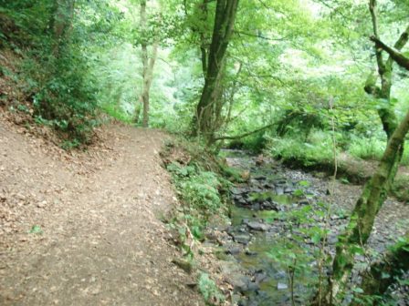
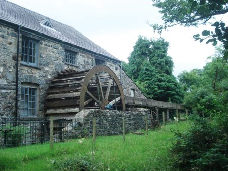
Eventually I emerged in a village called Dyserth which seemed exceptionally busy for its size, turns out it is the site of a famous 70ft waterfall. Leaving the NWP I scramble up beside it and follow paths in the woods above to suddenly emerge at a rock face overhanging the stream. A couple are just pulling their ropes down having done a fine bolted crackline up the side face, they tell me name of the rock – unsurprisingly Waterfall Buttress.

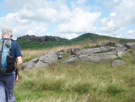
Some creative walking [trespassing] finds me back on the NWP which follows an old railway line into Prestatyn. But for a final flourish I divert on steep paths to climb Graig Fawr a limestone hill 151m high and giving excellent 360 views. Again curiously the NWP avoids it.

Across Colwyn Bay to the Ormes.

Across Colwyn Bay to the Ormes.

Prestatyn the end of the NWP/

Prestatyn and the end of the NWP.

Over to my right are the hills we followed when finishing backpacking Offa’s Dyke many years ago. I remember on reaching the beach in Prestatyn we just stripped off and rushed into the waves and were probably lucky not to be arrested. Today I meekly caught the train.

So the North Wales Path – over 60 miles of mainly good paths and cycle-ways from Bangor to Prestatyn; giving a fair balance of coastal and hill walking, as the logo depicts. Larger scale mapping would be a great help. I’ve thoroughly enjoyed the last five days and think this short route should be better publicised to be appreciated and used by more walkers.


NORTH WALES PATH – Day 4.

Rhos to Kinmel Bay. Highs and lows.

That should really be ‘lows and highs’ as I started the day on the front at Colwyn Bay, all a bit drab with its disused pier, overwhelming concrete and lack of facilities. Very few people ventured onto the sands. A poster probably reflecting the fading past. There was however a stunning art work of metal figures.I must have switched off walking along the bay as I went past the inland diversion and had to retrace to find paths up ‘Fairy Glen’, a green corridor following a stream up through Old Colwyn. This gave a chance for a break as I passed the high street. Old style, no frills, Gillian’s Kitchen – coffee and toasted teacake for £1.70, long may these places survive. Back into the glen to climb higher.  The next couple of hours passed in a different world in the hills around Llysfaen. I wandered through golf courses, untracked woodlands, village lanes with tiny cottages, open meadows and limestone escarpment. To be honest I felt lost most of the time, could have done with a 1:25,000 map, but I somehow stayed on the NWP as I kept coming across the infrequent waymarks. All the while there were views across the rolling countryside.  Don’t think many people venture up here. I eventually returned to the coast through an arch of a public house, The Valentine, in Llanddulas. The inn sign gives the wrong impression as the pub is really named after Lewis Valentine [born in Llanddulas] one of the founding members of Plaid Cymru. Then it was back on the coastal walkway/cycleway for 5 miles. The start wasn’t so bad at Abergele, I even found a fairly civilised cafe for beans on toast and a pot of tea. But from then on it was a continuous line of drab caravan parks separated from the beach by the railway. The wind farms out at sea didn’t seem over-intrusive in these surroundings. The few people braving the beach were huddled out of the wind, an epitome of English seaside holiday. As were the passing families with beefburgers, candy floss and cans of beer. The obese amongst these seem to have devised a certain ‘waddle’ to progress, much in evidence. I’m sure I looked just as strange to them with my boots and walking poles. Nobody stopped to chat. From time to time  screaming above the sound of  pop music announced a mini fun fair. Having said all that there were always extensive views; back to the Ormes and forward to the hills dropping to Prestatyn, the end of the NWP.There were a few passing aspects to improve my mood… I’d had enough at Kinmel Bay and found my way through a new marina to the River Clwyd where I’ll start tomorrow. Reflecting now this was a quite a varied days walking.


NORTH WALES PATH – Day 3.

Deganwy to Rhos.  Round the Great Orme and over the Little.

I thought today’s post would read – ‘walked round the Orme in rain and mist’

Well for the first hour or so that was the case and I was soaking by the time I stopped for a rest and was thankful for a coffee in the cafe.

Conway Mountain seen across the estuary before the rain.

Conway Mountain seen across the estuary before the rain.

Llandudno West beach - how many memorial seats do you need?

Llandudno West beach – how many memorial seats do you need?

When I reappeared the rain had stopped for the day so I started to enjoy myself and see the surroundings. Limestone cliffs above and below, I was searching out climbing lines and spotting mountain goats. Eventually found both.Near the end/beginning of the road there is a cave called Parisella’s [named after an ice cream parlour] where hard hard bouldering problems abound and always dry! It must be nice to be good enough to be sponsored. I digress. Now for some history …

Not long after …The pier is next to the fading Grand Hotel but the rest of Llandudno is thriving, ‘No Vacancy’ signs everywhere. It was busy on the prom…… my best advice is to catch a bus to Little Orme.

For some reason the North Wales Path misses out the summit of Little Orme, a great mistake. It was one of the best viewpoints yet.

Westwards

Westwards

Eastwards.

Eastwards.

There was only another lady and her daughter [locals] up here and they were lost and panicking, I walked down with them. The 5yr old asked where I had been in the world so I queried where she would like to go –  Abergele was high on her horizon! I had other random conversations today – a couple on the beach told me they were searching for the perfect sea-washed stick for a perch for their pet gecko – a man fishing for mackerel off the beach but waiting for high tide 4hours hence [why didn’t he start later?] – another fisherman hoping to go out later for sea-trout, he always wanted to fish the Hodder near my home.

I managed to get lost also in a mining area on the edge of the mountain, till the salmon fisherman showed me the steep way down, which was in fact signed, the post top left.

The steep quarry.

The steep quarry.

Ended the day back on the prom at Rhos on Sea where I found the delightful St Trillo’s Chapel. its altar stands over a spring and was established in the 6th C but has been rebuilt many times. Services are still held for a congregation of six.


NORTH WALES PATH – Day 2.

Abergwyngregyn to Deganwy. The hilly day.

A hot and sweaty 250m climb up a steep lane was a jolt at the start of the day. The little car park at the top was already full as we are on the edge of the Carneddau. a popular walking area. Having said that I saw no one for the next few miles.  The track heads up alongside ugly pylons presumably taking hydro electricity to England. I was musing on their incongruity and how it could have been avoided when I saw men hanging from one of the pylons – repairs underway, looked very scary as I know they don’t always disconnect first. DSC02627   From up here there were obviously good views to the coast and Anglesey and  down to the A55 corridor. I was feeling quite superior that I had chosen the high route. Then it was steeply down to the edge of Llanfairfechan where farmers were repairing a wall with awkward angular rocks, they commented on the easier ‘flatter’ stones we use in the Pennines.                   A complicated series of tracks through sheep country gained height once more for a couple of hours of exhilarating walking on snaking green paths through heather and gorse. Waymarking was sparse and I needed to keep referring to the OS map. Stone circles, lonely farms, idyllic streams, wild ponies, buzzards overhead, stonechat chatting. The old Penmaenmawr  stone quarries were skirted where once stone was lowered to jetties on the coast and apparently in their heyday dust covered the local villages. 

As I approached the Sychnant Pass there were more walkers in the hills. On the other side multiple paths cross Conway Mountain but curiously the NWP chooses to traverse below its summits. I couldn’t miss out the high point and was awarded with stunning birds eye views down to the boats at Conway, the Great Orme at Llandudno and the Carneddau foothills I’d been traversing.  Surely a mistake to bypass the ever so close summit on a North Wales walk. At one point I looked straight down to a caravan park cut of by roads and railways, I wouldn’t have though the ideal holiday. The walled town of Conway is always busy and today there was a fair in full swing. The day was sunny and warm so I continued past the Castle and over the bridge to walk the promenade to Deganwy, this deteriorated in new housing developments denying coastal access – who allows this? A sour end to a wonderful day’s walking.

NORTH WALES PATH – Day 1.

Bangor to Abergwyngregyn.  Aber Falls.

Couldn’t get that tune ‘The Day We Went To Bangor’ out of mind all morning. If you can’t remember listen here –

This rendition probably sums up the North Wales seaside resorts then and ?now. As an aside Jasper Carrot had a splendid parody involving Blackpool.

Anyhow to get back to this morning, industrial outskirts of Bangor led to country lanes and my route left the Coastal Path near the entrance to Penrhyn Castle. Walking up the Ogwen valley I came across what appeared to be a fairly well preserved mill  with an under flow wheel. Further on I passed Cochwillan Old Hall, a late 15th century house, apparently one of the best examples of a Welsh medieval estate houses. A good start. On a more mundane note many of the fields and lanes here have slate stone ‘hedges’.Buzzards were occupying the airspace above the rough fields. Little used lanes took me up into the foothills of the Carneddau and onto an old track traversing at about 250m above the coast. There were good views back over Penryhn Castle, Bangor, the Menai Straits and Anglesey.The diminutive Puffin Island off Anglesey was ever present.Turning a corner the view changed from the coast to the hilly interior and ones eyes are drawn to the twin Aber waterfalls. The North Wales Path crosses directly below the falls, the larger easterly one being the most visited from the valley. Up till now I had met no one but suddenly there were throngs of tourists.I had my quick fix of photos with the crowds and the quickly descended the wooded valley for a coffee in the excellent community Yr Hen Felin cafe in Abergwyngregyn, that’s a mouthful to pronounce.


NORTH WALES PATH – Croeso i Cymru.


My welcome to Wales was a Midlands’ accent spoken by mine host at a B and B in Llandudno. The heat wave had passed and I was looking forward to 5 days walking on the North Wales Path, running 62 miles from Bangor to Prestatyn. Not sure whether it is ‘The’ or ‘A’ North Wales Path but it has made it onto the OS Maps and is waymarked.DSC02511

It seems to take a more interesting route than the coastal path as it keeps dipping into the hills above the coast and avoiding the holiday excesses of the promenades.  A chance remark on Ruth’s Coastal Walk blog had me looking into this route a couple of weeks ago.   https://coastalwalker.co.uk/2016/07/04/bangor-to-aber/#more-14204

There is a Web site where you can download the mapped route at 1:50,000 which I hoped would be sufficient.

As the holiday season is in full swing I had difficulty finding last minute places to stay at the end of each day so plumped for this B and B in Llandudno, Rosedene Guest House to give them a plug. [PS They were excellent, good room, brilliant breakfasts, one of the best B and Bs I’ve stayed in.]        http://www.rosedenellandudno.co.uk

I realised that public transport was all I needed as there is an excellent service Arriva Cymru Coastliner connecting all the villages on the North coast. The buses talk to you, in English and Welsh, telling you the next stop which is also displayed – so you can’t go wrong. My lodgings turn out to be a couple of minutes from the Llandudno bus terminus at The Palladium [another imaginative Wetherspoon’s conversion, here from a 1920’s cinema] – so beer and bus on tap. The B and B has its own cat which sits on the pavement outside and greets all passers-by, I think it is a local celebrity.

PS – as well as the nationalistic Welsh Dragons I noticed a few blue EU flags flying today!

CREAKING GATES ON ROLLING GATE.

Climbing at Rolling Gate.

It’s the hottest day of the year with temperatures in the 30s. This high Yorkshire crag faces NW and seemed an ideal choice for the conditions and so it was. A sweaty walk deposited us in the shade of the scattered rocks which form a rather broken edge.                                                      The obvious start was Veterans Flake which wandered about to eventually surmount the large flake, all a bit of an anticlimax. It was however pleasant to belay on the top in a breeze with views over Grassington into upper Wharfdale.                                                                                  Next up was Long Crack a proper gritstone thrutch around several noses in a corner, sweaty work today. The descent  brought us to the foot of The Main Buttress and the start of Rolling Gate Buttress the starred route of the crag. The first steep and bold 10ft seemed hard, my left hand reluctant to leave a decent slot for small slopers above with only slanting footholds – surely not severe. Eventually a hand on the arete enabled my feet to move higher and the ‘better’ hand holds above reached, heart in the mouth stuff. Then large ledges were shuffled onto and left insecurely round bulges with no protection, I’d not brought the big friends. Don’t seem to remember it being this hard 40 years ago!

Rolling Gate Buttress.

Rolling Gate Buttress.

We retreated to a shady corner for lunch and composure, our gates were certainly creaking and our resolve weakening in the heat. However to the left was a rib leading to a cracked wall which looked inviting, The Pillar, and we couldn’t resist. Easy climbing up the right side of the lower rib was almost alpine in nature. A stance was taken below the top wall which close up looked steeper and longer.  Once committed a lovely sequence of slots, ledges and cracks led to the top on perfect gritstone – the best of the day. We only wished it could have gone on for another 50ft but life is not like that.

I finished with a quick solo of Six Metre Wall, there are lots of other good looking boulder problems hereabouts.

Fortunately we arrived back at the lane just as the farmer was wanting access for contractors with oversized trailers. [they were in a rush before tomorrow’s potential heavy rain] We thought we had parked responsibly but could now appreciate his problem and were soon on our way. What a change however to meet a pleasant and chatty farmer, in the circumstances, to round off our great day out.

SHARP HAW – Skipton.

Sharp Haw.

Sharp Haw.

Sharp Haw is not quite the Matterhorn of Skipton but it is an eye catching shapely fell standing like an island in the Aire Valley. Driving across from the west this morning its numerous peaks promised a day of exploration. Dragging The Pieman away from his garden we parked at the start of the track saving a couple of miles walking in the day. On our last visit we had just walked out of his house in Skipton but I think we were both feeling lazy today. Instead of following the bridleway over Flasby Fell we headed over rough ground to the rocky ridge overlooking Gargrave to make the most of the views. All around are familiar hills, nearby is the Embsay/Crookrise/Rylstone ridge whilst Waddington Fell, Longridge Fell and Pendle are prominent to the west. There is a birds eye view down the Aire Valley with its enclosing hills. As we made our way along the crest gritstone boulders littered the ground and there was evidence of chalky visits, UKC now lists over 200 boulder problems for this fell. The Pieman showed me a particularly nice slab which he used to solo as he passed on his regular fell run. A quick ascent had me pleased. Next stop was across some boggy ground to the shapely summit and trig point, this was already occupied by two girls so we dropped down through the woods and found a classy metal bench for lunch and putting the world to right. [Memorial to a Helen Handley a local artist and politician].

Pendle, Longridge Fell and Waddington Fell with Gargrave below.

Pendle, Longridge Fell and Waddington Fell with Gargrave below.

Coming out of the woods we went through Flasby hamlet, all of six houses, and into the parkland of the Hall. All well manicured English scenery.  A short stretch on the road took us past the stately Eshton Hall  where my guide for today had attended when it was a school, he thinks it is apartments now. After a few fields we were on the towpath of the Leeds – Liverpool canal for a couple of miles back towards Skipton. A friend lives on a barge here but I think the other side of Gargrave. Uphill lanes were followed through the scattered houses of Thorlby and Stirton where most of the farms have been upgraded to exclusive living. More interestingly by the road side is a ‘Tin Tabernacle’, a disused Methodist chapel built with corrugated iron probably at the beginning of the 20th century. The Pieman can remember his father auctioning off the harvest festival products for chapel funds many years ago. I wonder how long this building will last and if it is listed, you don’t see many now.

Eshton Hall.

Eshton Hall.

So if you are in this area maybe eschew the higher hills and explore this rocky island.


A plethora of bilberries.

As I parked up at Kemple End  little groups of bending figures dotted the fell side, they are clutching  plastic containers and their purple fingers announce their activity – bilberry picking. We are all eating a lot of BLUEBERRIES these days, they are commercially grown, are widely available in our shops and keep for several  days. Their close relative the BILBERRY [WHINBERRY or WHORTLEBERRY]  Vaccinium sp. grows wild and being much softer doesn’t keep so is better known by the foragers amongst us. From July onwards on Longridge Fell the low bushes are covered in purple berries which I must admit are fiddly to pick but are delicious to eat.


In southern France they are known as myrtille, in Italy mirtillo and are commonly found in local markets and delicious tarts. Professional collectors are seen out in the hills using wooden combs to quickly harvest large amounts which are pooled in large canisters which are carried down later in the day. It all looks hard work.

I drop down into the quarry where the other collectors don’t venture and am able to pick at leisure on laden bushes. I quickly fill a small container before a spot of bouldering on rather damp rock this morning. Mouthful’s of berries intersperse problems. The bell heather is just coming into flower and the flowering blackberries promise abundant fruit in a month or so.


I remember summer days’ climbing in the Lakes on multi pitch routes where every belay ledge was covered in ripe bilberries, scrumptious.

Oh it’s started to rain again, better get home and bake that pie.

STANAGE SHORTS.

They call it the Popular End for good reason, we sit on the top of the edge along with several other climbers belaying and watch a snake of maybe 30 children/guardians walking noisily up through the bracken, thankfully not to climb but just out for a ramble. A ring ousel cries out its distress. A constant stream of walkers past along the top. The line of cars parked below is not as long as on a weekend and the instructed groups are further along the edge, Grotto Slab area.

So we are able to pick at will climbs in the short Mantelpiece Buttress area. Rod has brought his friend, Pete, from way past along for an easy day on gritstone. We have two guide books, mine from 20 years ago with climbs described awkwardly left to right and Rod’s [2002 ed.] right to left but with useless diagrams. Things have moved on with guides and the later BMC editions are much better along with Rockfax. It is interesting to see how the grades have changed between our two editions, when I was soloing around innocently in this area all those years ago everything was diff – severe whereas now the routes are recorded a grade or two harder. They certainly felt it today.

Mantelpiece Crack.

Mantelpiece Crack.

Right Mantel.

Mantelpiece Right.

Top of Zip Crack.

Top of Zip Crack.

Right Edge.

Right Edge.

A whole catalogue of gritstone techniques were employed – jamming, bridging, udging, knees, slopers, laybacking, manteling etc etc on the climbs we selected. Which other rock type gives you such variety. We had a limited trad rack, no ‘friends’, so everything felt a bit bold. By tea time we’d had enough and soon were in the motorway jams on the way home. That’s another thing that’s changed in the 20 years – the amount of traffic, no wonder our visits to the Peak are becoming less frequent.

HASLINGDEN GRANE – THREE RESERVOIRS’ ROUND.

A meeting with ‘ the plastic bag man‘ was due. First draw a line between our abodes and roughly choose the halfway point, get out the map [West Pennine Moors] and devise a circular walk of reasonable length trying to avoid previous walks which is becoming increasingly difficult. At our 10am rendezvous in a car park off the Grane road  it was good to see  ‘the teacher‘ joining us. People were calling in at the cafe for breakfasts or coffee but few seemed to venture into the hills. We could hear loud bleating of sheep from the car park and as we climbed the hillside the reason became obvious – an industrious team of shearers were rapidly working their way through the flock and lots of silly looking naked sheep were running around. Above were whirling wind turbines, they seem to crop up on most of my walks now. We soon gained the waymarked Rossendale Way, RW, which traversed the hillside above a series of extensive abandoned quarries, two of which were water filled – nature parks in the future?Further on we must of passed above Troy Quarry, a previous climbing haunt of the three of us, so talk was of epics in the past. A massive worked out quarry was circumvented on the way down to Haslingden, ?Hutch Bank, where we had no knowledge of any climbing but there looked as though there were possibilities.  The next few footpaths are best forgotten –  unwaymarked, overgrown and unwalked, but we did emerge onto the road above Helmshore thankfully. A leisurely lunch was taken by the dam of Holden Wood Reservoir. Tracks led us back onto the RW and we enjoyed a fantastic traverse of the valley above Ogden and Calf Hey reservoirs. Is this really Lancashire?   Some  lovely stretches through woodland followed.  Above us was Musbury Heights which is mainly quarried, at one point a steep quarry incline came down from the heights and uniquely our path went under it in a small tunnel. Old crumbling farmsteads were passed, a reminder of the marginal agricultural activities before the reservoirs. Many farmers supplemented their income with hand loom weaving, mining and allegedly whiskey distilling. Apparently a 1000 people lived in the valley at one time.

A short section of road walking unfortunately brought us back to reality.