THE LANCASHIRE WITCHES WALK – Caton Moor to Lancaster Castle.

Our final stage of this fascinating walk began high on the Caton Moors. The well known, when  viewed from the motorway, wind turbines were rotating rapidly in the strong wind as we passed. Up here today we had extensive views of the Bowland Fells, Ingleborough and Pennine fells north, the Lune Valley and Morecambe Bay, an exhilarating start to the day. In a picnic area we found our first tercet of the day, No 6. A lane coming from nowhere brought us down into Brookhouse and we explored the back lanes and pretty houses of the village, roses seem to be a specialty of the gardens here.

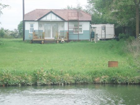
Across the main road we joined the Lune Valley Ramble into Lancaster along an old railway. All of a sudden humanity appeared – dog walkers, joggers and cyclists supporting the idea of good exercise and being able to participate in a safe and beautiful environment. Well done Lancaster with the help of European money!  Two men were setting off  cycling coast to coast  to Bridlington, a route my son speaks highly of. They were an odd couple one young and fit on a classy bike, the other hoping to rely on his electric motor to get across the Pennines. I hope their enthusiasm saw them through although I suspect they will have been very wet at the weekend. We crossed the famous Crook Of Lune [painted by Turner] on an impressive bridge. More cyclists were passing the next tercet. For a break we sat on the banks of the river below a weir near Halton old station. A fisherman engaged us in conversation about all things Lancashire, No fish were caught. it was about at this time that the zip on Sir Hugh’s shorts malfunctioned causing great hilarity to the fisherman and great embarrassment to the wearer. Apologies to anyone in Lancaster whom we shocked or offended.

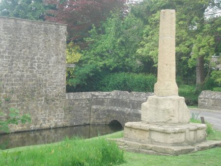
A pleasant stretch on a lane parallel to the motorway followed, large puddles where evidence of recent rainfall. We were heading for the castle but first we visited the prominent hill forming part of Williamson Park thought to be the site of the witches’ gallows, and now the site of the 9th tercet.  We wandered through attractive parkland and climbed up the baroque Ashton Memorial for views over Lancaster and the surrounding areas. Then it was down busy streets across town passing the Golden Lion pub where the witches were supposed to have been offered a final drink on the way to be hung – an unlikely tale. Incongruously two walkers in shorts, with walking poles, marched through the shopping area and eventually climbed up to the impressive castle gates and the last tercet. A lot of restoration work is going on so we didn’t linger.

Thus we had completed a trail full of interest which deserves to be better known.

The complete poem

‘The Lancashire Witches’ by Carol Ann Duffy

One voice for ten dragged this way once
by superstition, ignorance.
Thou shalt not suffer a witch to live.

Witch: female, cunning, manless, old,
daughter of such, of evil faith;
in the murk of Pendle Hill, a crone.

Here, heavy storm-clouds, ill-will brewed,
over fields, fells, farms, blighted woods.
On the wind’s breath, curse of crow and rook.

From poverty, no poetry
but weird spells, half-prayer, half-threat;
sharp pins in the little dolls of death.

At daylight’s gate, the things we fear                                                                                               darken and form. That tree, that rock,
a slattern’s shape with the devil’s dog.

Something upholds us in its palm-
landscape, history, place and time-
and, above, the same old witness moon

below which Demdike, Chattox, shrieked,
like hags, unloved, an underclass,
badly fed, unwell. Their eyes were red.

But that was then- when difference
made ghouls of neighbours; child beggars                                                                                              feral, filthy, threatened in their cowls.

Grim skies, the grey remorse of rain;
sunset’s crimson shame; four seasons,
centuries, turning, in Lancashire,

away from Castle, Jury, Judge,
huge crowd, rough rope, short drop, no grave
only future tourists who might grieve.

Sir Hugh’s own blog tells a similar tale of our progress –  http://conradwalks.blogspot.co.uk/

THE LANCASHIRE WITCHES WALK – Clitheroe to Slaidburn.

The scenery changes today as we leave the Ribble Valley and climb into the Bowland Hills. Rain is forecast and its rather dull in Clitheroe. Canoeists float downstream as we cross the river at Brungerley Bridge  and a group of youngsters are on the field path learning navigation.  We soon leave them behind and cross fields around Waddington, most of the farms/barns look hundreds of years old but many have had expensive makeovers.  Looking back Pendle Hill is in cloud. The hay meadows we pass through are full of flowers and brighten up a dull day. I have a painting at home representing the same scene. As we climb onto the moor on a drove road we realise we have been here together before whilst exploring Easington Fell last winter.There are no views today in the low cloud which is a shame as this is a wild and desolate moor. On the map are marked The Wife and Old Ned but they turn out to be disappointing piles of stones. A good track, presumably shooting, takes us down the fell to a shooting lodge marked as Fell Side. Dogs are caged up and greet us excitedly. At the moment we arrive the rain starts so we are lucky to find shelter and tables outside the lodge, lunch is taken. On the approach I had stuck my walking pole under a stone and a metal trap snapped shut almost breaking it, I couldn’t imagine what it could do to fingers. What are they trying to catch? Our lunchtime was enlivened by a ‘turkey’ parading about in front of the windows. The rain stopped and we continued on our way over a hill and down into Slaidburn, usually seen with a backdrop of Bowland Fells, but not today. Our tercet was in the carpark. The village was busy hosting a small steam fair which kept us entertained for awhile though the crowds and vehicles detractied from the normal tranquility of this lovely village. Familiar paths through woods and then open fields gained height, Curlews and Lapwings became a constant sight and sound. On past a graveyard for farming implements which looked like a ‘herd’ of dinosaurs across the land. We finished the day under the Bowland Fells just before the start of Roman Road over Salter Fell. We will want better visibility for that next section.


.


THE LANCASHIRE WITCHES WALK – Higham to Clitheroe.

An interesting day’s walk.

Delightful walking through farmland started the day from Higham. We passed several old farmhouses with mullioned windows and in the distance saw an unusual Gothic feeding shed [on the Huntroyde estate]

DSC01983

The next estate we entered was Read Hall, the walk goes through converted stables and into the parkland next to the rebuilt hall. Its owner in 1612 was Roger Nowell the magistrate who sent the witches to trial at Lancaster. Under Pendle Hill we followed bridleways which may well have been the actual route taken by the carts used to transport the captured witches. We diverted to Spring Wood to view our third tercet.

 Read Hall parkland.

Read Hall parkland.


On arriving at Wiswell we found a hidden pub, Freemasons Arms, and enjoyed a relaxing drink in its cosy bar. The village was a delight to explore with its alleys, stone cottages and neat gardens.

As we wandered through fields towards Clitheroe the sky was blackening over Pendle Hill and before long we were in a brief thunder storm.

Darkening skies.

Darkening skies.


Clitheroe is dominated by its castle and we spent time exploring. In the castle grounds was an ornamental turret, 1850, removed from the parapet of The Houses of Parliament and presented to the Borough of Clitheroe in 1937. Strange. We collected our 4th tercet and finished the day in sunshine at the parish church.


THE LANCASHIRE WITCHES WALK – Barrowford to Higham.

It was a hot morning when Sir Hugh and I parked up next to the Heritage Centre in Barrowford, the start of The Lancashire Witches Walk. Having  found the first tercet installment with its verse and witches’ name we set off through the alleys and cobbled back streets and were pleasantly surprised by the hidden beauty of the town. There were many reminders of its industrial past and we contemplated the human movement to and from the mills on the footpaths we were following today. Soon we were out into rural Lancashire at its best, undulating tracks between small stone built hamlets, over fields and alongside sparkling streams. On arriving in Barley we suddenly collided with mass tourism alongside Pendle Water – more Blackpool than countryside. Somehow we missed the cafe.  Then we were climbing away and passing the presumed site of  Malkin Tower, home of the Demdike family, a ruined hillside farm. .The next hour passed pleasantly but aimlessly circling round Lower Ogden Reservoir passing another tercet.  We ate lunch in the shade high above Newchurch in Pendle. Once in the village the Witches Galore gift shop had to be visited stocking everything from tacky witches to learned books, The lady owner had been there for 30 years and was a wealth of knowledge.  Sir Hugh emerged with a witch to scare his granddaughter and I another black cat, Impulsive shoppers. On a more cultural note we visited the church with its ‘eye of God’ to ward off evil spirits.  I was keen to visit the nearby Faughs Quarry where I’d climbed in the past and where there is a carved face in the rock, ?created by one of the quarry-men. Up to the ridge, Rigg of England, with good views, and then down to the village of Fence where the pub is closed and new housing is taking over.

Old house in Fence.

Old house in Fence.

Along the main road Ashlar House was passed, here some of the witches were questioned by local magistrates in 1612. The route onwards through  Lower White Lee farm was not helpfully waymarked and we had the impression they didn’t want walkers on their land. We finished in Higham with its prominent pub, Four Alls Inn, where one of the  witches, “Chattox” was accused of turning the beer sour  and bewitching the landlord’s son!

A good start to our walk with varied scenery and interesting history.


THE LANCASHIRE WITCHES WALK – pre ramble.

The Pendle district of Lancashire is infamous for its history of witches. Back in the 15-16th centuries witches made a living from herbal remedies, bone-setting and midwifery [humans and animals] and dabbled in curses and spells.  Usually single women they lived on the edges of society. Things came to a head in April 1612 when Alizon Device, a Demdike,  had an argument with a pedlar and he suffered what was probably a stoke. The landed gentry, who were also the magistrates, were keen to support the monarchy, James 1st who was opposed to ‘witchcraft’ and hoping to put themselves in a good light saw an opportunity to prosecute Alizon. Things then became complicated as other families, such as Chattox, were embroiled in the plots. Eventually twenty local ‘witches’  were arrested and brought before the magistrates and taken to Lancaster Castle for trial. Ten were hung in August of that year. Over the years a great deal of folklore has developed from this story. The walk, to coincide with the 400th anniversary of the events, was designed to follow roughly the route from Pendle to Lancaster and include some notable locations. Alongside this again to celebrate the 400 years  the poet laureate, Carol Ann Duffy, has written a poem in ten tercets to comment on the proceedings. To reflect the poem 10 cast iron installations  have been placed along the route each with a tercet from the poem and the name of a witch.


‘The Lancashire Witches’ by Carol Ann Duffy

One voice for ten dragged this way once
by superstition, ignorance.
Thou shalt not suffer a witch to live.

Witch: female, cunning, manless, old,
daughter of such, of evil faith;
in the murk of Pendle Hill, a crone.

Here, heavy storm-clouds, ill-will brewed,
over fields, fells, farms, blighted woods.
On the wind’s breath, curse of crow and rook.

From poverty, no poetry
but weird spells, half-prayer, half-threat;
sharp pins in the little dolls of death.

At daylight’s gate, the things we fear                                                                                               darken and form. That tree, that rock,
a slattern’s shape with the devil’s dog.

Something upholds us in its palm-
landscape, history, place and time-
and, above, the same old witness moon

below which Demdike, Chattox, shrieked,
like hags, unloved, an underclass,
badly fed, unwell. Their eyes were red.

But that was then- when difference
made ghouls of neighbours; child beggars                                                                                              feral, filthy, threatened in their cowls.

Grim skies, the grey remorse of rain;
sunset’s crimson shame; four seasons,
centuries, turning, in Lancashire,

away from Castle, Jury, Judge,
huge crowd, rough rope, short drop, no grave
only future tourists who might grieve.

The walk is 51miles long and divides neatly into 5 sections, which being relatively short would give us time to explore. Following on from our successful Wainwright’s Outliers venture Sir Hugh and I have joined forces to complete the walk which is fairly local to both of us. This also will facilitate car sharing logistics for daily ventures. The path has been well waymarked and much of the scenery will have changed little in the 400 years.

There are a couple of guide books available as well as a wealth of information on the web.

The Lancashire Witches Walk Guide.   Ian Thornton-Bryar  and  John Sparshatt, who developed the route.

The Lancashire Witches Walk.   Sue and Peter Flowers, Artistic Directors of Green Close who developed the Lancashire Witches 400 program and involved the various artists and Carol Duffy.

THE LANCASHIRE WITCHES WALK – Slaidburn to Caton Moor.

As we wandered up the Roman Road to Salter Fell I was expounding to Sir Hugh about the remoteness of this track and how one hardly meets another person when we glanced behind to see about 20 walkers bearing down on us. A charity walk was in progress, from Slaidburn to Lancaster on our route, they all seemed cheerful enough and we managed to keep our own solitude for most of the day. In truth they were going far quicker than us.

Charity walkers.

Charity walkers.

DSC02171

This is a familiar way for me, I must have walked it dozens of times whilst approaching The Bullstones a favourite remote moorland bouldering area of mine. The extensive rocks were clearly seen across the valley and I scanned some of my favourites with binoculars. Below in Croasdale is a barn with unusual stone sheep pens, I have bivied there with my grandson and watched Hen Harriers before their demise. We soon passed today’s tercet no 6.   A good pace had us over the watershed and looking down into Whitendale, another remote valley with Wolfstones high above and the Chipping fells in the background. To add to the splendour the Yorkshire Three Peaks became hazily visible as our track stretched across the moors. This is the place to be on a summer’s day and we stopped for lunch.  Black clouds appeared and it was raining over The Lune Valley, but we stayed dry for now. Leaving the main track at Higher Salter we plunged into an unknown world of deep hidden cloughs at the head of Mallowdale. A roller-coaster mile or so past remote farms, wooded valleys and uncut meadows,. A haphazard route where we had to keep checking our navigation, the preceding charity group had left a trail that helped. Waterproofs were donned but by the final rise onto Caton Moor we were drying out and reflecting on a great days walking full of contrasts.

THAT’S YOUR LOT.

A quick update from France.

The weather patterns have certainly become confused this year. We arrived in The Lot at the tail end of the bad weather which saw flooding in Paris and for the first few days it was cold, wet and miserable. Despite that short walks were achieved every day, lots of weeding in the garden and I even braved a swim most days. The orchids were past their best but sweet peas brightened up the byways. Different, to us, restaurants were visited and old friendships renewed. Lots of dark Cahors wine was imbibed. Talk was of the referendum; even the British living out here are divided.   Due to duplicate shopping trips, we amassed at one stage three dozen croissants – breakfasts became a major event.

JpegJpegThe weather changed to hot and sunny, butterflies appeared in their hundreds, kites and buzzards wheeled over the garden, out came the barbecue, the sun loungers appeared and the pool became the most desirable place to be.

The change in our weather fortunes reminds me of that old comedy song by Al Sherman ‘A letter from camp’  – they say we’ll have some fun if it stops raining.


From now on the shade of the woods was needed to make walking in the heat possible.


Soon be  home – that’s your Lot.


LANGDALE CLIMBING – first visit to White Crag.

From time to time my friend Mark phones for a day’s climbing whilst his school pupils sit exams or he is ‘officially’ marking papers – these outings have become known as ‘Marking Days’. So it was this week when we met up late morning in the carpark of a local curry house.  He had just acquired a camping van and proudly showed me round. The forecast was for thundery rain in the afternoon but we risked a trip up to Langdale to have a look at White Crag. I must have walked above this outcrop so many times on my way up to Gimmer without being aware of its existence. The valley was quiet with only one team on Raven Crag when we passed under it and then followed a level track to the lower of the two White Crag buttresses, a gentle 15mins.

Approaching the lowest White Crag.

Approaching the lowest White Crag.

Immediately two lines stood out  – the grooves of Bee Line and the Bumble Arete.                   Mark set off up the grooves which were cleaner than they appeared to a small overlap where a neat step up and left gained a wall with smaller holds, we didn’t think Bee Line, HS, warranted  a 4c grade.

Mark onto the arete of Bee Line.

Mark onto the arete of Bee Line.

Bumble Arete, VD, was pure joy – a little wall brought me suddenly onto the arete which had the best of holds all the way to the top, 60ft up. Worth the two stars.

Bumble Arete on the right.

Bumble Arete on the right.

Well satisfied we were having a snack when the boom of thunder filled the valley, the sky darkened and ominent  large rain drops splattered the rock. We sat tight for a while and thankfully the storm rumbled off to some other unfortunate Lakeland valley. So it was time to have a look at the upper crag which has only recently been  developed.

Once again obvious  lines on excellent rock promised good climbing.  Left Trouser Leg People, MVS, was brilliant, Easy rocks soon had Mark at the cruxy  move onto a slab and up into the left groove and a lovely finish round the overhang on jugs.We found a sneaky chain abseil which greatly eased the evenings climbing.

Move onto slab.

Move onto slab.

Juggy finish.

Juggy finish.

I couldn’t wait to get onto  Val Ferret, HS, just left, a groovy groove, a spicy layback and juggy finish. A grade easier but also worth two stars.

My sandwich box with  its tasty quiche was missing when we sat down to rest, left at lower crag no doubt, so my weight loss diet had a jump start.

Next was  Right Trouser Leg People, VS, a tricky wall lower down and  an absorbing groove higher up. A quick abseil and onto the thin slab of Langdale Ferrets, VS, with its steep finish.

Awkward slab on Lakeland Ferrets.

Awkward slab on Lakeland Ferrets.

Finishing Lakeland Ferrets.

Finishing Lakeland Ferrets.

As we gazed out over the green fields and rough hillsides opposite we seemed to be the only people in the valley.  A perfect end to a great days climbing. I will definitely return to these lovely unknown crags.

By the time we were back in Preston I was too weary for a curry but thanked them for the parking.      Roll on the next ‘Marking day’.


WARTON UPPER CRAG.

At last the weather is reliably warmish and sunny but the strong northerly wind forecast for the Lakes had Ron and I coming here for shelter.

I don’t think I’ve been in the car park quarry for years and was amazed at the in-growth of vegetation. OK it was never the most aesthetic of places to climb but I’ve enjoyed evening soloing sessions  here  and days washed out in the Lakes have been saved by a few quick ticks on the way home. Delectable Traverse, Leaning Tower and the Great Flake were always good value. Many of the routes are now inaccessible, sign of the times?  Despite this there was a group top roping a couple of sectors, maybe they will keep the place open.

The vegetation fights back.

The vegetation fights back.


So we trudge up through the trees on a maze of paths to somehow emerge at the Upper Crag which is prominent from the motorway but difficult to locate once here.

Its up there somewhere.

Its up there somewhere.

The climbs are short but on good quality limestone and they looked mostly clean. There are a series of grooves alternating with steeper walls/aretes. In the past I’ve set off mistakenly on the wrong route and the rest of the time made everything fit accordingly, who needs a guide book? Today we took a little more care to follow the correct descriptions. Despite the lowly grades I was pleased to be feeling more confident with my leading abilities and to follow Rod on his.

Rod on Yellow Wall.

Rod on Yellow Wall.

Finger of Fun.

Finger of Fun.

The descent gully was almost as hard as any of the climbs we did. Dodgy.

Dodgy descent route.

Dodgy descent route.

The day was hot and sunny so after a half dozen climbs or so we called an early finish, not like the old days when I would climb until it was dark.

The pink Valerian growing out of the rock faces back in the car park  was at its best, I’ve tried to transplant some to my garden with little success.

I managed to come home with a couple of ticks, of the insect variety.


SKIPTON MOOR.

My friend the ‘pieman’ has lived in Skipton most of his life and  surprisingly never knowingly  been up to the top of this moor directly above the town. Judging from the paths plenty of Skipton’s citizens do make the effort. We were able to walk from his front doorstep, after he and his wife had replenished my caffeine levels. This is always a busy town and today was market day. We found our way to the unpretentious  street leading up onto the moor and nearing its end were surprised  to see an old toll house, looking at the map we realised the lane had been the original way over to Addingham.  Where the houses end the tarmac reverted to cobbles and the track signed as A Dales High Way,  a 90 miles walk from Saltaire to Appleby  I’ve just read. This long distance path may be worth looking into.  A passerby told us to look out for Green and Greater Spotted Woodpeckers in the woods above. The bridleway soon gained height and worked its way across the western slopes of the moor, after about a mile we struck uphill to the summit. A trig point 373m, substantial cairns at the Eastern End and a recent narrow unstable looking one at the Western end. The views were surprisingly good with Skipton laid out below, Sharp Haw and Flasby Fell are prominent and there are distant views of Ribblesdale and Cravendale. Of interest to us was the view across to Embsay Moor which boasts several climbing venues  – Eastby, Deer Gallows and Crookrise all old haunts of ours.

A hazy Skipton below.

A hazy Skipton below.

Despite the weather being sunny and warm in the west it was dull and cold up here, hence the hazy photos, so we didn’t linger. Having to climb some walls we were back on the bridleway, Dales High Way, for easy going. Just about lunch time an inscribed seat appeared, we postulated its origins over sandwiches. At a lane there was an old finger post giving miles to 1mile to Draughton and 3miles to Silsden.     To complete the circuit we followed field paths between farms, mainly  converted into  modern dwellings, one with aggressive guard geese. A rocky subsidiary ridge was reached and this gave us easy walking back towards Skipton with views all the way. Before we knew it we had joined the bustle on the High Street. What a great little circuit which would be perfect for a summer’s evening stroll.

zCapture.JPGskipton

Spotted on the way back to Skipton, a Triumph Herald similar to one of my first cars.


THE THAMES PATH – day 8. A short loop, then back to Oxford.

Abingdon to Clifton Hampden.

By the time we arrived at Clifton Hampden we weren’t that far from Abingdon as the crow flies and were able to catch a bus back. This was the end of our week, the walking has been great and we intend to return to continue sometime in the future.

As I mentioned yesterday Abingdon is full of interest and it was maintained as we left the town bridge on the opposite bank of the Thames. Dog walkers were out in force and we met the lady walker using a boat and husband for backup – she must have been walking at our pace. We were soon in a very rural environment and enjoying the solitude, kites and buzzards were wheeling overhead.


Pleasant Abingdon living.

Pleasant Abingdon living.

Rural Thames.

Rural Thames.

A couple of locks gave us breaks and before long the elegant brick bridge at Clifton came into view.Our main objective before leaving the trail was a celebratory pint in the adjacent Barley Mow. The pub itself was a bit disappointing, as one customer asked  “where is the River?”,  but the beer garden was pleasant enough for a relaxing  drink. Looking back over the week I think quite a few of the riverside pubs have been over-hyped and overpriced, but you come to expect that in the Thames Valley. The village consisted of thatched cottages and a bus whisked us back to Abingdon and on to Oxford. Mel caught a train back home whilst I had time to look around Oxford. First I wanted somewhere to leave my luggage, train and bus stations no longer provide facilities but I found Oxford Backpackers Hostel did for a modest fee, well done them. I wandered without a map amongst the colleges, all of the famous names, and relaxed in the parks. Cycles were everywhere. Very few English voices were heard amongst the tourists or students. DSC01709

Spot the Gormley.

Spot the Gormley.

That was Oxford.

I just caught the last connecting train to Preston.


THE THAMES PATH – day 7. A busy stretch.

Oxford to Abingdon.

We were on the towpath fairly early on Sunday morning soon passing the classic Christchurch meadows on the opposite bank.  Already the river was full of cox-less fours and coxed eights, all being coached from the towpath by kamikaze trainers on bicycles. Each Oxford college has its own boathouse along this stretch. A significant number of runners were also pounding along, presumably college folk.

We also started to come across orange vested walkers staggering past us  with glazed eyes fixed on an end in Oxford. These brave people had set out from London yesterday at 8am and had walked day and night to get here 60 odd miles up the Thames. Heartbeat, the British Heart Foundation, will have benefited from their exertions.

There were various checkpoints for the walkers and backup from the Southern version of Mountain Rescue .

Sat by the lock at Sandford we were admiring a canal barge when the guy on board engaged us in conversation – ex-army with post traumatic stress he had been finding life difficult so bought the boat to live on for a life change. He had picked it up in Blackburn and had spent several weeks getting to here on the way to the Kent and Avon.  He regaled us with stories of travelling through the locks of the industrial towns and attacks from the local youths who see canal boats as a soft target. Best of luck to him.

We were flagging in the heat when we saw a poster for an art/coffee stop in the modern Radley College boat house. As part of an Oxfordshire art week the upper room had been set up as a gallery and coffee shop run by the lady artists themselves. A perfect place for a break and chat on the balcony looking out over the river.

On the opposite bank was the more romantic boat house of Nuneham House.

There were a lot of expensive riverside properties … … even this is probably out of our price range …As we approached the busy Abingdon Lock more and more Sunday strollers appeared  using local paths and riverbank.

Abingdon Lock.

Abingdon Lock.

Riverside Abingdon itself was an interesting old town to explore.


THE THAMES PATH – day 6. Dreaming of Spires.

Bablock Hythe to Oxford.

Unfortunately the ferry has gone which would have linked to the old towpath, the old winch is still there, instead soulless ‘caravan’ parks forced us away from the river for a couple of miles.

The rural walking was pleasant enough. Today’s walk encounter was a lady trail runner and her dog who passed us on her way to Abingdon, she had time to chat despite doing 20miles. We leisurely reached the river near Pinkhill wear and lock which was busy with pleasure craft. Hedged paths gave a change of scenery onwards to Swinford lock.where a stag party outing in sailor and pirate dress were abandoning there barge which was taking in water and listing, everyone survived.

More uncultivated meadows followed but unfortunately the only wildlife we saw were geese. Interestingly the banks were littered with opened fresh water mussels presumably by geese and ducks.

The noise of the approaching dual carriage way brought us back to civilization. Then it was over a bridge to the waterside Trout Inn which was packed despite the poor weather. Is it the setting, the good food or the Inspector Morse connection that draws people here. Despite only having one pint I managed to leave my sticks in the bar, we were well on the way to Oxford before I realised. This gave me the chance to view the ruined 17th century Godstow Abbey three times. Rain began for the first time as we followed the popular path towards those just visible Oxford spires. On the opposite bank was Port Meadow which has never been ploughed having been presented to Oxford by William the Conqueror.

Police activity in the street of our inn for the night had us worried, there was a cordoned off area as a ‘dangerous’ object was removed. The inn was packed with people unable to return home. We heard later it was a WW2 bomb. This was more exciting than the cup-final on TV.

We couldn’t understand the menu in the Korean restaurant visited but enjoyed an enjoyable meal, but I suspected most of the staff were in fact Chinese.   Back at our inn the beer was good but the accommodation dire.

I will return to look around Oxford on the way home.


THE THAMES PATH – day 4. Easy strolling.

Lechlade to Tadpole Bridge.

Today we have an easy stroll through through the flood meadows of the upper Thames.

Shortly after leaving Lechlade the first lock and weir are encountered, St. John’s. The Thames’ locks were constructed from the 17th century onwards and improved  navigation.  An increasing number of pleasure boats were moored up from now on but few were travelling.St. Johns Lock with Lechlade church behind.There is statue to Old Father Thames at St. John’s, originally designed for the Old Crystal Palace in 1854, moved to the source in 1958 and to its present position in 1974.

In the  next couple of miles the river meandered wildly. A common sight were WW2 pillboxes built to defend the Thames if an invasion occurred, they were all in good condition.

Another feature to keep recurring was wooden footbridges of a standard design linking fields and lanes across the river. These bridges were built to replace old demolished wears and have been themselves replaced over the years.

We diverted to the pretty village of Kelmscott where the Manor had been a home of William Morris, but unfortunately it was closed today. We grabbed a drink at the  upmarket Plough Inn which looked expensive for food.

'Arts and Crafts' in Kelmscott.

‘Arts and Crafts’ in Kelmscott.

Back on the river we walked through meadows with extensive open vistas. Buscot, Grafton, Radcot and Rushey Locks were all passed and appreciated, usually a seat was provided and water available. A feature of the locks were the lock keepers’ cottages with their tidy gardens, volunteers help out the Environmental Agency. Delightful places to  watch the river’s activities, they became a highlight of the walk eagerly looked forward to. The weirs enabling the river to flow past the locks all looked very high-tech.

Grafton Lock.

Grafton Lock.

A modern Weir.

A modern Weir.

Another wooden bridge.

Another wooden bridge.

Tadpole Bridge and The Trout Inn, one of many so named on the river, were easily reached marking the end of today’s stroll. The Inn was fully booked so using a taxi we had another night in the pleasant New Inn at Lechlade.


10 “TOP THINGS” I SAW IN UZBEKISTAN.

I have had an image of the ancient trading city of Samarkand in my mind dating from my fascination with geography as a child when I would  pour over pictures of the world in encyclopedias [the internet of the 50’s]. This was reinforced about 20years ago when I attended a lecture in Manchester from a bloke who had spent 6 months travelling the Silk Road  in the steps of Marco Polo. He hailed from Macclesfield and eventually arrived at the silk worm farm in China which supplied the local Cheshire silk weaving mill with the raw material. The lecture was a fascinating insight into his own adventures along the way as well as a portrait of the Silk Road and all its famous cities. So when some friends were organising a trip earlier last year I jumped at the chance of visiting this largely unknown country and the cities of Tashkent, Khiva, Bukhara and Samarkand. I’ve just realised I never published the post and have been prompted by a new series on BBC4.  So in no particular order ……….. Continue reading

THE THAMES PATH – day 2. Cotswold Water Park.

Kemble to Cricklade.

These mornings are just made for walking, fresh and sunny. So we had a spring in our step following the infant river as it wandered through pastures and small Cotswold villages with their creamy stonework buildings.   It was a few miles before we saw our first decent sized trout which didn’t seem interested in the myriad of mayflies. Some of the meadows were waterlogged and would be impassable in winter. This whole area is one big flood plain. Several old mills were passed despite the Thames being merely a stream, one wonders where the power came from.

Thanks.

Thanks.

Looking for trout.

Looking for trout.

Mayfly.

Mayfly.

Be prepared to wade.

Be prepared to wade.

Mill conversion.

Mill conversion.

The river lead us straight into the rather too posh White Hart in Ashton Keynes, we retreated to the beer garden. This delightful village is renowned for its many bridges and crosses.

Most of the day was spent passing through the Cotswold Water Park and its 140 lakes created from gravel extraction.  A large estate development looked expensive with exclusive houses lakeside. An angler set off with a wheelbarrow full of equipment to hopefully catch a carp.  Disappointingly few birds were seen – swans, grebe, mallard and wagtails.

Nature reserve.

Nature reserve.

Luxury living.

Luxury living.

To catch a carp...

To catch a carp…

Just before Cricklade the Path skirts around the edge of North Meadow, A Nature Reserve where, the rare snakeshead fritillary flowers. We must have just missed out but there were plenty of buttercups.

The pleasant small town of Cricklade had a wide historic high street and provided a good pub room and a Thai meal.


THE THAMES PATH – day 5. The Lonely Stretch.

Tadpole Bridge to Bablock Hythe.

The taxi drops us back at Tadpole bridge. The  Thames Path now goes through Chimney Meadows National Nature Reserve, a vast area of wildlife rich meadows managed by the local Wildlife Trust. This section also has two more remote locks with lovely gardens.  There are no  villages close to the Path. There are more geese than ducks on the river and large family groups take to the water as we approach.

Ancient pollarded willows.

Ancient pollarded willows.

Despite its general isolation we are constantly reminded of nearby Brize Norton airfield  as planes land and take off regularly and those large helicopters ply back and forth. Where is all the traffic from?

?Boeing Globemaster.


We pass the wooden Tenfoot Bridge (although it’s much wider than 10 feet) and Newbridge that is so new it dates from the 13th century. Adjacent to the latter is the Rose Revival where we called in for a reviving drink, As seems to be the normal with these Thames-side gastropubs the place was packed with diners eating average but hyped up pub food, Us booted walkers sloped off to the beer garden with our drinks to enjoy an elicit banana. Sandbags were a reminder of the threat of high water.

Newbridge and Rose Revival.

Newbridge and Rose Revival.


Even after Newbridge the now much larger Thames is still remote and amazingly rural. I spent a lot of time watching Black Headed Gulls swooping over the river presumably catching insects. They always seem more common inland than at the coast.

At Bablock Hythe, where there used to be a ferry there is still a pub, luckily for us right on route for a nights stay.

Who did we meet today?

There is more boat traffic now – seems to be two types, the traditional long boats and the luxury cruisers. The people living on the canal boats were always happy for a chat on where they were going and the finer points of their well looked after barges.

On a smaller river boat we met a lady walking the Path with her husband cruising their boat down stream alongside. A good solution to Thames Path walking  – luggage transfer, coffee stops and accommodation all in one place.

Convenient trail walking.

Convenient trail walking.

We were caught up by an Aussie couple walking the Path which they had organised from home. They were enjoying the scenery, bird life and the beer.


THE THAMES PATH – day 3. Contrasts.

Cricklade to Lechlade.

From Cricklade we followed the still small river, now supposedly navigable ?canoes only. Damsel flies proved difficult to photo and other flies were being devoured by low flying swifts.

We arrived at Castle Eaton just in time for a coffee in the delightful Red Lion.  From here the Thames Path is away from the river keeping to quiet lanes and tracks, enlivened by abundant Cow Parsley and the pungent aroma of Hawthorn [May]  blossom .  Cuckoos were making themselves heard.  It was on this stretch we met two interesting characters. One was virtually running holding an umbrella to fend off the showers. He turned out to be from Cumbria doing the Path in rapid lightweight fashion with his wife’s back up. The logo on his umbrella, LDWA, maybe explained his speed. The other chap, who we had more time to talk to, was the archetypal hardened backpacker. A straggly grey beard, a large rucksack with dangling appendages and a wealth of knowledge, he was busy getting water out of the river to filter!  We look forward to further meetings with the tortoise and the hare.


For reasons unknown there is no access to a long stretch of the Thames hereabouts (seeing some of the expensive property I can guess why) and one is forced to walk along the verge of a busy fast road for almost a mile. A disgrace for a National Trail.

At Inglesham however there is St.John the Baptist church, what a treasure. A medieval church saved from 19th century ‘improvement‘ by William Morris. The interior is centuries old with wooden box pews and medieval wall paintings and inscriptions. A unique example of times gone by.


Also at  Inglesham the redundant Thames and Severn Canal leaves the river near The Round House, Several round houses were built on this canal for the lock-keepers – horses were stabled on the ground floor with people living above. As we proceed boats start appearing  and the  river takes on a busier character.

Round House Farm.

Round House Farm.

Approaching Lechlade.

Approaching Lechlade.

Lechlade, another old market town, is reached by leaving the Thames Path at Halfpenny Bridge, a lovely old stone toll bridge still with its small toll house.
It tried to rain several times today.


THE THAMES PATH – to the source.

Kemble.

The weather improves south of Birmingham on the train journey down south, blue skies and fresh green fields. The Malvern Ridge was clearly seen reminding me of a superb day’s walking on the relatively unknown Geopark Way a couple of years ago. Despite train delays I met up with Mel at Kemble, south of Cirencester, for a week on The Thames Path – one of our annual pup to pub walks.

We had a pleasant afternoon walk up to the source of the River Thames which  lies in a remote Cotswold meadow beneath an elderly ash tree.  There was no evidence of water today but a sign said 184 miles, we’ll only manage half that. Our landlady said that there is never water at the source. The Thames Path is designated as a National Trail, acorn symbol, and is well waymarked from the outset.

A little way back to Kemble however the River Thames did appear at Lyd Well and soon was flowing clear and fast. Water Crowfoot was flourishing, wagtails were flitting about and a buzzard quartered the meadows. English countryside at its best.

A couple of pints of local Arkells beer with our supper and a splendid evening sky bodes well.


WAINWRIGHT’S OUTLYING FELLS – The Final Chapter.

The Bannisdale Horseshoe.

Lonely tramping.

By pure serendipity Sir Hugh and I had left this circuit to finish off our Winter tramps around these fells, it was AW’s last chapter also…  “take a companion who is agile enough to run for help… God be with you.”

With careful planning we parked up the hidden Bannisdale valley at Dryhowe Bridge reducing the day’s mileage. But six hours later we had tramped across eight and a half miles of grass with 3000ft of ascent. The ridge was broad and tussocky but the ground is thankfully drying out. A few cairns marked the indistinct tops and our view most of the day was northwards to the higher Kentmere fells. On the return leg a trig. point appeared on White Howe and from here were views over Kendal to the coast at Arnside, I think I could spot Sir Hugh’s house. These are remote fells and will not see many walkers. At last the temperature has improved and we enjoyed sunshine all day, you wouldn’t want to be here on a rainy or misty one.

Bannisdale.

Bannisdale.

Longsleddale and the distant Kentmere skyline

Longsleddale and the distant Kentmere skyline.

"agile enough"

“agile enough to run for help”

South from White Howe.

South from White Howe.

A few words about Sir Hugh – a good friend of several years initially climbing together, a fanatical long distance walker, dependable and enthusiastic to the end,  despite his dodgy knees I just manage to keep up with him. The Outlying Fells have been  a worthwhile project and given us good times out together, my appreciation of the area has been definitely broadened. May I have a rest now?


The completed Wainwright Outlying Fells.

The completed Wainwright Outlying Fells.