Tag Archives: Chipping Vale

…IT’S EXERCISE AFTER ALL.

When I pulled my curtains open this morning at about 7am people were already taking their daily exercise. They were the wise ones as the forecast was for the hottest day of the year by this afternoon. I considered, indeed almost succumbed to a quick breakfast and away. But no my daily sloth had me back in bed with the first coffee of the morning. I seem to be getting through vast amounts of ground coffee, there is another delivery expected tomorrow morning.

A second coffee followed as I sorted through my emails etc. A friend living in France has been in severe lockdown but now because of their diligence is allowed out to live more or less normally. He sent me a recent picture of his 3-month scruffy beard.

My enthusiasm for exercise fluctuates with the day, At the weekend I did a couple of decent walks. Yesterday I could not even summon the effort to drive across to East Lancs to climb with my friends – I’m still not convinced about keeping to 2m social isolation on such escapades.

Today would have been lovely up on Parlick and Fairsnape but I haven’t yet got my head around the risk factors of high moorland walking. Last week a group of people I know, local fell runners, had a simple run up Beacon Fell which ended up with a helicopter rescue of one of them. I know I’m becoming paranoid. All the excitement and hullabaloo of opening shops and pubs passes me by. Note that the medical establishment, which the politicians are casting aside, have issued warnings of progressing out of lockdown too rapidly. So I’ll be keeping to my relative shielding and the 2 metres distancing for a few more weeks until I can see we may have turned a corner.

So where do I go today?

Yes, you have guessed it – Longridge Fell. I opt for a simple circuit around the lanes up and down from Longridge onto the western half of the fell.

My enthusiasm increases with every few hundred feet of climbing. I take a keen interest in the flora on the verges. There is virtually no traffic to disturb me. I watch butterflies flitting over the flowers and marvel at the dedication some photographers must have to produce even the simplest of shots. See https://beatingthebounds.wordpress.com/ for an idea of what can be achieved locally.

At the point where the road went left, I decided to carry on and pick up tracks leading to the trig point. By now I was walking freely and could have continued for miles to the east with no way of getting home. As I climbed higher the heather which a week ago was nondescript was beginning to flower. I suspect this summer with all the moisture and now the heat we should have a good display on the fells. There is nothing finer than a purple hillside. Oh and I noticed a few small bilberries beginning to appear – get out the pie-dish.

Ir was only when I was on the summit ridge that I met anybody. A man with two young girls who had been collecting sheep’s wool, the oldest, about 5, suggested her mother could make a sheep out of it which seemed perfectly reasonable. A young man looking for a different way off the fell, no he didn’t have a map. I sent him on his way with precise directions but I had doubts as to his navigational skills. A young couple, new to the area, taking selfies on the edge of the escarpment with Chipping Vale below and the Bowland Fells in the background.

Reaching the car park I was admiring a modern smart fourth-generation Mazda MX 5, [I have a 15-year-old Second Generation convertible.] It turned out to belong to the young couple so we had an extended conversation on a wide variety of topics before they sped off down to Chipping with the wind in their hair.

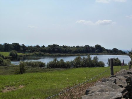
I was now on my homeward stretch down past the golf course with hazy Longridge ahead. I reached the little reservoir at the top of Longridge where I was on the lookout for grebes which often nest here. Some youngsters had climbed over the wall and were settling into a picnic above the water’s edge, all strictly private water board land. I jokingly admonished them for trespassing and said they didn’t want to be caught there when the water bailiff came around. I’d only walked about 50 yards when round the corner came the Waterboard van which stopped and gave a severe telling off to the youths who slinked away looking rather crestfallen.

By the time I reached home, it was far too hot to contemplate gardening.

Maybe tomorrow I’ll be away with the larks.

*****


LONGRIDGE FELL – UP AND OVER.

Eddie Waring commentated in his thick Yorkshire accent on Rugby League games in the ’60s and ’70s, one of his utterings “it’s an up and under” became almost a catchphrase. Planning this evening’s walk I wanted to push myself a little to see if my breathing had improved. For about a month or so I became breathless with the slightest of exertions which was rather disturbing, a persistent cough did not fill me with confidence either. I had a feeling I was on the mend so I needed some uphill walking. I had Eddie’s phrase at the back of my mind when I decided on an up and over walk across Longridge Fell. I’ve survived about 1000ft of ascent without too much stopping so I consider it a success.

The start of the up was on the south side of the fell, the over took me down the north side which left me with another up and over to complete the evening. The evening turned out sunny and calm with clear views in all directions, perfect walking conditions.

Although I’m trying my best to isolate myself from humanity and the lurking virus a few chance encounters enlivened the walk.

A few hundred yards through the rapidly growing plantation brings one to a little beck, Brownslow Brook. This is a favourite place of mine where the water tumbles out of the trees under a couple of wooden bridges before disappearing once again to emerge at the road to head down to Hurst Green as Dean Brook. I crossed it several times on my last outing. I often brought my boys here for dam building practice and have continued the ritual with my grandchildren. Tonight a couple were throwing sticks into the water for their Spaniel to retrieve, they were trying to wash off the dirt he had gathered from falling into a peat bog earlier. All three of them seemed to be enjoying the game.

Steeper climbing followed passing my favourite Beech tree.


Above the path winds upwards through recently felled land and someone has been at work creating a mountain bike track with curves and jumps incorporated, it looked great fun.

On cresting the ridge you enter thicker mature woodland where in the past I have enjoyed several nights wild camping. I was aiming for the path going off the fell when I heard thumping noises just below. I ventured into the trees to investigate and found three pleasant young lads creating a steep downhill MB track. They were hard at work with spades and rakes. What a contrast to the youths inundating and despoiling our other beauty spots on recent weekends. I wished them well and will check on their progress next time I’m passing.

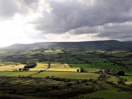
I found my own less steep rake going down the north side of the fell. It was an utter delight with the Vale of Chipping spread out below and the Bowland Hills in the background. [Header photo] Easy walking took me past Rakefoot Farm and out onto the Chaigley Road. I only had to walk a couple of hundred yards before a footpath sign pointed the way for my next up and over. This path had not been walked very often and degenerated into an assault course through nettles and brambles. Just when I thought I’d overcome the worst it turned into more of a stream than a path. My attention wandered to the flora beneath my feet and I was impressed by some of the smallest flowers I’ve seen. Minute water forget-me-nots and an unidentified even tinier chickweed type flower.  Trying to photo them with my phone was another matter.

At last, I was back on the open fell and climbing a definite rake without undue breathlessness. Once again there were minute flowers beneath my feet, one of the Bedstraws. As I had had enough ascent I did not feel the need to divert the short distance to the trig point. I did have time for one last backward view of Chipping Vale Bathed in the evening light. I then crossed the ridge and headed back into the forest for the downhill bit. The forest seemed empty and I made good progress on familiar tracks.

That was until I was further down and I came across the aftermath of last week’s forest fire. I was uncertain as to its whereabouts until now. Fire breaks had been created to prevent the fire from spreading. What a valiant effort from the firefighters otherwise the whole of the forest could have been lost. I chatted to a local who was also investigating the scene, we are not sure that the cause has been identified yet.

MEN Media

*****

On the way home I came across another of those inspiring poems inscribed on a slate that someone has been leaving around the fell.

“This is the time to be slow,
Lie low to the wall
Until the bitter weather passes.

Try, as best you can, not to let
The wire brush of doubt
Scrape from your heart
All sense of yourself
And your hesitant light.

If you remain generous,
Time will come good;
And you will find your feet
Again on fresh pastures of promise,
Where the air will be kind
And blushed with beginning.”

John O’Donohue.


At the end of the walk I felt I’d found my feet and the air was kind.

*****

VE DAY 75 CELEBRATIONS.


Lest we forget – I nearly did.

I decided to go out on my bike again today, partially to avoid people and secondly to explore further afield. Not that I don’t know ‘further afield’ in intimate detail. I pedalled off into the east and found myself coming into Chipping in the early afternoon. There was bunting everywhere and there seemed to be a street party underway, all well distanced. Only then did the realisation that it was the 75th anniversary of VE Day enter my all too isolated brain. I didn’t stop for an illicit drink but I wished everyone well as I cycled past. What a good turnout. Up at the church was a classic jeep and other period vehicles had been brought out to give some atmosphere. I felt a chump for not realising the day and forgetting the two minutes silence this morning at 11am.

I was huffing and puffing on some of the hills out of Chipping and I stopped at a gateway to take a photo down the valley. Along came a couple of cyclists, my friends Kevin and Shelagh. I last saw them just before the lockdown when I called at their house on a walk over the Chipping Fells. Today they were taking their exercise and hoping to buy some cheese at one of the local dairies. After pleasantries, they cycled off with S engaging electric mode. I continued more sedately enjoying the views and fresh air.

I arrived home within the hour pleased with my modest socially distanced circuit, my belated  VE Day observances and determined to go further tomorrow.

I’m praying the government doesn’t in the next few days unravel our attempts to slow the virus and protect our NHS.


*****

CURLEW COUNTRY, STANLEY FELL.

I’ve set the bar high with trying to keep my feet dry in the wet weather we’ve had. But I’ve found another walk which takes me on lanes into the rough fell country between Chipping Vale and the Bowland Fells, namely Stanley Fell. There is nothing more evocative of this wild habitat at this time of year than the cries of the Curlew and the Lapwing. They were both present in voice and vision whilst in the gale-force winds unable to be photographed, but you all know what they look like.

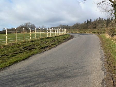
Walking up the road there was little traffic. More hens out on the loose than cars. White railings were used on corners of country lanes to improve visibility. I turned off into the Leagram Estate and passed the dell where snowdrops were in profusion last week. The next farm has a surfeit of sheep and lambs under roof all looking very healthy, they breed BlueFaced Leicesters here..

I love these tree roots.

Lanes continue to more remote farms many now upmarket residences. Ahead is proud Parlick. I’m getting into the hills.

I come out onto a road where Saddle End Farm is up the hill, I’m not going that way today but buy a half dozen free-range eggs at the end of their lane. I wonder if anyone is up on Fairsnape in this gale.

Saddle End Farm.

Turning right I follow the last of the tarmac which leads to the remotest farm, Burnslack. A culverted stream runs alongside. I recall coming here with my young children and exploring through the concrete pipes, admittedly not in flood conditions, to emerge higher up the stream – nine out of ten for child cruelty.

The way in…

A bridleway heads into the hills where the curlew are calling. On the way, a gate hangs on across the track, not even baler twine will save this one.

There is an old ford over a lively stream, I often feel an urge to follow these waters up to their hidden source, an endless task. This is remote country, not a coronavirus insight. As I come over the watershed there are the limestone knolls of Dinkling ahead and in the background Birkett Fell and Warrington Fell. Expansive uplifting scenery.

The track drops down to Lickhurst Farm, now a complex of stone residential conversions. Below is a little valley, a motorist parked up asks me where the Forest of Bowland is – I tell him he is in it and direct him through Little Bowland to the Inn at Whitewell. An old limekiln is passed…

… and a little further a low bridge over a stream, this used to be a ford and alongside is the original stone clapper bridge. This is unique in being a single stone over 15ft long. [Now guarded by wooden handrails.] All evidence of a way of living long past.

The road goes on by that often photographed and isolated red phonebox.

I have friends living in the Higher Greystoneley farm buildings so a cup of tea is very welcome. From there another stoney bridleway drops down to a ford, with wooden footbridge, and through limestone country to my car. I drive home in the gale knowing my feet remained dry and looking forward to poaching one of those farm eggs for lunch.

*****

.

OUT OF LONGRIDGE.

I wake to bright sunshine but take some time and coffee to get going. The health of two of my best friends is deteriorating; one with heart and kidney failure, the other with cruel dementia. I was talking to them both yesterday and it struck me that it doesn’t seem long since we were out climbing and walking together. So you have caught me in a pensive mood, not at all that  ‘happy new year’ feeling. I should have arranged a walk with one of my other friends for today – to ‘get me out of it’ but now it’s too late, I’ll just have to go myself which is not good for those introspective thoughts but I usually find the combination of sunshine and exercise clears my mind.

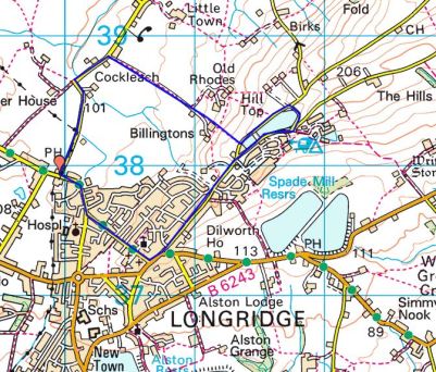
I’ve had enough of muddy fields recently so I’m happy to walk on roads for some much-needed exercise after the season’s excesses. Living where I do I’m lucky to be able to walk out my door and ascend a fell, in fact, the most southerly named fell in Britain, Longridge Fell. I’ve done it hundreds of times before. No matter there is always something new or worthwhile.  To start I spot a half dozen partridges running across the road in front of me, is it a covey or a bevy? And then a buzzard on the telegraph wires. After that, I seem to run out of wildlife sitings. Longridge is surrounded by water in the form of reservoirs and I pass the smallest one on my way out of town. Then I walk below the golf course which looks in fine fettle for winter but it must be a struggle in the wind, it is so exposed to the elements.

The road, the old Clitheroe road which kept to high ground, goes up and down towards the New Drop Inn. Few cars pass me. Turning the corner here I am walking in the footsteps of the Romans, this was their way from Ribchester to Carlisle.  The highest point on the road is reached near Cardwell House and looking back Pendle Hill looks as proud as ever. I bump into an old friend taking his dog for some exercise up the fell, we chat about all things local. This is his favourite hill and he’ll have his ashes scattered nearby. Coincidentally this is also one of my favourite viewpoints and my ashes will be here too, I told you I was in a morbid mood.  Years ago I asked a local artist, A Lord, to paint me the view from here over Chipping Vale with the Fairsnape/Totridge ridge in the background.

This painting is one of my prized possessions with its links to a past friend and to this great viewpoint. In the painting are the white iron railings that were a common sight on road corners around here to improve visibility for the motorist. They are slowly disappearing, I’ve always thought they should be listed as unique structures.

The weather was changing, dark rain clouds circling around the hills with the occasional rainbow over Chipping. Soon it was all downhill back to Longridge. Five miles with five hundred feet of ascent in one and a half hours. That’s how you clear your mind. Oh, and I found three good golf balls to boot.

*****

WAINWRIGHT’S WAY. 3. LONGRIDGE FELL TO DUNSOP BRIDGE.

Across Chipping Vale.

Here I am back at the trig point on Longridge Fell, it is a beautiful, cold but sunny Autumn day. Sir Hugh has joined the fun and we’ve taken one car to Dunsop Bridge and driven back to park below the fell. I’m sorry we are not keeping to AW’s use of public transport.

A warm-up walk and a catch-up chat soon sees us on the ridge with the compulsory visit to the summit trig. A few people are wandering about up here not wanting to miss the good weather. After a photo session and orientation of distant hills, mainly the Fairsnape ridge, Bowland and the Three Peaks, we find the steep rake dropping down into the Vale of Chipping, spread out below us. Our distant destination of Dunsop Bridge visible in the folds of the fells. This brings us to the road next to the Bradley Hall complex of buildings. WW says to go through the complex but our more modern map says go round the diversion to the left. This is the start of troublesome field navigation for the next mile or so. The waymarks run out, the paths run out, the stiles disappear, the fields get boggier and we are left to our own devices, no fences were damaged, no wires cut when we finally stumbled down a ladder stile onto the road next to Doeford Bridge. I think it took us longer than we realised.

A sign tells us we are entering the Queen’s land which we enjoy for the rest of today

.

This beautiful sandstone bridge spans the Hodder just downstream from where the River Loud joins having come out of Chipping Vale. The bridge is sketched in AW’s Bowland book.

Doeford Bridge. 1981. A Wainwright

There was a good volume of water today after several days of heavy rain. Having crossed another field we dropped down to the Hodder which had looped round a different way.  I wanted to have a look at the stepping stones next to Stakes farm so we made the short diversion, there was no way you could have crossed the river here today. Luckily we found a bench overlooking the river and stopped for lunch.

AW?

Behind us was Stakes Farm an early C17th house with mullioned windows and a plaque in Latin, translation please. Amazingly a brick extension has been built into the angle between the two wings.

We follow fields just above the river. The area between Longridge Fell and the Bowland fells is beautiful and unknown countryside, especially in today’s sunny weather, backed by the dark hills. Across the river used to be a ‘Wild boar park’ but it has closed recently. We cross the road into more fields running above the Whiewell Gorge where the river runs deep in the woods. [It is on the opposite bank that you can find the Fairy Hole caves.] Views into the Bowland Fells surrounding Dunsop Bridge keep us going.

I think we are following one of the aqueducts taking water out of the to industrial Lancashire, the distinctive Waterboard gates accompany us. We drop down past a graveyard and pop out onto the road next to the famous Inn at Whitewell. There is time to have a look into the adjacent Church of St. Michael with its striking stained glass window.  We resisted calling at the inn as time was drifting on and I think once seated it would have been difficult to get going again. A permissive path close to The Hodder leads deeper into Bowland with the next feature sketched by AW – Burholme Bridge.

Above us on the right was the distinctive Birkett Fell scene of one of our recent struggles. Our pace was slowing and instead of the familiar track by the river to Thorneyholme we crossed the pipe bridge, erected by Blackburn Borough Waterboard in 1882. with its unusual turnstile gates at either end. The way along the river was convoluted as we bypassed Root Farm famous for Kettledrum, a Derby winner bred hereabouts. Our arrival into Dunsop Bridge was unfortunately too late to have tea at Puddleducks Cafe.

Dunsop Bridge.   A Wainwright 1981.

We reflected on this wonderful crossing of Chipping Vale, Lancashire at its very best but wondered why 8 miles seemed so far. I was glad I’d divided this stage of WW into two enjoyable days, days to be savoured.

Here is an evening photo of the rake we descended from Longridge Fell early in the day.

Possibly Sir Hugh may have a different view of the day.   http://conradwalks.blogspot.com/

*****

TOTRIDGE FELL, BOWLAND.

 Last night after a bouldering session at Craig y Longridge I drove up the fell and took in the familiar view over Chipping Vale to the Bowland Hills. In front of me were the Fairsnape, Wolf, Saddle, Burnslack and Totridge Fells. How many times have I photographed this scene?  I’ve not been on the easterly of these for several years so there and then I decided on a full traverse of the range today. For every 100 visitors to Fairsnape there is probably only one on Totridge.

I can’t explain why I sat in bed with a couple of coffees delaying my departure. Sloth had taken control and it was with a great deal of difficulty that I finally emerged and started the walk at 11am. By then I realised a full traverse and return of 13 miles or so was impractical and I opted for a shorter 9miles from Saddle End, missing out Fairsnape. The heat of the last few days was diminished by a westerly breeze. Old tracks rise up from Saddle End farm and soon the open moor is reached. A steady metronomic pace is tapped out by my walking poles as I gain ground. There is not a soul in sight.

Saddle End Farm and fell.

On the 26th March 1962 three siblings left home and travelled by bus to Chipping and
walked over the fells, maybe to Langden Castle, on their return over Saddle Fell they were caught in a blizzard which resulted in the two brothers losing their lives due to hypothermia. Their sister survived to raise the alarm at Saddle End Farm. There was no Mountain Rescue Team in the area at that time so police and locals searched with BAC loaning a helicopter to help. Shortly after this tragedy two Mountain Rescue teams were formed in the area, the forerunners of Bowland Pennine MRT.

I mention the above because it is thought the boys may have sheltered in a small stone hut. I remember early walks on Saddle Fell in the 70’s the hut being by the track I’m on today, its roof was almost intact. Now it is a pile of stones but with a tragic history which I recollect every time I pass.
Reaching the wild top of Saddle Fell ignoring the track to Fairsnape I turned east at the watershed to follow the fence towards Totridge seen a couple of miles away. This stretch of fell is usually one of the boggiest in the area, I’ve been pulled out of the depths on one occasion,  deciding which side of the fence is the least hazardous often means crossing repeatedly without any real advantage. Today however the peaty ground was bone dry and I could just enjoy the scenery without any risk of sinking, the wooden poles placed to give buoyancy in wet conditions totally unneeded. [By the way the best ‘path’ is on the left of the fence.]

The views are far stretching over the Bowland area and all the hills and valleys I’ve been walking recently are identifiable. The Yorkshire Three Peaks are in the hazy background. Difficult to capture on camera.

Up here in this bleak wilderness one plant brightened up the peat bogs – the yellow starry flowered Bog Asphodel.

All I had to do was follow the fence, there is one pond to navigate found and a short section above Whitmore where you leave the fence at a tangent and take off into the peat to regain a wall in a short distance before rising onto Totridge and a final open track to the trig point at 496m. The trig pillar is looking decidedly unstable as the peat below it erodes, it will topple before long.

From the top a small path, not marked on the map, heads NE to drop steeply off the fell towards Mellor Knoll. If the correct line is taken zigzags descend quite pleasantly, not so pleasant ascending.  Halfway down today I found a place to sit, eat my sandwiches and contemplate the views over the Dunsop and Hodder valleys. In the distance over Mellor Knoll was a glimpse of Stocks Reservoir I walked around last week and closer at hand, above the Hodder, the tree capped Birkett Fell again climbed recently.

Over Mellor Knoll to Stocks and Yorkshire.

Birkett Fell, Waddington Fell and distant Pendle.                                                       

I dropped down to the fell wall and joined the bridleway coming from Hareden which goes into woods of beech and chestnut where I met the first people of the day, three gents enjoying the area.

My way back was on a series of bridleways and paths linking remote farms in the limestone country below the fells. Higher Fence Wood, Dinkling Green and Lickhurst. From the latter the track went further back up into the fells than I remember and I speeded up a little as bad weather was coming in.

Lickhurst Farm.

I used to cycle these ways when my children were getting into mountain biking, I don’t remember these stepping stones by a ford below Burnslack.

I arrived back at the car just as the rain did, my dilatory start almost catching me out.

*****


A SUNDAY MORNING STROLL.

I can’t say much new about Longridge Fell.

Over coffee I was plotting a route from Brock Bottoms when the phone rang. it was Dave asking if I fancied a walk on Longridge Fell. I couldn’t say no. I’ll put the river walk on hold.

I’ve not seen much of Dave since my PMR episode put rock climbing on hold, and anyway he is abroad most of the time. A quick turn around and we met up at Cardwell House car park at 10am.  He was not familiar with this western end of the fell so I had hoped to give him a good tour. We caught up on our recent relevant excursions. He has just had a successful three week’s climbing trip to the south of France, I’ve mainly been at the doctors. As I waited at the car park I tried out the panoramic mode on my camera with the Bowland Fells over Chipping Vale.

He seemed to be enjoying the route I took trough the forest until we hit an area of tree felling across the track, the next 200m was tedious to say the least. He likened it to anti tank defence terrain from the 2nd WW.

We eventually emerged onto a familiar track up towards the summit but a blocked path forced us onto another rough section.

The views from the trigpoint were exceptional but we didn’t linger as we had already taken much longer than anticipated.

The way back to the car traversed the fell overlooking the Vale of Chipping again on a track he had never used.

It was good to catch up.

*****

The weather was so good that I decamped to Craig Y Longridge on the way home for a bit of bouldering and more catching up with friends who were there, it was busy.Just across the road on a small reservoir a pair of great crested grebes have set up home in reeds within sight of the road. The female is sitting on three eggs so far and the male fussing around extending the nest.

ZIG ZAGGING UP FAIRSNAPE.

The way to the zigzags.

From Bleasdale, if the light is right, one can see a zigzag track going up the southern slopes of Fairsnape. Today, Easter Sunday, the sun was shining strongly onto that slope, and the way was not obvious, but a look at the satellite map shows the track clearly from Higher Fairsnape Farm.

Fairsnape is usually climbed from the outskirts of Chipping following tracks over Parlick but I have not used these zig zags and I thought today would be a good time to avoid the crowds. Sure enough, when I reached Fell Foot, there were already a dozen cars parked up; this is the spot where the paragliders start their trek up the hill. An insignificant footpath pointer on the corner led me into rough fields  where few go, but stiles some more substantial than others link up a pathless route which traverses round below Parlick to above Blindhurst farm. The sound of Lapwings and Curlews was everywhere; a hare popped up directly in front of me before disappearing into the distance. There seems to be an abundance of Orange Tip butterflies this year. There are newborn lambs and, in the sky, early paragliders. To my right is open access land [rough poor land that the landowners were happy to allow to be designated in the CRoW act] and it struck me that the colour of the land resembled the brown colouring on the 1:25,000 maps., poor land that the landowners were happy to allow to be designated in the CRoW Act

I dropped into a valley with a tributary of the River Brock and passed a green spot that would be ideal for a wild camp with my youngest grandchild if I could get him off his iPad. There was nobody about at Blindhurst Farm except newborn lambs.


Rough ground is crossed to reach Higher Fairsnape. The buildings look old with mullioned windows, and one wonders about the hardships of farming these remote places in the past and even now.

A signpost pointed the way on a concessionary path to reach the start of my zigzags. Once on the open fell, I enjoyed a leisurely ascent along the well-graded tracks; I always assume these tracks were used to bring peat down from the fells.

At one of the turns was the remains of a building, perhaps a shelter for the workers.

Years ago, I remember a similar structure with a disintegrating roof on the way up Saddle Fell; it has now become a pile of stones, but perhaps it hides a sombre history.

On 26th March 1962, three siblings left home, travelled by bus to Chipping, and walked over the fells, possibly to Langden Castle. On their return over Saddle Fell, they were faced with severe winter conditions, which resulted in the two brothers losing their lives due to hypothermia. Their sister Sheila survived to raise the alarm at Saddle End Farm. The brothers probably took shelter in the hut.  There was no Mountain Rescue Team in the area at that time, so it was left to the police and locals to search; British Aircraft Corporation loaned their Whirlwind helicopter to help. Shortly after this tragedy, a South Ribble Rescue team was set up, now the local Bowland Pennine team.

  Above me were paragliders soaring the thermals and lots of people coming up the route from Parlick, I had seen nobody for two hours. My track came onto the plateau only a few hundred yards from the summit. Up here there is a cairn with Paddy’s Pole, a wind shelter and the trig point, 510m. I had a quick look around for a suitable bivi spot in the near future.

I was able to take a summit photo of a couple on their first ascent of Fairsnape and pointed out that the true summit, 522m, was half a mile away NE and that conditions today were perfect for visiting it, as the peat hags that guard it have virtually dried up. I met up with them there later. The views were hazy – no Lakeland Hills or Three Peaks; Pendle and Longridge Fell were a blur.

522m summit.

A romp down the wallside and round Parlick. Looking back across Bleasdale towards Fairsnape, I saw no evidence of my zigzags. I walked below the popular spots for launching paragliders, and many were still airborne. I passed a late starter walking up with his load.

The day was finished before lunch back on the road at Fell Foot.

*****


LONGRIDGE FELL WANDERINGS.

A rather gloomy Longridge Fell with Pendle in the background.

I rose Phoenixlike from the ashes for a stroll on Longridge Fell. I had not been out for a month due to some chest infection or other and I wheezed my way round today. The weather was not the promised spring sunshine, in fact I wished I had donned an extra layer to cope with the cold wind.

I chose an anticlockwise circuit for some reason but before long this was denied to me by forestry work on wind-blown trees that had closed some paths. Over the last few years there has been a lot of tree felling partly due to fungal diseases attacking the spruce, and the edges of the remaining trees are susceptible to strong winds. I lost a Blue Spruce in my own garden two years ago and wonder whether I brought the disease back from the fell.

The diversions led me into parts of the forest long forgotten and rarely visited.

My favourite tree on the fell.

Approaching problems.

No further.

Deep in the hidden parts.

On the way back I enjoyed a  long open section past the trig point with decent views into Chipping Vale and across to the Bowland Hills. I met the only people I’d seen all day flying an extremely fast model glider.

The Bowland view.

What’s eating this?

The modern non-edible variety.

It was windy.

You can see from my plotted map that I walked an erratic route with some backtracking but managed 7 miles which pleased me.

*****

SKIPTON TO LONGRIDGE 4 – A sunny Longridge Fell.

Longridge Fell from the south, Kemple End is the steep bit at the right.

Higher Hodder Bridge to Longridge.

JD and I are sat in the bus station at Clitheroe waiting for the Skipton bus to arrive with the pieman on board. The alloted time passes and we wonder if we are in the right place, we circle the area in our car but no sign of him or the bus. The phone call elicits that the bus broke down! We look at each other and as the day is dismal and I lack enthusiasm we drive home  for other pastimes,  ie gardening.

Fast forward 24 hours and we are sat in Clitheroe bus station once again. I must admit the weather was far better today so we hoped the pieman would arrive. He did and within 10 minutes we are parked up at Higher Hodder Bridge at the base of Kemple End, the east end of Longridge Fell. After a stretch by the Hodder we start a fairly easy zigzag ascent of the fell. Behind us were views across the Ribble Valley to Pendle and Waddington Fell. We emerged at the road and stripped down to shirts for the rest of the 1000ft ascent in increasing temperatures.

Higher Hodder Bridge.

Climbing Kemple End, Pendle in the background.

Layers coming off.

A mixture of tracks and paths through the forest where there has been a lot of clearances of late, a magic route opened up in front of us. The lighting seemed to transport us to some alpine approach but there were no snowy peaks above. Familiar tracks head up the fell though in some places wind damaged trees create diversions. We came out of the trees at a well known viewpoint overlooking Bowland, the Three Yorkshire Peaks were in haze.

Magic light amongst the trees.

There is a way through.

More uprooted trees.

That viewpoint.

Our guest from Yorkshire is impressed by the scenery and we eventually arrive at Spire Hill the summit of Longridge Fell at 350m. At the trig point is a man talking on short wave radio as part of the Summits on the Air scheme.  He was mainly concerned with radioing his position although he requested a summit photo. Listening in to his pointless conversation with some unknown person made me think why we climb summits. We were sweating from our exertion, ready for lunch, breathing in the air and enjoying the situation and views particulrly of Chipping Vale and the Bowland Hills. It takes all sorts.

Radio ham.

Well deserved lunch with a little Brexit chat.

We had been climbing steadily all morning but from now it was gently downhill. The view over the Fylde was rather hazy but the sunshine became warmer as the day wore on. There was some unavoidable road walking past the golf club. This now popular venue had humble beginnings as a 9 hole course which was amalgamated with Preston Cycling Club at the beginning of the 20th century. They built an early clubhouse shared with the golfers and as time passed the golf developed and the cyclists moved elsewhere but the badge still remembers the joint beginnings.

Heading down with Parlick and Fairsnape in the distance.

When it all started.

Present day signage.

We took to fields again and entered Longridge via the old railway line used by the stone quarries. We had spent the whole time walking Longridge Fell, about 7miles as the crow flies, hence its name. Cutting through the streets we completed our house to house route from Skipton. Well that’s another of my straight lines accomplished and very enjoyable it has been; beautiful varied scenery, interesting history and good companionship with enough exercise on each occasion to fill a winter’s day. But now Spring is upon us thoughts drift to wider horizons.

*****

THE WAY OF THE CROW. Second day, Bleasdale to Arbour, Calder Valley.

JD seemed worried when I described the next leg of our straight line way – “it is extremely rough going, the game keepers are unfriendly and there are rumours of a wild rhinoceros”. Despite all that he agreed to join us on his recommended shortened version. The picture above was taken from his house when I picked him up in the morning, The Bleasdale Fells which we had to cross are to the left of the higher Fairsnape group. Beacon Fell is far left.

The car park at Bleasdale Church was busy with Sunday worshippers.

It was a glorious sunny morning as we used field paths into the heart of Bleasdale discussing our individual Saturday night’s exploits, I probably had the largest hangover, Sir Hugh had been consructing a cat flap and JD entertaing his family.

Donning extra layers when we realised how cold it was.

No that’s not the rhino but pretty scary anyhow.

After the isolated Hazelhurst Farm we found the beginnings of a land rover track that would, via a series of zigzags, take us steeply into the open access area and onto the fell top. We puffed our way up with frequent stops to admire the views over the nearby Fairsnape/Parlick fells with Bleasdale and  the Fylde below. Surprisingly and fortunately another quad track led to the remote trig point, 429m, of Hazelhutst Fell. We are on grouse shooting moors up here and much has been written about the persecution of other wildlife in this vicinity to try to promote the shooting fraternity. Whatever one’s opinions about grouse shooting I am strongly against the wilful and unlawful killing of our protected species. On this stretch of the walk we came across several loaded Fenn Traps which are legally only allowed for stoat trapping [killing] but are known to trap other species. These are lethal looking spring-loaded traps which could almost take the tip off your walking pole.

From the trig point there were hazy views across Morecambe Bay to Black Combe and Barrow. Taking a compass bearing we set off across the heather in a NNW direction and fortunately found another quad bike track taking us down past shooting butts so avoiding all the heavy going. After what I’ve said about the grouse shooting land owners we were thankful for their tracks. The final descent was vertiginous. The surroundings were reminiscent of a Scottish Glen and we found the bridge over the Calder to the Victorian shooting cabin of Arbour. This must be one of the best kept secrets of Lancashire.

We found a sheltered spot out of the cold east wind for lunch. There were no windows into the shooting lodge to see the rhinoceros head. The story goes that a rhino escaped from a train near Garstang and had to be shot, it’s trophy head being mounted in the lodge.

By now all the excitement was over and we had an easy walk out on the track alongside the River Calder.  We were back at Sir Hugh’s car much sooner than we’d planned because of those good moorland tracks. We will have to walk back in next time to rejoin our line.

*****


THE WAY OF THE CROW. First day, Longridge to Bleasdale.

I was apprehensive, walking in a straight line as possible would take us on unfrequented paths, would the way be feasible. We left the village down overgrown Gypsy Lane and shortly after found a gate secured by a cord, a veritable Gordian Knot. Out came Sir Hugh’s, I’ll blame him, Swiss Army Knife and we were through.

‘Gypsy Lane’

We passed the ponds, ‘figure of eight’ where my children used to go fishing without much success but I’m sure they had an adventure away from parental supervision – they never drowned so I must have been doing something right.

The next farm-yard, where I’d previously climbed walls to escape, was now well signed and we even had a resident directing us to the hidden stile ahead though the accompanying foot plank, couldn’t call it a bridge, didn’t inspire confidence.

The slippery plank.

We reached a farm gate on a public footpath which was securely padlocked, no Swiss Army knife could cope, but as if on cue a lady drove up in her battered pick-up and opened up for us. Remonstrating about obstructed footpaths didn’t seem to be appropriate. All was pleasant rural scenery with scattered farms, some in better condition than others.

The next problem was of our creation, contentedly walking along the tiny River Loud we were almost in someone’s back garden when we realised we’d missed our path but fortunately a gate allowed our escape onto the road.

The infant Loud.

Things improved as we headed closer towards the Bowland Hills and Bleasdale. We passed the small rural Bleasdale School and headed for the church where our car was parked. We were last here in gale force Ali. A group of fell runners were just setting off for a quick few miles and we exchanged pleasantries. Walkers, climbers , cyclists, runners tend to have a common background.

Is that an Ofsted verdict?

We had completed the first leg of our project with very little deviation from the straight and narrow and to be honest no serious obstacles except a lot of slippery stiles. Our way ahead over Hazelhurst Fell could be seen, the fell runner is pointing the way, but will there be any paths?

Yet another slippery stile.

***** 

THE WAY OF THE CROW. LONGRIDGE TO ARNSIDE.

My good friend Sir Hugh  [http://conradwalks.blogspot.com/ ] inhabits that lovely village Arnside whereas I have to put up with the gross overdevelopment of Longridge. For the last few winters we have had projects to keep us active in the shorter days. He has emailed once or twice with suggestions for this year but nothing has struck me as original, boringly I seem to have walked most of the Long Distance Paths in the NW. I came up with a counter suggestion – why don’t we draw a straight line between our houses and follow it as closely as possible. I know this idea has been used before, particularly successfully  by Nic Crane on his straight line Two Degrees West journey from Berwick-on-Tweed to The Isle of Purbeck. I seem to remember he gave himself  a kilometre leeway either side but had a lot of media support, I wonder if we could be even stricter. True to form Sir High has taken the bait and the line has been drawn.

It is the wrong time of year for backpacking so we will split the route into day walks. The distance as the crow flies is 26.5 miles but we will be lucky to keep it under 35 miles. No rules except keeping as close to the line as possible preferably on footpaths or quiet lanes, legal ground or not. There are some obvious obstacles in the way – the fells of Bleasdale, the Rivers Wyre and Lune, Quernmore Hall Estate and the M6. It will be a challenge overcoming them, lets get started.

MY DAILY WALK, [well almost daily].

The weather has not been good since my return from France, I feel Autumn is upon us.

It’s noticeable how often I comment on the state of the weather at the start of a post. Is that a British trait, am I obsessed with the climate or does it just reflect the close connection of conditions with my pastimes?  I remember when I was younger and outdoor time at a weekend was precious we would sally forth on walks or climbs whatever the weather. That would result in a fair share of days with no views and a good soaking on the hill or gripping climbs on cold slippery wet rock. Many of those occasions are vivid in my memory, proof of the importance to me of outdoor adventures and the companionships they bring. Character building was a phrase used. Now I take more heed of the forecast and try to choose the better days for my enjoyment or more likely head abroad to avoid the worst of our winter weather.

I’ve rambled off the subject.  I intend, now I’m free of the PMR stiffness, to  do a regular local walk most days to build up my fitness once again. How often have I said that? I have a 4mile circuit on my doorstep that suffices. Not only does one get some healthy exercise but also some physic benefits thrown in.  There are countless literary quotations extolling the virtues of walking, one of the simplest  –  “I have two doctors: my left leg and my right leg.”  G M Trevelyan.

I complain a lot, and will continue to do so, about the housing developments in Longridge destroying the character of the town but I’m still able to do this walk from my house into the country. Why drive anywhere in mixed weather when a walk can be accomplished from home.   A stroll down the road takes me past the cricket ground where today there was a match which I can stand and watch for a few overs. There’s something special about village cricket which makes it almost hypnotic to engage in, I think it is something to do with the enthusiasm of the players and the gentle clapping of the handful of spectators. Long may it be so. The lane I usually take up onto the fell gives a lovely view back across Chipping Vale to the Bowland Hills. The view is different with the seasons but gives a sense of space and nature within half a mile of leaving home. Today this was heightened by a pair of Buzzards wheeling and mewing above me. Time just goes by whilst you stand and watch. A glance over the reservoir at any other bird life – usually ducks and grebe. And a glance into Craig Y Longridge to see if anyone I know is climbing, not today with the damp conditions. My return down the town’s main street is more mundane but gives the opportunity for social engagement and grocery shopping.

A perfect little circuit, I’m off to do it again today when things will be different.

*****


DEEPER INTO CHIPPING VALE.

The Lazy Loud River.

There was a beautiful sunrise today which heralded good weather to come.

I’d arranged with JD to continue our intimate exploration of Chipping Vale by following as close as possible the little River Loud on its way to join the Hodder. My route was ambitious as from previous experience I know some of these paths are rarely walked. I was hoping for an easy day because of my recent stiffness and should have been concerned with the first stile we encountered off the road, awkward and overgrown.

Dr. Livingstone I presume.

To be honest we never really found a convincing path through the fields to the limestone Knainsley Quarry and once we were in its extensive area compass work was needed to get out. We emerged onto a lane bounded by expensive property conversions, lots of Range Rovers – that sort of place.

The next stile was impossible to negotiate, guarded by brambles and sloes, [reported to the authorities] but fortunately a gate took us into the same field to link up with a path that kept coming to more awkward overgrown stiles, but we slowly made progress to emerge probably on the wrong drive way at Loud Carr Side. All along this stretch we had wonderful views of the Bowland Fells to the north. Their road led us to Gibbon Bridge over the Loud. A substantial stile gave access to the river bank  here populated with Himalayan Balsam and more worryingly Japanese Knotweed, The river is small and flows along at a snail’s pace. Pushing on through the vegetation we made progress down stream, despite acrobatic stiles, to the stepping-stones  across the river. A few days ago there would have been little water here after the drought but we have had a lot of rain since and our crossing was a little tricky as some of the stones were submerged. A gentler stretch through fields and we emerged at Loud Mythom Bridge. What are these  iridescent beetles ‘feeding’ on dock leaves?  We walked on to Doeford Bridge where the Loud joins the much wider Hodder. A fisherman was casting in the Hodder below, a popular fishing river. We ate lunch at the bridge and watched many cyclists coming through from  the Trough of Bowland, and also speeding motorists having close shaves on the bends.

The Loud joining the Hodder just above Doeford Bridge.

We had considered continuing across the stepping-stones at  Stakes Farm but walkers coming in the opposite direction confirmed that they were impossible with missing stones and high water which is a regular problem. So we backtracked up the lane and onto a track heading for Greenlands, as we walked through the farmyard a, fortunately chained, dog leapt out of its kennel narrowly missing JD. That raised our heart rates.  More poor tracks and awkward stiles eventually brought us back to Gibbon Bridge. Cars were arriving for a wedding reception at the hotel. We didn’t have the heart to find the footpath through their grounds and spent the next half-hour or so lost in the fields which host the annual Chipping Steam Fair every May. Today turned out to be the Chipping Show held in fields on the edge of the village and we could hear loudspeaker announcements in the distance. The day was perfect for the show. From this side of the Loud we now had uninterrupted views south to Longridge Fell. A complicated series of fields, all thankfully well signed, took us from Pale Farm to the road and back over the Loud Lower Bridge to our car. We had achieved our idea of following the Loud but had found the walking difficult, in my condition, with overgrown paths and broken or blocked stiles.

*****

DEEP IN CHIPPING VALE.

One of the tags for my blog is ‘Chipping Vale’  and its used quite frequently.   I’m often looking down into this valley as it lies between Longridge Fell and the Bowland Fells. I’m not sure whether this is an official designation or a figment of my imagination. There is no mention on the OS maps, basically I’m referring to the Loud River catchment area which arises in the hills near Beacon Fell and meanders under Chipping into the Hodder at Doeford Bridge. Well today we’ll explore into this valley.

Chipping Vale from Longridge Fell.

There are several  points of interest – historic houses, ancient bridleways and limestone quarries. I’ve a book about limestone kilns and quarries in the area which highlights Arbour Quarry at Thornley as a major commercial  site, so I was keen to revisit it.

Since my trip up the NE coast of Scotland I’ve hit a problem – I suddenly overnight painfully stiffened up in my shoulders and thighs. After some prognostication I presented myself to my GP – Polymyalgia Rheumatica [PMR] was his initial diagnosis,  but the blood tests were equivocal. Give it another week and nothing much has changed, painful stiffness and similar bloods. I’m limiting myself to gentle walks around the village later in the day when I’m less stiff.

To hell with it I’m going for a longer walk and phone JD for companion, he’s strong enough to carry me if things become difficult.

So our venture into Chipping Vale commences. Field tracks out of Longridge are taken past ponds, where my lads used to fish for tench, to Gill Bridge over the River Loud, more of a stream than a river, where they had tickled unsuccessfully for trout. Private roads through the Blackmoss Estate formerly Lord Derby’s domain took us past converted barns and gentrified houses as is the norm around here. Indistinct field paths which seemed little walked brought us into the farmyard of Hesketh End a grade one listed C17th house.  The sandstone house has lovely mullioned windows and is noted for Latin inscriptions on the exterior telling of historic incidents.

Hesketh End.

Chipping Vale with Longridge Fell in the background.

A nearby  property was ruinous 20 years ago and is now a substantial dwelling. We came out onto the road close to the recently closed Dog and Partridge, many pubs are capitulating in rural surroundings. From here we crossed the River Loud by a wooden footbridge. The banks of the river were heavily overgrown with Himalayan Balsam, its scent pervading the area. The low-lying meadows here are frequently flooded in the winter months when our track would be underwater. We were heading for the extensive Arbour quarry, a source of limestone into the early C 20th. Lime was important to the farmers for improving their land. All that remains now are grassed over ridges and ponds, the latter having a large duck population. Sitting on a limestone outcrop for lunch we were covered with little black flies which fortunately were of the non-biting variety. We couldn’t identify them but they were similar to ones I call Thunder Flies, it was certainly very humid today. There was wild mint growing  everywhere giving a strong aroma and attracting Painted Lady butterflies. I had vague memories of a large limekiln somewhere here but we couldn’t find it today in all the summer growth. There is a photo in my book of it operational.

Crossing to the other side of the valley we climbed a lane to reach farms strung along the hillside of Longridge Fell on roughly the 150 m contour. I’ve often speculated this may be the spring line. Paths and lanes connect these properties and is known to some locals as ‘The Posties Track’. Some houses are still honest working farms but more and more are renovated as desirable properties, I must admit they all have superb views over Chipping Vale towards the Bowland Fells. We re-entered Longridge on the old railway line that ran along to stone quarries. The gentle walking was no problem but my stiffness made getting over the numerous stiles comical.

*****

BIVI ON LONGRIDGE FELL.

A unique experience.

I’ve been meaning to sleep up on Longridge Fell during this good weather but other things keep getting in the way. Made an effort last night before I disappear off to Scotland and arranging a late evening lift up the road was a great help. So at about 8.45pm I set off on the familiar track to the trig point. A few stragglers were wandering back down to the carpark and they wished me well. A few sheep looked at me strangely. The sun was already low and would go behind the Bowland Fells soon. I wasn’t going to see the sun setting over the sea at this time of year from up here, may have to have a night up on Fairsnape soon for that which would complete my trio of local fell bivis – including Beacon Fell.  [Memo to myself – better sleeping bag, camera as opposed to phone and a tripod.]  By the time I reached the top the sky was changing and the sun disappearing, I sat and watched with the three peaks clear to the east. A kestrel hovered right above me but soon flew off into the gloom leaving nothing but silence.

There was a cool breeze blowing from the north so I decided to go over the wall for a sheltered bivi spot and luckily found an almost level site yards from the trig point. I heard deer barking but none appeared. I was probably asleep by 10 but woke about one feeling decidedly chilly. I had my lightest sleeping bag and no spare clothes so couldn’t do much about it. There is little light pollution up here, a few lights down in Chipping, so the stars were clear, the moon was almost full. The next time I woke, about 4.45am, the sky was colouring over Yorkshire so I sat up and watched the changing display until the sun was fully up, 5.30am.  A lot of misty patches hung in the fields below and there was heavy condensation on my bivy bag suggesting the temperature had dropped considerably in the night. I managed an hour or so fitful sleep before packing up and walking home to the village just as it was coming to life. Another fine summer’s day in prospect highlighted by my night on the fell.

*****

THAT SHORT WALK OUT OF LONGRIDGE – UPDATE.

I was thwarted a few weeks ago on one of my regular local walks by a completely obstructed path.

Well today I followed the same route to see if anything had improved.

I’m not sure if the local authority or the farmer have got round to doing anything but I’m pleased to find the way open. I suspect some local walker/activist, I know a few, has cleared the way – well done. I think that in future with financial constraints placed on local authorities and the ever increasing pressure put on rural societies that we will all have to take things into our own hands to preserve the footpath network.


I continued on my way back to Longridge on unobstructed and for the most part signed rights of way.

*****

BOWLAND AT ITS BEST.

Looking up past Dunsop Bridge into the heart of Bowland.

14th June 2018. UK weather: Storm Hector batters Britain with winds of up to 100mph.

The above headlines in today’s papers were not encouraging but delving a little deeper and being three brave fellows we arranged a walk. We being ‘the rock man’, JD and myself. The idea was to stay low and leave late morning to avoid the worst of the storm. Leaving late was easily accomplished as the rock man was late anyhow. We parked up near Leagram Estate above Chipping avoiding any overhanging suspect trees. There was no sign of the wind abating.

Entering a windy Leagram Park.

Country lanes were used to weave through the fields bordering the fells. More and more barns have been converted into desirable residences and expensive 4×4’s kept pushing us into the hedgerows. The public road to the remote Burnslack was reached and followed before cutting off on the rougher track across the base of the fells. This is open country and felt wild today with the wind. Lickhurst was the next farm complex with new developments. The tenant, who was one of the last remaining true farmers, apparently has recently died. I had a long conversation with him when I last passed when he was telling me of his plans for retirement, sad news.

Lickhurst Farm.

Moving on we crossed the footbridge and headed up onto limestone pastures. These looked very dry as we’ve had virtually no rain for six weeks. The track down to Dinkling Green was found. JD and I had recollections of vicious dogs chained up here which would suddenly jump out as you passed through the farmyard. None today as the farmsteads have been gentrified. A nice stretch alongside a brook and we arrived at Higher Fence Wood, the farm with all those wooden hen houses.The rooster cockerel was proudly parading in front of his hareem. Free range eggs were advertised for £1.50 a dozen but unfortunately the cupboard was bare.

We were now in limestone country and relying on the rockman’s expert knowledge. There were limestone outcrops and signs of quarrying everywhere. We lunched under a limestone rockface of a long abandoned quarry. There were signs of chalk on the rock from modern-day boulderers.

Our lunch spot.

By now the sun was getting a little stronger but the wind was still bitterly cold. Tracks took us to New Laund Farm above the Inn at Whitewell which can be reached across the Hodder on stepping stones. Today however we stayed high and went into secretive mode for a little trespassing into the woods to locate Fairy Holes Caves. Once found we explored using our phone torches which proved far better than the old flashlight. I saw crinoid fossils which I had missed on previous occasions. The location is recognised as a Bronze Age burial site, probably dating to around 1800 BC.

The Inn at Whitewell.

Forbidden land.


We scrambled out onto the public right of way to Fair Oak , this gives some of the best views down into the Hodder Valley in both directions as it crosses a small col. See title picture for view NE. and below for River Hodder and SE to Longridge Fell.

‘Scrambling out’

From here on we wandered past old farmsteads all in a state of modern repair, Delightful residences but all so remote from anywhere. The old bridleway down from Greystoneley was followed over the ford.

Towards the end of the walk I wanted to explore a footpath I’d never used and it turned out perfect. From an old limekiln and quarry we went cross-country, unfortunately missing a crucial footbridge, back into the Leagram Estate. Delightful walking under the Fairsnape Fells with views across to Longridge Fell. The wind was still blowing strong when we reached the car but had detracted little from a grand day out.

My ‘new path’

Fairsnape Fells.

Longridge Fell.

*****