Tag Archives: Chipping Vale

FAIRSNAPE FELL.

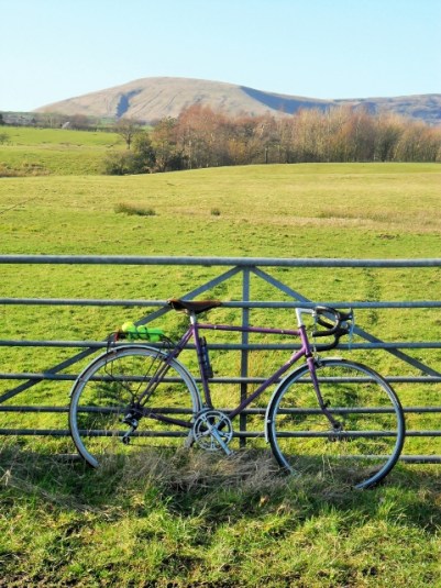
The phone rang shortly after 7am. It was going to be a very hot day and Dave suggested a walk over Fairsnape, above Chipping, early on. I grabbed a drink and my camwera and we were soon climbing the old track up Saddle Fell with a lovely breeze keeping us cool. I can only surmise that this track was for sledging down peat from the cloughs above. Crossing a fence before the watershed the track has been ‘improved’ with stones and gives a good walking surface to the true summit of Fairsnape, 520m. The last few yards of bog have been paved with slabs though today everything was so dry one could walk anywhere. Taking out my camera to record the summit I found the battery completely flat hence no pictures to accompany this post. The above photo taken later from Longridge Fell shows Parlick and Fairsnape to the left with Saddle Fell central. Below is the village of Chipping and lower right you can see the Steam Fair site which is open all Spring Bank weekend and attracts visitors from far afield.

The walk along the ridge was as dry as I have known it, we cut downhill before the trigpoint. Skylarks were singing and fluttering high above and several pairs of Curlews were flying past with their haunting call. A small brown bird flew up from under my feet and there in the heather was the most perfect round little nest lined with grass and containing four brownish eggs, probably Meadow Pipit. I cursed the lack of my camera.

Skirting round the west side of Parlick we avoided the worst of the steep descent and contoured back under the fells to Saddle End and the car. We were back home for lunch before the hottest part of the day. Only the next day did I discover a tick embedded in my groin which I quickly and cleanly removed with my extracting device. These little menaces seem to be becoming more common in sheep rearing areas and as they have the potential to carry Lymes Disease care should be taken to avoid them. I was asking for trouble walking in shorts.


LONGRIDGE FELL – YET AGAIN.

I had no sooner booked a trip to the Canary Islands, to get away from our dismal weather, when the temperature here shot up and the sun was shining. Will it last? Better get out, make the most of it and do a bit of training. Now when I say training I mean go for a short walk. I chose Longridge Fell again as I was hoping for clear views, but which way up?  It is so easy to park up near Cardwell House but I decided to reverse my usual routes for variety. This turned out to be quite different and not entirely successful, for some reason my anti clockwise circuit was strangely unbalanced. I couldn’t really say why – the wrong views, the wrong gradients, the wrong approach.

So what was new today, apart from the sunny weather?  There has been a lot of timber extraction on the fell in the last few years, partly due to the Ramorum fungus and also with maturity. Interestingly I’ve spent a few days recently cutting down a Blue Spruce in my garden. It suddenly lost all its needles a couple of years ago and has not recovered. Spruces are susceptible to the disease and I wonder whether I brought it back from the fell on my boots. The tracks on the fell have been improved to take the heavy machines and lorries involved. They only need to quarry superficially into the fellside to obtain  hardcore for the tracks. I had just passed one of these quarries when I came across a lorry and trailer being loaded with cut timber. It looked a slick operation.

Distant Pendle Hill.

Ready made hardcore quarry.

Smaller tracks took me to the top and the views were clearer than the other day, the Yorkshire Three Peaks were prominent and across Chipping Vale the Bowland Fells distinct. On my way down the ‘balcony’ path I started to meet people coming up from the now busy carpark.

A good 5.5 miles. I was home for lunch.


BEACON FELL CIRCUIT.

It was one of those out of body experiences – I was 11years and cycling as fast as I could around the Teesdale lanes getting strong for some time trialing; then I was in my teens touring various parts of Britain with my mates; now I’m 30 and exploring the Trough of Bowland and further afield doing 100 mile days; next I’m 50 and cycling across Europe on endless adventures. Now I’m off my bike and having to walk up a steepish hill onto Beacon Fell. Bugger.

Today’s circuit from home is about the same distance as the Preston Guild Wheel which I’ve been using recently but with HILLS – over a 1000ft of ascent. Your are on your own here.Still the roads are quiet, the sun is shining and I’m wrapped up against the freezing temperatures.

Beacon Fell is a local landmark and popular with strollers and families. It is one of my regular haunts usually walking as previous posts detail. I had forgotten how impregnable it was on a bike. Still the cafe is open all year. Despite the icy roads it was mainly fast downhill from here on the long way round to Chipping under the Fairsnape Fells. There were a few more hills I’d forgotten about!

and then I’m sprinting to the finish on the Champs-Élysées.

***

As an aside I passed several laneside garages long since abandoned, they were a feature of the countryside 50 years ago. They were never open when you needed petrol  on a Sunday afternoon but their skilled mechanics kept the locals cars and tractors on the road. No plug in diagnostics in those days.


Simply passing time.

BANG – I thought I had been shot!

The morning had been frosty but bright, and I was out on my bike for a few miles round the country lanes. Well wrapped up I was enjoying cruising downhill into Longridge when there was this explosion from my back wheel which immediately deflated. Luckily only half a mile to wheel the bike home and investigate the damage. The tyre had a large hole in it as had the inner tube. I realised my tyres were old and perished – hence the explosion. Looking back I should have been more circumspect before setting off as my saddlebag had been turned into a mouse nest whilst I’d been an inactive cyclist. They had chewed up a rag, a chocolate bar and a spare inner tube with its packet in my absence.   Next morning it was down to the bike shop for a couple of new tyres and inner tubes – after the horse has bolted.

Nesting saddle bag.

Nesting saddle bag.

Since I’ve been back from sunny Tenerife it has been bright and cold, but dry, here, I don’t normally like this time of year and try to go abroad, but I must admit the weather is superb for November. Hence, the sudden urge to go cycling. Whilst away I managed to violently ‘back heal’ the toilet basin in our small bathroom, no alcohol was involved – well maybe a little the night before. Bruised heals are painful, and I haven’t been keen to do much walking. A session at Preston climbing wall proved how unfit I was compared to my mates who have recently returned from Kalymnos. So afternoons have been spent up at CraigYLongridge, the local bouldering crag. I’ve surprised myself being able to have a session or two whilst the thermometer only showed 6C degrees  providing the sun was shining. A few other brave souls have joined me.

A cold Craigy.

A cold Craigy.

So the point of this post, apart from bicycle maintenance, is just to acknowledge how lucky I am to live within 5mins of climbable rock and within a network of Lancashire lanes in Chipping Vale just made for cycling.

Simple.

Longridge Fell – better late than never.

I don’t like to admit to many deadly sins, or virtues for that matter, but SLOTH was on the list today. I hadn’t got round to arranging a walk in the Lakes or in Yorkshire with friends and sloth set in whilst I was having my morning coffee back in bed. One voice said get up and going, the other persuaded me to linger listening to the radio. The morning evaporated whilst the sun shone outside. Something stirred in me and after a quick brunch I was parked up on Longridge Fell. I stopped to take a photo of rubbish dumped in the car park, picked some up later, and noticed the passenger door of the red car next to me was wide open with lots of articles on the front seat. Not daring to touch anything I closed the door and hoped no opportunistic thieves were about.

I have written about Longridge Fell many times, so what was new today?  Some more large chunks of trees have been felled whether because of the Ramorum fungus affecting the Larch or routine forestry work. There are forest roads which give good walking but I can’t come up here without visiting the trig. point, Spire Hill 350m. This diversion involves muddy tracks which today were semi frozen allowing one to break unexpectedly through the crust into the icy depths.  Haziness over the Bowland Fells  and Pendle precluded decent photography. Once I was back on the main forest track I strode out to Kemple End, I don’t normally go this far as it entails road walking back to the car but today I fancied the extra few miles. Sun glasses would have been useful against the low sun in the west. I caught up with a sprightly walker, he had been out all day having caught the bus from Preston and done a circuit of Longridge Fell and the Hodder. At the age of 75 he was out regularly and knew the Bowland area intimately, a true fell wanderer. He obviously declined my offer of a lift into Longridge. Wish I had got his name.DSC00685

At the end of my walk I came through the small bouldering venue of Crowshaw Quarry and I’m itching to get back on some of the problems in Spring. Talking of itching my friend John phoned me last week suggesting a trip back to Gran Canaria where we have unfinished business on the GR13. Needless to say flights are booked.

PS The red car had gone – hope all OK.

CHIPPING IN BLOOM.

I’ve talked about the village of Chipping several times as I often seem to be passing through. Today I was here again for a short circular field walk that a friend was planning for his walking group. We were impressed by the tidiness of the village and the abundance of colourful floral displays, the village looked reet gradely.

Chipping in bloom.

Chipping in bloom.

We didn’t spend a lot of time in the village this morning, but it is worth seeking out the stone-built cottages,  17th century school, churches, almshouses, club row and waterwheel. On the edge of the settlement we left the road and followed an old hawthorn hedge and ditch, all that remain of a Medieval  ‘pale’.

Line of the enclosure.

Line of the pale enclosure.

This was a wooden fenced enclosure for the deer park of Leagram Estate. There is a rare map in the Duchy Of Lancaster archives by a Roger Kenyon from 1608 delineating the park so that its boundary may be traced still. Not only did the pale keep in the deer but also acted as physical statement of privacy and privilege to the common people on the outside. This is thought to be the origin of the phrase ‘beyond the pale

Walking beyond the pale with Longridge Fell in the background.

Walking ‘beyond the pale’ with Longridge Fell in the background.

 We completed our simple circuit with first views to Longridge Fell and then the Fairsnape fells to the north. The route will need a few tweaks before the group use it – apparently they are not keen on too many stiles or boggy ground! There was intermittent rain and sun and the only other point of note was a ‘Zebra’ in a field.The Tour of Britain cycle race, stage 2 on Sept 7th, comes through Chipping and has a circuitous journey on the local lanes to Longridge and beyond. Hence all the yellow bikes, what Yorkshire can do so can we. Should be worth a watch.

A Local Weekend.

Writing this whilst outside is a torrential downpour and distant thunder. The strange summer weather continues. This weekend I’ve managed two contrasting walks.

Saturday. A dull morning but things improved after lunch so I took the opportunity to complete a few more map squares I had signed up to for in the Ramblers ‘Big pathwatch’.

The idea is that every public footpath in England and Wales, all 140,000 miles, should be walked and any problems noted and hopefully duly sorted. I like to do my bit for the local paths around Longridge. No big problems found today – only one electric fence with no safe way through. However it is the height of summer and the height of vegetation is noticeable on lesser walked paths, you certainly need long trousers. So by the end of the walk I had had enough of nettles and brambles, and the Ramblers can’t do anything about that.


Sunday. After yesterday’s field path navigations I felt the need to be free up on the fells. The morning was warm and sunny with the threat of storms later so I was away relatively early to park above Chipping for my usual Saddle Fell, Fairsnape and Parlick circuit. The path goes through the yard of Saddle Fell Farm and steeply up an old peat collectors track. Several WD numbered marker stones are passed – a reminder that these fells were once a tank and firing range back in the 40’s. Saddle Fell also has a tragic past – on a sunny  Sunday, 25th March 1962, three teenagers, two brothers [11 and 18] and their sister [15] set off from Chipping for a walk over to Langden Valley. The weather changed with low cloud and a snow storm moving in, they soon became disorientated and hypothermic. Somewhere on Saddle Fell the boys sort shelter in some rocks but the girl staggered on to raise the alarm at the farm. Both boys were dead when found the next day and this led directly to the establishment of a mountain rescue team in this area. As I climb the fell I pass an old stone shelter and often wonder if this was the site of the brothers last night.There was a very strong Easterly wind and I virtually ran along the ridge. With some local knowledge this route can be achieved without any serious bog trotting. The air was warm and the haze hid any distant views but you do experience a strong sense of wilderness and space up here. Today I was really only interested in putting some miles below my mountain boots and a quick 1000ft of climbing as part of getting a bit fitter for a forthcoming trip in the Austrian Alps. A few pairs of grouse startled me as they flew out of the heather, so they haven’t all been shot since the ‘glorious‘ 12th. Strangely for such a sunny morning there was virtually nobody on the fells and the wind was too strong for the parapenters and gliders. Although I did witness the strange sight of a group carrying the model planes up to fly – it looked as though they were carrying crosses up to Calvary.

I was back at the car in under two hours and will return for some more training with a heavy rucksack next time.

All along the hedgerows.

Daft or apt title for a cycle ride?

Having just returned from the heat of France I find that it’s hot here too. Great. I’m out early on the hottest day of the year creating my own breeze on the bike. Just the usual lanes around Chipping but as I ride I’m struck by the abundance of flowers in the hedgerows. So out comes the camera. Wild roses and honeysuckle. Brambles. Ragged Robin. Elderflower. Foxgloves. Cow Parsley.

A splendid show as I cycled past. I seem to remember a way of working out the age of a hedge – the number of different species of trees/shrubs in 30yards x 100. Not sure if this works but we do have some historic hedgerows in England. That’s if they are not stone walls as in the Pennines.

I was using small ‘quiet’ lanes but was it was evident that the van and car drivers didn’t share the same view. So different to France where a cyclist is given some respect, as I’ve recently experienced.  Over a hundred cyclists are killed in a year in the UK and many more seriously injured. I admit a majority of these are in urban areas but I didn’t feel particularly safe today.

http://www.rospa.com/road-safety/advice/pedal-cyclists/facts-figures/

To diverse I wandered off route and found myself at The Horns Inn, an 18th century pub, although originally a farm. They are renowned for their Goosnargh Duck menus and their micro brewery. The bar is unique as is the old gents urinal  [?architecturally listed]  across the road – seen on the right of the picture.Another on the whim diversion took me down Ford Lane and across the low stream. It can become dangerous after heavy rain as the height marker shows – I shudder to imagine such a deluge. There is a footbridge!

ARE BLISTERS PSYCHOLOGICAL?

Strange day really, a good friend called in late morning and after coffee we decided on a walk up Longridge Fell. Whilst putting on my boots in the porch I recounted how I last year I unexpectedly developed a blister on my toe despite having walked for miles in these admittingly  cheap boots. He replied that his more expensive well worn in Meindl boots never gave a problem.

Off we went up the fell in a cold Arctic wind, hail storms were blowing in across Chipping Vale and the Yorkshire peaks looked alpine from here, not that you can see them in this photo.

Snow showers across Bowland.

Snow showers across Bowland.

Within 20 mins –  ‘Just need to check a sore spot on my foot’  spoke the Rockman. Why?  When he  removed his boot there was a large sore blister on his heel.   Despite my usual systematic preparations I had no first aid kit in my sack. However being an ex scout he had some tape on his poles. Boots off , tape on, boots on. There was no obvious reason for his blister apart from the curse I must have put upon him by our earlier discussion.

A good few miles were then explored through the forest, A bit of fitness for me before a longish walk and for the unlucky Rockman something to reflect upon –  are blisters psychological?

PS. Nepal needs all the help we can give following the disastrous earthquake. 

Why don’t you donate now at       http://www.dec.org.uk

USING MY BUS PASS.

Windswept Parlick.

This last week I was thwarted on my planned two day walk because I couldn’t face paying  a pub £60 B&B!  Anyway the weather was not brilliant.

I’ve had some recent conversation with Conrad, he of the long walks, over the miles one drives in relation to actual walking distance. [we used a lot of public transport on our recent Cheshire Ring Walk]  I’ve been guilty in the past of driving long distances to accomplish a relatively small walk. Whilst I was ‘Munroing’ this was often a problem with a mad dash up North in the car at a weekend. I partially overcame this by stringing together hills on long backpacking trips, having travelled there by rail. At the time [1978] I had just read Hamish Brown’s book on his continuous journey and was enthused to do likewise on a smaller scale.

I hate to think of the air miles I’ve covered to reach my backpacking jaunts on the continent, again I’ve mitigated those somewhat more recently by using the eurorail network when possible. Rock climbing trips usually meant a lot of [shared] driving. Looking back I could have used public transport far more. No one is perfect.

I’m lucky to be able to walk from my house into the Bowland area and now use my car as little as possible locally. As Saturday afternoon proved to be fairly bright and dry I  set off to walk through the fields to Chipping. Time was short so I did a linear walk and then caught the bus back. This made for an enjoyable few hours with time for a coffee in The Cobbled Corner Cafe in Chipping whilst waiting for the bus, money into the local economy. Of course the bus pass comes in handy, must use it more often!

Nothing much happened on the walk. A couple of Buzzards were watched for some time. I’ve avoided the cliched photos of frisking lambs and sparkling snowdrops. Instead there is a strange green corrugated shed, a rotting ?Bedford truck and a farmer’s unsightly silage pile.

BLOWN AWAY.

               A post about nothing but the need to get out, exercise and enjoy one’s locality.We are just on the edge of the severe gales this weekend but nonetheless it’s hardly fit to be out. Previously I would have headed to the warmth of the climbing wall, but being wary of the associated big toe pain I ventured outdoors for my afternoon exercise. For some perverse reason I chose an exposed Longridge Fell circuit, mainly for the dry road walking. I only had my phone with me for pictures. The little reservoir at the top of the village resembled the mid Atlantic.

The wind blew me up the fell road in no time and I couldn’t resist a diversion to visit the trig point. The Vale of Chipping below was flooded in many areas, sunlight came and went as the clouds blew rapidly through.

Despite being back on the road progress was slow against the 30-40 mph gale coming straight at me, would not have liked to be any higher. A passing motorist even stopped to enquire whether I needed Help.  A forest area next to the road has been cleared of trees since I was last up here and was almost unrecognisable, the previously hidden ‘Sweden’ quarry, a large hole, was now laid bare on the hillside. There used to be some bouldering here but the rock reverted to vegetation through lack of traffic, maybe things could change.

The golf course was deserted, with the flags straining on the greens. This must be one of the most exposed golf courses in the country, running along the fell top.

In fact I saw only one other person, he was running around the road circuit. He is well know for running in his bare feet and true to form despite the cold and wet was not wearing shoes today!!!  I have hidden his identity / insanity on the photo.

Felt a touch of insanity myself as I battled against the wind and cold towards home, a welcome bath and the last of the mince pies. Probably do something similar tomorrow.

CYCLING THROUGH ‘THE TROUGH’

It had to be done. This is the classic ride from the Preston area. After recent trips on my bike, slowly building up strength, I knew that the next challenge was to cycle through The Trough of Bowland. Had not done this for 20 years, too busy climbing and walking. Set off today at lunchtime. The fells which I had to circumvent had ominous black clouds above them as I left Longridge. Was soon into Garstang and on to Scorton where the traditional stop at The Priory for coffee and cake was duly taken.   Got chatting to a fellow cyclist [I have put myself into that bracket now] turned out he was staying in Longridge for a couple of days and had escaped the family to ride today. I was glad of the cake as I followed twisting, undulating lanes towards the fells.

One particularly steep little hill climb caught me out and had me standing on the pedals. Once on the Trough road at Marshaw I just had to keep going at a steady pace and I was at the summit before I knew it. Set at 968ft is the Grey Stone of Trough marking the pre1974 boundary between Lancashire and West Riding of Yorkshire.

Heading towards Marshaw.

Wonderful scenery abounds up here in the Bowland Fells and today the conditions were perfect, clear warm and sunny and most important – no wind.  Great swooping descent to Dunsop Bridge.

Onwards by the Hodder to Whitewell, with it’s celebrated Inn.

The River Hodder.

I enjoyed the trip down the valley to Chipping and the short stretch back to Longridge in the late afternoon sunshine.

Feeling rather smug tonight with my modest achievement and dreaming up longer and longer cycling days.  LE to JOG?  Hang about — I’d better try 50 miles tomorrow first!

LE PETIT DEPART.

Cycling fever pitch is rising this weekend with Le Grand Depart of the Tour de France in Yorkshire.

To ease my left big toe pain I ended up doing a few short cycling trips  whilst in France last week.  After my last forays on my old road bike in the local hills I decided I needed lower gearing, so whilst I was away I had the front rings replaced to improve matters. The last couple of days I’ve been out on my bike again in Lancs. Many of the roads nearby are ‘classified’ as quiet country lanes – not that that makes much difference to the boy racers or the posh 4×4 brigade.

There has been an effort in the last few weeks to resurface some of the worst potholed sections which I have to be grateful for. Enjoyed a pleasant, short, circular ride today out to Bashall Eaves and back via Chipping in rather dull weather but it never rained. The hamlet of Walker Fold passes by in a flash, even at my speed.  The bridge over the River Hodder is the lowest point on the ride and today the river is running low. Uphill to Bashall Barn, a popular cafe developed in the need for farm diversification. The hamlet of Bashall Eaves is only a few scattered properties. The pub is sadly only open now at weekends, rural pubs are having a hard time round here. Called The Red Pump it has a history of a mysterious, unsolved murder in 1934.

Once past Browsholme Hall with its Tithe Barn [another cafe!] and the small hamlet called Cow Ark I was onto an old stretch of Roman Road, Watling Street linking Chaster to Carlisle. It can be traced over Longridge Fell visible down Chipping Vale.

Passed an old cheese press near a dairy. Chipping Vale produces a lot of Lancashire cheeses to this day.Quicker progress was made down the lanes into Chipping with its narrow streets. I resisted the café as I was home in 15 mins with no sprint finish.

OUT WITH THE BIKE.

Bike and Bowland.

Have not made much progress with my walking, go up to the shops for the paper and back in the morning, that’s about it. Not wanting to push the pain too far.  So for two months I’ve lived the proverbial couch potato and it’s not suiting my psychology. Didn’t think I would be able to pedal my bike with the post-op foot but last week out of desperation dragged my old trusty road bike out of the garage and gave it a spin around the village. Pleasantly surprised to manage with minimal discomfort, kicking myself for not trying earlier!

On the fair weather days I’ve pedalled around the flattish lanes realising how unfit my old body has become.  Today was one of the better with lovely almost warm sunshine and little wind. So in late afternoon I cycled out to Chipping and back, feeling much invigorated by the gentle exercise. Chipping is a delightful village at the foot of Parlick in the Bowland fells. It was mentioned in the Domesday book and is a fascinating place to look around. At the cobbled entrance to the old part is the building originally used as Brabins School established in 1684 and round the corner is a shop/cafe, built by the same John Brabin in 1668, said to be the oldest continuously trading shop in Britain. Two of the three pubs are still open. The Anglican Church of St Bartholomew’s presides over the village. So lots to see. Sadly the last remaining wood turning mill has closed.

Brabins School.

Another reason Chipping deserves its popularity for, especially with cyclists, is the  welcoming Cobbled Corner Café and that’s where I headed for today!

                                                                                                                                                             All is not rosy for the cyclist in these parts — motorists use the lanes as race tracks and if they don’t get you the proliferating potholes might.

  I need to readjust to two wheeled transport, somehow it doesn’t connect to the land as much as walking does for me. Still I may get fit and loose some weight.

The Preston Guild Wheel next.

LONGRIDGE FELL _ ON MY DOORSTEP.

Sunday. What a beautiful day dawned  – cold, clear and sunny. Perfect for walking. Hadn’t arranged anything with my walking mates so after a lengthy caffeine top up I decided on a full traverse of Longridge Fell. Able to do this from my doorstep! This is the definitive full crossing of the fell starting in Longridge itself. The route I did today includes parts of previous posted walks and is the last leg of The Longridge Skyline Walk in reverse.  [see posts – Tolkien Country.  Crosses, Stoneyhurst and the Hodder.   Fungi on the fell.  Longridge Skyline Walk.]

Set off up the road out of Longridge past the golf course for a couple of miles to the parking spot at Cardwell House. Here took to the fell on a pathway marked with small stone pillars.

Onto Longridge fell

This traverses nicely above the Thornley Valley and then rises gently to the wall leading up to Longridge Fell trig point. Several people were already up there admiring the views – wish I had been up earlier as the Three Peaks were in good clear visibility then.

Longridge Fell trig point in the distance.

From the trig point the way goes along a forest road and then dives into the woods on a clear path.

This path continues along the ridge meeting up with the forest road further on and then arrives at Sam’s View Point overlooking the Hodder Valley and the Bowland Hills.

Carrying on along the ridge you enter forest again on a muddy path with no views, today was eerily quiet.

Towards the end of this section there is a large area where the trees have been felled and already after a couple of years thousands of natural pine seedlings have sprung up like a miniature bonsai forest.

The path continues clearly down the ridge to emerge onto the road at Kemple End with its views of Clitheroe and Pendle. The gateway onto the road has had its metal gate stolen, as have several others in the area, presumably for scrap.   To complete the traverse I walked down the road to Higher Hodder bridge at the base of the fell. From here one can make your way back in fields either north or south of the fell. Today I chose the latter and walked through the grounds of Stonyhurst College and into Hurst Green.

Spring is in the air.

Called in at The Bayley Arms for a pint and a rest before dropping down an old lane to the delightful Dean Brook. The presence of at least two old bobbin mills bear witness to the cottage-industry that was once here.

The path goes over an old bridge and up a bridal way to the 17 th century Greengore hunting lodge with its abutments and camping barn.

  Soon the road on the fell is reached and access to a lane leading back up onto Longridge Fell. There was an interesting photo as I reached the top road.

Maybe the farmers don’t know the difference between beef and horse!!! Topical problem in the news at present.  From here  it is all downhill to Longridge itself and completed a rewarding traverse of  Longridge Fell.  On the way down a tree is passed that gives an idea  of the prevailing winds.

It’s grim up north.

*****

LONGRIDGE SKYLINE WALK.

Today was cold but sunny so there was no excuse not to get out in the countryside. All the snow from last weekend had disappeared, though this morning’s frost had firmed up the fields.

There have been some recent footpath diversions north of Longridge and these were affecting a route of mine, The Longridge Skyline Walk. I therefore took the opportunity to walk some of these paths to update my route description.

Parlick with Fairsnape brooding in the background.

Having brought my route description up to date I felt it was time to re-publicise this excellent route. I would love to see one of you keen fell walkers complete the circuit in a day! Here is my original, rather lengthy article………
                             LONGRIDGE SKYLINE WALK.
 Standing anywhere in the Loud Valley [The Vale of Chipping] north of Longridge one is aware of the beautiful surrounding scenery. Out to the west is space towards the coast but the remaining skyline consists of hills. Starting in the northwest is the well known Beacon Fell, and going clockwise around the horizon are Parlick, Fairsnape, Totridge, Birkett, Waddington and Longridge Fells. You will notice that these hills are all named using the northern word Fell, it is an interesting fact that Longridge Fell is the most southerly named fell in Britain.
Skyline and horseshoe walks have a fascination and draw for fell walkers, think of the many well known examples in our mountainous regions. They are usually fairly obvious in conception and provide a ready made visual and physical challenge. So it was for me, for many years living within sight of this round, and I have taken up its challenge on several occasions in the past, from the 70’s onwards. I soon realised the beauty, variety, relative isolation and rewarding views this walk provides.
However there was always a problem with my rounds, I was often trespassing!  Large tracts of the moorland areas in the east were private, often with shooting interests, with limited rights of way. So the walk was for private consumption only, but always very satisfying allowing one  knowledge of these ’hidden secrets’ of our northern hills.
However times change and with the implementation of the CRoW act nearly all the walk was either on Public Rights of Way or the newly created Access Areas. With the publication of O.S.maps showing the newly opened areas I was able to revisit more freely some areas of the walk and realised that a challenging circuit was now more feasible in design and description, if still no easier in physical execution.
Thus the 60Km / 37.5miles Longridge Skyline Walk  [LSW] was reborn.
Much of the Forest of Bowland is designated as an Area of Outstanding Natural Beauty and rightly so. Hence many areas are well known to walkers and country lovers alike, but you will find following this round many new corners to be enthralled by and whole areas of rough fell rarely walked in the last few decades. When were you last on Kitcham Hill or Waddington Fell?
Bowland’s diverse landscape – heather moorland, blanket bogs, wooded valleys and lowland farms – make not only for interesting walking but also provide a rich habitat for flora and fauna. The area is nationally renowned for its upland birds, so providing one with an opportunity of sighting many species on the walk. Red Grouse, Golden Plover, Lapwing, Curlew, Short Eared Owl, Ring Ouzel, Redshank, Merlin, Peregrine, Kestrel and the Hen Harrier. The latter has become the symbol of The Forest of Bowland. Take a small pair of binoculars.
By the nature of the ground to be covered, this walk should not be undertaken lightly, access land in the AONB offers some of the roughest and most remote walking in Lancashire. A sound experience of rough fell walking and the relevant navigational  skills are needed. Several miles are trackless and heavy going in the peat bogs. These areas are particularly difficult in the wetter months and are possibly best avoided at those times, not only for your progress but to lessen damage to the fragile terrain. Clear weather is a must really to help with navigation and to enable you to fully enjoy the outstanding views that the walk provides. The access areas may have seasonal restrictions which will be posted locally or found in advance from the usual sources. [Try Lancashire County Council] It would not be possible to take dogs on the whole route.
If the walk is started in Longridge the village of Dunsop Bridge makes a good halfway stopover if split into two days. There are limited bus services in the rural areas but Dunsop  Bridge is serviced from Clitheroe. Other smaller stages  over three or four days can be planned with the limited B&B accommodation in the area.  Completing the walk within a day would be a severe challenge for the fittest of walkers and maybe not the best way to appreciate the scenery. There are a few refreshment stops notably Beacon Fell Visitor Centre, Dunsop Bridge Café/PO, Bashall Barn and of course Longridge itself.
Longridge — Beacon Fell.  10km / 6m
Starting from the Millennium Cross in Longridge one is soon out into the countryside with early views of the skyline task ahead. After a short stretch of road walking the route goes onto a series of pleasant paths through farming land, both arable and stock. The agricultural changes in recent years are evident with the loss of hedges, expensive barn conversions, diversification with fishing lakes and a new golf course. As the ground rises to Beacon Fell views open up across the Fylde. Beacon Fell was opened in 1970 as one of Lancashire’s first Country Parks and has proved very popular with its easy access and good tracks suitable for all. The information centre is worth a visit as you pass on the way to the summit [266m] with its viewfinder. This summit is the first of the day and hopefully the weather will be clear for the extensive views.
Beacon Fell — Fairsnape Fell.  7km / 4.5m
Northwards the land now begins to change to rougher pastures approaching the higher fells, again the paths are clear and fairly well used. A wonderful area in spring for the sound and sight of Lapwings. Soon the bulk of Parlick is in front of you, but a winding old peat-sledge track takes you up the quieter side of the fell. The area is popular for gliding, parapenting and model planes so there is usually something in the sky to keep you distracted on the climb. Once at the top the fells stretch out before you and a good walking surface, enjoy it while you can, enables an easy section up to Fairsnape Fell with its shelters and trig point [510m] although the true summit [520m] is further on to the northeast.
Fairsnape Fell — Dunsop Bridge.  10.5km / 6.5m
The enjoyment of the next couple of hours along the ridge to Totridge Fell [496m] will depend on recent rainfall. Although there is a fence to guide you most of the way do not underestimate the difficulty underfoot and detours around the worst peat bogs are unavoidable. On a day of good visibility this is an exhilarating stretch with views to the Lakeland Hills, the vast uninhabited area of desolate fells to the north, the Three Peaks area, Pendle and the Lancastrian Fells to the south. The last legs of this walk over Waddington and Longridge Fells become clear. At the end of the ridge the beauty of the Hodder below you can be appreciated before the steep descent into the valley. The Trough of Bowland road can be busy at weekends but fields lead past a pheasant breeding farm to follow the River Dunsop into the village by its bridge. This a popular destination and after the solitude of the fells the number of trippers can come as quite a surprise, but the ice cream is great!
Don’t forget to look at the unique telephone box celebrating being at the centre of Great Britain.
Dunsop Bridge — Waddington Fell.  9.5km / 6m
This section of the walk covers new ground for most people and being trackless in parts will feel longer than the map suggests. It starts pleasantly along by the idyllic Hodder and then climbs to the exquisite wind blown, untrodden and heather clad top of Kitcham Hill [283m] From here rough moors are crossed to emerge through trees at the historic farm of Crimpton [Our Lady of the Fells] More rough trackless ground is crossed over Marl Hill [311m] heading for the mast [if you can see it!] on Waddington Fell. At one point navigation is helped by an old ditch once serving as a deer boundary for the important Browsholme Estate. Reaching the summit of Waddington Fell [395m] is a relief and most of the harder work is behind you. Once again you have stunning views from an unusual angle particularly good westwards down the length of the valley you have navigating round.
Waddington Fell — Higher Hodder Bridge.  9.5km / 6m
Downhill all the way! From the trig point you follow the obvious ridge southwards by the wall and continue down the mapped access area until it stops 0.5km short of the next Public Right of Way. Having overcome this problem field paths lead to the delightful Talbot Bridge, on past an old packhorse bridge and close to the old Bashall Hall. Soon you will be enjoying refreshments in Bashall Barn, the type of farm diversity I appreciate. More field paths bring you to The Higher Hodder Bridge.
Higher Hodder Bridge — Longridge Fell.  5.5km / 3.5m
A short stretch by the River Hodder and then you climb up to Kemple End a well known viewpoint over the Ribble Valley and Pendle. Now for a contrast you enter the sometimes gloomy forest leading uphill. Clearings are reached overlooking the Loud and Hodder valleys for relief until eventually you reach the final top of Longridge Fell [350m]. From the trig point enjoy the views northwards of patchwork fields below and the background of the route you have followed.
Longridge Fell — Longridge.  8km / 5m
The long descent to complete the round. If you have been blessed with good weather you will be able see Snowdonia ahead and pick out the Isle of Man Hills across Morecambe Bay with a background of the setting sun. Or then again it may be raining! Following the very edge of the fell you will come to the road at Jeffrey Hill car park. Here there are interesting  information boards about the area. There is the suggestion that the river Ribble may have reached the sea through the vale of Chipping at one time, being diverted by glacial deposits to it’s present more circuitous route to the south of Longridge Fell. The road has to be followed past the golf course for a couple of kilometres until you can take field paths towards Longridge. Near the end join the route of the old railway line which took stone from the extensive quarries to supply many Lancashire cities. Soon you are back at the Millennium Cross and maybe enjoying a pint in the Townley Arms reflecting on the last 60km!
Contact me if you would like detailed directions.

SUMMER’S END?

It’s official the wettest summer for a hundred years!  Even today a very wet morning in the area.

But just returned from a beautiful Thursday evening’s climbing in Cardwell Quarry. Lovely sunny evening, sunset and a beautiful new moon.

Re-climbed half a dozen quality routes with an old mate. Much cooler. Six others enjoying the evening.