The heat goes on, we somehow have avoided the thunderstorms rattling around the North West. Lethargy is the order of the day. But there is a breeze from the east, so some solace may be found up on the far end of Longridge Fell. Not again I hear you say that’s the third time in a week up there, but I’ve approached from three different but well-used directions. The lethargy prevents me going farther afield and the heat limits my delicate body’s distance and exertion. And anyhow I like my local fell.
When I moved to Longridge over 50 years ago few people used the fell for recreation. The forest tracks were constructed, but I don’t think the public were encouraged onto the land. I remember the spruce trees looked relatively young, as was I at the time. A few public footpaths criss-crossed the once open fell sides which must have been planted up in the late 60s to 70s. The 7th Edition, One inch to the mile, map of 1969 shows only a few scattered plantations with no forestry tracks. There was a way up from Jeffry (Jeffrey) Hill to the trig point, then 1148 feet (now350 m) but few went farther along the ridge. This involved for the most part delicate, muddy and pathless walking between the young trees.

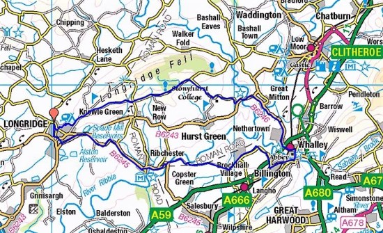
Compare with the modern map.

Over the years, thanks to intrepid walkers, a path developed along the ridge from the trig point all the way to Kemple End where the fell drops steeply to the Hodder. This was mainly in the new forest planting and could be very muddy in the winter. Mountain Bikers started using the forestry tracks and signage eventually appeared on the public right of ways. Old walls started to crumble but were still good orientation points. It has now become a popular walking and cycling destination. But come full circle and some areas are being harvested and the devastation that that brings can often wipe out the unofficial paths that had developed. On top of that recent storms have brought down many trees and affected paths can be difficult or impossible to follow. Clearance is for some reason slow paced.
My planned walk today would complete a trilogy of routes up Longridge Fell, from the West, South and now East. I would be walking some of those ‘unofficial’ paths and encountering both forestry and storm damage.
From the rough parking at Kemple End the main forest road traverses the fell, but I want to see how the little path in the trees to the north had survived. Starting on the left, SD 689406, down the road from the parking. The path looks well-used and the few trees that had blown down seem to have been cleared, all very promising. Buzzards circle overhead and blue butterflies flit around my feet. There is not much breeze although most of the time I’m in the shade. Steady progress uphill. At the first junction I know I could go left and regain the main forest road, but I go right to keep to the ridge. The path narrows and is enclosed in the trees, I recognise familiar landmarks. Before long though it comes up against some forestry work from a couple of years ago, a large area of felled trees on the northern scarp. People have escaped back left to the forest road. and that’s what I do. After 200 m on that road I spot an orange arrow on a tree at the edge of the destruction, is this a way back to the original path? After some haphazard wandering through orange dotted trees I give up and escape into the felled area onto a track of sorts used by logging vehicles. It leads me in the right direction westwards close to where the old path ran and if people use it will become an established way. Somewhere at the end where it joins with a forest road, more felling here, used to be a viewpoint (Sam’s View, I never found out who Sam was) but with new growth on the scarp it is no more. All in all a right mess. The latest OS map no longer tells the truth.

A good start.

Pushing on.

The old way through the trees on the ridge…

…soon disappeared in forestry devastation.

New trees have already been planted.

Orange hope?

Sam’s view?
I don’t feel like tackling the still obstructed way up to the trig point so simply follow an established path down to the forest road. I turn left and saunter back down to the car with the bulk of Pendle ahead.

No farther.

Escape path.

The main road.

Proud Pendle.
Last year there was a good crop of orchids along here but nothing to show at present. The Bird’s Foot Trefoil, Mouse-ear Hawkweed and ‘Fox and Cubs’ are all flowering. What delightful traditional countryside names.


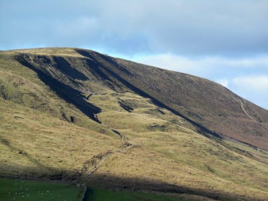
You may wonder why I’ve not yet included a route onto the fell from the north, well have a look at those contours. Longridge Fell is a ‘cuesta’ with a steep escarpment to the north and a gentle slope to the south. I have come up from the north many times but any ascent at the moment would be punishing in the heat. I will leave it to you to plan your own way up those footpaths from the Chipping side.
I fear for the fells as we have had no rain for weeks. One careless cigarette or a disposable barbecue, the weapon of choice for moorland fires, and we will be loosing a valuable habitat once more. Go careful out there.
***


Latest ESRI.


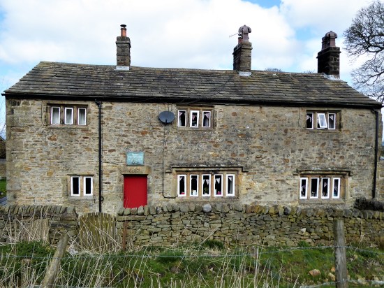


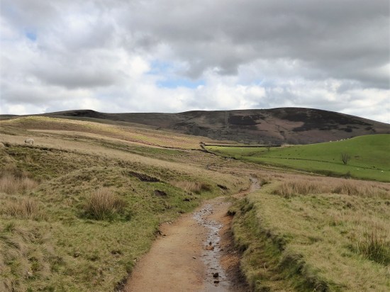


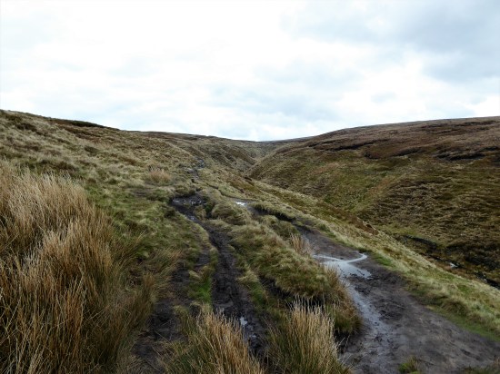


 A new path has been fashioned from the top of the Barley steps to the trig point. I must admit it blends as well as possible into the plateau and must save a lot of erosion. There is also a new stone shelter built into the nearby wall. Once through the wall as if by magic everybody disappears, and I have the whole of Pendle Moor to myself. There is no wind today, so it is almost perfect silence apart from all those soaring skylarks.


 I couldn’t resist a decent hill day as the weather remained fine. All change next week. ‘Head east old man’ was my mantra as I sped along the M65. Everyone else was going west to Blackpool or the Lakes. Boulsworth Hill my objective. So far so good, but the last chapter of Mark Sutcliffe’s Lancashire Cicerone guide would have had me parking above Wycoller. If there ever was a honeypot then Wycoller deserves that title. A secluded village of agricultural and hand loom workers in the C16th to C18th. Along came power looms in the C19th in nearby Lancashire towns and the population moved out. By 1896 the majority of people had moved away from the village, and it was virtually deserted. But a renaissance occurred in the mid C20th, the area was incorporated into a Country Park and people started moving back into the village renovating the properties. I well remember Longridge acquaintances of mine telling me of their plans for one of the houses in the 70s. I suspect you would have needed a bottomless purse to go ahead. For more information look at


 A good start to the day, although by now it was after noon. The expected crowds were milling around in the hamlet. Crossing and recrossing the series of


 I knew that the next section around the north side of the forest would be hard going. I aim for a pile of stones, marked as ‘The Wife’ on some maps.


 I’m soon off the fell and on a lane past Scriddles Farm. Don’t know the derivation, but we have had some lovely S’s today – Simpshey, Shivering and Scriddles.
 The next mile or so was not the best, unmarked paths and crumbling stiles. To make matters worse the afternoon light was rapidly deteriorating. I followed this way in reverse a while back with Sir Hugh and The Rockman, we struggled


 I
I


 At the next farm I weave through a complicated series of gates in their garden. Enquiring of a lady, to confirm my way, that few people walk through here – she says “most get lost”. I doubt the irony strikes her. Again a few yellow arrows wouldn’t go amiss. At last, I’m free and walk down a lane to another farm, Whitemoor Bottom. The guide says take the footpath on the right, but there is no obvious way – I strike boldly through the farmyard and onwards down the fields. This is horsey country and barriers keep appearing, is it this side of the wires or the other? Determination sees me through, and I drop into a wooded gully with little sign of others coming this way. But I’m on course and eventually come out onto a lane at Holly Bush Farm. Sand Hall, which looks as though it should be listed, is passed, and the lane takes me to Foulridge Reservoir.


 We are at the start of another heat wave, being out in the sun for long is energy sapping. But it is Tuesday when Rod and Dave go climbing, they have sensibly decided upon the shady Witches Quarry. I tag along.