Tag Archives: Pilgrimage

PILGRIM’S PROGRESS. MILLS, RAILS AND COBBLES.

Day 4.  Accrington – Haslingden.

I completed this short walk a week or so ago but didn’t get a chance to record it before being carted off to the hospital. I have left it till now to maintain the sequence of my ‘pilgrimage’ to Manchester or even Lichfield.

Leaving Accrington bus station, I end up in the Town Square area: municipal buildings, banks and churches from the Victorian era. Faded grandeur comes to mind.

I search for St James’ Church, founded on this site in 1546. The present building dates back to 1763 and is showing its age, but services are still taking place. Inside are memorials to the Peel family and 11th Battalion East Lancashire Regiment, better known as the Accrington Pals. 

Nearby Cannon Street Baptist Church has been converted into luxury apartments. And looks very smart. The centre of Accrington would be worth further exploration.

I strike out past the Tesco store, past the skate park and pick up a Cycleway 6 sign. Hynburn Greenway.

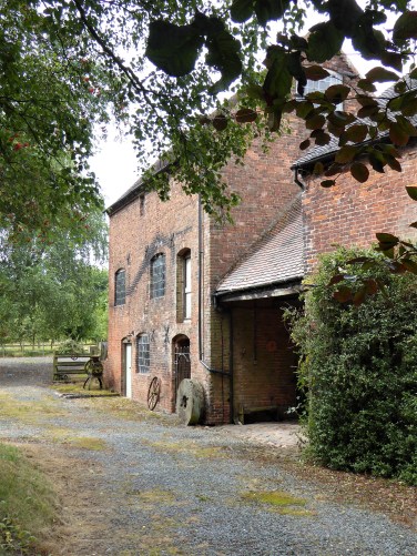
Hereabouts is the Ashton Frost Cog Wheel from the steam engine of Primrose Mill in nearby Church. The mill was built in 1884 and was capable of driving 400 Lancashire Looms. Demolished in the 80s. Scaitcliffe Mill was built in the 1850s as a cotton mill and later became Platt Brothers manufacturing looms.  All that was left was the canteen, now the offices of Hynburn Borough Council.

Across the way is the building of Globe Mill, a rival works manufacturing machinery for the Lancashire textile industry, 1853 – 1993, at its height employing 6000 people. Now a conference centre.

We are in the centre of Lancashire’s Industrial Revolution here. At one time, wall-to-wall mills and even a coalmine, right under the centre of Accy.

The cycleway goes alongside Platts Lodge between tall red metal columns. I now find these were the supports for a railway bridge. The lodge was built before 1848 when the Lancashire and Yorkshire Railway arrived from Bury, hence the surviving bridge columns over the water. The lodge served several industries in the vicinity but is now a nature reserve, even if it is a little neglected. Mill buildings across the way are a further reminder of the industrial past.

Looking back at town centre flats.

Before leaving the urban environment, another mill site, Victoria Mill, is passed through, the obvious weaving sheds displaying their roof lights.

This is what the whole area looked like on a 1900 map.

National Library of Scotland.

Now, on the Hynburn Greenway, the old rail line stretches slowly up a 1 in 40  incline from Accrington towards Baxenden—a good example of a reclaimed cycle/footpath. One soon forgets the busy town.

Down to the right is the Priestly Clough; the woodland here is ancient, from at least AD1600. At Shoe Mill Bridge, there used to be a five-arched bridge carrying the railway over the stream and a very tall mill chimney.

At Baxenden, the railway walk runs out, and a diversion through more old cotton mills, now used as a scrap yard, takes one across the road almost next to the famous Holland’s Pies factory.

Now, high on Back Lane, I have better views of the open countryside and distant moors. Was this the original byway before the Turnpike Road and industries arrived in the valley bottom? A stone trough gives some antiquity. There is Holland’s Pies in the valley.

 As I drop into Rising Bridge, there are terraced houses heading steeply down to the main road where there had been cotton mills. Note the cobbled streets; to be accurate, these are ‘setts’. Rectangular and often made from hard-wearing granite. Cobbles were rounded and taken from rivers.

Up a side street, I find a bench for lunch before going under the A56. A nearby carved wooden ‘Once upon a time’  chair is dedicated to a baby’s death.

Sometimes, it’s the smallest stories that are most beautiful, the smallest footprints that make the biggest impact and the tiniest of hearts that create an eternity of love.

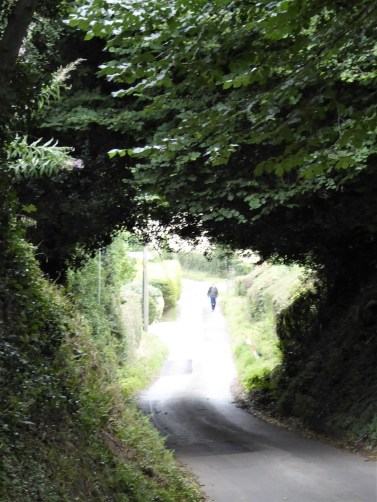
Now, back on a small lane. The traffic on that roundabout looks horrendous; this is when you are glad to be on foot.

I fall into step with a local walker; he is interested in my route. If I had known, he said, I could have used a slightly higher route, which would have taken me past The Halo Panopticon statue.

The road climbs steadily out of Rising Bridge with isolated rows of cottages at its side. When looking at the old maps, you realise there had once been collieries and mills all around, which explains their existence. Some may have been handloomers. Everything is on a slant along here. The road is named The King’s Highway on those maps.

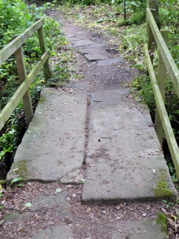
Stone setts are just below the surface.

I come across The Griffin Inn, the headquarters for Rossendale Brewery; I can’t go past without sampling their pale ale, appropriately named Halo. That’s Haslingden Moor across the way.

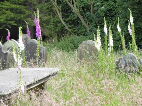
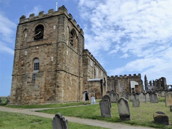
A distinctive feature on the hillside as one drives down the A56 past Haslingden is the squat church of St. James. This is to be my final destination for today. Little ginnels lead me into the churchyard. The church is closed.  Not a place to be on a misty night, the abandoned gravestones and memorials give it a ghostly atmosphere.


Here is an extract from the church’s history:-

Our building is, reputedly, the highest church above sea level in the country. The first recorded mention of Haslingden Church was in 1284 when it was one of the seven chapels in the Parish of Whalley….in 1296, the Tithes value of the Glebe was six pounds per year, and in 1535, the value of the living was put down in the King’s Book as seventeen pounds, eight shillings and threepence.

Between 1550 and 1574, the church was rebuilt in the perpendicular or Tudor style.

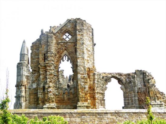
Disaster struck after a long period of burying within the church, so the building became unstable and eventually fell.   The church remained a ruin until the middle of 1773 when money was collected and rebuilding began. During the reconstruction, marriages, baptisms, and burials were solemnised in the old tower, which remained standing.

The third church on the site was completed in 1780 at a cost of one thousand, four hundred and fifty pounds and in 1827, the Tudor tower was demolished, costing seven pounds, and the present one erected at a cost of nine hundred pounds and the gallery was added in 1878.

The present bells were cast in 1830, and the clock was purchased through a public subscription in 1831.

The oldest gravestone is dated 1629. They give a fascinating history; life was perilous back then.

A sombre end to the day.

Haslingden in the late 1800’s – look at all those mills.

I catch a bus back to Accrington and look forward to my next section, which strikes out across the open moors away from the industrial past.

***

PILGRIM’S PROGRESS. WHALLEY TO ACCRINGTON.

Day 3.  Mainly Hynburn.

I managed to obtain a copy of ‘The Pilgrims’ Way from Whalley to Lichfield’ from the Holcombe Moor Heritage Group. (hmhg_chair@btinternet.com)  So, it goes further than Manchester, my original destination. That should give me plenty of walking opportunities this year. The booklet gives detailed directions for the stretch to Manchester, which I am walking at present, and then just outlines suggestions for an onward journey to Lichfield. Plenty of scope for researching and planning.

But first, let’s get to Manchester.

*

I don’t have time for the church; I’ll start there next time” That was the last entry in my pilgrimage route as I reached Whalley and visited the Abbey. And I have little time to spare today as I am late setting off on this next section. I have relied on some previous photos to illustrate the church’s exterior and interior.

The Church of St Mary and All Saints is an active parish church in the Diocese of Blackburn. A church probably existed on the site in Anglo-Saxon times, and the current building dates from the 13th century.

C15th Perpendicular East window with C19th glass.


The south door, with C11th Norman Pillars, incorporated.

There are three well-preserved C10th to C11th Anglo-Saxon crosses in the churchyard, which must have had some significance to the travelling monks.

*

The day had started badly; I arose unrested after an interrupted night. I was in two minds about whether to set off, what with my left hand pretty useless and my dreary state. I eventually decided to give it a go. Last week’s walks with friends had bolstered my confidence. I thank them all.

I go for the 9.58 bus, only to find it has left at 9.48, the correct time. Back home, I procrastinate, but with the day and my mood brightening, I eventually decide on the 10.48 to Whalley.

Whalley and its Nab.


That viaduct.

Whalley Nab has to be climbed. I follow the ancient Monks’ trod, which JD and I had descended a few weeks ago on our Hynburn Clog walk. It is much harder in this direction. I usually walk with a pair of poles, but for now, I can only grasp one, so that will have to do. It helps steady me, but I miss the rhythm of two. I want to report on cobbles worn smooth by packhorses over the centuries, but the way is still covered in autumn leaves.

At the top, I pass the cluster of properties, all now very desirable, but how did they fair in that mini winter we endured last month?

I realise I don’t think I have ever been to the true summit of Whalley Nab. Is it on private property?

Onwards on familiar paths, over one ancient broken clapper bridge and the next restored with concrete slabs.

The terrain is undulating! I flirt with the River Calder.

All beautiful green countryside. Unusually for walking in this area, Pendle Hill is not so prominent; it is a hazy Great Hameldon, up above Accrington, I am focused on.

I vaguely remember coming through that scout camp, but  I do not know when or why. Now, I am in new fields skirting Squires Farm and suddenly into the park on the edge of Great Hardwood.

There is a well-positioned War Memorial in the park. I can’t count the number of names lost in WW1.

On a more personal note.

St Bartholomew’s Church has a funeral in progress, so I don’t intrude. The tower of the present building probably dates from the 15th century. Most of the rest of the church is from the 16th century.  In 1880, the Lancaster architects Paley and Austin renovated the church with more additions.

Typical Lancashire terraced houses line the route into town. One terrace has been taken over by a care home association.

What can I say about Great Harwood?  Years ago, I used to know a lady who lived here, and it seemed a pleasant working-class town. Now, there doesn’t seem to be a shop of any value if you don’t need your nails painted, hair cut, or your vapes replenished. There is not a cafe or convenience store in sight. Maybe I am on the wrong street. Perhaps I am being harsh; if you live there, sorry and tell me otherwise. 

The first line of John Bunyon’s ‘The Pilgrims Progress’  – As I walked through the wilderness of this world,

I leave as I entered. I do love terraced housing.

Past the cemetery, there is a rural stretch of walking on an old railway, The Great Harwood Loop. Dr. Beeching was no fan of branch lines by 1963. I found this interesting read on the history of the line and the surrounding industries. http://www.disused-stations.org.uk/features/north_lancs_loop_line/index.shtml

The Leeds-Liverpool canal on a familiar towpath to Rishton.

When we came this way on the Canal Trod in January, the bridge cafe was closed – or was it? Today, I could see from the towpath that there was no sign of life in the cafe at street level above. I am not fussed about going up into Rishton to the friendly cafe we visited last time. I carry on, but once under the bridge, I think that the cafe may be open canalside. I push at an unmarked door and enter a den of iniquity. All heads are turned to the stranger. This is darkest Lancashire. Locals huddled over mugs of tea and scones in front of a roaring wood burner. I just about decipher the owner’s welcome and rather hurriedly order an instant coffee. During the time I spend in this hidden cavern, I glean a fair amount of local gossip from the ladies, possibly some of which would be helpful to the local police.  The blokes are of the silent type. I take a furtive photo.
Soon, after crossing the motorway on the Dunkenhalgh Aqueduct, I am approaching Church, a satellite of Accy. See how I have slipped into the local dialect there.

The origins of the Parish Church of St. James, Church Kirk, can be traced back as far as the seventh century. The tower of the present church is thought to date from the 13th century. The building is a sorry sight, with services long since abandoned and notices proclaiming a conversion to upmarket accommodation—a fate of many churches. I was hoping the churches would be the highlights of my journey, but this is disappointing.

Life around here hasn’t changed much in the last century for some. I see my first lambs of the year, always a joyous occasion…… and then I am immersed in industrial squalor along the canal.

The only glimmer of hope is a solitary fisherman intent on hooking the resident pike.

The last mile into Accrington, again on an old railway line,  was slightly nervy with lots of hooded characters frequenting the area. One prejudges the situation. I arrive into the centre of town without being mugged.

Tescos seems to dominate the scene, built alongside the railway line. 

St. James Church is nearby but my bus is due in a few minutes from the modern bus station for a journey through unknown surroundings to Blackburn. Another modern bus station, right in the centre of town. I have time to delve into the thriving market hall to buy some samosas for supper. The onward journey home is much more rural.

Accrington bus station.

Blackburn bus station.

Blackburn market.

I’m pleased with my eight solo miles, using only my right hand for support. As a walk, it has plenty of variety, and as a pilgrimage, it gives ample opportunity to reflect upon both our Christian and Industrial heritages. Closed shops, crumbling mills and graffiti reflect the issues confronting our modern society.

A LOCAL RAMBLE.

What a beautiful day again. It was a frosty start but full sun, blue skies and no wind.  Perfect for a walk. Again, I’m in luck. I have a phone call from a friend, C, suggesting coffee and maybe a walk. She knows of my predicament.

My ‘pilgrimage’ to Manchester is on hold; I would probably have been there by now, given the settled weather. But I’m delighted to be able to get out; my left hand is still useless, so I feel safer with the company.

After a coffee and a catchup, we set off on some of the lanes in Thornley.

Ferrari’s Country Inn has been in the same family for years but has recently been sold to Elle R Leisure, which owns other hotels and dining venues in the NW. Originally named Blackmoss House, it was built by the Earl of Derby in 1830 and was previously used as a shooting lodge. It was part of the Derby Estates until the late 1970s when it was taken over by the Ferrari family and transformed into a wedding venue. The new owners will name it Longridge House, which I think is a bit tame and has no real connectivity. Why not Blackmoss House or Hotel?

Today, there is much building activity in progress. It looks like an extension into the garden may be planned—lots of rubble, skips full of redundant goods, and burning mattresses. We poke into the skips and find whole dinner sets of white crockery. What a waste when they could have gone to charity. We speak to the friendly foreman who says we can help ourselves to whatever. (I just had a message from C to say that a carload is already on the way to the charity shops)

We walk on away from the acrid smoke. Across the fields, more massive ‘agricultural’ buildings have appeared. There is speculation about their use; a red glow surrounds them at night! The plot thickens.

Friends live in a cottage on the ridge above; we can see his house from here. I’ll have to ask them for information. I need to visit them sometime, possibly to acquire another couple of kittens. Here is the collection from a week ago.
The fields around Blackmoss are studded with molehills; some look ginormous.

On the road, we cross Gill Bridge over the infant Loud. We discuss the strange watershed hereabouts, which has the Loud flowing eastwards away from the coast to join the Hodder, which loops all the way around Longridge Fell to join the Ribble before reaching the coast. Meanwhile, streams just to the west, Sparling Brook and Westfield Brook, flow directly to the Wyre and out to sea, a much shorter and direct route.

In geological history, the Hodder did not flow eastward around Longridge Fell to join the River Ribble but instead ran westward along the Loud Valley from Doeford Bridge to the Derby Arms north of Longridge, continuing south-westward through Halfpenny Lane on the west side of Longridge to join either Blundell Brook past Broughton church and Woodplumpton to join the River Wyre, or else Savick Brook through Fulwood to join the River Ribble  (Wikishire)

No explanation for this is given. I have read somewhere that glacial deposits blocked the Hodder in a previous ice age, creating the watershed and the present flow of water. The other is that the earth’s crust buckled or tilted to create the division.

Taking to the fields, we head back. Going in the opposite direction to my usual sorties, my navigation is not up to scratch. Along here somewhere, we lose contact with C’s dog, causing some consternation for a while. Of course, she comes bounding back as though nothing had happened. Safely on the lead now through the farm, along Clay Lane and onto the roadside pavement.

Longridge Fell, looming above.

We part company at Mile Lane, which I follow up into the park.

I want to see a new tree planting here. Here is the idea.

Longridge Environment Group

We are delighted to share that Longridge is about to join a small number of pioneering towns and villages across Britain with a micro-wood, or Miyawaki micro forest, at John Smith’s Playing Field. Led by Lancashire County Council’s Treescapes initiative, experts in this approach to ecology, and supported by Longridge Environment Group.

 A miniature woodland, about the size of a tennis court, which is planted with native trees at ultra-high density on a specially prepared plot. To protect the tiny young trees from damage by deer and other browsing animals, the plot is ringfenced by chestnut paling.
Woodland soils have a fundamentally different character from those in grasslands. When trees are planted directly into grassland soils, they often have a higher failure (death) rate than those planted in woodlands. While most survive, they’re vulnerable to disease and drought stress and grow very slowly, as they expend so much energy on simply staying alive and healthy.
In a micro-wood, the trees are planted into a specially prepared plot, where the ground has been modified to create conditions much better suited to young trees. First, the turf is inverted, burying the vigorous grass and competing for nutrients with the trees. Then, the ground is cultivated to loosen the soil. This opens up air pockets, allowing water to percolate through the root zone, trapping warmth and allowing the roots to grow without forcing their way through cold, compacted soil. We then add about ten tonnes of organic matter, usually spent mushroom compost or well-rotted manure, topped off with about the same quantity of bark mulch. As well as fertilising the trees, this provides an instant home to the fungi, microbes and invertebrates that form the rich ecosystem supporting the trees. The mulch will also seal in water, be invaluable in hot, dry spells, and suppress competitive weeds, replicating the effect of leaf litter on a woodland floor.
When we plant the trees, we first dip them in a gloop infused with mycorrhizal fungi, enabling them to tap into soil nutrients more efficiently. The soil now resembles that of a woodland rather than a field. Conventional tree planting is carried out at a much lower density. However, when woodlands form naturally, the trees often grow at very high density. The trees that thrive initially aren’t usually the ones that create the mature woodland canopy. Species such as rowan, birch and hawthorn often grow much more vigorously than oaks in the first few years. These “pioneer” species act as a nurse crop for the trees that will later form the “climax” canopy of the mature woodland. The species mix for Longridge’s microwood includes pioneer and climax species and the small trees and shrubs forming the underwood of trees growing below the canopy.
 We follow the theory of potential natural vegetation, devised by Prof Akira Miyawaki, who advised this woodland creation technique in Japan in the 1970s. In a nutshell, we plant the assemblage of trees in the correct proportions that we think would grow on a site, with a few compromises if natural processes were allowed to take hold. We don’t plant sycamore because it will get there anyway, and we don’t plant ash or elm because of the diseases they’re suffering from.
Once the roots have become acclimatised, the trees will proliferate from late spring. Expect rowan, elder and other pioneer species to get going first. The odd one may put on over 1.5m in the first growing season. Some trees may even produce flowers and fruit in year one. The trees will form a dense thicket within two or three years. This will provide a home to vast numbers of insects and other invertebrates. These animals are the larder newly hatched songbirds, bats, hedgehogs, frogs, toads and newts. In time, a pair or two of breeding songbirds may nest there, and amphibians will find it a safe and sheltered place to hibernate.
 
They haven’t planted any trees yet, but the site looks tidy and prepared with mulch and bark. I’m not sure the fence is high enough to keep out deer. it will be interesting to see how this project develops.
 
My next port of call is JD’s house. Again, more coffee and catchup.
He accompanies me back, taking me through the new housing estate, which is far more extensive than seen from the road. Parts of it are quite attractive, with great views across to the Bowland Hills – for now. There seems to be an adequate number of ‘affordable’ properties, some of them bungalows suitable for the elderly.

We part company at Sainsbury’s, and I return home after a decent and interesting ramble. It’s not been easy taking pictures on my phone one-handed.
 
I dine on soup from the freezer for the third night running. convenient and wholesome.

YOU DON’T NEED YOUR HAND TO WALK.

It’s not as simple as that. You have to tie laces, do zips and put on gloves. Even while in the hospital, I was planning ways to complete my ‘pilgrimage’ to Manchester while we have this good spell of weather. I was being over-optimistic, my sons warned me. I countered with examples of how paraplegics, far worse than me, compete in the Olympic Games. However, I could see that problems could arise if I was alone and needed to carry out some of the above actions quickly.

A chance phone call to a colleague, who had also, by chance, been trying to get hold of me to arrange a walk with friends. When I explained that I had just come out of hospital with a nonfunctioning hand, he suggested maybe some other time. But this was the chance I was looking for – a walk with people who could help in the unlikely scenario of me needing assistance.

“Pick me up in the morning.” was my response.

This morning, I spent half an hour lacing up my boots in readiness. There were four of us taking a simple walk on Longridge Fell tracks. I was in my element, being out and about again. As I said, I felt like a fraud being in the hospital, and now I could pace out as well as the next man.

We have known each other for 50 years, and the banter between us was of the ‘Last of the Summer Wine’ variety.

Our loop of the fell roads was non-eventful until we tried to connect with a path down to the road, which I had previously used in the opposite direction less than a month ago. I confidently directed us down a likely looking narrow path. It turned out to be the wrong one—mea culpa.

So we had a longer walk along the road than necessary, but no problem.

I didn’t take my camera out with me because I couldn’t operate it. I struggled to get these two photos on my phone.

The day ended pleasantly in I’s kitchen with soup, delicious homemade bread and a selection of cheeses.  That’s what friends are for.

A PAUSE IN MY PEREGRINATIONS.

There is a happy ending to this story.

 I’m gazing out at the night sky from my room on the 4th floor of The Royal Preston Hospital.

With all this dry weather, you may expect me to be discussing further progress on my Pilgrim’s Way from Longridge to Manchester. That had been the plan.  I walked a little further at the end of the week, but I didn’t get a chance to write it up.

I awoke the following day to find I couldn’t move my left hand and wrist. Initially, I thought I had just slept badly on it, but after half an hour, I still couldn’t use it. Some anxiety set in that I may be having a stroke. My first inclination was to phone my son to take me to casualty, not an inviting thought. I remembered some recent NHS adverts detailing the first signs of a stroke and the importance of getting to the hospital as soon as possible. So I phoned NHS 111. After a bit of faffing, when the call handler couldn’t find my address, things went smoothly, and she immediately organised an emergency ambulance.

I only had time to grab a few clothes and medications before the sirens announced the ambulance’s arrival. They were brilliant and succinct in their history-taking, examination and assessment. Blood sugars, blood oxygen, ECGs and an intravenous line inserted. I was loaded into the ambulance for a quick blue-light journey. All I could hear was the siren sounding at various bottlenecks whose locations I tried to visualise. 12 minutes door to door.

Straight into the stroke reception unit (there were over 100 waiting next door in casualty) and their friendly nurses, soon seen by a doctor of unknown rank and sent for a brain  CCT scan down the corridor. Then, on the trolley, down a corridor that looked like a war zone, into the lift and up to a space in the ward, all within an hour from my house.

By now, I was attached to a heart monitor and an IV infusion drip. From then on, I lost track of where and when. The ‘stroke’ doctor examined me and looked puzzled. He would get his consultant to see me. Nil by mouth was the sign above my head. I just lay there, not wanting to bother my family unduly.

It seemed ages before the consultant arrived. He thought I probably hadn’t had a stroke, but more likely radial nerve damage to my arm. I would need an MRI scan of my brain and neck in the morning to clarify the situation. He ordered a cake and a glass of water from the ward to prove I could swallow without choking—a practical physician. Down came the drip, and I was moved to a smaller room, now not needing constant observation.

Time goes slowly. They find me some food for supper. Son C only lives half a mile from the hospital and arrives to check on me. And importantly, with a newspaper for my evening’s entertainment. I fumbled with the pages one-handed to get to the crosswords.

The usual frequent blood pressure, pulse, temperature, and blood sugar checks continued through the night—a succession of different nurses, all very professional, tending to me. I was beginning to feel like a fraud for occupying a bed when I was obviously not ill.

Day two dawned as I watched the sun rise over those East Lancashire hills I should have been walking in. What a view it was from up here. Stretching from the Pennines, Winter Hill, over the city’s landmarks: Deepdale Stadium, home of Preston North End FC, the skyscrapers, St. Walberg soaring steeple, Tulketh Mill, to the Fylde coast and Blackpool tower. Even the Welsh Hills could be made out in the background. What a great day to be on top of a fell or in a south-facing hospital ward four floors up. I used my nose to press take on my mobile against the window.

This is how it would have looked 100 years ago.

Speech therapists, physiotherapists and occupational therapists all visited without doing anything. But when was the trip for my MRI scan? I don’t think I saw a doctor. My son M and grandson S made the journey from Manchester, loaded with drinks, snacks, books, and papers, which are much appreciated. Of course, while they were visiting, a porter appeared to take me for my scan at about 4 pm. He insisted I use the wheelchair even though I am perfectly capable of walking. This is my fourth MRI scan in the last 6 months, so I’m becoming an expert. Even so, towards the end of the half-hour session, I developed an irritating tickle in my throat, which I only just managed to control without moving.

When I am wheeled back to my room an hour later, I find M and S tucking into snacks they had bought from the hospital shop. Their choices looked most unhealthy. Considering our nation’s rate of obesity, should a hospital be selling these products, they have banned smoking. Interestingly, my meals during my stay were fine, but again, there was too much emphasis on processed sugary foods.

Day 3 dawned sunny and bright; oh, how I wish I was out walking. But with a bit of luck, I would be discharged. After three days as an inpatient, somebody came to check on my regular medication, which I had smuggled in. Apparently, they should have been under lock and key; anyhow, the locked drawer on my bedside table was broken, so they remained in their plastic bag. 

My room was cleaned, I had a morning coffee, and I was offered towels for a shower. An exciting morning. At least I managed to read one of the books Grandson S brought me.   L’Étranger by Albert Camus. I remember reading it, in the original French version, back in the ’60s at university. I did those sorts of things then. It is easy and classic to read but challenging to understand without a background in existentialism.

Finally, the consultant appeared and confirmed his diagnosis of radial nerve damage. I would need further nerve conduction studies and physiotherapy as an outpatient. But I could be discharged after I was fitted with a wrist splint. Lunch was served. I packed my bags and put son C on red alert for my escape.

Things are not as simple in the NHS as nowadays. The physiotherapist and his student turned up and reassessed my problem. “We will get you a splint as soon as possible.” Would that mean another night in the hospital?  True to his word, he reappeared with the appropriate splints and promised to tell the ward nurse I could be discharged. He came back a little later to ask for a favour. His student had only recently arrived at UCLAN to commence a physiotherapy course and was rather shy at communicating with patients as yet. Would I be happy to talk to her for a while? Of course. So I had a lovely, broad, raging conversation with her for twenty minutes or more. Aged just 18, she had travelled a week ago to England from Dubai to start her vocational training. Her English, and her understanding of its subtleties, was excellent. She has already come up against the Scouse accent and conquered it; wait till she has a Glaswegian patient.  I probably gained as much from the conversation as she did.

It was getting late when the porter came to take me, wheelchair bound to the discharge ward. I’m not allowed to walk. Thankfully, I don’t have to wait for medication; I am free to go.

I told you the story had a happy ending.

I have nothing but praise for the treatment I received from beginning to end. There are niggles that shouldn’t be there, but the staff, many working 12-hour shifts, are holding the NHS together. They deserve our utmost support and whatever pay rise that they come by. Would you work 12 hours for the minimum wage under these stressful conditions?

Now, at home, I’m learning how to pull my trousers up and put on a shirt one-handed. Taking the tops of jars is a challenge. Thank heavens for microwave ovens and air fryers.

I’ll be back on the trail before you know it.

PILGRIM’S PROGRESS. ONWARDS TO WHALLEY.

Day 2. Ribchester to Whalley.

I have time to look around Ribchester before setting off on my walk this morning. I spoke about its mill heritage last time, and today, I alight from the bus next to Bee Mill and its repurposed sheds.

Before the cotton mills arrived, in common with many areas of East Lancashire,  the village was a centre for handloom weaving. The cottages of Church Street opposite the White Bull are a row of Weavers’ cottages noteworthy for their unusual configuration of windows. Built for the handloom weavers, they have three levels with a single window at the uppermost. Although it is commonly believed that the window in the top level is to illuminate the looms, this may not be the case as the weaving would probably have been carried out in the lowest part of the house because of the size of the loom and the need for damp conditions to keep the cotton flexible.

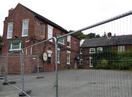
I pass both the pubs in the centre. I even have time for a quick look at the Roman Baths. It’s time to get moving. I follow the road eastwards out of the village, as taken by the Ribble Way. The pavement is narrow, and the road is busy, which is unpleasant. A true Pilgrim would follow the lane to visit the Norman church at Stydd with its medieval cross base.   https://lancashirepast.com/2014/07/05/the-knights-hospitallers-stydd-church-near-ribchester/

I have been that way many times, and I know the field paths onward to Ribchester Bridge are particularly muddy. This area was flooded two weeks ago, so I continue along the road to the bridge. A recent crash has damaged the parapet, dislodging stones into the Ribble; a crane is being set up to try and recover them. The bridge was built in 1789. 

I chose to walk the minor road to Salesbury Hall and then by the river to Dinkley Bridge. An alternative would be to keep on the north bank, but that path can be quite awkward. The two make a popular circuit from Hurst Green. I march past the grand gates of Lancashire Show Ground…

… and onto Salesbury Hall. A chapel existed on this site from medieval times, and slowly, a hall and estate developed around it. The original Old Hall was pulled down in 1883, and a large mansion was built on its site. Whenever I passed, it always reminded me of a French Chateau.

This hall was recently demolished, and a large modern mansion was built in 2005. Planning permission was also granted to convert the neighbouring farm complex into a rural office park—money talks.

I leave the road to enter Marle Woods. I pull out the trekking poles to negotiate the slippery terrain between tree roots. Here is Sale Wheel, the origin for Salesbury. Today, the Ribble is calm as it pours through the narrow rocky divide and spreads out in the ‘wheel’ before trundling on to Ribchester.

The footpath is slowly eroding away, a combination of footfall and floods.

The walk through the fields alongside the Ribble is a delight. More people are met, many doing the circuit I mentioned. We are all in a good mood with the winter sunshine. The new bridge is shining bright.

I catch a glance of the old Dinckley Hall before climbing up the road away from the river.

Branching off to Aspinalls. I find a seat for a break and a snack. The owners come along. It was their Mother’s seat, but I am welcome to use it. From here, I look across to Whalley Nab, with its pylon. The route goes up there next time.

Fields lead on before a drop to Dinckley Brook and ahead a holiday park. Static caravans are unexpected here in the Ribble Valley.

The path comes out at the Black Bull pub. More importantly, it is next to old St Leonard’s Church. I’ve been here many times; you can get the key to the church from the pub. Today, I look around the outside for evidence that it was built in 1557 using material from the dissolution of Whalley Abbey.

Beyond the church’s graveyard is another burial site – a large field dedicated to the lives lost in the adjacent Brockhall Hospital, a large Mental Institution in the old-fashioned sense. One of the largest mental institutions in Europe, housing 3,500 patients in 42 acres of grounds. A poignant memorial to the mainly unmarked graves of hundreds of residents. A Gerald Hitman bought the Brockholes site after the hospital closed and developed it as a gated housing estate. He and his son are buried there.  For a more detailed reading on the hospital and its cemetery  https://www.calderstones-cemetery.co.uk/brockhall-hospital-cemetery/

I do a little road walking, with Pendle ahead as usual, before fields across to Lower Elker where dogs come rushing at me. Fortunately, the lady farmer calls them off and has a pleasant chat with me about all things sheep.

The best and safest way to cross the busy A59 is by the bridge leading to Billington.

Whalley comes into view with the railway viaduct centrefold.

The public Right of Way towards the viaduct is blocked by a construction site with no explanation. They seem to be building everywhere in Whalley.

I am dwarfed by the railway viaduct – 600 yards long, 70 feet tall, 48 arches and over 6 million bricks, red and blue. There is a metal footbridge over the River Calder alongside the viaduct, Old Sol’s Bridge, originally serving a cotton mill on the south side of the river. It was built in 1993 to replace one built in 1909 and is named after Solomon Longworth, owner of Walmsley Mill, who donated the original bridge. Nearby is Longworth Street, formerly Factory Street,  built for the workers at the mill.

Once across, I head under the viaduct and enter the village through the original C13th gateway to Whalley Abbey.

The gardens are open, so I go through the next, C19th, gateway to look around.

The pay booth is closed, but a sign says to scan the QR code to pay; I cannot do that, so I walk about for free, which is what I expect the other visitors are doing.

The Abbey was a large Cistercian abbey founded in 1296 and dissolved in 1536 when it was largely demolished. Subsequently, a country house was built on the site for the  Assheton family. This, after many modifications over the years remains as a retreat and chapel.

Most of the ruins are just outlines of the previous monastic buildings. Some have fared better than others, and one gets a feel for the scale of the place.

My bus is due in a few minutes, so I don’t have time for the Church, I’ll start there next time.


I certainly picked a good day for this walk, with blue skies throughout and excellent views showing the Ribble Valley at its best.

***

THE START OF ANOTHER PILGRIMAGE?

Day 1.  Longridge to Ribchester.

A pilgrimage is best started from one’s doorstep.

As you know, I’m not religious, but I enjoy a walk with a purpose. If that purpose links religious or historical sites with a new countryside, I’m ready for the challenge. In the past, I have completed several ‘pilgrimages’. Possibly the most enjoyable was cycling the Camino from Le Puy en Valay in France to Santiago de Compostela in Spain. But I have enjoyed shorter trips in Britain. St. Cuthbert’s Way, St. Hilda’s Way, The Pilgrims Way, Two Saints Way, Lancashire Monastic Way. The list goes on.

I’ve found another one, recreating a route from Whalley Abbey to Manchester Cathedral courtesy of the Greenmount Village Walking Group.  https://www.westpennineway.org/pilgrims-way-2/

But why not walk from home?

There should be a link-up. I am looking for a direct route to Ribchester before another to Whalley to connect with the above-mentioned Pilgrims Way.

There is a break in the weather after all those storms. It’s clear, but winter is still in the air. I leave at lunchtime and am unsure what held me up;  just remembered it was the Big Garden Birdcount. I live just across from the pub. Perhaps a church would have been a better starting point, but there doesn’t seem to be anything of note in Longridge’s selection. *I take a shortcut up one of our stone terraces. There was a farm here before. I usually manage to get lost in the modern housing estate that follows. The climbing for the day is done by the time I reach the old Quarryman’s Inn, which is blue plaqued, but now an infant nursery. Down Tan Yard, through more quarries, houses new and old with views over our reservoirs and on to Lower Lane. Quitisential Longridge. The road is getting more hazardous to cross at the gated entrance to Higher College Farm. Now, a small industrialised site, but with hopes to develop an entire retail park, which is totally out of character for this rural setting. Their plans have been turned down for now. It would help if they would upgrade the stile for a start.

I’m now in open fields overlooking the Ribble Valley. But first, I need to pass through one of those agricultural graveyards where everything has been saved for the day it could be required – i.e. never. Lower College Farm is, thankfully, bypassed. They have some antique farming or milking implement on display. Any guesses as to what it is?

A brief spell on Hothersall Lane. I could have carried onto the bottom and followed the Ribble to Ribchester. But no, I want to try a Bridleway more directly to Ribchester. It is tarmac to Ox Hey and then muddy fields on unmarked paths; my GPX comes in handy on several occasions. The benefit of this higher way was the extensive views over the Ribble Valley, with Pendle Hill always taking the eye with the ever-changing light playing across its flanks. The Ribble winds its way through Ribchester, and from up here, it can be seen snaking into the distance, where the Hodder and the Calder have joined it. As well as Pendle, I can make out the lower hills of Whalley Nab, where this pilgrimage will take me.

I make a beeline to Parsonage Farm, where the land drops away to the Ribble Valley. I’m looking straight down to Ribchester from up here, and the staggered slanting roof lights of Bee Mill stand out.

This reminds me that Ribchester was once a busy mill village. There were two large cotton mills on either side of the road:  Ribblesdale Mill, with 405 looms, now demolished and replaced by a housing estate and the above-mentioned Bee Mill, 320 looms, the remains used by small industrial and retail units. The latter is also known as Bannisters Mill from the family that has owned it for generations.  When I first moved to the area in the early 70s, it was still operative, and we would buy fabrics from their mill shop. Its chimney was demolished in 2003. Here is an aerial photo from 1950, courtesy of Historic England, of Bee Mill in the foreground and Ribblesdale across the road. 

But I’m getting ahead of myself – I haven’t even reached the village.

My path takes me to the site of Bremetennacum, the Roman fort of which much has been written. https://en.wikipedia.org/wiki/Bremetennacum Nearby metal detectorists are combing a field, presumably legally? I’m heading to St. Wilfrid’s Church, Grade I listed with abundant historical interest. https://en.wikipedia.org/wiki/St_Wilfrid%27s_Church,_Ribchester

I go inside for a proper exploration, they have a good printed guide avaiable. There was a church on this site from the C13th, chapels were subsequentally addded and the tower in the C 15th. Unusully ‘dormer windows’ were constructed in the roof to give more light. Victorian restorations took place in 1881.
I find a few curios.

Dormer windows.


C14th font.

Church Wardens’ box pew.

Triple stone sedilia, for seating the clergy during mass.

C13th double bowled Piscina.

Inscribed box pew.

‘Lepers squint’ opening to the outside.


The Dutton Chapel on the north side contains fragments of a wall painting of Saint Christopher from the 14th or 15th century. At one time church walls would be extensively illustrated but most has been lost over the centuries. 

Modern stained glass, Dutton Chapel – can you spot Pendle?      

Fragments of Medieval glass.   

Carved figure on a column to Dutton Chapel. C14th.


Victorian glass in the Houghton Chapel.

In a niche inside the church I spottted a Scallop shell, someone else has been on a pilgrimage. The scallop shell was traditionaly associated with Pilgrims, especially en route to Santiago de Compostela. Mine, from 2001, is hanging from my bed.
 
In the churchyard there is a prominent sundial. Its original C14th base was for a cross, crosses were prominent on Pilgrim routes as waymarkers and for prayer. 
 
I wander down to the riverside, a picture of calm, and yet only two weeks ago it rose 10feet or more, flooding the lower part of the village, a frequent occurence. There is evidence of its ferrocity in one of the riverside trees. The fisherman across the way casting his favourite spot.

Today’s Journey really was completed at the Church; I wandered up the narrow lane to catch the bus home.

* After a bit more reading, I find that St. Lawrence’s Church on Chapel Hill in Longridge was built as a chapel of ease for St Wilfrid’s, Ribchester, in the early 16th century, So there is a connection, and perhaps I should have started there rather than at the pub.

***


Continue reading

LAST DAY ON THE TWO SAINTS WAY.

Cannock to Lichfield.      7 miles.

  My B&B host gives me a lift back to the Ring Circle Fort, and I’m on my way, downhill to Lichfield.  One was supposed to be able to see the cathedral from up here, but low cloud prevented that. There was good walking up on Gentleshaw Common and then old tracks through woods to come out onto quiet lanes to sleepy Chorley.

Back into the fields I came to Farewell Hall and the Church of St. Bartholomew built on the site of a priory.

For the next two miles I walked along the ancient Cross In Hand Lane, so named from the wooden cross pilgrims would hold as they approached St Chad’s Well. This lane was a joy to walk, in places hewn out between sandstone banks and in others with mature hedges. A scattering of farms were passed along the way, and at the bottom of the last hill a cave reputedly used by Medieval candle sellers to pilgrims.

Medieval cave?

Lichfield was entered alongside the old Pinfold, which has been recently restored.

The house belonging to Erasmus Darwin, the Physician and naturalist and Charle’s grandfather, is now a museum in the shadow of the cathedral. The man himself was looking out of a window. There are many fine houses in Lichfield which is worth a longer visit.

At last the three unique towers of Lichfield Cathedral were seen as I approached the magnificent entrance. A Saxon church was built here to house the bones of St Chad, to be replaced by a Norman Cathedral, the present Gothic structure dates from the 13th and 14th centuries.  One walks down the beautifully vaulted nave, through the chancel and there in front of you is the shrine of St. Chad.

Behind in the Lady Chapel are the famous Herkenrode stained-glass windows rescued from Belgium. St. Chads Head Chapel was closed to the public.

Two relics related to St Chad were on display —  The Lichfield Angel,  a beautiful limestone carving from the chest that contained his bones. The 8th century St. Chad Gospels, from which St Chads cross emblem was derived.

Leaving the Cathedral I notice the statue of St Chad by local sculptor Peter Walker  recently installed in the grounds. He looks a kindly man. The south door is every bit as good as the main one,

I then wander alongside the lake, Stowe Pool originally a 12th century millpond and fishery, to reach St Chad’s Church and Well and my final interpretation board!  When St. Chad arrived in Lichfield, 669, he baptised converts at a local spring and founded a monastery. He was buried here in 672 but his bones moved the Cathedral when it was built in 700. The present day church is mainly from the 14th century with many more recent modifications. Nearby is the Well which has been popular as a pilgrimage place, at one time surrounded by arched walls but now by a simple wooden structure. I’m not sure that the water is very pure.

My journey had come to an end, I have learnt a lot and experienced a good mixture of rural and urban scenery. The route was well thought out in that respect. The churches have been inspiring and whatever your religious views they are beautiful buildings and how well we preserve the past in Britain. The problem of churches being closed occurs anywhere nowadays. The guide book is well written and informative, the instructions are clear. There was no shortage of accommodation (putting my Crewe faux pas aside) or dining possibilities, although Covid precautions are still affecting the latter. As usual, I met relatively few people walking any distance, and only four on The Two Saints Way. I covered 90 miles from Chester to Lichfield, but I have to say I was relieved to know I could now rest my heel for a few days. There has been constant background pain all week, which at times distracted me from my surroundings — I was beginning to feel like a real pilgrim towards the end and possibly should have dipped my foot in St. Chads Well.

*****

DAY SEVEN ON THE TWO SAINTS WAY.

  Milford (Stafford) to Cannock.        10 miles.

  You have done well to follow me this far. I have done well to get this far. There are no churches to bore you with today!

  I have a dilemma — an extra and not particularly inspiring 4 miles from Stafford to reach Cannock Chase which I’ve done before on other occasions. A bus goes to Milford every hour. Dilemma solved, I take the pilgrim’s bus.

  This section over Cannock Chase brings back memories of when I completed it in reverse with my mate Mel 20 years ago. I’ve just returned from his delayed wake, he died in the middle of lockdown, April 2020. We were finishing The Heart of England Way back then, having walked from Lichfield to Stafford. As was our custom before travelling to our respective homes, we would have a few beers and a meal. We were in some dingy curry house in Stafford, Mel ordered a Chicken Jalfrezi, a fairly hot dish. When it arrived there must have been 30 whole chillis in it, I don’t know if there was any chicken. Mel managed a good three quarters of his meal. He was sweating profusely when the waiter came for the dishes, seeing the remains of his meal the waiter turned to Mel and said “so you don’t like chillies?”  This was met by much guffawing from Mel, he was still laughing about it years later. Great times.

   There are tracks all over the common at Milford, it must have been a nightmare during busy times in lockdown. Today it was mainly dog walkers parking up. Once in the trees the tracks can become confusing, I took the first compass bearing of the trip to get me into the Sherbrook Valley. There are numerous named LDWs coming through here.  As the clouds were down on the tops  I thought the valley route would be more attractive and so it turned out. Hands in pockets type walking, whistling a tune.

Having dallied with The Staffordshire Way, I joined The Heart of England Way, which led me to a visitor centre where I enjoyed a coffee and cheese slice. This was timed well, as it had started to rain. The car parks were full to overflowing, and yet the area is so vast that people soon thin out.

  The area around the visitor centre was RAF Hednesford in WW2 and has an interesting history worth reading. There are remains of huts scattered around and a Burma Star Memorial.  

   This area is popular with mountain bikers and there are several demanding loops heading into the trees and hills. The railway is crossed by an elaborate footbridge, which I don’t think was here the last time. More mountain  bikers were parked up just off the main road.

The main track I was using undulates through the forest and gradually climbs up to pass by an Iron Age Castle Ring Fort. This is the highest point on Cannock Chase at 801ft. The bracken growth at this time of year tends to hide the features, and the views weren’t good today.

There is a pub just down the road, but as was the case of many, it was closed and looking unkempt. I set off to walk the lanes but came across a pub that was open, The Rag. A pint and crisps were welcome and there happened to be a bus stop almost outside which would get me to my B and B on the edge of Cannock.  The bus driver was surprised to get a passenger from this out of the way place.  It was soup and sandwiches in my room tonight.


*****

DAY SIX ON THE TWO SAINTS WAY.

Stone to Stafford.      11 miles.

*****

  I enjoy a leisurely breakfast, this should be a short day. Another gel pad is added to my right heel, I’m beginning to walk on high heels.

It didn’t take me long to get back onto the way at St. Saviour’s churchyard in Aston. In the porch of the church I noticed a cockerel mounted above the door. Its interesting history was noted..

Behind hedges and walls across the lane is Aston Hall, now a home for retired priests. It was here in 1839 that the bones of St. Chad were found, having been hidden at the time of  the Reformation. They are now strangely in Birmingham Cathedral rather than the more obvious Lichfield. A lady dog walking told me how she discovered many of the local paths around here during lockdown and had noticed the TSW markers. I enjoyed a long stretch through fields with open atmospheric skies, just what you need to put a spring in your step in the morning.

I  then entered a watery nature reserve. A man birdwatching was eager to tell me of a large bull blocking the path at the next stile. He had taken evasive action and clambered along the banks of the stream, he was in no hurry to return. Forewarned, I proceeded carefully and sure enough the bull was lying there with his herd of cows. I never know which breeds are allowed in fields with public footpaths, and I probably wouldst recognise them anyhow. A bull is a bull whichever breed and this was a large one. I couldn’t see any obvious escape route, so I stood and watched for a while before tiptoeing cautiously past against my better judgment. I’m alive to tell the tale.

Burston village was across the canal, a few cottages surrounding a millpond, delightful. Behind and strangely adjoined to the last cottage was a little chapel, St. Rufin’s. (he of the legend)  It is thought there has been a church in this vicinity visited by pilgrims since the Middle Ages.

A peaceful stretch of canal was now followed  with boat owners relaxing or busying themselves with jobs on board.  I watched as boats negotiated the locks, by now I think I would be able to navigate these canals.

The guide book said leave the canal at the ornate bridge…   This took me into the village of Salt, I had promised myself a pint and sandwich in The Hollybush Inn, one of the oldest pubs in the country. Alas, it was closed. An appointed caretaker has been here since last July 2020 keeping an eye on the place. He was sat outside and pleased to chat, but there was no offer of a brew, even when I expressed my disappointment.     There followed a bit of hilly walking and wandering through large fields to come out in a crop being harvested on the edge of an MOD property. The incongruous memorial behind bars told the story of the Battle of Hopton Heath, fought here in 1643 between Royalists and Parliamentarians.    The entry into Hopton  through sandstone cuttings was promising, but the village was mainly modern bungalows.

  My way onwards to Beacon Hill was obvious and the hill promised views to The Wrekin and Cannock Chase. All I got was the approaching dark rain clouds over Stafford..  I’d had no rain all week, but ended up donning waterproofs for the last mile or so through the streets of Stafford. By the time I reached the centre, it was dry. St. Mary’s church was much better cared for compared to Stoke Minster, but unfortunately was closed. The foundations of an earlier Pre-Norman church can be seen  in front of the church.

  The narrow lane leading to the high street passed the largest wooden framed town house in England. Shame they can’t spell ‘phone’    Next door was my comfortable hotel, The Swan an old coaching inn, and opposite was the oldest building in Stafford, St. Chad’s Church,1150. In its grounds was the base of a Medieval stone cross.

*****

DAY FIVE ON THE TWO SAINTS WAY.

Stoke-on-Trent to Stone.     13.5 miles.

  A long day.

Having slept in I crept out of my Airbnb at 9am, nobody else was up. My first priority was to find breakfast. By the station, all the cafés and bars were busy with football supporters topping up their alcohol levels before travelling to Birmingham for a derby match. I found a popular little café near the Cathedral where I had another oatcake, this time with an egg filling.

The Cathedral was large and imposing, but with rather run down grounds, it was not open. The present church is from the 19th century. In the graveyard is a Saxon cross from the earliest 8th century church. The cross has fine carvings, which may be the origin of  The Staffordshire Knot emblem. Another church was built in Norman times and its arches survive in the graveyard. Apparently inside the Cathedral is a memorial to Josiah Wedgwood and also to Stanley Matthews the footballer. I found the graves of Spode and Wedgwood. Time to move on.

The canal was regained for a few miles to get me out of Stoke. A typical stretch of urban towpath but well-used by joggers and cyclists. Somehow, I walked past the Britannia Football Stadium without noticing it, its new name is the awful Bet365 Stadium. I did however spot the sign on the marina — line dancing?

I cut through the backstreets of Trentham and arrived at the entrance to Trentham Gardens, a very popular family destination, I did not have time to visit the Gardens, but I called at their café for my mid-morning brew. Shopping seemed to be the main attraction.

After crossing the River Trent, I passed by an old courtyard, the original entrance to the estate. It seemed a shame it was going to ruin. Across the road was a modern courtyard development  modelled on it giving no doubt very expensive accommodation.

A little church, St Mary’s, was tucked away on the edge of the gardens. In the graveyard was a Saxon cross with  a well-worn Kneeling stone at its base. Pilgrims would have prayed here for centuries.

A steep track led up the hillside into King Woods on a ridge, all part of medieval hunting grounds. Down below, traffic crawled along the M6 on the stretch I broke down on last week, that’s another story. I couldn’t miss the football ground from up here. Despite all the cars and crowds below at Trentham, I was the only person walking along the airy ridge. I was surprised then when I came across a Colditz type wire fenced enclosure. Apparently this is The Monkey Forest, one of the Trentham attractions which must have cost millions to construct. There was no sign of the Barbary Apes that live in there, but I hadn’t paid my entrance fee.

Farther on, I could hear excited voices in the woods and again I was surprised to come across an aerial assault course, the Trentham people certainly know how to extract money from visitors.

I made my own assault of the hill in front of me to come out into the open at the 1st Duke of Sutherland’s statue. His statue was erected here in 1836 as an indication of his service to the local populace. This popularity didn’t extend to his time in the highlands, where he was responsible for much of the Highland Clearances and was hated by the Scots for evermore. His statue on Ben Bhraggie has been threatened with  demolition on many occasions. There were good views down over Trentham Gardens with its lake and the Stoke area in general, and quite a few people had come up here for that reason. (heading photo)

At the bottom of the hill was the little village of Tittensor with the church of St. Luke’s in the middle of a housing estate. It had an attractive timbered tower, a Duchess of Sutherland foundation stone, a bench for refreshments and the now familiar TSW interpretation board.

There was a very pleasant stretch over Tittensor Chase’s sandy heathland. Just visible in the high bracken were a Saxon burial mound and a much larger hill fort, Bury Bank,  which at one time was the capital of Mercia and probably the birthplace of St. Werburgh, a then princess, to  King Wulfhere. This family has gone into folklore from the ‘fact’ that Wulfhere killed two of his sons, Wulfad and Rufin. Read the full story involving St. Chad  here.

Tittensor Chase.

Saxon mound.

Bury Bank, ancient fort ahead.

Then I was back on the Trent and Mersey canal towpath for a mile into Stone. The town makes much of the legend mentioned above. The main street looks similar to many other pedestrianised town centres with its Costa Coffee, Wethespoons, Mountain Warehouse etc.

The St. Michael’s Church was built in 1758 in the grounds of a previous Augustinian Priory, where there was a shrine to St. Wulfad, who was supposed to be buried here under a pile of stones. Today the church was closed so I couldn’t view the stained-glass window dedicated to Wulfad and Rufin. In the grounds was a family Mausoleum of Earl Vincent,  an admiral in the time of Lord  Nelson and a Crompton grave.

Vincent Mausoleum.

Crompton family C17th tomb.

My hotel for the night was out of town. On the way I stopped at a garage to buy some milk and in conversation with the attendant found he had some involvement with the church back in Tittensor. He is doing the Two Saints Way in day sections, we compared experiences, a strange meeting. My hotel, Stone House, was the best of the trip yet.- a sumptuous bath and an excellent Indian restaurant.

*****

DAY FOUR ON THE TWO SAINTS WAY.

Barthomley to Stoke-on-Trent.     12 miles.

  I think I was still in shock this morning, I emptied the coffee sachet into the bin rather than my cup and then I used my asthma spray on my armpits. What more could go wrong?

The advantage of the taxi back to Barthomley was I didn’t have to face that busy road again. The driver was Turkish and on the way I got his life history. He lives in Alderley Edge because that has more say with the girls on dating sites than Crewe would have.      He made out he was also a football agent and told me to look out for an up and coming star at Liverpool – Harvey Elliott.

I’ve inserted an extra heel pad into my right boot.

Well signed and stiled field paths took me south from Barthomley, heading for a valley which the guide book author rated as one of the most scenic stretches on the way. Mill Dale. I wasn’t  that impressed. Once I had found the path down into the valley, I felt hemmed in by fencing. I would have liked to wander by the water. Yes, there were good stretches of water in the distance, but I seemed separated from the reality. This was reinforced at the end near houses where the way ahead was obscured, deliberately? I made my way up into fields above the valley.

I crossed what must have been the M6 and then started climbing a small hill with views back to the Cheshire Plain, Mow Cop to the northeast and then down to villages with a monument to Wedgwood prominent on Bignall Hill behind. I assumed it to be for Josiah Wedgwood of ceramics and pottery fame, but I find out later it is a John Wedgwood, 1760-1839, a local coal mine owner and employer. Within a few hundred yards, the scenery has changed – gentle Cheshire to grittier Staffordshire.

Audley is the first village I come to with a welcome little bakery where I can sit outside in the sun and enjoy a coffee and cheese slice. Naughty but nice.  The route winds its way between villages using green areas which in the past have been a hive of industrial activity. The area was rich in coal, ores and clay. First Leddy’s Field reserve and then the much larger Apedale Country Park. I meet three walkers who lived around here as children and can remember the pits and railways. They are having a nostalgic meet up.

Leaving Leddy’s field.

‘Last of the summer wine’

Apedale.

Walking along the old railway, I make good progress. A park warden tells me of the problems they have had during lockdown with bad parking and litter. They were reduced to a skeleton staff who spent most of the time dealing with the nuisances and now are way behind with their general work. He is a keen walker, having completed many long distance paths, and is proud that the Two Saints Way comes through his patch. In another part of the park there is a heritage centre, museum and narrow gauge railway. Tours of some old mines are possible.

The pit railway.

Nice job!

A steep road, there are a lot of hills today, brings me into Chesterton, an old colliery village, and the outskirts of Stoke. It is urban walking for the rest of the day. The pubs here have closed down, the church has an unkempt appearance and the streets untidy with litter  The café I find specialises in Staffordshire Oatcakes  These are a local delicacy like an oaty pancake, very popular in the Stoke area, I buy one filled with cheese and sit on the steps of the nearby Salvation Army hall to eat it with my coffee. I must look like a tramp.

  An unsavoury park takes me up a hill into the next area of housing where I rely on my phone satnav to navigate me down to the Trent and Mersey Canal.

  The walk along the canal was varied from industrial wastelands to upmarket waterside living. There were reminders of the pottery trade all along the way. I stuck to the canal towpath, whereas the Two Saints Way wandered into the old garden festival site and on to visit the Potteries Museum. I had hoped to see the Staffordshire Saxon Hoard there, but the museum is closed until later in the year, which is a shame.

Best floral display.

Wasteland.

The Round House. Formerly part of the Wedgwood Etruria Pottery works, and built 1769.

I dallied at the junction of the Trent and Mersey with the Caldon Canal. The Etruria Industrial Museum there was closed!

  My Airbnb room in Stoke was not far from the canal in the student area, my hostess is a holistic practitioner and a musician, the house was an oasis of calm. Down the road was an Afghanistan restaurant which served fabulous food, the staff were obviously concerned about their relatives and happenings out there at the moment now under the Taliban. Most won’t be eating as well as I am – Qabuli Pulau.

*****

DAY THREE ON THE TWO SAINTS WAY.

Nantwich to Barthomley.      12 miles.

  I reflect on the temporary healing powers of beer and Brufen as I hobble into Nantwich on a lovely sunny morning. The Church of St. Mary doesn’t open its doors until 10am, so I poke about in the narrow streets with some surprising finds.

Chimney from a wheelwright’s forge and smithy,

The Market Hall.

Good to see it thriving.

Parked up for the day’s shopping.

Immaculate Higgins classic.  I saw the proud owner cycling on quiet lanes later in the day.

  St Mary is an amazing church – cathedral like. You are enthralled as soon as you enter the Nave. Most of the church is C14th, and it is recognised as one of the finest Medieval churches in England.   The splendid, intricately carved Monks stalls with triple canopies and their Misericords grab your attention.     A fine tomb to a Thomas Smith and his wife from the C17th…     …and an effigy of C14th Sir David Cradoc, patron of the church, in alabaster.   A majestic modern stained window depicted life in rural Cheshire, linked into the creation story with Halley’s Comet in the right trefoil, dating it to 1985.    I forgot to look for the several ‘Green Men’ in the church. On the outside there were some fine gargoyles, in the red sandstone.
  At last, I was away and walking through pleasant parks alongside the River Weaver. Dog walkers were in ascendancy – I wonder how long this passion with dogs will last? Nantwich seemed to be a good place to live.

    And then I was in the countryside with well-marked paths leading me on.   I was on my way to Wybunbury, Winbury to you, and I was pleased to find the post office open with coffee and sandwiches available to enjoy on the seat outside. I take every chance I can for a sit down and some caffeine.

  At the end of the village was St. Chad’s tower once a C15th church but now truncated since the demolition of the main part of the church in 1972 due to subsidence. The tower was stabilised in 1832 using methods of under-excavation, later employed to stabilise that leaning tower in Pisa. Apparently it still leans to the north. It is thought that one of the figures at the entrance depicts  St. Chad. A modern St. Chad’s church was passed in the village earlier.

As it was early C20th.

  The path out of the churchyard took me through a wetland reserve and up into horse paddocks with a multitude of stiles, when a simple footpath diversion would have been more sensible.   On the outskirts of Hough I met up with a man and his Springer Spaniel, both as keen as each other on exploring the boggy land in the woods which we traversed. Then it was into fields of tall maize, where you just had to follow a narrow corridor. Somewhere along there I crossed the West Coast mainline, the real one this time. I was glad of a sit down and coffee at the White Lion in Weston. Across the road was the small brick built All Saints’ Church with its unusual semicircular chancel.

  Time was passing on as I walked the narrow lanes to Englesea Brook a small hamlet with a museum devoted to Primitive Methodism. Originated in America, the movement began in England around 1807. It was mainly a working class movement and had a part to play in the establishment of the trade unions.  A prominent tomb in the graveyard is that of Hugh Bourne, one of the pioneers of Primitive Methodism.   Onwards past some fine houses with a few hills to climb at the end of the day.   At last the steeple of St. Bertoline’s Church at Barthomley came into view, standing on Barrow Hill an ancient burial ground. This is where on a visit a few months ago I discovered the Two Saints Trail, it felt good to return here. Each section of the way has an interpretation board erected by http://www.twosaintsway.org.uk

St. Bertoline’s is a handsome church in red sandstone, most of it dating from the 15th century, though there is a Norman doorway built into the north wall. Inside are tombs of past notables in the Crewe Chapel. The chancel was rebuilt in 1925–26 by Austin and Paley, well known church architects from Lancaster. Above the west door are three carved heads, the left one was replaced in 2015 with the homely face of Bishop Peter Forster of Chester. I met the vicar as he came to lock up and of course discussed at length ‘my pilgrimage’.  He had recently come to this church from a Blackpool parish – what a contrast.

  Adjacent to the church is the friendly White Lion Inn where I enjoyed a pint of beer in memory of Dor whose relatives are buried here and who loved this pub.   This has been a long day, five churches, but it was not finished. I had struggled to find accommodation in Barthomley and all I could manage was the Travel Lodge a mile or so away just off the motorway on a busy dual carriage way. I risked life and limb getting there only to find I wasn’t booked in. Not knowing there were two, I had by mistake booked the Travel Lodge in Crewe, a few miles away. They could accommodate me here, but at the cost of £100, the ‘walk in rate’. I laughed at that, as they had never had anybody actually walk in before, cars and lorries only. Helpfully, the receptionist suggested getting me a taxi to the other place and before I knew it I was putting my feet up in my booked room. That was the least expensive way out of the dilemma, and I would book a taxi to take me back to Barthomley in the morning. But I did feel stupid.

*****

The arrow on the map shows my eventual destination.

DAY TWO ON THE TWO SAINTS WAY.

 Tarporley to Nantwich.   12 miles.

  As soon as I arrived in Nantwich I searched out a chemist before they closed. I was in need of more Brufen and some gel heel pads as I had been in increasing pain during the day. I was still considering catching the train home, the station was close by. But let’s see what difference a night’s rest makes. The Railway Inn where I was staying weren’t doing meals, shortage of chefs at the moment with Brexit and Covid. I was content with a pint and a sandwich and that early night.

  This morning I had rejoined the Two Saints Way on the Shropshire Union Canal at the Shady Oak pub for a short stretch to Wharton’s Lock. I’d been here before on the Sandstone Trail which was followed up to Beeston Tor, arriving before the castle opened – another time.

  Then I ended up walking along quiet Cheshire lanes, as apparently the right of way across fields has been disputed, time the Council sorted that problem, it sniffs of rich landowners to me. At least from up here there were good views back of Beeston Castle.

  Bunbury was a spread out village where I stopped off at The Nags Head for a coffee, surprising how many people were drinking in the bar at this early hour.

  St. Boniface church, C15th, was on the highest point and as I arrived a funeral service was just finishing with people milling around outside. Out of respect, I was going to move on, but a chance conversation with the funeral director assured me they would be gone shortly. In fact, this had been a memorial service for a local resident who’d died during last year’s lockdown. A Scottish piper headed the ash scattering procession into the churchyard. Then I eventually looked around the beautiful sandstone church, featuring some outstanding stained-glass and historic tombs. The friendly vicar, who was very proud of his church, was interested in my route and pointed out not to be missed churches further along the way. The day was getting on, so I didn’t visit the Dysart Arms opposite.


I walked on to rejoin the canal at Bunbury locks, where there was the old stabling for express horses of days gone by.  

  Continuing along the canal I passed the equivalent of a motorway service station busy with barges and boating people. It appeared as though some regulars along this stretch were vying for floral boat of the year. I came across an unexpected café at a cheese factory. I don’t often pass a coffee stop, so I was soon ensconced with a brew. Lots of friendly people to chat to and a chance to put my foot up.

  The canal continued alongside a busy road and industrial estates. I was distracted enough to photo all the different flowers on the towpath. Up to 30 different species in a short stretch, I won’t bore you with all the pictures.

  Slowly the walk became more rural as I passed the Middlewich branch of the canal. The waters became much busier with traffic, everybody seemed to be having fun. 

   I decided not to take the Llangollen canal as my heel was playing up, I just continued along the Shropshire Union into Nantwich, a busy section of the canal.

Soon I was in Nantwich, with its many attractive and historic buildings.

  The church could wait until tomorrow, I was in need of a rest.

*****

CaptureTSW 2

DAY ONE ON THE TWO SAINTS WAY.

Chester to Tarporley.  11 miles.

  I started my Two Saints Way  “pilgrimage” in Chester. An early morning train had me there by 9am and the Cathedral is not far from the station.  The Romans built a settlement here with straight intersecting roads in AD 79. It was later inhabited by a Romano/British population, and it remained an important location for the domination of Wales. At the site of the present Cathedral, Christian worship began in late Roman times. A church and abbey were dedicated to St. Werburgh when her remains were moved here, protected by the Roman walls.  At the dissolution,1538,  the abbey was destroyed but the Cathedral subsequently survived. As was normal, additions and alterations took place up to the Victorian era. It has to become one of the best representatives of the Gothic and Perpendicular styles. I went to see the shrine of St. Werburgh. I was greeted by a model railway exhibition!

  Pete Waterman OBE, the record producer and railway enthusiast, has designed a layout to commemorate the work of Chester’s Civil Engineer Thomas Brassey, 1805 – 1870,  who in his lifetime was responsible for many of the railways in Britain and the rest of the world. There is a commemoration bust to him in the cathedral. Lots of excited children and adults were gazing at the little trains whizzing around Pete’s West Coast mainline. Is that the man himself?

  To get back to my purpose down the far end of the magnificent nave of the Cathedral was the shrine to St. Werburgh who looked a little small in her niche.

Elsewhere, there were stained-glass images of both my saints.


  There was much more to explore in the Cathedral, but I haven’t space here for more pictures. My journey had begun.

  The streets of Chester were busy with tourists and shoppers but around the corner was an old cross unnoticed by many, it stands at the  central Roman crossroads.  Then it was shops galore down Bridge Street…

… leading to Newgate, the Roman amphitheatre and St. John’s Church with its attendant Medieval ruined chapel, the first Saxon Chester Cathedral.    I reached the canal and set off Eastwards at last. This area had been the industrial heartland of Chester in the C19th, when it was an important port. There has been a sympathetic preservation of the old alongside modern living. This was the Chester Canal, the first part of the Shropshire Union network. The towpath has been ‘improved’ with tarmac giving fast going, but I found hard going on my heel. More locks followed and at Tarvin Road lock there was a traditional lockkeepers cottage and an unusual round lengthman’s hut.

My first diversion was into the village of Christleton, a wealthy backwater, to visit St. James, a C15th church built on the site of a much older wooden church. Inside were several interesting relics, including a marble font, Millennium stained-glass windows and a wooden carving of a pelican tearing its breast to feed its young.

  Alongside the church on the green was the village well and Victorian pump house.

  I found my way back to the canal, now passing elegant houses and gardens. Fishermen were after perch and roach. One chap I chatted to said he had had 20 catches that day but whilst I was there not a single bite!

  There were no locks on this stretch through the flat Cheshire countryside. Passing a marina, I watched a couple trying to steer their newly hired boat out of the basin.

  Along here I saw my first Way of St. Chad’s roundel marker.

  Onwards the towpath was rather overgrown, not many people walking this stretch. Over to the right was Beeston Tor with its prominent castle, on tomorrow’s walk.

My destination today was Wharton’s Lock, where I intended to have a drink in the Shady Oak pub whilst waiting for a taxi to Tarporley. Alas, the pub was closed, the first of many. I was preparing to walk up the roads to Tarporley when another disappointed couple who had travelled here for a drink offered me a lift. Before I knew it, I was sat in the beer garden of the Forrester’s Arms. That was fortuitous because by then I was limping on my bad heel and ominous thoughts of having to catch the train home tomorrow were in my mind. A good evening meal and a night’s sleep hopefully would put me in a different frame of mind, if not body, tomorrow.


*****

TSW 1


THE TWO SAINTS WAY.

   Whilst visiting Barthomley in Cheshire a few weeks ago I noticed a footpath marker for the Two Saints Way, a route I was unaware of. A bit of research on the LDWA site followed, and the guidebook was ordered.    (Incidentally I use Blackwell’s now for ordering online books. They are competitive with Amazon for price and delivery, are still independent and pay their taxes in the UK.)   The route has been devised as a 92mile (148K) Pilgrimage between the Cathedral cities of Chester and Lichfield. David Pott’s guide-book is well-produced and gives all the background information you need on the Saints and Churches. The directions seem precise and are separate from the descriptive information.

The Two Saints are St. Chad, whose shrine is in Lichfield, and St. Werburgh, enshrined in Chester. They were both alive in the kingdom of Mercia in the 7th century and were prominent in introducing Christianity to the region. In Medieval times, pilgrimages were made between the two cities and onwards. I have completed St. Cuthbert’s Way, The North Downs Way and St. Hilda’s Way in the past, not to mention the Camino de Santiago de Compostela, so this route sits alongside them nicely. I am not overtly religious, but the history and sense of purpose behind these ancient and modern pilgrimages appeal to me and give a theme and focal point to a long-distance walk. In any case, many ancient tracks now followed by our trails were originally used by monks linking their monasteries,  and these became trade routes. Wayside crosses are a common sight on our walking trails.

   St. Werburgh was the daughter of the Mercian King Wulphere, she learnt the Roman Christian faith from her mother and entered a convent at Ely. Over her life, she came to oversee all the convents in Mercia and was respected as a model of Christian virtue. She was buried at Hanbury, Staffordshire, but during a Danish invasion in the C9th her bones were moved to the safety of St. Peter and St. Paul in the walled city of Chester. Her shrine there became a pilgrimage site, and the abbey church became Chester Cathedral. A story links St. Werburgh and a miracle with a flock of geese, and a goose became a symbol of her.

   St. Chad was born around 634 to a Northumbrian family and had his early religious training under St. Aidan at Lindisfarne and then in Ireland. In his life, known for humility and Godliness, he took on many monastic positions and came to Lichfield in Mercia where he would baptise the converted in a holy well. Nearby, he founded St. Mary’s church. He was buried there in 672, but when a new church was built nearby in 700 his remains were transferred there, this was superseded by the present day Cathedral started in 1085. At the Reformation some of his bones were removed and hidden by Catholic families in Staffs, they were found at Aston Hall, on the route, and moved to Birmingham RC Cathedral. St. Chad’s well became a site of pilgrimage. The Gospels of St. Chad, documents from his time, are preserved in the Cathedral and the symbol of St Chad’s Cross was taken from them.

Enough of the history, I am looking forward to walking through traditional English countryside and interesting towns and cities. Hopefully a varied walk. For no good reason I’m starting in Chester and heading to Lichfield.   Uniquely, the Two Saints Way route is referred to as The Way of St Chad in the Chester to Lichfield direction and waymarked with the symbolic cross of St Chad. The route from Lichfield to Chester is referred to as The Way of St Werburgh and waymarked with a goose, her symbol.  So, I’ll be following the Way of St. Chad, but paying homage to St. Werburgh whenever I look back.


*****

Since I wrote this I ‘bruised’ my heel bouldering and have delayed the start of my walk. Wish me luck.

ST. HILDA’S WAY. DAY 4.

Friday, 2nd July. 8 miles. Sleights to Whitby.

I catch the bus back to Sleights and head down to the station to rejoin my route. As well as being on the Esk Valley line, the Whitby – Pickering Heritage uses this section. I had seen steam from trains yesterday and when I heard a hoot this morning I grabbed my camera for a shot of the steam train powering through…

…it turned out to be a diesel hauling the carriages today!

   I soon left the Esk Valley Way and used footpaths gradually gaining height through pleasant farmland. A bit of a hiccough had me vaulting barbed wire to get back on course to Sneaton, a small village in the hills, you have no inkling that the coast is just a couple of miles away. St. Hilda’s Church, Sneaton is set back from the road and yet again it was locked. I’ve chosen a bad time to visit these churches. The graveyard looks like a haven for wildlife. This church is renowned for its stained-glass window depicting Caedmon. Caedmon was a lay brother and herdsman at St. Hilda’s monastery. He had a dream that he could sing and, relating this to Hilda, she encouraged him to compose and sing religious verses, the original hymns? From up here I had my first view of Whitby Abbey, and my continuation was named the Monk’s Walk heading that way. Excellently preserved flagstones for almost a mile, well-worn from the passage of time, and a stone clapper bridge for good measure..

On the outskirts of town, I decided to try and stay high and approach the Abbey from the SE. This worked well, and I was soon on the headland with the Abbey ruins in front of me. That’s when I joined the crowds swarming out of the car park. I hadn’t quite expected the place to be so busy when for the last three days I was mostly alone. I suppose the Abbey is a major attraction and when you throw in Dracula, Scampi and Captain Cook, Whitby is a magnet for tourists.

St. Hilda’s Abbey  was destroyed by Danish invaders in 867. A new Abbey was started in 1078 as a Benedictine monastery. Gradually this became one of Yorkshire’s great houses with 40 monks and a large estate.  It was rebuilt several times in the C14th and C15th, and these are the ruins we see today. Henry V111 put paid to the monastery. Shelling by German warships in 1914 ensured the building deteriorated further.                                                                                                                                                                    (Don’t know what happened to my camera settings there.)

On the headland close to the Abbey is  St. Mary’s Anglican Church, of Norman foundation but much changed over the years, it probably is on the site of St. Hilda’s original monastery.

This was the first church that I had found open, and it had an interesting  interior, most of the floor space being occupied by box pews – some labelled for their occupants .               

Nearby is the Caedmon Cross, erected in 1898, which celebrates the spread of Christianity from St. Hilda’s Whitby and Caedmon and his Hymns  in particular. Hilda is depicted standing on the headless snakes – ammonites, and surrounded by five bishops she taught. In the background can be seen the square tower of St. Hilda’s Anglican Church, my next objective.

   The graveyard is extensive, but apparently starting to fall down the cliffs into the sea. There have been reports of bones on the beach!

I go down those famous 199 steps, join the crowds jostling in the narrow streets and find a café with a free table, I enjoy the traditional Whitby ‘fish and chips’ – not really different to fish and chips elsewhere.

I thread my way through the narrow alleys and steps past the famous Whalebones and Captain Cook.   …to arrive in front of St. Hilda’s Anglican Church. This impressive structure was built in 1888 when it was thought it may become a cathedral, hence its size and apparent rich contents again denied me by Covid restrictions.

   Across town was the more pleasing to my eye St. Hilda’s RC Church. Again apparently it is richly embellished with many references to Hilda.  It is a shame that I have not been able to view the interiors of all these St. Hilda’s churches, particularly for the stained-glass windows depicted her life. 

All I had to do now was walk up to St. Hilda’s Priory at Sneaton Castle. (a different Sneaton to this morning). I was a little dismayed to find it is now a wedding venue.

The Sisters of the Holy Paraclete owned Sneaton Castle, a Georgian property originally built by a Caribbean sugar plantation owner, James Wilson, when he retired to Whitby. The nuns moved into adjacent St Hilda’s Priory in 1915, and the castle was run as a girls’ boarding school and then a retreat, but the increasingly elderly community of nuns, whose numbers have dwindled to around 25, decided to sell up in 2018, realising the castle was making a loss. They have moved to a new priory on another part of the estate. I found it all a little confusing and didn’t take the opportunity to ask if I could view the Norman priory or even the new one.

Castle and Priory.

P1030610

St. Hilda.

*****

*****

That was my 40-mile circuit of this wonderful corner of the North Yorkshire Moors and the Esk Valley completed. Eight St. Hilda’s Churches were passed, as well as other important places of worship. My regret is not being able to view the interior of those churches, however they gave a focus to the walk. The stone trods were a delight, as were the villages, making this a worthwhile and interesting tramp which for the most part you have to yourself.

I think that is enough of going round in circles looking for churches for a while, Sir Hugh is trying to get me back on the straight and narrow.

ST. HILDA’S WAY. DAY 3.

Thursday 1st July. 10 miles. Glaisdale to Sleights.

Today I followed the Esk Valley Way except for my extra loop to visit St. Hedda’s RC Church, Egton Bridge; the Mortuary Chapel, Egton and St. Hilda’s Church, Egton.

   I walk down the road from my hotel past the rail station to arrive at the much photographed Beggar’s Bridge. There are several stories behind its construction.

It was built by a Thomas Ferris in 1619. Ferris was a poor man who hoped to wed the daughter of a wealthy local squire. In order to win her hand, he planned to set sail from Whitby to make his fortune. On the night that he left, the Esk was swollen with rainfall, and he was unable to make a last visit to his intended. He eventually returned from his travels a rich man and, after marrying the squire’s daughter, built Beggar’s Bridge so that no other lovers would be separated as they were. Wikipedia.  

   Whatever the story, it is an elegant bridge in good repair.  

The Esk Valley Way goes across a ford and into the woods, the Coast-to-Coast comes this way too, but I have no recollection of it. The woods are a peaceful haven as one climbs above the river, Stone trods appear and are a feature for the rest of the day.

   These stone paved ways are difficult to date but were thought to have originally connected the large monasteries, they being the only resources to fund such a scheme. Later in the 17th and 18th centuries, they would have extended as more commercial trade routes. I try to imagine this route being busy with packhorses travelling the county. The paving stones are worn from all that trade. Here in the woods is a particularly long section of preserved paving stones, how many more elsewhere have disappeared under tarmac or been destroyed by the plough? There are rocks in the woods which I wonder had been quarried for the paving I’m walking on.

One emerges onto a steep road, one in three, dropping to Egton Bridge. Here, hidden behind the Horseshoe Inn, are two series of stepping stones going across the Esk. A weir and mill race are obvious reminders of the industry on the river.

   Going up the road is St. Hedda’s RC Church. Hedda was a contemporary of Hilda at Whitby. Egton was a hotbed of dissention during the reformation. Its most famous RC priest, Nicholas Postgate, became a martyr, executed at York in 1679. The Roman Catholic congregation however continued to worship in secrecy, and this new church was built in 1866. Today the church is Covid closed, inside apparently is a shrine to Postgate. On the school next door is a statue of St. Hedda.

   Leaving the Esk Valley Way I take to the fields and woods past Lelum Hall Farm and climb steeply out of the valley, again with traces of the trod no doubt heading towards the old chapel.

Off the road at the top is Egton Memorial Chapel and Graveyard. The original C13th chapel of St. Hilda survived the dissolution period and continued as the Anglican Parish church, but it deteriorated and was demolished in 1876. A new St. Hilda’s was built in Egton, see below, but the graveyard has continued in use. The present mortuary chapel was built on the foundations of the old in 1897.  A rather sombre place but with good views across the dales.

   Egton village is spaced out around the wide street with lots of old attractive houses. I ask a man with his dogs the history of some buildings, but it turns out he has just moved here and is slowly finding out himself. He tells me of his restoration plans for his new property, not the retirement he had planned. He did however know about the  surviving ‘hearse house’ down the hill, as well as the house where secret Catholic masses were held.

The village continues down a steep hill, which must be a nightmare in hard winters. The new St. Hilda’s Church was built,1879,  using some stones from the original church. I wander around the outside to spot some old date stones, the church of course being locked.

                                                                                                                                                                                                                                                                                                                                               Back at the bottom of the hill I call in at The Postgate Inn (remember him  – the martyr) for a pint and surreptitiously my vegetable slice from yesterday – delicious.

    Now back on the EVW there is a rather dull track for a mile or so, my attention shifts to the plethora of common hedgerow flowers.

  This must have been a toll road through the estate at one time. The river is never far away, with the old stone paving alongside it. An old priory is mentioned, but now looks like a country residence. I meet up with the Egton newcomer again, he is out walking with his wife and one of the dogs, he knows nothing of the priory.

Further on, stone trods reappear as I walk through Spring Woods and on to elegant Newbiggin Hall with its nearby rusting tractors and paraphernalia collection.

More surviving stone trods cross fields and woods, with Sleights in view on the hillside ahead. I enter the lane close to St. Oswald’s Retreat, where some sisters from St. Hilda’s Priory, Whitby, live.

The lane leads to Sleights Station and a bus stop back to Glaisdale. I’m the only one on the bus, but at the next stop a lady boards and sits right adjacent to me. She obviously doesn’t understand social distancing. I was expecting three days sweat would keep most people away from me. It’s been a long day, and I’m rather weary when I arrive back at the Arncliffe Arms for my second night.

*****


ST. HILDA’S WAY. DAY 2.

Wednesday, 30th June. 11 miles. Danby to Glaisdale.

  People appeared from the woodwork this morning for breakfast, all the tables were occupied. Strange, I saw no one last night. Around the corner was a great little bakery where I queued outside in the rain, socially distanced, face mask on, to purchase my lunch. A lattice vegetable slice and a cheese scone, I was tempted by much more from their excellent selection. Danby sits around the village green with characteristic warm sandstone walls and those red clay pantile roofs, though the damp weather meant I didn’t linger.   

The bakery the previous evening.

The old water mill.

I had to walk a bit of a loop to visit St. Hilda’s Church outside Danby. As I walked up in the mist I had a vision of St. Hilda in the fields by her church. 

   If you are going to build a church two miles out of town and put it at the top of a steep hill, you are not guaranteed full congregations. But things would have been different 900 years ago when the first church appeared on this site. Parts of the present building go back some 500 years. Even the vicarage which I passed is a good walk to the church.  Again the church is locked, Covid precautions, so I missed the opportunity to view the stained-glass window depicting St. Hilda at the 664 Whitby Synod when she oversaw the debate on settling the date of Easter between the Roman and Celtic factions of the Church. Stained-glass doesn’t look as good from the outside.

The Whitby Synod window.

Some vicarage…

*****

…with guard dogs.

   I was wondering about the decision to follow the route up onto the moor in poor visibility and rain, but then I came across these ancient paving stones alongside the farm track and leading onto the moor. A path stretched out before me, and I marched along, oblivious to the weather. This is what walking is all about, a clear trod through the bracken traversing the valley side and eventually dropping to pick up the signed Esk Valley Walk with its logo of a leaping salmon. There were no leaping salmon at this time of year, but alongside the river with its sandbanks were lots of chattering sand martins.      I spent a little time chatting to the water bailiff who gave me lots of information about his work along the river.    A pleasant surprise was the Park Visitor Centre where despite coachloads of children I was able to have a good coffee.    Refreshed, I set off, knowing I had to climb back onto the moors once more. Coming down were a jovial trio of a certain age out on their weekly tramp, they had already done over ten miles. I slowly gained height in fields and then a steep rough track took me up onto a minor road which I would follow for two or three miles. It was up here that I met Graham, who was cycling from Luxembourg to Scotland with all his worldly possessions. A like-minded soul, we chatted for half an hour about all the things that are good and bad in the world. Whilst we were stood by the side of the road, a couple of road cyclists pulled up to say hello. They had come from Clitheroe (close to where I live) that morning and were heading for Whitby. A hundred miles of hilly country. Asked where they were staying for the night, I could hardly believe that they were turning round and heading home! We wished them good speed. My new mate trundled off at a more leisurely pace.

   It was good walking up on high, I hadn’t realised I was just under Danby Beacon which I passed yesterday – I am taking a circuitous route! As you can see from the pictures, the views across to the extensive valleys and moors were limited, but probably more atmospheric for that. A stone by the road took my attention and I could just make out lettering on one side. Later research showed it to be a listed boundary stone from 1736. The noisy lapwings seemed to enjoy having their photographs taken

Suddenly I was dropping down a 1in4 hill into the village of Lealholm. I now wish I had spent more time exploring this attractive place, as there is much more to see than is obvious from the road I came in on. I did however find a café open, The Shepherd’s Hall. Under strict COVID-19 rules, I was able to enjoy a pot of tea and a toasted teacake. When I was climbing with Tony it was almost a ritual to start the day with tea and toasted teacakes, I sat with pleasant memories.

An old well…

…with its chained cup.

   All I had to do now was to follow the well trodden Esk Valley Walk into Glaisdale, not always by the river as you would think. A watermill had been converted into a highly desirable residence. As my inn was in the lower half of the village, I didn’t have to climb  to the centre. I will never know what I missed, but I could sit outside with a pint looking up to it.    An excellent varied day despite the mixed weather. Because of the café stops, I hadn’t got round to eating my purchases from the bakery, they should still be fresh tomorrow.

*****

ST.HILDA’S WAY. Day 1.

Tuesday 29th June. 10.5 miles. Hinderwell to Danby.

   Not surprisingly the walk starts at my first St. Hilda’s Church. I’m in Hinderwell after a long drive to Whitby and a delayed bus journey, so I’m  more interested in the café set up in the old school. Fortified, I go in search of the church. An interpretation board gives me a potted history of St. Hilda, which is similar to my preamble.

  There has been a church on this site since the C12th, but the present church was started in 1773, it is dedicated to St. Hilda. The well said to have been discovered by her probably predates her, but gave its name to the village. (Old English Hildewella meaning Hild’s well.) The church is squat and plain and unfortunately locked under Covid conditions. I am able though to find the well in the grounds and yes, there is water in it. One down, seven to go.   The first half of the afternoon is spent wandering through farmland rising from the coast. Hay is being cut or rather silage is being baled. The paths are high in vegetation, not good for my hay fever or bare legs. St. Hilda’s Way is not signed, but follows rights of way. It’s all up and down, I suspect that’s going to be a feature of this walk, I’d forgotten how hilly this region is. As a teenager, living in Darlington, we cycled and youth hostelled extensively in the North Yorkshire Moors. Of course in due time we completed the Lyke Wake Walk, Cleveland Way, Wolds Way and the Coast to Coast through the area, but it is years since I’ve been back.

   I’ve a good feeling about the authors of the guidebook already. The instructions are clear and precise to navigate the way, which as I said is not waymarked. The logo for the way is an ammonite, which would have been an excellent choice for signing.

The afternoon heat became oppressive, the fields more and more equestrian orientated, so I escaped to the minor road running in the right direction. Here I could make better progress and there were views back to Hinderwell and the coast.   Eventually I reached Scaling Dam Reservoir, an artificial lake on the edge of the moors. Once this was skirted, I don’t know why paths on the north side weren’t  chosen away from the traffic noise of the busy A171, the walk took on a different character. Open moorland beckoned.   The bracken had not yet reached its full smothering growth so the footpath onto the moor was clear. It was good to hear the familiar call of the Lapwings and Curlews yet again this year. Height was gradually gained, and Bell Heather bordered the narrow path. Ling comes later in the year to give the ‘purple moors’ in August. Higher still a broader track was followed, all around on the map were marked tumuli and antiquities, but little was obvious to my untrained eye. I did however make a short detour to the remains of a medieval cross. The base was clear to see, with perhaps a bit of the shaft inside. These must be ancient tracks. Crosses were placed on regularly used routes linking settlements or on routes having a religious or funereal function.  A broader track took me up to Danby Beacon Hill which was rather disappointing as a motor road comes up here with all its litter problems. Apart from the car park there was a trig point, a topograph and a modern beacon to visit. Late afternoon was not the best time for distant visibility.

   Danby, down below somewhere, was hidden in the trees. Waymarkers reminded me I was in the North York Moors National Park. Rough fields dropped to Clither Beck and a lane took me to the door of The Duke of Wellington, my bed for the night.


   I’ve noticed before that bar staff often have poor local knowledge. I was the only one sat in the bar and asked the barman where the pleasant Daleside Beer I was drinking came from – he didn’t know, though he had been pulling pints of it for some time. (turns out it’s brewed in Harrogate)  He proceeded to ask where I was walking and then bring up on his phone an indecipherable satellite map of a completely different area where there was a recommended walk. Of course, he hadn’t heard of St. Hilda’s Way, but I wouldn’t have expected him to have. The conversation dried up, so I had an early night.


*****