I’ve been impressed so far with the walks from Mark Sutcliffe’s Cicerone guide to Walking in Lancashire. It’s a big county covering all types of terrain from the Coast to the Pennines, and he has chosen well. I must have walked most of his routes many times in the past, but he keeps throwing up little gems of variations new to me. Today was no exception. Nobody in their right mind would climb Pendle up those steps from the overrun village of Barley, I did in October 2020 as the lockdown restrictions for Covid were being relaxed. Never seen so much congestion on the roads or hill, but I was on a mission that day to find Fox’s Well. Mark takes us the quiet but long way up from the little village of Pendleton, a hamlet (tun) close to Pendle.
Pendle Hill dominates the landscape as you drive along the busy A69 though the Ribble Valley. It was along here I came today before branching off into the peace and quiet of Pendleton. I paid my dues and parked in the village hall’s car park as suggested in the guide, Walk 34 – ‘a challenging walk‘. I have been slowly increasing the mileage that my knee injury will cope with, it is nearly a year since the cycling accident that tore the medial ligament. Time is a slow but reliable healer, today’s rough 10 miles would be a test.
The sun is out as I walk past the Swan with Two Necks, I have visions of a pint outside on the return. Pendleton is unusual in that it has a stream running down its main street making it a favourite Ribble Valley venue. The pub regularly wins awards for its beer and food. Higher up the village the Fiddle Stone, once a clapper bridge across the stream now curiously spanning a patch of grass


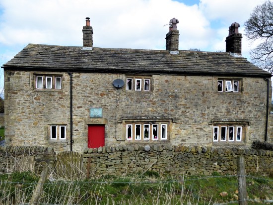
Leaving aside thoughts of beer, I soon take a lane into fields which rise up to Wymondhouses, a Pennine farm once used as a chapel. The plaque above the door states that the first Congregational Church in north-east Lancashire was founded here in 1667, a Mr Thomas Jolly being the nonconformist preacher. 


Rougher pastures and a sunken way led me onwards higher to come out onto the road at the Nick of Pendle, a low pass through these hills between the Ribble Valley and Sabden. A popular stopping off point for motorists seeking a picnic and a view. There were quite a few cars parked up this morning, the first people I had come across.

Back to Longridge Fell and Bowland.


Sabden down in the valley.
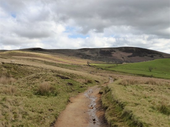
I was quickly back to peace and quiet on an obvious bridleway heading for Churn Clough and the Deerstones.

Bridleway with Deerstones on the horizon.
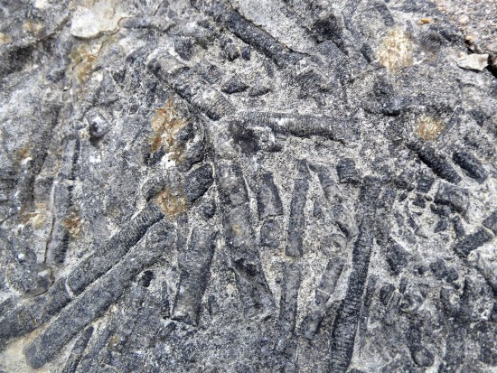
Below is the almost circular Churn Clough Reservoir, now used for fishing. Our path crosses the clough and then climbs steeply up its right bank heading for the Deerstones marked on the OS map. It is quite a pull-up. The day has changed, the sun has disappeared, and dark clouds fill the sky. The Deerstones look menacing in this light. At the back of my mind there is something of interest in the quarried stones, but I don’t divert without good reason. (I later read of the Devil’s Footprint. This feature was natural and caused by nodules of iron rich stone eroding out the harder gritstone bedrock. The legend is that the footprint was left by the Devil as he gathered stones in his apron to hurl at a nearby church. He then clumsily dropped them at nearby Apronfull Hill. I suspect that without prior knowledge the footprint would have been difficult to find. 


The Deerstones.
The path comes out onto the open moor at a gate. Paths go in all directions. I just head north on the vaguest of paths to join the main route coming up from the Nick. Pendle is a big hill and I feel minute in this landscape, it wouldn’t take much to get lost in its vastness on these SW slopes. All is sky and skylarks. You can’t capture this with a photograph, especially now that it is so dull.

Could be anywhere.
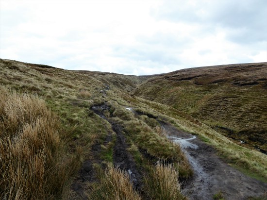
The path becomes more defined on the lip of the prominent Ogden Clough, a highlight of the day so far. 


I have distant memories of ploughing directly up that clough in a hard winter when all other tracks were obliterated. Today the going is good and as one approaches the summit the path has been ‘flagged’ to prevent erosion. There are still very few people using this way, but I fall into conversation with Max and his dog. He is full of tales of Lakeland walking, recently having completed the 214 Wainwright’s. He admits to being a little nervous on some of the Lakeland scrambles, I encourage him to take on Sharp Edge on Blencathra and maybe even Jack’s Rake on Pavey, I am not sure if he is convinced.

Wes, dog and flags.
By now we have reached the summit Trig point, at 557 m,and realise the place is thronged with people from the Barley side, what a contrast to our way up. Nonetheless, it is a good viewpoint over Pendleside and a sit down for a snack, but not for long as under the cloud it is decidedly chilly.


 A new path has been fashioned from the top of the Barley steps to the trig point. I must admit it blends as well as possible into the plateau and must save a lot of erosion. There is also a new stone shelter built into the nearby wall. Once through the wall as if by magic everybody disappears, and I have the whole of Pendle Moor to myself. There is no wind today, so it is almost perfect silence apart from all those soaring skylarks.

Empty spaces – skylark country.
Past the stone shelter and on to Scout’s Cairn, the path is very boggy all the way. The Yorkshire Peaks are a bit hazy, but I’m focused on Kemple End, Longridge Fell and Parlick, Fairsnape Fell framing Beacon Fell straight ahead. As I said photography is difficult in this light. 
The moor goes on forever. But is that sunshine returning? And now for that little bit extra. After a memorial cairn I drop steeply down into the extensive Ashendean Clough, a deep incision in Pendle’s SW slopes. This could be Scotland.

Memorial to two Clayton-le-moors Harriers members.

Down steeply to Ashendean Clough. Can you spot the Nick on the horizon?

The guide says to cross the stream, but that is not so easy today without getting my feet wet or even worse. A perfect little valley full of bright yellow gorse. A footbridge by a barn and I’m into rough pasture aiming for the next barn which I cannot see, but we get there in the end and come out onto the lane by Mearley Hall. That has been quite some hill day.


Howcroft Barn.


I arrive back in Pendleton and treat myself to that beer, sat outside in the late sunshine. Perfect. Reflecting on what has been a connoisseurs walk, mostly away from the popular Pendle routes. That has been quite some hill day.
***


 On the marsh shore are a couple of anchors caught up in a trawl net by a fishing boat in the 1980s. The larger one is of the type lost from the Mexico. The other dates back to the late C18th used by warships from the time of Admiral Nelson.


 I have never been a fan of Tolkien’s works. I dutifully read The Hobbit way back then but never progressed to The Rings Trilogy. My imagination doesn’t go along with his. Yet here on my doorstep we have a landscape which possibly influenced his writings – the Ribble Valley. He visited Hurst Green and Stonyhurst College where his son was boarding. Hence, a tourist devised Tolkien Trail, wooded valleys and secret riverbanks, has taken shape and become very popular.


 With the trees almost bare of leaves we saw extra detail today on our stroll out of Hurst Green. Mike had phoned me the night before thinking it could be a dry day, at least in the morning. My knee was painful from Saturday’s walk around the Silverdale area, but I didn’t like to put him off – I have done so several times recently. I picked him up as his car was looking worse for wear after a close encounter with an HGV. He is slowly working his way through the maze of insurance reports.


 Once on the top road we just ambled along catching up on the news, there were few cars to disturb us. Down the lane back to Stonyhurst we passed the well known Pinfold Cross commemorating a worker’s untimely death. Cometh the hour.


 I knew that the next section around the north side of the forest would be hard going. I aim for a pile of stones, marked as ‘The Wife’ on some maps.


 I’m soon off the fell and on a lane past Scriddles Farm. Don’t know the derivation, but we have had some lovely S’s today – Simpshey, Shivering and Scriddles.
 The next mile or so was not the best, unmarked paths and crumbling stiles. To make matters worse the afternoon light was rapidly deteriorating. I followed this way in reverse a while back with Sir Hugh and The Rockman, we struggled


 We are at the start of another heat wave, being out in the sun for long is energy sapping. But it is Tuesday when Rod and Dave go climbing, they have sensibly decided upon the shady Witches Quarry. I tag along.

 It’s two months since I was last able to do a walk out of Mark Sutcliffe’s guide book. Finding one locally I strode out today on his Jeffrey Hill chapter. The suggestion was to park at Little Town Dairy, a farm shop, nursery and café. I feel guilty using a businesses’ car park if I’m not giving them any business so I parked by the road higher up on the route, which was to prove tiresome later in the day.