Tag Archives: River Hodder

TWO FELLS. EASY EASINGTON AND WINDY WADDINGTON.

 The above shows Waddinton Fell on the left and Easington Fell on the right.

 The last thing I need when I’m trying to squeeze in an afternoon fell walk is a road closed sign.

 There is no quick way around Waddington, so it is even later, 1 pm, when I park up at the summit of the B6478 road over to Newton. This road doesn’t seem to have its own name, unlike nearby ‘The Trough’ or ‘Birdy Brow’. Long ago, we called it The Moorcock Road. But the Moorcock Inn has been gone for decades, replaced with private houses.

 Anyhow, I am here, the sun is shining, and the air is clear. I’m looking forward to a short fell excursion. Walking down the road from the parking, I pass Walloper Well. The fresh water flows continuously most of the year, passing cyclists often top up if they know about it. In the past, this would have been essential for horse-drawn carriages.

 My footpath leaves the road here, across boggy ground, and I wonder if it is the correct one as I flounder in the mire. Eventually, it becomes clearer and drier. I’ve been here many times, but not often in such brilliant conditions.

 Striding onwards, I don’t go to investigate Old Ned or The Wife, piles of stones on the moor. I’ve checked them out before, and they are just what the map says—piles of stones. I have never found an explanation for their origins.

The Wife?

  Leaving the Right of Way, I follow a quad bike track towards the summit of Easington Fell.  It’s all open access anyhow. The views open up in all directions, but most obviously towards the Yorkshire Three Peaks across the Craven Gap. A few stones mark the summit, a modest 396m.

 Turning around, I head back to the road. Initially, I had planned to extend the walk into Grindleton Forest, but looking at the time, I think better of it. The wind is increasing, and it is feeling quite cold. 

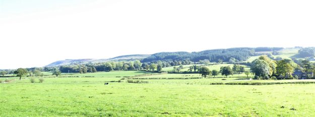
 Over to my left, across the Ribble Valley, Pendle looks as proud as ever.

 There is a clear track back after I get through the fell gate, which seems easier than usual.  A cross stile reminds me that the Lancashire Witches Way comes across here before heading into Bowland.

 All I have to do is follow the obvious track back to the road seen across the way. It is boggy but not too bad. Just wait until we have had some more rain. I’m aiming straight to the quarry at the summit of the road with Waddington Fell and its prominent mast behind. I can see my car clearly —the only one.

 On a whim, I decide to climb up onto Waddington Fell. But I first have to circumnavigate the extensive quarry, which is not in operation on weekends. Dropping down the road for some distance to a gate I know, which gives access onto the fell. It’s all supposed to be Open Access, but gates and walls get in my way. Nonetheless, I arrive at the trig point. Is it 395m or 396m, equalling Easington Fell, which I stood on less than an hour ago? I don’t care, as it is one of the best viewpoints in the area.

 360 degrees. Down Chipping Vale, The Bowland Fells and beyond, Yorkshire’s Three Peaks, Ribblesdale, and Pendle, obviously. My attempt at a whole-panorama shoot on my phone didn’t work out, so here are a few shots from my camera that don’t do it justice.

 The walk back is along the rim of the massive quarry.

Easington Fell in the background.

 A bonus as I make my way around are views down to the Hodder Valley with the village of Newton nestled in below Beatrix Fell.

 I’m still the only car parked up.

 A short but very satisfying afternoon. I’m relieved to be back in the car. On Waddinton Fell, I was exposed to a vicious wind, and the temperature dropped significantly—time to get the woolly hat and gloves out of the cupboard. And it is the end of British Summer Time for this year.

*

TOLKIEN AND CROMWELL IN THE MISTS OF TIME.

It is difficult to plot a flat five-mile walk in this part of the Ribble Valley. At least if you want to make it interesting. Sir Hugh is a connoisseur of trails, so I have to make this one at least appear interesting and at the same time without too much uphill.

He has kindly offered to come down from Cumbria in order to drive me to a walk I can’t easily reach otherwise. He left the choice to me.

The morning is misty, so we linger and catch up over coffee before leaving. A low-level walk is probably best in these conditions. Half a Tolkien is what I’ve named it. I could probably just about walk it blindfolded.

The Tolkien Trail is a walk around the area inspired by  J R R Tolkien’s writings during his stay at the college in the late 1940s. A number of names which occur in ‘The Hobbit’ and ‘The Lord of the Rings’ are similar to those found locally. The tourism people have made as much cudos from it as possible.

Leaving Hurst Green, the much-improved footpath drops steeply down to the Ribble. As we happily descend, I have nagging doubts at the back of my mind that we will have to climb back up at some stage. I need not have worried; Sir Hugh is a true soldier.

Peace is all around. There is no wind, and the Ribble flows sedately by, one of the great rivers of the North. The still, misty conditions add atmosphere to the banks. The stately aqueduct, 1880 era, carries a water pipe to Blackburn, but I can’t remember where it originated. ? Langden Intake at Dunsop Bridge.

We are now on an ‘astro turf’ path. At some stage, a plastic sports pitch has been taken up and relaid as a strip along the river bank, creating the perfect walking surface which blends in with the surroundings. It could be used to advantage on other popular/eroded paths. I think Sir Hugh has stepped offside at this point.

The trail further on has been surfaced with slate chippings, equally resistent but not as visually pleaasing. I wonder which will survive the longest?

Jumbles, where the river has a little dance, comes and goes.

Upstream, fishermen are trying their luck.

I point out Hacking Hall across the way, just visible in my header photo (garderobe was the word I was trying to bring to mind). The Calder joins in here at the site of the old Hacking Ferry, which would have been in operation in Tolkien’s time.

I have a secret up my sleeve. We are always looking for a comfortable seat to have lunch, but there is never one when needed. Today, I hone in on a fisherman’s bench just above where the Hodder, itself a sizeable river, joins the Ribble. Perfect, with extra brownie points.

Close by is the Winkley Oak, that magnificent ancient tree. I am always reassured to see it still standing after the winter storms.

The diverted path is no problem. However, I’m still not sure whether it is official.

As we slowly climb the lane, I mention that the tall trees nearby are a heronry at this time of year. They have nested here for generations. Peering up into the roof canopy, we fail to spot any nests. But then a couple of herons on the ground take to flight and land in the highest branches. They tend to lay early, so they are probably building nests at the moment. Their rasping cries break the general silence.

I find a group of Oyster fungi on a fallen tree, enough for a snack on toast later. (I’m still alive)

The path across the fields has been improved, and we are soon at that bus stop on the road junction. It is too misty for the classic view of Pendle Hill or Cromwell’s Bridge down below. More of him later. 

I try to ignore the steep bit of road climbing up to Stonyhurst College grounds. Sir Hugh hardly stops for breath. 

We take a back route through the college grounds, past all those terrets and observatories, until there in front of us is the magnificent St. Peter’s Church.

The front of the college is inspiring. The road leading to it is dramatic. The public right of way now goes elsewhere, but I remember walking straight up to the college years before security stepped in. In ignorance and encouraged by Sir Hugh, we walk out on that entrance drive between the ornamental ponds. I wonder whether the security cameras picked us up.

Once safely out of the gates, we have time to turn around and admire the college’s frontage.

The long road leads to the tacky, all-seeing Column of the Immaculate Conception on a mound. More interesting is a large wayside stone. After staying the night in Stonyhurst, Cromwell allegedly stood on this stone and described the mansion ahead of him as “the finest half-house in England”; the symmetry of the building was, at that time, incomplete. He fought the Preston battle the following day, 17th August 1648, against the Royalist army.

From here, it is a simple stroll back into Hurst Green just as the sun is breaking through.

An excellent five-mile walk full of interest and, as usual, with Sir Hugh full of bonhomie. His version will be available soon at https://conradwalks.blogspot.com/

A LOCAL RAMBLE.

What a beautiful day again. It was a frosty start but full sun, blue skies and no wind.  Perfect for a walk. Again, I’m in luck. I have a phone call from a friend, C, suggesting coffee and maybe a walk. She knows of my predicament.

My ‘pilgrimage’ to Manchester is on hold; I would probably have been there by now, given the settled weather. But I’m delighted to be able to get out; my left hand is still useless, so I feel safer with the company.

After a coffee and a catchup, we set off on some of the lanes in Thornley.

Ferrari’s Country Inn has been in the same family for years but has recently been sold to Elle R Leisure, which owns other hotels and dining venues in the NW. Originally named Blackmoss House, it was built by the Earl of Derby in 1830 and was previously used as a shooting lodge. It was part of the Derby Estates until the late 1970s when it was taken over by the Ferrari family and transformed into a wedding venue. The new owners will name it Longridge House, which I think is a bit tame and has no real connectivity. Why not Blackmoss House or Hotel?

Today, there is much building activity in progress. It looks like an extension into the garden may be planned—lots of rubble, skips full of redundant goods, and burning mattresses. We poke into the skips and find whole dinner sets of white crockery. What a waste when they could have gone to charity. We speak to the friendly foreman who says we can help ourselves to whatever. (I just had a message from C to say that a carload is already on the way to the charity shops)

We walk on away from the acrid smoke. Across the fields, more massive ‘agricultural’ buildings have appeared. There is speculation about their use; a red glow surrounds them at night! The plot thickens.

Friends live in a cottage on the ridge above; we can see his house from here. I’ll have to ask them for information. I need to visit them sometime, possibly to acquire another couple of kittens. Here is the collection from a week ago.
The fields around Blackmoss are studded with molehills; some look ginormous.

On the road, we cross Gill Bridge over the infant Loud. We discuss the strange watershed hereabouts, which has the Loud flowing eastwards away from the coast to join the Hodder, which loops all the way around Longridge Fell to join the Ribble before reaching the coast. Meanwhile, streams just to the west, Sparling Brook and Westfield Brook, flow directly to the Wyre and out to sea, a much shorter and direct route.

In geological history, the Hodder did not flow eastward around Longridge Fell to join the River Ribble but instead ran westward along the Loud Valley from Doeford Bridge to the Derby Arms north of Longridge, continuing south-westward through Halfpenny Lane on the west side of Longridge to join either Blundell Brook past Broughton church and Woodplumpton to join the River Wyre, or else Savick Brook through Fulwood to join the River Ribble  (Wikishire)

No explanation for this is given. I have read somewhere that glacial deposits blocked the Hodder in a previous ice age, creating the watershed and the present flow of water. The other is that the earth’s crust buckled or tilted to create the division.

Taking to the fields, we head back. Going in the opposite direction to my usual sorties, my navigation is not up to scratch. Along here somewhere, we lose contact with C’s dog, causing some consternation for a while. Of course, she comes bounding back as though nothing had happened. Safely on the lead now through the farm, along Clay Lane and onto the roadside pavement.

Longridge Fell, looming above.

We part company at Mile Lane, which I follow up into the park.

I want to see a new tree planting here. Here is the idea.

Longridge Environment Group

We are delighted to share that Longridge is about to join a small number of pioneering towns and villages across Britain with a micro-wood, or Miyawaki micro forest, at John Smith’s Playing Field. Led by Lancashire County Council’s Treescapes initiative, experts in this approach to ecology, and supported by Longridge Environment Group.

 A miniature woodland, about the size of a tennis court, which is planted with native trees at ultra-high density on a specially prepared plot. To protect the tiny young trees from damage by deer and other browsing animals, the plot is ringfenced by chestnut paling.
Woodland soils have a fundamentally different character from those in grasslands. When trees are planted directly into grassland soils, they often have a higher failure (death) rate than those planted in woodlands. While most survive, they’re vulnerable to disease and drought stress and grow very slowly, as they expend so much energy on simply staying alive and healthy.
In a micro-wood, the trees are planted into a specially prepared plot, where the ground has been modified to create conditions much better suited to young trees. First, the turf is inverted, burying the vigorous grass and competing for nutrients with the trees. Then, the ground is cultivated to loosen the soil. This opens up air pockets, allowing water to percolate through the root zone, trapping warmth and allowing the roots to grow without forcing their way through cold, compacted soil. We then add about ten tonnes of organic matter, usually spent mushroom compost or well-rotted manure, topped off with about the same quantity of bark mulch. As well as fertilising the trees, this provides an instant home to the fungi, microbes and invertebrates that form the rich ecosystem supporting the trees. The mulch will also seal in water, be invaluable in hot, dry spells, and suppress competitive weeds, replicating the effect of leaf litter on a woodland floor.
When we plant the trees, we first dip them in a gloop infused with mycorrhizal fungi, enabling them to tap into soil nutrients more efficiently. The soil now resembles that of a woodland rather than a field. Conventional tree planting is carried out at a much lower density. However, when woodlands form naturally, the trees often grow at very high density. The trees that thrive initially aren’t usually the ones that create the mature woodland canopy. Species such as rowan, birch and hawthorn often grow much more vigorously than oaks in the first few years. These “pioneer” species act as a nurse crop for the trees that will later form the “climax” canopy of the mature woodland. The species mix for Longridge’s microwood includes pioneer and climax species and the small trees and shrubs forming the underwood of trees growing below the canopy.
 We follow the theory of potential natural vegetation, devised by Prof Akira Miyawaki, who advised this woodland creation technique in Japan in the 1970s. In a nutshell, we plant the assemblage of trees in the correct proportions that we think would grow on a site, with a few compromises if natural processes were allowed to take hold. We don’t plant sycamore because it will get there anyway, and we don’t plant ash or elm because of the diseases they’re suffering from.
Once the roots have become acclimatised, the trees will proliferate from late spring. Expect rowan, elder and other pioneer species to get going first. The odd one may put on over 1.5m in the first growing season. Some trees may even produce flowers and fruit in year one. The trees will form a dense thicket within two or three years. This will provide a home to vast numbers of insects and other invertebrates. These animals are the larder newly hatched songbirds, bats, hedgehogs, frogs, toads and newts. In time, a pair or two of breeding songbirds may nest there, and amphibians will find it a safe and sheltered place to hibernate.
 
They haven’t planted any trees yet, but the site looks tidy and prepared with mulch and bark. I’m not sure the fence is high enough to keep out deer. it will be interesting to see how this project develops.
 
My next port of call is JD’s house. Again, more coffee and catchup.
He accompanies me back, taking me through the new housing estate, which is far more extensive than seen from the road. Parts of it are quite attractive, with great views across to the Bowland Hills – for now. There seems to be an adequate number of ‘affordable’ properties, some of them bungalows suitable for the elderly.

We part company at Sainsbury’s, and I return home after a decent and interesting ramble. It’s not been easy taking pictures on my phone one-handed.
 
I dine on soup from the freezer for the third night running. convenient and wholesome.

HOW HIGH’S THE HODDER MOMMA?

It’s a brand new year, but the same old weather that plagued last year: rain and plenty of it. I awoke to news of flooding in the northwest and looking out my back window, the fields were underwater. Ribchester has suffered again, so I won’t be heading that way, though it would have been good to see the Ribble in full flow at Sale Wheel. https://bowlandclimber.com/2020/02/17/sales-wheel-the-ribble-in-flood/

I decided instead to head over to the River Hodder at Higher Hodder Bridge. I suspected the Chaigley road might be flooded so I drove over the fell to drop down at Kemple End. Even on this higher road, there were one or two spots where I hesitated to drive through.

The road going down Birdy Brow was awash with flood debris and parts of the road itself were eroding.

I parked at the bottom and walked onto the bridge to view the river in full spate.

Taking the little cobbled path through the woods and over normally quiet streamlets, now dashing to meet the roaring river.

Places where I often go down to the riverside for views of the graceful bridge were underwater today, and I kept a healthy distance from the edge. The river was moving past at some pace.  It’s difficult to give an impression of the water’s power in a photo so I tried a video for better effect.

Ambling on along the muddy footpath, I came upon quieter stretches of water before it sped up again, hurtling towards the Ribble, where the confluence would be quite a sight.  Instead of returning the same way I picked up an unmarked track near one of the little footbridges; this took me up the hillside towards Rydding’s Farm, where walkers aren’t exactly welcomed with “dogs running loose” signs. I bypass them and take the farm track leading back to Birdy Brow. Looking back, a rather hazy Pendle Hill dominates as usual around these parts. I hadn’t walked far for my first walk of 2025. I’m pleased to see my car hadn’t been washed away and drove carefully back over the high road, stopping only to view the floods below in Chipping Vale.

Of course, while the mood takes you, it is worth listening to Johnny Cash.

***


SHADY GOINGS ON…

P1050821

I have been out tonight with a plastic bag collecting wild garlic and coming home my car has a heavy pungent smell. This always reminds me of an incident that happened years ago, I may have mentioned it before.

I was climbing with a friend from the village. We drove up to the Eden Valley in search of some sandstone. It must have been this time of year as on the foot approach along the river we ploughed through swathes of garlic. Even the base of the crag, where we dumped our sacks, was covered in the aromatic plants. The day wore on as we climbed several routes. Packed up we retired to a pub in Orton for a pint or two. The landlord even mentioned the garlic smell to which we had by now become oblivious. Arriving back in our village, rather later than planned due to the pub visit, I dropped my friend off at home. When I next met up with him he related how his wife had given him a good dressing down for being late, but even worse accused him of not climbing at all but dining out at an Italian restaurant with a secret belle, the garlic odour being so strong. He had difficulty persuading her otherwise. My car and climbing gear stunk for weeks.

No secret rendezvous tonight, just a short walk into some shady woods to harvest some Wild Garlic leaves. As a bonus I also enjoyed a good show of Bluebells. P1050852

P1050798P1050816

P1050832

P1050830

P1050815

P1050811

My bag of garlic is now emptied onto the kitchen worktop. I separate out the flowers, they are useful as a topping on salads for a quick flavour boost. the leaves I wash. In the past I have used them in a nettle and garlic soup and have made a tasty pesto sauce. But tonight I’m going to sauté the leaves in butter to have with a couple of poached eggs, accompanied by some new Jersey potatoes. P1050854

Et voila…

P1050869

BASHALL EAVES CIRCULAR.

P1040422

On the map this looks like a nice gentle rural walk, perfect for Mike’s training schedule before flying off to Madeira’s sunny adventures. I agreed to join him, secretly knowing the true facts from a relatively recent visit.

Another route he had chosen from Clitheroe Ramblers’ Walks in the Ribble and Hodder valleys. Today it was the Hodder.

The cloud was down on the Bowland Fells which is a shame as there is a fell race up there today. Even Longridge Fell stayed under mist as we drove alongside to park in Bashall Eaves.  We had a window of dry weather until about three this afternoon. Better get a move on.

All started well along a farm track, the guide’s instructions just said follow a waymarked route through the farm and cross five fields. Of course there were no waymarks and we had to ask the farmer the way out of his yard. He looked us up and down and delivered the fateful “there is a lot of water in the fields” before sending us into those fields. The first was the worst, a glutinous shaking morass. It was best to keep sidestepping the worst and not linger as your boots were being sucked down. To make things worse the stiles, if you could find them, were rotting and held together with string. Not a good start to the day and I knew things were to become far worse. Not many people come this way. P1040381P1040382

If we are going to have to become accustomed to water logged ground in the future I think I need to invest in some good walking Wellingtons.

Agden Farm was a Land Rover graveyard, at least the cows are kept inside,. The path, as it was, disappeared into undergrowth before tackling a steep ravine on muddy steps. This was the first of several cloughs we encountered today, steep and slippery down and steep and slippery back up.P1040390P1040386P1040393P1040398

Guesswork and some dodgy stiles delivered us to the next roller coaster, Paper Mill Wood, where at the bottom a fast flowing stream had to be forded. There was a brief respite alongside the River Hodder, the scenery idyllic. This is fishermen’s territory and there isn’t a lot of public access.P1040403P1040404P1040406P1040407P1040411P1040415

Open fields above the Hodder, with the instruction to head uphill to the three oaks. That was easy enough, they were unmistakable. Now head for a lone ash. This brought on a discussion on identifying trees in Winter mode, a skill neither of us had, I may go on a course I see they are running at Brockholes Nature Reserve.  Drop down to a stile wasn’t very helpful as we couldn’t see one. But there was the faintest evidence of a path, the first today. Not many come this way.P1040420

I was telling Mike about the next bridge, at one time erroneously marked as ‘Roman Bridge’ but more likely a mill packhorse bridge, we were heading for. How maybe 35 years ago my eldest son and I arrived at it on a walk to find it taped off and in a dangerous state. We recklessly crawled across the crumbling stonework with a large drop below us. I had returned a few times after it was rebuilt as a wooden structure in 1997. But the bridge we came to today didn’t look very impressive, perhaps my memory is playing tricks.  P1040425

No we weren’t there yet. Dropping farther into the woods we eventually arrived at the deep ravine of Mill Brook and the dramatic ‘new’ bridge. It was an impressive, as I had remembered it, and no doubt expensive, piece of engineering. The brook is 40 feet below. Having not met a single person since the first farm, a spaniel trotted across the bridge in front of us, soon to be followed by his master. The conversation that ensued turned out to be between two architects, one practising and the other retired. I listened in. He, the practising one, had just come from Lees House where he had been responsible for recent renovations. He warned us of more slippery paths to come and then posed on the bridge for his photo.P1040426P1040428

P1040434

The way onwards and upwards was indeed awkward through a series of fallen trees. Not many people come this way, get the idea.P1040435

The guide book has you continuing across fields to pick up the road for a while before doubling back to Lees House. A rather pointless exercise as there is on the map a lane direct to the house from the edge of the woods. All right, it may not be a public right of way but we were happy to risk it and we were soon through the buildings without encroaching on their privacy and back on track.

On track meant a narrow hemmed in path past Lees House and a slithering descent through the woods to yet another footbridge over Mill Brook. (I wonder if a direct way could be found alongside the brook from the near the ‘Roman’ bridge). I have never found an easy way up from this latest footbridge, often ending up in impenetrable Elephant grass. Today we staggered steeply upwards through the mud and low tree branches. Not many people come this way. The grass has not started its growing season yet, but was lurking in the background.  Eventually we were in the open fields heading to salvation. In hindsight, a wonderful thing, I think I might know a better way next time. P1040438P1040440P1040443P1040445

Salvation was reaching the farm track at Micklehurst Farm in the middle of nowhere. It was great to hear and see Lapwings flying over these fields.  Some of the caged working dogs were noisy but probably harmless, but the brown one on a short chain looked particularly menacing. How strong are those chains?

We didn’t quite make the entrance to Browsholme Hall. The seldom travelled side road took us through felled plantations, now being resurrected as nature reserves. That often in these parts is an equivalent for pheasant breeding and shooting grounds.

I diverted from the direct way back to Bashalls to show Mike the Saddle Bridge below Rugglesmire Hall. Probably from the C17th but restored, by public conscription in 1954. It is known locally as Fairy Bridge, said to have been built one night by fairies to help an old woodcutter who was being pursued by witches. A delightful spot. P1040455

In the hamlet of Bashall Eaves, maybe a dozen cottages, is a preserved Lancashire Cheese press worth a picture.P1040478

A delightful walk, all great fun. Those six miles took us over four hours. Come prepared for a testing time, but enjoy the unspoilt environment and wildlife of Bowland.

P1040451

Across the fields to Longridge Fell.

***

Screenshot 2024-02-17 165506

BEYOND THE PALE, STANLEY.

P1020925

I was up here a  few days ago in the frosty weather when I talked about the Leagram Deer Park. Today was all blue sky and not an icy patch to tread warily on. I’d already walked the pleasant mile along the quiet road from the site of Leagram Mill, passing some of those iconic railings sited to give visibility on the bends. Are they just a Lancashire thing?P1020856P1020858

Now I was entering the ancient laund of Leagram.  There was once an extensive deer park here in the 15 -16th centuries, l’ll  come to Stanley shortly. The pale was a ditch sometimes ‘fortified’ with hawthorn hedging demarcating and protecting the deer hunting area.  Parts of it can be seen on the present day estate where I am walking. From this we acquired the phrase “beyond the pale” – outside the bounds of acceptable behaviour. This how you find it with todays technology video.

Lovely parkland with Longridge Fell ‘beyond the pale’

P1020861P1020867P1020877

I walk on past the blue faced sheep and decide not to take the way to Park Gate as a tractor is muck spreading across the field. I walk on with Parlick up ahead. But I’m not heading for the high Bowland Fells, I’m going to skirt around under them on the track to Lickhurst.P1020892P1020897P1020899

First I stop to buy half a dozen free range eggs from the lane that leads to Saddle End Farm. P1020901

The Public Road ends short of the lane to the isolated Burnslack and the byway heading east is open to traffic but there are warnings to potential 4X4 users. Soon I’m at the ford over Leagram Brook, now provided with large stepping stones. Onwards becomes open moor named on the map as Stanley. P1020903P1020904P1020906P1020909P1020911P1020917

Edward Stanley, it turns out was keeper of Leagram deer park in the Royal Forest of Bowland between 1487 and 1523, and a soldier for both Henry VII and Henry VIII. The deer park died out in the C17th and the land passed into the Townley family. That’s how you inherited or were bestowed land in those days. It remained under the Townley family until 1938 when The Duchy Of Lancaster purchased much of the land. P1020950

Tipping my hat to to the duke or whoever I cross over Stanley and drop into Lickhurst. Remote farms, when I was working in the area, but now gentrified country properties made more accessible by bridges where there were previously fords. Having said that I got talking to a tradesman working on one of the properties who said they got caught out with the sudden snow and freezing conditions last week and spent two hours trying to get back up the hill to civilisation. P1020928

We are in Limestone country now, lots of coral reefs and more than one lime kiln along the way. I’m always impressed by the length of the single span stone across the brook here, now balustraded for health and safety.P1020932P1020935P1020939

Then there is that isolated red phone box, worth a post of its own. It is still functional but I wonder how many times it has been used in the last year. P1020941P1020948P1020944P1020958P1020953P1020968

One of the reasons I’m here is to visit friends at Greystonely. They are in so I enjoy an excellent coffee and them we join forces for the ongoing walk. P1020969P1020974

The bridleway down to another ford is looking worse from wear and tear, sat navs have led the unwary down this way, or rather ‘no way’. The bridleway improves past houses and eventually bring me back to my car on the road where I part company with my friends as they find another way back home.

I can repeat this walk as many times as I like – there is something special about it and the old Royal Deer Park. Here’s to Stanley.

***

Screenshot 2024-01-28 220733

Sadly a mere three weeks after my visit the lady pictured above had died of cancer of the pancreas. I still can’t believe it.

WHERE WATERS MEET.

P1000585

On our doorstep are two of the North’s great rivers, the Hodder and the Ribble. I don’t need an excuse to walk along either of them, and today I combine the two where they merge at Winkley on past Hurst Green. I park at the prominent bus stop just before the road drops down to the Lower Hodder Bridge. My previous posts on this area contain far more history and information than I’m about to give you on today’s short walk.

Hop across the road into fields and I’m on the popular Tolkien Trail and the not so popular Ribble Way. The well trodden ground shows just how popular anything to do with Tolkien has become, I estimate that 50% of people visiting Hurst Green walk the trail. Today I’m only sampling it. Soon I’m into the grounds of Winkley Hall and then become distracted by some fine bracket fungi. P1000566P1000592

P1000564

Past the farm with its ancient moat, now boasting a new ‘duck house’, and there is the Winkley Oak. Today I measured the circumference of the bole, 13m which is over 40 feet. somewhere I have read that it is almost 500 years old. This tree is an old friend of mine and I am pleased to see it in fine form. P1000576P1000578P1000583

By the fishermen’s hut the River Hodder slides into the River Ribble which continues it’s stately way to the sea. It is helped on its way a little farther by the smaller Calder coming from Burnley via Whalley. This latter junction is where the Hacking Ferry boat plied its trade until the 50s. The boat house is a little farther round the bend. I have always been intrigued by the tumulus marked on the map nearby and I try a long distance shot of it. The river is in gentle mood today but flood debris in the trees shows how turbulent it can become after heavy rain. P1000584P1000593P1000597P1000588P1000594P1000601

Soon after Jumbles I’m off the regular trail and heading up the hill to Cross Gills Farm. On the way I meet the lady farmer driving her buggy and checking on her sheep which she can recognise individually. We chat about all things farming, she is uncertain as to the future now that perhaps food can be created in the laboratory. A frightening thought. I’m offered a lift in her buggy up the steep hill to her farm, but that would be cheating wouldn’t it? and I may have missed these fungi and the view over the Ribble. P1000602P1000606P1000607

Straight across the main road into Stonyhurst College land. I circle the cricket pitch with it’s lovely period pavilion. P1000613

Out past Gardener’s Cottage  onto the road  leading back to my car. Halfway along I’m accosted by a lady, doesn’t happen often, who knows me from my past. Once I recollect who she is we spend more time lamenting the demise of all things important to the fabric of our society.  That’s two conversations today reflecting on our past and our future, and I was only out for a bit of exercise. That’s how it goes around here with such lovely folk. I reach the car just as it starts raining – serendipity. And there is Pendle as ever keeping a watch over the Ribble Valley.

P1000563

***

CaptureWinlkey.

ANOTHER SURPRISE.

20231018_131306

Following on from the unexpected meeting with Bruno the other day I had a surprise of a different sort today.

The approaching storm Babet seems to be passing us by. Yes it is windy, but the rain forecast has gone elsewhere leaving a sunny morning. A good opportunity to get up to Dunsop Bridge and have a better look at The Trough of Bowland Quarry which I’m supposed to be assessing for an upcoming new guide book to Lancashire climbing. I had a brief look in back at the end of July, but there were Peregrines about and the high bracken made exploration impossible.

The roads are quiet, and I enjoy the ride out through the Hodder valley and into the jaws of the Trough road. P1020492 The quarry is hidden away just before the road starts its winding ascent.  It’s late morning when I park up under the old Sykes Lead mine and the roadside Lime Kiln. The quarry faces west so should be sheltered from the easterly wind. A regular procession of motorcyclists pass me as I walk up the road to the gate.

A faint path leads into the quarry, all is peaceful and yes I’m out of the wind below the 70-foot wall of limestone. I have brought my extra long rope, so I should be able to abseil to the ground on it doubled. The bracken is dying back, and I can make my way up the right-hand side. It is steep, and I’m out of puff by the time I’m at the top. I’m concerned about where I can abseil from, the ground slopes steeply down to the top rim of the rock. I seem to remember from years ago trees above the main part but some of these have gone, and I’m limited to the far right side of the quarry. Being extra careful on the steep slope a solid birch tree is selected well away from the edge and using a sling around it I am able to anchor my rope. Gingerly I lower myself to the edge and peer over, my double rope makes the ground when I toss it down, that’s a relief. I should have had a photo looking down for those of you with a tender disposition.

I start to lower carefully as the top rocks are loose in . Before I toss any loose stuff down I bring my ropes back up out of the way, not wanting them damaged by falling rocks. One of the climbs here is called Guillotine, on the first ascent a dislodged rock cut through the climbers rope – not what you want to happen. I am starting to enjoy myself and the rock is generally sound. There is some good climbing here. I clear away a few saplings from some of the ledges as I come down, but this is just a preliminary inspection before deciding whether it would be worth the effort of a proper clean – yes we climbers are a bit obsessed. After some lunch I will go back up and have a closer look. On the photo, if you enlarge it, you can see my rope coming down just right of centre. 20231018_124750

As I am reaching the bottom I hear vehicles ascending a track on the fell on the opposite side of the road from the quarry. Strange. I thought I had heard voices up above me a little while earlier. Was I going to get challenged as to my right to be in there in the first place? By now there is a quite a crowd gathering across the way, and worryingly they all are carrying guns. The penny drops, and I realise I’m in the middle of a shoot. The beaters are coming across the fell above me and the guns are waiting to fire at whatever prey they are after, hopefully not me in the middle.

Time to get out of the firing line, I don’t know whether they can see me. Pull the rope down quickly, but no it keeps jamming. No shooting yet. Eventually I can just shove the rope into my sac and set off to walk out. They can see me now. I can vaguely hear them discussing me and expect a reprimand when I reach the road. But no they all seem friendly and wonder what I was doing in there, I apologise for getting in the way, but they don’t seem concerned as they are now banging away at birds flying over them. It gets very noisy. I try to take a video of the commotion, but it is difficult to anticipate when the birds will appear and the firings start.

Back at the car, now surrounded by 4X4s.  I talk to a man involved with the shoot – he is actually the caterer for their slap-up meal later. He tells me they are partridges and this is a sporting shoot as they fly so fast. Maybe only one in ten bite the dust, as opposed to grouse shooting when every two or three are shot. The shoot releases over three thousand partridges on this fell alone every year for the ‘sport’ – can you believe it. I bite my lip, I’m not as strong protestor as Greta Thunberg and I feel intimidated by all the guns. I do try to get a gentle dig in about whether they are still using lead shot, he is evasive with his answer and explains that most aren’t for consumption as there is little meat on them!

So it’s all for fun, as if I didn’t know it.

I’ll stick to enjoying the countryside in my own way and will be back in the quarry another day, but perhaps not on a Wednesday.

CICERONE’S LANCASHIRE – MORE OF THOSE LONG LONELY BOWLAND MILES.

P1010746

                                                                      Catlow Fell and Bowland Knotts.


Mark Sutcliffe’s Chapter 4.  Bowland Knotts and Cross of Greet.

Driving the lanes to Slaidburn once more and this time taking the continuation towards the Tatham Fells to park at the Cross of Greet Bridge, deep in Bowland. The last time I started a walk from here along the River Hodder, November 2020, the whole area was waterlogged and virtually impassable.  I am hoping for better conditions today after a few dry days. It’s a Bank Holiday weekend, yet I’m the only car parked up by the river.P1010901

I skip across the marshy area and have no problem fording the stream this time. The walk-up to the isolated barn goes well. A barn owl is disturbed as I peep inside, it flies off, and the chicks go quiet. I don’t hang about. Outside was a rusting lime spreader manufactured locally in Clitheroe ? Vintage 1960.

P1010751

The infant Hodder.


P1010759

Kearsden Brook ford.


P1010760

The Hodder gathering pace.


P1010764

The barn.


P1010770

Abode of owls.


P1010772

Atkinson Spreader, Clitheroe.

The way onto Pike Side is rather vague, and I end up following sheep tracks and even sheep. I realise that somewhere I have gone wrong arriving at an old lime kiln next to the wall, SD 725591. There are shake holes marked on the map, so there must be underlying limestone near about. With a bit of rough ground I regain the route by the gate, SD 723593. There are the ruins of an old barn here, and I follow the straight access track all the way to the road at Bowland Knotts, although at times it disappears underwater.

P1010777

Sheep track.


P1010788

Limekiln  SD 725591. 


P1010792

Gateway. SD 723593.


P1010808

To the road at Bowland Knotts.

There are craggy outcrops either side of the road and some are suitable for bouldering.  I find a seat not far off the road for lunch with Ingleborough in full view.

P1010816

Roadside bouldering in Yorkshire.


P1010817

Roadside bouldering in Lancashire.


P1010818

Peggy and John Phillips seat.

Tracks follow the wall westwards towards a trig point, 430 m,the highest point of the Bowland Knotts also recorded as Crutchenber Fell, a ladder stile crosses to it. This is a rough tramp, but there are good, if hazy, vistas into Yorkshire, Stocks Reservoir, Pendle and the Bowland Hills.

P1010821

Crossing to Crutchenber Fell.


P1010824

Trig 430 m.


P1010823

Bowland Knotts.

I stay on the south side of the wall for the undulating mile to the next feature, Cold Stone Crag. There is a path of sorts. There is climbing on this remote crag, but I doubt if many come this far, you might as well boulder back at the road. On one occasion I made the boggy walk in to photograph the crag for a new guidebook, only to arrive after the sun had moved round. The process was repeated the next day at an earlier hour. From up here the whole of the Pendleside panorama is visible.

P1010829

P1010831

P1010834

P1010837

Forever onwards alongside the wall and a gentle climb up to a height of  486 m, no cairn denotes the ‘summit’. The miles are long up here. An undecipherable boundary stone is encountered. The maps vary on the name of the hill – Great Harlow, Hailshowers Fell, Raven Castle or perhaps Catlow Fell.

P1010838

Catlow or Hailshowers Fell.


P1010845

Boundary Stone – Lancs/Yorks.


P1010847

Ravens Castle stones?

A little farther and a fence line leads me down to the road at the Cross of Greet. By the cattle grid is a large stone with a shallow square hole in the top. It stands at the Lune/Ribble watershed. formally the Lancs/Yorks border and may have had in the past a stone cross inserted into it.  Or was it a plague stone? nobody knows. I think it’s more likely to have been a cross at an important passage through these remote hills. 

P1010854

I chat to some cyclists riding the classic round from Slaidburn. Up to the Cross of Greet, over Tatham Fell past the Great Stone, maybe a brew at Bentham or Clapham and then back over Bowland Knotts, through Gisburn Forest to Slaidburn. I did it once with my mate Tone, never to be forgotten. P1010858

Down the road for 800 m then follow one of the faint paths down to the stream”  Well I’m not sure about the 800 m, and I don’t find any obvious paths. It will be even worse once the all encompassing bracken has grown. But I do find myself down at the Hodder, not the magnificent river it will later become, and hop over to the other side. P1010863P1010864

A slight climb and I am on the brink of an abandoned quarry. Stone from here was transported by rail to build the dam of Stocks Reservoir as the valley was slowly flooded in the 1930s for the Fylde Waterboard. Only the church was saved, stone by stone and rebuilt on higher ground. There is lots of archive material online.  The quarry is atmospheric particularly with the surviving, but rusting dinosaur of a steam crane. P1010868

P1010871

P1010877

P1010875

P1010884

At the edge of the quarry is the base of the Far Costy Clough, a worthwhile scramble up onto White Fell I’m lead to believe. Yet another one to add to my list. Another day.P1010880

I’m content to just to follow the old rails  out of the quarry back to the  Cross of Greet Bridge. Another longish day out in Bowland.P1010885

P1010891


P1010897

P1010900


***

CaptureCross of Great (3)

CICERONE’S LANCASHIRE – let there be light.

P1000084
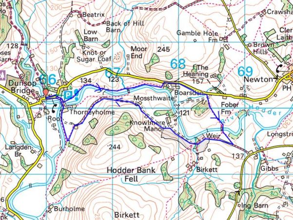
The clocks have changed, but my body hasn’t caught up as yet. Today had a sparkling alpine start and promised to be the best of the week. I struggled to get up having lost an hour somewhere. But with the minimum of faffing I’m away by 10.30. It only takes me a half hour to drive out to Dunsop Bridge. I know the sun doesn’t set tonight until after 7pm, so there is no rush, that’s the way I like it.

 Walk number 12, Whin Fell and Brennand, of Mark Sutcliffe’s guide promises – Another classic hill walk  combining steep climbs, big views and pleasant riverside rambling in the secluded hills and dales at the heart of the Forest of Bowland, 

 He has covered Bowland well with ten walks on my back door. Today I parked up just off the Trough road as recommended. Soon I was following a permissive path alongside Langden Brook. Oyster Catchers seem to have taken over many of our rivers but in the background I could plainly hear Lapwings and Curlews. This is open fell country,but since 1960 their numbers have dropped by 85%.P1000019P1000020

P1000023

Crossing Langden Brook.

Back on the road I pass the farmstead of Sykes.

P1000025The lime kiln gives a clue as to the bedrock hereabouts, but I shall soon be high in gritstone country.P1000026

The Trough of Bowland road snakes ever so slowly up the valley. I branch off right and have my own hill to climb.

P1000038The track soon peters out, and I’m left on boggy pathless territory forever upwards. This is designated as a bridleway, and I remember coming this way on a mountain bike 35 years ago with my son. No chance now. This area is isolated from the usual Bowland haunts, and I’m surprised to meet three walkers descending the pass. A friendly trio and we exchange banter. They have driven up from Manchester,  preferring this area to the crowded Peak District. They soon become a dot on this vast landscape as they descend towards the Trough Road and I struggle upwards. Across the way Totridge Fell keeps its head above most of the fells around here.

P1000039 (2)

P1000050

P1000063

The last time I was up here I continued to the top of Whin Fell with views to Morecambe Bay and beyond. This certainly feels like the centre of Bowland. Today I was conserving my energy to complete a rugged 7-mile circuit. and I soon reached the boggy col. Way down in the valley was Brennand Farm – the promised land. All I had to do was traverse Ouster Rake. It wasn’t as bad as I remember it. Over the years a groove has been eroded into the hillside making it feel far less exposed. But come a harsh winter and this becomes an icy trap where there have been several accidents. I still don’t believe I have cycled this route. I find a flat rock and eat my sandwich gazing down into the Brennand Valley, I must follow it higher into the hills one day, I don’t think I have ever been to the evocatively named Whitendale Hanging Stones.

P1000059

P1000078

P1000077

P1000069Looking back I was surprised to see how steep and craggy are the northern slopes of Whin Fell. At Brennand Farm (notice how it complements Sykes Farm passed earlier) all is pleasant with newborn lambs in the fields, no Spring walk is complete without some lamb photos. On down the Brennand Valley and then strangely back upwards to join Whitendale.P1000087

P1000092

P1000097

P1000101

P1000104

Looking back up the Brennand Valley.

From the water catchment works under Middle Knoll the River Dunsop gathers pace down the valley. All very familiar to me. I, too, gather pace alongside it on the good tarmacked water board road. I stop to try, unsuccessfully, to capture a photo of the Dippers merrily skimming down the river.  Sometimes Kingfishers flash up this section . There has been a lot of tree felling along here in the last few years. I’m soon onto those boggy fields I traversed last week to get me back onto the Trough road below Mellor Knoll and Totridge, and my car. There is plenty of light left for further exploration. Don’t get your Middle Knoll get confused with the Mellor Knoll.

P1000106

Joining Whitendale.


P1000108

Middle Knoll overlooking the Dunsop Valley.

P1000109

P1000113

Across the fields with Mellor Knoll and Totridge ever present.

CaptureWhin Fell

Post script. You will recall my horror the other day at the erosion being caused in the beech woods on the lower slopes of Totridge Fell above the Inch Perfect Trail Bikes outfit. Well let’s take the bull by the horns and drive up to their headquarters. It’s a long lane up to ‘New Hay Barn’ as it was. Now the centre for trail bike riding with accolades from Lancashire Tourism. I must admit they have developed a professional trail biking heaven. Lots of  manufactured technical obstacles in the lower fields for the enthusiastic biker.  I enter the impressive shop full of no doubt expensive bikes and kit, electric ones being top of the range. Videos are playing of the destruction they are doing to the hillsides. All very Formula One. 

P1000117P1000119P1000116

Simon the manager is on the defensive as I casually say I had been on the public bridleway on his land last week and was distressed  to see the erosion and damage being perpetrated in the beech woods above. He asserts that all has been verified planning wise, though I doubt the fine details. He seems to imagine, erroneously, that the bikes don’t go as high as the woods. His main grouse is dog walkers at loose amongst his trail bikes, albeit on a public bridleway. Being in a mellow mood I forget to ask him who actually owns the land (is it Duchy Land?) and does he have marshals out on trial days to warn the public  of the surrounding danger. We part with him saying he will have to have a trip up into the woods where I am showing concern. He has not seen the last of me. This is an Area of Outstanding Natural Beauty after all. Or is it?

Calm down. As I leave ahead of me is one of my favourite Bowland venues, Kitcham Hill Woods on Birkett Fell. All peace and quiet, long may it remain so, but I do wonder who will be looking after our countryside in the future.

P1000118 (2)


CICERONE’S LANCASHIRE – Whitewell, Mellor Knoll and the Hodder.

DSC00293 (1)

Haredon rook connects with Langden Brook which connects with the Hodder just after the River Dunsop, itself formed from the Brennand and Whitendale  waters, has joined in. In this part of Bowland there is a lot of water flowing off the hills down the Hodder towards the Ribble. So much water that I couldn’t safely cross the stepping stones at Whitewell this morning. Walk number 14 of Mark Sutcliffe’s Cicerone Lancashire. 

DSC00448 (1)DSC00445

The day promised the best weather of the week – sunny,mild and dry. And it was. I adjusted and parked up at Burholme Bridge a little farther up the Hodder.

The climb up the quiet road was a good warm-up before taking the footpath through the field.  It felt good to see Lapwings flying around and a couple of Curlews in the distance. I was in limestone country and all around were little outcrops and caves, I have explored some of these in the past so was content to walk by. The lane leads into the hills and a far off farm under Totridge Fell, but the bridleway goes off right into the woods. At one time there were numerous hen houses scattered about, true free-range poultry, but today there only seemed to be one shed left standing. 

DSC00300

Unnamed limestone caves.


DSC00307

The ‘last’ Whitmore hen house.

The path through these woods, Lower Fence, has always been boggy but since recent felling matters have improved somewhat. As height is gained views open up into the heart of Bowland above Dunsop. Leaving the firs a contrasting beech wood is entered. I have always enjoyed this high woodland stretch – beautiful beech trees with Totridge Fell towering above and views down through the trees to the twisting Hodder where I had parked. The farm below has hosted off-road motorbike trailing for some time, but it was confined to the lower fields and contrived obstacles. Inch Perfect Trials. There is now evidence that they are riding higher up into these ancient woods causing erosion and damage to the tree roots. Their promotional video illustrates this clearly. No doubt the land belongs to the organisation but, call me a spoil sport,  I don’t feel this is appropriate in the wild surroundings. Worryingly they seem to have received several Lancashire tourism awards. We don’t need that sort of tourism. Let’s not forget we are in the Forest of Bowland, a recognised Area of Outstanding Natural Beauty. I certainly would not like to walk this Public Bridleway when they are out to play. Who should I complain to? The King, if this is Duchy land? Now I’m home and writing this I am even more incensed – they are going to destroy that beautiful beech wood.

DSC00316

How it should remain.


DSC00313

Encroaching trails.


DSC00319

The Hodder Valley below.


DSC00322

What it is becoming.


DSC00323

Erosion…


DSC00321

…erosion


DSC00325 (1)

Destruction.

Maybe my mind was distracted, but I went astray at the col between Totridge and Mellor Knoll. It is easy to do so on the featureless ground. But basically all routes lead down to Hareden in the end. Incidentally if you are up here it is easy to gain the 344 m summit of Mellor Knoll, although there are no rights of way. Why wasn’t it included in the CRoW act’s open access land?

DSC00334 (1)

Mellor Knoll.


DSC00338 (1)

Off track.


DSC00344 (2)

Haredon, can you spot the car on the trough road?

At the farm a trailer was full of sheep presumably off to market. When I asked the little girl with her mother if they were her sheep she proudly said yes. the mother quickly intervened to say that they were going on holiday. Very diplomatic. 

DSC00349

Going on holiday!


DSC00352

Haredon Farm. 1690.


DSC00350

Always a warm welcome.

it was flat walking down the valley into Dunsop Bridge, but the weather had clouded over and become much colder, don’t we have a mixed climate. Mark’s route fortunately brings you past Puddleducks café, still functioning as an outside venue, I enjoyed a coffee. 

DSC00354

Hareden Brook, haunt of Dippers.

DSC00355

Langden Brook.

DSC00401

Puddleducks in the old post office.

DSC00405

On past that 100.000th BT phone box often considered the centre of Great Britain. Down the avenue of tall Redwoods to Thorneyholme Hall, once owned by the Townley family of Burnley, known for breeding race horses. Their land agent Richard Eastwood had success in the 1861 Derby with Kettledrum. It is believed that St. Hubert’s Church in the village was partly financed though the horse’s winnings. More of that later.DSC00408DSC00411 (1)

The path down the valley alongside the Hodder, now joined by the Dunsop and Langden Rivers, is always a joy surrounded by all those familiar hills. This is a good place to watch Sand Martins but of course they haven’t returned yet. The river bank in parts is being eroded, and the path has been changed with the introduction of those modern metal kissing gates which I don’t feel are very sympathetic with our countryside. That is the last of my gripes.   

DSC00415

Langden Brook joining the Hodder under the watchful eye of Mellor Knoll.

DSC00417

What’s wrong with the old one?

Since I was last along here the farm at  Burholme has had its rendering removed exposing lovely warm sandstone. The farmer busy with his lambs tells me it has C14 origins. Their Lonks are not to be messed with.DSC00423

DSC00419

By the time I was back at the graceful Burholme Bridge the sun was shining again.

DSC00436

I then drove back along to Dunsop Bridge to have a look at St. Hubert’s which I had become more aware of through  this blog.  All the history is there to read and I won’t repeat it. See also its listed building entry. The church sits squatly by the road leading to the Trough of Bowland.  The striking feature externally is the large white marble angel guarding the Towneley family vault. Inside I found very little lighting to fully appreciate the fittings. The exquisite stained-glass windows however showed up really well. Their leaflet describes a painting of Kettledrum, but I was unable to locate it. Mary Towneley  of more recent equestrian fame is also buried here. 

DSC00388

DSC00391 (1)

A good walk in the best Bowland scenery, which in truth I have done many times before at all times of the year, but never get tired of. (I did exactly the same walk on May 1st 2019.)  If you are intending to follow the Cicerone route in full come when the river is down so the stepping stones can be traversed and maybe a pint taken in the Inn at Whitewell.  There is a concessionary path off the road from near Burholme Bridge directly back to the Inn at Whitewell which would save some of the repetition of his route. 

DSC00451 (1)DSC00458                

CaptureHaredon

DSC00448 (1)

IS CYCLING DANGEROUS?

20220911_120519

I had an uneventful trip around the Guild Wheel yesterday. I can cycle 20 miles or so without any problem to my knee but can’t walk 4 miles, all to do with weight-bearing. So here I am back at my start, Red Scar, for another muscle strengthening ride. I wouldn’t go anywhere near the motorway system at present, so I’m staying local. The Wheel here takes you along the access road to Preston Crematorium which brings back many sad thoughts of departed friends. I’ve only gone a few hundred yards when ahead of me is a cluster of police cars and ambulances. How can this be on this dead end quiet lane?

A father and daughter were out for a gentle safe ride along the wheel. A stressed inattentive car driver travelling at speed on the wrong side of the road. Result one seriously injured cyclist and one very scared daughter. The dent in the car windscreen said it all. I hope the cyclist is OK.

I turn around and cycle back home.

CIRCULAR CYCLE TO WHALLEY.

Another sunny-day journey with the over-the-hill cyclist.

As I swooped down into Ribchester, at the back of my mind was the thought that later in the day I would have to regain all the height, plus more. The morning was perfect with blue skies and sunshine, and more importantly to me in my new cycling guise – no wind. A pause to look at the River Ribble at Ribchester Bridge and then along the south side of the valley. The Marles Wood car park looked busy with families setting off for a riverside walk. I enjoyed the quiet lanes that eventually wound into Whalley on the banks of the Calder. I’ve always been intrigued by the row of cottages as you enter the village, today whilst I was taking photographs a couple of residents emerged and told me that they had been built as workers accommodation by a nearby hall. They had no explanation as to why there were two levels of access.

Dropping into Ribchester.

The Ribble, at Ribchester Bridge.

Old St. Leonards Church, Langho.

Whalley bound.

Terrace Row.

River Calder and that viaduct.

Whalley centre.

My favourite café in the village was closed, so I just carried on towards Mitton with its three inns, a hall and a medieval church which I’ve mentioned before.  A fisherman was casting in the Ribble with proud Pendle in the background.

Medieval church and Mitton Great Hall.

  Talking of fishing, the last time I passed this way  the Three Fishes was closed but in recent months it has had a makeover and reopened under Michelin-starred chef Nigel Haworth. He is hoping to make it the best pub restaurant in the area, judging from the prices, I won’t be visiting soon.

The road ahead gave a rather disheartening view of Longridge Fell, my next objective. But first I crossed Lower Hodder Bridge with Cromwell’s Bridge adjacent, you can’t pass it without another photograph. This was the lowest point of the ride and I now had to climb 600 ft back up onto the fell, steady was the word. Once up there, I had a switchback ride all the way back into Longridge and a hot bath to ease my aches.

Kemple End,  Longridge Fell.

Cromwell’s Bridge.

Longridge beyond the reservoir.

***

A couple of extras –

Whilst I was climbing up the fell earlier, I had passed the well-known Pinfold Cross. This is what I wrote last time – The Pinfold Cross is a memorial to a former servant at Stonyhurst College and fiddler, James Wells. It was erected in 1834 at Stockbridge after he died in a quarry accident. On the front is inscribed the legend, ‘WATCH, FOR YOU KNOW NOT THE DAY NOR HOUR.’ Above this is written, ‘OFT EVENINGS GLAD MAKE MORNINGS SAD’. On the left is ‘PRAY FOR THE SOUL OF JAMES WELLS’ and on the right, ‘DIED FEB. 12TH, 1834′.

This is one of a series of crosses associated with Stonyhurst College whose grounds I have mainly skirted today. I did pass one of their gates and had time to ponder the school’s sign. I suppose times have changed and most primary schools now have a pre-school section. It is said that it helps children integrate better and prepare them for the learning experience to come. Oh! And it also provides a baby sitting service for busy parents out at work. What stuck me most was the 3-year-old reference. I couldn’t get it out of my mind and I imagined all these little children being abandoned at the school each day, God forbid if they were boarders. I’m sure it is not as bad as that and the toddlers have a great time.

Lily Allen, whom you may not be acquainted with, wrote a song expressing her own child’s anxiety left at home whilst Mum sang around the world. We have to be careful how we nourish our young offspring. Needless to say, I was humming the tune for the rest of the ride. Here is a version of this touching song where she is accompanied by Jules Holland – I’m only three.

THE RIVER DUNSOP.

The River Dunsop runs for only 2.3miles from the junction of its tributaries, the Brennand and the Whitendale rivers deep in the Bowland Hills, to where it enters the Hodder below Dunsop Bridge. At its head are weirs and fish ladders, trout should be heading up stream at this time of year. I’ve had a couple of forays onto the Hodder and the Lune in the last week in search of leaping fish, with no luck. My plan today is to check out the weirs at the head of the Hodder. The rain isn’t due until lunchtime, so I’m away earlyish.

  Because of my troublesome heel I’m avoiding walking any distance and this is why the River Dunsop has been chosen. From the café in Dunsop Bridge there is a private road, recognised as a bridleway, conveniently running alongside the length of the river. In past times I would have cycled all the way from Longridge, but today the bike is in the back of the car until the car park is reached. The crowds of summer have gone and there are only two other cars parked up.

  I pedal along happily taking in the scenery with Middle Knoll blocking the head of the valley. Despite it being a dull autumn day the situation is as dramatic as ever. The weirs I was aiming for are by the bridge at the junction of the rivers.  I’ve come this way many times before and photographed it in the sunshine. Such as here.

   You’ve guessed it — I saw no fish.

    Not really disappointed, my chances of leaping fish were low, I cycled farther up the track to look up into the Brennand Valley which seems to go on for ever into the distance. I’ve not explored that area for some time. From the map there are possible tracks all the way to the remote Wolfhole Crag. Likewise, I then intended cycling up the right-hand track for a short distance to obtain a similar view into the Whitendale Valley, but a notice banned cycles. That is the way to more desolate moorland past the Duchy farm, which I last walked going through to Hornby on Wainwright’s Way. 

The Brennand valley.

  It was good to be in this wonderful place even if only on the humble road low down in the valley.  It was a quick turn around and a gentle ride back to the café for coffee. The larch trees turning yellow lend some colour to the scene. 

Back down the valley with rain approaching.

The bridge over the Dunsop.

Puddleducks’ cafe.

  For anyone wanting to sample the wildness of Bowland without the commitment, this short journey up the valley, preferably on foot, is highly recommended. You can tell I’m passionate about Bowland.

Whilst driving home for lunch the rain started in earnest. The morning had been well spent.


CYCLING AROUND THE FELL.

Blue skies, sunshine and calm conditions, perfect for a local cycle ride. Longridge Fell is my regular walking ground, but today I was going to circumnavigate it on lanes from Longridge. You will notice my post is titled ‘around’ and not ‘up’, I had no intention of cycling the high road over the fell, there are enough undulations on the planned circuit.

There was a chill in the Autumn air but by the time I arrived in Chipping I was suitably warmed up. The road I took follows the north side of Longridge Fell before dropping to Higher Hodder bridge. A steep little hill up past a once popular inn had me puffing and to be honest I was always a little out of breath on any incline from then on, I’m having difficulty getting cycling fit. Walking is so much more relaxing.

Great Mitton and its Medieval Church are skirted, then the road winds up through the Ribble Valley to Hurst Green. I’d planned a break here as there are seats on the village green. A walker with his Spaniel had bagged the best one, but I ate my banana on an adjacent bench before going over for a chat about all things local, a pleasant diversion.

Back in the saddle, I was soon back into Longridge, feeling rather tired from this modest ride. I had covered 22 miles but had ascended 1600ft in the process, there are no flat roads in the Ribble Valley.

And that’s about it. I didn’t take many photos.

Chipping.

Couldn’t resist another picture of Cromwell’s Bridge over the Hodder.


Hurst Green interlude.

On arrival back home this gigantic corkscrew had arrived on the building site opposite me. Earlier in the year we, the local residents, stopped Barratts, in the guise of homely David Wilson Homes, from disruptive pile driving on this site which is probably unsuitable in the first place for building on due to the shifting sands. They are now having to drill down 30–40 ft to find solid ground, don’t buy a house on Inglewhite Meadow.

THE HODDER BETWEEN NEWTON AND SLAIDBURN.

Wednesday, June 2nd       5miles.      Slaidburn.

This is a repeat of a walk I did on a lovely summer’s day last year and today was another perfect warm and sunny day. We drove over with the roof down for Covid safety and for the exhilaration of the Lancashire hill country. As we parked up a red kite was being mobbed by crows above our heads. A new notice board has been erected on the river bank highlighting the very walk I had planned for today. https://ribblelifetogether.org/wp-content/uploads/2019/11/Slaidburn-route-guide.pdf  We virtually met no one apart from in Slaidburn.

The flatness of the riverside meadows was in contrast to the steep wooded limestone escarpment to our left. Dunnow Hall was looking resplendent. Instead of using the road, we followed a concessionary alongside the Hodder all the way to Slaidburn. As usual, the café and car park were busy with tourists and motorcyclists. We sat by the bridge for a welcome drink before that steep pull up the road and into fields going over small hills to Easington. From up here the enclosing bare Bowland Hills were a contrast to the green wooded valleys. Swifts few overhead.

The little Easington Beck was followed to Easington Manor and hamlet. Mike was pointing out properties on the northern flanks of Easington Fell that he developed for a businessman who had just sold TVR (the then Blackpool built sports car). Money was no object. Now back beside the Hodder we followed an old cobbled track, known locally as the ’causer’, to the bridge at Newton. Sand martins, dippers and wagtails all made an appearance on queue.

Dunnow Hall.

Whiteholme.

Mike not impressed by the village hall.

Ex-Methodist Chapel.

Slaidburn bridge shading sheep.

Bowland at its best.

Easington Beck.

Manor House

Back on the Hodder.

The Causer.

The pub in the village was closed, so we drove home for tea.  A classic little circuit made all the more enjoyable by the weather, and of course the company.

*****

For a more detailed description of the villages, have a look at …

NEWTON AND SLAIDBURN.

*****

THE HODDER ABOVE DUNSOP BRIDGE.

Sunday 16th May. 5miles. Dunsop Bridge.

It is rare for me to discover a local path that I have not walked, but I believe I found one today.

Mike phoned suggesting a walk and we agreed on driving a little further in one car to Dunsop Bridge, with the windows open. How risqué.

The plan was to walk up the waterboard road and traverse the boggy watershed between Brennand and Whitendale. Heavy overnight rain made me have a rethink, lets just walk around the Hodder. We found a place in the free [keep it to yourself] car park next to the café. Morning coffees were already being served take away style.

A stroll past the ducks on the green and the ‘Centre of Britain’ phone box and we were striding down the avenue of giant Sequoias leading to Thorneyholme Hall. Before the River Hodder a stile on the left gave access to fields which we were able to follow alongside the water. Not many people come this way, it was my first time. Old trees have outgrown their metal railings.

There is a large pipe bridge taking water from Slaidburn Reservoir towards the Fylde and a little farther on a flimsy looking suspension bridge. We examined it for sturdiness, it wobbled a lot. Continuing up the river bank we had only sheep and lambs for company. Unfortunately we had a short section on the road at Boarsden, in retrospect we could probably have used tracks in the fields with a little trespassing. Anyhow, we were soon back on an indistinct field path passing by a massive quarry which had eaten away a considerable amount of rock from a Limestone Reef Knoll. After a look around the base of the quarry we continued across fields to a suspension bridge identical to the one seen earlier, at least on this occasion we were justified in venturing onto the bridge as the public footpath crossed it. Feeling seasick we crossed another field to come out onto a lane.

I recognised my surroundings now, and we marched along over Giddy Bridge, a solid stone one, not at all giddy like the suspension bridges. The Knowlmere Manor House lies just off the track and is noted for its many chimneys, each room in the past must have had a fireplace – think of their energy rating.

The track rises past Mossthwaite with the Bowland Hills ahead and that first little bridge far below. We witnessed a commotion amongst a flock of jackdaws ahead of us, only when reaching the spot did we see the Sparrow Hawk awkwardly trying to fly off with its kill. I wanted to visit the banks of the Hodder downstream from its confluence with the Dunsop where sandbanks are home to sand martins but today, strangely, there were none.

We walked back upstream to Thorneyholme and crossed the river back to a busy Dunsop Bridge. Those metal kissing gates with the yellow latch are spreading everywhere. A takeaway coffee and cake were obligatory outside the PuddleDucks Café along with all the cyclists.

A lovely sunny morning’s stroll in stunning Bowland scenery.

*****

NOT AN OTTER ON THE HODDER.

JD phoned to suggest a walk by the rivers to try and spot otters which have been present recently. Suffice to say we didn’t see one but had an enjoyable walk nonetheless The stretch of waters we walked by I’ve described so many times in these pages, so I do not intend to repeat it here. We started on the Hodder and walked to its junction with The Ribble and then carried on to Hurst Green, basically part of the  Tolkien trail. Spring flowers were more varied with new species appearing, the bluebells continued to put on a good show and of course the wild garlic was at its best in the damp shady places. Many of you will know the route on seeing this tree, the Winkley Oak.

Midweek is becoming much quieter as many people have returned to work, we met only a handful of dog walkers. A favourite spot is where the Hodder and Ribble join, there is a bench inside a fisherman’s hut which provided a comfortable lunch spot looking out over the rivers. Farther downstream near Hacking Hall the sandy banks provide nesting spaces for Sand Martins which were flying low around us as we passed, lovely to see them back. A thunderstorm with heavy rain caught us on the last stretch to Hurst Green, the sky above Pendle having taken on mysterious dark hues. Pubs are still only able to serve outdoors and because of the rain there were no takers in the Shireburn or Bailey establishments  when we passed.

This was the first time I’d been walking with JD for probably 6 months, thus the lack of Otters didn’t dampen the day, but the rain certainly did try to.

THE TOLKIEN TRAIL AGAIN.

Saturday  27th March.     6.75 miles.      Hurst Green.

I expected Hurst Green to be full of cars this morning, but we were able to park up outside the Bailey Arms with no trouble. I think we stole a march on most people by being away early. A new signpost has been erected near the Shireburn Inn to get you on the right track. Dropping to join the River Ribble seemed muddier than normal, a lot of people have come this way in the last few months. To start with we had the riverside path to ourselves with wide-ranging views. Only as we approached Winkley Farm did a steady stream of people start appearing from the opposite direction. Fishermen were wading in the Ribble just upstream from where it joins the Hodder. A new path, not particularly aesthetic, gives a dry way across a particularly muddy field. A lot of people were milling about at Cromwell’s Bridge and on the path alongside the Hodder, we couldn’t work out how some of these groups were constituted with no social distancing in evidence – I suspect people are coming out of lockdown of their own volition. Up at Hodder Court Gandalf is staring out over the Ribble Valley, although his hat seems ready to fall off. We walked on through the grounds of Stonyhurst College to a now busy Hurst Green. I dread to think what this walk will be like after April 12th when people can travel further.

Here are a few photos…

A deserted Bailey Arms, I wonder whether it will survive.

We were glad of our poles in the mud.

Aqueduct over the Ribble taking water to Blackburn.

Distant Pendle.

Hodder and Ribble meet – spot the fisherman.

That Winkley Oak.

The new ‘bypass’

Trail walkers with Stonyhurst in the background.

Cromwell’s Bridge.

A wooden Gandalf.

*****

For more comprehensive views of this walk please have a look at

THE TOLKIEN TRAIL.

TO CATCH A SALMON.